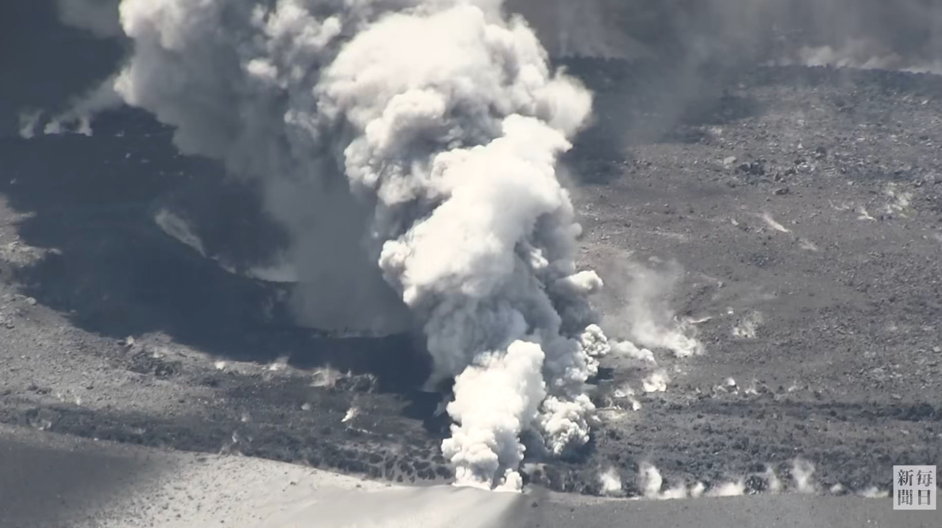
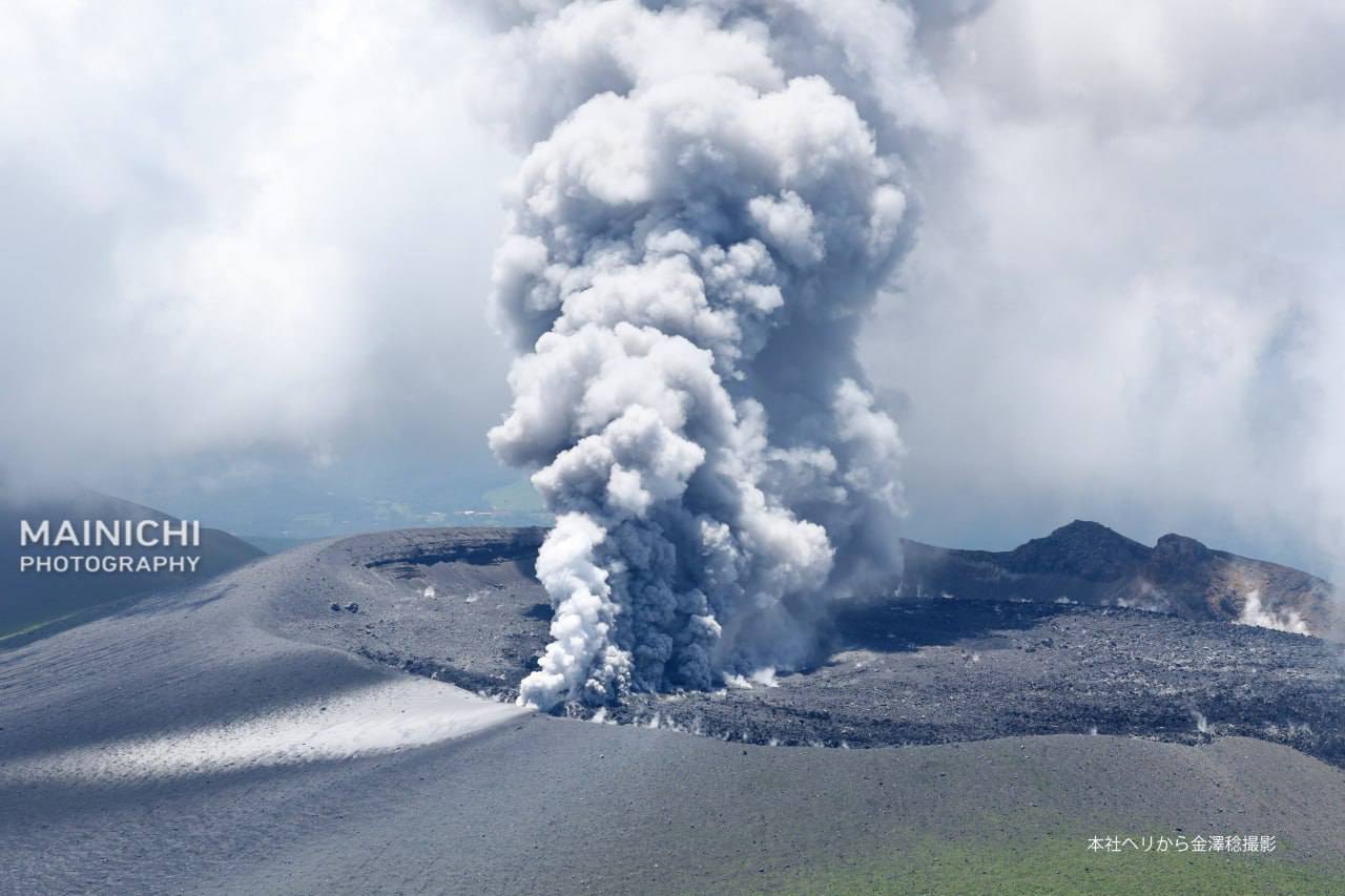
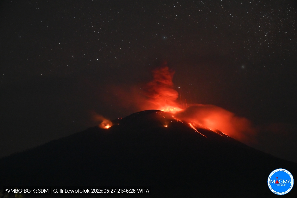
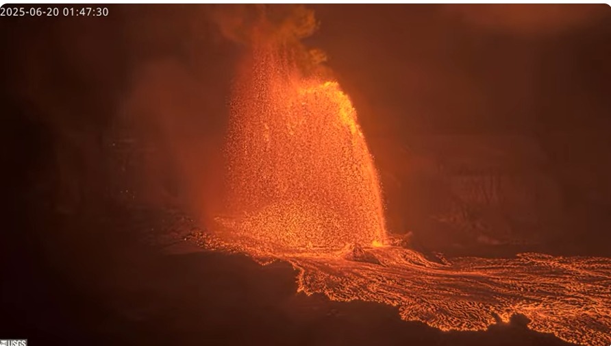
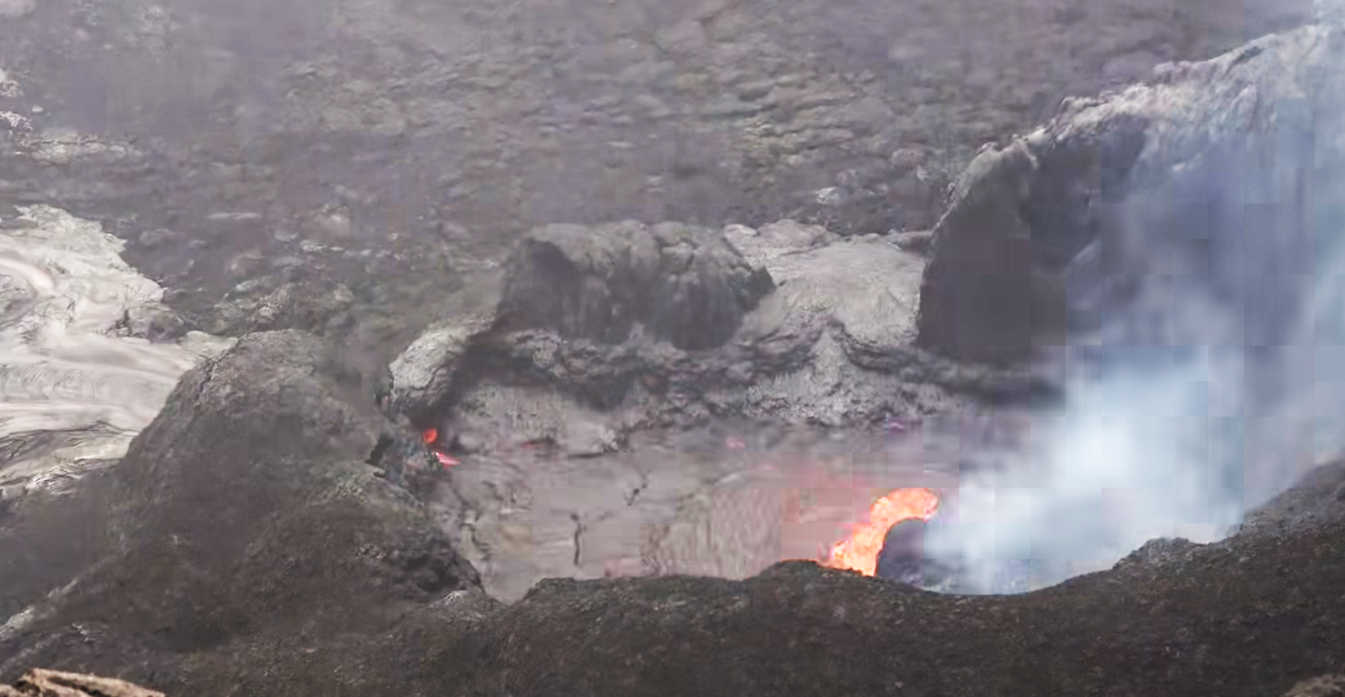
March 23, 2024. EN. Iceland : Reykjanes Peninsula , Indonesia : Merapi , Alaska : Great Sitkin , Chile : Laguna del Maule , Colombia : Galeras .

March 23 , 2024.


Iceland : Reykjanes Peninsula :

Stable eruptive activity . Lava flows south from the craters in an active stream .

Updated 21. March at 11:40 UTC

Average discharge rate for 17 – 20 March is 14.5 m3/s

The new lava now covers an area of 5.58 km2 and has a volume of 20.9 million cubic meters.
Accumulation of magma below Svartsengi seems to have stopped and instead magma flows directly to the surface and feeds the eruption.
Minor deformation has been measured in the Svartsengi area and in the proximity of the dyke intrusion.
The eruptive activity appears to have been relatively stable the last 24 hours. The same vents seem to be active, and craters continue to build up around the vents. Lava flows towards the south from the craters in an active lava stream, both on the surface and below the solidified surface of the lava.

Overview of the eruption site taken on a flight yesterday morning 20 March at 9am. It shows all the active volcanic vents.

Yesterday morning experts from the National Land Survey of Iceland and the Institute of Natural History conducted aerial photography flights over the eruption site. From these images it is estimated that over the period from 17-20 March the average discharge rate of the eruption is 14.5 m3/s. This is similar discharge rate as observed during the eruptions in Fagradalsfjall 2021-2023. However, the discharge rate during the first 24 hours of the eruption was significantly higher. The area of the new lava field was measured 5.58 km2 and the volume 20.9 million cubic meters. The map below shows the extent and thickness of the new lava as measured yesterday morning, 20 March. The lava is 16 m thick where its thickest by the craters.

Map showing the extent of the newly erupted lava. Violet layers show the older lava that erupted in December 2023, January 2024 and February 2024.

Very little deformation has been measured in the Svartsengi area and in proximity of the dyke formation. Any measured deformation is so small that variability between days is inconsiderable. Several more datapoints are needed to infer if any uplift continues in the area. It can though be determined that magma flows now directly to the surface, feeding the eruption.

The weather forecast today for the area is north and north-westerly winds, 8-15 m/s, gas pollution is dispersed to the east and south-east and could be felt in South Iceland, for example in Þorlákshöfn and in Vestmannaeyjar. A more northerly wind tomorrow (Friday), causing gas pollution to be dispersed to the south and south-east and could be felt in and around Grindavík.

Updated 22. March at 17:20 UTC

Updated hazard assessment. Increased risk due to gas emission.

Volcanis activity at the eruption site stable
Volcanic activity at the eruption sites near Sundhnúkur remains stable. There is little to no earthquake activity in the dike or its vicinity. Land uplift in the area around Svartsengi has been very slight since the dike intrusion and subsequent eruption began on March 16. This suggests that less magma is accumulating beneath Svartsengi and is instead flowing more directly out of the reservoir through the eruptive fissures. However, there may be indications that uplift has increased in Svartsengi since then, but it cannot be confirmed at this point. Measurements in the coming days will shed more light on this development.

Today’s (Friday’s) weather forecast includes north to northwesterly winds at around 8-15 m/s, shifting to a more northeasterly direction in the evening with somewhat lower speeds, and gentler northeasterly winds tomorrow morning. Gas emissions will mostly be directed south of the eruption sites towards Grindavík.

Source : IMO.

Photos : IMO , RÚV’s Ragnar Visage


Indonesia , Merapi :

MOUNT MERAPI ACTIVITY REPORT, March 15 – 21, 2024

OBSERVATION RESULT
Visual
The weather around Mount Merapi is generally clear in the morning and night, while it is foggy from noon to evening. White smoke, fine to thick, low to moderate pressure and 50 m high was observed from the observation post of Mount Merapi in Kaliurang on January 17, 2024 at 05:40 WIB.
This week, lava avalanches were observed 59 times towards the South-West (upstream of the Bebeng River) up to a maximum of 1,800 m. The sound of an avalanche was heard once from the Babadan post with little intensity.
It was observed that the morphology of the southwest dome had changed due to lava avalanche activity. The highest hot spot was observed at 247.4°C, lower than the previous measurement temperature. The morphology of the median dome is relatively constant. The hot spot was observed at 207.3°C, lower than the previous measurement temperature. Based on the analysis of aerial photos dated March 21, 2024, the volume of the southwest dome was measured at 2,066,400 m3 and that of the central dome at 2,358,000 m3.

Seismicity
This week, the seismicity of Mount Merapi recorded
2 shallow volcanic earthquakes (VTB),
14 multi-phase (MP) earthquakes,
1 low frequency earthquake (LF),
335 avalanche earthquakes (RF),
6 tectonic earthquakes (TT).
The intensity of earthquakes this week is still quite high.

Deformation
The deformation of Mount Merapi monitored by EDM this week showed a shortening rate of 0.3 cm/day.

Rain and lahars
This week there was rain at Mount Merapi lookout post with a rain intensity of 19 mm/hour for 60 minutes at Babadan lookout post on March 17, 2024. No additional flow or lahar was reported in the rivers that have their source on Mount Merapi.

Conclusion
Based on the results of visual and instrumental observations, it was concluded that:
1. Mount Merapi’s volcanic activity is still quite high in the form of effusive eruptive activity. The activity status is set to the “SIAGA” level.

Source : BPPTKG

Photo : Andi Volcanist


Alaska , Great Sitkin :

The eruption of lava within the summit crater of Great Sitkin Volcano continues. Partly cloudy satellite imagery showed steaming and elevated surface temperatures from the active lava flow. The active northwestern lava flow lobe that started in January 2024 is warm and mostly snow-free. Satellite radar data through March 19 showed growth of the northwest lava flow, as well as uplift of the lava flow surface above the vent region. Seismic activity remains relatively low with occasional small volcanic earthquakes.

Great Sitkin Volcano on September 3, 2023, during helicopter approach for sampling efforts by AVO geologists. Image is looking west at the east margin of the summit flow field.

The current prolonged period of lava eruption at Great Sitkin Volcano began in July 2021. No explosive events have occurred since a single event in May 2021.

The volcano is monitored by local seismic, geodetic, and infrasound sensors and web cameras, as well as regional infrasound and lightning networks and satellite data.

Source : AVO

Photo : Loewen, Matt


Chile , Laguna del Maule :

Seismology

The seismological activity of the period was characterized by the recording of:
681 seismic events of type VT, associated with the fracture of rocks (Volcano-Tectonics). The most energetic earthquake had a Local Magnitude (ML) value equal to 2.6, located 3.2 km to the East-South-East relative to the center of the lagoon, at a depth of 7.6 km .

Fluid geochemistry
No anomalies have been reported in the emissions of sulfur dioxide (SO2) into the atmosphere in the area near the volcanic complex, according to data published by the Tropospheric Monitoring Instrument (TROPOMI) and the Ozone Monitoring Instrument (OMI) Sulfur Dioxide Group.

Geodesy
From data provided by 7 GNSS stations, which monitor deformation in the volcanic complex, we observe that the inflationary process recorded since 2012 continues,
particularly during the period evaluated, we note that:
– The distances between stations maintain the trends and magnitudes compared to the previous period, with lengthening or shortening rates which reach a maximum magnitude of 1.4 cm/month.
– The maximum vertical rise remains in the central sector of the lagoon, with a speed of 2.0 cm/month for this period, recorded at station MAU2.
– Through the use of the InSAR technique, using Sentinel 1A satellite images, signals associated with deformation of a magnitude and pattern similar to those previously recorded in the complex are observed, with an area maximum inflation near the center of the lagoon. In particular, for this period, a decrease in subsidence is observed east of Laguna Fea, in accordance with GNSS data.

The recording of VT type seismic activity continues recurrently, preferentially located to the South-West, East and South-East of the center of the lagoon. The process of cortical deformation continues to evolve at rates similar to those observed historically. On the surface, there are no apparent changes linked to volcanic dynamics. From the above, we conclude that the volcanic system always records internal activity with energy levels above its basic threshold. The technical alert is maintained in:
YELLOW TECHNICAL ALERT: Changes in the behavior of volcanic activity.

Source : Sernageomin

Photo : auteur inconnu


Colombia , Galeras :

Galeras Volcano Weekly Activity Bulletin

From the monitoring of the activity of the GALERAS VOLCANO, the MINISTRY OF MINES AND ENERGY through the COLOMBIAN GEOLOGICAL SERVICE (SGC) reports that:

For the period between March 12 and 18, 2024 and compared to previous weeks, a decrease in the number of events was observed, but with an increase in seismic energy. Earthquakes associated with fluid transit showed similar occurrence to events associated with rock fracture. The fracture earthquakes were located in a scattered manner in the volcanic region, at distances between 0.5 and 18 km, with depths between 0.5 and 13 km from its summit (4,200 m above sea level). ).

It is worth highlighting the earthquake that occurred on March 18 at 11:12 p.m., located 18 km northeast of Galeras, with a depth of 10 km and a magnitude of 2.4, which was reported as felt by the residents of different areas of the city of Pasto and other cities near the epicenter.
Gas emissions were recorded in the fumarole fields of Las Chavas, to the west, and El Paisita, to the north of the active cone, with white gas columns, of low height and variable dispersion due to the action of the winds.
Other volcanic monitoring areas showed stability in their recordings.
Volcanic activity remains on YELLOW ALERT Status: Active volcano with changes in baseline behavior of monitored parameters and other manifestations

Source et photo : SGC

23 Mars 2024. FR. Islande : Péninsule de Reykjanes , Indonésie : Merapi , Alaska : Great Sitkin , Chili : Laguna del Maule , Colombie : Galeras .

23 Mars 2024.


Islande , Péninsule de Reykjanes :

Activité éruptive stable. La lave coule vers le sud depuis les cratères dans un ruisseau actif.

Mise à jour le 21 mars à 11h40 UTC

Le débit de décharge moyen du 17 au 20 mars est de 14,5 m3/s

La nouvelle lave couvre désormais une superficie de 5,58 km2 et a un volume de 20,9 millions de mètres cubes.
L’accumulation de magma sous Svartsengi semble s’être arrêtée et le magma coule directement à la surface et alimente l’éruption.
Des déformations mineures ont été mesurées dans la région de Svartsengi et à proximité de l’intrusion du dyke.
L’activité éruptive semble avoir été relativement stable ces dernières 24 heures. Les mêmes évents semblent être actifs et des cratères continuent de se former autour des évents. La lave s’écoule vers le Sud depuis les cratères dans un courant de lave actif, à la fois en surface et sous la surface solidifiée de la lave.

Vue d’ensemble du site de l’éruption prise lors d’un survol hier matin 20 mars à 9h. Il montre tous les évents volcaniques actifs.

Hier matin, des experts du National Land Survey of Islande et de l’Institut d’histoire naturelle ont effectué des survols de photographie aérienne au-dessus du site de l’éruption. A partir de ces images, on estime que sur la période du 17 au 20 mars, le débit moyen de l’éruption est de 14,5 m3/s. Il s’agit d’un taux de décharge similaire à celui observé lors des éruptions de Fagradalsfjall de 2021 à 2023. Cependant, le taux de décharge au cours des premières 24 heures suivant l’éruption était nettement plus élevé. La superficie du nouveau champ de lave a été mesurée à 5,58 km2 et son volume à 20,9 millions de mètres cubes. La carte ci-dessous montre l’étendue et l’épaisseur de la nouvelle lave mesurée hier matin, 20 mars. La lave a une épaisseur de 16 m là où elle est la plus épaisse près des cratères.

Carte montrant l’étendue de la lave nouvellement émise. Les couches violettes montrent la lave plus ancienne qui a été émise en décembre 2023, janvier 2024 et février 2024.

Très peu de déformations ont été mesurées dans la région de Svartsengi et à proximité de la formation du dyke. Toute déformation mesurée est si petite que la variabilité entre les jours est insignifiante. Plusieurs points de données supplémentaires sont nécessaires pour déduire si un soulèvement se poursuit dans la région. On peut cependant déterminer que le magma s’écoule désormais directement vers la surface, alimentant l’éruption.

Les prévisions météorologiques aujourd’hui pour la région indiquent des vents du Nord et du Nord-Ouest de 8 à 15 m/s, la pollution gazeuse est dispersée à l’Est et au Sud-Est et pourrait être ressentie dans le Sud de l’Islande, par exemple à Þorlákshöfn et à Vestmannaeyjar. Un vent plus du Nord demain (vendredi), provoquant une dispersion de la pollution gazeuse vers le Sud et le Sud-Est, pourrait être ressenti dans et autour de Grindavík.

Mise à jour le 22 mars à 17h20 UTC

Évaluation des dangers mise à jour. Risque accru en raison des émissions de gaz.

Activité volcanique stable sur le site de l’éruption
L’activité volcanique sur les sites d’éruption près de Sundhnúkur reste stable. Il y a peu ou pas d’activité sismique dans le dyke ou à proximité. Le soulèvement des terres dans la zone autour de Svartsengi a été très léger depuis le début de l’intrusion et de l’éruption qui a suivi le 16 mars. Cela suggère que moins de magma s’accumule sous Svartsengi et s’écoule plus directement hors du réservoir à travers les fissures éruptives. Cependant, il peut y avoir des indications selon lesquelles le soulèvement a augmenté à Svartsengi depuis lors, mais cela ne peut pas être confirmé à ce stade. Les mesures des prochains jours permettront de mieux comprendre cette évolution.

Les prévisions météorologiques d’aujourd’hui (vendredi) incluent des vents du Nord au Nord-Ouest d’environ 8 à 15 m/s, se déplaçant vers une direction plus Nord-Est dans la soirée avec des vitesses légèrement plus faibles, et des vents du Nord-Est plus doux demain matin. Les émissions de gaz seront principalement dirigées au Sud des sites d’éruption, en direction de Grindavík.

Source : IMO.

Photos : IMO , RÚV’s Ragnar Visage


Indonésie , Merapi :

RAPPORT D’ACTIVITÉ DU MONT MERAPI, 15 – 21 mars 2024

RÉSULTAT D’OBSERVATION
Visuel
Le temps autour du mont Merapi est généralement clair le matin et la nuit, tandis qu’il est brumeux du midi au soir. De la fumée blanche, fine à épaisse, de pression faible à modérée et de 50 m de haut a été observée depuis le poste d’observation du mont Merapi de Kaliurang le 17 janvier 2024 à 05h40 WIB.
Cette semaine, des avalanches de lave ont été observées 59 fois vers le Sud-Ouest (en amont de la rivière Bebeng) jusqu’à un maximum de 1 800 m. Le bruit d’une avalanche a été entendu une fois depuis le poste de Babadan avec peu d’intensité.
Il a été observé que la morphologie du dôme Sud-Ouest avait modifié en raison de l’activité des avalanches de lave. Le point chaud le plus élevé a été observé à 247,4 °C, soit une température inférieure à la température de mesure précédente. La morphologie du dôme médian est relativement constante. Le point chaud a été observé à 207,3 °C, soit une température inférieure à la température de mesure précédente. Sur la base de l’analyse de photos aériennes datées du 21 mars 2024, le volume du dôme Sud-Ouest a été mesuré à 2 066 400 m3 et celui du dôme central à 2 358 000 m3.

Sismicité
Cette semaine, la sismicité du mont Merapi a enregistrée
2 séismes volcaniques peu profonds (VTB),
14 tremblements de terre à phases multiples (MP),
1 tremblement de terre basse fréquence (BF),
335 tremblements de terre d’avalanches (RF),
6 tremblements de terre tectoniques (TT).
L’intensité des tremblements de terre cette semaine est encore assez élevée.

Déformation
La déformation du mont Merapi surveillée par EDM cette semaine a montré un taux de raccourcissement de 0,3 cm/jour.

Pluie et lahars
Cette semaine, il y a eu de la pluie au poste d’observation du mont Merapi avec une intensité de pluie de 19 mm/heure pendant 60 minutes au poste de Babadan le 17 mars 2024. Aucun flux supplémentaire ou lahar n’a été signalé dans les rivières qui prennent leur source sur le mont Merapi.

Conclusion
Sur la base des résultats d’observations visuelles et instrumentales, il a été conclu que :
1. L’activité volcanique du mont Merapi est encore assez élevée sous forme d’activité éruptive effusive. L’état d’activité est réglé au niveau « SIAGA ».

Source : BPPTKG

Photo : Andi Volcanist


Alaska , Great Sitkin :

L’éruption de lave dans le cratère sommital du Volcan Great Sitkin se poursuit. Des images satellite partiellement nuageuses ont montré de la vapeur et des températures de surface élevées dues à la coulée de lave active. Le lobe de coulée de lave actif du Nord-Ouest qui a débuté en janvier 2024 est chaud et pratiquement sans neige. Les données radar satellite jusqu’au 19 mars ont montré une croissance de la coulée de lave du Nord-Ouest, ainsi qu’un soulèvement de la surface de la coulée de lave au-dessus de la région des évents. L’activité sismique reste relativement faible avec de petits tremblements de terre volcaniques occasionnels.

Le volcan Great Sitkin le 3 septembre 2023, lors d’une approche en hélicoptère pour les travaux d’échantillonnage des géologues de l’AVO. L’image regarde vers l’Ouest, sur la marge Est du champ d’écoulement du sommet.

La période prolongée actuelle d’éruption de lave du volcan Great Sitkin a commencé en juillet 2021. Aucun événement explosif ne s’est produit depuis un seul événement en mai 2021.

Le volcan est surveillé par des capteurs sismiques, géodésiques et infrasons locaux et des caméras Web, ainsi que par des réseaux régionaux de capteurs d’infrasons et de foudre et des données satellite.

Source : AVO

Photo : Loewen, Matt


Chili , Laguna del Maule :

Sismologie

L’activité sismologique de la période a été caractérisée par l’enregistrement de :
681 événements sismiques de type VT, associés à la fracture des roches (Volcano-Tectonique). Le séisme le plus énergétique avait une valeur de Magnitude Locale (ML) égale à 2,6, situé à 3,2 km à l’Est-Sud-Est par rapport au centre de la lagune, à une profondeur de 7,6 km.

Géochimie des fluides
Aucune anomalie n’a été signalée dans les émissions de dioxyde de soufre (SO2) dans l’atmosphère dans le secteur proche du complexe volcanique, selon les données publiées par le Troposphérique Monitoring Instrument (TROPOMI) et l’Ozone Monitoring Instrument (OMI) Sulphur Dioxyde Group .

Géodésie
À partir des données fournies par 7 stations GNSS, qui surveillent la déformation dans le complexe volcanique, on observe que le processus inflationniste enregistré depuis 2012 se poursuit,
notamment au cours de la période évaluée, on constate que :
– Les distances entre stations maintiennent les tendances et les grandeurs par rapport à la période précédente, avec des taux d’allongement ou de raccourcissement qui atteignent une grandeur maximale de 1,4 cm/mois.
– La montée verticale maximale reste dans le secteur central de la lagune, avec une vitesse de 2,0 cm/mois pour cette période, enregistrée à la station MAU2.
– Grâce à l’utilisation de la technique InSAR, à l’aide des images satellite Sentinel 1A, on observe des signaux associés à une déformation d’une ampleur et d’un motif similaires à ceux précédemment enregistrés dans le complexe, avec une zone d’inflation maximale proche du centre de la lagune . En particulier, pour cette période, une diminution de la subsidence est observée à l’Est de Laguna Fea, conformément aux données GNSS.

L’enregistrement de l’activité sismique de type VT se poursuit de manière récurrente, préférentiellement localisée au Sud-Ouest, Est et Sud-Est du centre de la lagune. Le processus de déformation corticale continue son évolution à des rythmes similaires à ceux observés historiquement. En surface, il n’y a aucun changement apparent lié à la dynamique volcanique. De ce qui précède, on conclut que le système volcanique enregistre toujours une activité interne avec des niveaux d’énergie supérieurs à son seuil de base. L’alerte technique est maintenue dans :
ALERTE TECHNIQUE JAUNE : Modifications du comportement de l’activité volcanique.

Source : Sernageomin

Photo : auteur inconnu


Colombie , Galeras :

Bulletin d’activité hebdomadaire du volcan Galeras

Du suivi de l’activité du VOLCAN GALERAS, le MINISTÈRE DES MINES ET DE L’ÉNERGIE à travers le SERVICE GÉOLOGIQUE COLOMBIEN (SGC) rapporte que :

Pour la période comprise entre le 12 et le 18 mars 2024 et par rapport aux semaines précédentes, une diminution du nombre d’événements a été observée, mais avec une augmentation de l’énergie sismique. Les tremblements de terre associés au transit des fluides ont présenté une occurrence similaire aux événements associés à la fracture des roches. Les séismes de fracture ont été localisés de manière dispersée dans la région volcanique, à des distances comprises entre 0,5 et 18 km, avec des profondeurs comprises entre 0,5 et 13 km par rapport à son sommet (4 200 m d’altitude).

Il convient de souligner le tremblement de terre survenu le 18 mars à 23h12, situé à 18 km au Nord-Est du Galeras, avec une profondeur de 10 km et une magnitude de 2,4, qui a été signalé comme ressenti par les habitants de différents secteurs de la ville de Pasto et d’autres villes proches de l’épicentre.
Des émissions de gaz ont été enregistrées dans les champs de fumerolles de Las Chavas, à l’Ouest, et d’El Paisita, au Nord du cône actif, avec des colonnes de gaz blanches, de faible hauteur et une dispersion variable due à l’action des vents.
Les autres zones de surveillance volcanique ont montré une stabilité dans leurs enregistrements.
L’activité volcanique reste en ALERTE JAUNE Statut : Volcan actif avec des changements dans le comportement du niveau de base des paramètres surveillés et d’autres manifestations

Source et photo : SGC

March 17, 2024. EN. Iceland : Reykjanes Peninsula , Indonesia : Merapi , Chile : Laguna del Maule , Ecuador : Reventador , Colombia : Galeras .

March 17 , 2024.


Iceland , Reykjanes Peninsula :

Eruption has started between Mt. Hagafell and Mt. Stóra Skógfell . This is the fourth eruption on the Sundhnúksgíga crater row from the beginning of the unrest in October 2023

Updated 17. March at 01:25 UTC

The Icelandic Met Office has updated the hazard map for the area. Lava flow continues to the south and southeast. The speed of the lava front is estimated to be 1 km/hr.
If the eruption continues at the same rate the scenario of lava reaching the ocean needs to be considered.

Now, about five hours into the eruption, the activity has been fairly constant for the whole length of the fissure.

Updated 16. March at 23:50 UTC

A volcanic eruption has begun between Mt. Hagafell and Mt. Stóra Skógfell. The eruption began at 20:23 UTC on 16 March, with a 2.9-km-long fissure forming quickly. The length and location of the fissure is similar to the eruption on 8 February 2024.

The pre-eruptive warning phase was very short. The first warning to the Department of Civil Protection and Emergency Management was at 19:43 UTC, and the onset of eruption was confirmed on web cameras just 40 minutes later. The eruption is effusive in nature, so the eruption plume consists mainly of steam and gas.

Picture showing the status of the eruption at 21:40.

The Icelandic Coast Guard performed a helicopter flight over the eruption area. The flight had experts from IMO, the University of Iceland, the Department of Civil Protection and Emergency Management. Lava is flowing westwards from the eruption fissure in the direction of Grindavíkurvegur (road) and the protection barriers for the Svartsengi region. Additionally, a large lobe of lava is flowing southeast, towards the protection barriers for Grindavík.

The map shows the fissure opening in red. Orange lines shows lava barriers.

From initial assessments of web camera imagery and aerial photographs from the helicopter flight, the eruption is thought to be the largest (in terms of magma discharge) of the three previous fissure eruptions from the Sundhnúkur crater row. This estimate applies to the first hour of eruptive activity.

At 22:10 UTC, the southern lava front was just 200 m from the barriers on the eastern side of Grindavík and moving at a rate of about 1 km per hour. At 22:20 UTC, lava was 700 to 800 m away from Grindavíkurvegur, nothwest of Grindavík, moving at a rate of approximately 1 km in 1.5 hours.

Source : IMO.

Photo : Veðurstofan / Safetravel FB , .DCPEM/Björn Oddsson , IMO.


Indonesia , Merapi : 

Mount Merapi Activity Report March 8-14, 2024. Published March 15, 2024

OBSERVATION RESULT
Visual
The weather around Mount Merapi is generally clear in the morning and night, while it is foggy from noon to evening. White smoke, fine to thick, low to moderate pressure and 150 m high was observed from the observation post of Mount Merapi Babadan on March 13, 2024 at 09:50 WIB. This week, lava avalanches were observed 91 times towards the South-West (upstream of the Bebeng River) up to a maximum of 1,800 m. The sound of an avalanche was heard once from Kaliurang post with low intensity. It was observed that the morphology of the southwest dome had changed due to the activity of hot cloud avalanches and lava avalanches. The morphology of the median dome is relatively constant. Based on the analysis of aerial photos from January 10, 2024, the volume of the southwest dome was measured at 2,663,300 m3 and that of the central dome at 2,358,400 m3.

Seismicity
This week, the seismicity of Mount Merapi recorded:
1 shallow volcanic earthquake (VTB),
13 multi-phase (MP) earthquakes,
380 avalanche earthquakes(RF),
6 tectonic earthquakes (TT).
The intensity of earthquakes this week is still quite high.

Deformation
The deformation of Mount Merapi monitored by EDM this week showed a shortening rate of 0.14 cm/day.

Rain and lahars
This week there was rain at Mount Merapi lookout post with a rain intensity of 52 mm/hour for 93 minutes at Kaliurang lookout post on March 14, 2024. No additional flow or lahar was reported in the rivers that have their source on Mount Merapi.

Conclusion
Based on the results of visual and instrumental observations, it was concluded that: The volcanic activity of Mount Merapi is still quite high in the form of effusive eruptive activity. The activity status is set to the “SIAGA” level

Source : BPPTKG

Photo : Andi Volcanist .


Chile , Laguna del Maule :

Special Report on Volcanic Activity (REAV), del Maule regions, Laguna del Maule volcanic complex, March 17, 2024, 02:50 local time (mainland Chile)

The National Geology and Mining Service of Chile (Sernageomin) announces the following PRELIMINARY information, obtained through the monitoring equipment of the National Volcanic Monitoring Network (RNVV), processed and analyzed at the Southern Andean Volcano Observatory (Ovdas):

On Sunday March 17, 2024, since 01:47 local time (04:47 UTC), monitoring stations installed near the Laguna del Maule volcanic complex recorded a low-energy seismic swarm associated with the fracturing of rocks (volcano-tectonic). At the time of issuing this report, 13 events were recorded. Localized events are concentrated around 7 km west-southwest of the center of the lagoon.

The characteristics of the largest earthquake after its analysis are as follows:

ORIGINAL TIME: 01:53 local time (04:53 UTC)
LATITUDE: 36.106°S
LONGITUDE: 70.577° W
DEPTH: 6.3 km
LOCAL MAGNITUDE: 0.2 (ML)

Observation :

At the time of issuing this report, the swarm of earthquakes continues, however it has decreased in frequency of occurrence of events.

The technical volcanic alert is maintained at YELLOW level.

Source et photo : Sernageomin


Ecuador , Reventador :

DAILY REPORT ON THE STATE OF REVENTADOR VOLCANO, Saturday March 16, 2024.
Information Geophysical Institute – EPN.

Surface activity level: Moderate, Surface trend: No changes
Internal activity level: Moderate, Internal trend: No changes

Seismicity: From March 15, 2024, 11:00 a.m. to March 16, 2024, 11:00 a.m.:

The following table shows the number of seismic events from the reference station in the last 24 hours.

Explosion (EXP) 47
Long Period (LP) 7
Transmitting tremor (TREMI) 8
Tremor harmonic (TRARM): 11

Precipitation/Lahars:
Light rains were recorded in the volcano area without generating mud or debris flows. **Heavy rains could remobilize accumulated material and generate mud and debris flows that travel down the volcano’s flanks and flow into rivers downstream.

Emissions/ash column:
Over the last 24 hours, thanks to the network of surveillance cameras, several emissions of gas and ash have been recorded with heights between 200 and 800 meters above the level of the crater, in the West-North-West directions. , West and South-West. Regarding these emissions, the Washington VAAC has published three emission reports with heights between 800 and 1,000 meters above the crater level, in the West, West-Northwest and Northwest directions.

Observation:
During last night, the descent of incandescent material along the flanks of the volcano was observed up to 900 meters below the level of the crater. At the time of closing this report, the volcano remained partially clear.

Alert level: Orange.

Source : IGEPN.

Photo : Benjamin Bernard ( archive).


Colombia , Galeras :

Galeras Volcano Weekly Activity Bulletin

Regarding the monitoring of the activity of the GALERAS VOLCANO, the MINISTRY OF MINES AND ENERGY, through the COLOMBIAN GEOLOGICAL SERVICE (SGC), reports that:

During the period from March 5 to 11, 2024, and compared to what was recorded the previous week, a decrease in seismic occurrence was observed, however, the level of energy released was maintained. The seismic activity of the volcano continues to be characterized by the predominance of events associated with rock fracture, followed by seismicity linked to fluid movements. For the most part, fracture events were located sparsely across the volcanic region, at distances less than 18 km from the main crater, with depths less than 14 km from the reference height (4,200 m above the sea level) and magnitudes less than 1.7.

Small gas emissions were recorded, mainly coming from the main crater and the fumarole fields “Las Chavas” and “El Paisita” (located respectively to the West and North of the crater), presenting white columns, low pressure output and variable dispersion due to wind action. In the other volcanic monitoring areas, stability was present.

Volcanic activity remains on YELLOW ALERT Status: Active volcano with changes in baseline behavior of monitored parameters and other manifestations.

Source and photo : SGC.


17 Mars 2024. FR. Islande : Péninsule de Reykjanes , Indonésie : Merapi , Chili : Laguna del Maule , Equateur : Reventador , Colombie : Galeras .

17 Mars 2024.


Islande , Péninsule de Reykjanes :

Une éruption a commencé entre le mont Hagafell et le mont Stóra Skógfell . Il s’agit de la quatrième éruption sur la rangée de cratères Sundhnúksgíga depuis le début des troubles en octobre 2023.

Mise à jour le 17 mars à 01h25 UTC

Le Met Office islandais a mis à jour la carte des dangers pour la région. La coulée de lave se poursuit vers le Sud et le Sud-est. La vitesse du front de lave est estimée à 1 km/h.
Si l’éruption se poursuit au même rythme, le scénario d’une lave atteignant l’océan doit être envisagé.

Aujourd’hui, environ cinq heures après le début de l’éruption, l’activité est restée assez constante sur toute la longueur de la fissure.

Mise à jour le 16 mars à 23h50 UTC

Une éruption volcanique a commencé entre le mont Hagafell et le mont Stóra Skógfell. L’éruption a commencé à 20h23 UTC le 16 mars, avec une fissure de 2,9 km de long se formant rapidement. La longueur et l’emplacement de la fissure sont similaires à ceux de l’éruption du 8 février 2024.

La phase d’alerte prééruptive a été très courte. Le premier avertissement adressé au Département de la protection civile et de la gestion des urgences a eu lieu à 19 h 43 UTC, et le début de l’éruption a été confirmé par des caméras Web à peine 40 minutes plus tard. L’éruption est de nature effusive, de sorte que le panache de l’éruption est principalement constitué de vapeur et de gaz.


Photo montrant l’état de l’éruption à 21h40. 

Les garde-côtes islandais ont effectué un survol en hélicoptère de la zone de l’éruption. Le vol était composé d’experts de l’OMI, de l’Université d’Islande et du Département de la protection civile et de la gestion des urgences. La lave s’écoule vers l’Ouest depuis la fissure de l’éruption en direction de Grindavíkurvegur (route) et des barrières de protection de la région de Svartsengi. De plus, un grand lobe de lave coule vers le Sud-Est, vers les barrières de protection de Grindavík.

La carte montre l’ouverture de la fissure en rouge. Les lignes orange montrent des barrières de protection contre la lave.

D’après les premières évaluations des images de webcams et des photographies aériennes du vol en hélicoptère, l’éruption est considérée comme la plus importante (en termes de décharge de magma) des trois précédentes éruptions de fissures de la rangée de cratères de Sundhnúkur. Cette estimation s’applique à la première heure d’activité éruptive.

À 22h10 UTC, le front de lave Sud se trouvait à seulement 200 m des barrières du côté Est de Grindavík et se déplaçait à une vitesse d’environ 1 km par heure. À 22h20 UTC, la lave se trouvait à 700 à 800 m de Grindavíkurvegur, au Nord-Ouest de Grindavík, se déplaçant à une vitesse d’environ 1 km en 1,5 heure.

Source : IMO.

Photo : Veðurstofan / Safetravel FB , .DCPEM/Björn Oddsson , IMO.


Indonésie , Merapi : 

Rapport d’activité du Mont Merapi 8-14 mars 2024. Publié le 15 mars 2024

RÉSULTAT D’OBSERVATION
Visuel
Le temps autour du mont Merapi est généralement clair le matin et la nuit, tandis qu’il est brumeux de midi au soir. De la fumée blanche, fine à épaisse, de pression faible à modérée et de 150 m de haut a été observée depuis le poste d’observation du mont Merapi Babadan le 13 mars 2024 à 09h50 WIB. Cette semaine, des avalanches de lave ont été observées 91 fois vers le Sud-Ouest (en amont de la rivière Bebeng) jusqu’à un maximum de 1 800 m. Le bruit d’une avalanche a été entendu une fois depuis le poste de Kaliurang avec une faible intensité. Il a été observé que la morphologie du dôme Sud-Ouest avait changé en raison de l’activité des avalanches de nuages ​​chauds et des avalanches de lave. La morphologie du dôme médian est relativement constante. Sur la base de l’analyse de photos aériennes du 10 janvier 2024, le volume du dôme Sud-Ouest a été mesuré à 2 663 300 m3 et celui du dôme central à 2 358 400 m3.

Sismicité
Cette semaine, la sismicité du mont Merapi a enregistré :
1 tremblement de terre volcanique peu profond (VTB),
13 tremblements de terre à phases multiples (MP),
380 tremblements de terre d’avalanches(RF),
6 tremblements de terre tectoniques (TT).
L’intensité des tremblements de terre cette semaine est encore assez élevée.

Déformation
La déformation du mont Merapi surveillée par EDM cette semaine a montré un taux de raccourcissement de 0,14 cm/jour.

Pluie et lahars
Cette semaine, il y a eu de la pluie au poste d’observation du mont Merapi avec une intensité de pluie de 52 mm/heure pendant 93 minutes au poste de Kaliurang le 14 mars 2024. Aucun flux supplémentaire ou lahar n’a été signalé dans les rivières qui prennent leur source sur le mont Merapi.

Conclusion
Sur la base des résultats d’observations visuelles et instrumentales, il a été conclu que : L’activité volcanique du mont Merapi est encore assez élevée sous forme d’activité éruptive effusive. L’état d’activité est réglé au niveau « SIAGA »

Source : BPPTKG

Photo : Andi Volcanist .


Chili , Laguna del Maule :

Rapport spécial sur l’activité volcanique (REAV), régions del Maule, complexe volcanique Laguna del Maule, 17 Mars 2024, 02h50 heure locale (Chili continental)

Le Service national de géologie et des mines du Chili (Sernageomin) annonce les informations PRÉLIMINAIRES suivantes, obtenues grâce à l’équipement de surveillance du Réseau national de surveillance volcanique (RNVV), traitées et analysées à l’Observatoire des volcans des Andes du Sud (Ovdas) :

Le Dimanche 17 Mars 2024 , depuis 01h47 heure locale (04h47 UTC) , les stations de surveillance installées à proximité du complexe volcanique Laguna del Maule ont enregistré un essaim sismique de faible énergie associé à la fracturation des roches ( volcano-tectonique). Au moment de l’émission de ce rapport , on comptabilise 130 évènements. Les évènements localisés se concentrent aux environs de 7 km à l’Ouest-Sud-Ouest du centre de la lagune.

Les caractéristiques du séisme le plus important après son analyse sont les suivantes :

HEURE D’ORIGINE : 01h53 heure locale (04h53 UTC)
LATITUDE : 36,106° S
LONGITUDE: 70,577° O
PROFONDEUR : 6,3 km
MAGNITUDE LOCALE : 0,2 (ML)


Observation :

Au moment de l’émission de ce rapport l’essaim de séismes continue , cependant il a diminué en fréquence d’apparition des évènements.

L’alerte technique volcanique est maintenue au niveau JAUNE.

Source et photo : Sernageomin


Equateur , Reventador :

RAPPORT QUOTIDIEN DE L’ETAT DU VOLCAN REVENTADOR , Samedi 16 Mars 2024.
Information Geophysical Institute – EPN.

Niveau d’activité Superficiel: Modéré , Tendance de surface : Sans changements
Niveau d’activité interne: Modéré , Tendance interne : Sans changements

Sismicité : Du 15 Mars 2024 , 11:00h au 16 Mars 2024 , 11:00h : 

Le tableau suivant montre le nombre d’événements sismiques de la station de référence au cours des dernières 24 heures.

Explosion (EXP) 47
Longue Période (LP) 7
Tremor d’émission (TREMI ) 8
Tremor harmonique ( TRARM ): 11

Précipitations / Lahars :
De légères pluies ont été enregistrées dans la zone du volcan sans générer de boue ni de coulées de débris. **De fortes pluies pourraient remobiliser les matériaux accumulés et générer des coulées de boue et de débris qui descendraient les flancs du volcan et se déverseraient dans les rivières en aval.

Colonne émissions/cendres :
Au cours des dernières 24 heures, grâce au réseau de caméras de surveillance, plusieurs émissions de gaz et de cendres ont été enregistrées avec des hauteurs comprises entre 200 et 800 mètres au-dessus du niveau du cratère, dans les directions Ouest-Nord-Ouest, Ouest et Sud-Ouest. Concernant ces émissions, le Washington VAAC a publié trois rapports d’émission avec des hauteurs comprises entre 800 et 1 000 mètres au-dessus du niveau du cratère, dans les directions Ouest, Ouest-Nord-Ouest et Nord-Ouest.

Observation:
Au cours de la nuit dernière, la descente de matières incandescentes le long des flancs du volcan a été observée jusqu’à 900 mètres sous le niveau du cratère. Au moment de clôturer ce rapport, le volcan restait partiellement dégagé.

Niveau d’alerte: Orange.

Source : IGEPN.

Photo : Benjamin Bernard ( archive).


Colombie , Galeras :

Bulletin d’activité hebdomadaire du volcan Galeras

Concernant le suivi de l’activité du VOLCAN GALERAS, le MINISTÈRE DES MINES ET DE L’ÉNERGIE, à travers le SERVICE GÉOLOGIQUE COLOMBIEN (SGC), rapporte que :

Durant la période du 5 au 11 mars 2024, et par rapport à ce qui a été enregistré la semaine précédente, une diminution de l’occurrence sismique a été observée, cependant, le niveau d’énergie libérée a été maintenu. L’activité sismique du volcan continue d’être caractérisée par la prédominance d’événements associés à la fracture des roches, suivis par la sismicité liée aux mouvements des fluides. Pour la plupart, les événements de fracture étaient localisés de manière dispersée dans la région volcanique, à des distances inférieures à 18 km du cratère principal, avec des profondeurs inférieures à 14 km par rapport à la hauteur de référence (4 200 m au dessus du niveau de la mer) et des magnitudes inférieures à 1,7.


De petites émissions de gaz ont été enregistrées, provenant principalement du cratère principal et des champs de fumerolles « Las Chavas » et « El Paisita » (situés respectivement à l’Ouest et au Nord du cratère), présentant des colonnes blanches, une faible pression de sortie et une dispersion variable due à l’action du vent. Dans les autres zones de surveillance volcanique, la stabilité était présente.

L’activité volcanique reste en ALERTE JAUNE Statut : Volcan actif avec des changements dans le comportement du niveau de base des paramètres surveillés et d’autres manifestations.

Source : SGC.


March 08, 2024. EN. Indonesia : Ili Lewotolok , Russia / Kuril Islands : Ebeko , Iceland : Reykjanes Peninsula , Indonesia : Ibu , Chile : Laguna del Maule .

March 08 , 2024.


Indonesia , Ili Lewotolok :

An eruption of Mount Ili Lewotolok occurred on Thursday, March 7, 2024 at 1:29 p.m. WITA with the height of the ash column observed at ± 800 m above the summit (± 2223 m above sea level). The ash column was observed to be gray with thick intensity, oriented towards the East. This eruption was recorded on a seismograph with a maximum amplitude of 4.6 mm and a duration of 49 seconds.

SEISMICITY OBSERVATIONS:
82 emission earthquakes with an amplitude of 2 to 15.7 mm and earthquake duration of 20 to 218 seconds.
1 Non-harmonic tremor with an amplitude of 3.8 mm and an earthquake duration of 321 seconds.

PVMBG reported that the eruption at Lewotolok continued during 28 February-5 March. Daily white-and-gray ash plumes rose as high as 900 m above the summit and drifted NW, E, and SE. The lava flow on the SE flank was 2 km long and the flow on the S flank was 600 m long; the distal end of the longer flow did not advance, though lava effusion continued, and new flows possibly overlapped the older flows. The Alert Level remained at 3 (on a scale of 1-4) and the public was warned to stay 2 km away from the vent and 3 km away from the vent on the S and SE flank. According to a news article residents were asked to bring their livestock into the villages.

Source : Magma Indonésie. GVP.

Photo : PVMBG


Russia / Kuril Islands , Ebeko :

VOLCANO OBSERVATORY NOTICE FOR AVIATION (VONA)

Issued: March 06 , 2024
Volcano: Ebeko (CAVW #290380)
Current aviation colour code: ORANGE
Previous aviation colour code: orange
Source: KVERT
Volcano Location: N 50 deg 41 min E 156 deg 0 min
Area: Northern Kuriles, Russia
Summit Elevation: 1156 m (3791.68 ft)

Volcanic Activity Summary:
A moderate explosive eruption of the volcano continues. According to visual data from Severo-Kurilsk, explosions sent ash up to 2.5 km a.s.l., and ash cloud drifted to the south-east of the volcano.
A moderate explosive eruption of the volcano continues. Ash explosions up to 6 km (19,700 ft) a.s.l. could occur at any time. Ongoing activity could affect low-flying aircraft and airport of Severo-Kurilsk.

Volcanic cloud height:
2000-2500 m (6560-8200 ft) AMSL Time and method of ash plume/cloud height determination: 20240306/2048Z – Visual data

Other volcanic cloud information:
Distance of ash plume/cloud of the volcano: 5 km (3 mi)
Direction of drift of ash plume/cloud of the volcano: SE
Time and method of ash plume/cloud determination: 20240306/2048Z – Visual data

Source : Kvert

Photo : Flower of love ( capture d’écran )


Iceland , Reykjanes Peninsula:

Increased likelihood of volcanic eruption. Updated hazard assessment. Zones 2 and 3 have been merged into one zone

Updated 7. March at 17:00 UTC

Likely sequence of events over the next several days:

The volume of magma beneath Svartsengi continues to increase, which could result in a new dike intrusion and possibly an eruption.
An eruption could occur with very short notice, possibly less than 30 minutes.
The most likely eruption site is between Stóra-Skógafell and Hagafell.
Seismic activity associated with the volcanic unrest has been decreasing since Saturday, with very few earthquakes detected in the past few days. However, unfavorable weather conditions have disrupted seismic monitoring by dampening small events, so there have likely been additional minor earthquakes that could not be detected.

Weather conditions over the next 24 hours will likely hinder the Meteorological Office’s earthquake monitoring system. The forecast indicates that Reykjanes will experience strong winds from the southeast accompanied by rain and limited visibility, especially in mountainous regions. Precipitation will decrease in the early morning, with occasional showers coinciding with reduced visibility expected tomorrow and the following days. Winds are expected to decrease over the weekend, coming from the southeast or northwest on Sunday.

Inflation continues at Svartsengi, and model calculations based on GNSS data from March 3rd to 6th indicate that approximately 1.2 million cubic meters of magma has been injected into the magma chamber during these days. Therefore, approximately 10 million cubic meters of magma has accumulated in the magma chamber overall since the last eruption. The current situation is therefore similar to what it was before the eruption on March 2nd.

Updated hazard assessment
The Meteorological Office has updated the hazard assessment map. The hazard level remains unchanged from the last map. One change has been made to the zoning; Zones 2 and 3 have been merged into one single zone. Given the development of the activity, there is no longer a reason to assess the risk in these areas separately. The new hazard assessment map took effect at 3 p.m. today, Thursday, March 7th. This hazard assessment is valid until March 12th, barring any changes to the situation.

Source : IMO

Photos : mbl.is/Eggert Jóhannesson , IMO


Indonesia , Ibu :

An eruption of Mount Ibu occurred on Friday, March 8, 2024 at 11:41 a.m. WIT with the height of the ash column observed at ±2,000 m above the summit (±3,325 m above the level of the sea). The ash column was observed to be gray with thick intensity, oriented towards the South and South-West. At the time of writing, the eruption was still ongoing.

SEISMICITY OBSERVATIONS:
12 eruption/explosion earthquakes with an amplitude of 15 to 28 mm and a duration of 24 to 70 seconds.
124 emission earthquakes with an amplitude of 2 to 14 mm and earthquake duration of 6 to 45 seconds.
5 harmonic tremors with an amplitude of 2 to 8 mm and an earthquake duration of 45 to 75 seconds.
162 shallow volcanic earthquakes with an amplitude of 2 to 16 mm and a duration of 6 to 12 seconds.
4 distant tectonic earthquakes with an amplitude of 12-24 mm, and earthquake duration 65-140 seconds.

RECOMMENDATION
1. Communities around Mount Ibu and visitors/tourists should not practice activities within a radius of 2.0 km and a sectoral extension of 3.5 km towards the crater opening in the northern part of the active crater from Mount Ibu.
2. In the event of falling ash, people who carry out activities outside the home are advised to wear nasal, oral (mask) and eye (glasses) protection.

Source et photo : Magma Indonésie .


Chile , Laguna del Maule :

Seismology
The seismological activity of the period was characterized by the recording of:
682 seismic events of type VT, associated with the fracturing of rocks (Volcano-Tectonics). The most energetic earthquake had a Local Magnitude (ML) value equal to 2.1, located 6 km east-southwest from the center of the lagoon, at a depth of 5.8 km.
5 LP type seismic events, associated with fluid dynamics inside the volcanic system (Long Period). The size of the largest earthquake evaluated from the Reduced Displacement (RD) parameter was equal to 4.9 cm2.
1 TR type seismic event, associated with the dynamics maintained over time of fluids inside the volcanic system (TRemor). The size of the largest earthquake evaluated from the Reduced Displacement (RD) parameter was equal to 6.6 cm2.

Fluid geochemistry
No anomalies have been reported in the emissions of sulfur dioxide (SO2) into the atmosphere in the area near the volcanic complex, according to data published by the Tropospheric Monitoring Instrument (TROPOMI) and the Ozone Monitoring Instrument (OMI) .

Geodesy
From data provided by 7 GNSS stations, which monitor deformation in the volcanic complex, we observe that the inflationary process recorded since 2012 continues,
Particularly during the period evaluated, it can be noted that:
– The distances between stations maintain the trends and magnitudes compared to the previous period, with lengthening or shortening rates which do not exceed 1.2 cm/month.
– The maximum vertical rise remains in the central sector of the lagoon, with a speed of 2.1 cm/month for this period, recorded at station MAU2.
– The change in trend is evident in the vertical components of the stations located south of Laguna Fea, showing a vertical elevation of the area with maximum rates of 0.8 cm/month.
– Through the use of the InSAR technique, using Sentinel 1A satellite images, signals associated with deformation of a magnitude and pattern similar to those previously recorded in the complex are observed, with an area maximum inflation near the center of the lagoon. In particular, for this period, a clear decrease in subsidence is observed east of Laguna Fea in accordance with GNSS data.

The recording of VT seismic activity continues, although with an energy level and recurrence lower than previous periods, the seismicity is localized in three active sources located in the South-West, East and South- East of the center of the lagoon. We distinguish the recording of a tremor episode and certain LP signals, whose characteristics suggest the location of the source of this type of activity at deep levels. The process of cortical deformation continues to evolve at rates similar to those observed historically. On the surface, there are no apparent changes linked to volcanic dynamics. From the above, we conclude that the volcanic system always records internal activity with energy levels above its basic threshold.

In this way, the volcanic technical alert is maintained by:
YELLOW TECHNICAL ALERT: Changes in the behavior of volcanic activity

Source : Sernageomin

Photo : OAAV

08 Mars 2024. FR. Indonésie : Ili Lewotolok , Russie / Iles Kouriles : Ebeko , Islande : Péninsule de Reykjanes , Indonésie : Ibu , Chili : Laguna del Maule .

08 Mars 2024.


Indonésie , Ili Lewotolok :

Une éruption du mont Ili Lewotolok s’est produite le jeudi 7 mars 2024 à 13h29 WITA avec la hauteur de la colonne de cendres observée à ± 800 m au-dessus du sommet (± 2223 m au-dessus du niveau de la mer). La colonne de cendres a été observée comme étant grise avec une intensité épaisse , orientée vers l’Est. Cette éruption a été enregistrée sur un sismographe avec une amplitude maximale de 4,6 mm et une durée de 49 secondes.

OBSERVATIONS DE LA SISMICITE:
82 tremblements de terre d’émissions d’une amplitude de 2 à 15,7 mm et durée du séisme de 20 à 218 secondes.
1 Tremor non harmonique d’une amplitude de 3,8 mm et d’une durée de séisme de 321 secondes.

Le PVMBG a rapporté que l’éruption du Lewotolok s’est poursuivie du 28 février au 5 mars. Des panaches quotidiens de cendres blanches et grises s’élevaient jusqu’à 900 m au-dessus du sommet et dérivaient vers le Nord-Ouest, l’Est et le Sud-Est. La coulée de lave sur le flanc Sud-Est mesurait 2 km de long et la coulée sur le flanc Sud mesurait 600 m de long ; l’extrémité distale du flux le plus long n’a pas avancé, bien que l’épanchement de lave ait continué et que de nouveaux flux aient peut-être chevauché les flux plus anciens. Le niveau d’alerte est resté à 3 (sur une échelle de 1 à 4) et le public a été averti de rester à 2 km de l’évent et à 3 km de l’évent sur les flancs Sud et Sud-Est. Selon un article de presse, il a été demandé aux habitants de ramener leur bétail dans les villages.

Source : Magma Indonésie. GVP.

Photo : PVMBG


Russie / Iles Kouriles , Ebeko :

AVIS D’OBSERVATION DU VOLCAN POUR L’AVIATION (VONA)

Publié : 06 mars 2024
Volcan : Ebeko (CAVW #290380)
Code couleur aviation actuel : ORANGE
Code couleur aviation précédent : orange
Source : KVERT
Emplacement du volcan : N 50 degrés 41 min E 156 degrés 0 min
Région : Kouriles du Nord, Russie
Altitude du sommet : 1 156 m (3 791,68 pi)

Résumé de l’activité volcanique :
L’ éruption explosive modérée du volcan se poursuit. Selon les données visuelles de Severo-Kurilsk, les explosions ont envoyé des cendres jusqu’à 2,5 km d’altitude et un nuage de cendres a dérivé vers le Sud-Est du volcan.
Cette éruption explosive modérée du volcan continue. Des explosions de cendres jusqu’à 6 km (19 700 pieds) d’altitude pourraient survenir à tout moment. L’activité en cours pourrait affecter les avions volant à basse altitude et l’aéroport de Severo-Kurilsk.

Hauteur des nuages volcaniques :
2 000-2 500 m (6 560-8 200 ft) AMSL Heure et méthode de détermination du panache de cendres/hauteur des nuages : 20240306/2048Z – Données visuelles

Autres informations sur les nuages volcaniques :
Distance panache de cendres/nuage du volcan : 5 km (3 mi)
Direction de dérive du panache de cendres/nuage du volcan : SE
Heure et méthode de détermination du panache/nuage de cendres : 20240306/2048Z – Données visuelles

Source : Kvert

Photo : Flower of love ( capture d’écran )


Islande , Péninsule de Reykjanes :

Probabilité accrue d’éruption volcanique . Évaluation des dangers mise à jour. Les zones 2 et 3 ont été fusionnées en une seule zone
Mise à jour le 7 mars à 17h00 UTC

Déroulement probable des événements au cours des prochains jours :

Le volume de magma sous Svartsengi continue d’augmenter, ce qui pourrait entraîner une nouvelle intrusion de dyke et éventuellement une éruption.
Une éruption pourrait survenir dans un délai très court, peut-être moins de 30 minutes.
Le site d’éruption le plus probable se situe entre Stóra-Skógafell et Hagafell.
L’activité sismique associée aux troubles volcaniques est en baisse depuis samedi, avec très peu de tremblements de terre détectés ces derniers jours. Cependant, des conditions météorologiques défavorables ont perturbé la surveillance sismique en atténuant les petits événements, de sorte qu’il y a probablement eu d’autres tremblements de terre mineurs qui n’ont pas pu être détectés.

Les conditions météorologiques au cours des prochaines 24 heures gêneront probablement le système de surveillance des tremblements de terre du Bureau météorologique. Les prévisions indiquent que Reykjanes connaîtra des vents forts du Sud-Est accompagnés de pluie et une visibilité limitée, en particulier dans les régions montagneuses. Les précipitations diminueront tôt le matin, avec des averses occasionnelles coïncidant avec une visibilité réduite attendue demain et les jours suivants. Les vents devraient diminuer au cours du week-end, venant du Sud-Est ou du Nord-Ouest dimanche.

L’inflation se poursuit sous Svartsengi, et les calculs de modèles basés sur les données GNSS du 3 au 6 mars indiquent qu’environ 1,2 million de mètres cubes de magma ont été injectés dans la chambre magmatique au cours de ces jours. Par conséquent, environ 10 millions de mètres cubes de magma se sont accumulés dans l’ensemble de la chambre magmatique depuis la dernière éruption. La situation actuelle est donc similaire à ce qu’elle était avant l’éruption du 2 mars.

Évaluation des dangers mise à jour
Le Bureau météorologique a mis à jour la carte d’évaluation des risques. Le niveau de danger reste inchangé par rapport à la dernière carte. Un changement a été apporté au zonage; Les zones 2 et 3 ont été fusionnées en une seule zone. Compte tenu du développement de l’activité, il n’y a plus de raison d’évaluer séparément le risque dans ces zones. La nouvelle carte d’évaluation des risques est entrée en vigueur à 15 heures. aujourd’hui, jeudi 7 mars. Cette évaluation des risques est valable jusqu’au 12 mars, sauf changement de situation.

Source : IMO

Photos : mbl.is/Eggert Jóhannesson , IMO


Indonésie , Ibu :

Une éruption du mont Ibu s’est produite le vendredi 8 mars 2024 à 11 h 41 WIT avec la hauteur de la colonne de cendres observée à ± 2 000 m au-dessus du sommet (± 3 325 m au-dessus du niveau de la mer). La colonne de cendres a été observée comme étant grise avec une intensité épaisse , orientée vers le Sud et le Sud-Ouest. Au moment de la rédaction de ce rapport, l’éruption était toujours en cours.

OBSERVATIONS DE LA SISMICITE :
12 séismes d’éruptions / explosions d’une amplitude de 15 à 28 mm et d’une durée de 24 à 70 secondes.
124 tremblements de terre d’émissions d’une amplitude de 2 à 14 mm et durée du séisme de 6 à 45 secondes.
5 tremors harmoniques avec une amplitude de 2 à 8 mm et une durée de tremblement de terre de 45 à 75 secondes.
162 tremblements de terre volcaniques peu profonds d’une amplitude de 2 à 16 mm et d’une durée de 6 à 12 secondes.
4 tremblements de terre tectoniques lointains d’une amplitude de 12-24 mm, et durée du séisme 65-140 secondes.

RECOMMANDATION
1. Les communautés autour du mont Ibu et les visiteurs/touristes ne doivent pas pratiquer d’activités dans un rayon de 2,0 km et une extension sectorielle de 3,5 km vers l’ouverture du cratère dans la partie Nord du cratère actif du mont Ibu.
2. En cas de chute de cendres, il est conseillé aux personnes qui effectuent des activités à l’extérieur de la maison de porter une protection nasale, buccale (masque) et oculaire (lunettes).

Source et photo : Magma Indonésie .


Chili , Laguna del Maule :

Sismologie
L’activité sismologique de la période a été caractérisée par l’enregistrement de :
682 événements sismiques de type VT, associés à la fracturation des roches (Volcano-Tectonique). Le séisme le plus énergétique avait une valeur de Magnitude Locale (ML) égale à 2,1, situé à 6 km à l’Est-Sud-Ouest par rapport au centre de la lagune, à une profondeur de 5,8 km.
5 événements sismiques de type LP, associés à la dynamique des fluides à l’intérieur du système volcanique (Longue Période). La taille du plus grand séisme évalué à partir du paramètre Déplacement Réduit (DR) était égale à 4,9 cm2.
1 Événement sismique de type TR, associé à la dynamique entretenue dans le temps des fluides à l’intérieur du système volcanique (TRemor). La taille du plus grand séisme évalué à partir du paramètre Déplacement Réduit (DR) était égale à 6,6 cm2.

Géochimie des fluides
Aucune anomalie n’a été signalée dans les émissions de dioxyde de soufre (SO2) dans l’atmosphère dans le secteur proche du complexe volcanique, selon les données publiées par le Troposphérique Monitoring Instrument (TROPOMI) et l’Ozone Monitoring Instrument (OMI) .

Géodésie
À partir des données fournies par 7 stations GNSS, qui surveillent la déformation dans le complexe volcanique, on observe que le processus inflationniste enregistré depuis 2012 se poursuit,
Particulièrement au cours de la période évaluée, on peut noter que :
– Les distances entre stations maintiennent les tendances et les grandeurs par rapport à la période précédente, avec des taux d’allongement ou de raccourcissement qui ne dépassent pas 1,2 cm/mois.
– La montée verticale maximale reste dans le secteur central de la lagune, avec une vitesse de 2,1 cm/mois pour cette période, enregistrée à la station MAU2.
– Le changement de tendance est évident dans les composantes verticales des stations situées au Sud de Laguna Fea, montrant une élévation verticale de la zone avec des taux maximaux de 0,8 cm/mois.
– Grâce à l’utilisation de la technique InSAR, à l’aide des images satellite Sentinel 1A, on observe des signaux associés à une déformation d’une ampleur et d’un motif similaires à ceux précédemment enregistrés dans le complexe, avec une zone d’inflation maximale proche du centre de la lagune . En particulier, pour cette période, une nette diminution de la subsidence est observée à l’Est de Laguna Fea conformément aux données GNSS.

L’enregistrement de l’activité sismique VT se poursuit, même si avec un niveau d’énergie et une récurrence inférieurs aux périodes précédentes, la sismicité est localisée dans trois sources actives situées au Sud-Ouest, à l’Est et au Sud-Est du centre de la lagune. On distingue l’enregistrement d’un épisode de tremor et certains signaux LP, dont les caractéristiques suggèrent la localisation de la source de ce type d’activité à des niveaux profonds. Le processus de déformation corticale continue son évolution à des rythmes similaires à ceux observés historiquement. En surface, il n’y a aucun changement apparent lié à la dynamique volcanique. De ce qui précède, on conclut que le système volcanique enregistre toujours une activité interne avec des niveaux d’énergie supérieurs à son seuil de base.

De cette manière, l’alerte technique volcanique est maintenue en :
ALERTE TECHNIQUE JAUNE : Modifications du comportement de l’activité volcanique

Source : Sernageomin

Photo : OAAV

February 23 , 2024. EN. Alaska : Kanaga , Indonesia : Gamalama , Chile : Laguna del Maule , Colombia : Nevado del Ruiz , Guatemala : Fuego .

February 23 , 2024.


Alaska , Kanaga :

Seismicity was quiet at Kanaga Volcano over the past day. No activity was observed in cloudy satellite and webcam images.

A steam-driven explosion occurred at Kanaga on December 18, 2023 and since then, seismic activity at the volcano has been above background. This unrest may mean that the likelihood of explosive ash-producing activity has increased.

Local seismic and infrasound sensors and web cameras are used to monitor Kanaga. AVO also uses regional infrasound and lightning networks as well as satellite data.
Symmetrical Kanaga stratovolcano is situated within the Kanaton caldera at the northern tip of Kanaga Island. The caldera rim forms a 760-m-high arcuate ridge south and east of Kanaga; a lake occupies part of the SE caldera floor. The volume of subaerial dacitic tuff is smaller than would typically be associated with caldera collapse, and deposits of a massive submarine debris avalanche associated with edifice collapse extend nearly 30 km to the NNW. Several fresh lava flows from historical or late prehistorical time descend the flanks of Kanaga, in some cases to the sea. Historical eruptions, most of which are poorly documented, have been recorded since 1763. Kanaga is also noted petrologically for ultramafic inclusions within an outcrop of alkaline basalt SW of the volcano. Fumarolic activity occurs in a circular, 200-m-wide, 60-m-deep summit crater and produces vapor plumes sometimes seen on clear days from Adak, 50 km to the east.

Source : AVO

Photo : Boyce, Ellie/ Alaska Volcano Observatory / University of Alaska Fairbanks, Geophysical Institute.


Indonesia , Gamalama :

VOLCANO OBSERVATORY NOTICE FOR AVIATION – VONA

Issued : February 23 , 2024
Volcano : Gamalama (268060)
Current Aviation Colour Code : YELLOW
Previous Aviation Colour Code : unassigned
Source : Gamalama Volcano Observatory
Notice Number : 2024GML001
Volcano Location : S 0 deg 48 min 00 sec E 127 deg 19 min 48 sec
Area : North Maluku, Indonesia
Summit Elevation : 5488 FT (1715 M)

Volcanic Activity Summary :
Increasing in volcanic activity.

Volcanic Cloud Height :
Best estimate of ash-cloud top is around 6768 FT (2115 M) above sea level or 1280 FT (400 M) above summit. May be higher than what can be observed clearly. Source of height data: ground observer.

Other Volcanic Cloud Information :
Ash cloud moving to west. Volcanic ash is observed to be white to gray. The intensity of volcanic ash is observed to be thick.

SEISMICITY OBSERVATIONS:
1 emission earthquake with an amplitude of 6 mm and duration of the earthquake of 20.19 seconds.
14 deep volcanic earthquakes with an amplitude of 4 to 12 mm, earthquake duration from 8.67 to 20.03 seconds.
6 local tectonic earthquakes with an amplitude of 4-42 mm, and earthquake duration 20.26-33.81 seconds.
10 deep tectonic earthquakes with an amplitude of 6-18 mm, earthquake duration 33.89-77.78 seconds.

Source : Magma Indonésie

Photo : KOMPAS/HERU SRI KUMORO


Chile , Laguna del Maule :

Seismology
The seismological activity of the period was characterized by the recording of:
818 seismic events of type VT, associated with rock fractures (Volcano-Tectonics). The most energetic earthquake had a Local Magnitude (ML) value equal to 3.6, located 3.6 km East-South-East of the center of the lagoon, at a depth of 7.6 km .
1 LP type seismic event, associated with fluid dynamics inside the volcanic system (Long Period). The size of the earthquake evaluated from the Reduced Displacement (RD) parameter was equal to 0.7 cm2.
1 TR type seismic event, associated with the dynamics maintained over time of fluids inside the volcanic system (TRemor). The size of the earthquake evaluated from the Reduced Displacement (RD) parameter was equal to 13 cm2.

Fluid geochemistry
No anomalies have been reported in emissions of sulfur dioxide (SO2) into the atmosphere in the area near the volcanic complex, according to data published by the Tropopheric Monitoring Instrument. (TROPOMI).

Geodesy
From the data obtained by 5 GNSS stations, we can observe that the inflationary process recorded since 2012 continues, in particular for this period we can note that:
– The distance between stations remained with stable trends, with no change during the period.
The maximum amplitudes of extension and shortening of these distances are approximately 1.0 cm/month, a lower value than in the previous period.
– The maximum vertical rise remains in the central sector of the lagoon, with a speed of 1.6 cm/month, recorded at station MAU2. Furthermore, there has been a change in trend, from rising to subsidence in the stations located to the South and South-East of the lagoon since the last days of December with a maximum magnitude of -1.1 cm/month. On the other hand, the subsidence trend continues in the stations located south of Laguna Fea, with vertical speeds reaching –0.8 cm/month.
– Through the use of the InSAR technique, from Sentinel 1A satellite images, signals associated with deformations of a magnitude and pattern similar to what has been observed in recent years and in accordance with GNSS data, with a maximum inflation zone near the center of the lagoon and with a subsidence zone to the east of Laguna fea.

Satellite geomorphological analysis
According to the analysis of PlanetScope Scene (3 m/px) and Sentinel 2 L2-A (10 m/px) satellite images in combination of true and false color bands, no morphological or
variations attributable to volcanic activity.

During the evaluated period, the appearance of VT and LP activity continues, remaining above its baseline threshold. Although VT seismicity has decreased in quantity, in recent months an increase in the maximum recorded local magnitude has been observed. Regarding deformation, displacement rates continue with values similar to those historically recorded, referring to inflation around the peninsula and the process of subsidence of lesser magnitude in the Barrancas region. Therefore, it is determined that the volcanic system continues with internal activity even higher than its basic threshold, the technical alert is maintained:
YELLOW TECHNICAL ALERT: Changes in the behavior of volcanic activity

Source : Sernageomin

Photo : Auteur inconnu


Colombia , Nevado del Ruiz :

Weekly bulletin on the activity of the Nevado del Ruiz volcano

From the monitoring of the activity of the NEVADO DEL RUIZ VOLCANO, the MINISTRY OF MINES AND ENERGY through the COLOMBIAN GEOLOGICAL SERVICE (SGC) reports that:

In the week of February 13-19, 2024, the volcano continued with unstable behavior. Compared to the previous week, the main variations in the parameters monitored were:

– Seismic activity associated with the fracturing of rocks within the volcanic edifice has increased in the number of earthquakes recorded and has maintained similar levels in seismic energy released. The earthquakes were located mainly in the Arenas crater and on the different flanks of the volcano, mainly at distances less than 7 km from the crater. The depths of the events varied between 1 and 8 km from the summit of the volcano. The highest magnitude of the week was 1.6, corresponding to the earthquake of February 18 at 3:18 p.m., located in the southeast sector of the crater, 2 km deep.

– Seismicity associated with fluid dynamics inside volcanic conduits has decreased in the number of earthquakes recorded and in the seismic energy released. The seismic signals had low to moderate energy levels and were primarily related to pulsatile emissions of ash and gas into the atmosphere. Using cameras used to monitor the volcano, several ash emissions and changes in relative temperature of the emitted material associated with some of these seismic signals were confirmed.

– When monitoring surface activity, from satellite monitoring platforms, several thermal anomalies were detected at the bottom of Arenas crater with energy levels varying between low and high. On February 15, the maximum value recorded since monitoring of this parameter (since 2007) was obtained with a value slightly higher than the maximum obtained on January 23, 2024.

The state of alert for volcanic activity remains at:
YELLOW ALERT: ACTIVE VOLCANO WITH CHANGES IN THE BEHAVIOR OF THE BASE LEVEL OF MONITORED PARAMETERS AND OTHER MANIFESTATIONS

Source : SGC

Photo : Julian Fernando Aranzazu Henao


Guatemala , Fuego :

Weather conditions: Clear weather
Wind: northeast
Precipitation: 0.0 mm.

Activity:
The Fuego OVFGO volcano observatory reports weak degassing above the crater. Weak, moderate and a few strong explosions are recorded, which occur at a frequency of 6 to 11 per hour. These explosions generate columns of gas and gray ash at heights of 4,500 to 4,700 meters above sea level (14,763 to 15,420 feet), which travel 15 km to the southwest.

The explosions produce weak to moderate avalanches around the crater and towards the Seca, Ceniza, Las Lajas and Taniluyá ravines where some of the ejected material reached the vegetation. At night and early morning, an incandescent pulse was observed at heights of 200 to 300 meters above the crater. Low to moderate rumbling sounds with weak shock waves are also reported, sounds similar to those of a train locomotive are heard with one-minute intervals. Falling fine ash particles are reported in the communities of Panimache I and II, Morelia, Santa Sofía, los Yucales and other nearby communities southwest of the volcanic complex.

Source : Insivumeh.

Photo : Diego Rizzo .


23 Février 2024. FR. Alaska : Kanaga , Indonésie : Gamalama , Chili : Laguna del Maule , Colombie : Nevado del Ruiz , Guatemala : Fuego .

23 Février 2024.


Alaska , Kanaga :

La sismicité était calme sur le volcan Kanaga au cours de la dernière journée. Aucune activité n’a été observée sur les images satellite et webcam nuageuses.

Une explosion provoquée par de la vapeur s’est produite sur le Kanaga le 18 décembre 2023 et depuis lors, l’activité sismique sur le volcan a été supérieure à la normale. Ces troubles peuvent signifier que la probabilité d’une activité explosive de production de cendres a augmenté.

Des capteurs sismiques et infrasons locaux et des caméras Web sont utilisés pour surveiller le Kanaga. L’AVO utilise également des réseaux régionaux de capteurs d’infrasons et de foudre ainsi que des données satellitaires.

Le stratovolcan symétrique Kanaga est situé dans la caldeira de Kanaton, à la pointe Nord de l’île de Kanaga. Le bord de la caldeira forme une crête arquée de 760 m de haut au Sud et à l’Est du Kanaga ; un lac occupe une partie du plancher Sud-Est de la caldeira. Le volume de tuf dacitique subaérien est plus petit que celui qui serait généralement associé à l’effondrement de la caldeira, et les dépôts d’une avalanche massive de débris sous-marins associés à l’effondrement de l’édifice s’étendent sur près de 30 km au Nord-Nord-Ouest. Plusieurs coulées de lave fraîche datant de l’époque historique ou de la préhistoire tardive descendent les flancs du Kanaga, dans certains cas jusqu’à la mer. Des éruptions historiques, dont la plupart sont mal documentées, ont été enregistrées depuis 1763. Le Kanaga est également noté pétrologiquement pour ses inclusions ultramafiques au sein d’un affleurement de basalte alcalin au Sud-Ouest du volcan. L’activité fumerolienne se produit dans un cratère sommital circulaire de 200 m de large et 60 m de profondeur et produit des panaches de vapeur parfois observés par temps clair depuis Adak, à 50 km à l’Est.

Source : AVO

Photo : Boyce, Ellie/ Alaska Volcano Observatory / University of Alaska Fairbanks, Geophysical Institute.


Indonésie , Gamalama :

AVIS D ‘OBSERVATION DU VOLCAN POUR L’AVIATION – VONA

Publié : 23 février 2024
Volcan : Gamalama (268060)
Code couleur aviation actuel : JAUNE
Code couleur aviation précédent : non attribué
Source : Observatoire du Volcan Gamalama
Numéro d’avis : 2024GML001
Localisation du volcan : S 0 deg 48 min 00 sec E 127 deg 19 min 48 sec
Zone : Moluques du Nord, Indonésie
Altitude du sommet : 5 488 pieds (1 715 M)

Résumé de l’activité volcanique :
Augmentation de l’activité volcanique.

Hauteur des Nuages Volcaniques :
La meilleure estimation du sommet du nuage de cendres se situe à environ 6 768 pieds (2 115 m) au-dessus du niveau de la mer ou 1 280 pieds (400 m) au-dessus du sommet. Peut être supérieur à ce qui peut être observé clairement. Source des données de hauteur : observateur au sol.

Autres informations sur les nuages volcaniques :
Nuage de cendres se déplaçant vers l’Ouest. Les cendres volcaniques sont blanches à grises. L’intensité des cendres volcaniques est observée comme étant épaisse.

OBSERVATIONS DE LA SISMICITE:
1 séisme d’émission d’une amplitude de 6 mm et durée du séisme de 20,19 secondes.
14 tremblements de terre volcaniques profonds d’une amplitude de 4 à 12 mm, durée du tremblement de terre de 8,67 à 20,03 secondes.
6 tremblements de terre tectoniques locaux d’une amplitude de 4-42 mm, et durée du séisme 20,26-33,81 secondes.
10 tremblements de terre tectoniques profonds d’une amplitude de 6-18 mm, durée du séisme 33,89-77,78 secondes.

Source : Magma Indonésie

Photo : KOMPAS/HERU SRI KUMORO


Chili , Laguna del Maule :

Sismologie
L’activité sismologique de la période a été caractérisée par l’enregistrement de :
818 événements sismiques de type VT, associés à des fractures rocheuses (Volcano-Tectonique). Le séisme le plus énergétique avait une valeur de Magnitude Locale (ML) égale à 3,6, situé à 3,6 km à l’Est-Sud-Est par rapport au centre de la lagune, à une profondeur de 7,6 km.
1 Événement sismique de type LP, associé à la dynamique des fluides à l’intérieur du système volcanique (Longue Période). La taille du séisme évaluée à partir du paramètre Déplacement Réduit (DR) était égale à 0,7 cm2.
1 Événement sismique de type TR, associé à la dynamique entretenue dans le temps des fluides à l’intérieur du système volcanique (TRemor). La taille du séisme évaluée à partir du paramètre Déplacement Réduit (DR) était égale à 13 cm2.

Géochimie des fluides
Aucune anomalie n’a été signalée dans les émissions de dioxyde de soufre (SO2) dans l’atmosphère dans le secteur proche du complexe volcanique, selon les données publiées par Tropopheric Monitoring Instrument. (TROPOMI) .

Géodésie
A partir des données obtenues par 5 stations GNSS, on peut observer que le processus inflationniste enregistré depuis 2012 se poursuit, en particulier pour cette période on peut noter que :
– La distance entre les stations est restée avec des tendances stables, sans changement au cours de la période.
Les amplitudes maximales d’allongement et de raccourcissement de ces distances sont d’environ 1,0 cm/mois, une valeur inférieure à celle de la période précédente.
– La montée verticale maximale reste dans le secteur central de la lagune, avec une vitesse de 1,6 cm/mois, enregistrée à la station MAU2. Par ailleurs, on constate un changement de tendance, de la montée à l’affaissement dans les stations situées au Sud et au Sud-Est de la lagune depuis les derniers jours de décembre avec une magnitude maximale de -1,1 cm/mois. En revanche, la tendance à l’affaissement se maintient dans les stations situées au Sud de Laguna Fea, avec des vitesses verticales qui atteignent –0,8 cm/mois.
– Grâce à l’utilisation de la technique InSAR, à partir des images satellite Sentinel 1A, des signaux associés à des déformations d’une ampleur et d’un schéma similaires à ce qui a été observé ces dernières années et conformément aux données GNSS, avec une zone d’inflation maximale proche du centre de la lagune et avec une zone d’affaissement à l’Est de la Laguna fea.

Analyse géomorphologique satellitaire
D’après l’analyse des images satellite PlanetScope Scene (3 m/px) et Sentinel 2 L2-A (10 m/px) en combinaison de bandes de vraies et fausses couleurs, aucun changement morphologique ou
variations attribuables à l’activité volcanique.

Pendant la période évaluée, l’apparition de l’activité VT et LP se poursuit, restant au-dessus de son seuil de base. Bien que la sismicité VT ait diminué en quantité, on a observé au cours des derniers mois une augmentation de la magnitude locale maximale enregistrée. En ce qui concerne la déformation, les taux de déplacement se poursuivent avec des valeurs similaires à celles historiquement enregistrées, faisant référence à l’inflation autour de la péninsule et au processus d’affaissement de moindre ampleur dans la région de Barrancas. De ce fait, il est déterminé que le système volcanique continue avec une activité interne encore supérieure à son seuil de base, l’alerte technique est maintenue :
ALERTE TECHNIQUE JAUNE : Modifications du comportement de l’activité volcanique

Source : Sernageomin

Photo : Auteur inconnu


Colombie , Nevado del Ruiz :

Bulletin hebdomadaire sur l’activité du volcan Nevado del Ruiz

Du suivi de l’activité du VOLCAN NEVADO DEL RUIZ, le MINISTÈRE DES MINES ET DE L’ÉNERGIE à travers le SERVICE GÉOLOGIQUE COLOMBIEN (SGC) rapporte que :

Dans la semaine du 13 au 19 février 2024, le volcan a continué avec un comportement instable. Par rapport à la semaine précédente, les principales variations des paramètres surveillés ont été :

– L’activité sismique associée à la fracturation des roches à l’intérieur de l’édifice volcanique a augmenté en nombre de tremblements de terre enregistrés et a maintenu des niveaux similaires dans l’énergie sismique libérée. Les séismes ont été localisés principalement dans le cratère Arenas et sur les différents flancs du volcan, principalement à des distances inférieures à 7 km du cratère. Les profondeurs des événements variaient entre 1 et 8 km par rapport au sommet du volcan. La magnitude la plus élevée de la semaine a été de 1,6, correspondant au séisme du 18 février à 15h18, situé dans le secteur Sud-Est du cratère, à 2 km de profondeur.

– La sismicité associée à la dynamique des fluides à l’intérieur des conduits volcaniques a diminué dans le nombre de séismes enregistrés et dans l’énergie sismique libérée. Les signaux sismiques présentaient des niveaux d’énergie faibles à modérés et étaient principalement liés à des émissions pulsatiles de cendres et de gaz dans l’atmosphère. Grâce aux caméras utilisées pour surveiller le volcan, plusieurs émissions de cendres et des changements de température relative du matériau émis associés à certains de ces signaux sismiques ont été confirmés.

– Lors du suivi de l’activité de surface, depuis les plateformes de surveillance satellitaire, plusieurs anomalies thermiques ont été détectées au fond du cratère Arenas avec des niveaux d’énergie variant entre faible et élevé. Le 15 février, la valeur maximale enregistrée depuis le suivi de ce paramètre (depuis 2007) a été obtenue avec une valeur légèrement supérieure au maximum obtenu le 23 janvier 2024.

L’état d’alerte pour l’activité volcanique reste à :
ALERTE JAUNE : VOLCAN ACTIF AVEC CHANGEMENTS DANS LE COMPORTEMENT DU NIVEAU DE BASE DES PARAMÈTRES SURVEILLÉS ET AUTRES MANIFESTATIONS

Source : SGC

Photo : Julian Fernando Aranzazu Henao


Guatemala , Fuego :

Conditions atmosphériques : Temps clair
Vent : nord-est
Précipitations : 0,0 mm.

Activité:
L’observatoire du volcan Fuego OVFGO rapporte un faible dégazage au-dessus du cratère. Des explosions faibles, modérées et quelques fortes sont enregistrées, qui se produisent à une fréquence de 6 à 11 par heure. Ces explosions génèrent des colonnes de gaz et de cendres grises à des hauteurs de 4 500 à 4 700 mètres au-dessus du niveau de la mer (14 763 à 15 420 pieds), qui se déplacent 15 km vers le Sud-Ouest.

Les explosions produisent des avalanches faibles à modérées autour du cratère et vers les ravins Seca, Ceniza, Las Lajas et Taniluyá où une partie des matériaux éjectés a atteint la végétation. La nuit et tôt le matin, une impulsion incandescente a été observée à des hauteurs de 200 à 300 mètres au-dessus du cratère. Des grondements faibles à modérés avec de faibles ondes de choc sont également signalés, des sons semblables à ceux d’une locomotive de train sont entendus avec des intervalles d’une minute. Des chutes de fines particules de cendres sont signalées dans les communautés de Panimache I et II, Morelia, Santa Sofía, los Yucales et d’autres communautés proches au Sud-Ouest du complexe volcanique.

Source : Insivumeh.

Photo : Diego Rizzo .


February 8, 2024. EN. Iceland : Reykjanes Peninsula , Philippines : Mayon , Japan : Suwanosejima , Indonesia : Ibu , Chile : Laguna del Maule , Colombia : Nevado del Ruiz

February 08 , 2024.


Iceland , Reykjanes Peninsula :

Apparemment , une éruption à commencé en Islande .


The Icelandic Reykjanes Peninsula is once again experiencing increased seismic activity. As evidenced by images broadcast this Thursday by the island’s television, this area of southwest Iceland is once again affected by a volcanic eruption, the third in the region since December 18. The images show orange-red lava flows accompanied by a cloud of smoke rising from a fissure in the Icelandic night. “At 05:30 (GMT) this morning, a small earthquake began to intensify northeast of Sýlingarfell. About 30 minutes later, an eruption started in the same area,” wrote the Icelandic Meteorological Office (IMO).

“According to initial reports from the Coast Guard surveillance flight, the eruption took place in the same area as that of December 18. The crack is approximately three kilometers long,” adds the IMO. The institute predicted an imminent eruption in its latest report.

Source : MBL IS , via Michal Geryk / FB. Le Parisien.


Philippines , Mayon :

PHIVOLCS reported that unrest continued at Mayon during 31 January-6 February. Crater incandescence was visible daily. The seismic network recorded a few volcanic earthquakes and rockfall signals during the week. A phreatic explosion was recorded by the seismic network at 1647 on 4 February and lasted for two minutes and 49 seconds. The explosion produced an ash-and-steam plume that rose 1.2 km above the summit and drifted SW, ejected blocks onto the flanks, and generated pyroclastic density currents that descended the flanks. Booming noises were reported by residents. The Alert Level remained at 2 (on a 0-5 scale). Residents were reminded to stay away from the 6-km-radius Permanent Danger Zone (PDZ) and pilots were advised to avoid flying close to the summit.

SETTINGS
Eruption: 1 phreatic eruption (duration 169 seconds)
Seismicity: 0 volcanic earthquake
Sulfur dioxide flow: 621 tonnes / day (February 2, 2024)
Plume: Moderate emission; northwest drift
Ground deformation: Short-term inflation of the building

Sources : GVP , Phivolcs.

Photo : Gulfnews.


Japan , Suwanosejima :

JMA reported that the eruption at Suwanosejima’s Ontake Crater continued during 29 January-5 February. Crater incandescence was observed in webcam images nightly and rumbling was occasionally heard in Toshima village (3.5 km SSW). A total of three explosions were recorded during the week, ejecting large blocks as far as 300 m from the vent. The first explosion, at 1135 on 29 January, produced an ash plume that rose 1 km above the crater rim and drifted SE. The second explosion was recorded at 0950 on 31 January, though details about emissions were unknown. The third explosion, at 2223 on 31 January, generated an ash plume that rose 500 m and drifted E. The Alert Level remained at 2 (on a 5-level scale) and the public was warned to stay at least 1 km away from the crater.

The 8-km-long island of Suwanosejima in the northern Ryukyu Islands consists of an andesitic stratovolcano with two historically active summit craters. The summit is truncated by a large breached crater extending to the sea on the east flank that was formed by edifice collapse. One of Japan’s most frequently active volcanoes, it was in a state of intermittent Strombolian activity from Otake, the NE summit crater, between 1949 and 1996, after which periods of inactivity lengthened. The largest recorded eruption took place in 1813-14, when thick scoria deposits blanketed residential areas, and the SW crater produced two lava flows that reached the western coast. At the end of the eruption the summit of Otake collapsed, forming a large debris avalanche and creating the open Sakuchi caldera, which extends to the eastern coast. The island remained uninhabited for about 70 years after the 1813-1814 eruption. Lava flows reached the eastern coast of the island in 1884. Only about 50 people live on the island.

Sources : Agence météorologique japonaise (JMA) , GVP.

Photo : N. Geshi. Geological Survey of Japan, H.Seo


Indonesia , Ibu :

Mount Ibu exhibited an eruption on Thursday, February 8, 2024 at 1:41 p.m. WIT with the height of the ash column observed at ±1000 m above the summit (±2325 m above sea level). The ash column was observed to be gray with thick intensity, oriented towards the East. This eruption was recorded on a seismograph with a maximum amplitude of 28 mm and a duration of 88 seconds.

SEISMICITY OBSERVATIONS
28 eruption/explosion earthquakes with an amplitude of 15 to 28 mm and a duration of 25 to 85 seconds.
107 emission earthquakes with an amplitude of 2 to 14 mm and earthquake duration of 10 to 45 seconds.
138 Shallow volcanic earthquakes with an amplitude of 2 to 14 mm and an earthquake duration of 6 to 12 seconds.
7 deep tectonic earthquakes with an amplitude of 2 to 16 mm, and duration of the earthquake 55 to 95 seconds.

PVMBG reported that Ibu continued to erupt during 17-23 January. White-and-gray ash emissions rose 200-1,500 m above the summit and drifted in multiple directions. An eruptive event at 2200 on 2 February produced a white, gray, and black ash plume that rose as high as 2 km above the summit and drifted mainly SW. Booming noises were heard at the observation post. According to a news article, incandescent material was ejected 600 m above the summit and as far as 1 km to the N, NW, W, and S. The Alert Level remained at 2 (the second highest level on a four-level scale), with the public advised to stay outside of the 2 km hazard zone and 3.5 km away from the N area of the active crater.

Sources : Pusat Vulkanologi et Mitigasi Bencana Geologi (PVMBG, également connu sous le nom de CVGHM), Antara News , GVP.

Photo : Magma Indonésie.


Chile , Laguna del Maule :

Special Report on Volcanic Activity (REAV), Maule region, Laguna del Maule volcanic complex, February 7, 2024, 5:50 p.m. local time (mainland Chile)

The National Geology and Mining Service of Chile (Sernageomin) announces the following PRELIMINARY information, obtained through the monitoring equipment of the National Volcanic Monitoring Network (RNVV), processed and analyzed at the Andes del Sud Volcanological Observatory ( Ovdas):

On Wednesday February 7, 2024 at 5:40 p.m. local time (8:40 p.m. UTC), monitoring stations installed near the Laguna del Maule volcanic complex recorded an earthquake associated with rock fracturing (volcano-tectonic type, VT).


The characteristics of the largest magnitude earthquake recorded so far after its analysis are as follows:
ORIGINAL TIME: 5:40 p.m. local time (8:40 p.m. UTC)
LATITUDE: 36.074°S
LONGUITUDE: 70.465°W
DEPTH: 7.6 km
LOCAL MAGNITUDE: 3.8 (ML)

Comments:

Following the event described, no increase in seismicity was recorded.

The technical volcanic alert remains at the Yellow level.

Source : Sernageomin.

Photo :  neuqueninforma.gob.ar


Colombia , Nevado del Ruiz :

Weekly bulletin on the activity of the Nevado del Ruiz volcano

From the monitoring of the activity of the NEVADO DEL RUIZ VOLCANO, the MINISTRY OF MINES AND ENERGY through the COLOMBIAN GEOLOGICAL SERVICE (SGC) reports that:

In the week from January 30 to February 6, 2024, the volcano continued with unstable behavior. Compared to the previous week, the main variations in the parameters monitored were:
– Seismicity associated with fluid dynamics within volcanic conduits showed similar levels in the number of earthquakes recorded and an increase in seismic energy released. The seismic signals were mainly related to pulsatile emissions of ash and gas into the atmosphere and showed low to moderate energy levels. In particular, the duration of some signals of this type was longer than that recorded the previous week. Thanks to cameras used to monitor the volcano and reports from SGC staff or Los Nevados National Natural Park officials, several ash emissions associated with some of these seismic signals have formed. Thermal cameras (FLIR) also captured several changes in the relative temperature of emitted materials related to them.

– Seismic activity associated with the fracturing of rocks within the volcanic edifice has maintained similar levels in the number of earthquakes recorded and in the seismic energy released. The earthquakes were located mainly in the Arenas crater and on the northeast, southeast and south-southwest flanks of the volcano, up to approximately 5 km from the crater. The depths of the events varied between less than 1 and 7 km from the volcano summit. The highest magnitude of the week was 1.1, corresponding to the earthquake of February 2 at 6:48 a.m., located approximately 2 km south-southeast of the crater, at 4 km depth. The recording of seismicity linked to the activity of the lava dome (protuberance or mound) located at the bottom of the crater continued. This seismicity had low energy levels and was generally short-lived.

Sulfur dioxide (SO2) outgassing rates were variable and continued at low values. The decreasing trend in this parameter is not only due to volcanic activity but also to the weather conditions of the week (low wind speeds, variable wind direction and cloud cover). The maximum height of the gas or ash column (vertically and dispersed) was 1800 m measured above the summit of the volcano on February 5, associated with the emission of ash at 09:53. The direction of column dispersion was variable and was observed vertically on many occasions. The column of gas and water vapor observed on the afternoon of Sunday February 4 is distinguished by its density and its orange hues caused by solar reflection during sunset.
– When monitoring thermal anomalies at the bottom of Arenas Crater from satellite monitoring platforms, anomalies of moderate energy levels persist.

Source : SGC

Photo : Alex Jimenez Matiz


February 7, 2024. EN. Italy : Stromboli , Italy / Sicily : Etna , Iceland : Reykjanes Peninsula , Indonesia : Marapi , Chile : Laguna del Maule .

February07 , 2024.


Italy , Stromboli :

06 February 2024 16:41 (15:41 UTC) PRESS RELEASE ON THE ACTIVITY OF STROMBOLI

The National Institute of Geophysics and Volcanology, Osservatorio Etneo, communicates that at 3:09 p.m. UTC, surveillance cameras recorded an explosion of slightly higher intensity than usual from the Central-South crater area. This event is part of the ordinary activity typical of Stromboli.
From a seismic point of view, at 3:09 p.m., an event was recorded with an amplitude and waveform comparable to those observed in previous hours. No significant variation is observed in the average amplitude of the volcanic tremor and in the frequency of appearance of VLP events.
Ground deformation data from the inclinometer network showed no significant changes.

Further updates will be communicated shortly.

WEEKLY BULLETIN, from January 29, 2024 to February 4, 2024. (issue date February 6, 2024)

SUMMARY STATEMENT OF ACTIVITY
In light of the monitoring data, it appears:
1) VOLCANOLOGICAL OBSERVATIONS: Normal Strombolian activity was observed during this period. The total hourly frequency fluctuated between average values (10-13 events/h). The intensity of the explosions was low in the North crater area and variable from medium to high in the South-Central area.
2) SISMOLOGY: The monitored seismological parameters do not show significant variations.
3) GROUND DEFORMATIONS: The island’s ground deformation monitoring networks showed no significant changes to report for the period under review.
4) GEOCHEMISTRY: SO2 flux at medium level
CO2 flux in the summit zone: there are no updates.
C/S ratio in the plume: there are no updates.
Helium Isotope Ratio in Thermal Aquifer: There are no updates.
CO2 flux in Scari: stable values at average levels.
5) SATELLITE OBSERVATIONS: Thermal activity observed by satellite was generally low level with some rare and isolated thermal anomalies of moderate level.

VOLCANOLOGICAL OBSERVATIONS
In the observed period, the eruptive activity of Stromboli was characterized through the analysis of images recorded by the INGV-OE surveillance cameras located at Pizzo (SPT), at altitude 190m (SCT-SCV) and at Punta dei Corvi (SPCT). The explosive activity was mainly produced by 3 (three) eruptive vents located in the northern area of the crater and by 2 (two) vents located in the south central area.

It should be noted that the Pizzo camera, after the technical intervention, became continuously active again from February 3, while on February 4, due to cloud cover, the visibility of the crater terrace was not not sufficient for a correct description of the eruptive activity.

Observations of explosive activity captured by surveillance cameras
In the area of the North crater (N), with two vents located in sector N1 and one vent located in sector N2, explosive activity was observed mainly of low intensity (less than 80 m in height). The products emitted in the eruption were mainly coarse materials (bombs and lapilli). The average frequency of explosions fluctuated between 2 and 5 events/h.
In the South-Central zone (CS) sectors S1 and C did not show significant activity while in sector S2 the two active vents showed explosions of varying intensity, of average (less than 150 m from height) to high (greater than 150 m height) emitting fine materials mixed with coarse matter. The average frequency of explosions varied between 5 and 9 events/h.

Source : INGV.

Photos : INGV , Stromboli stati d’animo / Sebastiano Cannavo.


Italy / Sicily , Etna :

WEEKLY BULLETIN, from January 29, 2024 to February 4, 2024. (issue date February 6, 2024)

SUMMARY STATEMENT OF ACTIVITY
In light of the monitoring data, it appears:

1) VOLCANOLOGICAL OBSERVATIONS: Degassing activity from the Bocca Nuova crater and the South-East crater.
2) SEISMOLOGY: Low seismic activity due to fracturing. Average amplitude of the volcanic tremor at mid-level.
3) INFRASOUND: Moderate infrasound activity with sources located near the Bocca Nuova crater.
4) GROUND DEFORMATIONS: Over the past week, ground deformation monitoring networks have not recorded any significant changes.
5) GEOCHEMISTRY: SO2 flux at medium level
The soil CO2 flux presents average values.
The partial pressure of CO2 dissolved in groundwater presents values included in seasonal variability.
The helium isotopic ratio is high.
6) SATELLITE OBSERVATIONS: Thermal activity observed by satellite was generally weak.

VOLCANOLOGICAL OBSERVATIONS
During the week, monitoring of the activity of Etna was carried out using the surveillance cameras of the INGV – Osservatorio Etneo.
In general, during the observation period, the volcanic activity was characterized by continuous and variable degassing activity from the Southeast Crater (CSE) and the Bocca Nuova Crater (BN).

In particular, during the week, the Southeast Crater (CSE) continued to fuel continuous degassing from two emission points and the summit fumarole field and Bocca Nuova (BN) produced pulsed degassing. continuous from at least two vents located inside.
Occasionally, between February 1 and 2, hot gases emitted by Bocca Nuova (BN). produced faint glows visible during the night.
The Voragine crater (VOR) and the North-East crater (CNE) remain obstructed and are characterized by slight fumarolic degassing.

Source : INGV

Photo : Salvatore Lo Giudice.


Iceland , Reykjanes Peninsula :

Ongoing magma accumulation beneath the Svartsengi-Þorbjörn area continues . Still increased likelihood of a new magmatic dyke intrusion and ensuing volcanic eruption

Updated 5 February 16:00 UTC

Ongoing magma accumulation beneath the Svartsengi-Þorbjörn area continues, even though the rate of inflation has decreased slightly in recent days. Similar processes were observed before the previous dyke intrusions and eruptions north of Grindavík in January 2024 and December 2023. According to updated geodetic models based on satellite and GNSS data covering the interval from 16 January to 5 February, the volume of magma recharge to the Svartsengi reservoir is now estimated at about 9 million m3. From geodetic modelling of the January 2024 intrusion and eruption, it is estimated that approximately 9 to 13 million cubic meters of magma flowed from the Svartsengi magma reservoir, feeding the eruption that began near Hagafell on 14 January. Therefore, the estimated volume of magma recharge has now reached the lower limit of the amount believed to have been tapped in January. Consequently, there is an increased likelihood of a new magmatic dyke intrusion and ensuing volcanic eruption in the coming days to weeks.

Latest satellite radar comparison, showing ground surface changes between 23 January and 4 February 2024. Red shading show the area of maximum inflation and grey shading shows area where measurements were not possible due to variations in snow cover between images.

Since last Friday, nearly 200 earthquakes have been measured in the area north of Grindavík, most of them around or below magnitude 1 at depth of 3-4 km. The largest earthquake occurred on the morning of Sunday, 4 February, near Sundhnúkur, and was a M2.2 at a depth of approximately 6 km.

The IMO continues to closely monitor the area, and the current hazard assessment map remains valid until 3:00 PM on 8 February, if there are no changes in activity.

Source et photo : IMO.


Indonesia , Marapi :

An eruption of Mount Marapi occurred on Tuesday, February 6, 2024 at 5:02 p.m. WIB with the height of the ash column observed at ± 800 m above the summit (± 3691 m above sea level). The ash column was observed to be gray to brown in color with thick intensity, oriented towards the North. This eruption was recorded on a seismograph with a maximum amplitude of 30.4 mm and a duration of 38 seconds.

SEISMICITY OBSERVATIONS:
3 emission earthquakes with an amplitude of 1.7 to 1.9 mm and duration of the earthquake of 40 to 47 seconds.
2 low-frequency earthquakes with an amplitude of 1.1 to 2 mm and an earthquake duration of 12 to 22 seconds.
1 hybrid/multiphase earthquake with an amplitude of 1.9 mm, and an earthquake duration of 18 seconds.
2 Shallow volcanic earthquakes with an amplitude of 1.9 to 3.13 mm and an earthquake duration of 10 to 22 seconds.
2 deep volcanic earthquakes with an amplitude of 2.2 to 2.3 mm,  and an earthquake duration of 15 to 16 seconds.
1 Distant tectonic earthquake with an amplitude of 1.8 mm, and an earthquake duration of 62 seconds.
1 Continuous tremor with an amplitude of 0.5 to 1.5 mm, dominant value of 1 mm.

RECOMMENDATION
1. Communities around Mount Marapi and climbers/visitors/tourists should not enter and conduct activities within a 4.5 km radius of the eruption center (Verbeek crater) of Mount Marapi.
2. Communities living around the valleys/streams/river banks that originate at the summit of Mount Marapi should always be aware of the potential threat of lahars that may occur, particularly during the rainy season.

Source  : Magma Indonésie.

Photo : Inyiak Hendri


Chile , Laguna del Maule :

Seismology
The seismological activity of the period was characterized by the recording of:
1785 VT type seismic events, associated with the fracturing of rocks (Volcano-Tectonics). The most energetic earthquake had a Local Magnitude (ML) value equal to 1.8, located 3.5 km South-South-East of the center of the lagoon, at a depth of 7.2 km compared to the average height of the lagoon.
1 LP type seismic event, associated with fluid dynamics inside the volcanic system (Long Period). The size of the largest earthquake evaluated from the reduced displacement (RD) parameter was equal to 0.4 cm2.

Fluid geochemistry
No anomalies have been reported in the emissions of sulfur dioxide (SO2) into the atmosphere in the area near the volcanic complex, according to data published by the Tropospheric Monitoring Instrument (TROPOMI) and the Ozone Monitoring Instrument (OMI) Sulfur Dioxide Group .

Geodesy
Geodetic activity was characterized by:
– The available line lengths show slight changes in magnitude, while maintaining the direction of trends compared to the previous period, without highlighting significant changes in said trends. The line with the highest rate of change reaches 1.78 cm/month, a value equivalent to that measured in previous periods.
– A change in trend with a deflationary direction can be observed in the station located southeast of the lagoon during the last days of December and the first days of January, reaching a rate of variation of 1.2 cm/month.
– Thanks to InSAR, signals associated with a deformation of magnitude and pattern similar to the historical average recorded in the complex are observed, with a zone of maximum inflationary deformation near the center of the lagoon and with a zone of subsidence close to the Laguna fea sector.

In conclusion, we observe shifts in trends similar to previous periods, with slight variations in magnitude and in line with the inflationary process recorded since 2012 by the OVDAS geodetic monitoring network.

Satellite geomorphological analysis
Based on the analysis of PlanetScope Scene (3 m/px) and Sentinel 2 L2-A (10 m/px) satellite images in combination of true and false color bands, no morphological or
variations attributable to volcanic activity.
During the evaluated period, the appearance of VT and LP activity continues, remaining above its baseline threshold. However, VT earthquakes show a decrease in both the number of events and their energies, compared to the first half of January. Deformation rates continue with values similar to those historically recorded regarding inflation around the peninsula. On the other hand, in the Barrancas area, we continue to observe a subsidence process of lesser magnitude. Due to the above, a moderately active system is still evident and the technical alert is maintained in:
YELLOW TECHNICAL ALERT: Changes in the behavior of volcanic activity

Source : Sernageomin .

Photo : OAAV