March 5 , 2026.
Italy / Sicily , Etna :
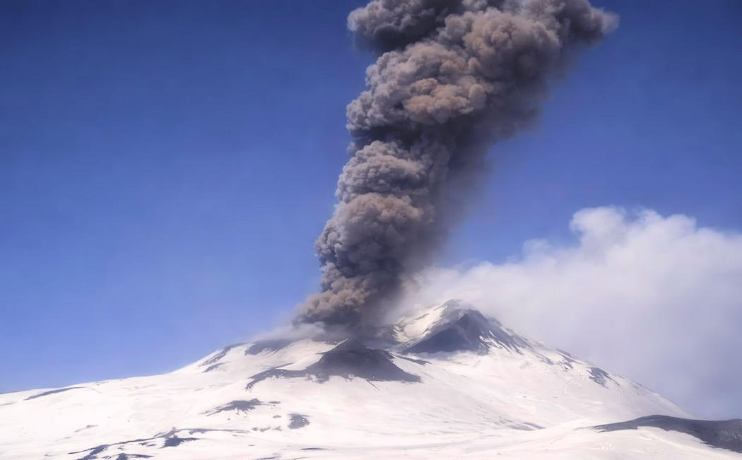
Etna Activity Update, March 4, 2026, 2:05 PM (1:05 PM UTC).
The National Institute of Geophysics and Volcanology, Etna Observatory, reports that at 12:12 PM UTC, monitoring cameras observed an impulsive explosion originating from the Bocca Nuova crater, producing an ash emission that dispersed within minutes in the eastern quadrants of the volcano.
From a seismic perspective, at 12:12 PM UTC, an oscillation of greater than normal amplitude was recorded, correlated with explosive activity. This is associated with an infrasound event located in the Bocca Nuova area. The average tremor amplitude increased moderately from the beginning of the day until approximately 8:40 AM UTC, reaching the average range where it is currently being maintained.
The center of gravity of the tremor sources is located between the Northeast and Voragine craters, at an average depth of approximately 3 km above sea level. Localized infrasound activity continues in the Northeast crater area, with low to moderate amplitudes.
Regarding the explosive event at 12:12 UTC, the permanent GNSS and tiltmeter deformation monitoring networks have not detected any significant changes.
Further information will be released promptly and, in any event, within 3 hours of the publication of this announcement.
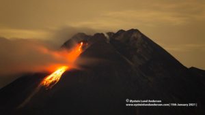
Mount Etna. Impulsive explosive event of March 4, 2026 at 1:12 PM
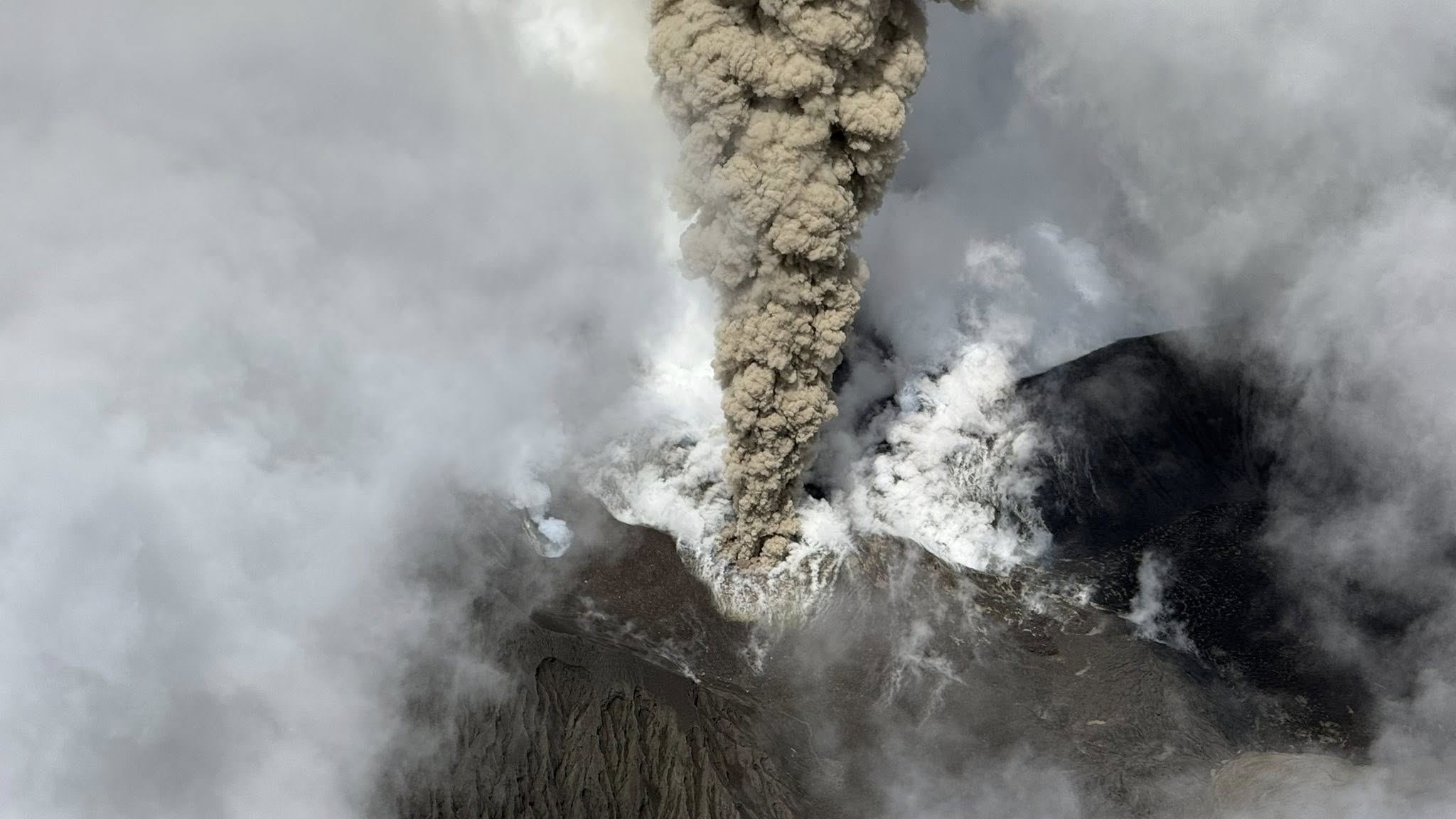
On Wednesday, March 4, 2026, at 1:12 PM local time, Mount Etna was struck by an impulsive explosive event lasting a few minutes, which affected the summit crater of Bocca Nuova.
This event generated an ash cloud approximately 1.5 km high, which was quickly dispersed by high-altitude winds to the northeast, causing light ashfall on the upper part of the volcano.
This type of event occurs suddenly, without any geophysical warning signs, and is one of the various types of explosive events that can occur in the summit craters of Mount Etna.
The Bocca Nuova crater was itself affected by an impulsive event with the same characteristics as today’s, on August 25, 2010.
To date, no correlation has been established between this explosive event and the magnitude 4.5 earthquake that occurred this morning at 7:05 a.m. local time in the province of Catania.
Source et photo : INGV.
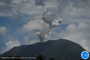
Vanuatu Archipelago, Ambae :
The Vanuatu Meteorology and Geohazards Department (VMGD) reported continuing eruptive activity at Ambae during 19-25 February. Activity first started to increase in November 2025 with periodic ash emissions but escalated on 12 February. Satellite data and webcam images indicated that a lava eruption occurred during 12-13 February, and residents reported ashfall. Activity decreased during 14-15 February based on seismic data.
Low-to-moderate thermal anomalies were identified in satellite images during 19-21 February. Seismicity increased on 20 February. High to extremely high levels of sulfur dioxide emissions were identified in satellite data during 20-21 February. Continuous ash-and-gas emissions rising from the summit were visible in satellite and webcam images during 20-23 February. A webcam image at 0530 on 22 February showed a plume rising above the summit that was half white from steam-and-gas and half gray from ash. Later that day, at 1400, a dense cloud of steam, gas, and ash was visible rising more than 1.3 km above the summit. Ground observers heard noises related to explosive activity and reported volcanic gas odors. Ash fell in communities to the S and SE during 22-23 February. On 23 February the Alert Level was raised to 3 (on a scale of 0-5), and the public was warned to stay outside of Danger Zone B, defined as a 3-km radius around the active vents in Lake Voui, and to stay away from drainages during heavy rains.
Seismic activity was continuous, characterized by volcanic tremor and volcano-seismic events during 22-24 February. Satellite instruments continued to detect very high to extremely high amounts of sulfur dioxide, and a moderate thermal anomaly, on 24 February. Ash-and-gas plumes were visible in webcam images, rising just over 1 km above the summit. The Wellington Volcanic Ash Advisory Centre (VAAC) reported that on 25 February gas-and-steam plumes with intermittent ash were visible in webcam images rising to 3 km (10,000 ft) a.s.l., or about 1.5 km above the summit; weather clouds obscured satellite views.
Sources: Vanuatu Meteorology and Geohazards Department (VMGD), Wellington Volcanic Ash Advisory Center (VAAC), GVP.
Photo : Unity Airlines Vanuatu
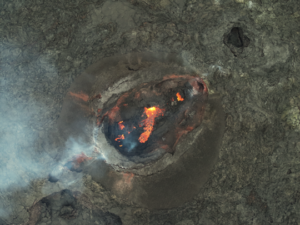
La Réunion Island , Piton de la Fournaise :
The Observatoire Volcanologique du Piton de la Fournaise (OVPF) reported that the eruption at Piton de la Fournaise decreased during 19-25 February. The elongated cone around the fourth fissure, on the lower SE flank of Dolomieu Crater, continued to grow. Lava fountains were visible from Piton de Bert rising from the central part of the cone and lava flows continued to advance downslope through developing sections of lava tubes. The lava flow field widened and thickened near the eruptive site in the Grandes Pentes area during the week; the longest lava flow had stopped the previous week at about 1,725 m elevation, on the lower part of Grandes Pentes, about 2.6 km from the road. Numerous rockfalls at the eruptive site and recently emplaced lava flows were detected by the seismic network and confirmed during field observations, though the daily numbers began to decrease around 24 February.
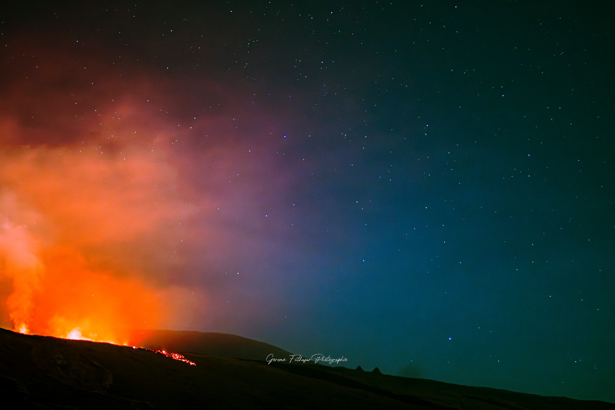
Lava-flow rates estimated from satellite data were 1-12 cubic meters per second, though estimates could vary due to cloud cover, and indicated decreasing effusion rates. Summit seismicity decreased; earthquakes beneath the summit were last detected on 22 February. The intensity of the eruptive tremor, indicative of lava effusion and gas emissions, was relatively low and stable during the week with a few low-amplitude fluctuations; amplitude peaks about every four hours were recorded during 24-25 February likely associated with variations in surface activity. Sulfur dioxide emissions were as high as 10,000 tons per day (t/d) on 13 February, at the beginning of the eruption, rapidly decreased during 13-15 February, and were less than 100 t/d starting on 16 February. The Alert Level remained at 2.1 (on a 0–4 scale).
Sources: Observatoire Volcanologique du Piton de la Fournaise (OVPF) , GVP.
Photo : FotoGraph FotoGraph / FB.
Mexico , Popocatepetl :
The Centro Nacional de Prevención de Desastres (CENAPRED) reported that eruptive activity continued at Popocatépetl during 18-25 February. The seismic network recorded 5-32 long-period events per day, accompanied by steam-and-gas emissions that drifted mainly SW, ESE, and NW. In addition, the seismic network recorded 0-123 minutes of tremor daily. During 19-20 February there were 53 minutes of low-amplitude tremor, including 40.5 minutes of high-frequency signals and 12.5 minutes were harmonic signals, as well as 376 minutes of low-amplitude exhalation sequences. Minor ashfall was reported in the municipalities of Hueyapan, Tetela del Volcán, and Ocuituco. According to the Washington Volcanic Ash Advisory Center (VAAC) an ash plume was visible in webcam and satellite images on 19 February rising 5.8-6.1 km (19,000-20,000 ft) a.s.l. (as high as 400 m above the summit) and drifting SW and W. An ash emission at 01h46 on 20 February produced a long dense ash plume visible in satellite images at 03h31 that drifted W and WNW at an altitude of 6.7 km (22,000 ft) a.s.l. (as high as 1.3 km above the summit). At 09h11 another long ash plume drifted almost 95 km W of the summit at the same altitude.
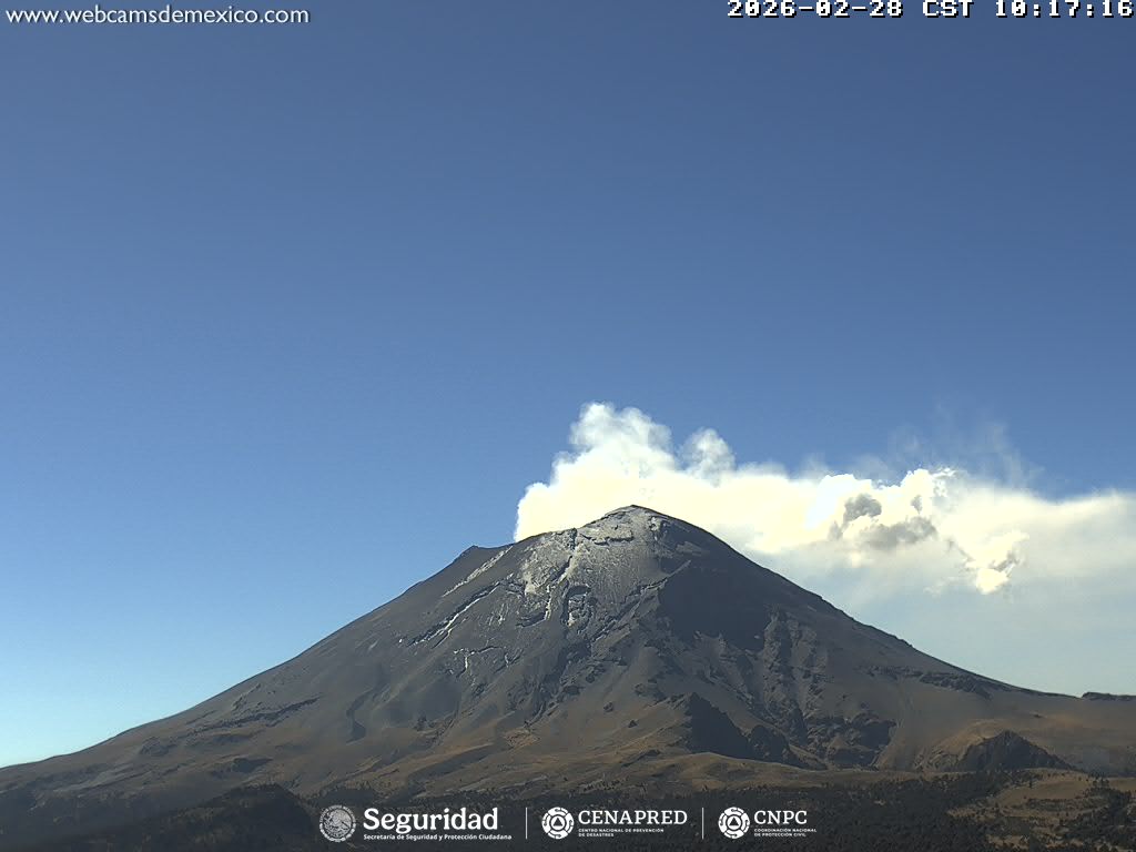
Later that day, at 14h56, an ash plume was visible drifting WSW at 5.8 km a.s.l. and continuous ash emissions were visible in webcam images. In the evening moderately dense ash puffs were visible in satellite images drifting W. CENAPRED webcam images captured at 01h28 and 22h26 on 20 February showed incandescent material on the upper flanks. The VAAC reported that at 05h56 on 21 February an ash plume fanned out to the SW based on satellite and webcam images, and at 11h51 ash plumes were visible drifting W at 6.1 km a.s.l. Later that evening ash puffs rose to the same altitude and drifted W. On 22 February ash plumes were visible in satellite images drifting less than 30 km SW at an altitude of 6.1 km. Minor ashfall was reported by CENAPRED in the municipalities of Yecapixtla and Tetela del Volcán during 21-22 February.
The Alert Level remained at Yellow, Phase Two (the middle level on a three-color scale) and the public was warned to stay 12 km away from the crater.
Sources: Centro Nacional de Prevencion de Desastres (CENAPRED), Washington Volcanic Ash Advisory Center (VAAC), GVP.
Japan , Sakurajima :
The Japan Meteorological Agency (JMA) reported ongoing eruptive activity at Minamidake Crater (Aira Caldera’s Sakurajima volcano) during 16-23 February. Crater incandescence was visible in webcam images during dark hours. A very small eruptive event was recorded on 18 February. The Alert Level remained at 3 (on a 5-level scale), and the public was warned to be cautious within 2 km of both the Minimadake and Showa craters.
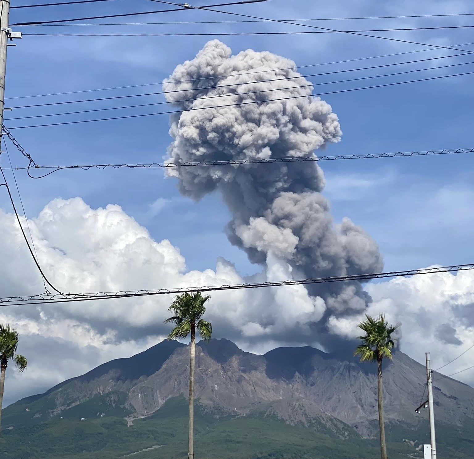
The Aira caldera in the northern half of Kagoshima Bay contains the post-caldera Sakurajima volcano, one of Japan’s most active. Eruption of the voluminous Ito pyroclastic flow accompanied formation of the 17 x 23 km caldera about 22,000 years ago. The smaller Wakamiko caldera was formed during the early Holocene in the NE corner of the caldera, along with several post-caldera cones. The construction of Sakurajima began about 13,000 years ago on the southern rim and built an island that was joined to the Osumi Peninsula during the major explosive and effusive eruption of 1914. Activity at the Kitadake summit cone ended about 4,850 years ago, after which eruptions took place at Minamidake. Frequent eruptions since the 8th century have deposited ash on the city of Kagoshima, located across Kagoshima Bay only 8 km from the summit. The largest recorded eruption took place during 1471-76.
Sources: Japan Meteorological Agency (JMA) , GVP.
Photo : Kumiko Nagai.