April 19 , 2026.
La Réunion Island , Piton de La Fournaise :
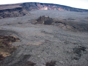
Press release from the Paris Institute of Earth Physics / Piton de la Fournaise Volcanological Observatory, April 19, 2026 – 8:30 a.m. local time – 4:30 a.m. UTC.
Resumption of Tremor
Since approximately 6:20 a.m. (local time, 2:20 a.m. UTC) on April 19, 2026, a low-amplitude volcanic tremor has been recorded again. According to the OVPF recordings, the source of this signal is located on the east-southeast flank of the volcano. This signal, still of low intensity, could indicate an imminent resumption of eruptive activity, most likely at the level of the last eruptive cone of the eruption that began on February 13, 2026.

Currently, no lava flows are visible on the observatory’s cameras. However, the presence of this tremor indicates the presence of magma at shallow depths and suggests the possibility of lava flows resuming in the short term. Degassing is also still being observed at the eruption site.
The OVPF continues to closely monitor the evolution of the activity.
Source : OVPF-IPGP.
Photo : Imaz Press Réunion.
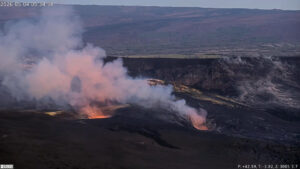
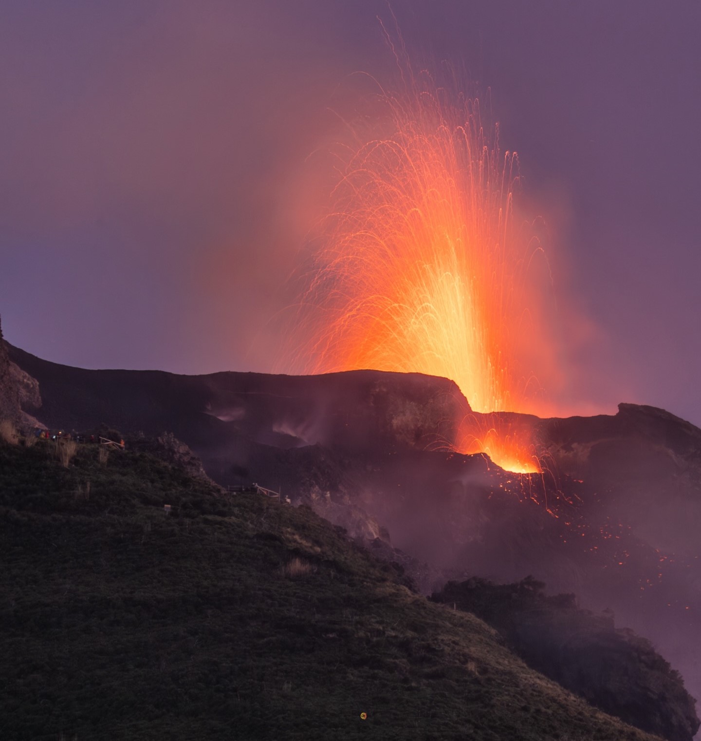
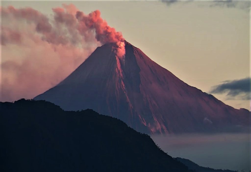
Italy , Stromboli :
Stromboli Activity Report, April 19, 2026, 00:55 (22:55 UTC).
The National Institute of Geophysics and Volcanology, Etna Observatory, reports, based on analysis of surveillance camera images, that effusive activity due to a lava overflow from the northern area of the crater has been ongoing since approximately 22:00 UTC. This activity is producing a lava flow whose front is located in the upper-middle part of the Sciara del Fuoco.
From a seismic perspective, the average amplitude of volcanic tremor shows no significant variation and remains within the average range. No significant variation was observed in the frequency and amplitude of explosion earthquakes.
GNSS network deformation data shows no significant variation.
Further information will be released soon.
Source : INGV
Photo : Stromboli stati d’animo / Sebastiano Cannavo
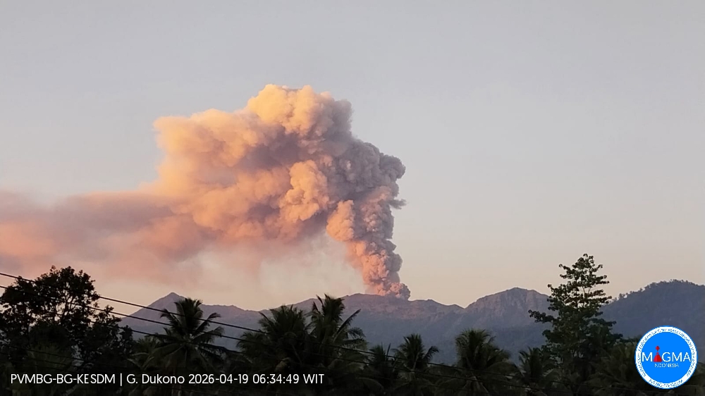
Indonesia , Dukono :
An eruption of Mount Dukono occurred on Sunday, April 19, 2026, at 06:22 WIT, with an observed ash column height of approximately 1400 m above the summit (approximately 2487 m above sea level). This ash column, white to gray in color, was highly intense and moving eastward. At the time of writing, the eruption was still ongoing..
Seismic Observations
129 eruption earthquakes with amplitudes between 6 and 34 mm and durations from 31.64 to 48.77 seconds.
Two tectonic earthquakes, occurring at intervals of 14 to 15 mm, with durations from 99.73 to 176.3 seconds.
Continuous seismic tremor with amplitudes between 1 and 6 mm, predominantly 5 mm.
Recommendations
(1) Communities living near Mount Dukono and visitors/tourists are advised to refrain from any activity, climbing, or approaching the Malupang Warirang crater within a 4 km radius.
(2) Since volcanic ash eruptions occur periodically and the distribution of ash follows the direction and speed of the wind, making the ash cover area unstable, communities around Mount Dukono are advised to always have masks/face coverings and mouth coverings available to use as needed to avoid the dangers of volcanic ash to the respiratory system.
Source et photo : PVMBG.
Colombia , Nevado del Ruiz :
Manizales, April 14, 2026, 3:00 PM
Regarding the monitoring of activity at the Nevado del Ruiz volcano, the Colombian Geological Survey (SGC), an agency under the Ministry of Mines and Energy, reports that:
During the week of April 7-13, 2026, the volcano continued to exhibit unstable behavior. Compared to the previous week, the main variations in monitored parameters were as follows:
– Seismic activity associated with rock fracturing processes within the volcanic edifice remained stable, both in terms of the number of recorded earthquakes and the seismic energy released. The earthquakes were located in the Arenas crater and on the south-southwest flank, within 5 km of the crater, and, to a lesser extent, on other flanks of the volcano, up to 12 km from the crater. The magnitude of the earthquakes was less than 1.0, indicating low energy, and their depth ranged from less than 1 km to 7 km relative to the reference level.
– Seismicity related to fluid dynamics in volcanic conduits decreased, both in the number of earthquakes and in the seismic energy released. This activity was dominated by short-duration, low-energy events. During the week, no ash emissions or changes in the apparent temperature of the emitted materials, associated with this type of event, were observed.
– Emissions of water vapor and volcanic gases, primarily sulfur dioxide (SO₂), from the Arenas crater into the atmosphere were variable. Estimated daily SO₂ fluxes related to degassing processes increased slightly compared to the previous week; however, they remained low. This increase was partly due to favorable wind direction at the monitoring stations. Additional monitoring, using satellite data, observed low SO₂ emissions.
The vertical height of the gas, vapor, or ash column varied between 200 and 700 m above the volcano’s summit, with values between 200 and 400 m predominating. The dispersal direction varied across different sectors of the volcano, mainly towards the north-northwest, northwest, and northeast flanks.
Monitoring thermal anomalies at the bottom of the Arenas crater, using satellite platforms, has made it possible to detect several low-energy anomalies.
Source : SGC.
Photo : Ramirez Jorge
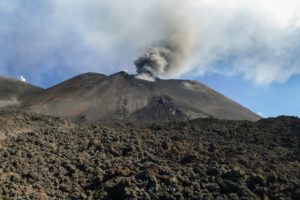
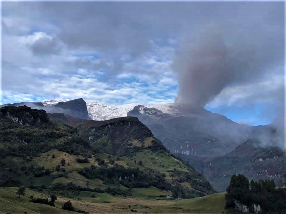
Ecuador , Sangay :
DAILY REPORT ON THE STATE OF SANGAY VOLCANO, Saturday, April 18, 2026.
Geophysical Information Institute – EPN.
Surface Activity Level: High, Surface Trend: No Change
Internal Activity Level: Moderate, Internal Trend: No Change
Seismicity: From April 17, 2026, 11:00 AM to April 18, 2026, 11:00 AM:
Seismicity:
Explosion (EXP): 348
Rain/Lahars:
Precipitation has been recorded in the volcano area, but it has not generated any mudflows or debris flows. **In the event of heavy rainfall, accumulated material could be remobilized, causing mudflows and debris flows that would cascade down the volcano’s flanks and into nearby rivers.**
Emissions/Ash:
Since yesterday afternoon, several gas and ash emissions have been recorded by the monitoring camera system. These emissions reached an altitude of less than 1,300 meters above the crater rim and drifted northeast and northwest. They were also observed in satellite imagery. The Washington VAAC agency published four ash emission reports, with altitudes between 900 and 1,200 meters above the crater rim and trajectories toward the east and northeast.
Gas:
The MOUNTS satellite system detected 17.9 tons of sulfur dioxide (SO₂), measured yesterday at 1:59 p.m. local time.
Other monitoring parameters:
The FIRMS satellite system recorded 3 thermal anomalies, the MIROVA-MODIS satellite system 2 thermal anomalies, and the MIROVA-VIIRS satellite system 2 thermal anomalies in the last 24 hours.
Observation:
From yesterday afternoon until the time of writing this report, the volcano remained partly cloudy. However, early this morning, a flow of incandescent material was observed up to 1,200 meters below the crater rim.
Alert level: Yellow
Source et photo : IGEPN
Indonesia , Anak Krakatau :
VOLCANO OBSERVATORY NOTICE FOR AVIATION – VONA
Issued : April 17 , 2026
Volcano : Anak Krakatau (262000)
Current Aviation Colour Code : YELLOW
Previous Aviation Colour Code : yellow
Source : Anak Krakatau Volcano Observatory
Notice Number : 2026KRA009
Volcano Location : S 06 deg 06 min 07 sec E 105 deg 25 min 23 sec
Area : Lampung, Indonesia
Summit Elevation : 502 FT (157 M)
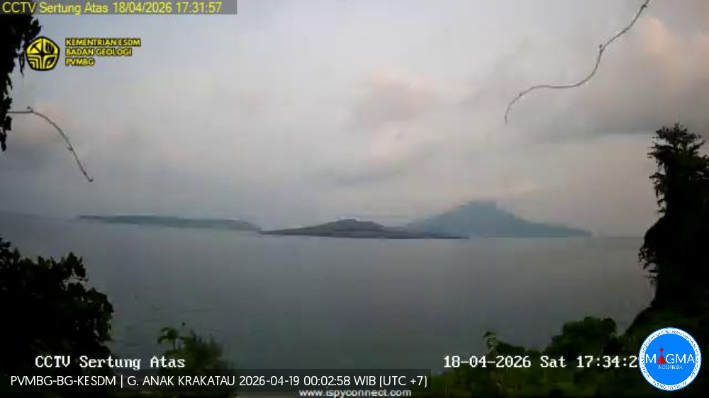
Volcanic Activity Summary :
Increasing in volcanic activity.
Volcanic Cloud Height :
Best estimate of ash-cloud top is around 518 FT (162 M) above sea level or 16 FT (5 M) above summit. May be higher than what can be observed clearly. Source of height data: ground observer.
Other Volcanic Cloud Information :
Ash cloud moving from southwest, west to northwest. Volcanic ash is observed to be white. The intensity of volcanic ash is observed to be thin.
Remarks :
Tremor recorded on seismogram with maximum amplitude 2 mm. The weather was cloudy, ranging from overcast to rainy. The volcano was clearly visible at times but occasionally obscured by fog. Winds were light, blowing toward the west, southwest, and northwest. White, thin, weak gas emissions were observed, rising to a height of approximately 5 meters.
Source et photo : PVMBG.