April 20 , 2026.
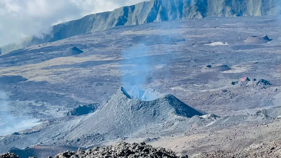
La Réunion Island , Piton de la Fournaise :
Press release from the Paris Institute of Earth Physics, Piton de la Fournaise Volcanological Observatory, April 20, 2026 – 8:45 a.m. local time – 4:45 a.m. UTC.
Tremor
Tremor has been recorded since approximately 6:20 a.m. (local time, 2:20 a.m. UTC) on April 19. The intensity of this tremor is currently low and fluctuating. The source of this tremor is located on the east-southeast flank of the volcano and is positioned in the same location as during the eruptive activity phases from February 13 to April 12.
Currently, only degassing is observed at the eruptive sites associated with the activity from February 13 to April 12, located at an altitude of 2056-2120 m on the east-southeast flank of the volcano.
This tremor nevertheless indicates the presence of magma at shallow depths; thus, a resumption of lava flows cannot be ruled out.
Seismicity
Since the cessation of surface eruptive activity on April 12 at 11:10 PM (local time), shallow seismicity beneath the summit remains weak; however, deep seismicity persists. This seismicity is located west of the summit, approximately 6 km below sea level.
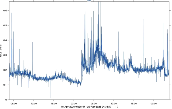
Amplitude of the eruptive tremor measured at the FOR seismic station located on the south-southeast flank of the volcano, over the last 48 hours. The vertical axis indicates the tremor amplitude (in micrometers per second) and the X-axis represents the time in UTC (local time -4 hours) (©OVPF-IPGP).
Deformation
In parallel, slight inflation appears to be emerging over the last three days. This parameter will need to be confirmed in the coming days.
Source : OVPF-IPGP.
Photos : Cynthia Veron , OVPF.
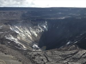
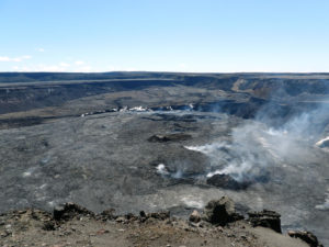
Hawaii , Kilauea :
HAWAIIAN VOLCANO OBSERVATORY DAILY UPDATE, U.S. Geological Survey
Sunday, April 19, 2026, 8:27 AM HST (Sunday, April 19, 2026, 18:27 UTC)
19°25’16 » N 155°17’13 » W,
Summit Elevation 4091 ft (1247 m)
Current Volcano Alert Level: ADVISORY
Current Aviation Color Code: YELLOW
Overview:
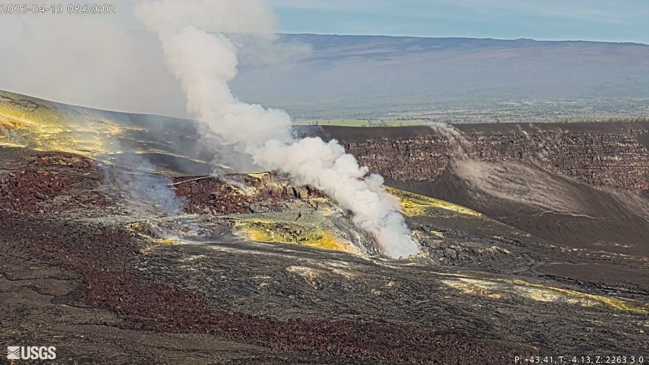
The summit eruption of Kīlauea in Halemaʻumaʻu is paused. Overall summit region inflation has continued since the end of episode 44 on April 9. However, the summit region slowly deflated for much of yesterday, returning to inflation late last night. Because of the brief deflationary excursion, the forecast models now suggest that lava fountaining episode 45 will occur slightly later, sometime between Tuesday, April 21, and Sunday, April 26. Strong and continuous glow, with frequent flames, have continued to be visible at the south vent over the past day.
No significant activity has been noted along Kīlauea’s East Rift Zone or Southwest Rift Zone.
Summit Observations:
Glow was consistently visible at the Halemaʻumaʻu south vent overnight, along with prolonged periods of intense flaming—likely caused by the ignition of volcanic gases escaping the vent. The north vent continues to emit volcanic gases, but no glow was visible there overnight.
Low-level seismic tremor continues during the ongoing eruptive pause, and no earthquakes were recorded in Kīlauea summit region in the past 24 hours. Since the end of lava fountaining episode 44 on April 9, the Uēkahuna tiltmeter (UWD) has tracked approximately 13.1 microradians of inflationary tilt (note that this value is unchanged from the value reported in yesterday’s update due to the deflation and reinflation that occurred during the past 24 hours). This instrument recorded 17.6 microradians of deflationary tilt in total during the episode.
With the eruption paused, the sulfur dioxide (SO2) emission rate from Halemaʻumaʻu is likely now varying within a typical range of 1,000 to 5,000 tonnes per day. For the past few days, winds near the eruptive vents have been steady out of the northeast in the mornings before transitioning to more variable directions in the afternoons and evenings.
Rift Zone Observations:
Rates of seismicity and ground deformation remain low in the East Rift Zone and Southwest Rift Zone. SO2 emissions from the East Rift Zone remain below the detection limit.
Source et photo : HVO.
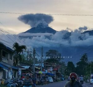
Indonesia , Semeru :
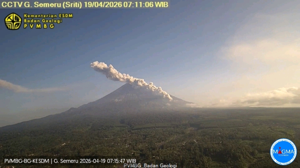
An eruption of Mount Semeru occurred on Sunday, April 19, 2026, at 07:06 WIB, with an observed ash column height of approximately 1000 m above the summit (approximately 4676 m above sea level). This ash column, white to gray in color, was highly intense and directed southwest. The eruption was recorded by a seismograph with a maximum amplitude of 22 mm and a duration of 271 seconds.
Seismic Observations
14 eruption earthquakes with amplitudes of 15 to 22 mm and durations of 77 to 130 seconds.
6 emission earthquakes with amplitudes of 3 to 6 mm and durations of 34 to 67 seconds.
2 distant tectonic earthquakes with amplitudes of 4 to 5 mm and durations of 81 to 115 seconds.
Recommendations
1. All activity is prohibited in the southeast sector of Besuk Kobokan, within 13 km of the summit (epicenter of the eruption). Beyond this distance, the public is advised to refrain from any activity within 500 meters of the Besuk Kobokan shoreline due to the risk of pyroclastic flows and lava flows extending up to 17 km from the summit.
2. Refrain from any activity within a 5 km radius around the crater/summit of Mount Semeru due to the risk of (incandescent) rock projection.
Source et photo : PVMBG.
Colombia , Galeras :
San Juan de Pasto, April 14, 2026, 4:50 PM
Regarding the monitoring of activity at the Galeras volcano, the Colombian Geological Survey (SGC), an agency under the Ministry of Mines and Energy, reports the following:
During the week of April 7-13, 2026, the main variations in monitored parameters, compared to the previous week, were as follows:
● Volcanic activity remained low, with a decrease in the number of seismic events and their energy release. Most earthquakes were associated with rock fracturing processes within the volcanic edifice.
● Due to their low energy, only six earthquakes were detected, located near the volcanic area, at distances of up to 6.4 km and at depths of less than 5.4 km from the summit of the Galeras volcano (4,200 m altitude), with magnitudes of less than 1.0.
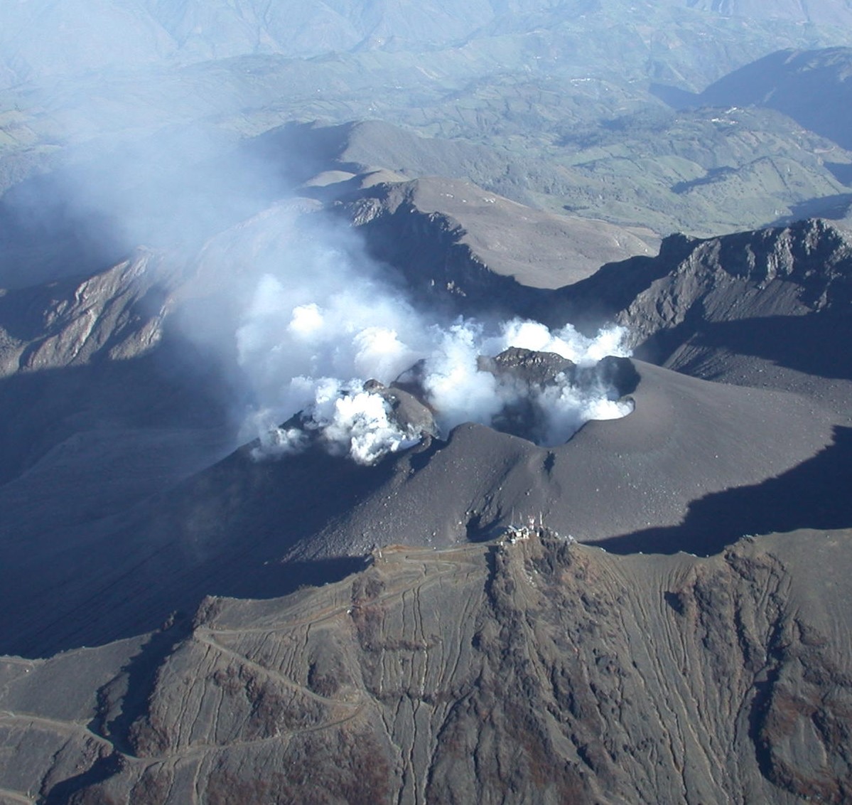
● Throughout the week, low-altitude plumes of white gas were observed, with varying dispersion depending on wind direction, originating primarily from the fumarolic fields of El Paisita, to the north, and Las Chavas, to the west of the volcanic cone.
● All other volcanic monitoring parameters remained stable.
Given the above, the Geological Survey of Colombia (SGC) recommends closely monitoring the situation by consulting the weekly bulletins and other information published through its official channels, as well as the instructions of local and departmental authorities and the National Unit for Disaster Risk Management (UNGRD).
Volcanic activity remains at the yellow alert level: Active volcano with changes in the baseline behavior of monitored parameters and other manifestations.
Source et photo : SGC.
Ecuatdor , El Reventador :
REVENTADOR VOLCANO DAILY STATE REPORT, Sunday, April 19, 2026.
Geophysical Information Institute – EPN.
Surface Activity Level: High, Surface Trend: No Change
Internal Activity Level: Moderate, Internal Trend: No Change
From April 18, 2026, 11:00 AM to April 19, 2026, 11:00 AM:
Seismicity:
Explosions (EXP) 73
Long Period (LP) 18
Emission Tremors (TREMI) 16
Harmonic Tremors (TRARM) 9
Precipitation/Lahars:
No precipitation was recorded in the volcano area. **In the event of heavy rains, this could remobilize the accumulated materials, generating mud and debris flows that would rush down the sides of the volcano and flow into nearby rivers.
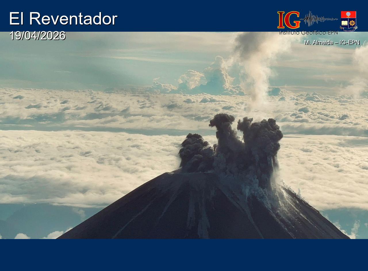
Emission column/ash:
Several gas and ash emissions were observed, reaching an altitude of 400 meters above the crater, drifting east-northeast and northeast. Additionally, the GOES-19 satellite system detected several gas and ash plumes rising between 800 and 1,000 meters above the crater, drifting east-northeast, east, east-southeast, and northeast. Regarding this activity, the Washington VAAC issued five reports documenting ash emissions at an altitude between 1,000 and 1,300 meters above the crater, drifting northeast, east, east-southeast, and east-northeast.
Other monitoring parameters:
Over the past 24 hours, the FIRMS satellite system recorded 17 thermal anomalies, while the MIROVAMODIS system recorded 2, and the MIROVA-VIIRS 375 and MIROVA-VIIRS 750 systems each recorded 1.
Observation:
IG technicians in the field observed incandescent blocks detached from a lava flow. At the time of writing, the volcano is shrouded in clouds.
Alert level – SGR: Orange
Source : IGEPN.
Photo : M Almeida / IGEPN