September 30 , 2026.
Italy / Sicily , Etna :
WEEKLY BULLETIN, September 21, 2026 – September 27, 2026 (issue date: September 29, 2026)
ACTIVITY SUMMARY
Based on monitoring data, the following is observed:
1) VOLCANOLOGICAL OBSERVATIONS: Variable degassing activity at the summit craters and ash emissions of varying intensity from the Northeast Crater.
2) SEISMOLOGY: Absence of fracturing seismic activity with magnitude Ml ≥ 2.0. Mean volcanic tremor amplitude moderately variable, fluctuating between low and medium values.
3) INFRASOUND: Infrasonic activity generally low to moderate, localized at the Northeast Crater.
4) GROUND DEFORMATION: Signals from ground deformation monitoring networks indicate an ongoing inflation phase.
5) GEOCHEMISTRY: SO2 flux at a medium and increasing level.
Soil CO2 flux (Etnagas): medium values.
Partial pressure of dissolved CO2 in groundwater (EtnaAcque network): no update.
Helium (He) isotope ratio at peripheral sites: the latest data from September 22, 2026, confirm high values.
SO2/HCl ratio (FTIR): medium to high values.
6) SATELLITE OBSERVATIONS: Thermal activity observed by satellite in the summit area was at a low to moderate level. 7) OTHER OBSERVATIONS: Data from the RADONETNA network collected during the week of September 21–27, 2026, revealed few potential anomalies—whether positive or negative—and these were essentially short-lived. These apparently anomalous variations were observed at the Piano Provenzana, Santa Venerina, and Rifugio Sapienza sites.
A sample of volcanic ash was collected and analyzed approximately 16 km from the Northeast Crater; it consisted of fine ash with an overall reddish coloration.
VOLCANOLOGICAL OBSERVATIONS
During the week in question, monitoring of Etna’s volcanic activity was conducted through the analysis of images from INGV – Osservatorio Etneo (INGV-OE) surveillance cameras and through field observations.
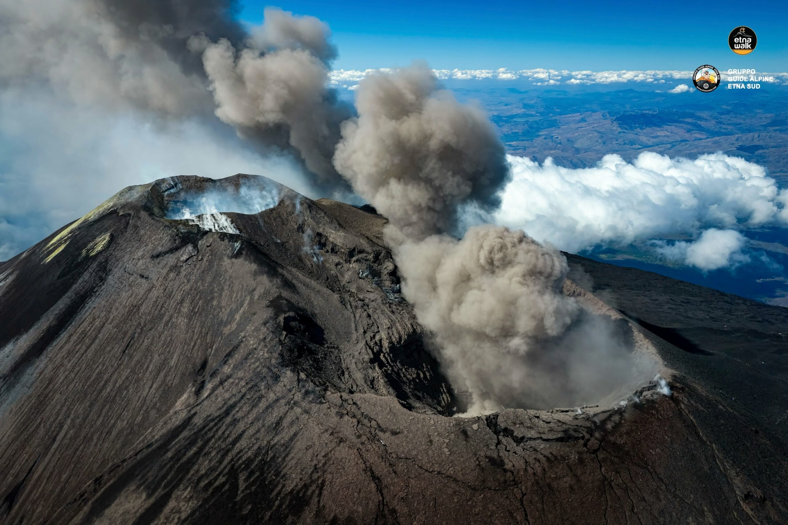
Compared to the activity observed the previous week (see Report No. 39/2026 ETNA), activity at Etna’s summit craters was characterized solely by variable ash emission from the North-East Crater. Specifically, an increase in ash emissions was recorded starting on September 24; this generated a modest reddish-brown volcanic plume rising to approximately 4 km above sea level and caused light ashfall on Etna’s southeastern flank, extending as far as the coast. From the late afternoon of September 28, the intensity of ash emission became highly variable, producing a volcanic plume that was at times heavily diluted.
Finally, regarding the other summit craters, Bocca Nuova exhibited degassing from the BN-1 vent, while the Voragine and South-East craters displayed their usual fumarolic activity issuing from numerous fractures along the crater rims.
Source : INGV.
Photo : Etna Walk / Gruppo guide alpine Etna Sud.
Italy , Stromboli :
WEEKLY BULLETIN, September 21, 2026 – September 27, 2026 (issue date: September 29, 2026)
ACTIVITY SUMMARY
Based on monitoring data, the following is noted:
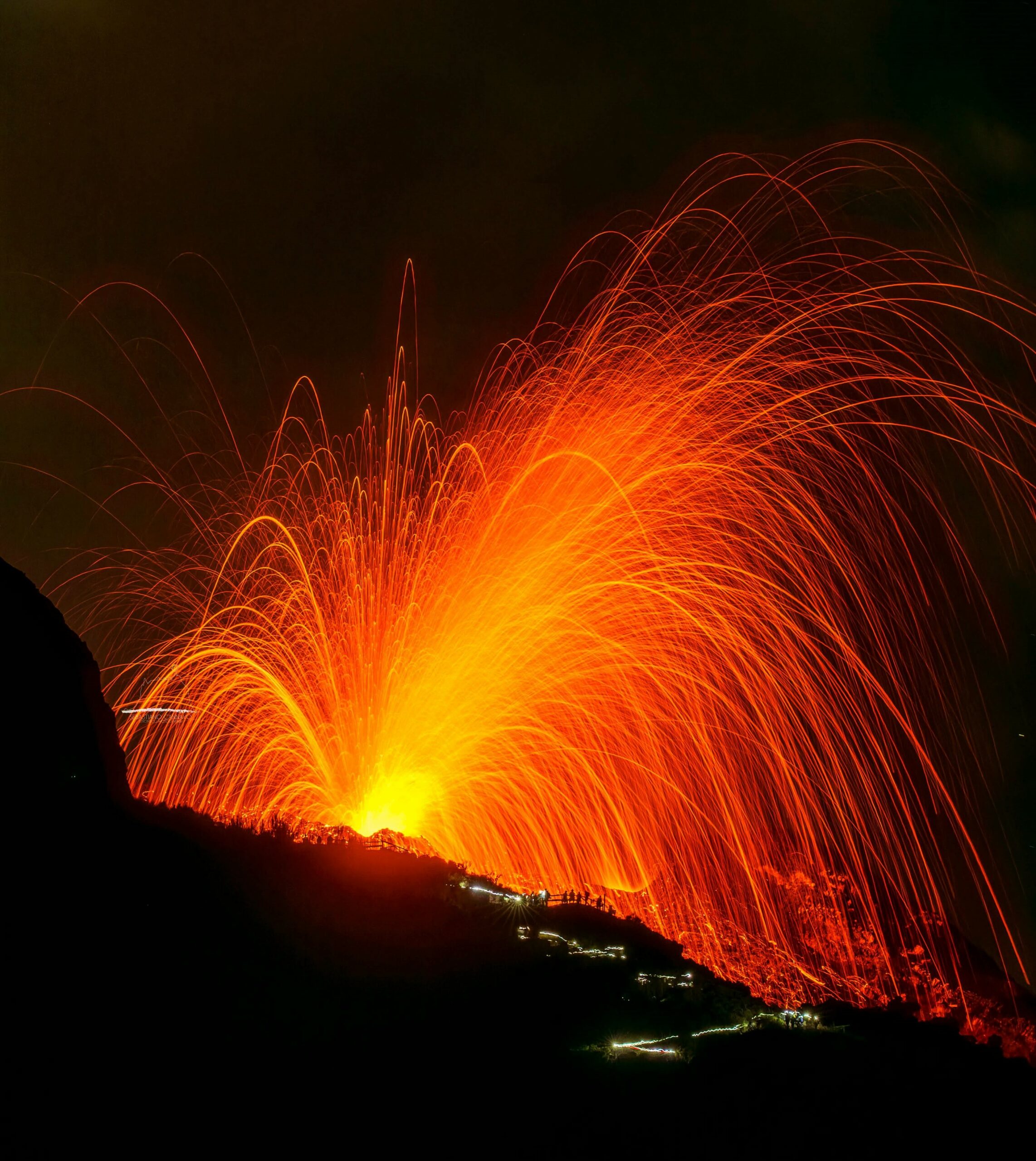
1) VOLCANOLOGICAL OBSERVATIONS: Ordinary Strombolian-style eruptive activity across both crater zones, occasionally accompanied by spattering (lava ejections) in the North crater zone. The frequency of total explosive activity (including the North and Central-South crater zones) was at a medium-high level, with low explosion intensity in both the North and Central-South crater zones.
2) SEISMOLOGY: During the week in question, no earthquakes with a magnitude of Ml ≥ 1.0 were located in the Stromboli Island area.
3) GROUND DEFORMATION: Signals from ground deformation monitoring networks showed no significant variations.
4) GEOCHEMISTRY: SO2 flux at a medium level.
Soil CO2 flux (Pizzo zone – STR02): no update.
C/S ratio in the plume: no update.
Helium isotopic ratio (R/Ra): no update.
Soil CO2 flux in the San Bartolo zone: high values.
Soil CO2 flux in the Scari zone: no update.
5) SATELLITE OBSERVATIONS: Satellite-observed thermal activity in the summit area ranged from low to medium levels.
VOLCANOLOGICAL OBSERVATIONS
Observations of explosive activity captured by surveillance cameras
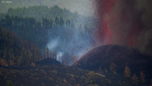
During the observation week, Stromboli’s eruptive activity was characterized through the analysis of images recorded by INGV-OE surveillance cameras located at an elevation of 190 m above sea level and at Punta dei Corvi (SCT-SCV and SPCT, respectively). Explosions in the North crater area (Zone N) primarily produced coarse material (bombs and lapilli); in the Central-South crater area (Zone CS), explosions produced mainly fine material mixed with coarse material. The average explosion frequency for Zone N was at medium-to-high levels. In Zone CS, the average explosion frequency was at medium-to-low levels. The total daily average hourly explosion frequency (Zone N + Zone CS) was at a medium-to-high level.
The intensity of explosive activity remained generally low in both crater areas.
Source : INGV.
Photo : Stromboli stati d’animo / Sebastiano Cannavo
Hawaii , Kilauea :
HAWAIIAN VOLCANO OBSERVATORY DAILY UPDATE , U.S. Geological Survey
Tuesday, September 29, 2026, 9:02 AM HST (Tuesday, September 29, 2026, 19:02 UTC)
19°25’16 » N 155°17’13 » W,
Summit Elevation 4091 ft (1247 m)
Current Volcano Alert Level: WATCH
Current Aviation Color Code: ORANGE
Summary:
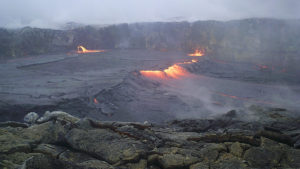
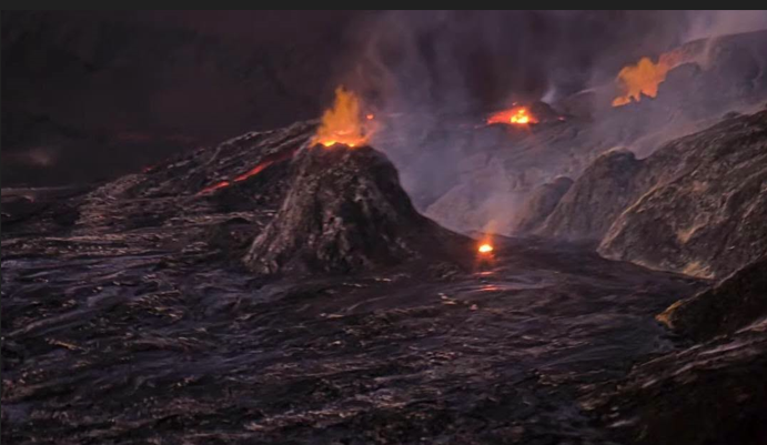
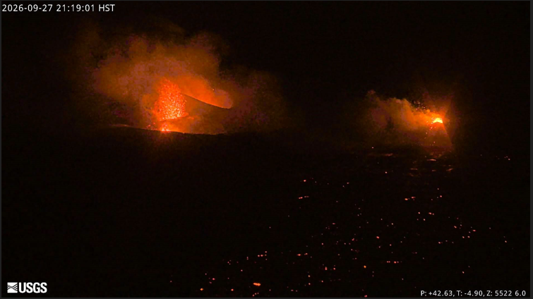
Numerous rapid cycles of south vent overflows and drainback occurred overnight within Halema’uma’u crater at the summit of Kīlauea. The north and south vents had strong glow and intermittent spatter. There is no anomalous activity outside of the summit.
Overview:
Episode 55 fountaining remains a possibility during the ongoing Kīlauea summit eruption. Precursory overflows from the north vent resumed on the night of September 22. Short, rapid cycles of south vent overflows and lava drainback occurred repeatedly overnight. Glow and flames were observed from the north and south vents throughout the night, with intermittent spatter bursts. Summit tilt was variable over the past 24 hours but recorded overall inflation. Continuous tremor remains the dominant seismic signal across the summit.
No anomalous seismic activity or deformation has occurred outside of the summit region, and no significant activity has been noted along Kīlauea’s East Rift Zone or Southwest Rift Zone.
Summit Observations:
Precursory overflows from the north vent resumed on September 22, beginning at 10:10 p.m. HST, after about 10 days of quiescence at the vent complex. Overflow activity from the south vent began on September 27, however, the north remained dominant until last night when short, rapid cycles of overflows and lava drainback began at 7:44 p.m. HST. The overflows have lasted about 2-5 minutes, with most pauses between each cycle lasting about 5-7 minutes. There have now been 165 overflows since September 22, and about 80 of those occurred during these rapid cycles. The north and south vents continued to glow strongly overnight and emit flames and intermittent spatter. No other areas of incandescence were observed across the summit region last night.
Continuous tremor is the dominant seismic signal across the summit. There were 14 small and shallow earthquakes located across the summit region in the past day, but they did not form clusters in time or location.
Summit tilt has been variable over the past day, with overall inflation of about 0.3 microradians. The current total inflation since the end of episode 54 is about 16.8 microradians, which is about 4 microradians greater than what was lost during episode 54 fountaining.
During inter-episode pauses, the sulfur dioxide (SO2) emission rate from the summit typically varies between 1,000 and 5,000 tonnes per day. Winds are currently forecast from the east.
Rift Zone Observations:
Rates of seismicity and ground deformation remain low in the East Rift Zone and Southwest Rift Zone. SO2 emissions from the East Rift Zone remain below the detection limit. No significant ground deformation was recorded in either rift zone.
Source : HVO.
Photos : USGS.
Indonesia , Semeru :
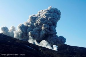
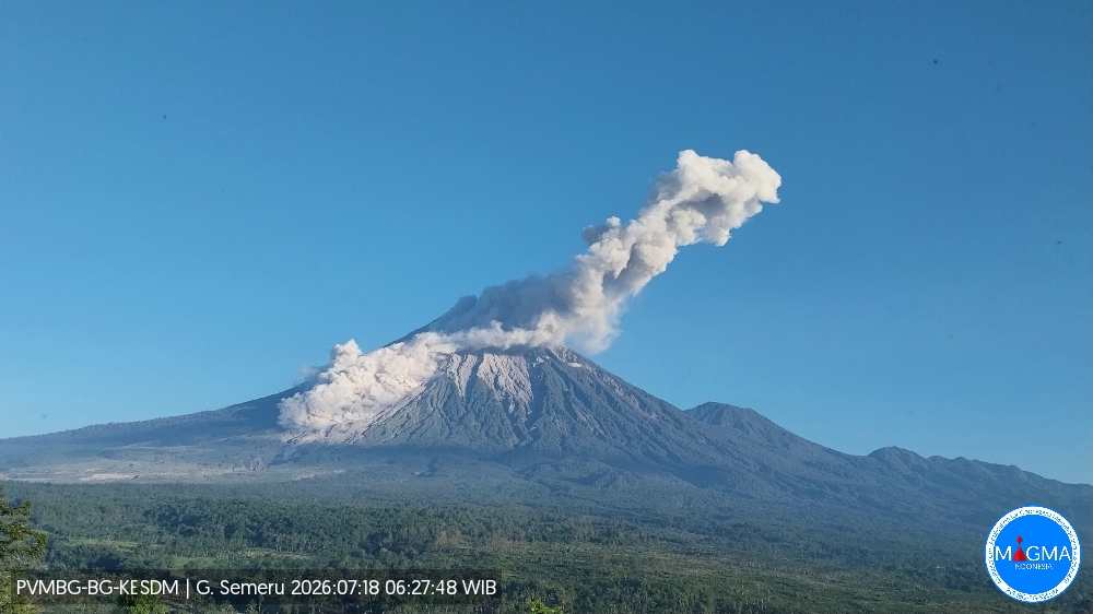
An eruption of Mount Semeru occurred on Tuesday, September 29, 2026, at 07:41 (Western Indonesian Time), with an ash column rising approximately 1,000 m above the summit (or about 4,676 m above sea level). The column, white to gray in color and of high density, drifted eastward. The eruption was recorded by a seismograph with a maximum amplitude of 22 mm and a duration of 125 seconds.
Seismic observations
22 eruption earthquakes, with amplitudes of 15–22 mm and durations of 78–154 seconds.
4 rockfall earthquakes, with amplitudes of 2–12 mm and durations of 46–65 seconds.
5 emission earthquakes, with amplitudes of 3–5 mm and durations of 55–89 seconds.
2 harmonic tremors, with amplitudes of 1–4 mm and durations of 92–159 seconds.
Recommendations
1. Do not conduct any activities in the southeast sector along the Besuk Kobokan River within a 13 km radius of the summit (the eruption center). Beyond this distance, the public must not engage in activities within 500 meters of the banks of the Besuk Kobokan, due to the potential risk of pyroclastic flows and lahars extending up to 17 km from the summit.
2. Do not conduct any activities within a 5 km radius of the crater or summit of Mount Semeru, as this area is exposed to the risk of (incandescent) rockfall.
Source et photo : PVMBG.
Colombia , Puracé – Los Coconucos volcanic chain :
Popayán, September 29, 2026, 3:00 PM.
Based on monitoring of activity in the Los Coconucos volcanic chain, the Colombian Geological Service (SGC)—an agency attached to the Ministry of Mines and Energy—reports the following:
The Puracé volcano (Los Coconucos volcanic chain) is shifting from alert level orange to level yellow: an active volcano showing behavioral changes relative to the baseline of monitored parameters, along with other manifestations.
Over the past ten days, activity at the Puracé volcano has shown a gradual decrease in several monitored parameters—parameters that had previously justified the shift from alert level yellow to orange on August 1, 2026. This behavior indicates a trend toward stabilization of the volcanic system, allowing for a return to alert level yellow. The technical parameters considered are described below:
● Since September 15, a notable decrease has been observed in the frequency and energy of ash emissions.
● Seismic energy associated with fluid movements within the volcano—which had increased starting July 20, 2026—has decreased over the last few days.
● Thermal anomalies recorded last August in the Puracé volcano’s crater have diminished; in September, they were of very low energy. This temperature change was linked to heat transfer via gases escaping from the volcano’s interior into the atmosphere.
● Sulfur dioxide (SO2) emission values have shown neither significant increases nor sudden fluctuations indicating a rise in the supply of this magmatic gas. Similarly, carbon dioxide (CO2) emission values have recorded significant decreases over the past two weeks.
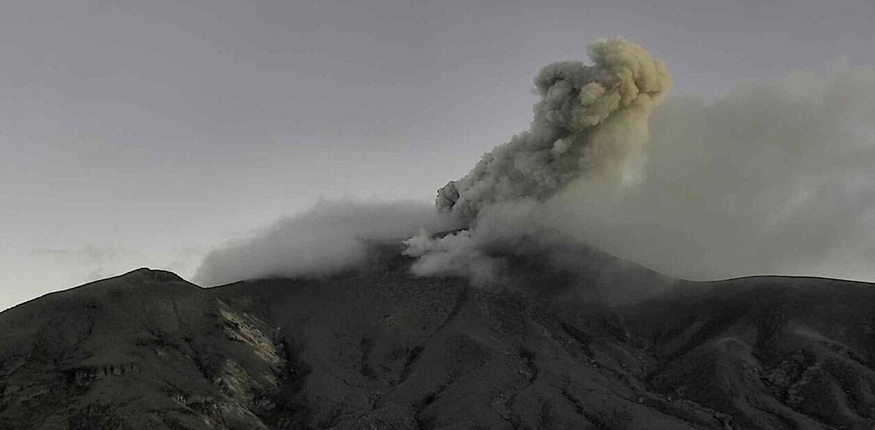
● Volcanic surface deformation rates are comparable to those recorded prior to the shift to orange alert, with no further variations observed.
It should be noted that, although the monitored parameters for the Puracé volcano (Los Coconucos volcanic chain) are trending toward stability, the volcano could rapidly destabilize at any time, leading to a return to orange alert or even an escalation to red alert. Consequently, the public must remain attentive to changes in volcanic activity and avoid approaching the crater area, as it may be affected by sudden gas or ash emissions.
At the yellow alert level, the volcano may exhibit seismicity linked to fracturing and fluid movement (at moderate levels with occasional spikes), slight to moderate deformation, moderate degassing levels (SO2 and CO2), and changes in the physicochemical parameters of thermal springs and fumaroles. Observations may also include increased height and density of the water vapor and gas plume, recorded noises and infrasound signals, and low-energy thermal anomalies.
The SGC recommends closely monitoring the evolution of this activity via periodic or special bulletins and other information published on our official channels, as well as adhering to instructions from local and departmental authorities and the National Unit for Disaster Risk Management (UNGRD).
The volcanic activity alert level is shifting to yellow: the volcano is exhibiting significant changes in monitored parameters.
Source et photo : SGC.