May 7 , 2026.
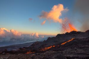
Italy , Stromboli :
Stromboli Activity Update, May 5, 2026, 7:33 PM (5:33 PM UTC)
The National Institute of Geophysics and Volcanology (INGV-OE), Etna Observatory, announces that, based on analysis of CCTV footage, effusive activity
continues in the North Crater area, as indicated in the updates of May 4 (11:24 AM UTC) and May 5 (4:29 AM UTC). The most advanced front of the lava flow is located,
according to observations by INGV-OE personnel in the field, in the central sector of the Sciara del Fuoco. This activity is accompanied by the rolling of incandescent blocks that reach the coastline. Strombolian activity also continues in the North and Central-South Crater areas.
From a seismic perspective, the average amplitude of volcanic tremor has not shown significant variations compared to the previous report, remaining within the normal range. A decrease in the frequency and amplitude of explosion earthquakes has been observed.
The GNSS network currently shows no significant changes.
Further information will be released soon.
Source : INGV
Photo : Stromboli stati d’animo / Sebastiano Cannavo.
Philippines , Mayon :
VOLCANIC ACTIVITY REPORT FOR MAYON VOLCANO , 7 May 2026 , 09:15 AM
Summary of Recent Significant Activity:
Since the onset of magmatic eruption on 6 January 2026, activity at Mayon Volcano has been dominated by nearly steady-rate lava effusion or non-explosive eruption of lava from its summit crater. Eruption slowly transitioned in mid-February to lava effusion with occasional episodes of weak Strombolian activity and short-lived lava fountaining (SLLF) at localized vents inside the summit crater. Multiple lava flows and thousands of lava collapse-fed rockfall and pyroclastic density currents (PDCs) or uson – hazardous mixtures of hot volcanic gas, ash and fragmented rock that rush down the volcanic slopes – have been generated on three (3) major drainage systems on the southern to eastern slopes – the Mi-isi, Bonga and Basud Gullies – including minor drainages in between, within the six-kilometer-radius Permanent Danger Zone (PDZ).
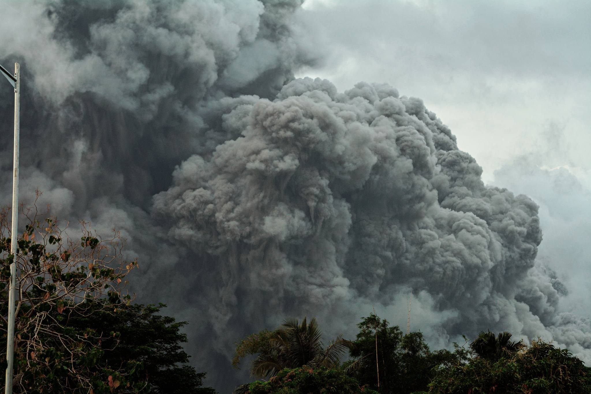
In the late afternoon of 2 May 2026, two long series of successive lava collapse-fed PDCs were generated on the Mi-isi Gully and evolved to become the largest PDCs of the 2026 eruption so far (Figure 1). The first series began at 4:28 PM and lasted 39 minutes and, while the second, more energetic series followed shortly at 5:09 PM and lasted 95 minutes until 6:44 PM. Visual observations of these were hampered by thick cloud cover on the upper half of the Mayon edifice. Nonetheless, very distinct broadband tremor –volcanic earthquake that typically accompanies large-volume lava flow effusion with associated lava collapse in Mayon– was clearly recorded in 11 of 14 seismic stations of the Mayon Volcano Network (MVN) during these series, causing a brief increase in seismic energy release (RSAM). No explosion signals were recorded by infrasound systems of the MVN.
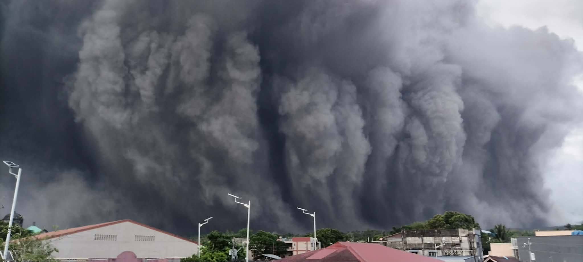
PDCs of the first series were small-volume and were thus confined to the upper 2-3 kilometers of the edifice, producing slightly brownish-gray convecting ash clouds that likely consisted of disintegrated oxidized and degassed lava. By 5:30 PM , more voluminous PDCs with billowing ash clouds could be seen descending the Mi-isi-Binaan Channel within four kilometers from the crater. These were rapidly followed by a succession of PDCs that pushed beyond the five kilometer reaches of the channel, generating darker ash clouds that likely consisted of disintegrated fresh lava. Moderately strong (at least 8 m/s) winds dispersed the ash clouds to the west. Using peak amplitudes in the broadband tremor, at least seven (7) and 22 PDC-generating lava collapse events could be identified in the first and second series, respectively .Of these, the 5:50 PM event , registered the peak trace amplitude and corresponded to the most voluminous and farthest PDC visually observed.
Various social media footages documented enormous clouds of dark ash rising five (5) kilometers above the PDCs during active transport and even after PDCs came to full stop. Based on visual observations, ash clouds from discrete PDCs accumulated into a massive phoenix column (Figure 4) that detached from the PDCs and continued moving downslopeas an ash curtain. This settled as ashfall across a narrow swath west of the volcano, consistent with distribution modelling using Ash3D (Mastin et al, 2021) published in the social media pages of PHIVOLCS for general guidance. Based on reports of local government officials, DRR partners and the PHIVOLCS Quick Response Team (QRT) as of 4 May 2026, four (4) cities/municipalities and 109 barangays experienced ash .
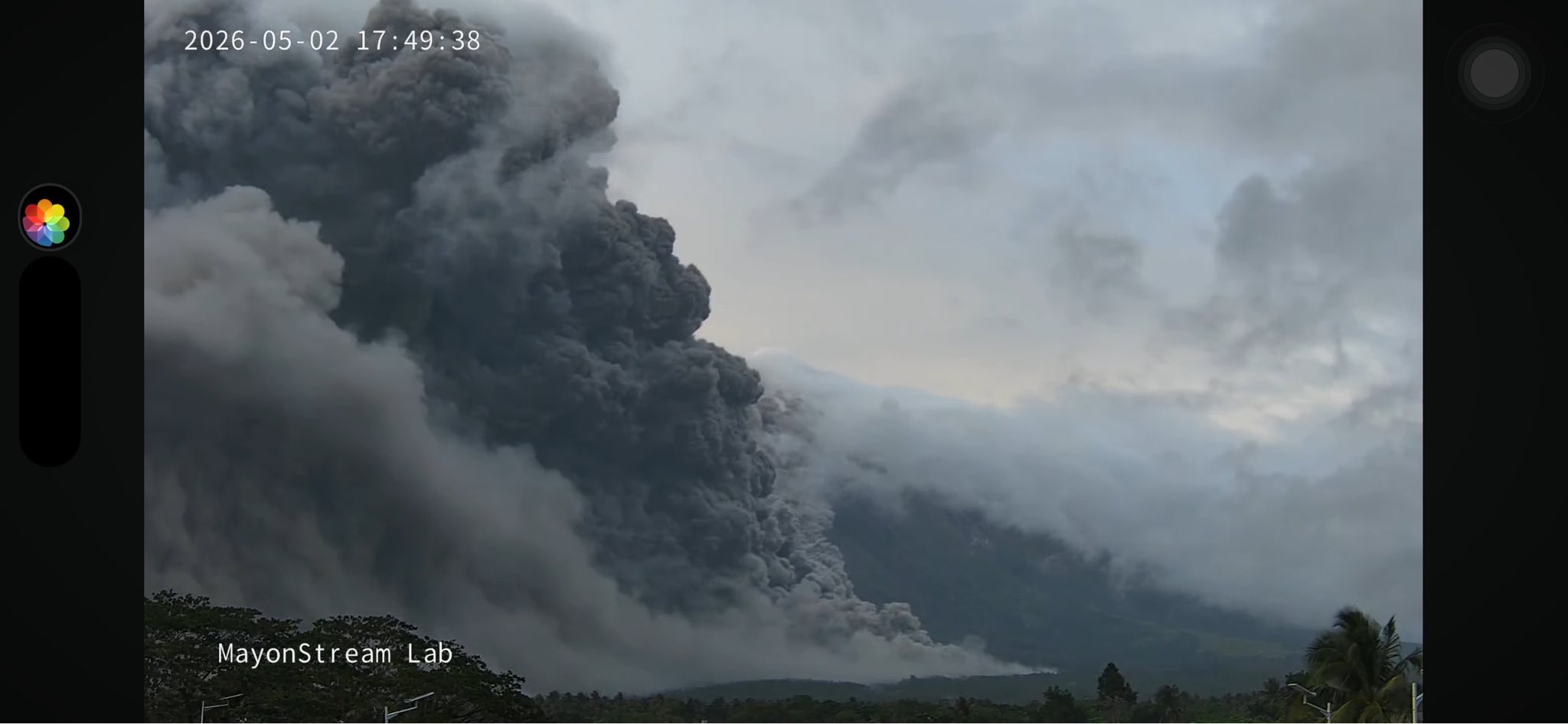
Before, during, and after these two pyroclastic flow episodes, Mayon’s monitoring parameters remained stable, with only spikes in the RSAM index and variable reversals in ground deformation data recorded in response to large lava flows and collapses. Mayon’s eruptive activity continued during this period and persists to this day in the form of quiet lava flows and occasional Strombolian and SLLF eruptions.
Source : Phivolcs.
Photos : Philippine Emergency Alerts, Mayon Stream Lab.
Indonesia , Dukono :
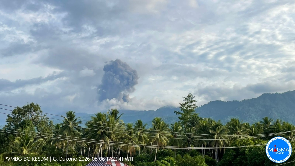
An eruption of Mount Dukono occurred on Wednesday, May 6, 2026, at 5:18 PM WIT, with an observed ash column height of approximately 1500 m above the summit (approximately 2587 m above sea level). This ash column was gray and very dense, oriented to the west and northwest. At the time of writing, the eruption was still ongoing.
Seismic Observations
82 eruption earthquakes with amplitudes between 7 and 20 mm and durations from 14.92 to 117.96 seconds.
5 distant tectonic earthquakes with amplitudes between 10 and 34 mm and durations from 36.2 to 86.95 seconds.
1 continuous seismic tremor with amplitudes between 1 and 8 mm, primarily 6 mm.
Recommendations
(1) Communities living near Mount Dukono and visitors/tourists are advised to refrain from any activity, climbing, or approaching the Malupang Warirang crater within a 4 km radius.
(2) Since eruptions with volcanic ash occur periodically and the distribution of ash follows the direction and speed of the wind, making the ash cover area unstable, communities around Mount Dukono are advised to always have masks/face coverings and mouth coverings available to use as needed to avoid the dangers of volcanic ash to the respiratory system.
Source et photo : PVMBG.
Colombia , Chiles / Cerro Negro :
San Juan de Pasto, May 5, 2026, 4:40 PM
Regarding the monitoring of activity at the Chiles-Cerro Negro Volcanic Complex (CVCCN), the Colombian Geological Survey (SGC), an agency under the Ministry of Mines and Energy, reports the following:
For the period from April 28 to May 4, 2026, the main variations in monitored parameters, compared to the previous week, were as follows:
● Seismic activity did not show significant variations. Similar values were observed for frequency and seismic energy released. The strongest earthquake, with a magnitude of 3.9, occurred south of the summit of Chiles, less than 1 km away and at a depth of 3.7 km from the summit of Chiles volcano (4,700 m above sea level). The earthquake was recorded on April 28 at 5:31 AM. It was felt by some residents of the municipality of Cumbal and the canton of Chiles. The seismic activity was mainly concentrated between the collapse zone of the Chiles volcano and about 3 km to the south, at depths between 1 and 5 km below the summit of the volcano (4,700 m altitude).
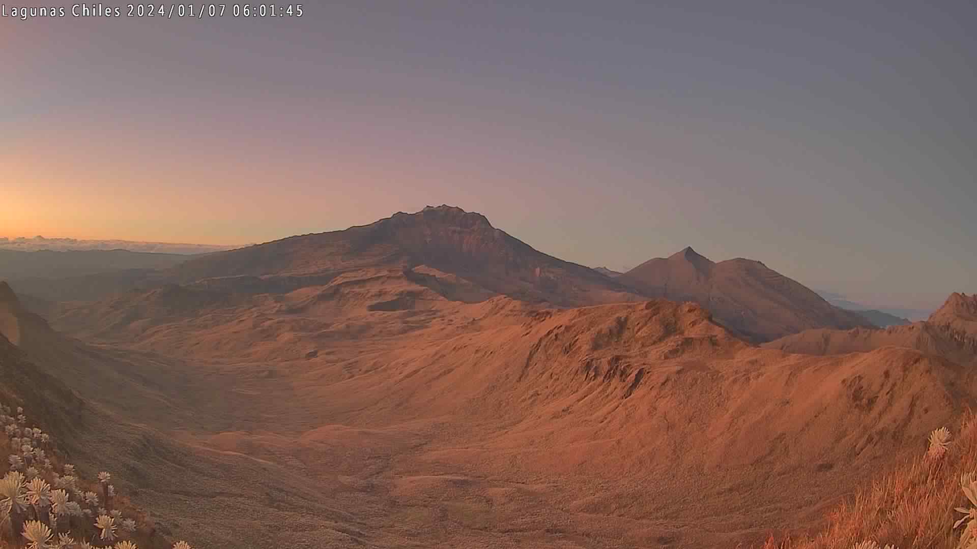
Furthermore, seismic activity related to fluid movements continues, sometimes transient, sometimes persistent.
● The recording of variations in volcanic deformation, measured by satellite sensors and ground stations in the area of influence of these volcanoes, continues.
Based on the assessment and correlation of monitored parameters, the Geological Survey of Colombia (SGC) recommends closely monitoring its evolution by consulting the weekly bulletins and other information published through its official channels, as well as the instructions of local and departmental authorities and the National Unit for Disaster Risk Management (UNGRD).
Volcanic activity remains at the yellow alert level: active volcano with changes in the basic behavior of monitored parameters and other manifestations.
Source et photo : SGC.
Guatemala , Fuego :
Atmospheric conditions: Partly cloudy
Wind: East
Precipitation: 2.3 mm
Activity:
During the night and early morning, weak to moderate degassing was recorded, with fumaroles reaching approximately 200 meters above the crater and dispersing westward. Explosive activity continued with 8 to 13 weak to moderate explosions per hour, generating ash plumes between 4,400 and 4,700 meters in altitude, which drifted westward and southwestward.
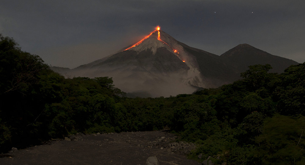
Some explosions were accompanied by rumbling sounds, shock waves, and brief noises similar to those of locomotives, associated with the continuous expulsion of gas. Incandescent glows were observed up to 300 meters above the crater, accompanied by small avalanches. Incandescent material fell back around the crater, flowing down into the ravines of Ceniza, Taniluyá, Seca, Santa Teresa, Trinidad, and Las Lajas, sometimes reaching the tree line.
Source : Insivumeh.
Photo : Moises Castillo