March 30 , 2026.
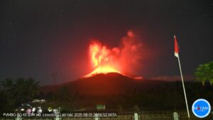
La Réunion Island , Piton de la Fournaise :
Press release from the Paris Institute of Earth Physics / Piton de la Fournaise Volcanological Observatory, March 30, 2026 – 8:30 a.m. local time – 4:30 a.m. UTC
Eruption in progress
Summary
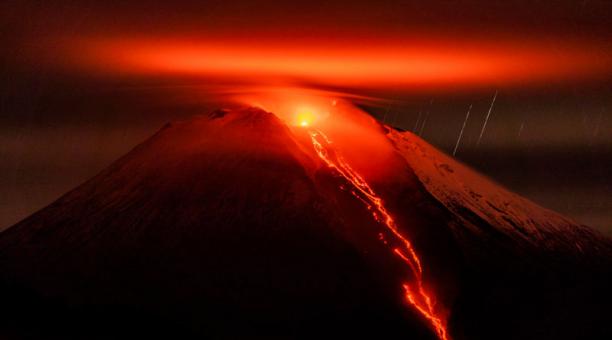
The eruption that began on February 13, 2026, resumed on March 28 at approximately 3:00 p.m. local time. Only one eruptive site is active on the south-southeast flank, at the cone formed between February 13 and March 25. Only the main southeast flow is being replenished. Lava tube activity is well-developed with numerous resurgences. At the eruptive cone,
lava surges and overflows are observed. The eruptive tremor (an indicator of lava and gas flow) has been stable over the last 24 hours.
Observations at the different sites
After a pause observed between March 25 (4:30 p.m. local time) and March 28, the eruption which began on February 13, 2026 on the South-Southeast flank of the volcano resumed on March 28 at around 3 p.m. local time.
The eruptive site remains on the south-southeast flank of the volcano at an altitude of 2056 m, at the cone formed between February 13 and March 25.
At the eruptive cone, the lava level is high, with active eddies and recurring lava overflows associated with the rising of gas bubbles.
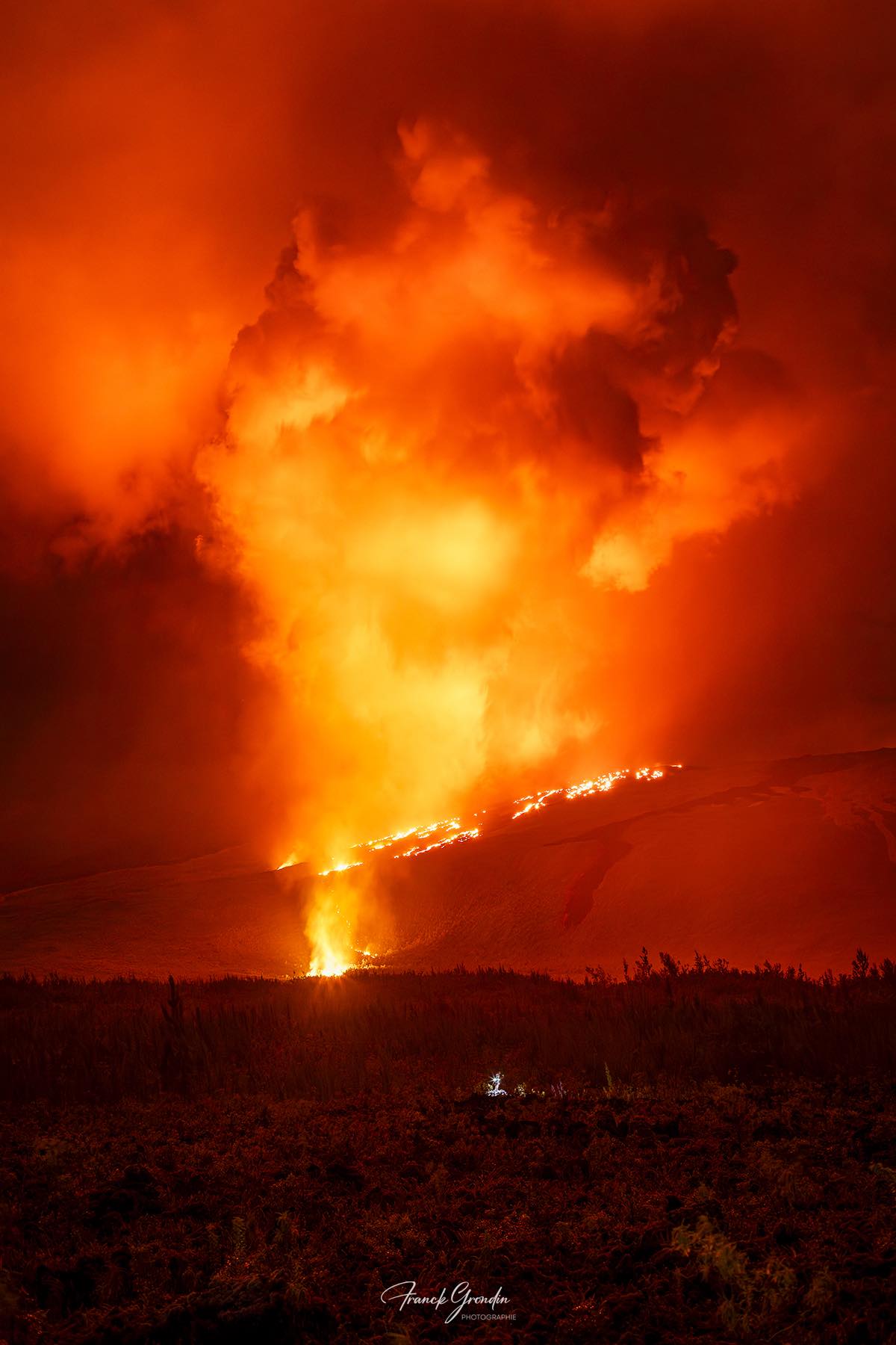
Lava tunnel activity continues downstream of the cone, with numerous resurgences visible in the lava field formed between February 13 and March 25, 2026. These resurgences are clearly visible in the Grandes Pentes area. Only the southern arm of the lava field is currently active.
Yesterday afternoon, a resurgence occurred just upstream of the RN2 highway, which had already been cut off by lava on March 13, feeding a flow several hundred meters long and overlapping the flows previously formed in this area. The other active resurgences upstream of the RN2 were located more than 1 km from the RN2.
This morning, resurgences were observed at the level of the platform.
With the platform being replenished by lava tubes, an intensification of the gas plume at the point of entry into the ocean is expected.
Indeed, even if it is currently of low intensity, a gas plume is always present at the point where the lava enters the ocean, and its intensity depends on the amount of lava reaching the ocean. This plume is mainly composed of water vapor, hydrochloric acid (HCl), and fine particles. When the lava, at a temperature of approximately 1130°C, comes into contact with ocean water rich in sodium chloride, it generates an acidic aerosol in the form of fine suspended droplets. This plume also contains particles of pulverized lava and fragments of volcanic glass, which can be carried hundreds of meters to kilometers by the wind.
Explosions could also occur if the platform becomes destabilized. Indeed, this platform, composed of an accumulation of lava flows and rock fragments, remains highly unstable and fragile. In the event of sudden destabilization, explosions of varying intensity could occur.
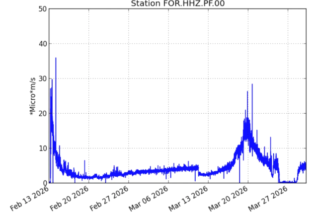
Evolution of tremor amplitude (an indicator of lava and gas emissions at the surface) between February 13 and March 30, 2026, at the FOR seismological station located near the eruptive site (©WebObs/OVPF-IPGP).
Instrumental Observations
Over the past 24 hours, seismicity has remained low, with two shallow volcano-tectonic earthquakes (above sea level) and three deep volcano-tectonic earthquakes (below sea level). These earthquakes were located in the summit area of the volcano.
Since the resumption of activity on March 28, inflation, indicating the repressurization of the shallow magma reservoir (located approximately 1.5-2 km deep below the summit area), has slowed. This parameter will need to be confirmed in the coming days.
The intensity of the eruptive tremor (an indicator of lava and gas flow) has been relatively stable since March 29 at 12:00 local time (8:00 UTC).
Surface flow rates, estimated from satellite data via the HOTVOLC platform (OPGC – Université Clermont Auvergne), have indicated values below 7 m³/s since the resumption of activity. It should be noted that these estimates can vary significantly depending on cloud cover and become zero in the event of total cloud cover. Current activity in the lava tube also tends to underestimate the flow rates observed by satellite methods.
Alert Level 2.2
Source : OVPF / IPGP.
Photos : Frog 974 photographies / FB , OVPF.
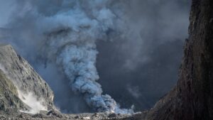
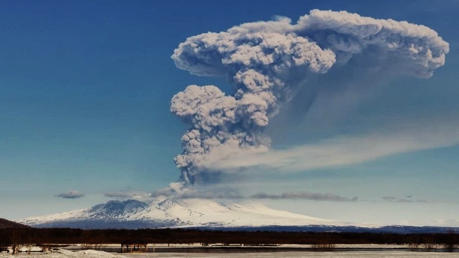
Kamchatka , Sheveluch :
KVERT VOLCANIC ACTIVITY NOTICE (VAN)
Issued: March 29 , 2026
Volcano: Sheveluch (CAVW #300270)
Current aviation colour code: ORANGE
Previous aviation colour code: red
Source: KVERT
Notice Number: 2026-32
Volcano Location: N 56 deg 38 min E 161 deg 19 min
Area: Kamchatka, Russia
Summit Elevation: 3283 m (10768.24 ft), the dome elevation ~2500 m (8200 ft)
Volcanic Activity Summary:
An explosive-extrusive eruption of the volcano continues, accompanied by powerful gas-steam activity; a new block of lava continues to grow in the northern part of the lava dome. Satellite data showed no new ash explosions have been observing on the volcano at now, but ash cloud on the altitude 4.5 km a.s.l. continues to move for 390 km to the north-east of the volcano.
This explosive-extrusive eruption of the volcano continues. Ash explosions up to 12 km (39,400 ft) a.s.l. could occur at any time. Ongoing activity could affect international and low-flying aircraft.
Volcanic cloud height:
NO ASH CLOUD PRODUSED
Other volcanic cloud information:
NO ASH CLOUD PRODUSED
Source : Kvert.
Photo : Jara Pokorny / Sopky světa FB via B. Duyck .
New Zealand , White Island :
No further ash emissions detected from Whakaari/White Island. Volcanic Alert Level lowered to 2 and Aviation Colour code remains at Orange.
Published: Mon Mar 30 2026 2:10 PM
No further ash emission has been observed at Whakaari/White Island since Tuesday 24 March. The Volcanic Alert Level is lowered to 2 and the Aviation Colour Code remains at Orange. While no eruptive activity has been observed since Tuesday, the likelihood of further ash emission remains elevated.
Last week Whakaari/White Island produced a minor volcanic eruption. The eruption was observed from our mainland cameras (Whakatāne and Te Kaha) with the resulting ash plume drifting to the west. The eruption plume was also observed on satellite data by MetService. No further activity has been observed since last Tuesday. However, the likelihood of further ash emission remains elevated. An observation flight will be undertaken as soon as weather conditions permit.
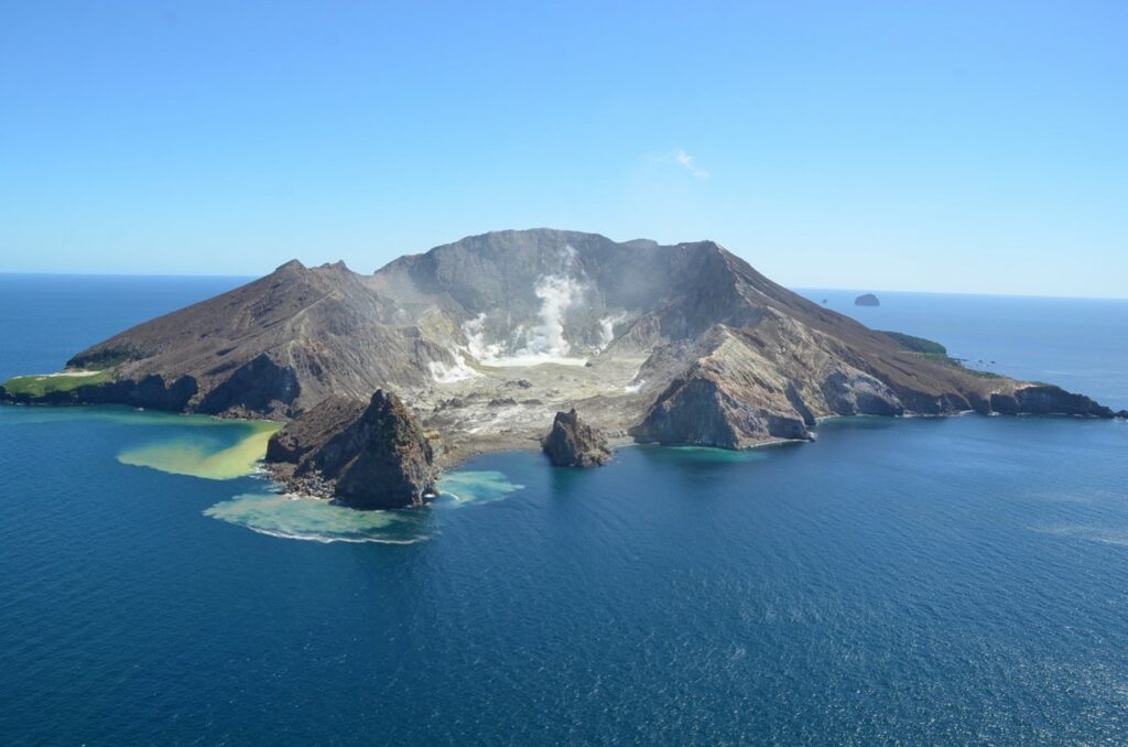
As we are no longer seeing signs of an eruption, we have decreased the Volcanic Alert Level to 2 (Moderate to heightened volcanic unrest) and the Aviation Colour Code remains at Orange. While eruptive activity has ceased for now, volcanic activity could re-escalate with little or no warning. Further sudden, more explosive events could therefore affect the crater floor and immediate vicinity of the island, although ashfall affecting the mainland remains unlikely.
The Earth Sciences New Zealand Volcano Monitoring Group and National Geohazards Monitoring Centre continue to closely monitor Whakaari/White Island for any changes in activity. Without sensors on the island, our monitoring of Whakaari/White Island continues to rely on remote cameras, satellite imagery, and periodic gas and observation flights. We will provide further updates when information becomes available.
Source : Geonet / Agnes Mazot / Duty Volcanologist
Photo : Brad Scott, GNS Science. ( archive ).
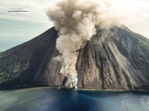
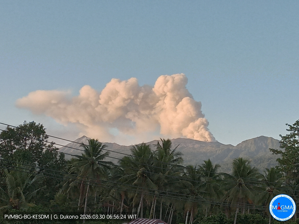
Indonesia , Dukono :
Mount Dukono erupted on Monday, March 30, 2026, at 6:52 AM WIT. An ash column was observed approximately 900 meters above the summit (at an altitude of about 1,987 meters). This thick, white column extended southeastward. At the time of writing, the eruption was still ongoing.
Seismic Observations
15 eruption earthquakes with amplitudes between 6 and 10 mm and durations from 34.05 to 81.64 seconds.
One distant tectonic earthquake with an amplitude of 6 mm and a duration of 69.86 seconds.
Continuous seismic tremor with an amplitude of 1 to 4 mm, primarily 2 mm.
Recommendations
Communities living near Mount Dukono and visitors/tourists are advised to refrain from any activity, climbing, or approaching the Malupang Warirang crater within a 4 km radius.
Given that eruptions with volcanic ash projection are periodic and that the ash dispersion depends on the direction and strength of the wind, making the coverage area unstable, it is recommended that communities near Mount Dukono always have masks/face coverings available to protect themselves from respiratory risks related to volcanic ash.
Source et Photo : PVMBG.
Ecuador , Sangay :
DAILY REPORT ON THE STATE OF SANGAY VOLCANO, Sunday, March 29, 2026.
Geophysical Information Institute – EPN.
Surface Activity Level: High, Surface Trend: No Change
Internal Activity Level: Moderate, Internal Trend: No Change
Seismicity: From March 28, 2026, 11:00 AM to March 29, 2026, 11:00 AM:
Seismicity:
Explosions (EXP): 56
Precipitation/Lahars:
No rain has been recorded in the volcano area in the last 24 hours. **Heavy rainfall could remobilize accumulated material, generating mudflows and debris flows that would cascade down the volcano’s flanks and into nearby rivers.**
Emissions/Ash:
Since yesterday afternoon, surveillance cameras have recorded several emissions of gas and ash drifting northeast and northwest, reaching altitudes between 500 and 1,000 meters above the crater. The Washington VAAC issued two reports of ash clouds reaching altitudes of 600 and 900 meters, drifting east and southeast, respectively.
Gas:
The MOUNTS satellite system detected 28.1 tons of sulfur dioxide (SO₂), measured yesterday at 1:37 p.m. local time.
Other monitoring parameters:
The MIROVA-MODIS, MIROVA-VIIRS 375, and MIROVA-VIIRS 750 satellite systems each recorded two thermal anomalies, and the FIRMS satellite system recorded 16 in the last 24 hours.
Observation:
Last night, monitoring cameras observed several episodes of incandescent material falling along the northwest flank of the volcano, reaching a distance of up to 1,200 meters below the crater. At the time of writing, the volcano remains shrouded in clouds.
Alert level: Yellow
Source : IGEPN
Photo : EFE.