July 6 , 2026.
Italy / Sicily , Etna :
Statement on Mount Etna activity, July 5, 2026, 09:43 (07:43 UTC).
The National Institute of Geophysics and Volcanology (INGV), Etna Observatory, reports that ash emissions began around 05:45 UTC from the vent located on the upper eastern flank of the Voragine crater. These emissions intensified around 06:45, generating an eruption plume that rose approximately 1.5 km above the volcano’s summit and drifted towards the south and south-southeast sectors.
Forecast models based on meteorological data indicate ash dispersion towards the south over the coming hours.
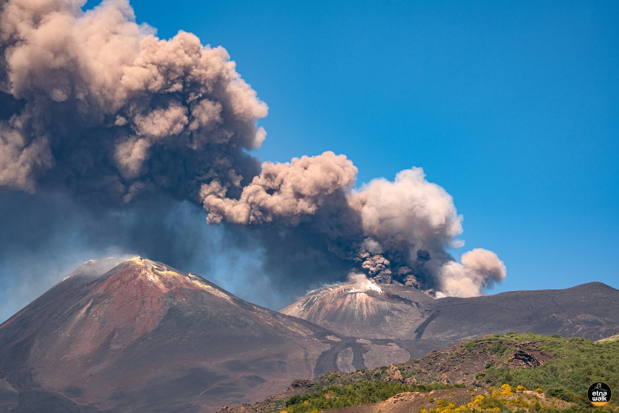
In recent days, Strombolian activity has continued at the vent located on the flank of the Voragine crater, while the effusive activity at the vent situated at an elevation of 3,030 m—which began on June 26—gradually declined and ceased on July 4.
Additionally, during the night of July 2–3, a second small lava flow formed from a point between the Strombolian vent and the effusive vent; it traveled just over a hundred meters before coming to a halt on the morning of July 3.
The average amplitude of volcanic tremor remains high, showing a steady upward trend. Since yesterday, this trend has been characterized by significant fluctuations in values, which have become more pronounced over the last few hours.
The peak tremor amplitude for this eruptive episode was recorded at 06:30 UTC.
The centroid of the tremor sources remains located in the Voragine crater area, at an elevation of approximately 3,000 meters above mean sea level. Infrasonic activity is currently low in terms of the number of events and energy released; however, periods of intense activity reaching very high levels have been observed in the last few hours.
The sources are located in the Voragine crater area, although minor activity has also been observed at the Northeast Crater in recent hours.
Deformation monitoring networks are currently detecting no significant changes. It should be noted that, starting at 05:45 UTC, variations were observed at the ECPN summit tiltmeter station (approximately 0.3 microradians until 07:30 UTC) and at the DRUV dilatometer station (decompression of approximately 8 nanostrains until 07:00 UTC).
Further information will be provided as soon as possible.
VOLCANO OBSERVATORY NOTICE FOR AVIATION (VONA)
Date of issue: July 6, 2026
Volcano: Etna (211060)
Current color code: RED
Previous color code: red
Source: Etna Volcano Observatory
Notice number: 2026/0060/05E01
Volcano location: 37°44′ N, 15°00′ E
Area: Italy
Summit elevation: 3300 m
Volcanic activity summary:
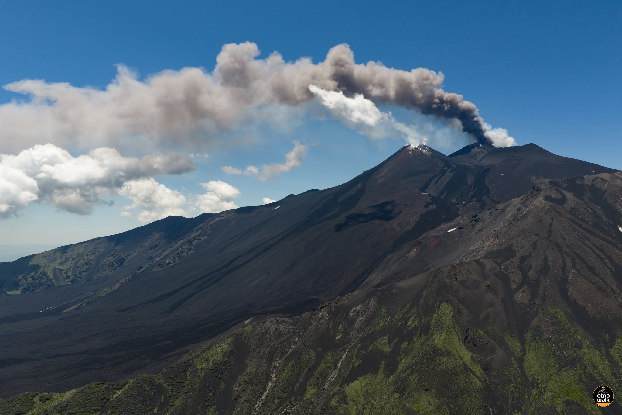
Strong Strombolian activity is observed at the summit craters; significant ash emission is underway.
Volcanic plume height:
Estimated volcanic plume height above the summit is approximately 4500 m; data from surveillance cameras.
Other volcanic plume information:
The ash plume is drifting towards the South-Southeast (S-SE).
Remarks:
The phenomenon is observed via visible-light and thermal surveillance cameras.
Source : INGV.
Photos : Etna Walk / Giuseppe Distefano / Marco Restivo .
Kamchatka , Sheveluch :
KVERT VOLCANIC ACTIVITY NOTICE (VAN)
Issued: July 6 , 20260706/0145Z
Volcano: Sheveluch (CAVW #300270)
Current aviation colour code: ORANGE
Previous aviation colour code: red
Source: KVERT
Notice Number: 2026-64
Volcano Location: N 56 deg 38 min E 161 deg 19 min
Area: Kamchatka, Russia
Summit Elevation: 3283 m (10768.24 ft), the dome elevation ~2500 m (8200 ft)
Volcanic Activity Summary:
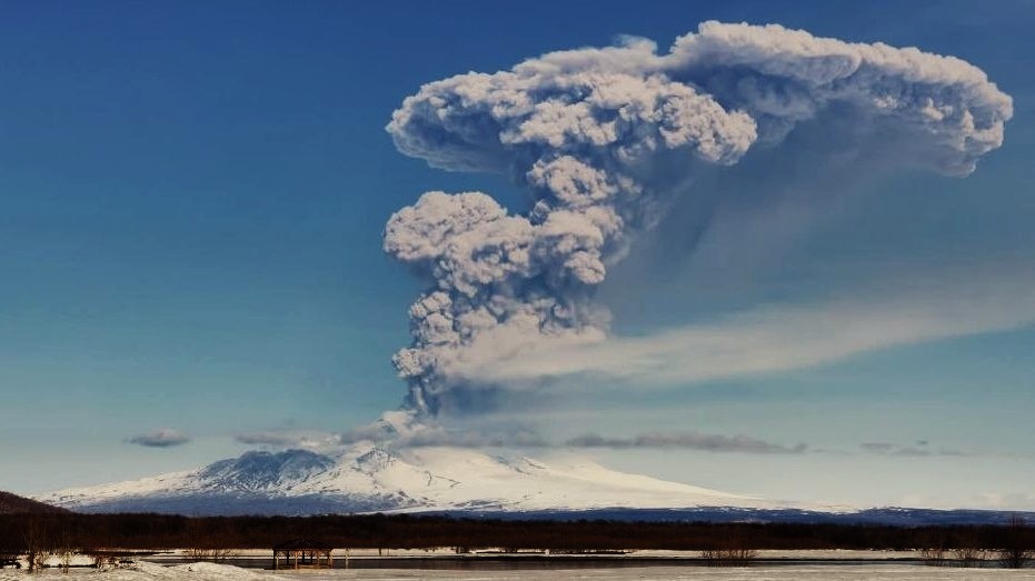
The explosive-extrusive eruption of the volcano continues, accompanied by powerful gas-steam activity; a new block of lava continues to grow in the northern part of the lava dome. No new ash explosions have been observing on the volcano at now, but an ash cloud 215×100 km in size is located 630 km to the south-west of volcano (from ash explosions up to 12 km a.s.l. at 07:16 UTC on 05 July).
The explosive-extrusive eruption of the volcano continues. Ash explosions up to 12 km (39,400 ft) a.s.l. could occur at any time. Ongoing activity could affect international and low-flying aircraft.
Volcanic cloud height: NO ASH CLOUD PRODUCED
Other volcanic cloud information: NO ASH CLOUD PRODUCED
Source : Kvert
Photo : Jara Pokorny / Sopky světa FB .
Indonesia , Lewotobi Laki-laki :
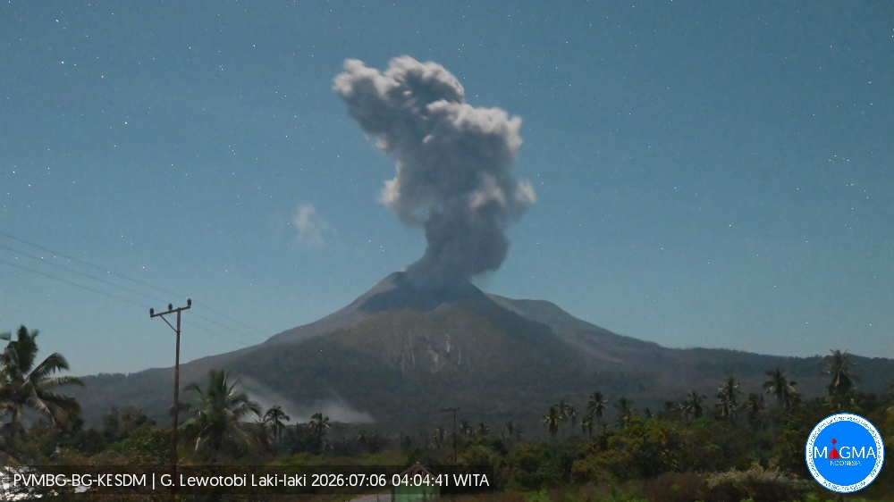
An eruption of Mount Lewotobi Laki-laki occurred on Monday, July 6, 2026, at 04:02 (WITA), with an ash column rising approximately 1,000 meters above the summit (or about 2,584 meters above sea level). The observed ash column was gray and dense, drifting toward the north and northeast. The eruption was recorded by the seismograph with a maximum amplitude of 44.4 mm and a duration of 145 seconds.
VOLCANO OBSERVATORY NOTICE FOR AVIATION – VONA
Issued : July 6 , 2026
Volcano : Lewotobi Laki-laki (264180)
Current Aviation Colour Code : ORANGE
Previous Aviation Colour Code : orange
Source : Lewotobi Laki-laki Volcano Observatory
Notice Number : 2026LWK148
Volcano Location : S 08 deg 32 min 20 sec E 122 deg 46 min 06 sec
Area : East Nusa Tenggara, Indonesia
Summit Elevation : 5069 FT (1584 M)
Volcanic Activity Summary :
Eruption with volcanic ash cloud at 20h02 UTC (04h02 local).
Volcanic Cloud Height :
Best estimate of ash-cloud top is around 8269 FT (2584 M) above sea level or 3200 FT (1000 M) above summit. May be higher than what can be observed clearly. Source of height data: ground observer.
Other Volcanic Cloud Information :
Ash cloud moving from north to northeast. Volcanic ash is observed to be gray. The intensity of volcanic ash is observed to be thick.
Remarks :
Eruption recorded on seismogram with maximum amplitude 44.4 mm and maximum duration 145 second.
Source et photo : PVMBG.
Colombia , Galeras :
San Juan de Pasto, June 30, 2026, 4:00 PM.
Based on monitoring of Galeras volcano activity, the Colombian Geological Service (SGC)—an agency attached to the Ministry of Mines and Energy—reports the following:
During the week of June 23 to 30, 2026, the main variations in monitored parameters compared to the previous week were as follows:
● Although volcanic activity remained at a low level, an increase was recorded in both event frequency and released seismic energy. The majority
of this seismicity remained associated with rock-fracturing processes within the volcanic edifice.
● Fracturing-related events were concentrated primarily near the central crater, at depths ranging from 1 to 3 km below the summit of Galeras volcano (4,200 meters above sea level). Three earthquakes with a magnitude greater than 2.0 were reported during the week, all occurring on June 25.
Their characteristics are detailed below:
the first was located 8.9 km to the northeast (NE), at a depth of 9.5 km and with a local magnitude of 2.4;
the second, 2 km southwest (SW) of the crater, at a depth of 4.2 km and with a magnitude of 2.6;
and the third, 2 km southwest (SW), at a depth of 3.6 km and with a magnitude of 2.1.
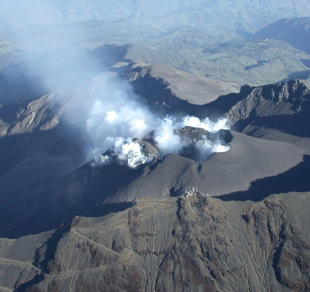
● Intermittent emissions of white gas were observed, characterized by low plume heights and dispersion directions that varied with the wind. These emissions originated primarily from the fumarole fields of El Paisita (to the north) and Las Chavas (to the west), as well as from the main crater.
● Other volcanic monitoring parameters remained stable.
In light of the above, the SGC recommends closely monitoring the situation via weekly bulletins and other information released through our official channels, and adhering to instructions issued by local and departmental authorities and the National Unit for Disaster Risk Management (UNGRD). Volcanic activity remains at the yellow alert level: an active volcano showing changes in the baseline behavior of monitored parameters, as well as other manifestations.
Source et photo : SGC.
Ecuador , Sangay :
DAILY STATUS REPORT FOR SANGAY VOLCANO, Sunday, July 5, 2026.
Information from the Geophysical Institute – EPN.
Surface activity level: Moderate; Surface trend: Decreasing
Internal activity level: Moderate; Internal trend: Unchanged
Seismicity: From July 4, 2026, 11:00 to July 5, 2026, 11:00:
Seismicity:
Here is the count of seismic events recorded at the reference station:
Explosion (EXP): 26
Precipitation / Lahars:
Precipitation was recorded in the volcano area, though it did not trigger mud or debris flows. **In the event of heavy rain, accumulated material could be remobilized, generating mud and debris flows that would descend the volcano’s flanks and spill into adjacent watercourses.
Emission Plume / Ash:
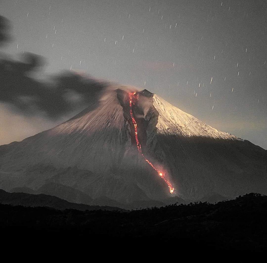
Due to adverse weather conditions, it was not possible to observe gas and ash emissions via the surveillance camera system. However, satellite imagery detected an emission forming a plume that rose 700 meters above the crater rim and drifted eastward. In connection with this activity, the Washington VAAC issued a report noting a gas and ash emission with a plume reaching 850 meters above the crater rim, drifting northeastward.
Observation:
From yesterday afternoon until the time of writing this report, the volcano remained entirely obscured by cloud cover.
Alert Level: Yellow
Source : IGEPN
Photo : Eqphos_fotografía / FB.