August 14 , 2026.
Hawaii , Kilauea :
HAWAIIAN VOLCANO OBSERVATORY STATUS REPORT / U.S. Geological Survey
Thursday, August 13, 2026, 1:56 AM HST (Thursday, August 13, 2026, 11:56 UTC)
19°25’16 » N 155°17’13 » W,
Summit Elevation 4091 ft (1247 m)
Current Volcano Alert Level: ADVISORY
Current Aviation Color Code: YELLOW
Summary:
Episode 53 of the ongoing Halemaʻumaʻu eruption began at 3:45 p.m. HST August 12 and ended at 1:23 a.m. HST on August 13, 2026, after 9.6 hours of fountaining.
Activity Summary:
Episode 53 of the ongoing Halemaʻumaʻu eruption began around 3:45 p.m. HST August 12 and ended abruptly at 1:23 a.m. HST on August 13, 2026.
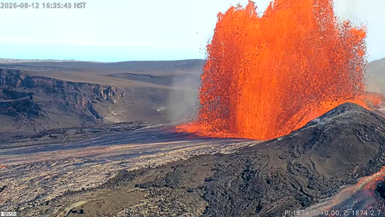
The maximum lava fountain height was approximately 500 feet (150 meters) above ground level from the north vent. The south vent never fountained during this episode. The new west vent (formerly the collapse pit) periodically emitted flames during the episode that were most visible after 7:00 p.m. HST.
The maximum plume height was approximately 18,000 (5,500 meters) above mean sea level.
Tephra fall was restricted completely to the closed area of Hawaiʻi Volcanoes National Park to the southwest and west of the active Halemaʻumaʻu vents.
Episode 53 Chronology:
Lava fountain episode 53 in Halemaʻumaʻu at the summit of Kīlauea began around 3:45 p.m. HST August 12, 2026, and ended at 1:23 a.m. HST on August 13, 2026, after 9.6 hours of continuous fountaining from the north vent. The last four minutes were marked by gas jetting and flames from the north vent. The south vent never fountained during this episode but did overflow along with the new west vent (formerly the collapse pit) near the beginning of the episode. The new west vent (formerly the collapse pit) periodically emitted flames that were most visible after 7:00 p.m. HST. The instantaneous effusion rate peaked at about 300 cubic yards (230 cubic meters) per second at approximately 5:15 p.m. HST, with an average effusion rate of 180 cubic yards (135 cubic meters) per second for the entire fountaining episode. An estimated 6 million cubic yards (4.6 million cubic meters) of lava erupted and covered about 40-50% of the Halemaʻumaʻu crater floor. Seismicity followed the normal change in tremor patterns seen after most fountain episodes. The Uēkahuna tiltmeter (UWD) recorded about 14.0 microradians of deflationary tilt during episode 53.
Fountain activity transitioned gradually from precursory lava flows from the north vent. Small glimpses of spatter were seen after 10:00 a.m. HST but spatter was not consistently visible until 11:04 a.m. HST. This was followed by a series of short-lived lava overflows that began at 11:20 a.m., 11:35 a.m., 11:45 a.m., and 12:23 p.m. HST, each lasting 1-4 minutes. A fifth sluggish flow began around 1:00 p.m. HST and became sustained, gradually growing for about 45 minutes. At 1:45 p.m. HST, there was a dramatic increase in output correlated with a switch to deflationary tilt. A double dome fountain formed and began feeding a broad overflow that rapidly extended more than 2,000 feet (600 meters) from the vent. Large overflows from the south vent began at 3:26 p.m. and 3:38 p.m. HST and lasted approximately 5-6 minutes each. A small flow was also visible from the west vent (previously referred to as the new collapse feature) beginning at 3:31 p.m. HST. This small flow lasted for 28 minutes and ended 14 minutes after the start of episode 53. Two more flows sourced from the south vent and the west vent began at 4:02 p.m. and 4:03 p.m. respectively. The flow from the south vent only lasted 3 minutes. In contrast, the flow from the new west vent lasted 14 minutes and increased in intensity until it finally overflowed and drained into the south vent. There may have been other short periods of activity from the new west vent at 4:30 and 4:42 p.m. HST, but the view was obscured by the north vent fountains at that time.
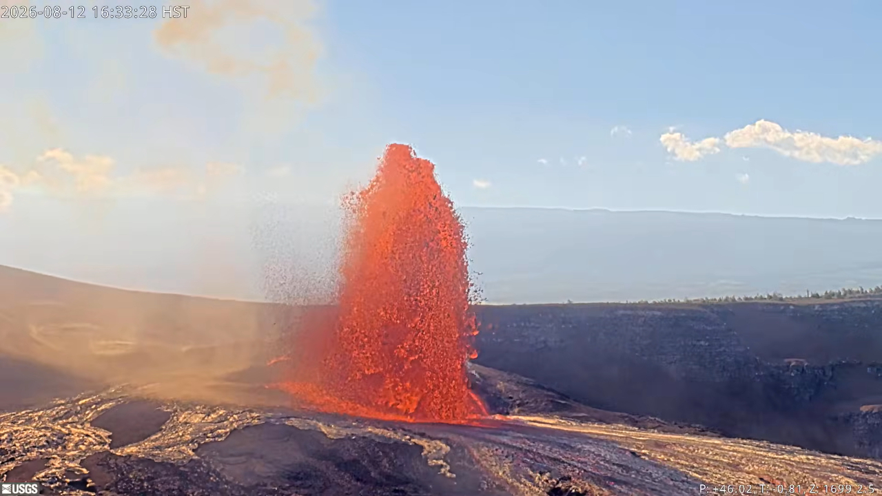
The transition from precursory activity to the onset of episode 53 fountaining was marked by increasing height of the north vent dome fountain, greater eruptive volume, increased deflation and rapidly increasing tremor. The north vent lava fountain reached a peak height of approximately 500 feet (150 meters) around 5:00 p.m. HST and produced significant heat and ash, feeding a gas plume that reached a maximum height of about 18,000 feet (5,500 meters) above sea level based on webcam images and data reported by the National Weather Service (NWS).
By 6:40 p.m. HST on August 12, fountain heights decreased to about 350-400 feet (110-120 meters) above ground level, and plume heights decreased to 15,000 feet (4,500 meters) above sea level. Fountain heights remained mostly constant until about 9:00 p.m. HST when they began to slowly drop, reaching 330 feet (100 meters) just before 10:00 p.m. HST. The plume cloud heights also dropped to about 10,000 feet (3,000 meters) at the same time. By midnight, the fountain had dropped slightly to 300 feet (90 meters) high with little change in the altitude of the plume cloud. The final fountains varied from about 100-200 feet (30-60 meters) high during the last half hour of the eruption, which ended abruptly at 1:23 a.m. HST on August 13.
The abrupt switch from summit deflation to inflation at the end of episode 53 indicates that another lava fountaining episode is likely.
Source : HVO
Photo : USGS.
Italy / Sicily , Etna :
Statement on Etna’s activity, August 13, 2026, 19:37 (17:37 UTC).
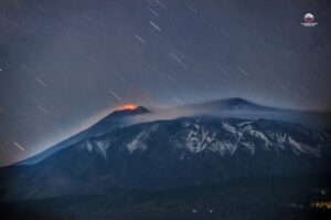
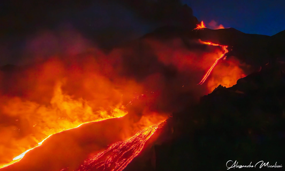
The National Institute of Geophysics and Volcanology (INGV) – Etna Observatory (OE) reports that, based on video surveillance images and field inspections by INGV (OE) personnel, effusive activity is continuing at the eruptive vents located at elevations of 2,750 m and 1,900 m (see the statement from August 10 at 22:25 UTC), while effusive activity at the 2,090 m elevation has ceased (see the statement from August 11 at 10:41 UTC). As of 09:45 UTC, the most advanced active lava fronts originating from the 1,900 m vent had reached an elevation of 1,340 m, having moved past Rocca Capra (Valle del Bove).
Explosive activity at the Voragine crater increased significantly starting at 16:55 UTC, with ash emissions dispersing towards the southern quadrant.
Seismically, starting around 10:00 UTC, the average amplitude of volcanic tremor—while remaining within a high range—showed a marked increase, peaking between 12:00 and 15:00 UTC. Currently, tremor amplitude is exhibiting slight fluctuations while remaining at high levels. Tremor source centroids are located in the Voragine crater area and north of the Bocca Nuova crater, at an elevation of approximately 3,000 m above sea level.
Since the start of the day, a gradual increase in infrasonic activity has been recorded; this activity intensified significantly from 10:00 UTC onwards and is currently at a very high level. Infrasonic events have been located primarily in the Voragine crater area, with amplitudes rising progressively from low to high values. To a lesser extent, infrasonic sources also originated from the Northeast Crater, where amplitudes remained consistently high.
Signals from ground deformation monitoring networks show no significant changes.
Further information will be provided as soon as possible.
Source : INGV.
Photo : Alessandro Micalizzi.
Japan , Esan :
The Japan Meteorological Agency (JMA) reported that volcanic earthquakes with hypocenters near the crater floor at Esan increased during 5 August through the next morning. The event count was 53 on 5 August, with an additional 6 through 1200 on 6 August. This was the first time since 31 March 2012 that the 24-hour maximum earthquake count exceeded 50 events at Esan. No volcanic tremor was recorded, and ground deformation and fumarolic conditions at the craters showed no changes. JMA stated that no signs of increasing volcanic activity were recognized. The Alert Level remained at 1 (on a 5-level scale).
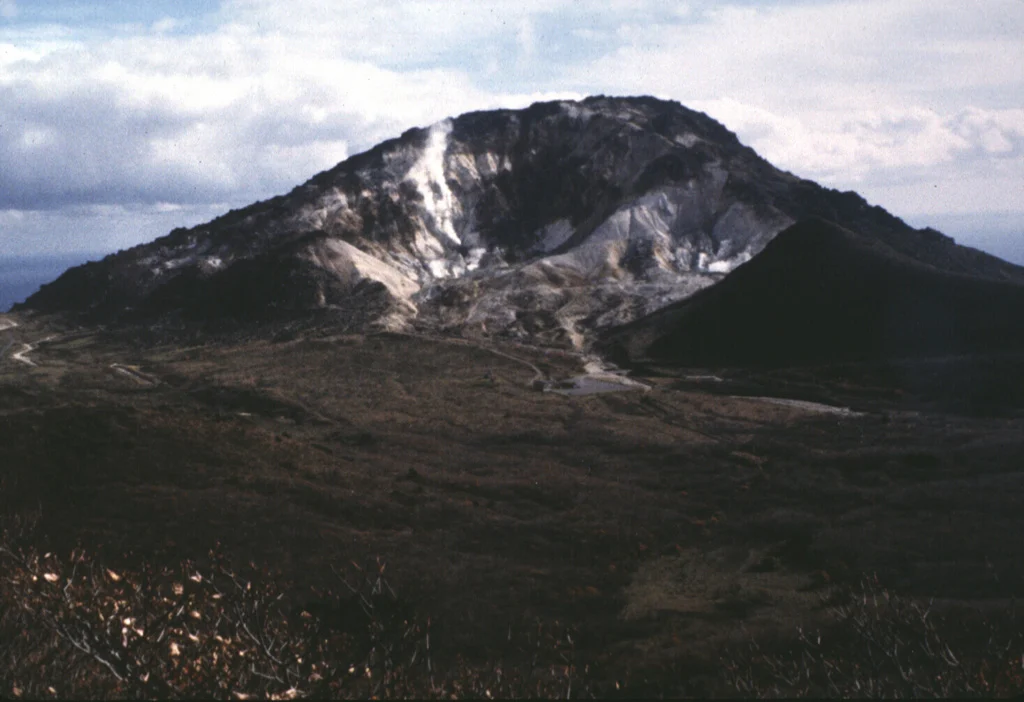
Esan is a small volcanic complex of seven overlapping andesitic-to-dacitic lava domes on the eastern tip of the Oshima Peninsula across the Tsugaru Strait from Honshu. The complex consists of five late Pleistocene and two early Holocene lava domes, Esan and Misaki. A minor phreatic eruption in 1846 produced a mudflow that caused many fatalities. The latest activity was a small eruption in 1874. Active fumaroles occur at a thermal area on the upper NW flank.
Sources: Japan Meteorological Agency (JMA) , GVP.
Photo : Ken-ichi Arai, 1996 (Hokkaido University).
Mexico , Popocatepetl :
The Centro Nacional de Prevención de Desastres (CENAPRED) reported that daily exhalations at Popocatépetl continued during 6-12 August, accompanied by water vapor, volcanic gases, and ash; daily counts ranged from 35 to 74. Six minutes of tremor were recorded during 5-6 August. Emissions of water vapor and volcanic gases were visible from the crater each morning and drifted generally W to NW. Cloud cover restricted visibility of the crater on 9-10 August. From 11 August the ash content of the exhalations was described as occasionally light rather than continuous.
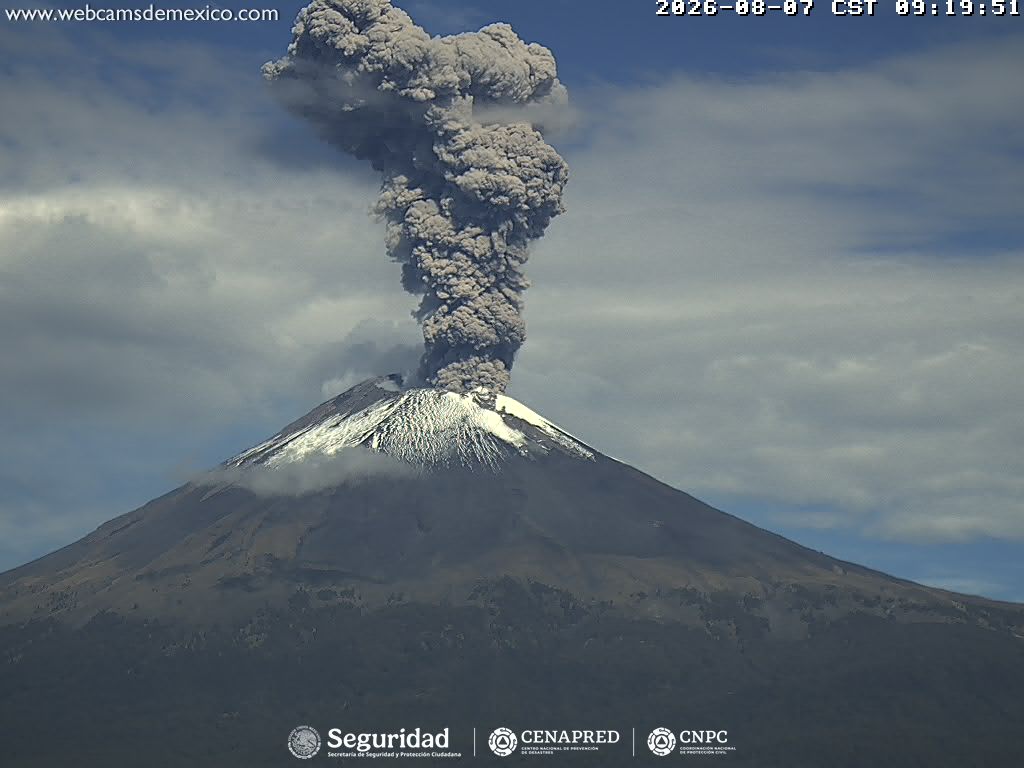
The Washington VAAC reported ash plumes on 6-8 August. Plumes rose to about 1 km above the summit on 6 August and drifted SW and then W, extending approximately 45 km WNW of the summit. On 7 August a plume rose to about 2.2 km above the summit and drifted N, though strong winds spread ash towards the W to NNE, causing ashfall within about 20 km of the summit. The Centro Nacional de Comunicaciones (CENACOM) reported light ashfall on 7 August in Cuernavaca, Tlayacapan, Yautepec, Totolapan, and Jiutepec, all in Morelos. On 8 August a plume rose to about 1.6 km above the summit and drifted W, and ash emission activity was characterized as high. Ash was no longer identifiable in satellite imagery later that day, when only water vapor and gas were observed emitting from the summit. No further advisories were issued through 12 August. The Alert Level remained at Yellow, Phase Two (the middle level on a three-color scale) and the public was warned to stay 12 km away from the crater.
Sources: Centro Nacional de Prevencion de Desastres (CENAPRED), Washington Volcanic Ash Advisory Center (VAAC) , GVP.
Indonesia , Merapi :
The Pusat Vulkanologi dan Mitigasi Bencana Geologi (PVMBG) reported that the eruption at Merapi (on Java) continued during 6-12 August with lava avalanches produced by the active lava dome on the upper SW flank. The seismic network recorded 4-19 lava avalanches per day that traveled as far as 2 km down the SW flank. Two pyroclastic flows were detected on 10 August, one of which was also observed descending the SW flank, and single flows were detected on 11 and 12 August. The Alert Level remained at 3 (on a scale of 1-4), and the public was warned to stay 3-7 km away from the summit, based on location.
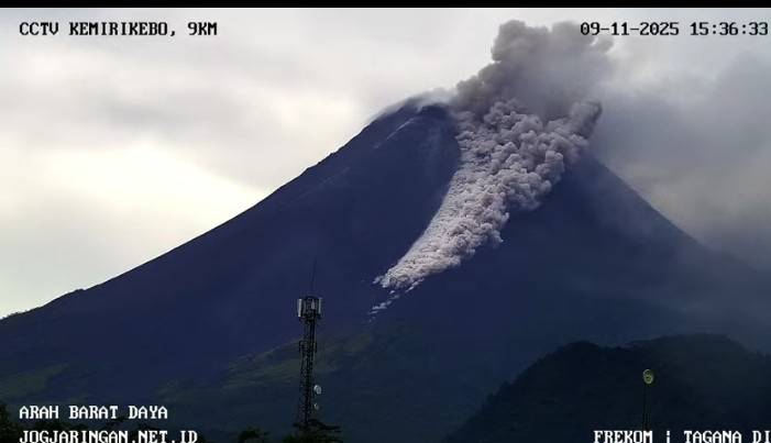
Merapi, one of Indonesia’s most active volcanoes, lies in one of the world’s most densely populated areas and dominates the landscape immediately north of the major city of Yogyakarta. It is the youngest and southernmost of a volcanic chain extending NNW to Ungaran volcano. Growth of Old Merapi during the Pleistocene ended with major edifice collapse perhaps about 2,000 years ago, leaving a large arcuate scarp cutting the eroded older Batulawang volcano. Subsequent growth of the steep-sided Young Merapi edifice, its upper part unvegetated due to frequent activity, began SW of the earlier collapse scarp. Pyroclastic flows and lahars accompanying growth and collapse of the steep-sided active summit lava dome have devastated cultivated lands on the western-to-southern flanks and caused many fatalities.
Sources: Pusat Vulkanologi dan Mitigasi Bencana Geologi (PVMBG, also known as CVGHM) , GVP.
Photo : Frekom ( archive).