August 16 , 2026.
Italy / Sicily , Etna :
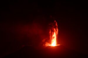
Statement on Mount Etna activity, August 15, 2026, 10:26 (08:26 UTC).
The National Institute of Geophysics and Volcanology (INGV), Etna Observatory (Osservatorio Etneo), reports that video surveillance images indicate the lava field is undergoing partial cooling. Meanwhile, INGV-OE personnel are conducting field inspections.
Activity at the Voragine crater continues with low-level ash emissions, confined to the summit area.
Seismically, the average amplitude of volcanic tremor underwent a significant change this morning. Starting around 04:00 UTC, a very rapid drop in values was recorded; within about an hour, these values had returned to a low level. The centroids of the volcanic tremor sources are currently located in the area between the Voragine crater and the Southeast Crater, at an elevation of approximately 2,500 m above sea level.
Since around 04:00 UTC—the time marking the start of the sharp drop in volcanic tremor—infrasonic activity has also almost completely ceased.
Signals from tiltmeter stations indicate a trend toward a return to normal values. Signals from GNSS stations confirm a trend of deflation in the volcanic edifice.
Statement on Mount Etna activity, August 15, 2026, 12:15 (10:15 UTC).
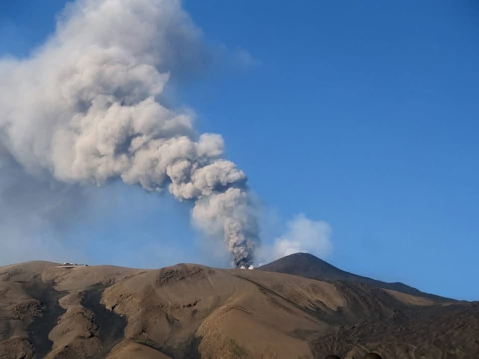
The National Institute of Geophysics and Volcanology (INGV) – Etna Observatory reports that field observations by INGV-OE personnel confirm ongoing effusive activity at eruptive vents located at elevations of 2,750 m and 1,990 m. The lava flow front has reached an elevation of approximately 1,600 m near Rocca Musarra, covering earlier flows. At 08:40 UTC, a brief explosion occurred at the Northeast Crater, generating an ash plume that—according to dispersion forecast models—drifted southward. Currently, only minor ash emission, confined to the summit area, is continuing.
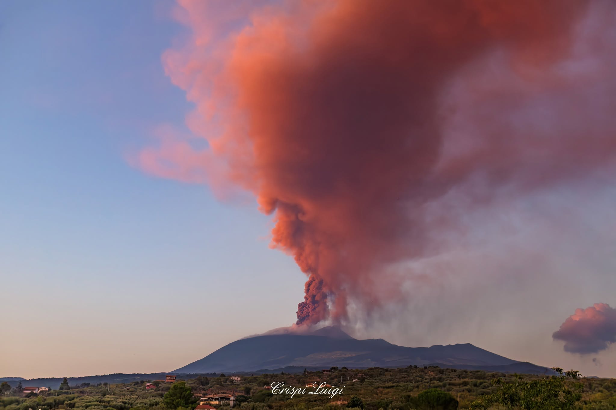
Regarding seismic activity, around 08:20 UTC, the average amplitude of volcanic tremor underwent a very rapid, transient increase, reaching moderate levels with a peak at 08:40 UTC. Subsequently, following a sharp drop, the tremor amplitude returned to a low level by 09:00 UTC, where it has remained. Coinciding with the rise in tremor—and exclusively during this intensification phase—the tremor source centroids were located at the Northeast Crater, at an elevation of approximately 2,000 m above sea level. Currently, the tremor source is located at the Voragine Crater, at an elevation of approximately 2,600 m above sea level.
Starting at 08:26 UTC, significant, temporary infrasonic activity was recorded for about half an hour; this was characterized by a succession of at least twenty high-amplitude infrasonic events, all located at the Northeast Crater. No infrasonic activity is currently being observed.
We confirm the information previously communicated: the return to the initial state of deformations observed via the tiltmeter network and the consolidation of the deflationary trend of the volcanic edifice, as observed by the GNSS network.
Further information will be provided as soon as possible.
Source : INGV.
Photos : Orazio Paterno , Luigi Crispi .
Indonesia , Anak Krakatau :
An eruption of Mount Anak Krakatau occurred on Sunday, August 16, 2026, at 09:12 (Western Indonesia Time), with an ash column rising approximately 200 m above the summit (or about 357 m above sea level). The ash column, ranging from gray to black in color and of moderate to high density, drifted toward the southwest and west. The eruption was recorded by the seismograph with a maximum amplitude of 43 mm and a duration of 59 seconds.
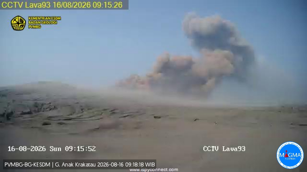
Seismic observations
1 eruption earthquake, with an amplitude of 43 mm and a duration of 59 seconds.
1 episode of continuous tremor with an amplitude of 5 to 30 mm (dominant amplitude: 10 mm).
Recommendations
The public, visitors, tourists, and hikers are advised not to approach Mount Anak Krakatau or engage in activities within a 3 km radius of the active crater.
Source et photo : PVMBG.
Chile , Laguna del Maule :
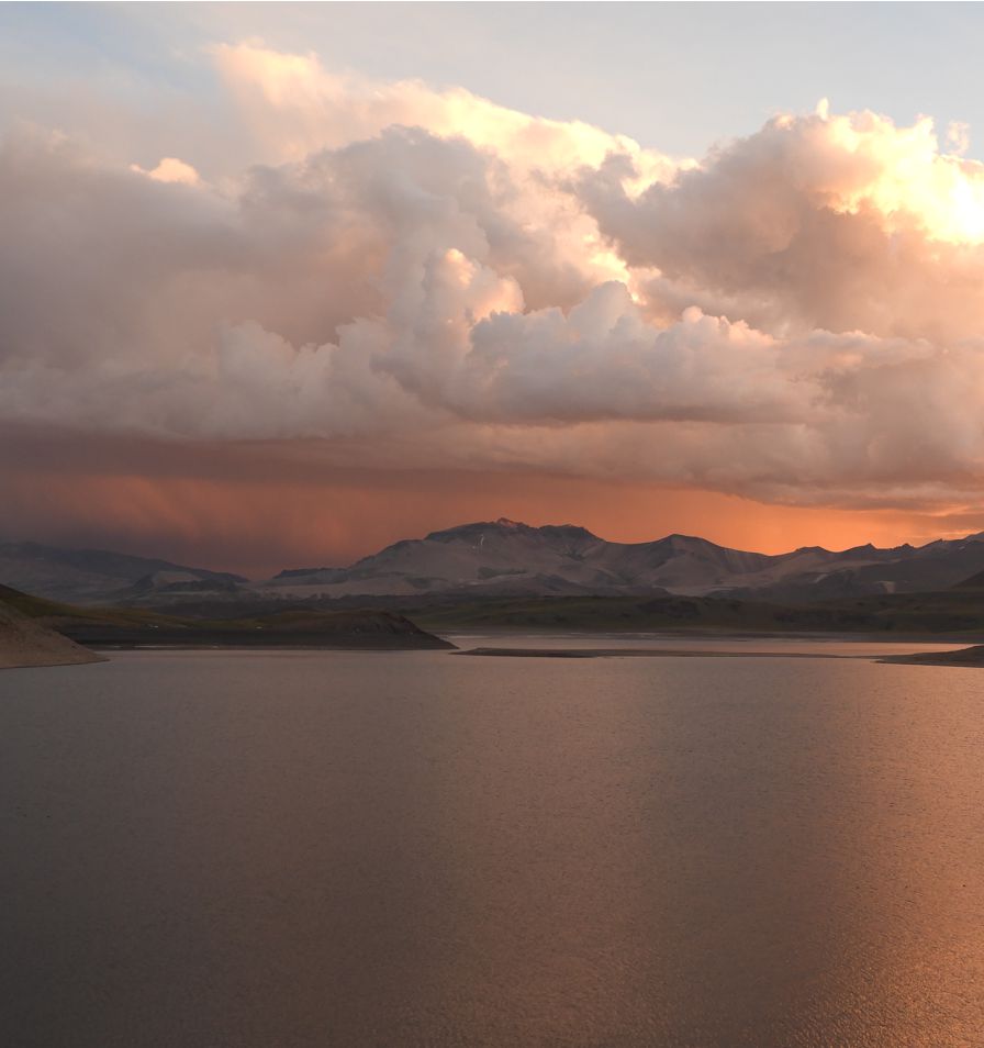
During the reporting period, volcano-tectonic (VT) seismic activity—associated with rock fracturing within the volcano—showed a slight decrease in the number of recorded events, while energy release levels remained similar to those of the previous period.
The most energetic VT event recorded (reported in the REAV) had a local magnitude (ML) of 3.2 and was located 10 km west-southwest (WSW) of the lagoon center, at a depth of 4.7 km relative to the lagoon’s mean elevation.
Activity associated with fluid dynamics within the volcanic system—manifesting as long-period (LP) events—showed a number of events
and energy release values similar to those of the previous period.
The energy of the most significant event, measured by its reduced displacement (RD), was 1 cm².
One (1) hybrid (HB) event was recorded, associated with both rock fracturing and fluid movement within the volcanic system.
The energy of this event, based on its reduced displacement (RD), was 4.6 cm².
Data from GNSS stations indicate that the uplift process is continuing, with deformation rates similar to those observed during previous periods.
Images from surveillance cameras revealed no surface activity associated with the volcanic complex.
Furthermore, satellite image processing detected no thermal anomalies associated with the volcanic complex.
Source et photo : Segemar
Costa Rica , Rincón de la Vieja :
OVSICORI-UNA Statement – Update of August 14, 2026
Eruptive activity
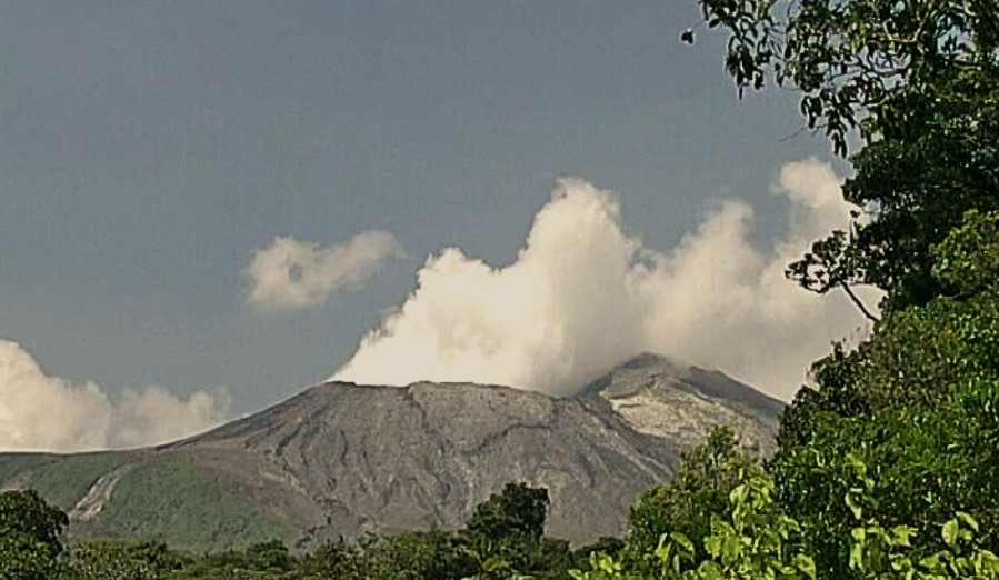
Seven eruptions were recorded this week. This figure represents a decrease in the number of eruptions compared to the previous week. However, the magnitude of three of these events exceeded that of the eruptions occurring over the preceding two weeks. Three eruptions of moderate intensity took place on August 11 and 13. The eruption on August 11 at 5:24 PM triggered a small lahar. Residents in the area to the north reported secondary lahars in the Pénjamo, Azul, La Azufrada, and La Zanjonuda rivers on August 12 and 14. A total of 69 eruptions have been recorded since July 2. Four of these caused lahars to descend the volcano’s northern flank.
Seismic activity
A slight increase in the number of LP and « tornillo »-type events was observed prior to the higher-magnitude eruptions (August 11). Background tremor remained low for most of the period and increased following the eruptions. At the time of writing, the tremor shows a decrease in amplitude, with a predominance of high frequencies (3 to 6 Hz). Additionally, brief tremor pulses with frequency content between 0.5 and 6 Hz are being observed. Sporadic volcano-tectonic earthquakes were also recorded, occurring both in the immediate vicinity of the crater and at greater distances. Finally, the dominant frequency of « tornillo »-type events decreased over the course of the week.
Geochemical gas observations
An increase in the SO2 emission rate has been observed since mid-June 2026. The average SO2 flux for this week stands at 329 ± 187 t/d, with a peak value of 2,422 t/d recorded on August 13, 2026. These figures indicate a rise compared to the previous week, when the average flux was 299 ± 156 t/d with a maximum of 1,558 t/d. Despite the decrease observed the previous week, an upward trend in emissions is evident this week. The SO2 flux remains above the baseline values observed in early June 2026. The Multi-GAS station indicates very low SO2 concentrations (<1 ppm).
Source : Ovsicori
Photo : Ovsicori ( archive)
Ecuador , El Reventador :
DAILY STATUS REPORT FOR REVENTADOR VOLCANO, Saturday, August 15, 2026.
Information from the Geophysical Institute – EPN.
Surface activity level: High; Surface trend: Unchanged
Internal activity level: Moderate; Internal trend: Unchanged
From August 14, 2026, 11:00 AM to August 15, 2026, 11:00 AM:
Seismicity:
Explosions (EXP): 68
Long-period (LP): 12
Emission tremor (TREMI): 1
Harmonic tremor (TRARM): 6
Precipitation / Lahars:
No precipitation was recorded in the area. **Heavy rains could remobilize accumulated material and generate debris-laden mudflows (lahars) capable of descending the volcano’s flanks and flowing into adjacent rivers.**
Gas and ash emissions / Plumes:
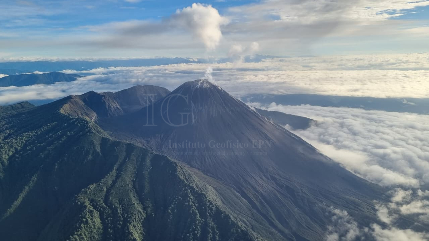
The surveillance camera system detected several gas and ash emissions; the resulting plumes reached heights of 400 to 600 meters above the crater rim, drifting west and southwest. Concurrently, the Washington VAAC issued a report noting a plume rising 700 meters above the crater rim and moving westward.
Other monitoring parameters:
The VIIRS 375 and FIRMS satellite systems recorded 1 and 5 thermal anomalies, respectively, over the past 24 hours.
Observations:
From yesterday afternoon until the time of writing, the volcano remained largely obscured by cloud cover. During the early hours of the day, the surveillance camera system observed incandescent material descending to a level 900 meters below the crater rim.
Alert Level – SGR: Orange
Source et photo : IGEPN.