July 5 , 2026.
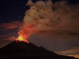
Indonesia , Lewotobi Laki-laki :
Seismic observations
2 eruptive earthquakes with an amplitude of 47.3 mm and a duration of 60 to 74 seconds.
1 « emission » type earthquake (gust earthquake) with an amplitude of 2.9 mm and a duration of 47 seconds.
3 episodes of non-harmonic tremor with an amplitude of 2.9 to 4.4 mm and a duration of 67 to 188 seconds.
2 low-frequency earthquakes with an amplitude of 10.5 to 18.5 mm and a duration of 27 to 28 seconds.
2 distant tectonic earthquakes with an amplitude of 2.9 to 4.4 mm and a duration of 40 to 61 seconds.
VOLCANO OBSERVATORY NOTICE FOR AVIATION – VONA
Issued : July 4 , 2026
Volcano : Lewotobi Laki-laki (264180)
Current Aviation Colour Code : ORANGE
Previous Aviation Colour Code : orange
Source : Lewotobi Laki-laki Volcano Observatory
Notice Number : 2026LWK145
Volcano Location : S 08 deg 32 min 20 sec E 122 deg 46 min 06 sec
Area : East Nusa Tenggara, Indonesia
Summit Elevation : 5069 FT (1584 M)
Volcanic Activity Summary :
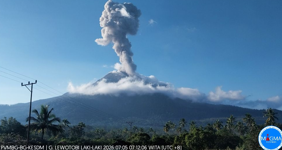
Eruption with volcanic ash cloud at 23h04 UTC (07h04 local).
Volcanic Cloud Height :
Best estimate of ash-cloud top is around 9549 FT (2984 M) above sea level or 4480 FT (1400 M) above summit. May be higher than what can be observed clearly. Source of height data: ground observer.
Other Volcanic Cloud Information :
Ash cloud moving from north to northeast. Volcanic ash is observed to be gray. The intensity of volcanic ash is observed to be thick.
Remarks :
Eruption recorded on seismogram with maximum amplitude 47.3 mm and maximum duration 74 second.
Source et photo : PVMBG.
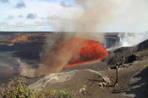
Colombia , Nevado del Ruiz :
Manizales, June 30, 2026, 8:10 PM.
Based on monitoring of the Nevado del Ruiz volcano’s activity, the Colombian Geological Service (SGC)—an agency attached to the Ministry of Mines and Energy—reports the following:
During the week of June 23 to 29, 2026, the volcano continued to exhibit unstable behavior.
Compared to the previous week, the main variations in the monitored parameters were as follows:
– Seismic activity associated with rock-fracturing processes within the volcanic edifice decreased, regarding both the number of recorded earthquakes and the seismic energy released. Seismic events were located primarily on the north-northeast flank, at distances between 2 km and 5 km from the Arenas crater and at depths between 4 km and 5 km, as well as within the crater itself at depths of less than 2 km. To a lesser extent and in a scattered manner, earthquakes occurred on other flanks of the volcano, up to a distance of 10 km from the crater. Earthquake depths ranged from 2 km to 6 km. The maximum magnitude was 1.3, corresponding to earthquakes recorded on June 25 at 12:02 AM and June 28 at 1:15 AM; these were located at the Arenas crater and 3 km northeast of it, respectively, at a depth of 2 km relative to the volcano’s reference level.

– Seismicity associated with fluid dynamics within the volcanic conduits has decreased, in terms of both the number of recorded earthquakes and the seismic energy released.
The seismic signals were short-lived and low-energy. During the week, no long-duration seismic signals, pulsatory ash emissions, or changes in the apparent temperature of the gas plume were recorded.
– Emissions of water vapor and volcanic gases—primarily sulfur dioxide (SO₂)—into the atmosphere from the Arenas crater were variable. The estimated SO₂ flux associated with degassing processes decreased compared to the previous week. Additionally, supplementary monitoring using satellite data platforms indicated low levels of SO₂ output. The vertical height of the gas and water vapor plume remained below 500 m above the volcano’s summit, reaching a maximum of 1,100 m on the morning of June 24. Plume dispersion showed a preferential trend toward the volcano’s northwest flank and, occasionally, toward the west-northwest flank.
Satellite monitoring of thermal anomalies at the base of the Arenas crater remained limited due to heavy cloud cover in the area; however, a few low-intensity anomalies were detected.
Source et photo : SGC.
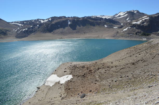
Chile , Laguna del Maule :
SPECIAL REPORT ON VOLCANIC ACTIVITY, July 1, 2026
The Argentine Geological and Mining Service (SEGEMAR), through the Argentine Volcanic Monitoring Observatory (OAVV), reports that today, Wednesday, July 1, 2026, at 14:40 local time (17:40 UTC), volcanic monitoring stations installed near the Laguna del Maule volcanic complex recorded a volcano-tectonic (VT) earthquake associated with rock fracturing within the volcanic system.
Event information
Origin time: 14:41 local time (17:41 UTC)
Latitude: -36.102°
Longitude: -70.606°
Depth: 5.7 km
Local magnitude: 3.3 (ML)
OBSERVATIONS:
At the time of writing this report, VT activity continues to be recorded, although most detected events are characterized by low energy. Nevertheless, given this activity context, the occurrence of further events of significant magnitude remains possible.
It should be noted that no surface activity or variations in other monitoring parameters have been detected at the volcanic complex. This specific episode has not affected Argentine territory, and no reports have been received from nearby Argentine populations.
CONCLUSIONS
The technical alert level remains unchanged, and volcano monitoring will continue in constant coordination with the Southern Andes Volcanological Observatory (OVDAS) in Chile; any changes will be reported.
Source : Segemar .
Photo : Claudio Arriagada .
La Martinique , Mount Pelée :
Weekly Report / Institut de physique du globe de Paris / Martinique Volcanological and Seismological Observatory (OVSM)
Saint-Pierre, July 3, 2026, at 3:15 PM local time (GMT-4)
Between June 26, 2026, at 4:00 PM (UTC) and July 3, 2026, at 4:00 PM (UTC), the OVSM recorded 160 earthquakes of volcanic origin:
• 159 volcano-tectonic earthquakes. Of these, 9 had a magnitude (local magnitude Mlv or duration magnitude Md) greater than 0.5, and 3 had a magnitude greater than 1. The largest had a magnitude of Mlv=1.26; the others were of lower energy. These earthquakes were located at depths ranging from 0.6 to 1.9 km beneath the volcano’s summit. Volcano-tectonic seismicity is associated with micro-fracturing within the volcanic edifice, linked to the overall reactivation of the volcano observed since 2019.
• 1 deep long-period earthquake, located at a depth of 25 km southwest of Mount Pelée, with a magnitude of Mlv = 0.55. Deep long-period earthquakes are characterized by signals containing only low frequencies and are associated with the circulation of magmatic fluids deep within the Mount Pelée volcanic system.
No earthquakes were felt by the population.

The previous week, the OVSM recorded 53 volcano-tectonic earthquakes. As of July 3, 2026, and over the past four weeks, the OVSM has observed a total of 436 volcanic earthquakes, representing an average of 109 earthquakes per week.
During phases of volcanic reactivation in volcanoes similar to Mount Pelée, it is common to observe seismic activity that varies in intensity and frequency. The probability of short-term eruptive activity remains low. However, given the observations gathered in recent years—and particularly over the last few months—a change in the situation over the medium term (weeks to months) cannot be ruled out.
The volcanic alert level, in accordance with the measures established by the authorities, is currently YELLOW: vigilance.
Source et photo : Direction de l’OVSM-IPGP
Indonesia , Anak Krakatau :
Clarification regarding the misleading video about the Anak Krakatau volcano (July 4, 2026)
Anak Krakatau is an active Type A volcano located in the waters of the Sunda Strait; administratively, it falls under the jurisdiction of South Lampung Regency in Lampung Province. However, the volcano is monitored from two observation posts: Kalianda and Pasauran.
Historical records document a massive eruption in 1883 that triggered a tsunami. Furthermore, on December 22, 2018, seismic tremors set off an eruption and a partial collapse of the volcano’s structure, causing a tsunami in the Sunda Strait region. Following this event, a series of minor eruptions—marking a phase of volcanic rebuilding—continued until December 16, 2023. A period of relative calm has been observed since then; nevertheless, Anak Krakatau continues to exhibit low-energy magmatic activity.
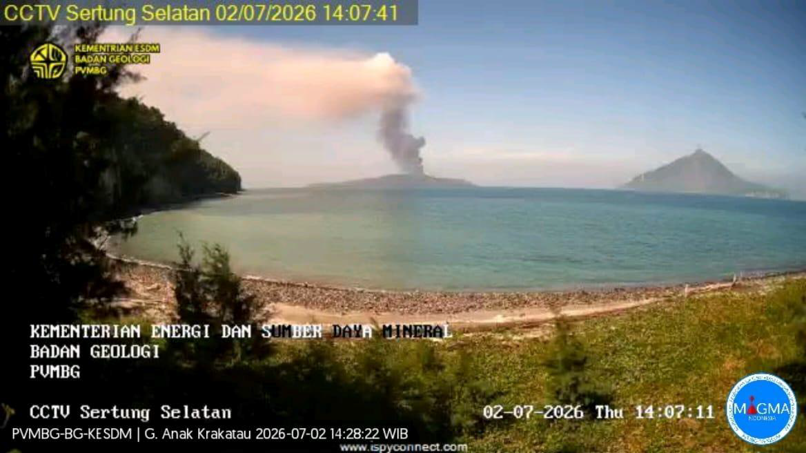
A video circulating on social media claims to show an eruption of Anak Krakatau filmed from a ship. Verification has confirmed that this video does not show a current eruption of the volcano; the information is therefore false. Monitoring data indicate that Anak Krakatau has experienced two eruptions since July 2, 2026: one on July 2, 2026, at 2:05 PM (WIB local time) and another on July 3, 2026, at 11:50 AM (WIB). The public is advised not to believe or share unverified videos. All official information regarding Anak Krakatau’s activity is communicated exclusively through the official channels of the Geological Agency (PVMBG) and MAGMA Indonesia. Furthermore, information is circulating suggesting a recommended safety distance of 5 km around the volcano. This information is incorrect. The current official recommendation prohibits the public, tourists, and fishermen from engaging in any activity within a 3 km radius of Anak Krakatau’s eruptive center. The public is urged to rely on official information released by the Geological Agency (PVMBG) and not to be easily swayed by information lacking a clear source.
Source et photo : PVMBG.