July 4 , 2026.
Indonesia , Anak Krakatau :
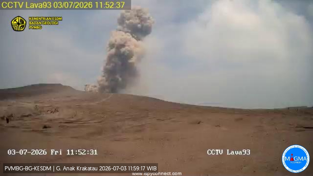
An eruption of Mount Anak Krakatau occurred on Friday, July 3, 2026, at 11:50 a.m. (Western Indonesia Time, WIB), with an ash column reaching a height of approximately 200 m above the summit (or about 357 m above sea level). The ash column, ranging in color from gray to brown and of moderate to high density, drifted toward the west and northwest. The eruption was recorded by the seismograph with a maximum amplitude of 65 mm and a duration of 32 seconds.
Seismic observations
1 distant tectonic earthquake with an amplitude of 10 mm and a duration of 35 seconds.
1 episode of continuous tremor with an amplitude of 1 to 3 mm (primarily 1 mm).
Recommendations
The public, visitors, tourists, and hikers must not approach Mount Anak Krakatau or engage in activities within a 3 km radius of the active crater.
Source et photo : PVMBG.
Iceland , Reykjanes Peninsula :
Ground uplift and magma accumulation continue beneath Svartsengi
Uplift beneath Svartsengi continues at a steady rate
Continued slow magma accumulation, likely ending in a new dike intrusion and possibly an eruption remains the most likely scenario
Hazard assessment unchanged, validity extended until 30 September
Ground deformation
Magma accumulation and ground uplift continue beneath Svartsengi. The average rate of magma accumulation over the past few weeks has remained steady.
The most likely scenario remains continued slow magma accumulation, eventually leading to a new dike intrusion and possibly a volcanic eruption.
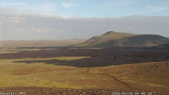
View from Húsafell towards Þorbjörn, encompassing the eruption sites.
Seismic Activity
Earthquake activity along the Sundhnúkur crater row and near Grindavík remains relatively low and is similar to previous weeks. No significant changes in seismic activity have been observed in recent weeks.
Hazard Assessment
The hazard assessment remains unchanged, and its validity has been extended until 30 September.
Source et photo : IMO.
Kamchatka , Sheveluch :
KVERT VOLCANIC ACTIVITY NOTICE (VAN)
Issued: July 3 , 2026
Volcano: Sheveluch (CAVW #300270)
Current aviation colour code: RED
Previous aviation colour code: orange
Source: KVERT
Notice Number: 2026-60
Volcano Location: N 56 deg 38 min E 161 deg 19 min
Area: Kamchatka, Russia
Summit Elevation: 3283 m (10768.24 ft), the dome elevation ~2500 m (8200 ft)
Volcanic Activity Summary:
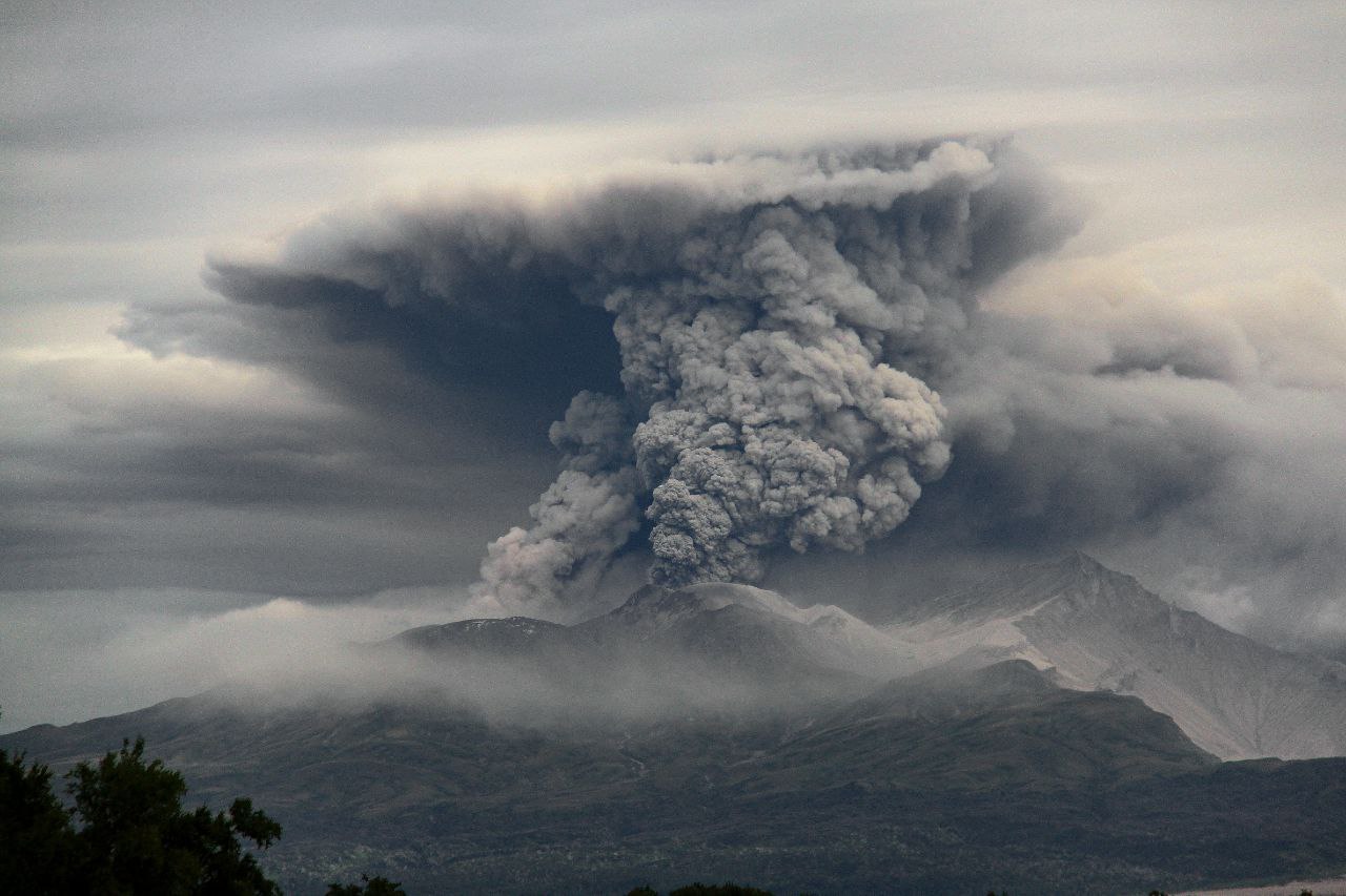
The explosive-extrusive eruption of the volcano continues, accompanied by powerful gas-steam activity; a new block of lava continues to grow in the northern part of the lava dome. Explosions sent ash up to 10.5 km a.s.l. (start of an event at 20:05 UTC), and an ash cloud move for 65 km to the northwest of the volcano.
The explosive-extrusive eruption of the volcano continues. Ash explosions up to 12 km (39,400 ft) a.s.l. could occur at any time. Ongoing activity could affect international and low-flying aircraft.
Volcanic cloud height:
10500 m (34440 ft) AMSL Time and method of ash plume/cloud height determination: 20260703/2040Z – Himawari-9 14m15
Other volcanic cloud information:
Distance of ash plume/cloud of the volcano: 63 km (39 mi)
Direction of drift of ash plume/cloud of the volcano: NW / azimuth 326 deg
Time and method of ash plume/cloud determination: 20260703/2100Z – Himawari-9 14m15
Start time of explosion and how determined: 20260703/2005Z – Satellite data
Volcanic activity summary (July 4, 2026)
The volcano’s explosive and extrusive eruption continues, accompanied by intense gas and steam activity; a new lava block continues to grow on the northern part of the lava dome. No new ash explosions are currently being observed at the volcano; however, at 01:50 UTC on July 4, an ash cloud measuring 80 x 55 km was detected 195 km northwest of the volcano (originating from ash explosions that reached 10.5 km above sea level at 20:05 UTC on July 3). Ash clouds from explosions that reached 11 km above sea level at 08:54 UTC on July 2 remain visible in satellite imagery. At 01:50 UTC on July 4, the northern edge of the ash cloud was located 385 km (azimuth 328) from the volcano, and the southern edge was 984 km (azimuth 162) from the volcano.
Source : Kvert .
Photo : Viktor Frolov ( archive ).
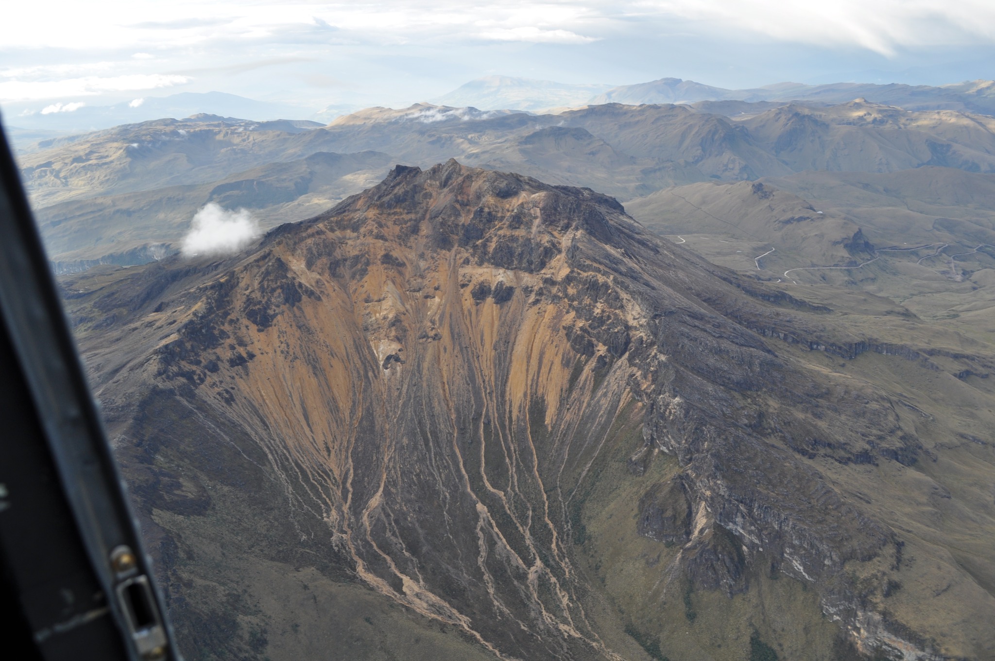
Colombia , Chiles / Cerro Negro :
San Juan de Pasto, June 30, 2026, 4:00 PM.
Based on monitoring of the Chiles-Cerro Negro volcanic complex (CVCCN), the Colombian Geological Service (SGC)—an agency attached to the Ministry of Mines and Energy—reports the following information:
For the period from June 23 to June 29, 2026, the main changes in monitored parameters compared to the previous week were as follows:
● Regarding seismic activity, a slight decrease in event frequency and an increase in released energy were recorded. Seismicity associated with rock-fracturing processes predominated, followed by activity linked to fluid dynamics.
● Localized earthquakes were concentrated in the southern sector of the Chiles-Cerro Negro volcano. In general, the depth of these earthquakes ranged from 2 to 8 km below the volcano’s summit (4,700 meters above sea level).
Two earthquakes of significant magnitude were recorded: the first event occurred on June 27, 2026, with a magnitude of 2.9, at a distance of 7.9 km to the northeast (NE) and a depth of 5.7 km below the summit; the second event had a local magnitude of 2.8, at a distance of 2.5 km to the west (W) and a depth of 3.5 km. Neither of these earthquakes was reported as felt by local residents.
● Analysis of data from satellite sensors and ground stations continued to show variations associated with deformation processes in the volcanic zone.
Based on the assessment and correlation of monitored parameters, the SGC recommends closely monitoring the situation’s evolution via weekly bulletins and other information released through our official channels, as well as adhering to the instructions of local and departmental authorities and the National Unit for Disaster Risk Management (UNGRD).
Volcanic activity remains at the yellow alert level: an active volcano showing changes relative to the baseline behavior of monitored parameters and other manifestations.
Source et photo : SGC.
Costa Rica , Poas :
OVSICORI-UNA Weekly Volcanic Monitoring Bulletin, July 3, 2026
Latitude: 10.20° N;
Longitude: 84.23° W;
Elevation: 2,687 m above sea level.
Current activity level: Alert
No eruptions were recorded this week. Tremor amplitude increased significantly and is currently peaking at a multi-year high. Tremor frequency dropped to the lowest levels of the year (~1 Hz). Tremor fragmentation was observed, resulting in discontinuous events. Notably, on July 2 at 05:00, the amplitude decreased rapidly; this could suggest conduit obstruction and subsequent system pressurization, making the onset of eruptions likely. The number of long-period events remains very low. Two distal volcano-tectonic earthquakes were recorded this week on the eastern flank at a depth of 3.5 km below the summit, with local magnitudes of 1.9 and 1.5; both occurred on June 30. A decrease in the number of high-frequency events is observed at stations near the crater.
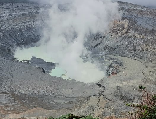
The geodetic network detected no clear deformation pattern, with the exception of slight uplift around the crater that is not yet considered significant. A drop in the SO2/CO2 ratio was recorded, falling from values near 1.8 last week to values near 1.0 this week. The H2S/SO2 ratio continues to show values below 0.1. NOVAC stations recorded 235 ± 59 tonnes of SO2 per day, a flux comparable to that of the previous week (241 ± 58 t/d). The SENTINEL satellite detected the SO2 plume on several occasions, with a peak value exceeding 16.2 tonnes of SO2 on June 25. The level of the hyperacidic lake fluctuated—dropping by nearly half a meter at times—but ended the week with a net rise of approximately 0.4 m.
On June 23, the hyperacidic lake had a temperature of 74°C and a pH of approximately 0.2. Another notable observation is that, throughout June, the oxidation-reduction potential (ORP) of the lake water hovered around 280 mV—a value lower than in previous months (when it exceeded 300 mV)—indicating a decrease in the flux of fresh, oxidizing magmatic gases (SO2) into the hydrothermal system feeding the lake.
Source : Ovsicori.
Photo : Sergio Lucena