April 15 , 2026.
La Réunion Island , Piton de la Fournaise :
Press release from the Paris Institute of Earth Physics / Piton de la Fournaise Volcanological Observatory, April 14, 2026 – 4:10 PM local time – 12:10 PM UTC
Resumption of Tremor
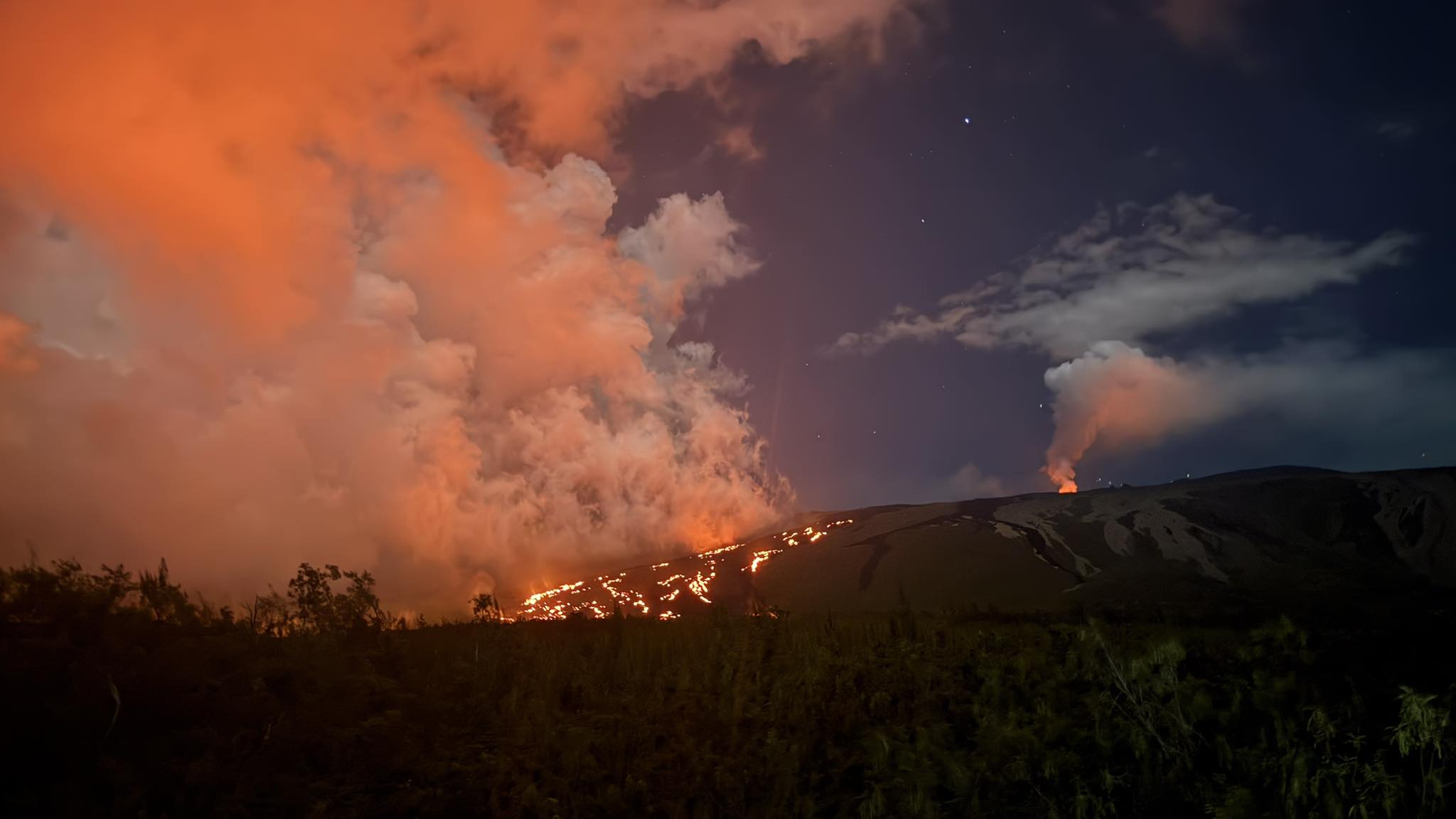
Since approximately 3:00 PM (local time, 11:00 AM UTC) on April 14, 2026, a low-amplitude volcanic tremor has been recorded again. According to the OVPF recordings, the source of this signal is located on the East-Southeast flank. This signal, still weak, could indicate an imminent resumption of eruptive activity, most likely at the last eruptive cone of the eruption that began on February 13, 2026. Currently, there is no lava flow at the surface, but the presence of this tremor nevertheless indicates the presence of magma at shallow depths and suggests the possibility of lava flow in the near future.
The OVPF continues to closely monitor developments in the activity.
Press release from the Paris Institute of Earth Physics / Piton de la Fournaise Volcanological Observatory, April 15, 2026 – 8:30 a.m. local time – 4:30 a.m. UTC
Tremor
Tremor* has been recorded since approximately 3:00 p.m. (local time, 11:00 a.m. UTC) on April 14. The source of this tremor is located on the east-southeast flank of the volcano and is positioned in the same location as during the eruptive activity phases from February 13 to April 12.
Yesterday evening (between 6:30 p.m. and 10:00 p.m. local time), a rapid increase in tremor was observed. No surface lava emissions were detected in the images from the observatory cameras during this period. Since then, a residual, low-intensity tremor has continued to be recorded.
Currently, only degassing is observed at the eruptive sites associated with the activity from February 13 to April 12, located at an altitude of 2056-2120 m on the east-southeast flank of the volcano.
This tremor nevertheless indicates the presence of magma at shallow depths; thus, a resumption of lava flows cannot be ruled out.
Last night, a glowing, incandescent point was observed at the summit of the eruptive cone, in the area of the most intense degassing on the cone formed between April 9 and 12. This incandescent point did not originate from lava ejecta and was already present the previous day. However, it is certain that material at very high temperatures, and potentially even molten, still resides inside the cone.
Seismicity
Since the cessation of surface eruptive activity on April 12 at 11:10 p.m. (local time), seismicity beneath the summit remains low.
Deformation
Slight asymmetric deformation of the summit is currently being recorded. This parameter will be confirmed in the coming days.
Source : OVPF / IPGP.
Photo : Samuel RBT/ FB (archive)
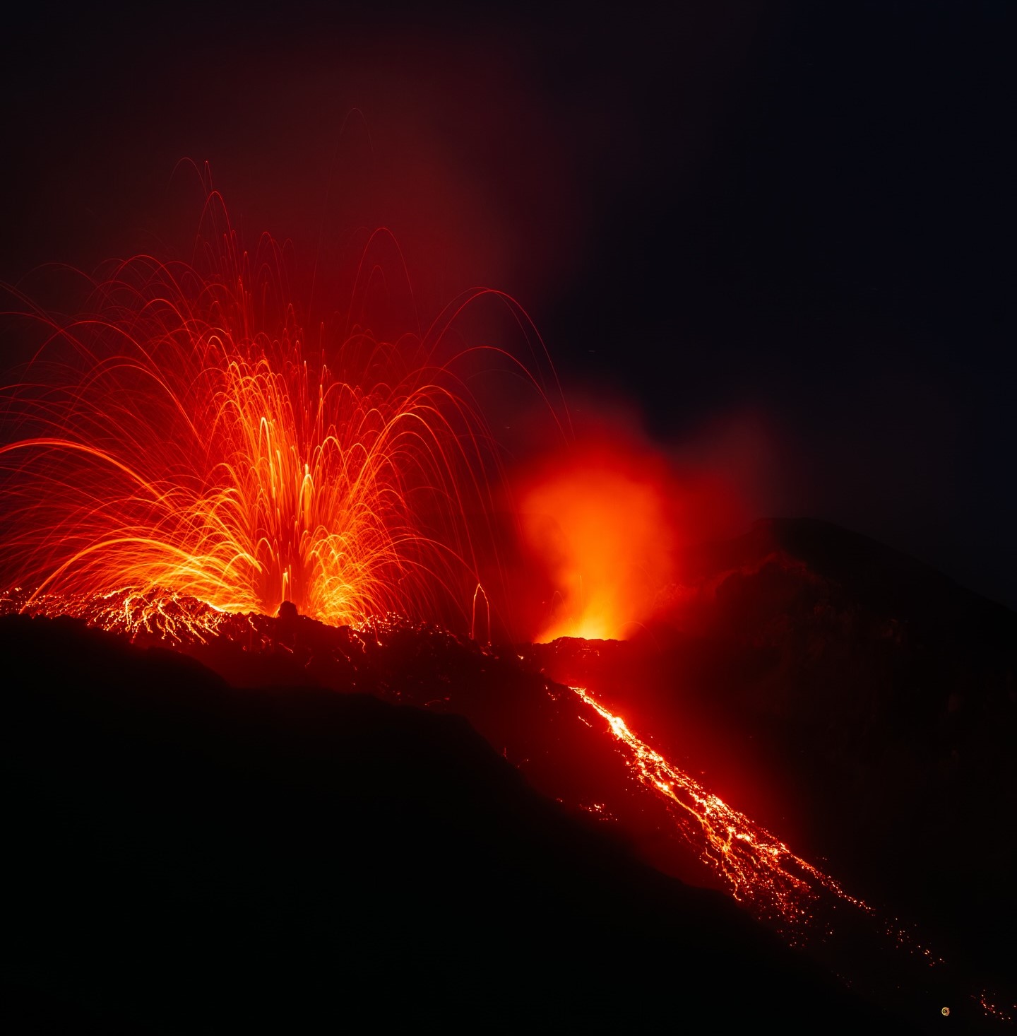
Italy , Stromboli :
WEEKLY BULLETIN, from April 6, 2026 to April 12, 2026. (Issuance date: April 14, 2026)
ACTIVITY SUMMARY
Based on monitoring data, the following points should be noted:
1) VOLCANOLOGICAL OBSERVATIONS: During the reporting period, ordinary Strombolian-type eruptive activity was observed, interrupted by lava ejections and overflows from the North Crater area. The total hourly frequency of explosions fluctuated between average values (11 events/hour) and very high values (27 events/hour). Intensity was mostly low to medium in the North and Southwest Crater areas.
2) SEISMOLOGY: The monitored seismic parameters did not show any significant variations.
3) GROUND DEFORMATION: GNSS network signals showed no significant changes. Clinometric network data for the week are not available.
4) GEOCHEMISTRY: SO₂ flux at an average level and increasing.
Soil CO₂ flux in the Pizzo area (STR02): average to high values (approximately 9,000 g/m²/day).
C/S ratio in the plume: no update available for the past week.
Dissolved helium isotope ratio (R/Ra) in the thermal aquifer: data from the last sample taken on March 23, 2026, are high (R/Ra = 4.50).
Soil CO₂ flux in the San Bartolo area: average to high values.
Soil CO₂ flux in the Scari area: average values.
5) SATELLITE OBSERVATIONS: The thermal activity observed by satellite in the summit area was generally moderate, characterized by the effusive event that began on April 12, 2026, and ended on April 13, 2026.
VOLCANOLOGICAL OBSERVATIONS:
During the observation period, Stromboli’s eruptive activity was characterized by the analysis of images recorded by the INGV-OE monitoring cameras located at an altitude of 190 m (SCT-SCV) and at Punta dei Corvi (SPCT). Explosive activity was primarily produced by five eruptive vents located in the North Crater area and by at least two vents located in the Central-South Crater area.
On April 12 and 13, a lava flow was observed in the North Crater area.
Observations of explosive activity captured by surveillance cameras:
Five active winds were observed in the North Crater area (N), two in sector N1 and three in sector N2. These vents produced low-intensity explosive activity (eruptive products reached a height of less than 80 m) and medium-intensity explosive activity (products reached a height between 80 m and less than 150 m). In addition, weak but continuous ejection activity was observed at the vents in sector N2. This activity was particularly intense for short periods on April 9, 11, and 12. The eruptive products were mainly composed of coarse material (bombs and lapilli). The average frequency of explosions varied between 10 and 19 events per hour.
Two main vents were observed in the Central-South Crater (CS) area, generating explosions of fine material, sometimes mixed with coarse material, of low to medium intensity. The average frequency of explosions ranged from zero to seven events per hour.
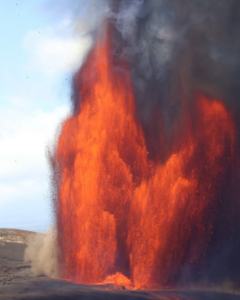
Lava overflow of April 12 and 13, 2026.
On April 12 and 13, a lava overflow occurred from the southern vent in the North Crater area, specifically from sector N2, overlooking the Sciara del Fuoco.
Starting at 3:36 PM UTC on April 12, following intense ejection activity at the vents in sector N2, large blocks of incandescent material began rolling toward the upper part of the Sciara del Fuoco, quickly resulting in a lava flow. The lava flow extended to the upper-middle part of the Sciara del Fuoco within a few hours. In the early hours of April 13, despite the heavy projections, the lava flow appeared to be slowly being fed and cooling.
Source : INGV.
Photo : Stromboli stati d’animo / Sebastiano Cannavo
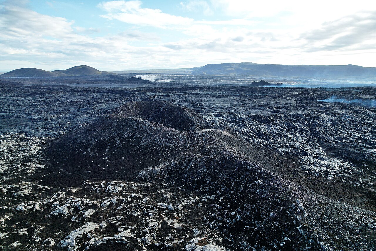
Iceland , Reykjanes Peninsula :
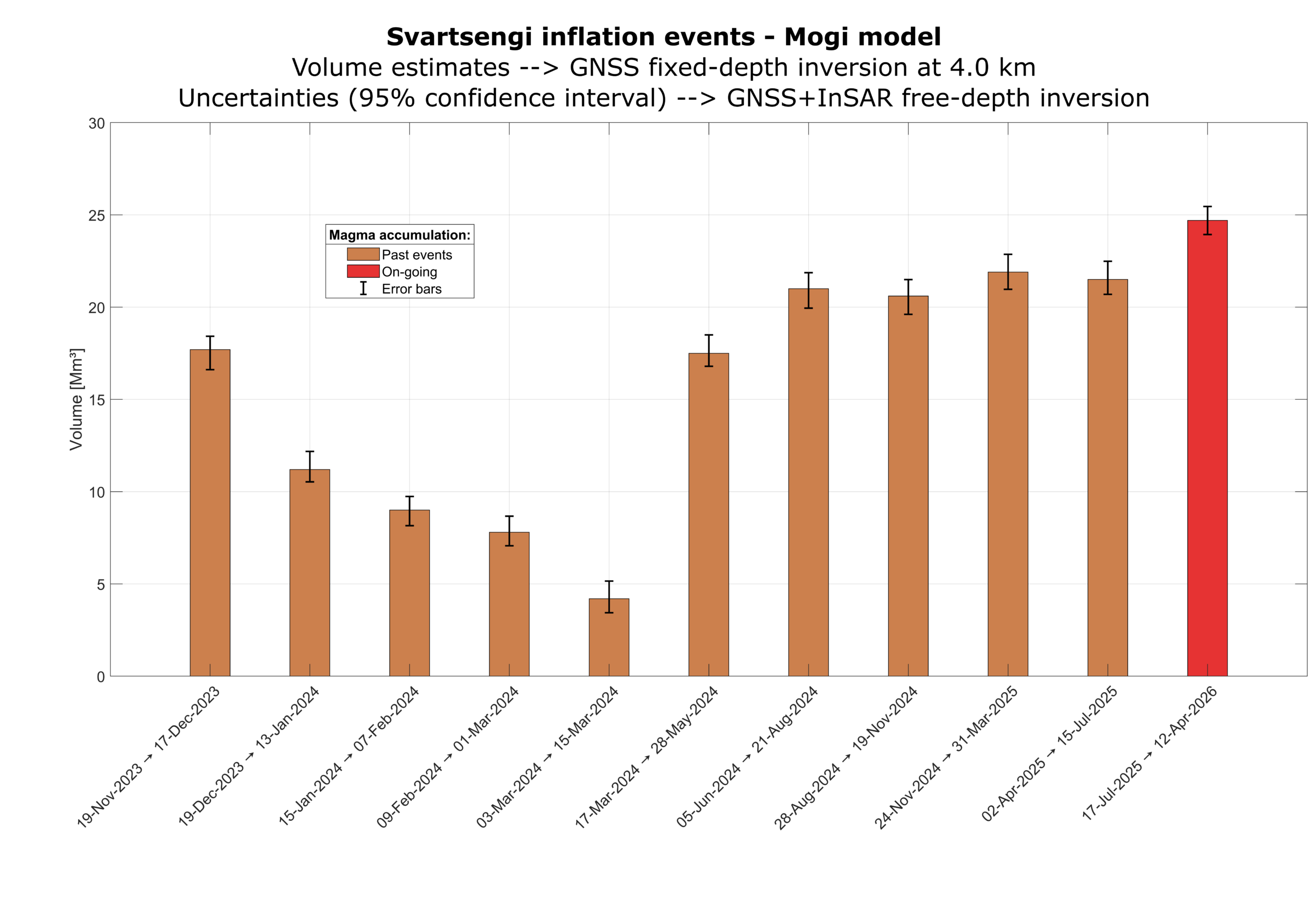
Uplift and magma accumulation continues beneath Svartsengi
Updated 14 April
Dike propagation and an eruption on the Sundhnúkur crater row remain the most likely scenario
About 25 million cubic meters of magma have accumulated beneath Svartsengi
Low seismic activity continues to be measured in the area
Hazard assessment unchanged and valid until June 30
Deformation
Uplift and magma accumulation continues in a similar manner as in recent weeks, with magma inflow being slow but steady. According to model calculations, about 25 million cubic meters of magma have now accumulated beneath Svartsengi since the last eruption in July last year. This is the largest volume measured since the eruptions began on the Sundhnúkur crater row.
As magma continues to accumulate and pressure in the system increases, the most likely scenario is that a magmatic dike will propagate from Svartsengi toward the Sundhnúkur crater row, which could lead to an eruption. Short warning times must be expected, as before, ranging from about 20 minutes up to just over four hours.
Seismic activity
Seismic activity has remained low in recent weeks along the dike region, averaging about two small earthquakes per day.
Yesterday, April 13, thirteen small earthquakes were recorded at around 10 km depth in Fagradalsfjall, whereas no more than three earthquakes per day have been recorded there in recent months.
Source : IMO.
Photos : Sundhnukur / Steinninn , IMO.
Indonesia , Dempo :
An eruption of Mount Dempo occurred on Wednesday, April 15, 2026, at 11:45 AM WIB, with an observed ash column height of approximately 3,500 m above the summit (approximately 6,673 m above sea level). This white ash column was of moderate intensity and extended to the northeast. The eruption was recorded by a seismograph, with a maximum amplitude of 30 mm and a duration of 829 seconds.
VOLCANO OBSERVATORY NOTICE FOR AVIATION – VONA
Issued : April 15 , 2026
Volcano : Dempo (261230)
Current Aviation Colour Code : RED
Previous Aviation Colour Code : orange
Source : Dempo Volcano Observatory
Notice Number : 2026DEM011
Volcano Location : S 04 deg 01 min 48 sec E 103 deg 07 min 48 sec
Area : South Sumatra, Indonesia
Summit Elevation : 10154 FT (3173 M)

Volcanic Activity Summary :
Eruption with volcanic ash cloud at 04h45 UTC (11h45 local).
Volcanic Cloud Height :
Best estimate of ash-cloud top is around 21354 FT (6673 M) above sea level or 11200 FT (3500 M) above summit. May be higher than what can be observed clearly. Source of height data: ground observer.
Other Volcanic Cloud Information :
Ash cloud moving to northeast. Volcanic ash is observed to be white. The intensity of volcanic ash is observed to be medium.
Remarks :
Eruption recorded on seismogram with maximum amplitude 30 mm and maximum duration 829 second. Tremor recorded on seismogram with maximum amplitude 0.5 mm.
Source et photo : PVMBG.
Guatemala , Santiaguito :
Atmospheric conditions: Clear skies
Wind: Northwest
Rainfall: 0 mm
Activity:
Activity is being recorded at the Caliente dome of the Santa María-Santiaguito volcanic complex. Weak white degassing fumaroles are observed 300 meters above the crater, along with weak to moderate explosions at a rate of 0 to 3 per hour, which are ejecting columns of gas and ash up to an altitude of 3,400 meters (11,155 feet). These columns are drifting southeast under the influence of the wind. Incandescent rock blocks are visible in free fall, drifting mainly toward the southwest and northeast flanks.
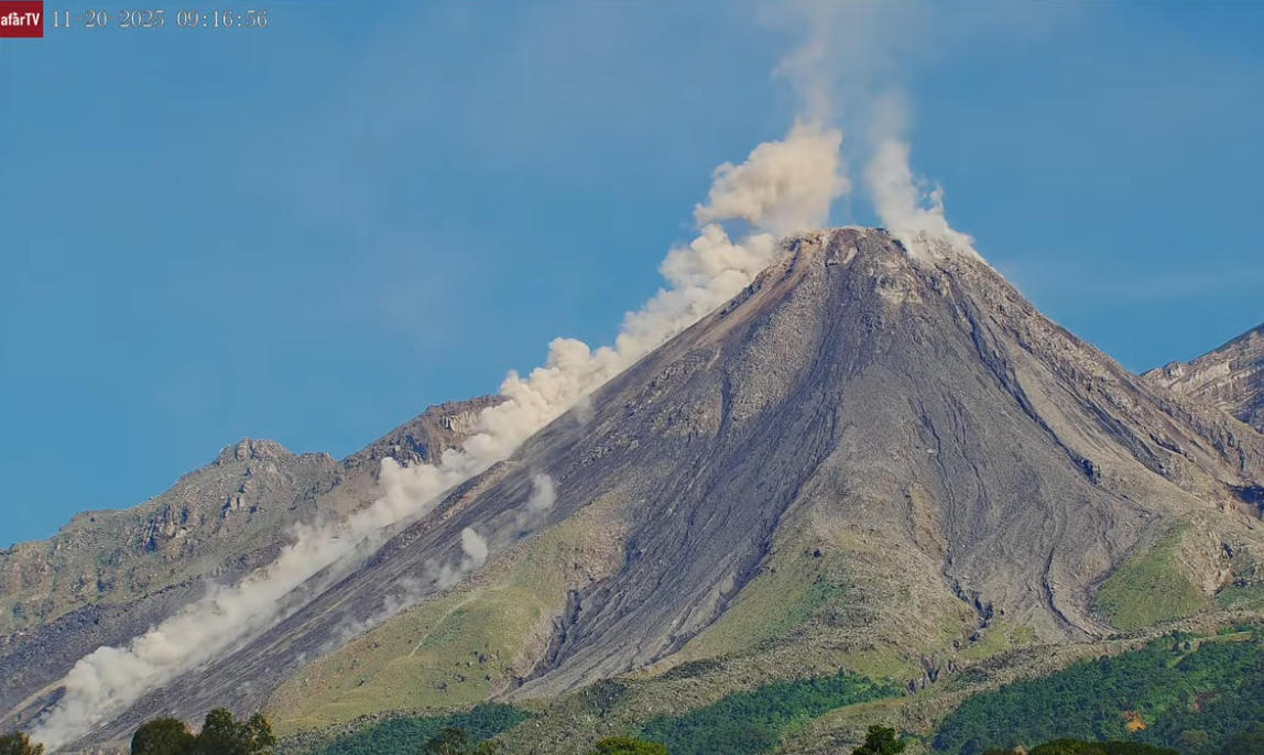
Due to the wind direction, light ashfall is possible on the San José farm in La Quina and the surrounding area. Because of the abundant accumulation of rock material on the Caliente dome and the promontory overlooking the lava flow on its southwest flank, the generation of long-distance pyroclastic density currents in all directions cannot be ruled out; therefore, it is recommended to follow the guidelines of Special Bulletin BESAN-002-2026.
Source : Insivumeh
Photo : Afar tv