June 22 , 2026.
Indonesia , Lewotobi Laki-laki :
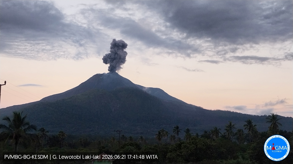
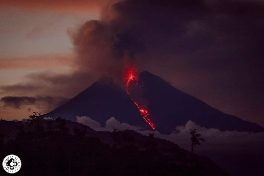
An eruption of Mount Lewotobi Laki-laki occurred on Sunday, June 21, 2026, at 5:40 PM WITA, with an observed ash column height of approximately 600 m above the summit (approximately 2184 m above sea level). This ash column was gray and very dense, and was oriented to the west and northwest. The eruption was recorded by a seismograph, with a maximum amplitude of 11 mm and a duration of 121 seconds.
Seismic Observations
One eruption earthquake with an amplitude of 5.9 mm and a duration of 111 seconds.
Two emission earthquakes with amplitudes between 2.9 and 3.7 mm and a duration of 32 to 36 seconds.
Four non-harmonic tremors with amplitudes between 2.9 and 7.4 mm and a duration of 64 to 178 seconds.
A low-frequency earthquake with an amplitude of 14.8 mm and a duration of 26 seconds.
Two tectonic earthquakes, separated by amplitudes between 4.4 and 8.5 mm and a duration of 43 to 78 seconds.
Recommendations
1. Residents living near Mount Lewotobi Laki-laki and visitors/tourists are advised to avoid all activities within a 5 km radius of the epicenter of the Mount Lewotobi Laki-laki eruption.
2. The public should remain calm, follow the directives of the regional government, and not believe rumors of dubious origin.
Source et photo : PVMBG.
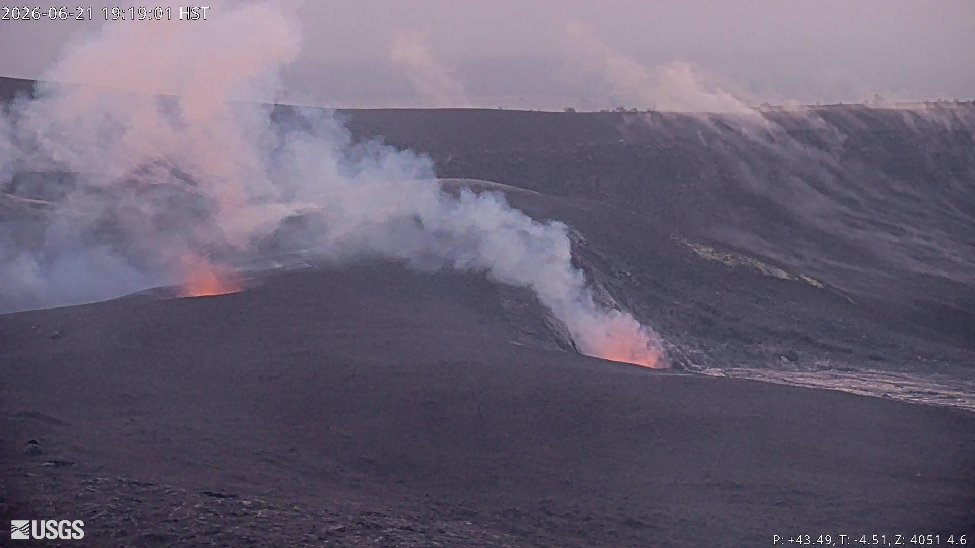
Hawaii , Kilauea :
HAWAIIAN VOLCANO OBSERVATORY DAILY UPDATE, U.S. Geological Survey
Sunday, June 21, 2026, 8:57 AM HST (Sunday, June 21, 2026, 18:57 UTC)
19°25’16 » N 155°17’13 » W,
Summit Elevation 4091 ft (1247 m)
Current Volcano Alert Level: ADVISORY
Current Aviation Color Code: YELLOW
Summary:
Kīlauea volcano is not erupting; the summit eruption in Halemaʻumaʻu is paused. The onset of episode 50 fountains is likely between June 24 and June 27 with June 25-26 most likely.
Overview:
The summit eruption of Kīlauea in Halemaʻumaʻu remains paused. Summit inflation, vent glow and flaming, and degassing continues, indicating that another episode is likely. Forecast models indicate that the onset of fountaining episode 50 is likely to begin between June 24 and June 27 with June 25-26 most likely.
No significant activity has been noted along Kīlauea’s East Rift Zone or Southwest Rift Zone.
Summit Observations:
Continuous periods of strong glow and large flames were visible from the south vent in Halemaʻumaʻu overnight. Moderate-to-strong glow was also observable from the north vent on the web cameras last night.
Seismic tremor has been relatively constant over the past day and only one earthquake (magnitude 1.0) was recorded within Kaluapele (Kīlauea caldera) in the past 24 hours.
Kīlauea summit deflation totaled 15.5 microradians during episode 49. Once the episode ended, inflation resumed and has since recovered 10.7 microradians of tilt at the summit tiltmeter at Uēkahuna (UWD).
With the eruption now paused, the sulfur dioxide (SO2) emission rate from the summit is likely now varying within a typical range of 1,000 to 5,000 tonnes per day.
Rift Zone Observations:
Rates of seismicity and ground deformation remain low in the East Rift Zone and Southwest Rift Zone. SO2 emissions from the East Rift Zone remain below the detection limit.
Source et photo : HVO
Ecuador , Sangay :
DAILY REPORT ON THE STATE OF SANGAY VOLCANO, Sunday, June 21, 2026.
Information Geophysical Institute – EPN.
Surface Activity Level: High, Surface Trend: Descending
Internal Activity Level: Moderate, Internal Trend: No Change
Seismicity: From June 20, 2026, 11:00 AM to June 21, 2026, 11:00 AM:
Seismicity:
Due to data transmission problems, it was not possible to record seismic events using the reference station.
Rainfall/Lahars:
No rainfall has been recorded in the area. **Heavy rain could remobilize accumulated material and generate debris-laden mudflows (lahars), which could cascade down the volcano’s flanks and flow into nearby waterways.**
Emissions/Ash:
Due to cloud cover over the volcano, it was not possible to observe gas and/or ash emissions using surveillance cameras or the GOES-19 satellite system. The Washington VAAC agency has also not issued any emissions reports for this volcano.
Note:
From yesterday afternoon until the time of writing, the volcano has remained completely obscured by clouds.
Alert Level: Yellow
Source : IGEPN
Photo : Camara Rota
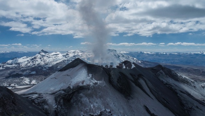
Peru , Sabancaya :
Event Data
Local Date and Time: June 15, 2026 – 12:15 PM
Bulletin Analysis Period: June 8-14, 2026
Volcanic Alert Level
Orange Alert Level: The volcano’s eruptive activity has increased significantly. Increased seismic activity, frequent explosions, and emissions of ash and ballistic fragments have been observed.
Conclusions
The IGP reports that the eruptive process of the Sabancaya volcano continues. During this period, no volcanic explosions have been detected, only emissions of water vapor, ash, and gas reaching up to 2,000 meters above the volcano’s summit, in addition to seismic activity associated with the movement of magmatic fluids and internal fracturing. Therefore, the volcanic alert level remains orange.
Recommendations
Adopt the prevention and preparedness measures in accordance with the current orange volcanic alert level.
Do not approach within 12 km of the crater. In case of ashfall, cover your nose and mouth with damp cloths or a mask. Keep the doors and windows of your home closed.
Outlook
The occurrence of future volcanic explosions generating eruptive columns over 2 km high is considered likely, with a risk of impact on districts in the Colca Valley and surrounding areas due to the dispersal of volcanic ash. Therefore, the volcanic alert level remains orange.
Source et photo : Cenvul .
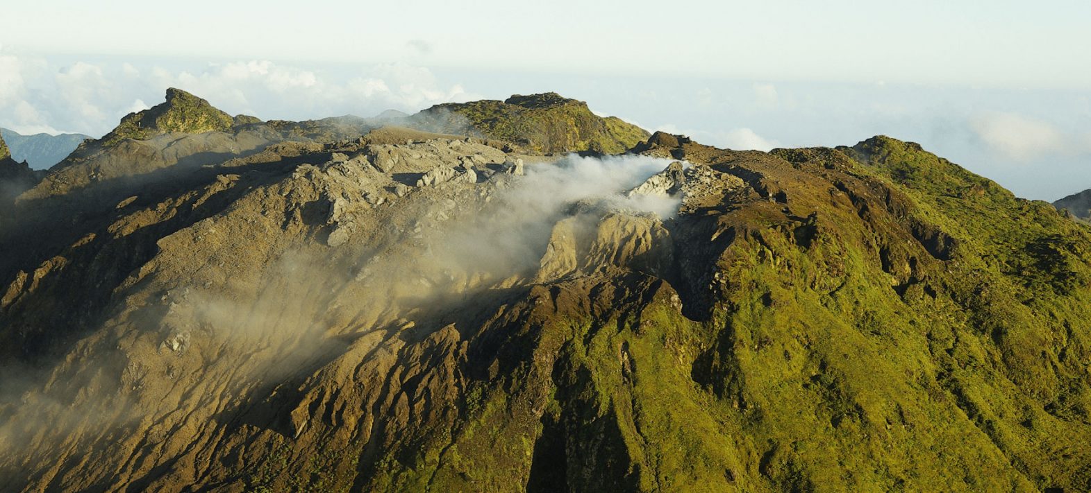
Guadeloupe , La Soufrière :
Monthly Bulletin, Paris Institute of Earth Physics, Guadeloupe Volcanological and Seismological Observatory
Summary
– Seismicity: 45 negative magnitude earthquakes occurred at a depth of less than 1 km beneath the La Soufrière dome. The energy released (135 kJ) is significantly lower than the previous month (1.3 MJ).
– Deformation: The deformation regime of the La Soufrière dome is steady.
– Hydrothermal Fluids: The thermal springs are not showing any abnormal disturbances in the hydrothermal system.
Based on the observations summarized in this bulletin, and in accordance with the measures implemented by the authorities, the volcanic alert level remains: Vigilance: Yellow
Regional Earthquake Activity
Medium-intensity tectonic activity with 124 earthquakes (maximum magnitude of 6.3) recorded on regional fault networks, including 35 earthquakes in the Saintes area.
This May was marked by a strongly felt earthquake of magnitude 6.3, which occurred on May 16 at 10:50 a.m. It was located 104 km north-northeast of Anse-Bertrand, at a depth of 57 km.
Source et photo : OVSG/IPGP.