April 11 , 2026.
Hawaii , Kilauea :
HAWAIIAN VOLCANO OBSERVATORY STATUS REPORT , U.S. Geological Survey
Thursday, April 9, 2026, 8:52 PM HST (Friday, April 10, 2026, 06:52 UTC)
19°25’16 » N 155°17’13 » W,
Summit Elevation 4091 ft (1247 m)
Current Volcano Alert Level: ADVISORY
Current Aviation Color Code: YELLOW
Activity Summary:
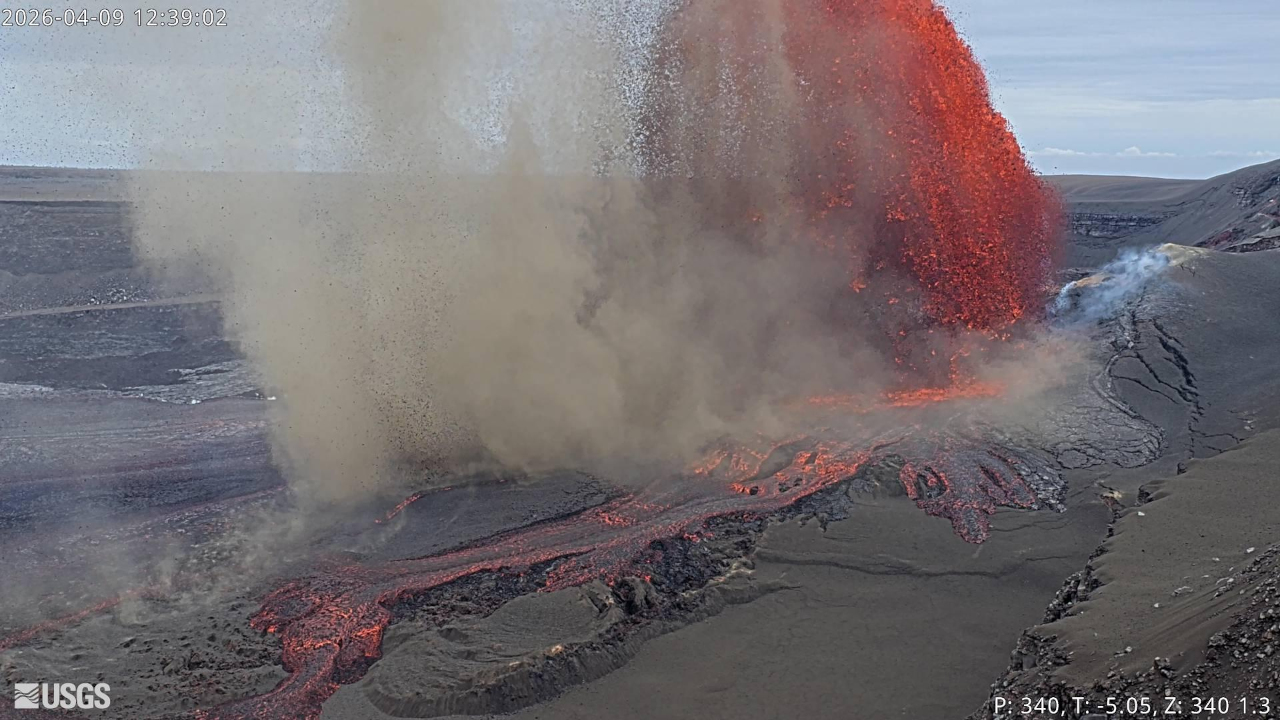
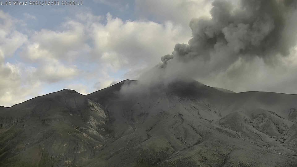
Episode 44 of the ongoing Halemaʻumaʻu eruption ended abruptly at 7:41 p.m. HST on April 9, 2026, after 8.5 hours of continuous lava fountaining. The eruption is currently paused.
Tephra fell outside of the closed area of Hawaiʻi Volcanoes National Park along the north rim of Kaluapele (Kīlauea caldera) and in adjacent communities. Tephra as large as 10 inches (25 centimeters) was reported in the Volcano Golf Course subdivision, and fine ash and Peleʻs hair was reported as far away as Hilo.
Episode 44 Chronology:
Episode 44 lava fountaining stopped at 7:41 p.m. HST on April 9, 2026, after 8 hours and 31 minutes of continuous lava fountaining from the north vent. The south vent never fountained during this episode, but it displayed periodic gas jetting and flames. The highest peak or instantaneous effusion rate of just over 500 cubic yards (390 cubic meters) per second occurred around 12:30 p.m. HST on April 9. Episode 44 saw an average effusion rate of 260 cubic yards (200 cubic meters) per second, with an estimated 7.5 million cubic yards (5.8 million cubic meters) of lava erupted and covering about 50% of the Halemaʻumaʻu crater floor. The Uēkahuna tiltmeter (UWD) recorded about 17.6 microradians of deflationary tilt during episode 44.
Episode 44 lava fountaining began at 11:10 a.m. HST on April 9, 2026, almost a week after the onset of precursory lava overflows on April 3. There were approximately 75 precursory overflows from April 3 to the start of episode 44 lava fountaining on April 9. Only 4 precursory overflows originated from the north vent, all on the morning of April 9. The last of these began at 10:08 a.m. HST and erupted continuously until transitioning into the onset of episode 44 at 11:10 a.m. HST. The start of episode 44 was marked by a sharp increase in seismic tremor and deflationary tilt recorded at the Uēkahuna tiltmeter (UWD). At first, the north vent grew slowly to about 330 feet (100 meters) in height by 12:00 p.m, then it reached a maximum of about 800 feet (240 meters) by 12:45 p.m. HST. Afterwards it gradually dropped, and by 4:00 p.m. it was 500 feet (150 meters) in height, then it further diminished until the end of the episode at 7:41 p.m. HST.

The single lava fountain produced significant heat and ash, feeding a plume that reached a maximum height of about 15,000 feet (4,500 meters) above sea level by 1:30 p.m. HST. Southerly winds directed the plume and tephra fall to the north of Halemaʻumaʻu.
This eruption was much smaller in size than episodes 41–43, but due to steady winds it produced a tephra fallout pattern similar to but not as thick as episode 43. The plume deposited tephra within Hawaiʻi Volcanoes National Park near Kīlauea Military Camp and into the adjacent Volcano Golf Course subdivision.
Alert levels were raised from ORANGE / WATCH to RED / WARNING by the USGS Hawaiian Volcano Observatory at 12:36 p.m. HST reflecting potential hazards to surrounding communities and aviation. Highway 11 through Volcano and the Kīlauea section of Hawaiʻi Volcanoes National Park were closed due to the hazards. The National Weather Service issued an ashfall WARNING at 12:40 p.m. HST following an earlier ashfall advisory. Ash and Pele’s hair was reported as far away as Kaumana, just west of Hilo.
Source : HVO
Photos : USGS.
La Réunion Island , Piton de la Fournaise :
Press release from the Paris Institute of Earth Physics / Piton de la Fournaise Volcanological Observatory, April 11, 2026 – 9:20 a.m. local time – 5:20 a.m. UTC
Eruption in progress
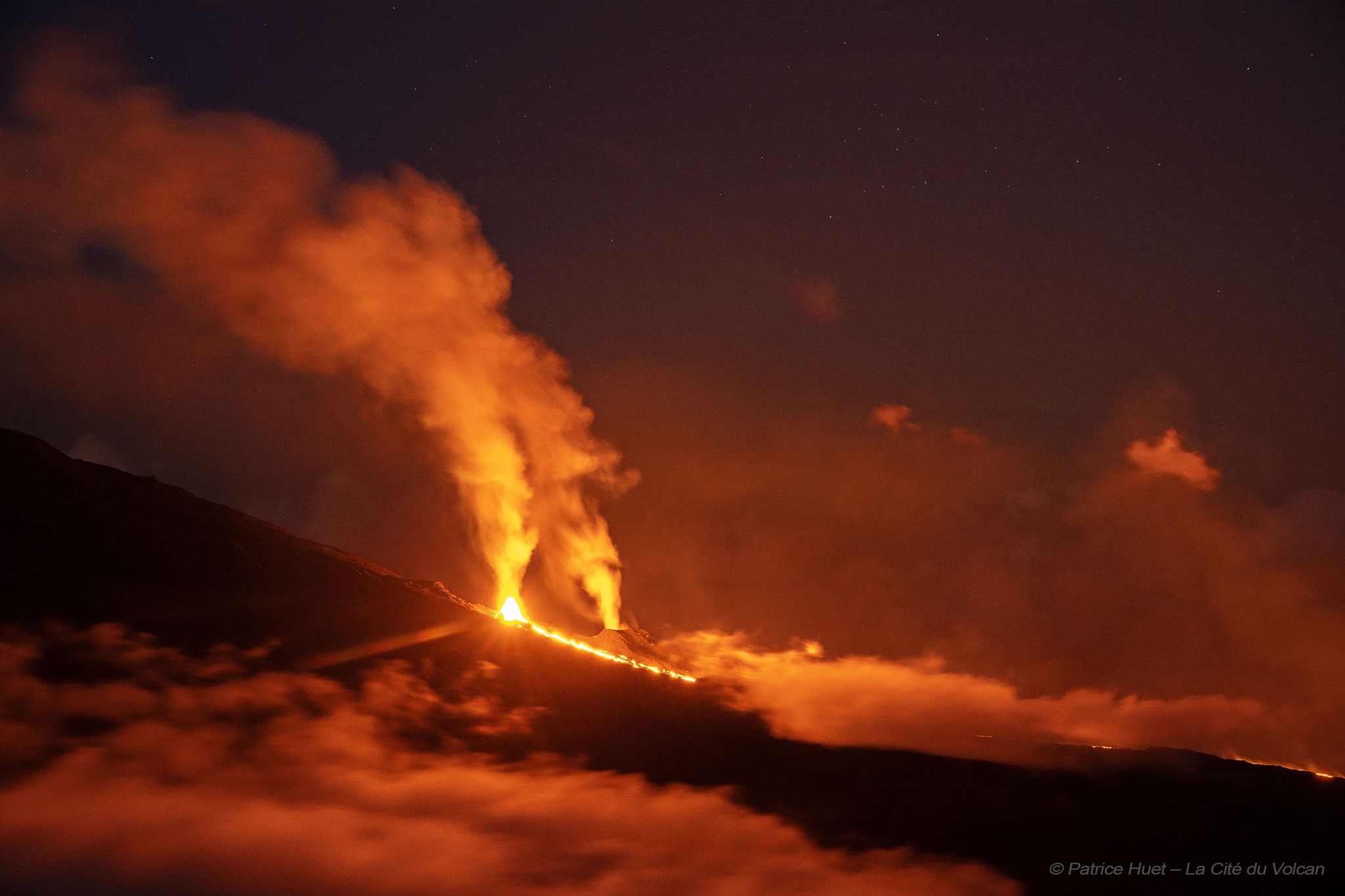
The eruption that began on February 13, 2026, at Piton de la Fournaise continues. After two periods of inactivity (between March 25 and 28 and between April 3 and 8), eruptive activity resumed on April 8 at approximately 1:15 p.m. local time, initially within the eruptive cone formed on February 13 at an altitude of 2,056 m on the south-southeast flank of the volcano, and since April 9 (9:15 a.m. local time) at a second vent located approximately 180 m further upstream in an area already weakened on February 13.
It should be noted that no new dike* has formed or propagated in connection with this vent. It is therefore still the same eruption, but with the opening of a new vent on the surface. As a reminder, at the beginning of the eruption, a total of four eruptive fissures opened before converging on a single point on the south-southeast flank of the volcano.
This new vent, further upstream, is currently the most active, with lava fountains whose fallout is forming a new cone. This cone remains breached (open), facilitating lava flows. As for the cone formed on February 13, activity there remains low, although significant degassing is still being observed.
Following the opening of this new emission point, the lava flow activity is currently located upstream of the Grandes Pentes and forms a new lava field, close to and south of the one formed between February 13 and April 3.
Tremor and Flow Rates
Following a period of intermittent volcanic tremor† observed when activity resumed on April 8 (see press release of April 9), tremor has been continuous since 12:25 local time (8:25 UTC) on April 9, and relatively stable since then, with only slight fluctuations.
Surface lava flow rates estimated using satellite data (HOTVOLC, OPGC-Université Clermont Auvergne) have shown maximum values of 15 m³/s over the last 24 hours. It should be noted that these values may be underestimated due to observational biases, particularly related to meteorological conditions (cloud cover) and the potential development of lava tube flows, which limit the detection of thermal radiation.
Estimates of sulfur dioxide (SO₂) flux measured by satellite (TROPOMI) and estimated by the DOAS NOVAC network show a new degassing peak following the resumption of the eruption and the opening of the new eruptive site. The total mass of SO₂ emitted since the start of the eruption is estimated at over 80 kt.
Seismicity
Seismic activity has been increasing since yesterday, with 34 shallow volcano-tectonic earthquakes recorded on April 10 and 36 earthquakes since 00:00 UTC on April 11.
Deformation
Following the cessation of the eruption on April 3, inflation of the edifice was recorded, reflecting pressurization of the shallow magma reservoir located between 1.5 and 2 km below the summit of the volcano. Since the resumption of activity on April 8, we have entered a new phase of deflation, similar to the previous eruptive episode. This setting will be confirmed in the coming days.
Alert Level 2.2
Source : OVPF / IPGP.
Photo : Patrice Huet / La cité du volcan / FB.
Colombia , Puracé – Los Coconucos volcanic chain :
Popayán, April 7, 2026, 3:00 PM
Regarding the monitoring of activity at the Puracé volcano – Los Coconucos volcanic chain – the Colombian Geological Survey (SGC), an agency under the Ministry of Mines and Energy, reports the following:
During the week of March 31 to April 6, 2026, seismic activity continued to be recorded, associated with fluid movement within the volcanic edifice, including long-period (LP) tremors, pulsed tremors (TR), and continuous tremor. These earthquakes were located below the crater of the Puracé volcano, at depths of less than 1 km, and were linked to circulation processes and the release of volcanic gases into the atmosphere. These gases dispersed according to the wind direction, reaching a maximum altitude of 700 m above the summit of the volcano. Continuous tremor is still being recorded beneath the craters of the Piocollo and Curiquinga volcanoes, at depths of less than 2 km, associated with fluid dynamics within the volcanic system. Fracture seismicity has remained stable compared to previous weeks, both in frequency and energy, and has been mainly localized between the Puracé and Piocollo volcanoes, at depths between 1 and 3 km, with magnitudes less than 1.
Low levels of sulfur dioxide (SO₂) emissions have been recorded, and gases continue to escape from fissures in the craters of the Curiquinga and Piocollo volcanoes. Furthermore, the slow deformation process continues between the Puracé, Piocollo, and Curiquinga volcanoes, detected after the eruptive episode of Curiquinga on January 20, 2025. In conclusion, the variations observed in the Los Coconucos volcanic chain (Puracé volcano) indicate that the system continues to evolve and that further ash emissions and fallout are possible, depending on the prevailing wind direction.
The public is advised not to travel to the upper part of the volcanic chain and to closely monitor the official bulletins of the Colombian Geological Survey (SGC). The alert level for volcanic activity remains yellow: active volcano showing changes in monitored parameters and other manifestations.
Source et photo : SGC.
Chile , Lascar :
During the study period, a drastic decrease in the number of volcano-tectonic events (VTEs), associated with rock fracturing within the volcano, and in the energy released, was observed. The most energetic event had a local magnitude (LM) of 0.3. Long-period (LP) events, related to fluid dynamics within the volcano, also showed a marked decrease in their number and a moderate decrease in recorded energy compared to the previous period. The reduced displacement (DR) value of the most energetic event was 4.3 cm².
Visual cameras at the volcano recorded continuous whitish plumes of degassing emanating from the active crater. These plumes varied in size, reaching a maximum height of 560 m above the crater rim on March 31. Ten sulfur dioxide (SO₂) anomalies were detected in the atmosphere, according to data from the tropospheric monitoring instrument (TROPOMI). An average SO₂ flux of 341 tonnes/day was recorded, with a maximum of 708 tonnes/day on March 23, thanks to the Differential Absorption Optical Spectroscopy (DOAS) instrument located 6 km east-southeast of the crater.
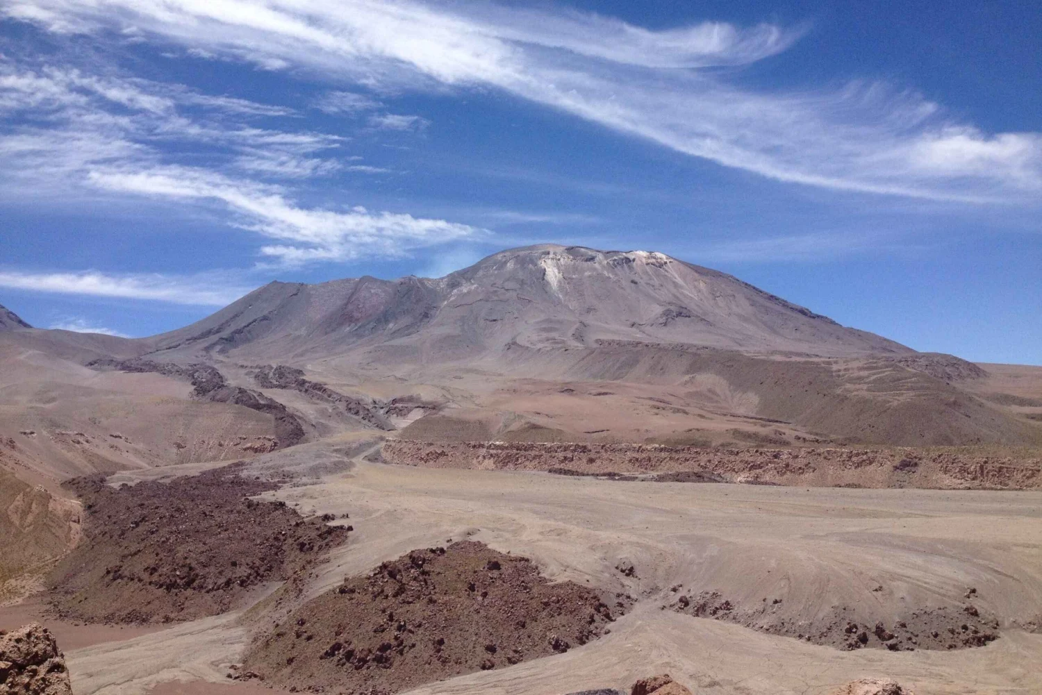
Data from long- and short-period interferometric radar (InSAR) analysis of Sentinel-1 images show no deformation near the volcano. During the study period, Sentinel-2 L2A images recorded areas of anomalous thermal radiation distributed within the crater, covering an area of approximately 2,700 m², according to information obtained via the NHI Tools web application. An increase in the power of the maximum thermal anomaly was also recorded by the MODIS sensor on the MIROVA platform, reaching a value of 5.0 MW on March 29.
The use of satellite imagery (Planetscope, Sentinel-2) revealed subsidence of the crater floor and the presence of unconsolidated material at its base, linked to gravitational processes. At the same time, degassing points from previous periods remain visible.
Source : Segemar .
Photo : Myguidechile . com
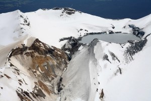
Alaska , Great Sitkin :
Lava continues to slowly erupt within the summit crater at Great Sitkin Volcano. Minor lava dome growth to the southwest and rockfalls down the south side of the lava field continue. Elevated surface temperatures from the warm, active lava dome were also observed when viewing conditions allowed. Seismic activity remains low, with occasional small volcanic earthquakes and seismic signals from small rockfalls within the crater.
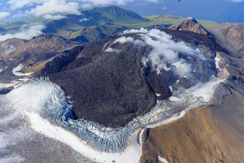
The current lava eruption began in July 2021 and has filled most of the summit crater and advanced into the valleys below. There have been no explosions at Great Sitkin Volcano since an event in May 2021. The volcano is monitored using local seismic and infrasound sensors, satellite data, and web cameras, and regional infrasound and lightning networks.
Source : AVO.
Photo : Loewen, Matt / Alaska Volcano Observatory / U.S. Geological Survey.