May 29 , 2026.
Indonesia , Ili Lewotolok :
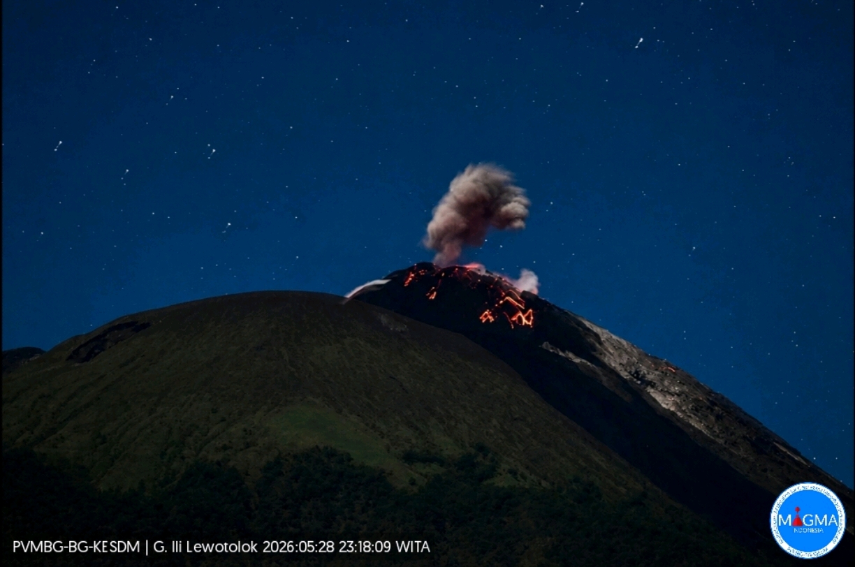
An eruption of Mount Ili Lewotolok occurred on Thursday, May 28, 2026, at 11:17 PM WITA. The observed ash column rose approximately 100 meters above the summit (about 1523 meters above sea level). This ash column, white to gray in color, was dense and directed southeast. The eruption was recorded by a seismograph with a maximum amplitude of 19 mm and a duration of 36 seconds.
Seismic Observations
19 eruption earthquakes with amplitudes ranging from 11.1 to 59.7 mm and durations ranging from 31 to 71 seconds.
58 emission earthquakes with amplitudes ranging from 2.2 to 15.5 mm and durations ranging from 20 to 57 seconds.
Two harmonic tremors with amplitudes ranging from 4.8 to 8.1 mm and durations ranging from 125 to 144 seconds.
A hybrid/multiphase earthquake with an amplitude of 7.5 mm and a duration of 26 seconds.
Four deep volcanic earthquakes with amplitudes ranging from 5.7 to 42 mm, periods ranging from 0.8 to 1.3 seconds, and durations ranging from 11 to 20 seconds.
A local tectonic earthquake with an amplitude of 2.8 mm, a response period of 8 seconds, and a duration of 37 seconds.
Three distant tectonic earthquakes with amplitudes ranging from 8 to 38.7 mm, response periods of 11.7 to 24 seconds, and durations ranging from 81 to 274 seconds.
Recommendations
1. Residents living around Mount Ili Lewotolok, as well as visitors, climbers, and tourists, are advised to refrain from any activity or access within a 2 km radius of the Mount Ili Lewotolok activity center.
2. Be vigilant for the risk of lava avalanches and pyroclastic flows in the south, southeast, west, and northeast sectors of Mount Ili Lewotolok.
Source et photo : PVMBG.
Japan , Asamayama :
The Japan Meteorological Agency (JMA) reported declining unrest at Asamayama. Deformation, notably on the W flank, stagnated in May 2024. Sulfur dioxide emissions began decreasing in June 2025 and by December of that year had reached low levels. The number of shallow volcanic earthquakes had been declining since July 2025. The average number of earthquakes per day overall decreased from around 30 in March 2026 to below 30 by May. The Alert Level was lowered to 1 (on a scale of 1-5) at 11h00 on 22 May and the public was warned that eruptive products could impact areas within 500 m of the crater.
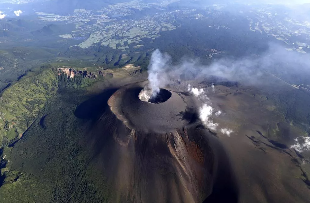
Asamayama, Honshu’s most active volcano, overlooks the resort town of Karuizawa, 140 km NW of Tokyo. The volcano is located at the junction of the Izu-Marianas and NE Japan volcanic arcs. The modern Maekake cone forms the summit and is situated east of the remnant of an older andesitic volcano, Kurofuyama, which was destroyed by a late-Pleistocene landslide about 20,000 years before present (BP). Growth of a dacitic shield volcano was accompanied by pumiceous pyroclastic flows, the largest of which occurred about 14,000-11,000 BP, and by growth of the Ko-Asamayama lava dome on the east flank. Maekake, capped by the Kamayama pyroclastic cone that forms the present summit, is probably only a few thousand years old and has observed activity dating back at least to the 11th century CE. Maekake has had several major Plinian eruptions, the last two of which occurred in 1108 (Asamayama’s largest Holocene eruption) and 1783 CE.
Sources: Japan Meteorological Agency (JMA) , GVP.
Photo : nautiljon
Italy , Stromboli :
Stromboli Activity Update, May 28, 2026, 7:55 PM (5:55 PM UTC).
The National Institute of Geophysics and Volcanology, Etna Observatory, announces that analysis of images from the monitoring camera network shows that, since the early hours of this morning, the effusive activity due to lava overflows from the North Crater area, which began on May 26 (Stromboli Update of May 26, 2026 at 8:10 AM UTC), has decreased slowly and gradually and is now over. The lava field is cooling, while ordinary Strombolian activity continues in the North and Central-South Crater areas, and lava eruptions of varying intensity are occurring in the North Crater area.
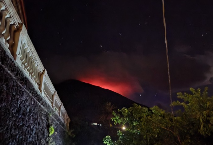
From a seismic perspective, the average amplitude of volcanic tremors is currently within the normal range. No significant variations have been reported in the frequency and amplitude of explosion earthquakes. Analysis of high-frequency GNSS signals has not detected any significant ground deformation.
Further information will be released soon.
Source : INGV.
Photo : S Vitton.
Stromboli , Promise:
The Cauldron has just returned from Stromboli. As often happens, we stayed at Pensione Aquilone, a little paradise of calm, serenity, and breathtaking scenery. It’s a haven of peace on this magnificent island (beach a 5-minute walk away, town center right next door, and well-located for climbing the volcano).

Le Chaudron highly recommends this place, you won’t be disappointed.
LCDV.
Bismarck sea , South of Rambutyo :
The Rabaul Volcano Observatory (RVO) reported that the eruption at Titan Ridge, previously identified as the Central Bismarck Sea volcano, decreased during 21-28 May. Hydroacoustic data indicated that the eruption was ongoing, though the number of events had declined. Steam plumes were visible in satellite images rising from the two vents and drifting W and NW during 21-25 May, though they were less vigorous. Pumice continued to rise to the surface, though the pumice rafts were smaller. Minor amounts of ash in the plumes indicated that pumice pieces were degassing at the surface. A M 5.7 earthquake occurred just N of the eruption site at 2008 on 22 May; it was the first recorded since 17 May and did not appear to have changed the eruption characteristics.
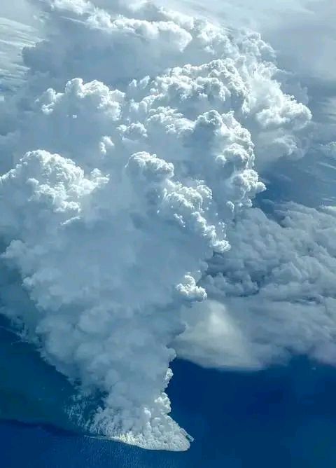
Thermal anomalies around the base of the plumes were identified in Middle Infrared Observations of Volcanic Activity (MIROVA) hot-spot detection system during 22-24 May. The plumes had significantly decreased during 25-28 May and were characterized as a narrow, wispy fume drifting a few kilometers NW when visible among weather clouds. Some pumice was still being generated and formed rafts that spread SW, W, and NW, but they were much smaller. A small thermal anomaly was identified on 27 May. RVO warned ships to avoid the pumice rafts.
Source: Rabaul Volcano Observatory (RVO), GVP.
Photo : Across PNG.
Mexico , Popocatepetl :
The Centro Nacional de Prevención de Desastres (CENAPRED) reported that eruptive activity was low at Popocatépetl during 20-27 May. The seismic network recorded 10-53 long-period events per day, though 148 long-period events were detected during 26-27 May. The signals were accompanied by steam-and-gas emissions that sometimes contained ash and drifted mostly E and SE. In addition, the seismic network recorded a period of tremor that lasted just over two hours during 23-24 May and one volcano-tectonic earthquake at 0136 on 25 May. According to the Washington Volcanic Ash Advisory Center (VAAC) ash plumes visible in webcam and satellite images during 25-27 May rose to 6.1 km (20,000 ft) a.s.l. (as high as 400 m above the summit) and drifted S, SSE, and SE. The Alert Level remained at Yellow, Phase Two (the middle level on a three-color scale) and the public was warned to stay 12 km away from the crater.
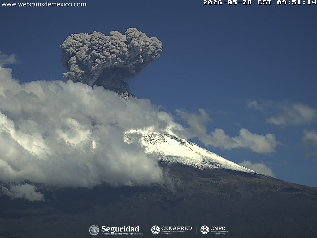
Activity over the last 24 hours:
230 eruptions and 246 minutes of eruption sequences were detected.
The alert level for Popocatépetl volcano remains at Yellow (Phase 2).
Cenapred strongly advises against attempting to climb the volcano, as explosions are projecting incandescent fragments, as has been observed recently. Respect the 12-kilometer exclusion zone around the crater; being within it is dangerous. In case of heavy rain, stay away from the bottom of ravines due to the risk of mud and debris flows.
Sources : Centre national de prévention des catastrophes (CENAPRED), GVP.