December 14 , 2025.
Alaska : Shishaldin
ALASKA VOLCANO OBSERVATORY INFORMATION STATEMENT , U.S. Geological Survey
Saturday, December 13, 2025, 11:11 AM AKST (Saturday, December 13, 2025, 20:11 UTC)
54°45’19 » N 163°58’16 » W,
Summit Elevation 9373 ft (2857 m)
Current Volcano Alert Level: ADVISORY
Current Aviation Color Code: YELLOW
Strong northerly winds in the vicinity of Shishaldin Volcano have picked up loose volcanic ash and dust on the surface and are carrying it to the south-southwest. The National Weather Service has issued a SIGMET for this low-level event and suggests that the maximum cloud height is 9,000 ft (2.7 km) above sea level.
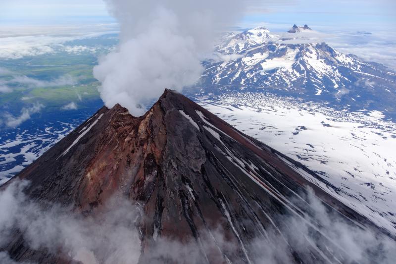
This phenomenon is not the result of recent volcanic activity and occurs during times of high winds and dry snow-free conditions at Shishaldin and other volcanic areas of Alaska. No eruption is in progress. All of the volcanoes of the Katmai area (Griggs, Katmai, Novarupta, Mageik, Martin, Snowy and Trident) remain at Aviation Color Code GREEN and Alert Level NORMAL. Resuspended volcanic ash should be considered hazardous and could be damaging to aircraft and health.
Shishaldin Volcano, located near the center of Unimak Island in the eastern Aleutian Islands, is a spectacular symmetric cone with a base diameter of approximately 16 km (10 mi). A 200-m-wide (660 ft) funnel-shaped summit crater typically emits a steam plume and occasional small amounts of ash. Shishaldin is one of the most active volcanoes in the Aleutian volcanic arc, with at least 54 episodes of unrest including over 26 confirmed eruptions since 1824. Most eruptions are relatively small, although the April-May 1999 event generated an ash column that reached 45,000 ft above sea level.
Source : AVO.
Photo : Loewen, Matt
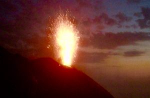
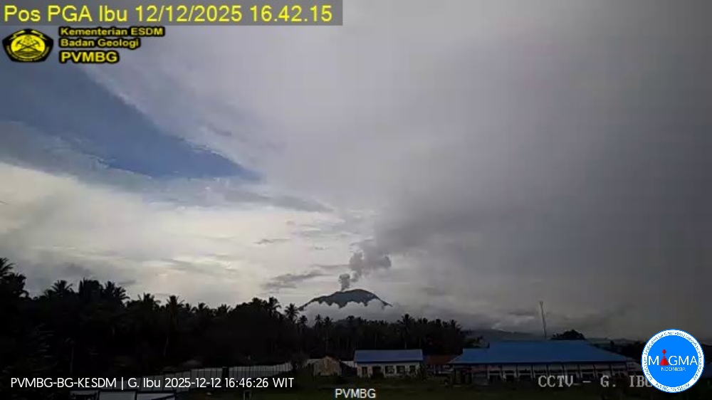
Indonesia , Ibu :
Mount Ibu erupted on Saturday, December 13, 2025, at 4:14 PM WIT. An ash column was observed approximately 1,000 meters above the summit (at an altitude of about 2,325 meters). This ash column, white to gray in color, was moderately to strongly intense and drifted northeast. The eruption was recorded by a seismograph, with a maximum amplitude of 28 mm and a duration of 47 seconds.
VOLCANO OBSERVATORY NOTICE FOR AVIATION – VONA
Issued : December 13 , 2025
Volcano : Ibu (268030)
Current Aviation Colour Code : ORANGE
Previous Aviation Colour Code : orange
Source : Ibu Volcano Observatory
Notice Number : 2025IBU1181
Volcano Location : N 01 deg 29 min 17 sec E 127 deg 37 min 48 sec
Area : North Maluku, Indonesia
Summit Elevation : 4240 FT (1325 M)
Volcanic Activity Summary :
Eruption with volcanic ash cloud at 07h14 UTC (16h14 local).
Volcanic Cloud Height :
Best estimate of ash-cloud top is around 7760 FT (2425 M) above sea level or 3520 FT (1100 M) above summit. May be higher than what can be observed clearly. Source of height data: ground observer.
Other Volcanic Cloud Information :
Ash cloud moving to northeast. Volcanic ash is observed to be gray. The intensity of volcanic ash is observed to be thick.
Remarks :
Eruption recorded on seismogram with maximum amplitude 28 mm and maximum duration 47 second.
Source et photo : PVMBG.
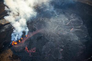
Colombia , Puracé – Los Coconucos volcanic chain:
Popayán, December 13, 2025, 9:35 AM
Regarding the monitoring of activity in the Los Coconucos volcanic chain, the Colombian Geological Survey (SGC), an agency under the Ministry of Mines and Energy, reports the following:
Since the publication of yesterday’s extraordinary bulletin and up to the date of this announcement, earthquakes related to fluid movements within the volcanic edifice continue to occur. These include long-period (LP) earthquakes, seismic pulses (TR), and continuous tremor. This seismicity is primarily located beneath the Puracé volcano crater, at a depth of less than 1 km, and is linked to the internal dynamics of gases and their emission into the atmosphere. Furthermore, low-magnitude seismic signals, associated with rock fracturing, were recorded less than 1 km east of the Purace volcano crater, at depths between 1 and 2 km.
Some seismic signals were associated with ash emissions dispersed primarily to the northwest, following the wind direction, and reaching an altitude of 700 m above the volcano’s summit. A total of 15 ash emissions were recorded, triggering alerts to the Civil Aviation Authority.
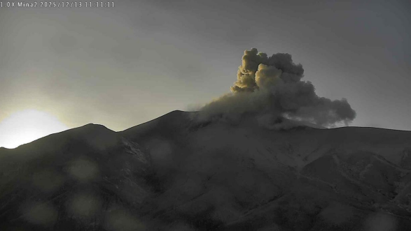
Recording from the Mina camera, located 2.2 km north of the Purace volcano. Gas and ash plume recorded at 6:11 a.m. on December 13, 2025.
In addition, the monitoring network reported ashfall in Coconuco, northwest of the volcano, and in the Rionegro region, to the southwest.
Significant levels of sulfur dioxide (SO₂) emissions into the atmosphere continue to be detected by satellite, dispersing primarily westward within a 300 km radius of the volcano. Similarly, a temperature increase is still being recorded in the crater area, likely linked to the emission of hot gases from within the volcano.
The orange alert remains in effect, but temporary fluctuations in volcanic activity are possible, meaning it may sometimes decrease compared to previous days or weeks. However, this does not necessarily mean that the volcano has returned to a stable level of activity. A return to the yellow alert level (increased stability) requires a reasonable timeframe to assess all monitored parameters and identify any trends indicating such a return.
Given the above, the Geological Survey of Colombia (SGC) recommends staying away from the volcano’s crater and surrounding areas, closely monitoring the situation through special bulletins and information published on our official channels, and following the instructions of local and regional authorities and the National Unit for Disaster Risk Management (UNGRD).
The volcanic activity level remains at ORANGE alert: Volcano with significant changes in monitored parameters.
Source et photo : SGC.
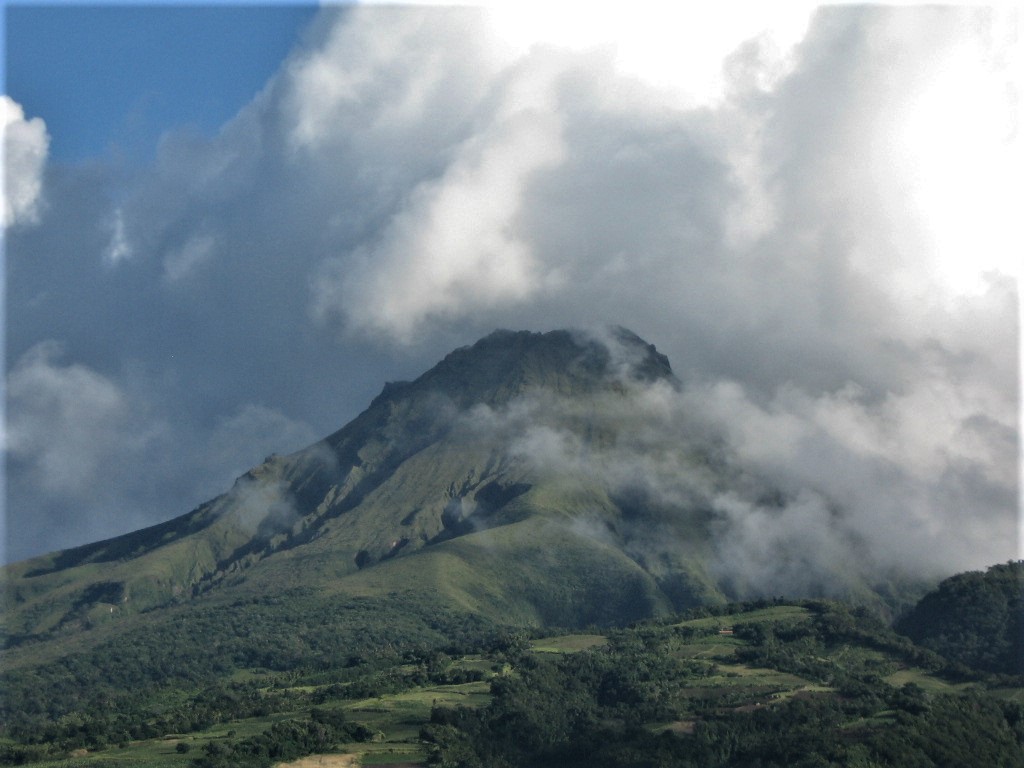
La Martinique Island, Mount Pelée :
Weekly Report, Paris Institute of Earth Physics / Martinique Volcanological and Seismological Observatory
Saint-Pierre, December 12, 2025, 5:00 PM local time (GMT-4)
Volcanic activity is stable this week with 19 volcanic earthquakes observed.
Between December 5, 2025, 4:00 PM UTC and December 12, 2025, 4:00 PM UTC, the Martinique Volcanological and Seismological Observatory recorded:
• 19 shallow volcano-tectonic earthquakes. Among them, 3 have a magnitude (duration magnitude Md or local magnitude Mlv) greater than 0.5. The largest has a magnitude Mlv of 1.7. The others are of lower energy. These earthquakes originate from the well-known seismically active zones of Mount Pelée, located between 1.0 and 1.4 km below the summit of the volcano.
Shallow volcano-tectonic seismicity is associated with microfracturing in the volcanic edifice, linked to the overall reactivation of the volcano observed since 2019.
No earthquakes have been felt by the population.
The previous week, the OVSM (Mountain Seismological Observatory) recorded 27 volcanic earthquakes. As of December 12, 2025, and over the past four weeks, the OVSM has observed a total of 299 volcanic earthquakes, an average of 74 to 75 earthquakes per week.
During phases of volcanic reactivation of volcanoes similar to Mount Pelée, seismic activity of varying intensity and frequency is common. The probability of an eruptive activity in the short term remains low. However, considering all the observations collected since the end of 2018 and their nature, and based on recent observations from the OVSM-IPGP (Paris Institute of Earth Physics), we cannot rule out a change in the situation in the medium term (weeks, months).
For more details on observations and interpretations of volcanic activity over the longer term, please refer to the OVSM’s monthly bulletins.
The volcanic alert level, in accordance with the provisions made by the authorities, is currently: YELLOW: vigilance.
Source : Direction de l’OVSM-IPGP.
Photo : Jmp48 / Wikipedia
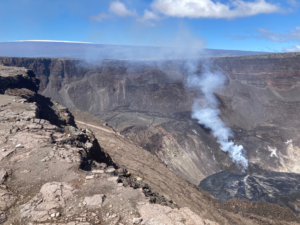
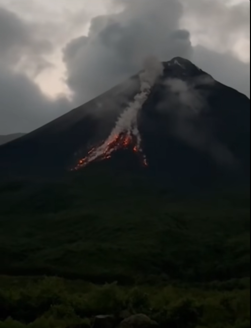
Ecuador , El Reventador :
REVENTADOR VOLCANO DAILY STATE REPORT, Saturday, December 13, 2025.
Information Geophysical Institute – EPN.
Surface Activity Level: High, Surface Trend: No Change
Internal Activity Level: Moderate, Internal Trend: No Change
From December 12, 2025, 11:00 AM to December 13, 2025, 11:00 AM:
Seismicity:
Due to technical issues at the seismic monitoring stations, statistics for seismic events associated with the volcano are not available.
Rainfall/Lahars:
No precipitation has been recorded in the volcano area. **Heavy rainfall could remobilize accumulated material, generating mud and debris flows that would cascade down the volcano’s flanks and flow into nearby rivers.**
Emission Column/Ash:
Due to weather conditions, it was not possible to observe gas and ash emissions via the monitoring camera system; however, GOES-19 satellite imagery detected a gas and ash plume that reached 1,200 meters above the crater, drifting northeast. Regarding this activity, the Washington VAAC issued three reports, describing plumes rising between 700 and 1,300 meters above the crater rim, drifting west, west-southwest, and west-northwest.
Gas:
The MOUNTS satellite system recorded 0.9 tons of SO₂ (sulfur dioxide) yesterday at 1:21 p.m. local time.
Other monitoring parameters:
Over the past 24 hours, the FIRMS satellite system recorded six thermal anomalies, and VIIRS recorded three.
Observation:
From yesterday afternoon until the time of writing, the volcano remained completely obscured by clouds.
Alert Level – SGR: Orange
Source : IGEPN
Photo : Guia fotografica / FB.