August 10 , 2026.
Italy / Sicily , Etna :
Statement on Etna’s activity, August 9, 2026, 17:59 (15:59 UTC).
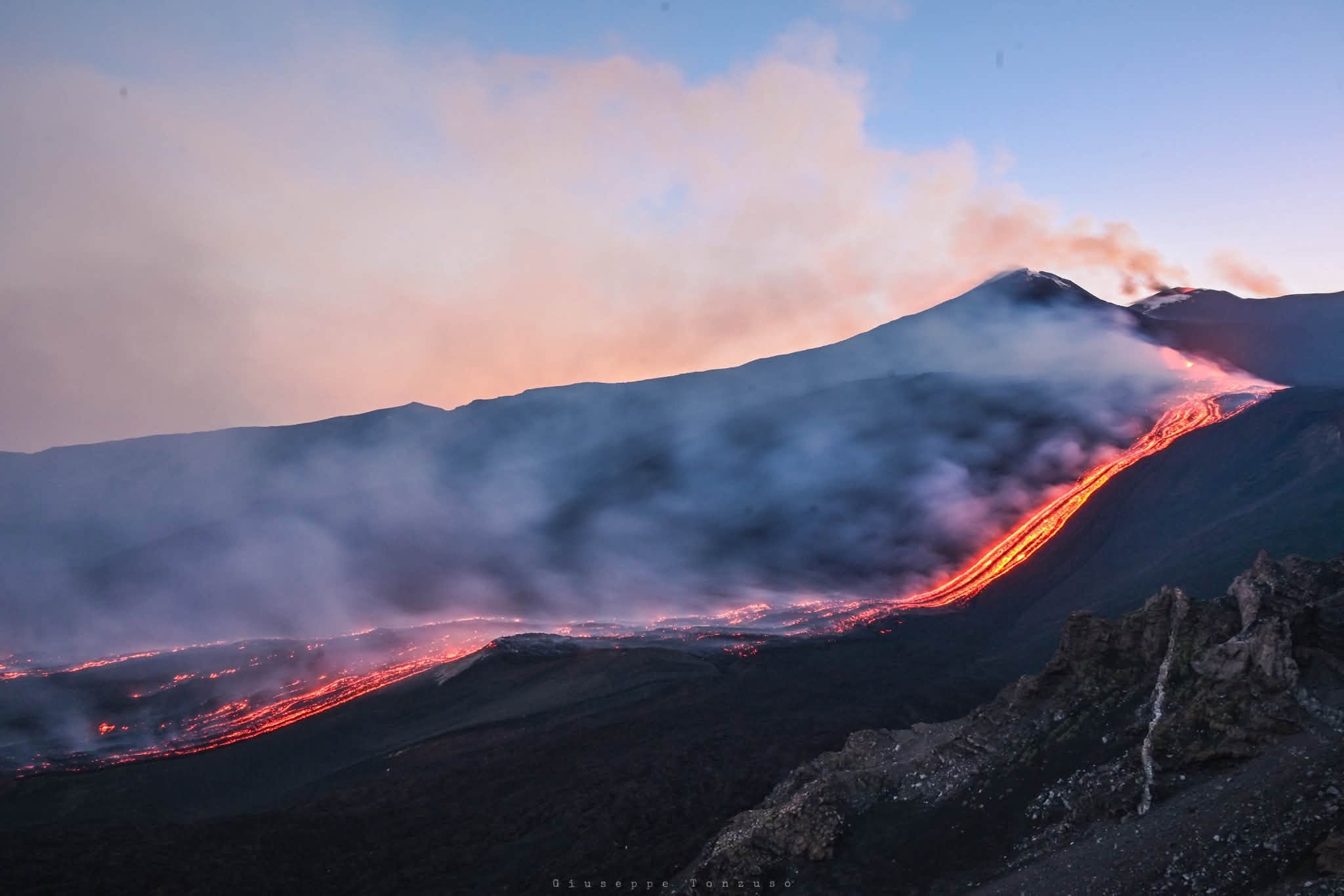
The National Institute of Geophysics and Volcanology (INGV) – Etna Observatory – reports that field inspections by INGV personnel and analysis of video surveillance footage indicate that explosive activity at the Voragine crater is continuing today, characterized by alternating phases of varying intensity. During the most intense phases—such as the one currently underway—bomb fallout is observed in the summit area, accompanied by heavy ash emissions; the plume is currently dispersing towards the south-southeast. Eruptive vents located at elevations of 2,750 m and 2,360 m are active, feeding various lava flows that form complex lava fields with overlapping sections in places. Due to weather conditions, it has not been possible to determine the exact position of the furthest-advanced active flow fronts; however, they remain confined to the elevation range between 2,100 m and 1,850 m.
Seismically, tremor levels remain high, localized primarily beneath the Voragine crater at an elevation of approximately 3,000 m above sea level. Infrasonic activity is moderate in terms of both event frequency and energy; localized events are occurring mainly at the Voragine crater and, to a lesser extent, at the Northeast Crater.
GNSS and tiltmeter monitoring networks show no significant changes. Summit tiltmeter stations continue to record the trend reversal that began on August 6 and was reported in previous bulletins. The maximum recorded variation, approximately 6.6 microradians, was detected at the Cratere del Piano (ECP) station.
Further information will be provided as soon as possible.
Source : INGV.
Photo : Giuseppe Tonzuso.
Colombia , Nevado del Ruiz :
Manizales, August 4, 2026, 4:45 PM.
Based on monitoring of the Nevado del Ruiz volcano’s activity, the Colombian Geological Service (SGC)—an agency attached to the Ministry of Mines and Energy—reports the following information: during the week of July 28 to August 3, 2026, the volcano continued to exhibit unstable behavior. Compared to the previous week, the main variations in monitored parameters were as follows:
– Seismic activity associated with rock-fracturing processes within the volcanic edifice showed a decrease in the number of recorded earthquakes, while the seismic energy released remained at similar levels. The earthquakes were primarily located near the Arenas crater and along the volcano’s west-southwest, south-southeast, and south-southwest flanks, at distances of less than 6 km from the crater. To a lesser extent, events were recorded on other flanks of the volcano, up to 12 km from the crater. Earthquake depths ranged from less than 1 km to 6 km below the volcano’s summit.
The earthquake with the highest magnitude occurred on August 2 at 12:59 AM, reaching a magnitude of 1.1. This event was located 3 km south-southeast of the crater, at a depth of 3 km.
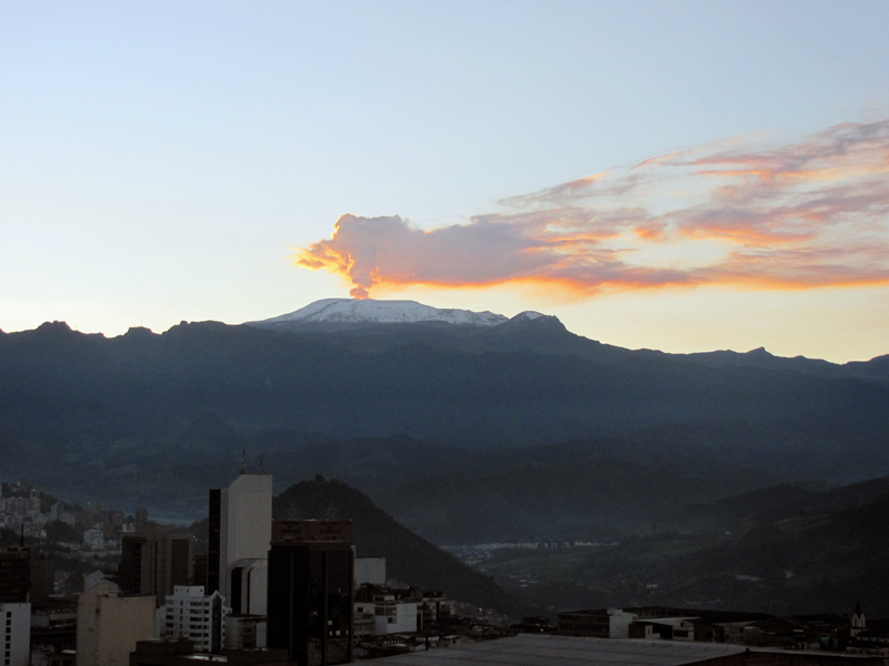
– Seismicity associated with fluid dynamics within the volcanic conduits showed a decrease in the number of events and a slight increase in released seismic energy.
This seismicity was characterized primarily by short-duration, low-energy signals. The trend observed in previous weeks persisted: no ash emissions
or changes in the apparent temperature of the gas plume were confirmed. – Emissions of water vapor and volcanic gases—primarily sulfur
dioxide (SO₂)—into the atmosphere continued from the Arenas crater. The estimated SO₂ flux associated with degassing processes decreased slightly compared to the previous week.
Additional monitoring via satellite data platforms continued to show low levels of SO₂ output. – The vertical height of the gas and water vapor plume remained mostly between 200 and 300 m above the volcano’s summit, reaching a maximum of 400 m on July 30. Plume dispersion showed a preferential trend toward the volcano’s northwest flank. Although no ashfall was reported during the week, the impact of remobilized previously deposited volcanic material cannot be ruled out due to strong winds in the area.
– Satellite monitoring of thermal anomalies at the bottom of the Arenas crater yielded data indicating low energy levels. Heavy cloud cover in the area limited the detection of these anomalies.
Source et photo : SGC.
Hawaii , Kilauea :
HAWAIIAN VOLCANO OBSERVATORY DAILY UPDATE , U.S. Geological Survey
Sunday, August 9, 2026, 9:38 AM HST (Sunday, August 9, 2026, 19:38 UTC)
19°25’16 » N 155°17’13 » W,
Summit Elevation 4091 ft (1247 m)
Current Volcano Alert Level: ADVISORY
Current Aviation Color Code: YELLOW
Summary:
Kīlauea volcano is not erupting. Models indicate another episode is likely with the current forecast between August 11 and 14.
Overview:
The summit eruption of Kīlauea in Halemaʻumaʻu remains paused. Overnight, continuous weak glow was only observed from the north vent, the south vent and crack remained dark. Approximately 2.2 microradians of deflationary tilt has been recorded since early Friday morning. Current inflation models indicate that the forecast window for episode 53 has shifted to Tuesday-Thursday, August 11–14.
No significant activity has been noted along Kīlauea’s East Rift Zone or Southwest Rift Zone.
Summit Observations:
Overnight, continuous weak glow was observed from the north vent, while no glow was observed from the south vent. A few small spots of incandescence were observed from the northern end of the new crack, where they have been a persistent feature. No flames or spatter were observed overnight, although glow from the north vent and incandescence from the fissure occasionally intensified coincident with gas piston spikes.
Irregular periods of gas pistoning continued overnight into this morning but occurred less frequently. Larger tremor spikes were spaced approximately 30 minutes to 2 hours apart. Three small, (<M1.0), earthquakes were detected across the broader Kīlauea summit region over the past 24 hours, one of which occurred within the northern wall of Halema’uma’u crater at approximately 5:45 a.m. HST.
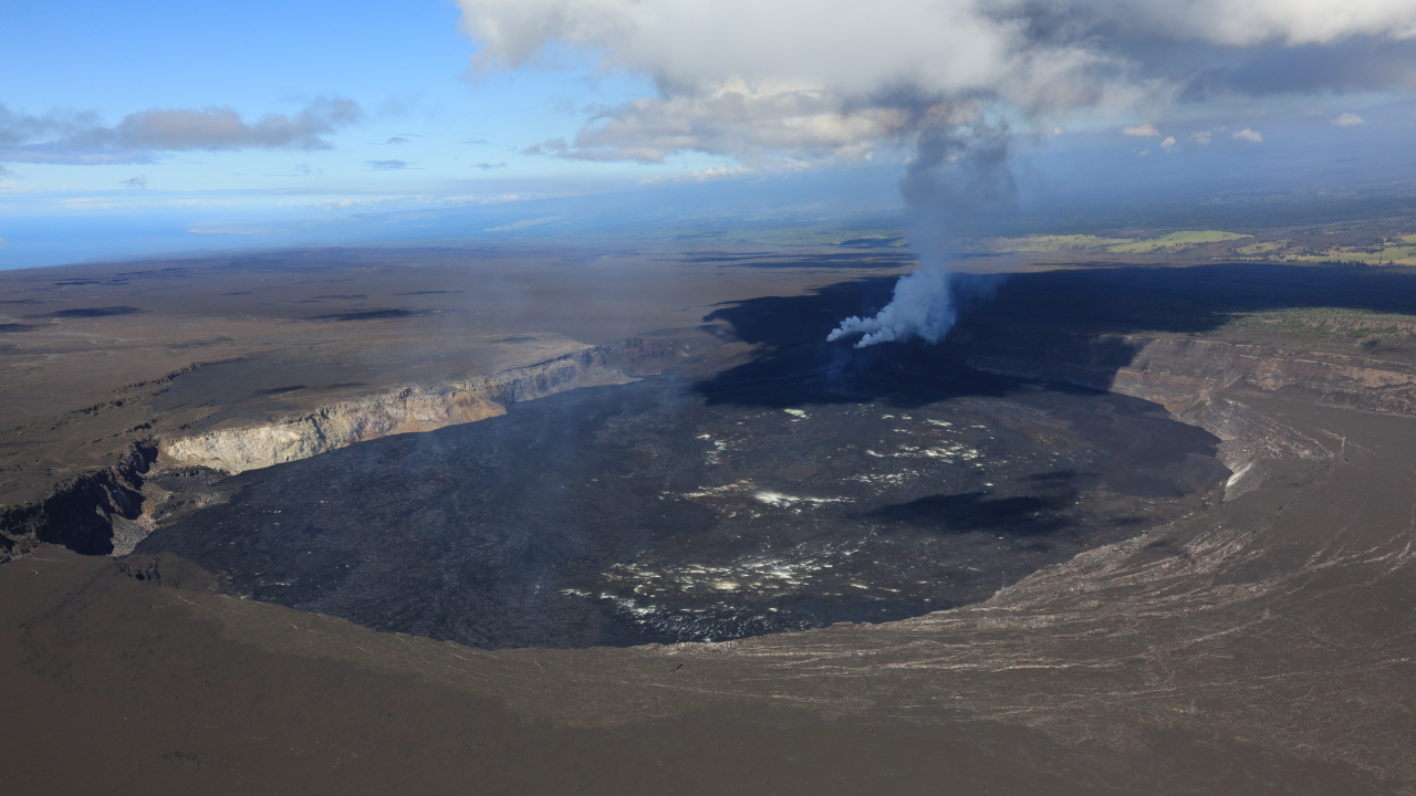
Since the end of episode 52, the Uēkahuna (UWD) tiltmeter has recorded a net 10.1 microradians of inflationary tilt, after reaching a maximum of 12.3 microradians early Friday. Since 6:00 a.m. HST Friday, UWD has recorded approximately 2.2 microradians of deflation. Deflation slowed and leveled out from about 1 p.m. HST yesterday to 4 a.m. HST this morning, with no net gain or loss in tilt. A slow deflationary trend resumed on the UWD tiltmeter around 4:00 a.m. HST and continues this morning. Similar periods of deflationary tilt occurred just prior to episodes 51 and 52. Episode 52 produced 14.4 microradians of deflationary tilt at UWD. Summit tiltmeter SDH was offset a little over 1 microradian by a deep Pahala earthquake just after 4:30 a.m. HST.
Summit sulfur dioxide (SO₂) emission rates are likely varying within the typical range of 1,000–5,000 tonnes per day. Winds are currently light from the east-northeast at 6–10 mph, with gusts potentially reaching 18 mph. Degassing plumes from the north vent and new crack are being carried west-southwest, while degassing from the south vent remains minimal.
Rift Zone Observations:
Rates of seismicity and ground deformation remain low in the East Rift Zone and Southwest Rift Zone. SO2 emissions from the East Rift Zone remain below the detection limit.
Source et photo : HVO.
Ecuador , Sangay :
DAILY STATUS REPORT FOR SANGAY VOLCANO, Sunday, August 9, 2026.
Information from the Geophysical Institute – EPN.
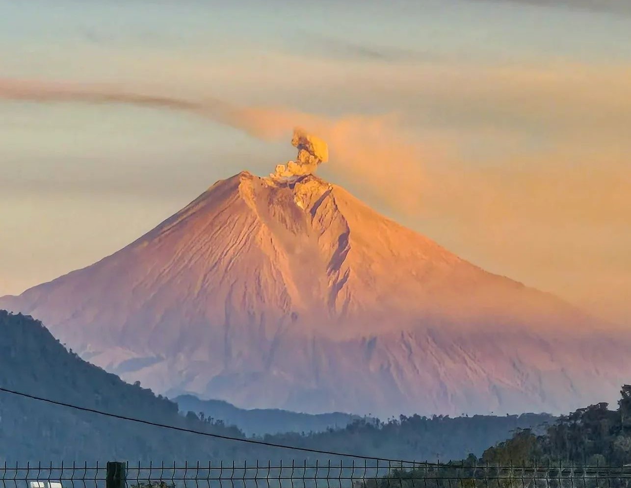
Surface activity level: Moderate; Surface trend: Decreasing
Internal activity level: Moderate; Internal trend: Decreasing
Seismicity: From August 8, 2026, 11:00 to August 9, 2026, 11:00:
Seismicity:
Here is the count of seismic events recorded at the reference station:
Explosion (EXP): 5
Precipitation / Lahars:
Precipitation in the area has not triggered lahars. **Heavy rains could remobilize accumulated material and generate debris-laden mudflows (lahars) that would descend the volcano’s flanks and reach adjacent rivers.**
Emission plume / ash:
Weather conditions prevented the observation of gas and/or ash emissions via both the surveillance camera system and satellite platforms. Furthermore, the Washington VAAC has issued no reports regarding the volcano’s activity.
Other monitoring parameters:
The MIROVA-VIIRS-375 satellite system detected a thermal anomaly.
Observation:
From yesterday afternoon until the time of writing this report, the volcano has remained largely obscured by clouds.
Alert level: Yellow
Source : IGEPN
Photo : Cristopher Cardenas / volcan Sangay / FB.
Costa Rica , Poas :
OVSICORI-UNA Weekly Volcanic Monitoring Bulletin, August 7, 2026
Latitude: 10.20° N;
Longitude: 84.23° W;
Elevation: 2,687 m above sea level.
Current activity level: Vigilance
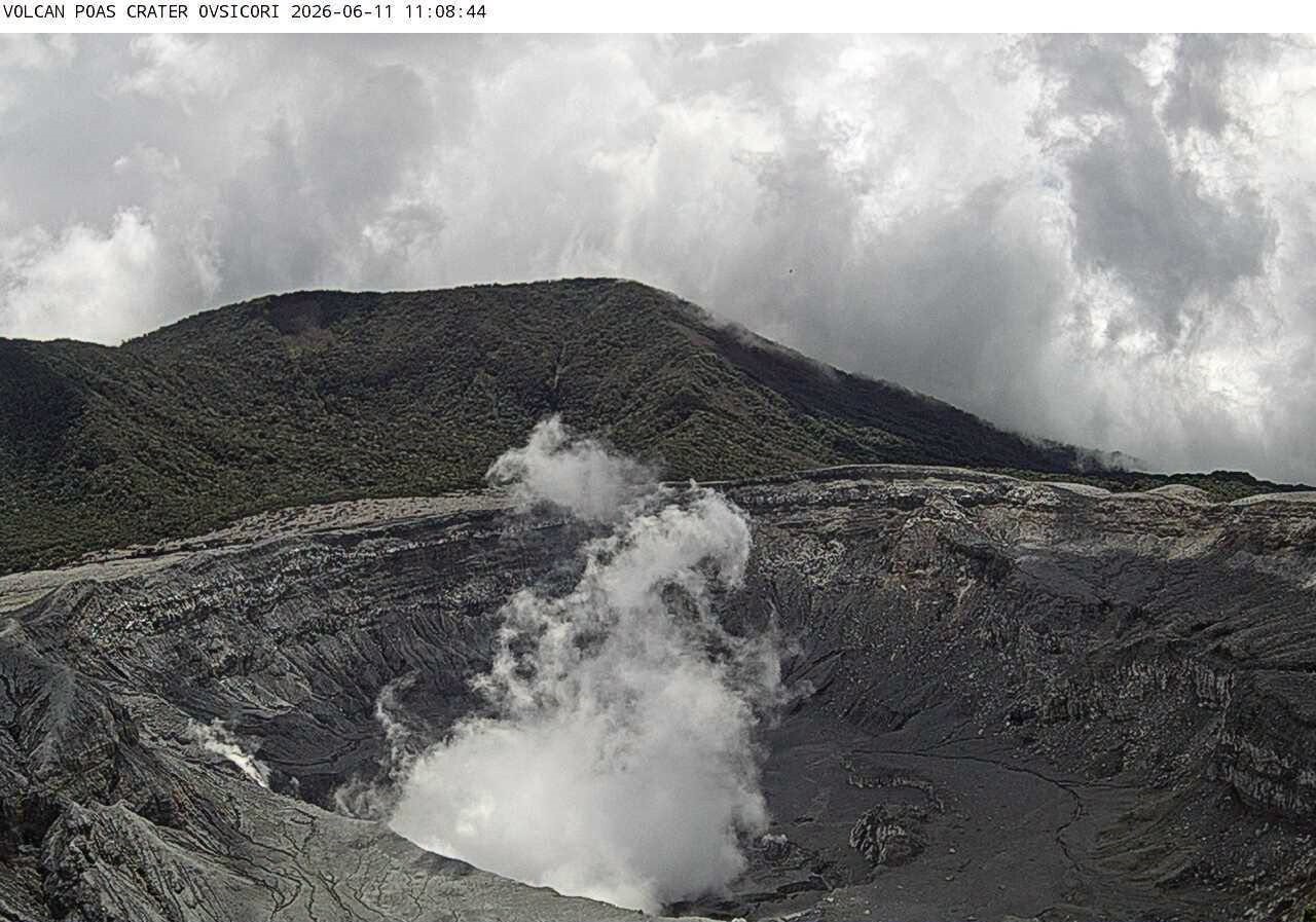
No eruptions were recorded this week. Tremor amplitude remains stable at moderate levels. The number of long-period events decreased this week. No
volcano-tectonic earthquakes were recorded. The geodetic network shows no significant deformation.
Multi-GAS stations recorded an average SO2/CO2 ratio of 1.6 ± 0.5—a value slightly higher than that reported the previous week (1.4 ± 0.5)—but this variation is not significant. The H2S/SO2 ratio remains below 0.1.
NOVAC stations recorded 205 ± 73 tonnes of SO2 per day, a flux comparable to that of the previous week (193 ± 91 t/d).
Source et photo : Ovsicori.