August 11 , 2026.
Italy / Sicily , Etna :
Statement on Etna’s activity, August 10, 2026, 20:03 (18:03 UTC).
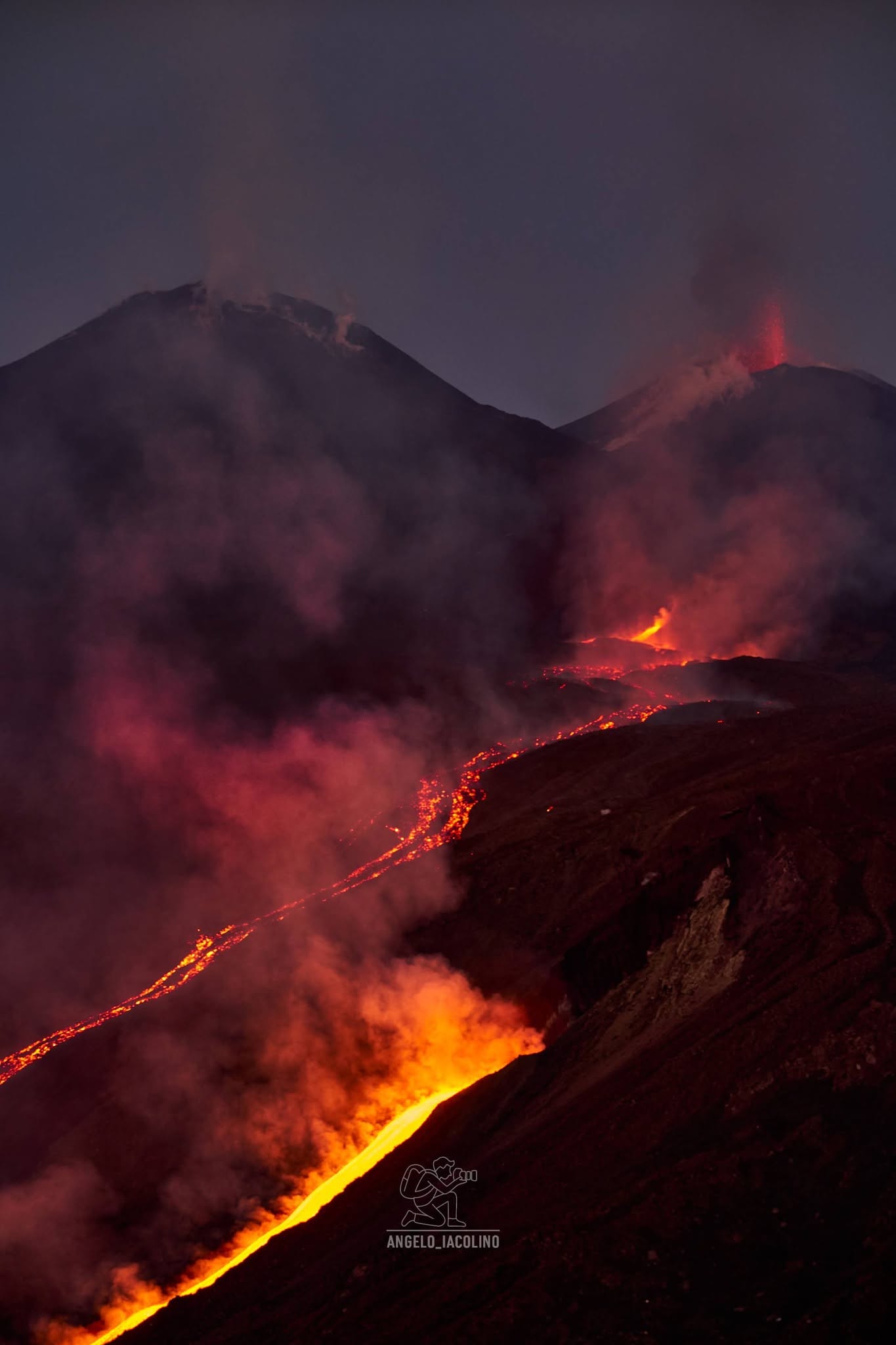
The National Institute of Geophysics and Volcanology (INGV), Etna Observatory, reports that surveillance camera images show persistent effusive activity at vents located at elevations of 2,750 m and 2,360 m. Following a field inspection carried out this afternoon by INGV personnel in the Valle del Bove, it was observed that the flow’s most advanced active front is being well fed; by 17:00 UTC, it had moved past Rocca delle Palombe, reaching an elevation of 1,370 m. Meanwhile, intense explosive activity continued throughout the day at the Voragine crater, generating abundant ash emissions that fell onto the volcano’s southern flank; this activity is ongoing.
Since the last update at 08:16 UTC today, the average amplitude of volcanic tremor has remained within a high range. The source centroid has been located in the Voragine crater area, at an elevation between 2,900 and 3,000 m. Infrasonic activity has decreased and currently remains low; infrasonic events have been located in the Voragine crater area with varying amplitudes. Regarding ground deformation measurements, tiltmeter signals recorded at summit stations confirm previously reported trends, albeit with a slight attenuation. Conversely, GNSS signals show no significant variation.
Statement on Etna activity, August 11, 2026, 00:25 (22:25 UTC).
The National Institute of Geophysics and Volcanology (INGV) – Osservatorio Etneo – reports that a new eruptive vent opened around 21:30 UTC in the Valle del Bove, at an estimated elevation of approximately 1,900 m, near Monte Simone. Further information will be provided as soon as it becomes available. Meanwhile, intense explosive activity continues at the Voragine crater, generating ash emissions that are currently dispersing towards the south-southeast.
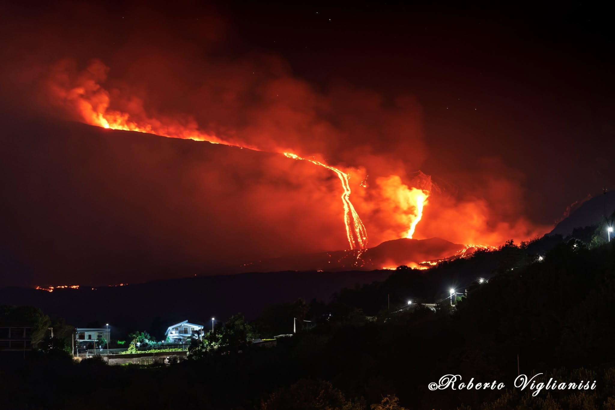
The average amplitude of volcanic tremor remains at a high level. Since the last update at 18:03 UTC, the source centroid has been located both in the Voragine crater area and in the zone between Voragine and the Northeast Crater, at depths ranging from 2,500 to 3,000 m above sea level. Infrasonic activity is moderate; infrasonic events are located in the Voragine crater area and exhibit amplitudes ranging from low to high. No significant changes in deformation signals have been detected compared to the previous update.
Further information will be provided as soon as possible.
Source : INGV.
Photo : Angelo Iacolino , Roberto Viglianisi .
New Zealand , Ruapehu :
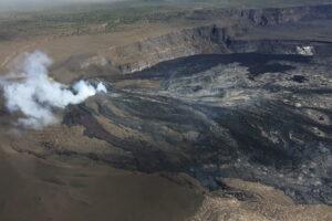
Decrease in volcanic tremor at Ruapehu. Volcanic Alert Level remains at Level 1. Published: Tue Aug 11 2026 11:51 AM
Since the last Volcanic Activity Bulletin on 3 August, volcanic tremor at Mt Ruapehu has decreased from moderate to weak levels. There has been minimal change in measured gas emissions as well as the temperature of Te Wai ā-moe (Ruapehu Crater Lake). Volcanic activity remains within the range typical for minor unrest. The Volcanic Alert Level therefore remains at Level 1.
After reaching peak levels on August 2, tremor intensity at Ruapehu has returned to weak levels. No minor low-magnitude earthquakes have been detected beneath the volcano. Te Wai ā-moe temperatures decreased slightly to ~20°C but have remained well within values observed since the start of 2026.
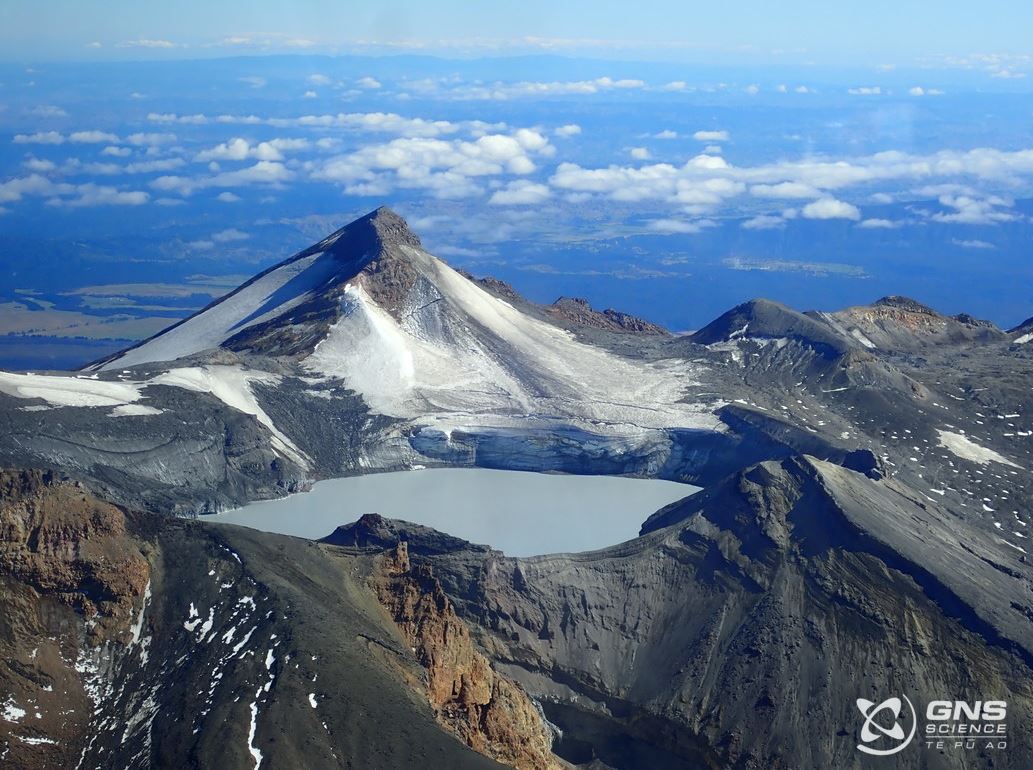
A gas flight was conducted over the volcano last week, finding reduced levels of sulphur dioxide (SO₂) and carbon dioxide (CO₂) since early July. Persistent upwelling was clearly visible at the lake surface during the flight, with some sulphur slicks observed.
Current activity at Ruapehu remains within the range expected during minor volcanic unrest. Therefore, the Volcanic Alert Level remains at 1 and the Aviation Colour Code at Green.
The Earth Sciences New Zealand Volcano Monitoring Group and National Geohazards Monitoring Centre will continue to closely monitor Ruapehu volcano 24/7 for any changes in activity. We will provide further updates when information becomes available or the status changes.
Source : Geonet / Oliver Lamb / Duty Volcanologist .
Photo : Gns science nz.
Indonesia , Ili Lewotolok :
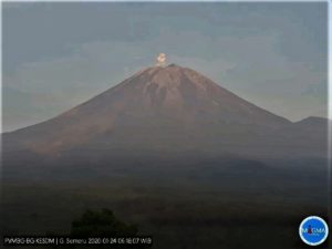
An eruption of Mount Ili Lewotolok occurred on Tuesday, August 11, 2026, at 07:11 (WITA), with an ash column reaching a height of approximately 500 m above the summit (or about 1,923 m above sea level). This dense, white-to-gray column drifted southeast. The eruption was recorded by the seismograph with a maximum amplitude of 40 mm and a duration of 71 seconds.
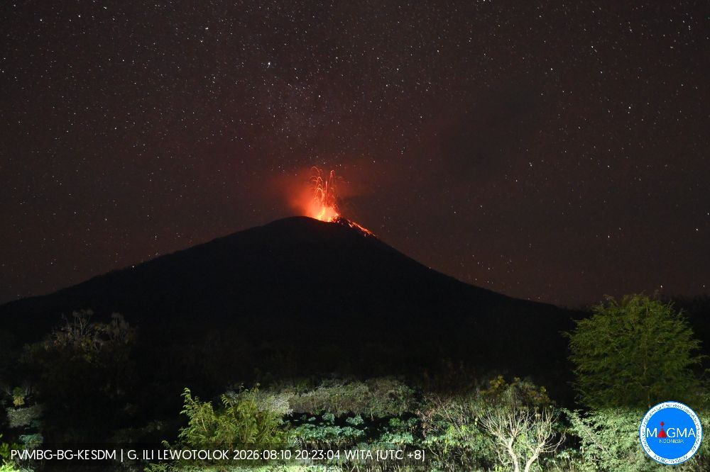
Seismic observations
115 eruption earthquakes with amplitudes of 16.6–40 mm and durations of 26–128 seconds.
109 emission earthquakes with amplitudes of 2.2–40 mm and durations of 16–53 seconds.
2 harmonic tremors with amplitudes of 4.4–16.6 mm and durations of 98–127 seconds.
1 non-harmonic tremor with an amplitude of 1 mm and a duration of 131 seconds.
2 deep volcanic earthquakes with amplitudes of 6.6–11.1 mm and durations of 16–18 seconds.
1 distant tectonic earthquake with an amplitude of 22.1 mm and a duration of 86 seconds.
Recommendations
1. Communities living near Mount Ili Lewotolok, as well as visitors, climbers, and tourists, must not enter or conduct activities within a 2 km radius of the Mount Ili Lewotolok activity center.
2. Remain vigilant regarding potential hazards associated with lava avalanches/rockfalls and pyroclastic flows in the southern, southeastern, western, and northeastern sectors of Mount Ili Lewotolok.
Source et photo : PVMBG.
Martinique , Mount Pelée :
Weekly Report, Institut de physique du globe de Paris, Martinique Volcanological and Seismological Observatory (OVSM)
Saint-Pierre, August 7, 2026, at 3:00 PM local time (GMT-4)
Volcano-tectonic seismic activity
Between July 31, 2026, at 4:00 PM (UTC) and August 7, 2026, at 4:00 PM (UTC), the OVSM recorded 109 earthquakes of volcanic origin:
• 106 volcano-tectonic earthquakes. None had a magnitude (local magnitude Mlv or duration magnitude Md) greater than 1. The vast majority of these earthquakes were located at depths between 0.9 and 1.3 km below the volcano’s summit. However, one volcano-tectonic earthquake was located at a depth of 5.5 km below sea level, slightly southwest of the domes.
• 2 low-energy, shallow hybrid-type earthquakes located at a depth of 1.2 km below the volcano’s summit.
• 1 deep long-period earthquake located east of Montagne Pelée at a depth of 26 km, with a magnitude of Mlv = 0.7.
No earthquakes were reported felt by the population.
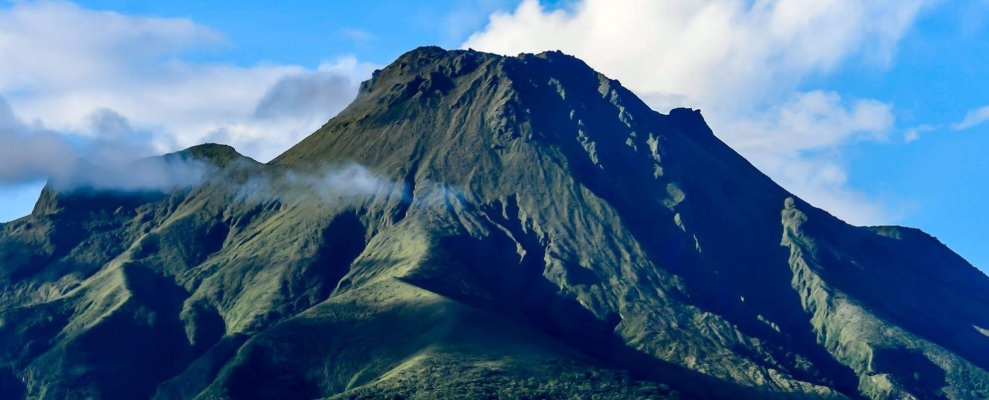
The previous week, the OVSM recorded 124 volcano-tectonic earthquakes. As of August 7, 2026, and over the past four weeks, the OVSM has observed a total of 372 volcanic earthquakes, representing an average of 93 earthquakes per week.
Deformation of Mount Pelée
Since May 2026, the OVSM has been recording ground displacements of several centimeters in the summit area of Mount Pelée. Over the last four weeks, maximum displacement rates have been around 1 cm per month, a slight decrease compared to the previous month. These displacements are consistent with deformation of the volcanic edifice caused by an inflating pressure source located at a depth of approximately 1 km beneath the summit.
The probability of short-term eruptive activity remains low. However, given the observations gathered over recent months and years, a change in the situation in the medium term (weeks to months) cannot be ruled out.
The volcanic alert level, in accordance with the measures established by the authorities, is currently YELLOW: vigilance.
Source : Direction de l’OVSM-IPGP
Photo : OVSM-IPGP.
Guatemala , Santiaguito :
Weather conditions: Clear skies
Wind: Easterly
Precipitation: 7.4 mm
White gas emissions are observed above the Caliente dome; fumaroles are rising to a height of 300 meters and drifting towards the west and southwest. Between one and three low-to-moderate intensity explosions are occurring per hour, ejecting columns of gas and ash up to 700 meters above the dome in the same direction. Incandescence was recorded in the crater during the night and early morning, accompanied by collapses and the descent of incandescent blocks along the flanks.
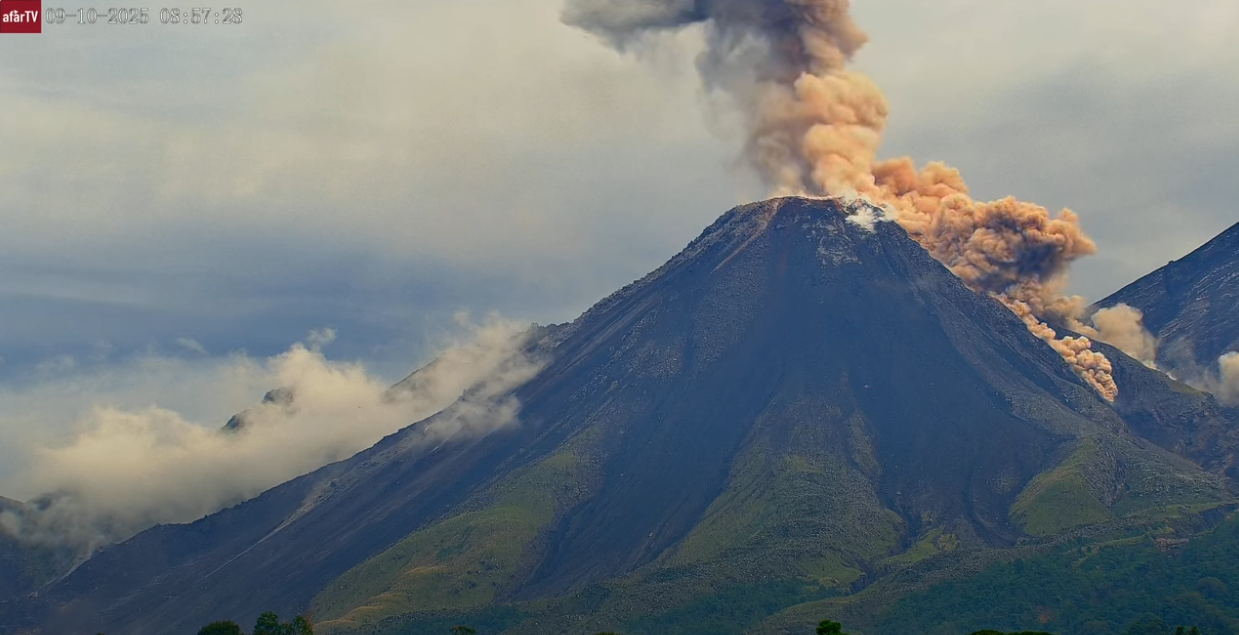
Given the high level of activity and the risk of major collapses, the formation of long-range pyroclastic density currents in any direction cannot be ruled out; it is therefore recommended to follow the instructions in special bulletin BESAN-002-2026. Furthermore, precipitation could mobilize material accumulated in ravines and riverbeds, potentially triggering lahars during the afternoon and evening. It is recommended to avoid ravines and riverbeds and to strictly adhere to the instructions in special bulletin BESAN-016-2026.
Source : Insivumeh
Photo : Afar TV.