October 15 , 2024.
Chile , Copahue :
Seismology
The seismological activity of the period was characterized by the recording of:
32 VT-type seismic events, associated with rock fracturing (Volcano-Tectonic). The most energetic earthquake had a Local Magnitude (ML) value equal to 1.5, located 7.9 km to the North-Northeast of the volcanic building, at a depth of 4.0 km from the crater.
5 LP-type seismic events, associated with fluid dynamics inside the volcanic system (Long Period). The size of the largest earthquake evaluated from the Reduced Displacement (DR) parameter was equal to 4.7 cm2.
6 VLP-type seismic events, associated with the dynamics of large volumes of fluids inside the volcanic system (Very Long Period). The size of the largest earthquake evaluated from the Reduced Displacement (DR) parameter was equal to 20 cm2.
Fluid Geochemistry
The sulfur dioxide (SO2) emissions data obtained by the Differential Optical Absorption Spectroscopy (DOAS) equipment, corresponding to the Mellizas station, installed 6 km east-northeast of the active crater, presented an average value of 396 ± 586 t/d, with a maximum value of 505 t/d on September 26. Depending on the activity of the volcano, these values remain at levels considered low.
No anomalies have been reported in sulfur dioxide (SO2) emissions into the atmosphere in the area near the volcano, according to data published by the Tropopheric Monitoring Instrument (TROPOMI) and the Ozone Monitoring Instrument (OMI) Sulphur Dioxide Group.
Thermal anomalies by satellites
During the period, no thermal alerts were recorded in the area associated with the volcano, according to the analytical processing of Sentinel 2-L2A satellite images, in combination with false color bands.
Geodesy
The analysis of the data provided by 4 GNSS stations, which allow the monitoring of the deformation of the volcanic system, shows that there has been a change in the trend of the displacement of the station located to the north of the active crater, reaching a value of 0.1 cm/month. for the vertical component, which differs subtly from the deflationary trend recorded at this station since 2021 and which could be linked to changes in the internal activity of the volcano in the surface area.
Surveillance cameras
The images provided by the fixed camera, installed near the volcano, recorded a degassing column from September 25, with a maximum height of 480 meters, consistent with the increase in surface activity, which would be associated with the progressive depletion of the crater lake in this last period.
The activity remained at levels considered low, suggesting a stability of the volcano.
The volcanic technical alert is maintained at: GREEN TECHNICAL ALERT: Active volcano with stable behavior – There is no immediate risk
Observation:
Given the behavior of this volcanic system observed over the last eight years, sudden, small explosions without precursors affecting the immediate surroundings of the active crater cannot be ruled out. However, in the context of its base level, this type of event has not been frequent, which is why it is considered to have a low probability of occurrence. The hazards associated with this minor activity consist of the ejection of ballistic pyroclasts, the emission of ash and volcanic gases.
Source : Sernageomin
Photo : Carpediem1971
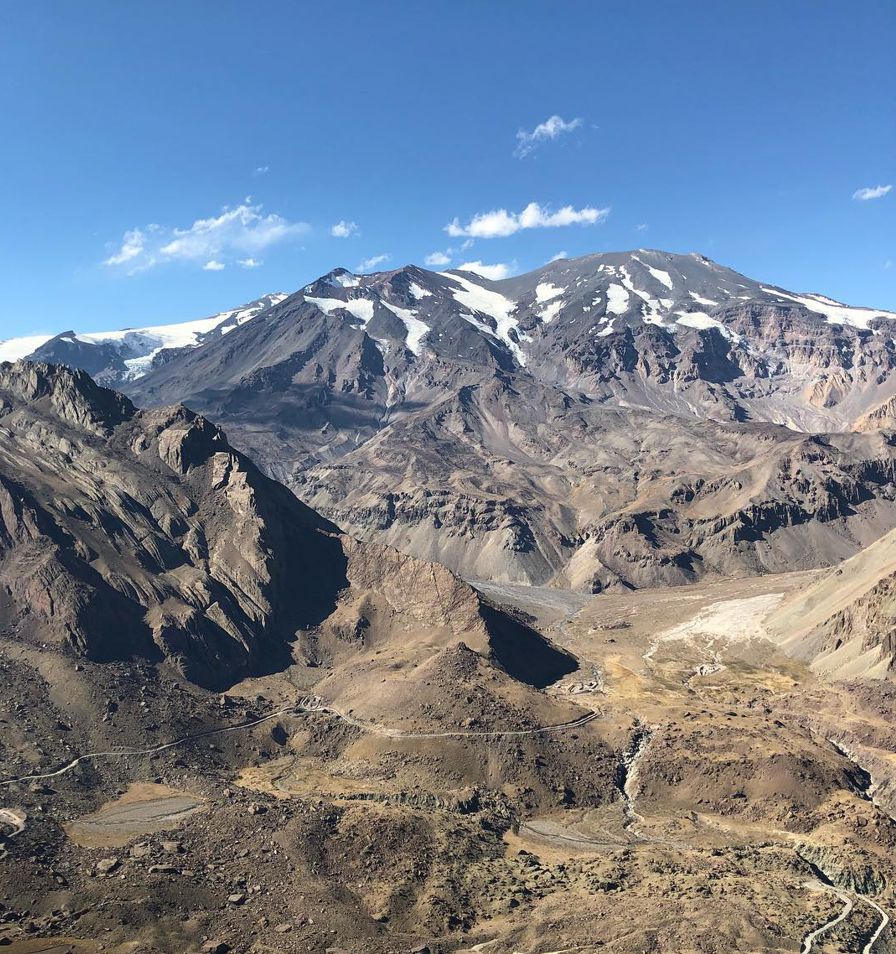
Chile , San José :
Special Report on Volcanic Activity (REAV) Santiago Metropolitan Region, San José Volcano, October 11, 2024, 2:40 p.m. local time (Continental Chile).
The National Geological and Mining Service of Chile (Sernageomin) publishes the following PRELIMINARY information, obtained through the monitoring teams of the National Volcanic Monitoring Network (RNVV), processed and analyzed at the Southern Andean Volcanological Observatory (Ovdas):
On Friday, October 11, at 2:08 p.m. local time (5:08 p.m. UTC), the monitoring stations installed near the San José Volcano recorded a VT (volcano-tectonic) earthquake associated with rock fracturing in the volcanic system.
The earthquake characteristics after its analysis are as follows:
TIME OF ORIGIN: 14:08 local time (17:08 UTC)
LATITUDE: 33.853° S
LONGITUDE: 70.022° West
DEPTH: 7.2 km
LOCAL MAGNITUDE: 3.3 (ML)
Observations:
At the time of this report, no additional volcanic or seismological activity or changes in the usual behavior of the volcano have been detected.
The volcanic technical alert remains at GREEN level.
Source : Sernageomin.
Photo : Observatoire Argentin de vigilance volcanique.
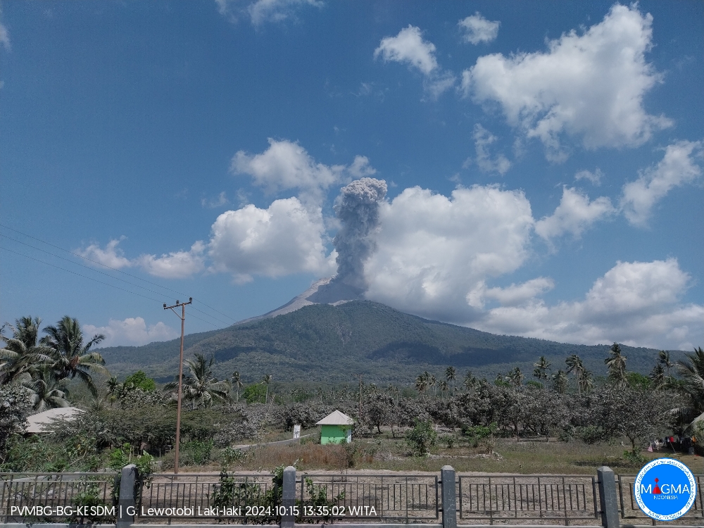
Indonesia , Lewotobi Laki-laki :
An eruption of Mount Lewotobi Laki-laki occurred on Tuesday, October 15, 2024, at 1:31 PM WITA with the height of the ash column observed at ± 800 m above the summit (± 2384 m above sea level). The ash column was observed to be gray in color with a thick intensity, oriented toward the southwest. This eruption was recorded on a seismograph with a maximum amplitude of 5.9 mm and a duration of 388 seconds.
VOLCANO OBSERVATORY NOTICE FOR AVIATION – VONA
Issued : October15 , 2024
Volcano : Lewotobi Laki-laki (264180)
Current Aviation Colour Code : ORANGE
Previous Aviation Colour Code : orange
Source : Lewotobi Laki-laki Volcano Observatory
Notice Number : 2024LWK635
Volcano Location : S 08 deg 32 min 20 sec E 122 deg 46 min 06 sec
Area : East Nusa Tenggara, Indonesia
Summit Elevation : 5069 FT (1584 M)
Volcanic Activity Summary :
Eruption with volcanic ash cloud at 05h31 UTC (13h31 local).
Volcanic Cloud Height :
Best estimate of ash-cloud top is around 7629 FT (2384 M) above sea level or 2560 FT (800 M) above summit. May be higher than what can be observed clearly. Source of height data: ground observer.
Other Volcanic Cloud Information :
Ash cloud moving to southwest. Volcanic ash is observed to be gray. The intensity of volcanic ash is observed to be thick.
Remarks :
Eruption recorded on seismogram with maximum amplitude 5.9 mm and maximum duration 388 second.
Source et photo : Magma Indonésie.
Hawaii , Kilauea :
Monday, October 14, 2024, 7:59 AM HST (Monday, October 14, 2024, 17:59 UTC)
19°25’16 » N 155°17’13 » W,
Summit Elevation 4091 ft (1247 m)
Current Volcano Alert Level: ADVISORY
Current Aviation Color Code: YELLOW
Activity Summary:
Kīlauea volcano is not erupting. Weak steaming continues on the inactive September 15–20 lava flow field within Nāpau Crater on the middle East Rift Zone. No changes have been detected in the lower East Rift Zone or Southwest Rift Zone. A wildfire that began on September 15 to the south of Nāpau Crater continues smoldering at this time, with wildfire smoke intermittently visible in S2cam imagery.
Summit Observations:
There were 2 earthquakes detected beneath the Kīlauea summit region over the past 24 hours. The summit tiltmeters at Uēkahuna and Sandhill show no significant inflation or deflation over the past few days. The most recent measurement of the sulfur dioxide (SO2) emission rate at the summit was approximately 60 tonnes per day on September 17, 2024.
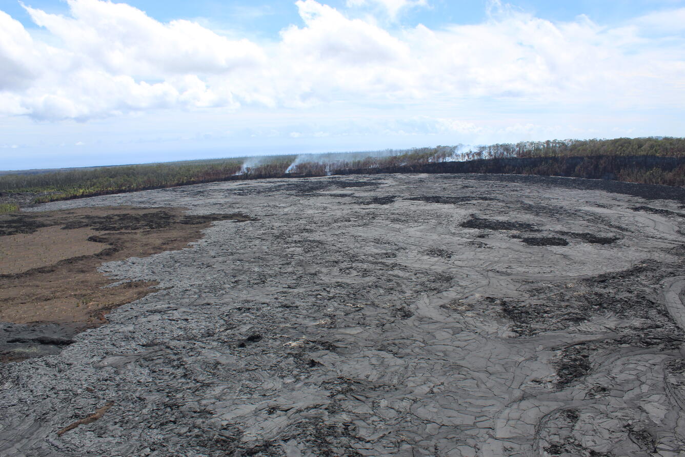
This aerial photo of Nāpau Crater, looking south, shows the lava flows (gray) from the recent Kīlauea middle East Rift Zone eruption. Along the south rim of the crater (background of image), smoke plumes are visible from a small wildfire that continues to burn in a remote area of Hawai‘i Volcanoes National Park.
Rift Zone Observations:
The middle East Rift Zone (MERZ) eruption near Nāpau Crater stopped around 10 a.m. HST on the morning of September 20. Only minor steaming from the eruption site has been seen in webcam imagery since that time. No SO2 from the eruption site was detected on Monday, September 23 during measurements on Chain of Craters Road, indicating that MERZ SO2 emissions are negligible.
Shallow earthquake counts are steady over the past day with 13 earthquakes in the MERZ and upper East Rift Zone, with tremor no longer being recorded on seismometers near the eruption site. Tiltmeters in the MERZ show modest deflation and GPS instruments show low rates of deformation.
All recent activity was confined to the middle East Rift Zone between Makaopuhi Crater and Puʻuʻōʻō and there are no indications of any changes downrift in the lower East Rift Zone.
Source : HVO
Photo : USGS/ L. DeSmither ( 7 octobre 2024).
Guatemala , Santiaguito :
Atmospheric conditions: Partly cloudy
Wind: Northeast
Precipitation: 14.2 mm.
Activity:
The Santa María-Santiaguito Volcanic Complex Observatory reports poor visibility over the Caliente Dome due to atmospheric conditions. Moderate explosions are recorded that raise columns of grayish gas and ash to heights of up to 700 meters above the dome, which move to the south and southwest under the action of the wind. These explosions are accompanied by low degassing noises, similar to those of an airplane turbine.

Noises caused by weak avalanches are reported. Ash falls are expected at Finca La Tranquilidad, Loma Linda and others. During the afternoon and evening, rains could cause lahars to descend into the channels descending from the Caliente Dome. Activity remains at a high level, so there is the possibility that, due to explosions or gravity, some of the accumulated material could collapse and generate pyroclastic flows over long distances to the southwest, south and southeast.
Source : Insivumeh
Photo : Conred. ( 2021)