September 2 , 2026.
Italy / Sicily , Etna :
WEEKLY BULLETIN, August 24, 2026 – August 30, 2026 (issue date: September 1, 2026)
ACTIVITY SUMMARY
Based on monitoring data, the observations are as follows:
1) VOLCANOLOGICAL OBSERVATIONS: Variable degassing activity at the summit craters, associated with episodic ash emissions from the Northeast Crater.
2) SEISMOLOGY: Absence of seismic activity linked to fracturing with local magnitude (Ml) ≥ 2.0. Tremor amplitude remained at a generally moderate level.
3) INFRASOUND: Infrasonic activity varied between low and high levels.
4) GROUND DEFORMATION: Signals from ground deformation monitoring networks showed no significant variation over the past week.
5) GEOCHEMISTRY: SO2 flux at a high level.
Soil CO2 flux (Etnagas network): average values.
Partial pressure of dissolved CO2 in groundwater (EtnaAcque network): no update.
Helium (He) isotope ratio at peripheral sites: latest data indicate high values (August 26, 2026).
6) SATELLITE OBSERVATIONS: Satellite-observed thermal activity in the summit area remained generally low, with isolated anomalies of moderate intensity.
VOLCANOLOGICAL OBSERVATIONS
During the observation period, monitoring of Etna’s volcanic activity was conducted through the analysis of images from the surveillance camera network of the National Institute of Geophysics and Volcanology (INGV) – Osservatorio Etneo.
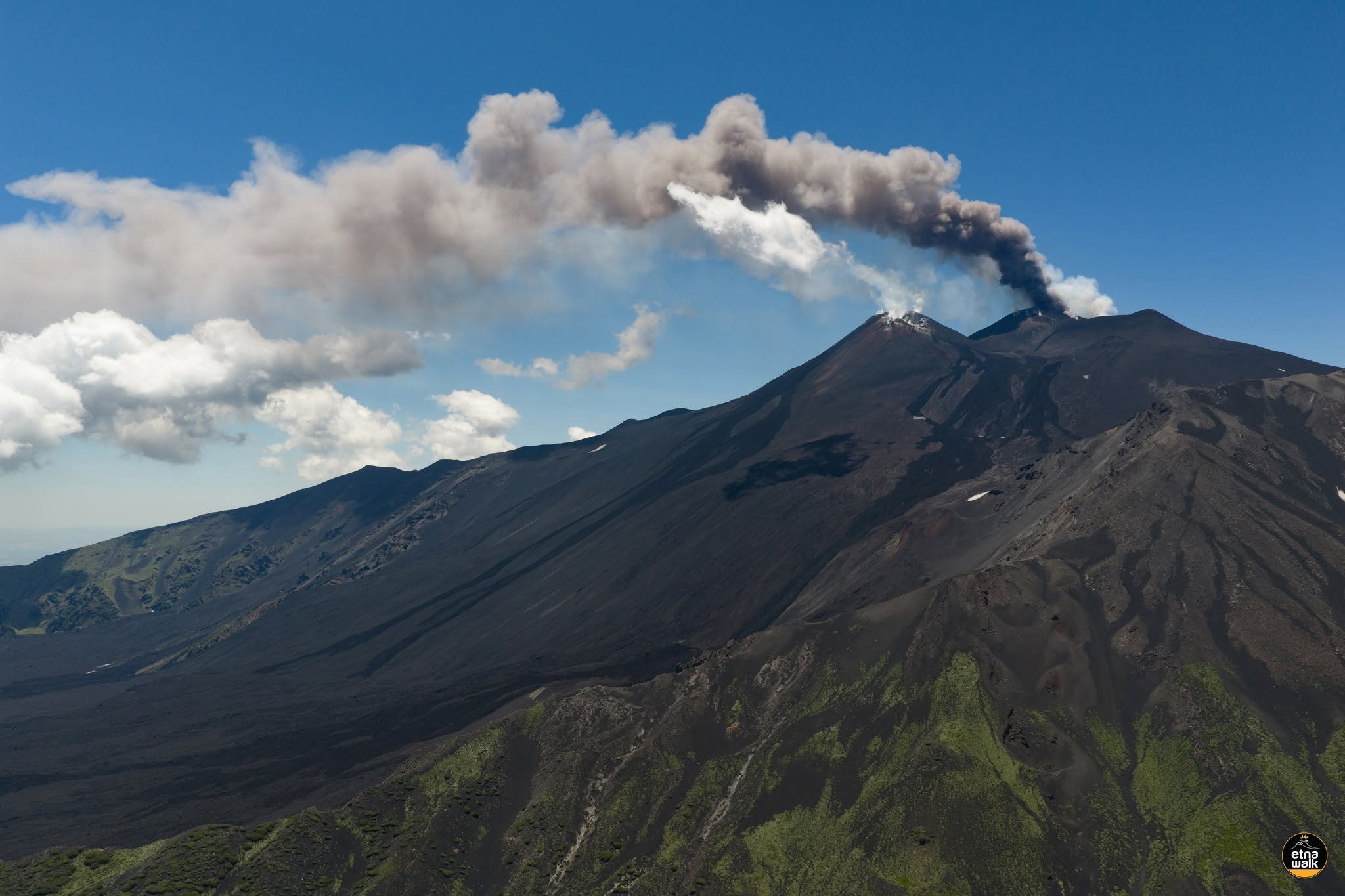
Following the eruptive episode that occurred between August 6 and 23, Etna’s activity was characterized by variable degassing at the summit craters—primarily the Northeast Crater, which produced pulsed degassing associated with sporadic, low-intensity ash emissions.
Regarding the Southeast Crater, activity was marked by moderate fumarolic degassing emanating from the crater’s summit areas.
Source : INGV
Photo : Etna Walk / Giuseppe Distefano / Marco Restivo.
Italy , Stromboli :
WEEKLY BULLETIN, August 24, 2026 – August 30, 2026 (issue date: September 1, 2026)
ACTIVITY SUMMARY
Based on monitoring data, the observations are as follows:
1) VOLCANOLOGICAL OBSERVATIONS: Ordinary Strombolian eruptive activity across both crater zones. The frequency of total explosive activity—encompassing both the North Crater zone and the Central-South Crater zone—is at a high level, with average explosion intensity in both zones.
2) SEISMOLOGY: Monitored seismic parameters show no significant variations.
3) GROUND DEFORMATION: Signals from ground deformation monitoring networks show no significant variations.
4) GEOCHEMISTRY: SO2 flux at a medium-low level.
Soil CO2 flux (Pizzo zone – STR02): no recent data available.
C/S ratio in the plume: no recent data available.
Helium isotope ratio (R/Ra): decreasing, though remaining at high values.
Soil CO2 flux in the San Bartolo zone: values ranging from medium-high to high.
Soil CO2 flux in the Scari zone: average values.
5) SATELLITE OBSERVATIONS: Thermal activity observed by satellite in the summit area was generally at a low to moderate level.
VOLCANOLOGICAL OBSERVATIONS
Observations of explosive activity captured by surveillance cameras
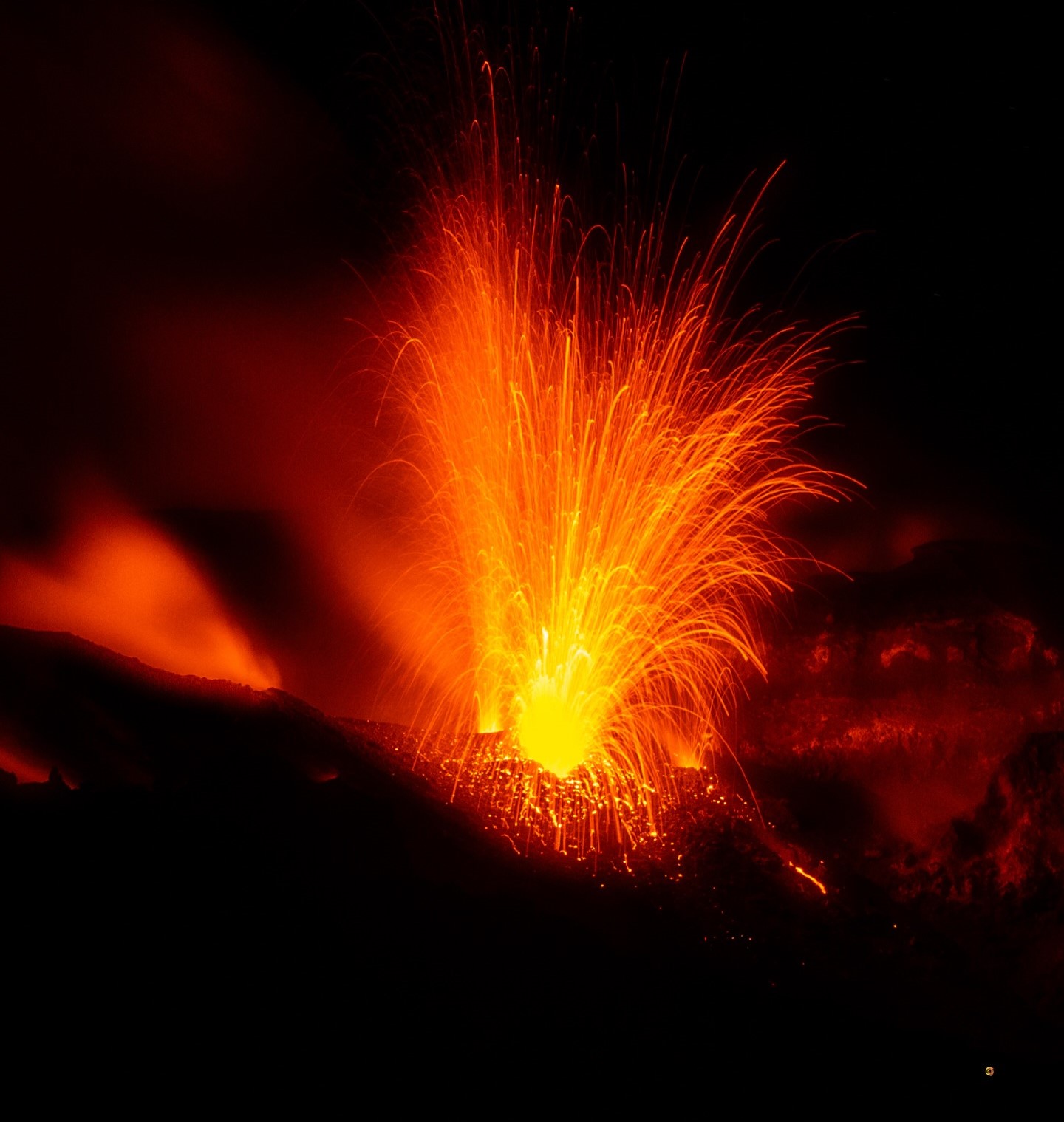
During the observation week, Stromboli’s eruptive activity was characterized through the analysis of images recorded by INGV-OE surveillance cameras located at an elevation of 190 m above sea level and at Punta dei Corvi (SCT-SCV and SPCT, respectively). Explosions in the North crater area (Zone N) primarily produced coarse material (bombs and lapilli), whereas explosions in the Central-South crater area (Zone CS) produced a mixture of predominantly fine and coarse material.
The average explosion frequency for the North zone fell within the medium range, and intensity remained at a predominantly medium-high level. In the Central-South zone, the average explosion frequency was at a medium level, and the intensity of explosive activity was generally medium-high. The total average hourly explosion frequency (Zone N + Zone CS) was at a high level.
Source : INGV
Photo : Stromboli stati d’animo / Sebastiano Cannavo
Indonesia , Anak Ranakah :
INCREASE IN ACTIVITY LEVEL AT ANAK RANAKAH VOLCANO (NTT): SHIFT FROM LEVEL I (NORMAL) TO LEVEL II (WASPADA) EFFECTIVE SEPTEMBER 1, 2026, AT 23:00 WITA.
Anak Ranakah volcano, located in Manggarai Regency (East Nusa Tenggara province), exhibited increased seismic activity following the magnitude 7.7 earthquake that struck Flores on August 15, 2026. This rise was reflected in an increase in the number of local tectonic earthquakes (rising from 38 to 414 events per day) and distant tectonic earthquakes (rising from 32 to 418 events per day). On the same day, the number of deep volcanic earthquakes also increased, rising from 10 to 35 events per day. Although remaining relatively high, volcanic seismic activity at Anak Ranakah declined towards the end of August 2026. On September 1, 2026, a renewed increase in the number of deep volcanic earthquakes was observed—a trend that was continuing at the time this report was written. The occurrence of deep volcanic earthquakes indicates rock fracturing processes driven by deep magmatic influx, altering the stress and pressure within the structure of Anak Ranakah volcano.
Based on seismic observations made between August 1 and August 31, 2026, recorded activity included 367 deep volcanic earthquakes, 3,272 local tectonic earthquakes, 2,776 distant tectonic earthquakes, and 218 felt earthquakes (with intensities ranging from II to VII on the MMI scale). For September 1, 2026, up to 18:30 WITA, recorded activity included 94 deep volcanic earthquakes, 144 local tectonic earthquakes, 85 distant tectonic earthquakes, and 1 felt earthquake (MMI intensity II). Seismic energy estimated using the RSAM (Real-time Seismic Amplitude Measurements) method showed a significant increase starting August 15, 2026, followed by a decline at the end of August 2026. However, energy levels rose again on September 1, coinciding with an intensification of deep volcanic seismicity.
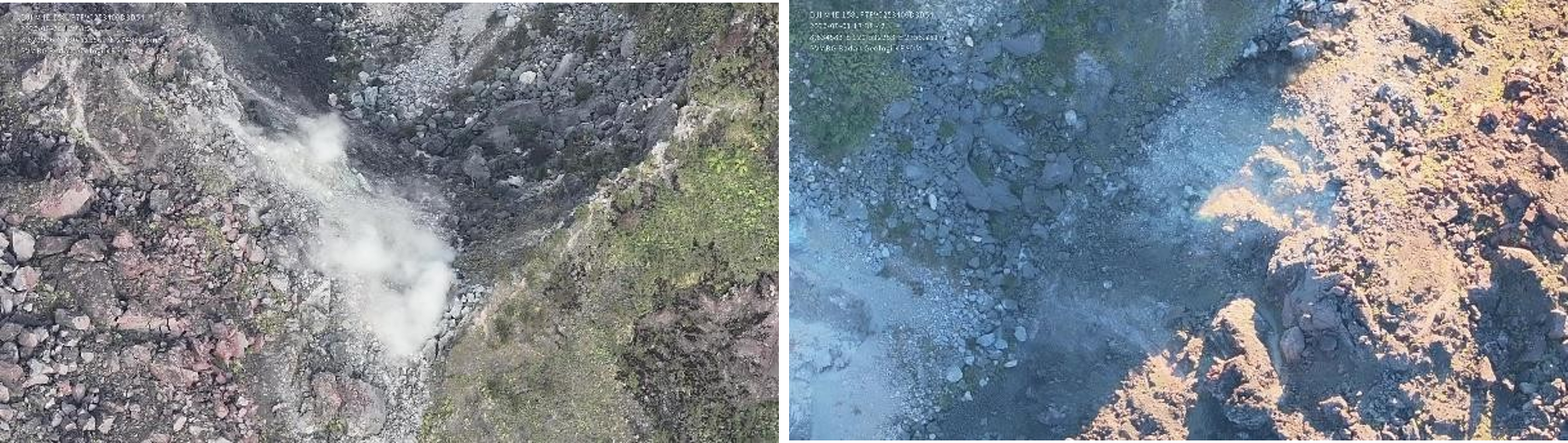
Visual observations generally revealed no emissions from the crater of Mount Anak Ranakah. Visual inspections conducted via drone on August 25 and September 1, 2026, highlighted changes in solfatara emissions located west of the lava dome; the emissions observed on August 25 appeared denser than those observed on September 1. No significant changes were noted regarding the state of the lava dome itself, despite landslides occurring in several areas of Mount Anak Ranakah on August 18 and 20, triggered by felt earthquakes.
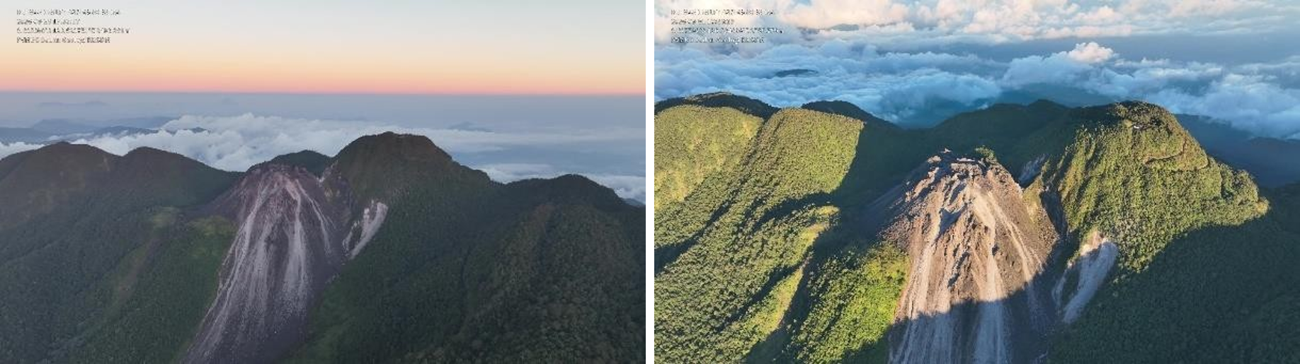
Based on visual and instrumental monitoring data, Mount Anak Ranakah is exhibiting increased seismic activity. Given the current potential risks, the activity level of Mount Anak Ranakah has been raised from Level I (NORMAL) to Level II (VIGILANCE/WASPADA), subject to the following recommendations: local residents, visitors, hikers, and tourists must not enter or conduct activities within a 1 km radius of the Mount Anak Ranakah activity center.
Source et photo : PVMBG.
Colombia , Puracé – Los Coconucos volcanic chain :
Popayán, September 1, 2026, 2:30 PM.
Based on monitoring of activity in the Los Coconucos volcanic chain, the Colombian Geological Service (SGC)—an agency attached to the Ministry of Mines and Energy—reports the following information:
Since the last bulletin, seismic signals associated with fluid dynamics within the volcanic conduits—specifically tremor-type (TR) signals—have remained predominant; they continue to be located beneath the Puracé volcano crater at depths of less than 1 km. An increase in seismicity linked to rock fracturing (volcano-tectonic, VT) has also been observed—in terms of both frequency and energy release—with approximately 80 events recorded. These events were located between 10 and 15 km northeast of the Puracé volcano, at depths ranging from 7 to 11 km. Furthermore, slow ground deformation persists in the area encompassing the Puracé, Piocollo, and Curiquinga volcanoes.
Between 2:00 PM yesterday and the time of this bulletin’s publication, eight ash emissions were recorded, reaching a maximum height of 240 m above the volcano’s summit. Some of these emissions were visible from the rural communities (*veredas*) of Campamento, Alto Anambío, Cristales, and Chapío in the municipality of Puracé, as well as from the city of Popayán.
Gas monitoring indicates that sulfur dioxide (SO2) emissions are continuing and that an upward trend in soil carbon dioxide (CO2) concentrations persists. No thermal anomalies associated with the crater floor have been recorded, according to data published on satellite monitoring platforms.
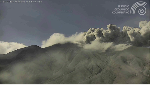
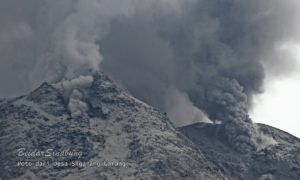
Recording from the Mina camera, located 2.2 km north of Puracé Volcano, showing ash emission on September 1, 2026, at 08:43.
Overall, regarding the various volcanic monitoring methods, values recorded by instruments at the volcano in recent weeks have reached peak levels; they significantly exceed usual baseline values, thereby indicating a major shift in the volcano’s dynamics.
In light of the above, the SGC recommends closely monitoring the evolution of this phenomenon through daily bulletins and other information released via our official channels, as well as adhering to instructions from local and departmental authorities and the National Unit for Disaster Risk Management (UNGRD). The volcanic alert level remains at Orange: a volcano exhibiting significant changes in monitored parameters.
Source et photo : SGC.
Costa Rica , Rincón de la Vieja :
OVSICORI-UNA Statement – Update as of August 28, 2026
Summary:
The OVSICORI-UNA volcanic monitoring group is maintaining the activity level of Rincón de la Vieja volcano at 3 (Alert).
This decision is based on the following observations:
● An increase in eruptive activity has been recorded, with 14 eruptions noted over the past week, including the largest of the year. A small syn-eruptive lahar (triggered by the eruption) was recorded on August 24 at 2:13 PM.
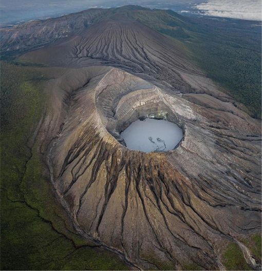
● Since July 2, 98 phreatic eruptions have been recorded. Six of these eruptions generated lahars that flowed into rivers on the volcano’s northern flank; the eruption on August 25 at 11:10 PM was the most energetic of the year. Background tremor remains low-amplitude, and a slight increase in « tornillo » (screw-shaped) events has been observed.
● GNSS stations are not detecting any significant deformation.
● This week, the volcano emitted an average of approximately 600 tonnes of SO₂ per day—a level similar to the previous week—confirming the upward trend observed since mid-June.
Eruptive activity continues. SO₂ emissions remain above baseline levels. Conditions suggest that further eruptions could occur, including events of equal or greater magnitude than those recorded to date. Consequently, the activity level for Rincón de la Vieja volcano remains at 3 (Vigilance).
Source : Ovsicori
Photo : Soy Tico.