October 8 , 2026.
Hawaii , Kilauea :
HAWAIIAN VOLCANO OBSERVATORY STATUS REPORT , U.S. Geological Survey
Wednesday, October 7, 2026, 3:13 PM HST (Thursday, October 8, 2026, 01:13 UTC)
19°25’16 » N 155°17’13 » W,
Summit Elevation 4091 ft (1247 m)
Current Volcano Alert Level: WATCH
Current Aviation Color Code: ORANGE
Summary:
Satellite imagery shows the extent of the Sept 30-Oct 1 near surface dike in Kaluapele, the summit caldera of Kīlauea volcano. Recent activity has impacted the ongoing eruption resulting in an update of interpretations and possible outcomes.
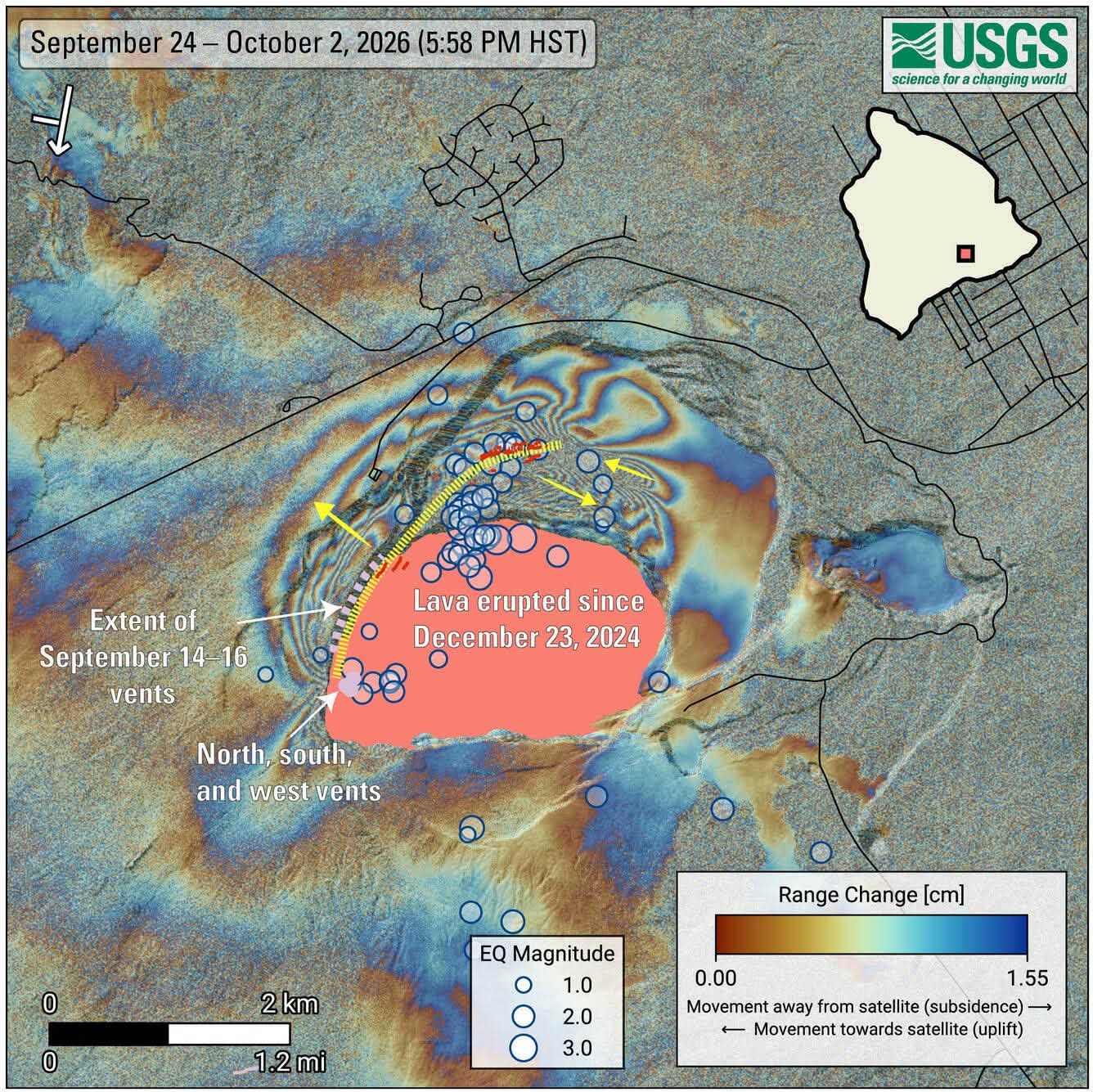
COSMO-SkyMed Second Generation (CSG) interferogram showing deformation of the ground surface around the summit of Kīlauea volcano from September 24 to October 2, 2026. Blue circles mark earthquakes recorded during this period, with larger circles representing stronger earthquakes. Most of the earthquakes occurred between September 30 and October 1, 2026.The yellow dotted line and arrows show the main path of the underground intrusion and the relative motion of the ground surface, respectively. New cracks, which likely opened around September 30, were identified through various remote-sensing methods, and are shown in red. The pattern of deformation is consistent with a shallow, nearly vertical sheet of magma—called a dike—located about 1 kilometer (~0.6 miles) or less beneath the yellow line.The symbol in the upper-left corner shows the satellite’s flight direction with an arrow and its viewing direction with a bar. The pink polygon represents the lava flows covering the crater floor. Main vents are shown as light-purple circles, while the extent of vents and fissures that opened between September 14 and 16, 2026, is shown as a light-purple dashed-line. Roads are shown in black.The satellite data used to generate the interferogram were provided by the Italian Space Agency (ASI, Agenzia Spaziale Italiana).
Summary
Recent satellite imagery shows the intrusion of magma that was emplaced on September 30 to October 1, 2026, followed fracture systems created in Kaluapele (Kīlauea’s summit caldera) during the 2018 collapse of Halemaʻumaʻu. This intrusion was emplaced very near the surface north of Halemaʻumaʻu resulting in a narrow band of surface deformation and new, small surface fractures.
Emplacement of the Dike Intrusion
An earthquake swarm began around 2 p.m. HST on the afternoon of September 30th about 1 mile (1.5 km) beneath the vent complex in Halemaʻumaʻu. About 30 located events occurred in this area and by about 8 p.m. HST, the seismicity had moved northeastward at the same depth, extending from the rim of Halemaʻumaʻu well into Kaluapele. An additional 50 events were located in this area before 4 a.m. HST on October 1. Earthquakes continued to occur at diminishing rates over the next day, with the largest event being a magnitude-3.5 at 7:55 a.m. HST on October 2, located beneath the northern edge of Halemaʻumaʻu. About 130 earthquakes were recorded in total.
Location and Shape of the Dike Intrusion
Recent Interferometric Synthetic Apeture Radar (InSAR) satellite images were used to construct an interferogram that more precisely determines the shape and location of the dike intrusion. The interferogram requires a satellite image acquired before and one after the event, so it can be several days to two weeks before the pair of images are both acquired. Orbital passes by the Italian Space Agency’s COSMO-SkyMed Second Generation satellites on September 24 and October 2 were used to construct an interferogram map showing the interpreted location and length of dike intrusion.
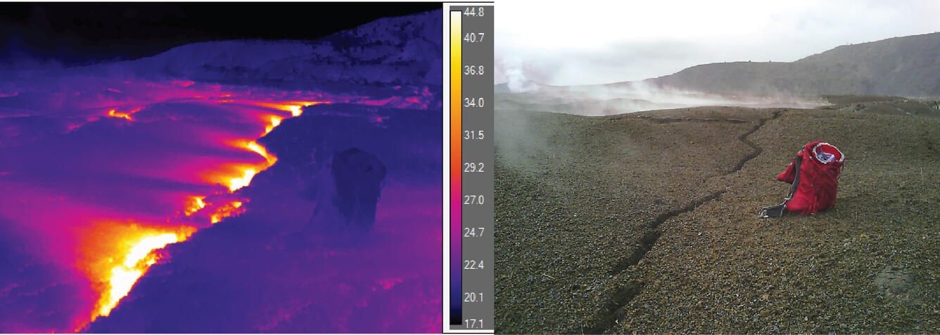
A comparison of a thermal image and visual image of the new cracking in the north caldera at Kīlauea summit. The bands of higher ground temperatures extend to the left of the crack because the warm steam is carried southwest by the tradewinds. The temperature scale is in Celsius, with maximum observed temperatures in these cracks of about 60 dg C, or 140 dg F.
The patterns of surface deformation show that the dike extends from the established vent area in Halemaʻumaʻu and cuts across the northwestern part of Kaluapele. The deforming areas following parallel to the western rim of Halemaʻumaʻu and Kaluapele are very narrow and elongate, mapping the path of magma intruding within a thousand feet (about 300 meters) or less of the surface. The path of the dike follows fractures in the caldera floor that formed in 2018 and created a series of new, small fractures that were identified on other satellite images.
Interpretation
The rising elevation of the established north-south-west vents over the course of this eruption has increased the pressure necessary to push magma out of the vents and trigger a major fountain episode. The normal pattern of consistent rates of summit inflation prior to the onset of fountain episodes began to change to stepwise inflation prior to episode 51. Episodes 51-54 all showed similar patterns of inflation, broken by periods of no inflation that could last for several days. Since the end of fountaining episode 54 on August 25, these inconsistent inflationary patterns have continued. The opening of six vents on and below the northwest wall of Halemaʻumaʻu on September 14-16 suggests that magma is able to intrude into pre-existing weak, fractured areas along the northern and western boundaries of Halemaʻumaʻu without having to create new space (that event lacked earthquakes and significant deformation). The September 30-October 1 intrusion shows that magma is also exploiting fractures formed within Kaluapele during the 2018 collapse, and that event was accompanied by earthquakes and ground deformation as cracks either open or expand and compress adjacent rocks. The occurrence of these two small-volume intrusions below Kilauea’s summit region within the past month suggests the pressure required to erupt dense degassed magma from the established vents is also high enough to allow magma to exploit weaknesses below the surface along the pre-existing, 2018 crack systems. Magma is being injected into these weak areas as dikes that start from the subsurface dike below the established vents and move northwards into the fractured areas.
Source : HVO.
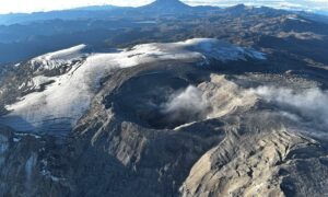
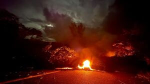
Photos : USGS , USGS/ M. Patrick.
Indonesia , Ibu :
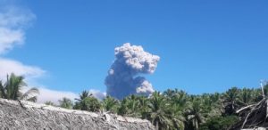
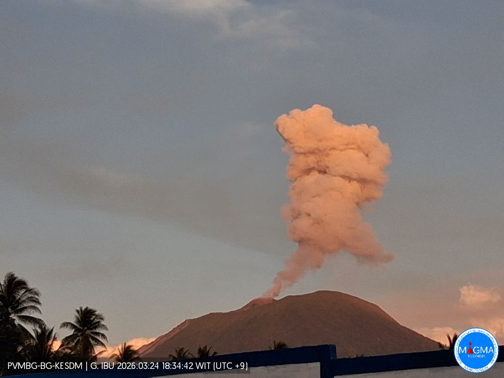
An eruption of Mount Ibu occurred on Thursday, October 8, 2026, at 14:39 WIT; an ash column was observed reaching approximately 500 meters above the summit (or about 1,825 meters above sea level). The ash column, which appeared gray and dense, drifted northeast. The eruption was recorded by the seismograph with a maximum amplitude of 28 mm and a duration of 57 seconds.
Seismic observations
89 eruption earthquakes with amplitudes of 15–28 mm and durations of 31–81 seconds.
1 « emission-type » earthquake (gust earthquake) with an amplitude of 10 mm and a duration of 35 seconds.
11 harmonic tremors with amplitudes of 2–20 mm and durations of 41–125 seconds.
97 low-frequency earthquakes with amplitudes of 2–10 mm and durations of 17–29 seconds.
120 shallow volcanic earthquakes with amplitudes of 2–8 mm and durations of 7–21 seconds.
3 deep volcanic earthquakes with amplitudes of 6–28 mm and durations of 14–23 seconds.
3 local tectonic earthquakes with amplitudes of 10–28 mm and durations of 23–30 seconds.
12 distant tectonic earthquakes with amplitudes of 2–28 mm and durations of 34–134 seconds.
Recommendations
1. Communities living near Mount Ibu, as well as visitors and tourists, are advised not to conduct any activities within a 2 km radius, nor within the 3.5 km sectoral extension zone stretching toward the crater opening on the northern flank of Mount Ibu’s active crater.
2. In the event of ashfall, individuals outdoors are advised to protect their nose and mouth (using masks) and their eyes (using protective eyewear).
Source et photo : PVMBG.
Colombia , Puracé – Los Coconucos volcanic chain:
Popayán, October 6, 2026, 3:30 PM.
As part of the monitoring of activity at the Puracé volcano—part of the Los Coconucos volcanic chain (CVLC)—the Colombian Geological Service (SGC), an agency attached to the Ministry of Mines and Energy, reports the following:
During the week of September 29 to October 5, 2026, there was a slight increase in the number of seismic events associated with fluid movement (gases and liquids originating from magma and its interaction with the hydrothermal system). These events continued to be located primarily beneath the Puracé volcano crater, at depths of less than 2 km.
Seismicity associated with rock fracturing (VT) remained at levels similar to those recorded the previous week in terms of the number of events; these were located northeast of the volcano, at distances of 11 to 18 km and depths ranging from 7 to 14 km, with a magnitude 3.2 ML event standing out among them. Additionally, low-magnitude events were located at depths of 1 to 4 km in the area where the flanks of the Puracé and Piocollo volcanoes meet.
The process of slow ground deformation continues in the sector situated between the Puracé, Piocollo, and Curiquinga volcanoes. Furthermore, significant values continue to be recorded
regarding atmospheric emissions of sulfur dioxide (SO₂) and carbon dioxide (CO₂), reaching up to 200 tonnes/day and 1,100 ppm, respectively. Satellite
observations identified low-energy thermal anomalies within the crater itself during this period.
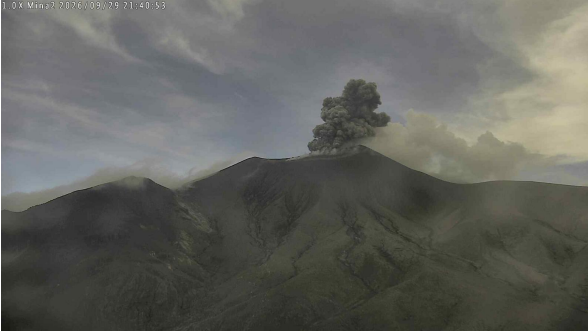
Ash emission at Puracé volcano on September 29, 2026, at 16:40. Footage from the Mina2 camera, located 2.2 km northwest of Puracé volcano.
Thirty-six ash emissions were recorded, reaching altitudes of up to 2,000 meters above the volcano’s summit; continuous degassing was also observed. Dispersion occurred primarily toward the northwest and west of the volcano. Reports of ground vibrations were received from the rural area of Puracé, along with reports of ashfall there and in Coconuco and Paletará.
In conclusion, the variations observed at Puracé volcano indicate that the system remains unstable regarding several monitored parameters; further ash emissions and ashfall are possible, dispersing according to the prevailing wind direction. Furthermore, the occurrence of additional changes in volcanic activity—potentially leading to more energetic surface manifestations—cannot be ruled out.
The volcanic activity alert level remains at « Yellow »: active volcano showing changes in the baseline behavior of monitored parameters and other manifestations.
Source et photo : SGC.
Guatemala , Santiaguito :
Weather conditions: Clear skies
Wind: Southwest
Precipitation: 21.8 mm
Activity
The Santiaguito Volcano Observatory reports conditions favorable for observing the dome.
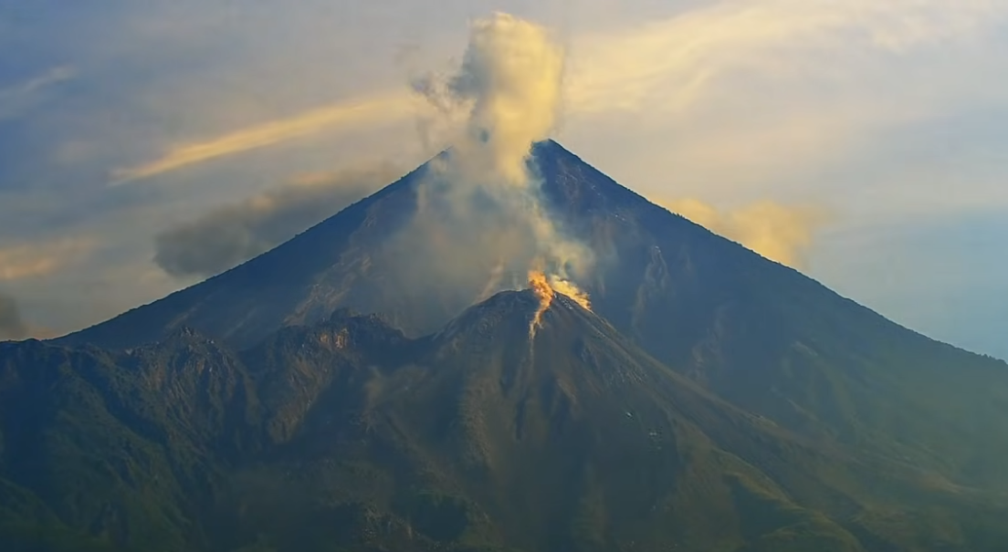
Weak to moderate explosions are being recorded at a rate of 1 to 4 per hour, propelling gas and ash columns up to 800 meters in altitude. These columns are drifting northeastward with the wind. Incandescence is visible at the dome, as is the shedding of incandescent rock blocks onto the western, southwestern, and southern flanks.
Ashfall is possible over Las Majadas, El Chorro, and surrounding areas due to wind direction. Due to the significant accumulation of rocky material, the « Domo Caliente » (Hot Dome) and the promontory above the lava flow could collapse and generate long-range pyroclastic density currents moving southwest; therefore, the recommendations in special bulletin BESAN-016-2026 should be followed.
Source : Ovsicori
Photo : Afar tv.
La Réunion , Piton de la Fournaise :
Monthly Bulletin. Institut de physique du globe de Paris / Piton de la Fournaise Volcanological Observatory. September 2026.
Observations
During September 2026, the OVPF-IPGP recorded a total of the following events at the Piton de la Fournaise massif:
• 222 shallow volcano-tectonic earthquakes (0.2 to 1.5 km above sea level), mostly beneath the Bory and Dolomieu summit craters;
• 60 deep earthquakes (below sea level) located beneath the western part of the terminal cone;
• 142 rockfalls or collapses.
September 2026 was marked by an increase in activity beneath Piton de la Fournaise, with 222 shallow volcano-tectonic earthquakes (above the shallow magma reservoir) and 60 deep earthquakes located at depths of 6 to 8 km below sea level, west of the summit. The majority of these earthquakes were of low magnitude (M<1), preventing precise localization of the events. The rise in shallow seismicity was particularly pronounced from September 17, 2026, onwards, indicating increased pressurization of the shallow reservoir.
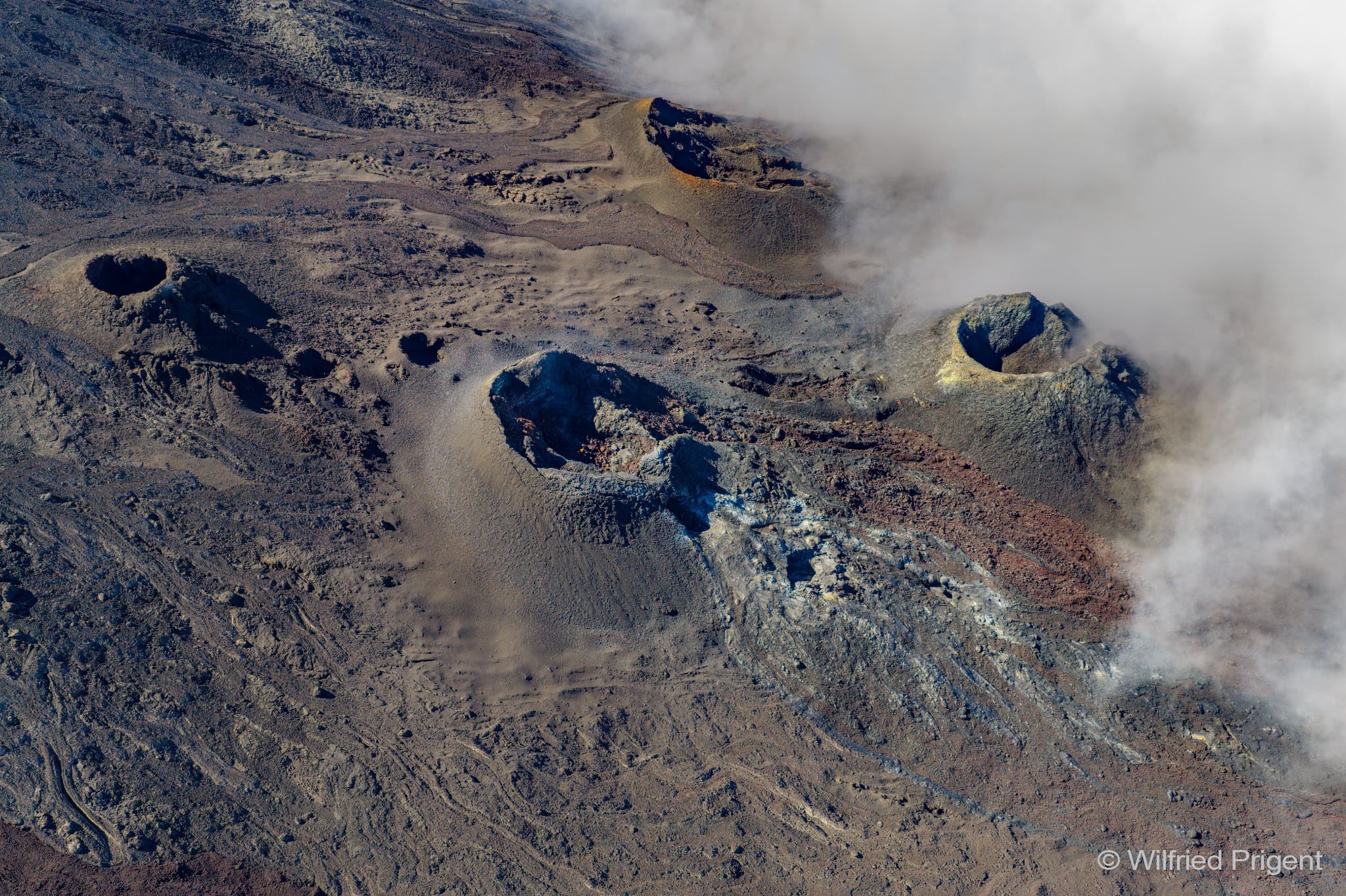
142 rockfalls were also observed. As in previous months, these rockfalls were located partly at the summit of Piton de la Fournaise and the Rivière de l’Est escarpment, but also at the eruptive cones and recent lava flows on the east-southeast flank of Piton de la Fournaise.
Deformation
Following the cessation of inflation observed in June 2026, inflation of the edifice has been recorded since early August 2026, accompanied by a slight increase in the distances between station pairs located on either side of the summit craters.
The expansion of the summit area since early August amounts to approximately 2 cm. Displacement vectors and the 3D linear strain map indicate an inflation source located beneath the summit of the edifice.
Numerical modeling of the sources driving these deformations indicates that, for the period from August 1 to September 31, 2026, there was a primary inflating source centered beneath the summit area at an elevation of approximately 1.6 km above sea level. A secondary deflating source is located at a depth of approximately 10 km below sea level.
The shallow source could be linked to the pressurization of a shallow magma reservoir.
Summary
In September 2026, inflation of the edifice persisted, indicating continued pressurization of the shallow magma reservoir. An increase in shallow seismicity has been observed since September 17, reflecting an acceleration of activity beneath the summit. Deep seismic activity also persisted throughout the month, potentially suggesting deep-seated fluid movement.
It should be noted that this process of shallow reservoir pressurization can last from several weeks to several months before the reservoir roof ruptures—leading to magma injection toward the surface and potentially an eruption—but it may also cease without resulting in an eruption in the short term.
Source : OVPF.
Photo : Wilfried Prigent / ovpf/FB.