October 26 , 2026.
La Réunion , Piton de la Fournaise :
Indonesia , Karangetang :
Seismic data
5 deep volcanic earthquakes, with an amplitude of 5.0 to 30.0 mm and a duration of 12.0 to 23.0 seconds.
7 shallow volcanic earthquakes, with an amplitude of 2.0 to 4.0 mm and a duration of 9.0 to 16.0 seconds.
4 hybrid/multi-phase earthquakes, with an amplitude of 2.0 to 5.0 mm and a duration of 15.0 to 17.0 seconds.
133 emission-related earthquakes, with an amplitude of 7.0 to 50.0 mm and a duration of 25.0 to 113.0 seconds.
3 eruption-related earthquakes, with an amplitude of 50.0 mm and a duration of 103.0 to 260.0 seconds.
56 harmonic tremors, with an amplitude of 2.0 to 50.0 mm and a duration of 39.0 to 489.0 seconds.
86 rockfall-related earthquakes, with an amplitude of 2.0 to 10.0 mm and a duration of 22.0 to 110.0 seconds.
5 distant tectonic earthquakes, with an amplitude of 5.0 to 20.0 mm and a duration of 67.0 to 381.0 seconds.
30 non-harmonic tremors, with an amplitude of 2.0 to 50.0 mm and a duration of 53.0 to 526.0 seconds.
Recommendations
(1) The public, as well as visitors and tourists, are advised not to approach, hike in, or conduct any activities within the designated danger zone. This zone encompasses a 1.5 km radius around the summits of Kawah Dua (the northern crater) and the main crater (the southern crater), as well as an extended sector reaching 2.5 km toward the south-southwest.
(2) Remain vigilant regarding the risk of lava avalanches and pyroclastic flows, which may occur at any time due to the instability of previously accumulated volcanic materials—which remain prone to collapse—particularly in the areas located to the south, southeast, west, and southwest.
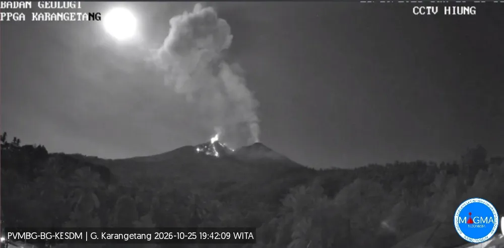
Source et photo : PVMBG
Hawaii , Kilauea :
HAWAIIAN VOLCANO OBSERVATORY DAILY UPDATE, U.S. Geological Survey (USGS)
Sunday, October 25, 2026, 8:37 a.m. HST (Sunday, October 25, 2026, 6:37 p.m. UTC)
19°25’16 » N 155°17’13 » W
Summit elevation: 4,091 ft (1,247 m)
Current Volcano Alert Level: ADVISORY
Current Aviation Color Code: YELLOW
Summary:
The eruption of Kīlauea within Halema’uma’u crater is currently paused, following the conclusion of the lava fountaining associated with Episode 55 on October 17. Re-inflation of the summit continues today; forecasts indicate that Episode 56, characterized by lava fountaining, is expected to occur between October 30 and November 5, 2026.
Overview:
The summit eruption of Kīlauea, located within Halemaʻumaʻu crater, is paused following the lava fountaining observed during Episode 55 on October 17, 2026. Data from tiltmeters installed at the summit show that re-inflation began immediately after the end of Episode 55 and is continuing at a slow, steady pace. Assuming that the re-inflation of the magma chamber follows patterns observed in the past, Episode 56—characterized by lava fountaining—is expected to occur between October 30 and November 5, 2026.
.
Summit observations:
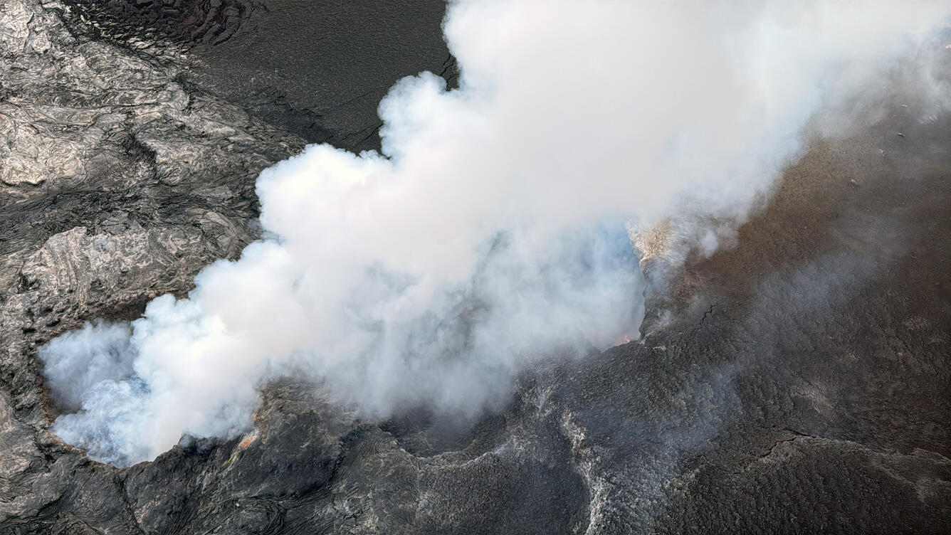
An intense, continuous glow was observed again overnight at the West vent, while a low-to-moderate intensity glow was visible at the North vent, within Halema’uma’u crater. No glow was perceptible at the South vent, which was covered by a layer of tephra during Episode 55.
Continuous, low-intensity seismic tremor has persisted over the last 24 hours, punctuated at times by more pronounced jolts. This type of seismic signal is characteristic of the pauses between eruptive episodes. Two earthquakes were recorded in the summit area over the past 24 hours.
Ground tilt indicating steady reinflation has continued over the last 24 hours. The UWD tiltmeter recorded a total tilt of 13.3 microradians, reflecting inflation since the end of Episode 55. During Episode 55, a tiltmeter located at the summit, at Uēkahuna (UWD), had measured a tilt of 21 microradians, reflecting deflation. The ground tilt trends observed following the lava-fountaining phases are comparable to those recorded prior to Episode 54.
During the lulls between episodes, the sulfur dioxide (SO2) emission rate at the summit typically ranges between 1,000 and 5,000 tonnes per day. Weather forecasts indicate light winds from the northeast, which will push the gas plume toward the southwest today, over the Kaʻū Desert.
Observations in the rift zones:
Seismic activity and ground deformation remain low in both the East Rift Zone and the Southwest Rift Zone. SO2 emissions from the East Rift Zone remain below the detection threshold. No significant ground deformation has been recorded in either of these rift zones.
Source : HVO.
Photo : USGS / L. DeSmither.
Chile / Argentina , Nevados de Chillan :
SPECIAL REPORT ON VOLCANIC ACTIVITY, October 25, 2026
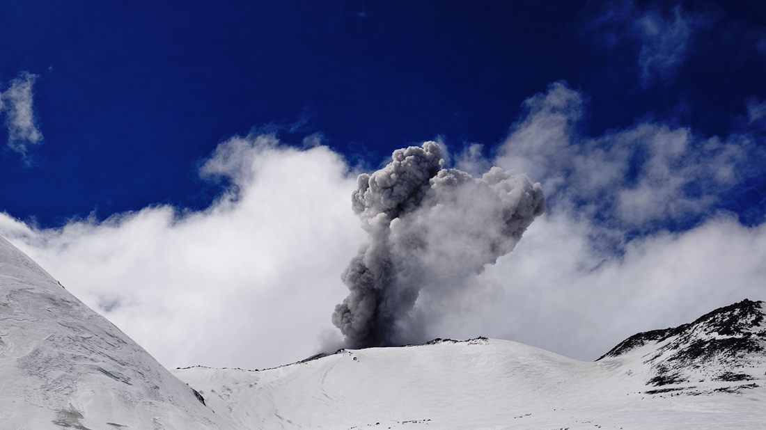
The Argentine Geological and Mining Service (SEGEMAR), through its Argentine Volcanic Monitoring Observatory (OAVV), reports that today, Sunday, October 25, 2026, between 13:23 local time (16:23 UTC) and 18:16 local time (21:16 UTC), volcanic monitoring stations installed in the vicinity of the Nevados de Chillán volcanic complex—belonging to OVDAS—recorded at least 6 minor eruptive episodes. These were characterized by the emission of pyroclastic material and gases, with columns reaching heights between 800 m and 2,300 m above the crater rim, dispersing primarily toward the southeast (SE).
Details of the most significant event recorded:
Reduced displacement: 69 cm²
Column height: 2,300 m above the crater rim
Direction of dispersion: Southeast (SE)
OBSERVATIONS:
At the time of this report’s publication, recurring explosive activity continues at the volcano’s active crater. As noted in previous reports, the occurrence of similar—or even more intense—events cannot be ruled out. Based on available information, the recorded events have remained localized to areas near the active craters; to date, no populations within Argentine territory have been affected.
CONCLUSIONS:
The technical alert level remains in place, and monitoring of the volcano continues in constant communication with Chile’s Southern Andes Volcanological Observatory (OVDAS); any further developments will be reported.
Colombia , Galeras :
San Juan de Pasto, October 20, 2026, 4:21 PM
As part of the ongoing monitoring of activity at the Galeras volcano, the Colombian Geological Service (SGC)—an agency under the Ministry of Mines and Energy—reports the following:
During the week of October 13 to 19, 2026, the primary changes in monitored parameters, compared to the previous week, were as follows:
● Amidst stable volcanic behavior, a decrease was recorded in both the frequency of seismic events and the total seismic energy released. Most of this seismicity remained associated with rock-fracturing processes and, to a lesser extent, with fluid dynamics within the volcanic edifice.
● A magnitude 1.3 earthquake was located 2.8 km east of the main crater, at a depth of 5.9 km below the summit (4,270 m above sea level).
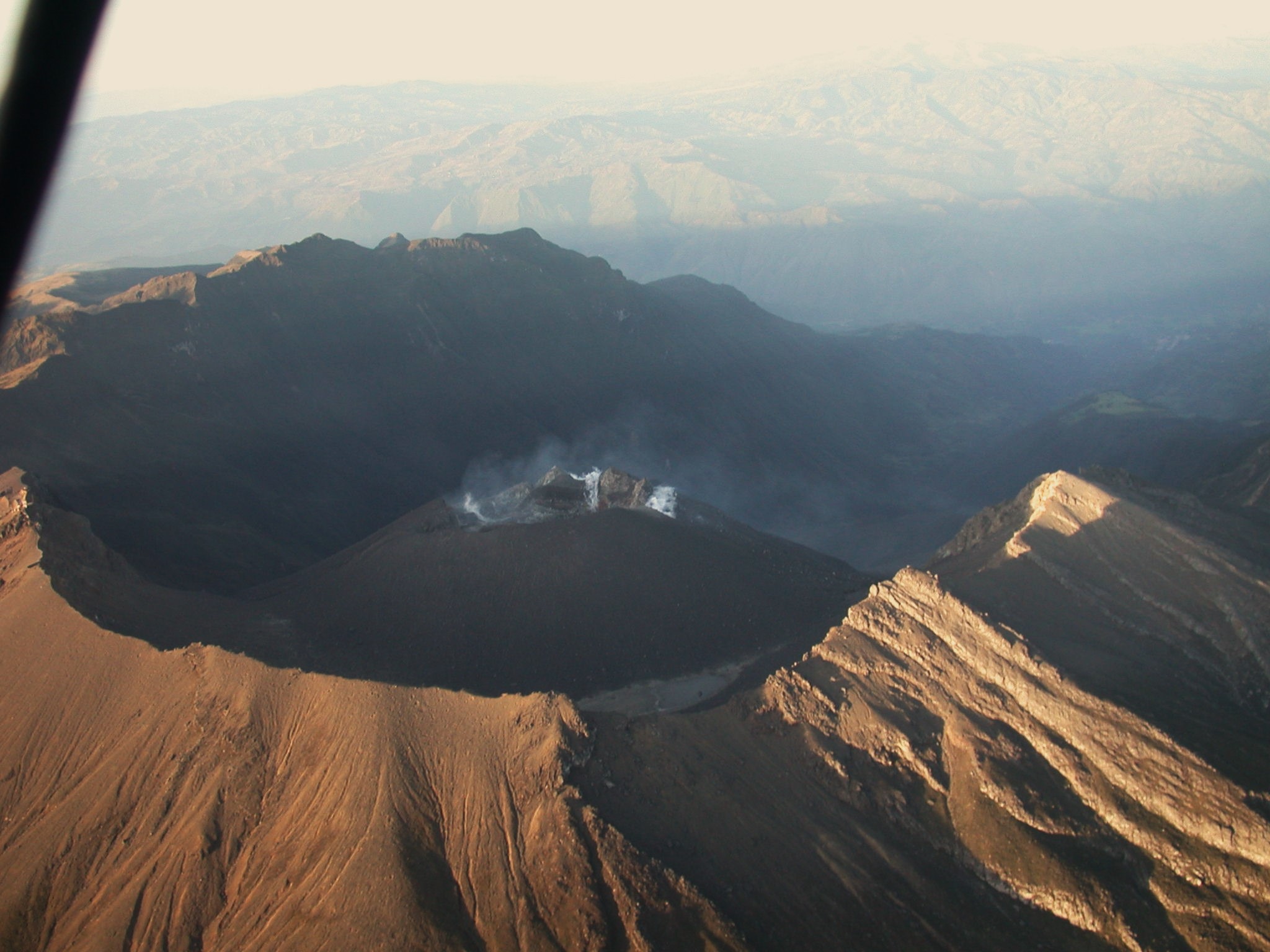
● Gas emissions, appearing as low-altitude, white-colored plumes, were observed; these dispersed according to the wind direction. The emissions originated primarily from the « El Paisita » (to the north) and « Las Chavas » (to the west) fumarole fields, as well as from the main crater.
● Other volcanic monitoring parameters remained stable.
In light of the above, the SGC recommends closely monitoring the situation through weekly bulletins and other information released via our official channels, and adhering to the instructions provided by local and departmental authorities, as well as those from the National Unit for Disaster Risk Management (UNGRD).
Volcanic activity remains at the « Yellow » alert level: an active volcano exhibiting changes in the baseline behavior of monitored parameters, along with other manifestations.
Source et photo : SGC