May 11 , 2026.
Italy , Stromboli :
Stromboli Activity Update, May 11, 2026, 01:41 (23:41 UTC)
The National Institute of Geophysics and Volcanology, Etna Observatory, reports that monitoring cameras have observed continuous effusive activity since 22:40 UTC, due to lava overflows in the North Crater area. This activity is producing a lava flow whose front is located in the upper-middle sector of the Sciara del Fuoco.
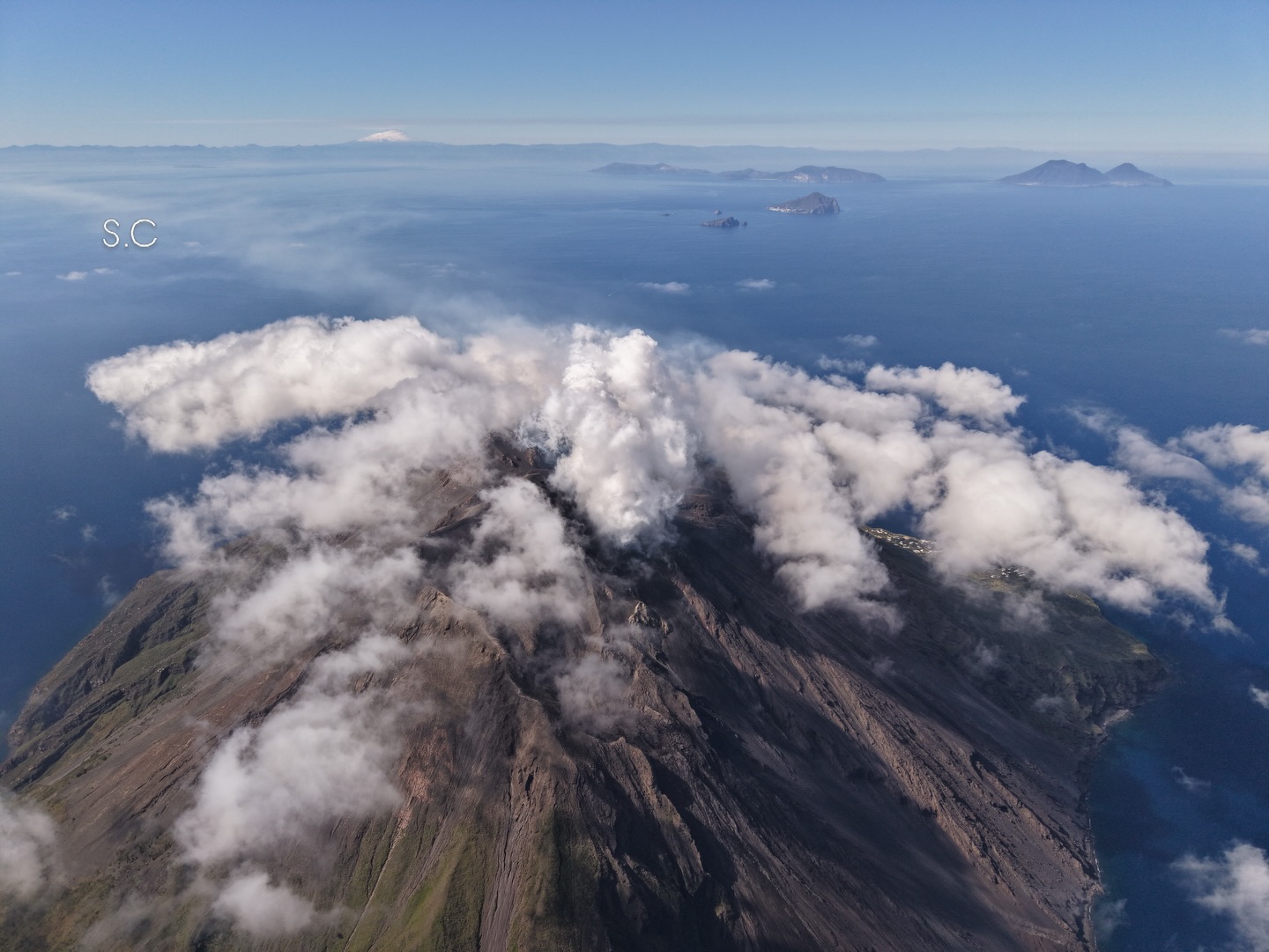
From a seismic perspective, the average amplitude of volcanic tremor shows an upward trend and has been high for about an hour. No significant changes have been observed in the frequency and amplitude of explosion earthquakes.
Deformation data from the GNSS (HF) network currently show no significant changes.
Further information will be released soon.
Source : INGV.
Photo : Stromboli stati d’animo / Sebastiano Cannavo
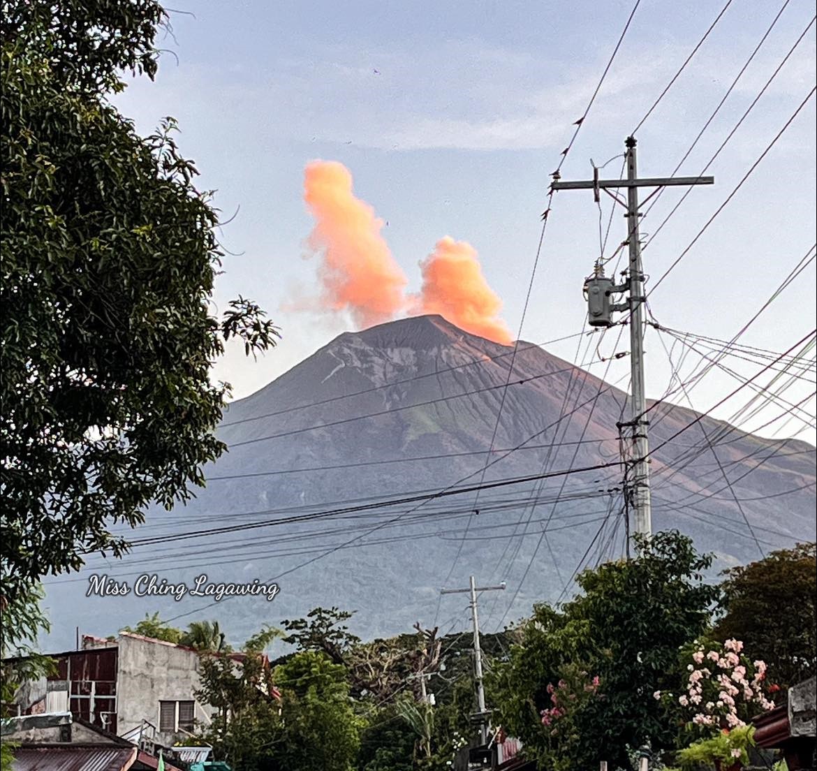
Philippines , Kanlaon :
KANLAON VOLCANO ADVISORY , 11 May 2026 , 1:30 AM
Notification of crater glow or banaag at Kanlaon Volcano.
Since 4 November 2024, invisible emissions of superheated volcanic gas plumes from the Kanlaon Volcano summit crater have been occasionally detected at nighttime by infra-red and high-resolution camera monitoring by the Kanlaon Volcano Observatory (KVO). Superheated gas activity has persisted this year, becoming more frequent since 13 April 2026. At around 7:00 PM of 10 May 2026, KVO reported observing with the naked eye for the first time incandescence at the Kanlaon Volcano summit caused by superheated volcanic gas, followed by netizen reports of the same observations. Such a phenomenon when it becomes visible to the naked eye is called crater glow or banaag, a common precursor of magmatic eruption at Mayon Volcano. While this is a new development, monitoring parameters have persisted in approximately the same level after Kanlaon’s last moderately explosive eruption on 15 March 2026. Since then, seismicity remained at the steady rate of six (6) volcano-tectonic earthquakes/day, while sulfur dioxide (SO2) gas emissions based on campaign mDOAS measurements averaged 1,646 tonnes/day and have increased only slightly to 2,382 tonnes/day this past week. Ground deformation parameters have been non-steady but still indicate a sustained and slow-rate inflation of the volcano edifice since 2022. Nonetheless, if crater glow becomes sustained and intensifies, this would indicate that magma is close or at the crater and could warn of increasing chances of magmatic unrest within days.
The public is reminded that while Alert Level 2 prevails over Kanlaon, the alert status may step up to Alert Level 3 should magmatic eruption be forewarned by sustained and intensifying crater glow or banaag at the summit crater. Magmatic eruption would generate life-threatening volcanic hazards such of pyroclastic density currents or PDCs, lava flows, ballistic projectiles, ashfall, rockfall and others. It is strongly recommended that communities within the 4-km radius Permanent Danger Zone or PDZ strictly remain evacuated and those within the PDC Hazard Zones be vigilant and ready for evacuation in case the chances of magmatic eruption increase. Local government and DRR partners must ready their response measures, paying special attention to the vulnerable members of the community including the elderly, those with medical conditions, expecting mothers and infants. In addition, increased vigilance against potential syn-eruption lahars and sediment-laden streamflow in channels draining the edifice is strongly advised should intense rains occur during eruptive unrest. Civil aviation authorities must also advise pilots to avoid flying close to the volcano’s summit as ash from any sudden eruption can be hazardous to aircraft.
DOST-PHIVOLCS maintains close monitoring of Kanlaon Volcano and any new development will be immediately communicated to all concerned stakeholders.
Source : DOST-PHIVOLCS
Photo : Miss Ching Lagawing
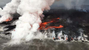
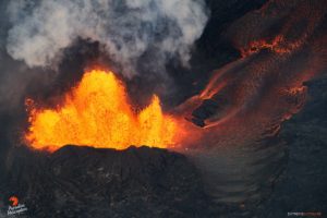
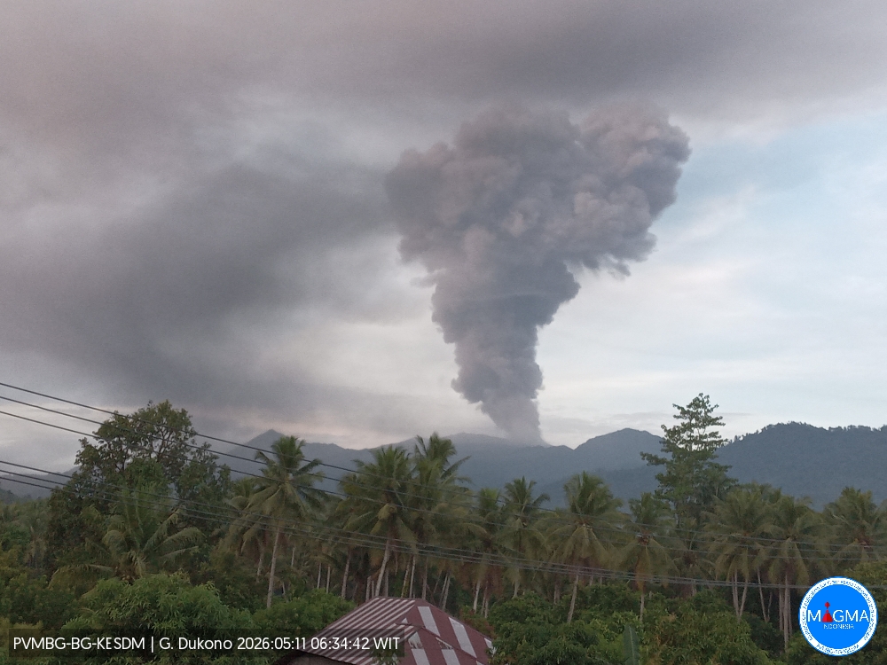
Indonesia , Dukono :
An eruption of Mount Dukono occurred on Monday, May 11, 2026, at 06:30 WIT, with an observed ash column height of approximately 2700 m above the summit (approximately 3787 m above sea level). This gray-black ash column was highly intense and extended northward. At the time of writing, the eruption was still ongoing.
Seismic Observations
63 eruption earthquakes with amplitudes ranging from 6 to 34 mm and durations from 32.54 to 229.2 seconds.
3 distant tectonic earthquakes with amplitudes between 6 and 7 mm and durations from 100.16 to 143.06 seconds.
1 continuous seismic tremor with amplitudes between 1 and 4 mm, predominantly 2 mm.
Recommendations
(1) Residents living near Mount Dukono and visitors/tourists are advised to refrain from any activity, climbing, or approaching the Malupang Warirang crater within a 4 km radius.
(2) Considering that eruptions with volcanic ash occur periodically and that the distribution of ash follows the direction and speed of the wind, so that the area where the ash lands is not constant, people living around Mount Dukono are advised to always carry masks/face coverings and mouth coverings to use when needed to avoid the threat that volcanic ash poses to the respiratory system.
Source et photo : PVMBG.
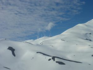
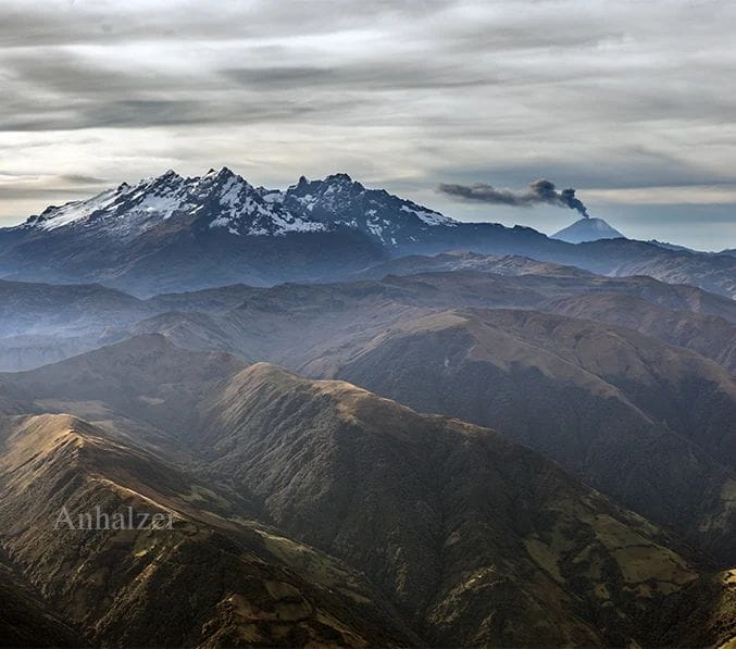
Ecuador , Sangay :
DAILY REPORT ON THE STATE OF SANGAY VOLCANO, Sunday, May 10, 2026.
Geophysical Information Institute – EPN.
Surface Activity Level: High, Surface Trend: No Change
Internal Activity Level: Moderate, Internal Trend: No Change
Seismicity: From May 9, 2026, 11:00 AM to May 10, 2026, 11:00 AM:
Seismicity:
Explosion (EXP): 55
Rainfall/Lahars:
Rainfall has been recorded in the volcano area, but it has not generated any mudflows or debris flows. **In the event of heavy rainfall, accumulated material could be remobilized, causing mudflows and debris flows that would cascade down the volcano’s flanks and into nearby rivers.**
Emissions/Ash Column:
Due to adverse weather conditions, it was not possible to observe gas and ash emissions, either through the monitoring camera system or satellite imagery. Furthermore, the Washington VAAC has not issued any reports regarding volcanic activity.
Note:
From yesterday afternoon until the time of writing this report, the volcano has remained completely obscured by clouds.
Alert Level: Yellow
Source : IGEPN
Photo : Jorge Anhalzer ( archive).
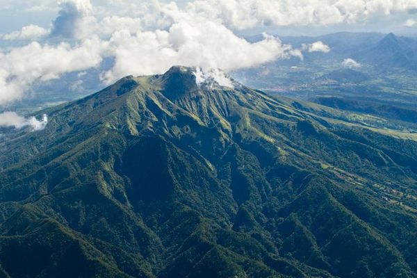
La Martinique , Mount Pelée :
Weekly Report, Paris Institute of Earth Physics / Martinique Volcanological and Seismological Observatory
Saint-Pierre, May 8, 2026, 4:15 PM local time (GMT-4)
Between May 1, 2026, 4:00 PM UTC and May 8, 2026, 4:00 PM UTC, the Martinique Volcanological and Seismological Observatory (OVSM) recorded 336 volcanic earthquakes:
• 328 volcano-tectonic earthquakes. Among them, 22 had a magnitude (local magnitude Mlv or duration magnitude Md) greater than 0.5 and 5 had a magnitude greater than 1. The largest had a magnitude Mlv of 1.3. The others were of lower energy. The vast majority of these earthquakes were located at depths between 0.4 and 1.7 km below the volcano’s summit. However, one earthquake was preliminaryly located at a depth of 4.4 km below sea level, directly beneath Mount Pelée. This volcano-tectonic seismicity is associated with microfracturing within the volcanic edifice, linked to the overall reactivation of the volcano observed since 2019.
• Eight shallow hybrid earthquakes were recorded. Among them, four had a local magnitude (Mlv) greater than 0.5. The largest had a magnitude Mlv of 0.7. The others were of lower energy. These earthquakes were located primarily in the same areas as the shallow volcano-tectonic earthquakes. The seismic signals of these types of earthquakes are enriched in low frequencies and are associated with the circulation of fluids (gases, hydrothermal fluids) within the volcanic edifice. No earthquakes were felt by the population.
The previous week, the OVSM (Swiss Volcanic Observatory) recorded 494 volcanic earthquakes. As of May 8, 2026, and over the past four weeks, the OVSM has observed a total of 1,801 volcanic earthquakes, an average of 450 to 451 earthquakes per week.
During periods of volcanic reactivation of volcanoes similar to Mount Pelée, seismic activity of varying intensity and frequency is common. The probability of an eruptive activity in the short term remains low.
However, based on observations accumulated in recent years, and particularly in recent months, a change in the situation in the medium term (weeks to months) cannot be ruled out. For more details on observations and interpretations of volcanic activity over the longer term, please refer to the OVSM’s monthly bulletins. The volcanic alert level, in accordance with the measures implemented by the authorities, is currently YELLOW: vigilance.
Source : Direction de l’OVSM-IPGP.
Photo : Parc naturel Martinique