March 28 , 2026.
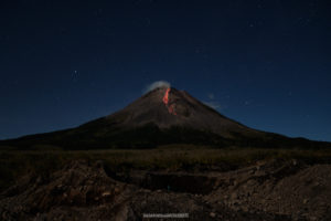
La Réunion Island , Piton de la Fournaise :
The Observatoire Volcanologique du Piton de la Fournaise (OVPF) reported that the eruption at Piton de la Fournaise intensified during 18-25 March and then ended in the early evening on 25 March. The eruption was characterized by activity at the main cone on the lower SE flank of Dolomieu Crater, lava flows being transported though lava tubes E in two main branches, a N and S flow, and an active ocean entry. On 18 March the lava effusion rate, estimated using satellite data, increased with peak values of 16 cubic meters per second. That same day lava flows were active on the upper part of the N flow; the distal end of the N flow had stalled on 16 February, stopping at about 660 m elevation or about 2.6 km from the National Road 2 (RN2). Lava fountaining resumed at the main cone on 19 March with jets of lava rising tens of meters above the cone’s rim. The S flow continued to produce lava breakouts both above and below RN2, and both enlarged the platform at the ocean entry. OVPF scientists measured lava temperatures up to 1,130 degrees Celsius as it reached the ocean. Acidic plumes composed of sea water, steam, and volcanic gases rose at the points where lava contacted ocean water.
The platform at the ocean entry continued to build during 21-24 March, though less lava was reaching the platform, and mainly reaching the ocean through tubes. Small collapses occurred along the platform’s margins due to wave action, though by 24 March the platform extended the coastline by about 193 m and was at least 840 m wide along the pre-existing coastline. Lava flow rates declined and were estimated to be as high as 13 cubic meters per second during 22-23 March. Deflation signals distinctly slowed by 23 March and ceased at the summit by 24 March. Lava fountaining continued at the main cone and the cone filled with lava; during 22-24 March lava overflowed the crater rim multiple times. Tremor indicating lava effusion and gas flux decreased during 0500-0700 on 24 March and the amplitude dropped sharply at 0700. Seismicity below the summit was lower during 22-23 March then increased on 24 March but remained below levels detected during the peak of deflation. Tremor levels fluctuated during 24-25 March. The S flow ceased being active at around 1630 on 25 March. The Alert Level remained at 2.2 (on a 0-4 scale).
Sources : Observatoire volcanologique du Piton de la Fournaise (OVPF) , GVP.
Photo :D. Dupré .
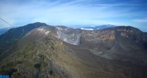
Japan , Suwanosejima :
The Japan Meteorological Agency (JMA) reported that eruptive activity at Suwanosejima’s Ontake Crater continued during 13-20 March. Incandescence was observed nightly in webcam images. An eruptive event on 14 March produced a plume that rose 400 m above the crater rim. Rumbling was heard at the Suwanosejima Branch Office in Toshima village (3.5 km SSW). The Alert Level remained at 2 (the second level on a five-level scale) and the public was warned to be cautious within 1.5 km of the crater.
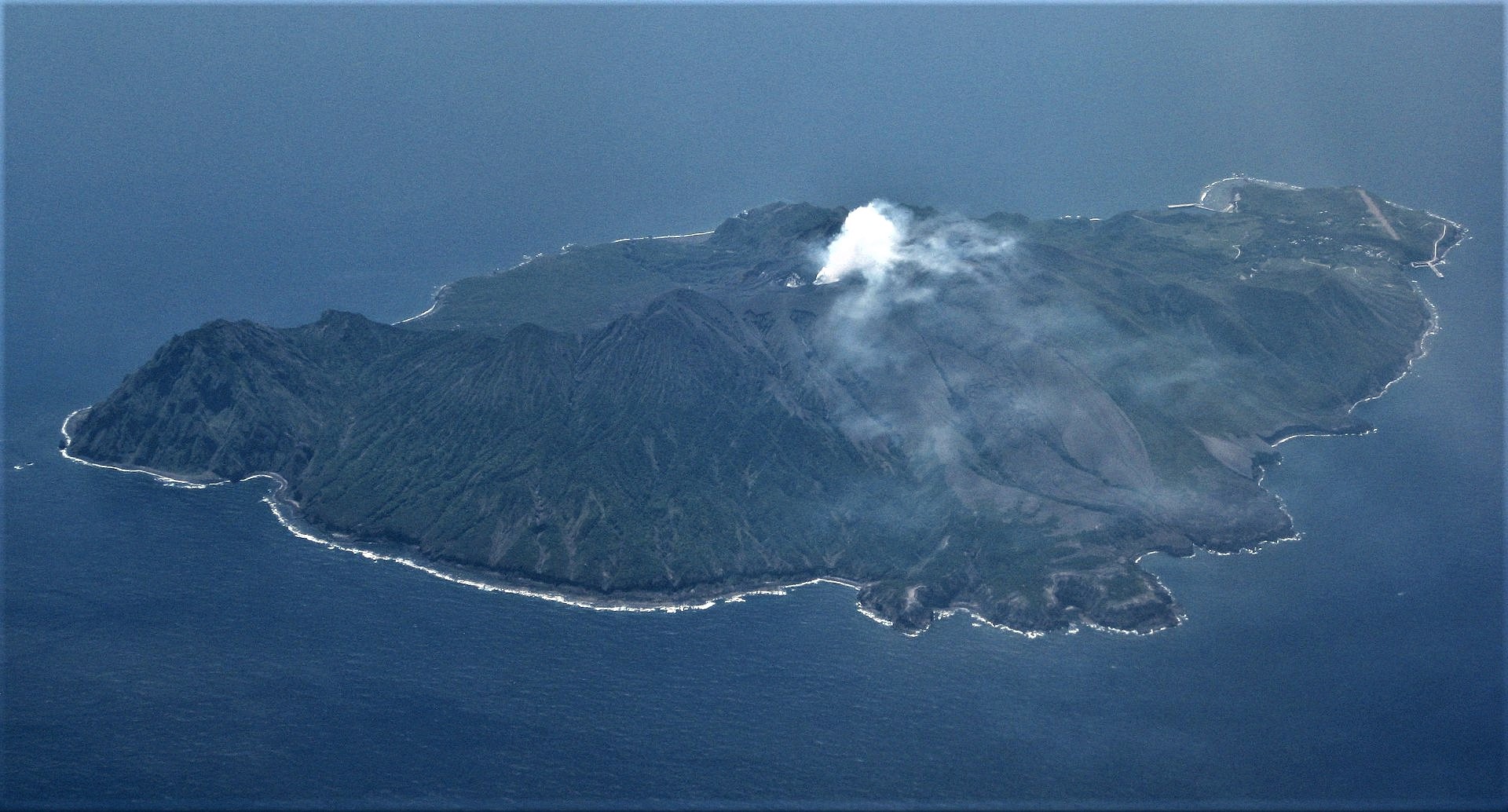
The 8-km-long island of Suwanosejima in the northern Ryukyu Islands consists of an andesitic stratovolcano with two active summit craters. The summit is truncated by a large breached crater extending to the sea on the E flank that was formed by edifice collapse. One of Japan’s most frequently active volcanoes, it was in a state of intermittent Strombolian activity from Otake, the NE summit crater, between 1949 and 1996, after which periods of inactivity lengthened. The largest recorded eruption took place in 1813-14, when thick scoria deposits covered residential areas, and the SW crater produced two lava flows that reached the western coast. At the end of the eruption the summit of Otake collapsed, forming a large debris avalanche and creating an open collapse scarp extending to the eastern coast. The island remained uninhabited for about 70 years after the 1813-1814 eruption. Lava flows reached the eastern coast of the island in 1884. Only about 50 people live on the island.
Sources: Japan Meteorological Agency (JMA) , GVP.
Photo : Ray Go.( archive).
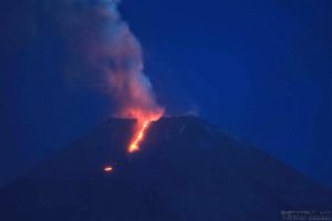
Vanuatu Archipelago , Ambae :
The eruption at Ambae continued during 19-24 March based on ash advisories from the Wellington Volcanic Ash Advisory Center (VAAC). According to the VAAC gas, steam, and ash plumes were visible in webcam and satellite images rising as high as 4.6 km (15,000 ft) a.s.l., or about 3 km above the summit, and drifting S on most days. The plumes were intermittent, occasionally obscured by weather clouds, and sometimes only plumes of gas and steam were identified. Sulfur dioxide emissions were detected on 21 March. The Alert Level remained at 3 (on a scale of 0-5), and the public was warned to stay outside of Danger Zone B, defined as a 3-km radius around the active vents in Lake Voui, and to stay away from drainages during heavy rains.
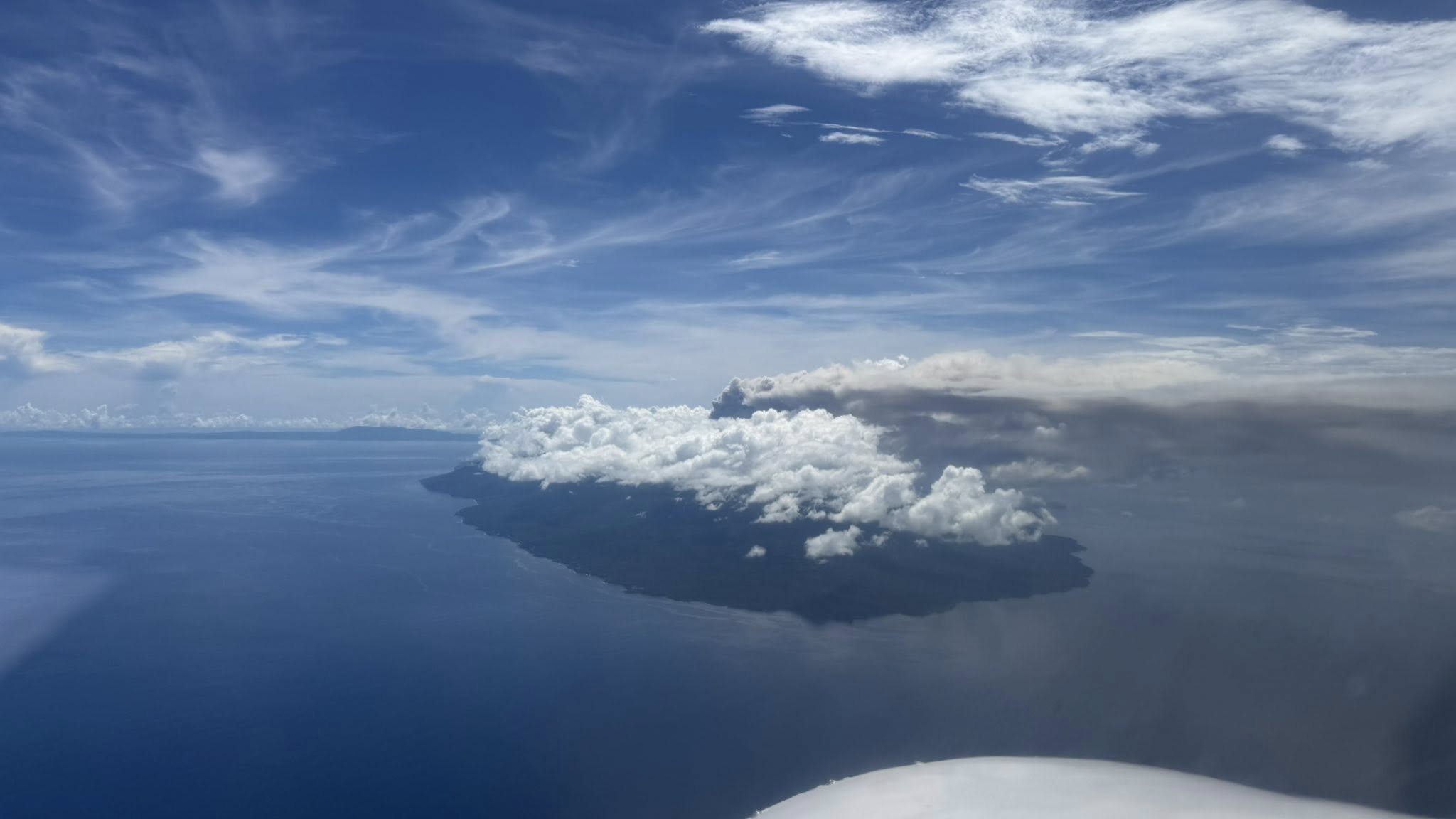
The island of Ambae, also known as Aoba, is a massive 2,500 km3 basaltic shield that is the most voluminous volcano of the New Hebrides archipelago. A pronounced NE-SW-trending rift zone with numerous scoria cones gives the 16 x 38 km island an elongated form. A broad pyroclastic cone containing three crater lakes (Manaro Ngoru, Voui, and Manaro Lakua) is located at the summit within the youngest of at least two nested calderas, the largest of which is 6 km in diameter. That large central edifice is also called Manaro Voui or Lombenben volcano. Post-caldera explosive eruptions formed the summit craters about 360 years ago. A tuff cone was constructed within Lake Voui (or Vui) about 60 years later. The latest known flank eruption, about 300 years ago, destroyed the population of the Nduindui area near the western coast.
Sources: Wellington Volcanic Ash Advisory Center (VAAC) , GVP.
Photo : Unity Airlines Vanuatu
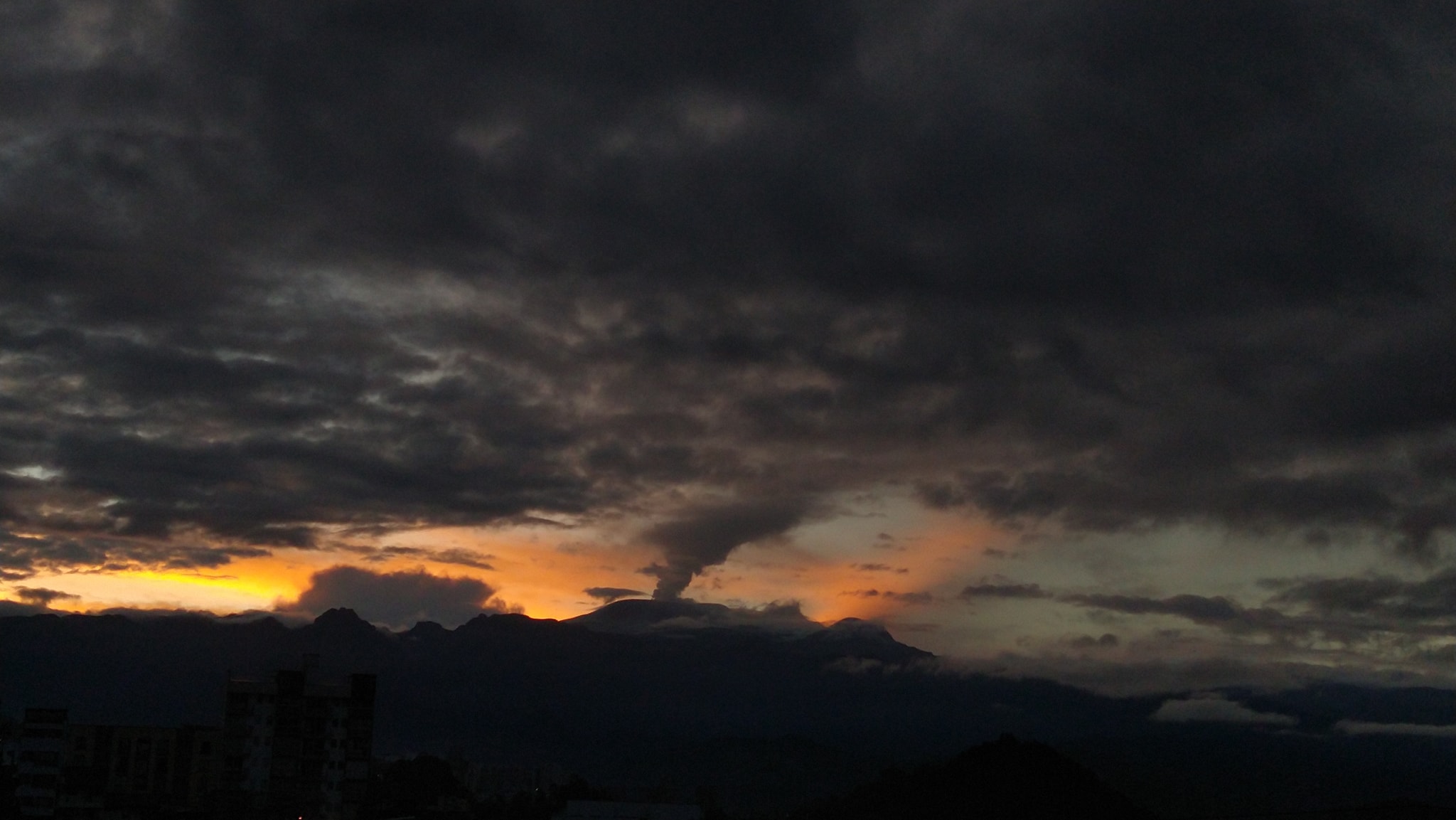
Colombia , Nevado del Ruiz :
Manizales, March 24, 2026, 7:30 PM
Regarding the monitoring of activity at the Nevado del Ruiz volcano, the Colombian Geological Survey (SGC), an agency under the Ministry of Mines and Energy, reports the following:
During the week of March 17-23, 2026, the volcano continued to exhibit unstable behavior. Compared to the previous week, the main variations observed for some monitored parameters are as follows:
– Seismicity associated with fluid dynamics within the volcanic conduits, characterized by short-duration signals, increased in the number of recorded events and in seismic energy released. However, no long-duration seismic signals were recorded. The energy levels of the recorded signals were mostly low and, occasionally, slightly moderate. During this week, no pulsatile ash emission or variation in the apparent temperature of the emitted materials, associated with certain seismic signals, were observed.
Seismic activity associated with rock fracturing processes within the volcanic edifice remained stable, both in terms of the number of recorded events and the seismic energy released. Earthquakes were primarily located in the Arenas crater and on the volcano’s eastern flank, up to 5 km from the crater. More scattered earthquakes were also recorded, to a lesser extent, on other flanks of the volcano, within 12 km of the crater. The depth of the earthquakes ranged from less than 2 km to 8 km below the datum. The highest magnitudes of the week were 1.2 and 1.4. These values correspond respectively to the earthquakes recorded on March 19 at 5:01 a.m. in the Arenas crater (at a depth of 1 km) and on March 22 at 5:06 a.m., 12 km north-northeast of the Arenas crater (at a depth of 7 km).
The emission of water vapor and volcanic gases, primarily sulfur dioxide (SO₂), into the atmosphere continued through the Arenas crater. The estimated SO₂ flux, associated with degassing processes, remained variable, with low values, and decreased compared to the previous week. This decrease is partly attributed to the wind direction, which prevailed toward the eastern flank of the volcano (from east-northeast to south-southeast), where the coverage of the monitoring stations is less extensive. Additional monitoring using satellite data also observed low levels of SO₂ emissions.
– The height of the gas and water vapor column generally remained below 500 m above the summit of the volcano. However, the maximum height reached during the week was 600 m on March 22 at 6:05 PM. The direction of dispersal of the column was variable, with a preferential tendency toward the southeast flank and, to a lesser extent, toward the southwest, south-southeast, and east-northeast flanks of the volcano.
Monitoring of thermal anomalies at the bottom of the Arenas crater using satellite platforms showed that energy levels remained low.
Source : SGC.
Photo : Julian Fernando Aranzazu Henao
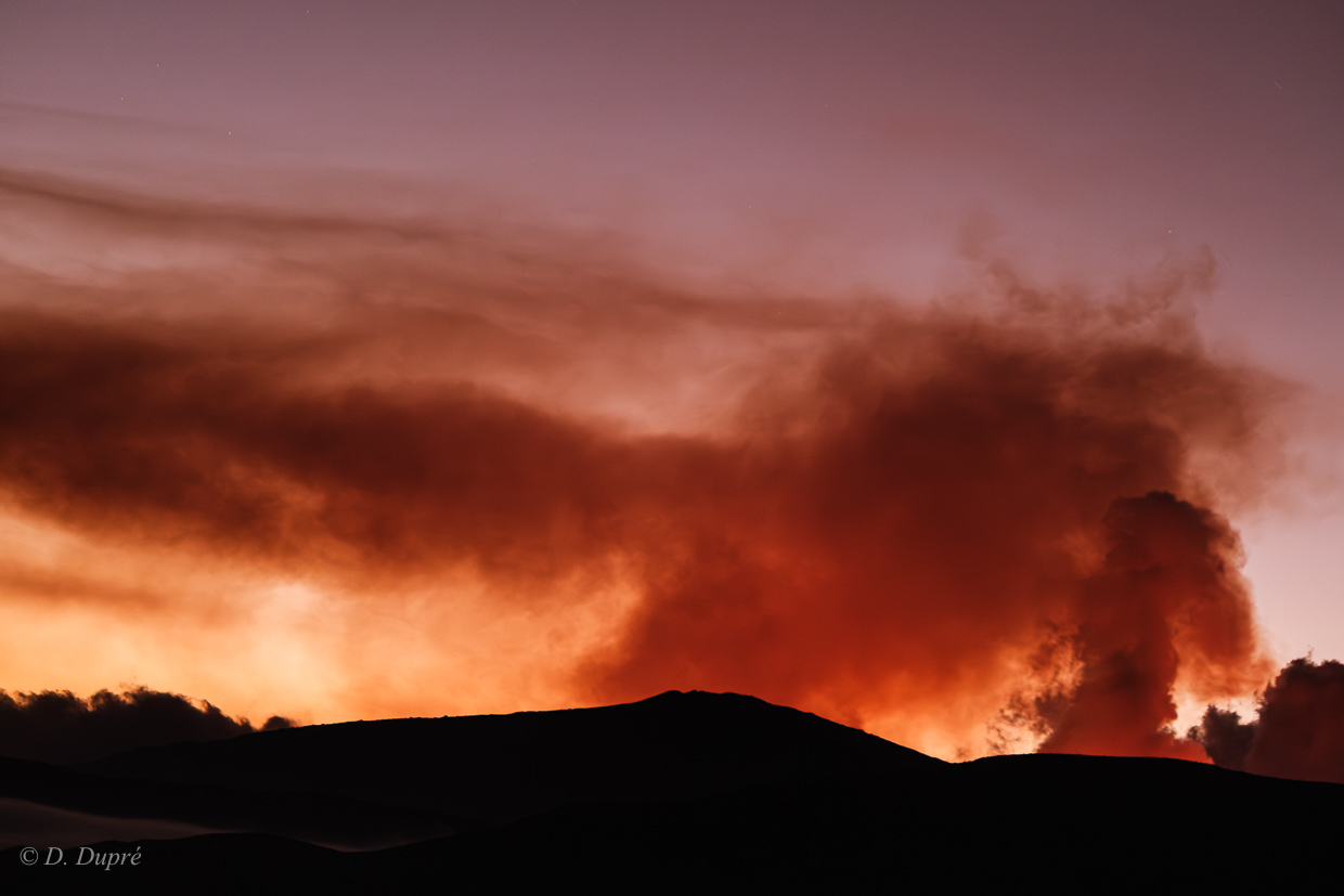
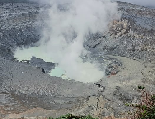
Costa Rica , Poas :
OVSICORI-UNA Volcanic Monitoring Weekly Bulletin, March 27, 2026.
Latitude: 10.20°N;
Longitude: 84.23°W;
Altitude: 2,687 m
Current Activity Level: Alert
Seismic activity at Poás remains dominated by long-period (LP) earthquakes, with a slight decrease in recent days, totaling approximately 100 events per day. On the morning of March 22, seismographs recorded a small swarm of low-amplitude, near-surface volcano-tectonic (VT) earthquakes. At approximately 8:15 a.m., a small eruption without ash emission was recorded, with a plume rich in water vapor and gas escaping from vent A at the bottom of the crater. Seismic tremor increased slightly in intensity on March 22 before decreasing in the following days. It exhibits slight, sporadic variations in intensity, but generally remains relatively stable. The geodetic network does not record any significant crustal deformation.
The Boca A MultiGAS station recorded an increase in the SO₂/CO₂ ratio, rising from values close to 1.1 to a weekly average of 2.1 ± 1.1, with a peak of 3.8 recorded on Saturday, March 21. At the visitor lookout, SO₂ concentrations reached 4.5 ppm. This week, DOAS stations recorded an average SO₂ flux of approximately 70 t/d, with a peak of 350 t/d. The European SENTINEL satellite has detected SO₂ masses not exceeding 80 tonnes in the atmosphere above Lake Poás since January 4, 2016.
The level of this hyperacidic lake began to drop rapidly this week (minimum -1.5 m), it has a milky gray color, and its surface is experiencing significant evaporation.
Source : Ovsicori .
Photo : Sergio Lucena ( archive).