July 31 , 2026.
Italy / Sicily , Etna :
Statement on Mount Etna activity, July 30, 2026, 05:24 (03:24 UTC).
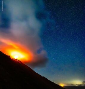
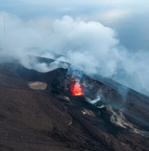
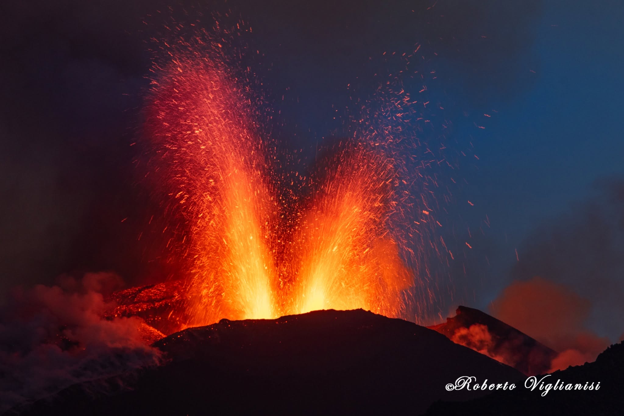
The National Institute of Geophysics and Volcanology (INGV), Etna Observatory, reports that Strombolian activity has been observed at the Voragine crater via the camera network since approximately 01:30 UTC. This activity, which has gradually intensified over the past few hours, is generating ash emissions dispersing towards the northwest.
The average amplitude of volcanic tremor has shown significant fluctuations throughout the day, reaching high levels, and recorded a sudden increase at 01:30 UTC.
The sources are located in the area of the Voragine and Bocca Nuova craters, at an elevation of approximately 3,000 m above sea level. Infrasonic activity is low, and the
event sources are located in the Northeast Crater area. A slight variation was recorded at the DRUV dilatometer station.
Update on Mount Etna activity, July 30, 2026, 12:20 (10:20 UTC).
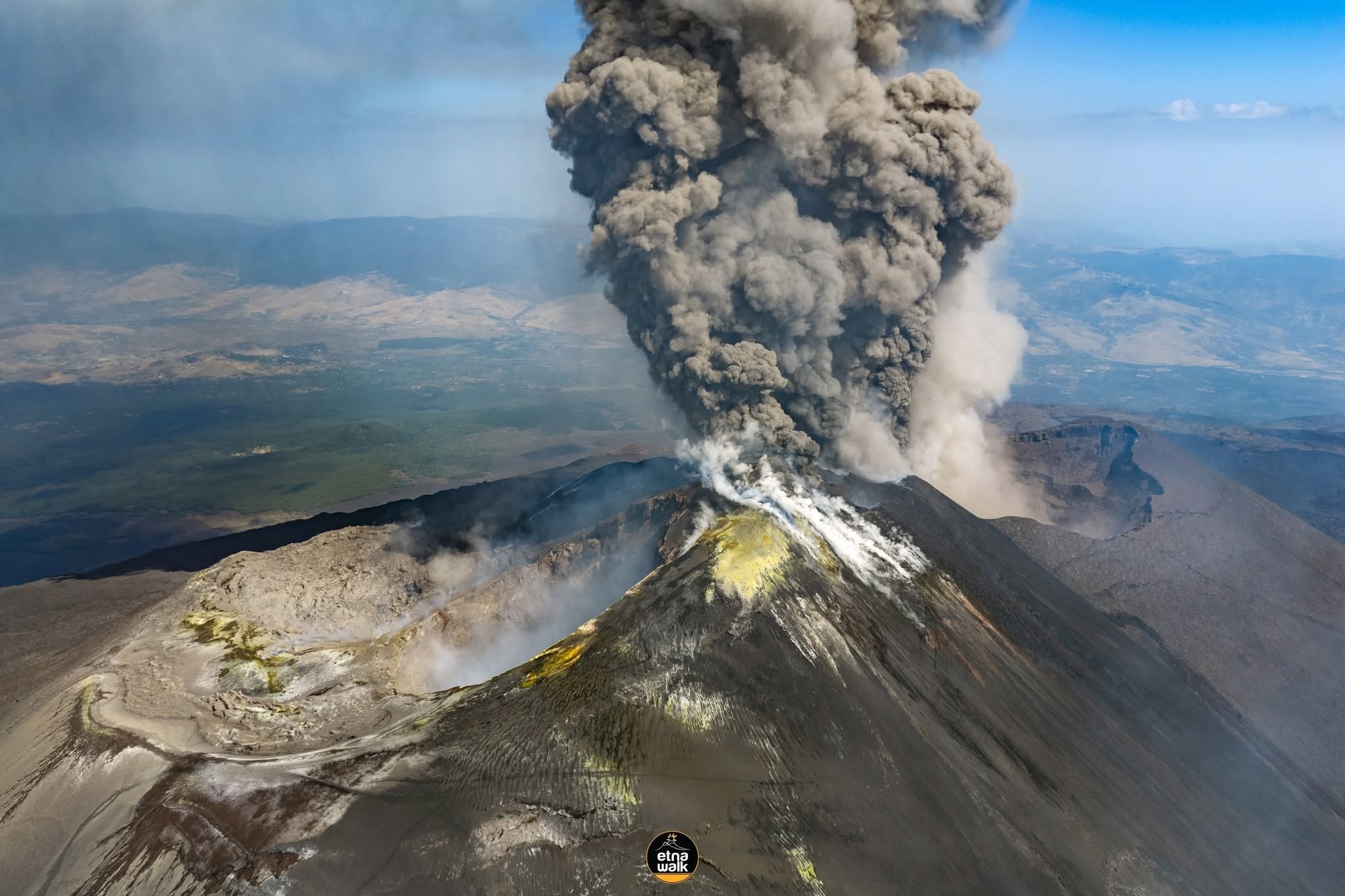
The National Institute of Geophysics and Volcanology (INGV) – Etna Observatory (OE) reports that analysis of images from the OE camera network revealed a small pyroclastic flow originating from the Voragine crater at 07:59 UTC, moving towards the Valle del Bove, an uninhabited area. Strombolian activity at the Voragine crater, which began around 01:30 UTC, intensified gradually throughout the morning, evolving into very vigorous Strombolian activity and subsequently into lava fountaining. Ash emissions increased significantly starting at 07:00 UTC, feeding a plume that reached an altitude of approximately 7 kilometers above sea level and is drifting towards the western sector of the volcano. INGV field personnel reported ashfall over the town of Bronte. Since approximately 08:30 UTC, Strombolian activity has gradually decreased
and is currently very low, although intense ash emissions persist.
Regarding the average amplitude of volcanic tremor: following the increase noted in the previous bulletin, values dropped rapidly starting at 08:00 UTC, while remaining
within a high range. Until approximately 07:00 UTC, the tremor source was located just west of the Voragine and Bocca Nuova craters; Subsequently, it shifted toward the Voragine crater, at an elevation of approximately 3,000 meters above sea level. Regarding infrasonic activity, moderate-energy events localized at the Voragine crater were observed starting at 04:30 UTC; activity levels are currently low. In terms of deformation, the DRUV dilatometer recorded a decompression of approximately 60 nanostrains starting at 01:30 UTC.
During the same period, the Cratere Del Piano (ECP) summit tiltmeter station recorded a variation of approximately one microradian.
Statement on Etna’s activity, July 30, 2026, 21:33 (19:33 UTC).
The National Institute of Geophysics and Volcanology (INGV) – Etna Observatory – reports that effusive activity began at 18:49 UTC in the upper part of the Valle del Leone, at an elevation of approximately 2,700 meters, based on observations by INGV personnel. Strombolian activity continues at the Voragine crater, generating a lava flow that is spilling into the Northeast Crater, as well as an ash plume drifting towards the southwest. Finally, ashfall has been reported in the Monte Denza area.
Since the last update (issued at 10:20 UTC), the average volcanic tremor amplitude has remained high, showing an upward trend; it experienced a sudden increase starting around 17:00 UTC, peaking around 18:00 UTC. Currently, the amplitude remains at a high level. The tremor source was located in the Voragine crater area (at an elevation of approximately 3,000 m) until 17:00 UTC, after which it shifted between the Voragine and Bocca Nuova areas. Infrasonic activity intensified from 17:10 UTC, with the event rate reaching a very high level around 18:00 UTC; it is currently decreasing. The sources of these events are located at the Voragine crater.
Regarding ground deformation, the DRUV dilatometer station has recorded a decompression of approximately 180 nanostrains since the activity began. During the same period, the Cratere Del Piano (ECP) summit tiltmeter station recorded a variation of approximately 2.5 microradians.
Further information will be provided as soon as possible.
Source : INGV.
Photos : Etna Walk /Giuseppe Distefano / Marco Restivo , Roberto Viglianisi .
Philippines , Bulusan :
The Philippine Institute of Volcanology and Seismology (PHIVOLCS) reported increased seismicity at Bulusan in a 28 July advisory, noting that a total of 109 volcanic earthquakes were recorded by the seismic network during 0000-1500. The seismicity mostly consisted of volcano-tectonic earthquakes associated with rock fracturing located at shallow depths beneath the edifice. Weak-to-moderate gas emissions rose from the summit crater and active vents; sulfur dioxide emissions were low levels, averaging 50 tonnes per day on 21 July.
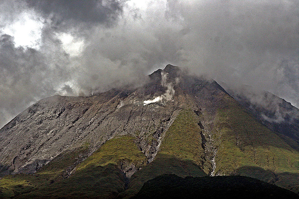
The Alert Level remained at 1 (the second lowest level on a scale of 0-5). The public was reminded not to enter the 4-km-radius Permanent Danger Zone (PDZ) and to exercise vigilance within the 2-km Extended Danger Zone (EDZ) on the SE sector. Pilots were warned not to fly close to the summit because of the potential of ash plumes from phreatic eruptions.
Sources : Philippine Institute of Volcanology and Seismology (PHIVOLCS) , GVP.
Indonesia , Anak Krakatau :
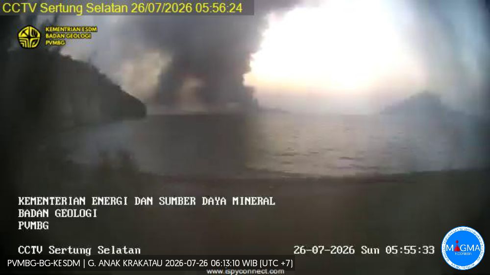
The Center for Volcanology and Geological Hazard Mitigation (PVMBG) reported ongoing eruptive activity at Krakatau from July 23 to 29. A white, gray, and black ash plume rose up to 300 m above the summit on July 25, and a white and gray ash plume rose 100 m above the summit on July 26. The alert level remained at 2 (on a scale of 1 to 4), and the public was advised to stay 2 km away from the summit.
Seismic observations
1 low-frequency earthquake with an amplitude of 4.4 mm and a duration of 5 seconds.
4 hybrid/multiphase earthquakes with amplitudes ranging from 4.3 to 13 mm; durations varied from 6 to 11 seconds.
1 episode of continuous tremor with an amplitude of 0.5 to 3 mm (dominant amplitude of 1 mm).
Recommendations
The public, visitors, tourists, and hikers must not approach Mount Anak Krakatau or engage in activities within a 3 km radius of the active crater.
Sources : Centre de volcanologie et de prévention géologique (PVMBG, également connu sous le nom de CVGHM), GVP.
Japan , Tokachidake :
The Japan Meteorological Agency (JMA) reported that at around 1107 on 22 July a small eruption at Tokachidake’s Crater 62-2 generated a black plume that rose 200 m above the crater rim. An infrasound signal associated with the eruption had a maximum amplitude of 0.76 pascals and volcanic tremor was recorded for about 45 seconds. The Alert Level remained at 2 (on a scale of 1-5) and the public was warned that eruptive products may impact areas within 1.5 km of the crater.
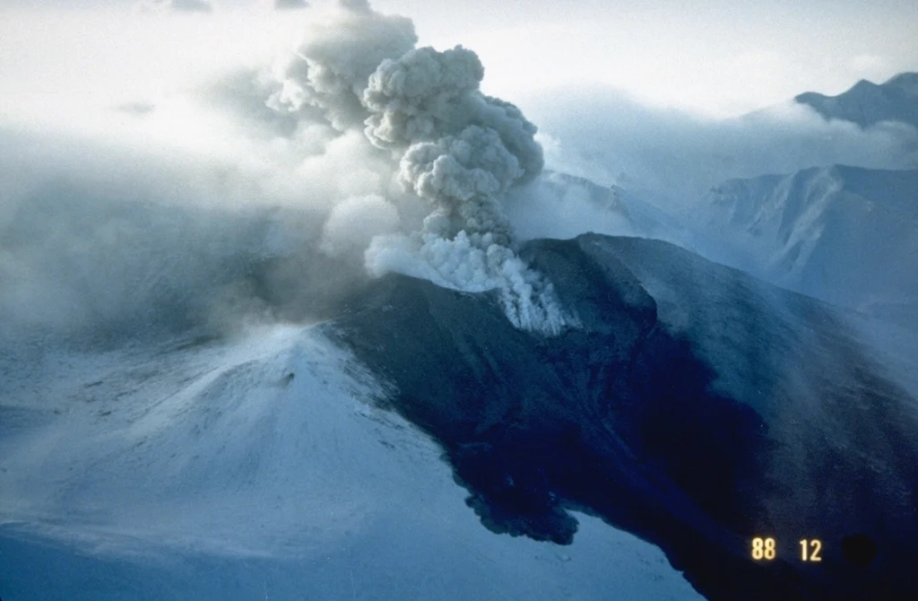
Tokachidake volcano consists of a group of dominantly andesitic stratovolcanoes and lava domes arranged on a NE-SW line above a plateau of welded Pleistocene tuffs in central Hokkaido. Numerous explosion craters and cinder cones are located on the upper flanks of the small stratovolcanoes, with the youngest Holocene centers located at the NW end of the chain. Frequent historical eruptions, consisting mostly of mild-to-moderate phreatic explosions, have been recorded since the mid-19th century. Two larger eruptions occurred in 1926 and 1962. Partial cone collapse of the western flank during the 1926 eruption produced a disastrous debris avalanche and mudflow.
Sources: Japan Meteorological Agency (JMA) , GVP.
Photo : GVP.
Japan , Kuchinoerabujima :
The Japan Meteorological Agency (JMA) reported that the number of shallow volcanic earthquakes increased beneath an area near Kuchinoerabujima’s Furudake Crater with 100 earthquakes recorded during 18-27 July. Some of the events were located near Shindake Crater (just N of Furudake). No significant changes to emissions at either Shindake or Furudake craters were observed during a field survey on 23 July. However, the geothermal area around Shindake persisted and some areas on the Furudake Crater floor had expanded. The Alert Level was raised to 2 (on a scale of 1-5) at 2000 on 27 July; the public was warned that ejected blocks may land within 1 km of both craters, and pyroclastic flows may affect areas within 2 km of the W flank of Shindake Crater.
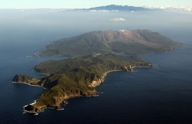
A group of young stratovolcanoes forms the eastern end of the irregularly shaped island of Kuchinoerabujima in the northern Ryukyu Islands, 15 km W of Yakushima. The Furudake, Shindake, and Noikeyama cones were erupted from south to north, respectively, forming a composite cone with multiple craters. All historical eruptions have occurred from Shindake, although a lava flow from the S flank of Furudake that reached the coast has a very fresh morphology. Frequent explosive eruptions have taken place from Shindake since 1840; the largest of these was in December 1933. Several villages on the 4 x 12 km island are located within a few kilometers of the active crater and have suffered damage from eruptions.
Sources: Japan Meteorological Agency (JMA) , GVP.
Photo : Asahi Shimbun