July 30 , 2026.
Hawaii , Kilauea :
HVO/USGS Volcanic Activity Notice
Current Volcano Alert Level: WATCH
Current Aviation Color Code: ORANGE
Issued: Tuesday, July 28, 2026, 9:36 PM HST
Source: Hawaiian Volcano Observatory
Notice Number: 2026/H359
Location: N 19 deg 25 min W 155 deg 17 min
Elevation: 4091 ft (1247 m)
Area: Hawaii
Summary:
Episode 52 of the ongoing Halemaʻumaʻu eruption continues at 9:15 p.m. HST on July 28, 2026.
Volcanic Activity:
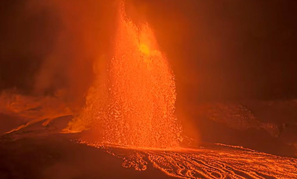
Episode 52 of lava fountaining in Halemaʻumaʻu began at the summit of Kīlauea began at 7:10 p.m. HST on July 28, 2026 and continues as of this notice. Fountains are close to peak height of about 500 feet (150 meters) at 9:15 p.m. HST. Effusion rate is also peaking at 350 cubic yards per second (270 cubic meters per second).
The National Weather Service radar shows the maximum plume height reached 19,000 feet AMSL (above mean sea level) and is currently at about 16,000 feet AMSL. Winds are still below the inversion and the plume is currently rising vertically. Currently no tephra is falling on the overlooks closest to the Halema’uma’u vents, but it is possible they will experience light fall of ash and Pele’s hair later in the eruption. Above 10,000 feet AMSL, winds are weak buand out of the north. Satellite images indicate that volcanic gas is moving southward from the vent area at high altitudes. Most higher tephra can be expected to fall south of the Halema’uma’u vents within the closed areas of Hawai’i Volcanoes National Park.
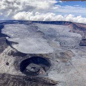
All eruptive vents and lava flows are confined to Halemaʻumaʻu crater within Hawaiʻi Volcanoes National Park. Tephra fall from volcanic ash clouds is greatest within 3 miles (5 km) of the vents, lighter ash and Pele’s Hair may stay suspended for large distances from the vents.
Wednesday, July 29, 2026, 3:19 AM HST (Wednesday, July 29, 2026, 13:19 UTC)
Summary:
Episode 52 of the ongoing Halemaʻumaʻu eruption began at 7:10 p.m. HST July 28 and ended at 2:36 a.m. HST on July 29, 2026.
Activity Summary:
Episode 52 of the ongoing Halemaʻumaʻu eruption began around 7:10 p.m. HST July 28 and ended abruptly at 2:36 a.m. HST on July 29, 2026.
The maximum lava fountain height was approximately 500 feet (150 meters) above ground level from the north vent. The south vent never fountained during this episode but did emit flames at the end of the eruption.
The maximum plume height was approximately 19,000 (5,800 meters) above mean sea level.
Tephra fall was restricted mostly to the closed area of Hawaiʻi Volcanoes National Park to the southwest of the active Halemaʻumaʻu vents.
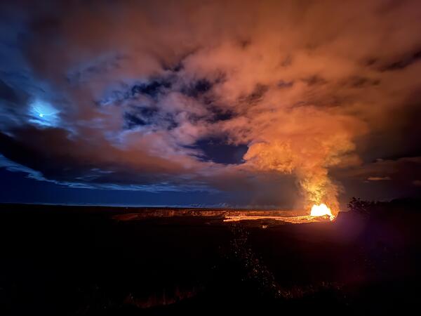
Episode 52 Chronology:
Lava fountaining episode 52 in Halemaʻumaʻu at the summit of Kīlauea began around 7:10 p.m. HST July 28 and ended at 2:36 a.m. HST on July 29, 2026, after 7.4 hours of continuous fountaining from the north vent. The last 4 minutes were marked by gas jetting and flames from the north vent. The south vent never fountained during this episode but did emit flames at the end of the episode. The instantaneous effusion rate peaked at about 350 cubic yards (270 cubic meters) per second at approximately 9:15 p.m. HST, with an average effusion rate of 250 cubic yards (190 cubic meters) per second for the entire fountaining episode. An estimated 6.1 million cubic yards (4.7 million cubic meters) of lava erupted and covered about 40-50% of the Halemaʻumaʻu crater floor. Seismicity followed the normal change in tremor patterns seen after most fountain episodes. The Uēkahuna tiltmeter (UWD) recorded about 14.4 microradians of deflationary tilt during episode 52.
Precursory activity began from the north vent on the morning of July 28 with 6 overflows between 10:22 a.m. HST and 1:53 p.m. HST, the longest lasting over 30 minutes. These were immediately followed by the onset of a vigorous overflow fed by 10-30 foot (3-10 meter) high dome fountains from the north vent at 1:56 p.m. HST which continued until the onset of episode 52 fountaining at 7:10 p.m. HST. The transition was marked by increasing height of the dome fountain, greater eruptive volume, increased deflation and rapidly increasing tremor.
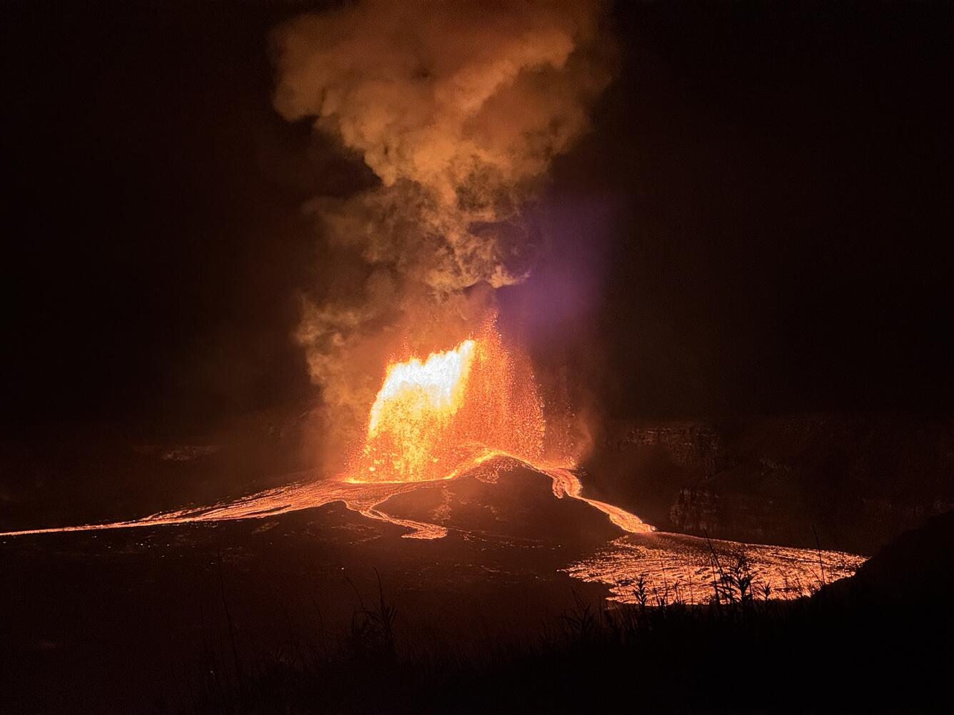
Lava fountained from the north vent in Halemaʻumaʻu at the summit of Kīlauea for nearly 7.5 hours on the night of July 28-29, 2026. During the eruptive episode, the instantaneous effusion rate peaked at about 350 cubic yards (270 cubic meters) per second at approximately 9:15 p.m. HST, with an average effusion rate of 250 cubic yards (190 cubic meters) per second for the entire fountaining episode. An estimated 6.1 million cubic yards (4.7 million cubic meters) of lava erupted and covered about 40-50% of the Halemaʻumaʻu crater floor.
The north vent lava fountain reached a peak height of approximately 500 feet (150 meters) around 9:00 p.m. HST and produced significant heat and ash, feeding a plume cloud that reached a maximum height of about 19,000 feet (5,600 meters) above sea level based on radar data reported by the National Weather Service (NWS). Winds were out of the northeast during the initial hours of fountaining and caused the plume to move toward the south during the most energetic part of the episode. Later in the evening the lower level winds died and the plume became more vertical but did not spread over populated areas. The plume track largely remained within Hawaiʻi Volcanoes National Park with most tephra falling in the closed area.
Fountain and plume heights gradually decreased in height to about 400 feet (120 meters) AGL and 10,000 feet (3,000 meters) AMSL, respectively, by 11:00 p.m. HST July 28. Episode 52 ended abruptly at 2:36 p.m. HST on July 29. Fine ash was noted within public areas of Hawaiʻi Volcanoes National Park. No tephra was reported from any other populated areas.
The abrupt switch from summit deflation to inflation at the end of episode 52 indicates that another lava fountaining episode is likely.
Source et photos : HVO
Photos : USGS , USGS/ D. Downs. , USGS / K. Mulliken .
Colombia , Chiles / Cerro Negro :
San Juan de Pasto, July 28, 2026, 3:30 PM.
Based on monitoring of the Chiles-Cerro Negro volcanic complex (CVCCN) activity, the Colombian Geological Service (SGC)—an agency affiliated with the Ministry of Mines and Energy—
reports the following information:
For the period from July 21 to July 27, 2026, the main changes in monitored parameters compared to the previous week were as follows:
● Regarding seismic activity, a slight decrease in event frequency was recorded, while a slight increase in released energy was noted. Seismicity
associated with rock-fracturing processes predominated, followed by activity linked to fluid dynamics.
● Localized earthquakes were concentrated in the southern sector of the Chiles volcano. In general, the depth of these earthquakes ranged from 2 to 8 km below the volcano’s summit (4,700 meters above sea level). The maximum magnitude recorded was 2.0.
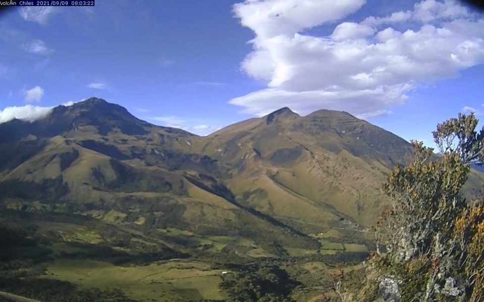
● Analysis of data from satellite sensors and ground stations has continued to show variations associated with deformation processes in the volcanic zone.
Based on the assessment and correlation of monitored parameters, the SGC recommends closely monitoring the situation’s evolution via weekly bulletins and other information published through our official channels, as well as adhering to the instructions of local and departmental authorities and the National Unit for Disaster Risk Management (UNGRD).
Volcanic activity remains at the yellow alert level: an active volcano showing changes in the baseline behavior of monitored parameters and other manifestations.
Source et photo : SGC.
Alaska , Shishaldin :
Minor seismic activity and infrasound were detected at the volcano during the past day. Steam emissions were observed in satellite and web camera images over the past day, and produced a visible plume towards the south. The plume was longer than what has been observed recently, but it does not indicate a significant change in unrest. Typical sulfur dioxide gas emissions were observed in satellite data from yesterday afternoon.
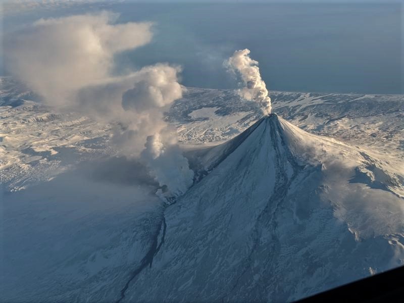
Local seismic and infrasound sensors, web cameras, and a geodetic network are used to monitor Shishaldin Volcano. In addition to the local monitoring network, AVO uses nearby geophysical networks, regional infrasound and lightning data, and satellite images to detect eruptions.
Source : AVO.
Photo : Brekke, Matt.
Indonesia , Ili Lewotolok :
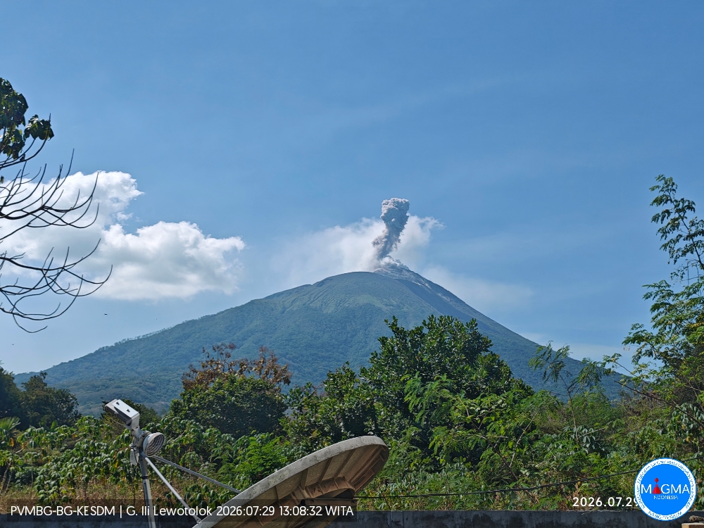
An eruption of Mount Ili Lewotolok occurred on Wednesday, July 29, 2026, at 1:07 PM (WITA), producing an ash column estimated to be approximately 600 m above the summit (or about 2,023 m above sea level). The observed ash column was gray and dense, drifting toward the southeast. The eruption was recorded by the seismograph with a maximum amplitude of 6.6 mm and a duration of 38 seconds.
Seismic observations
22 eruption earthquakes with amplitudes of 3.3–22.1 mm and durations of 28–68 seconds.
34 emission earthquakes with amplitudes of 2.8–8.8 mm and durations of 21–58 seconds.
1 non-harmonic tremor with an amplitude of 6.6 mm and a duration of 272 seconds.
Recommendations
1. Communities living near Mount Ili Lewotolok, as well as visitors, climbers, and tourists, must not enter or conduct activities within a 2 km radius of the Mount Ili Lewotolok activity center.
2. Vigilance is advised regarding potential risks of lava avalanches, rockfalls, and pyroclastic flows in the southern, southeastern, western, and northeastern sectors of Mount Ili Lewotolok.
Source et photo : PVMBG.
Guatemala , Santiaguito :
Weather conditions: Clear skies
Wind: Northeasterly
Precipitation: 16.5 mm
Activity
The Santiaguito volcano observatory reports favorable conditions for observing the dome.
Low- to moderate-intensity explosions are being recorded at a rate of 1 to 3 per hour, propelling gas and ash plumes up to 800 meters in altitude. These plumes are drifting southwestward due to the wind. Incandescence is visible at the dome, along with falling incandescent rock blocks on the western, southwestern, and southern flanks.
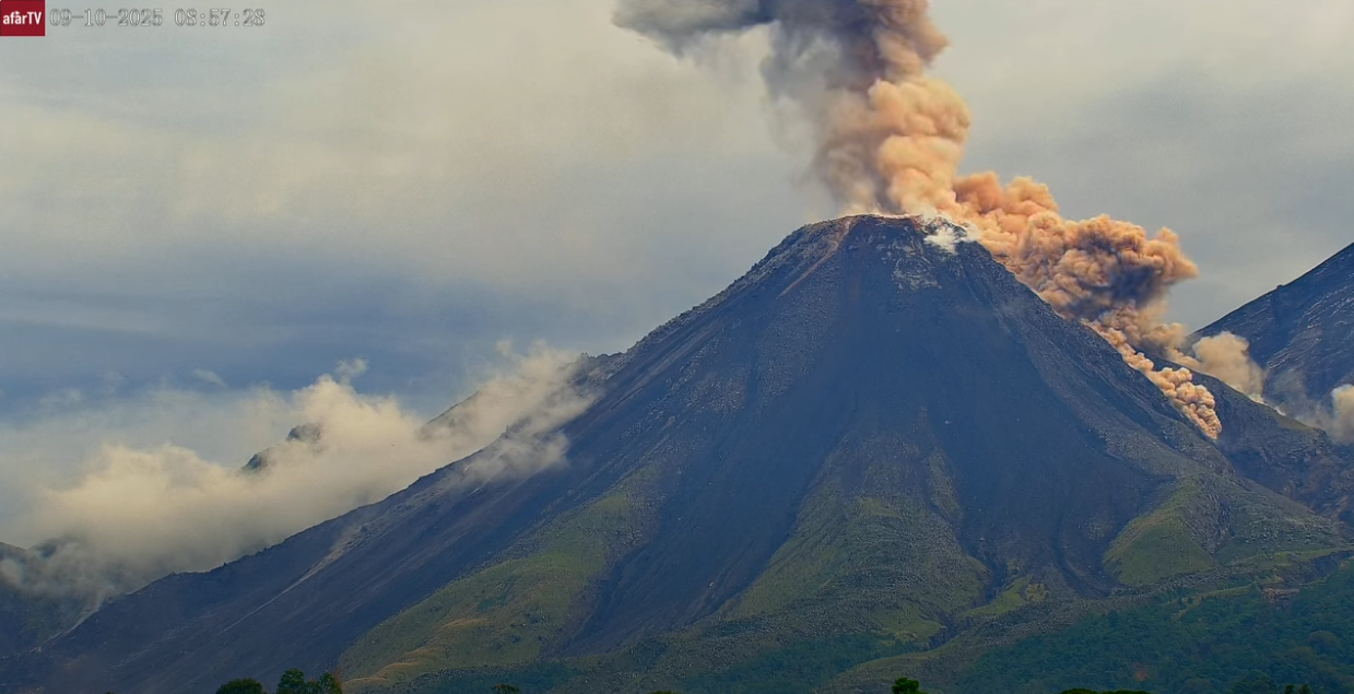
Ashfall is possible over San Marcos Palajunoj, La Tranquilidad, and surrounding areas due to wind direction. Given the significant accumulation of rocky material, the Caliente dome and the promontory overlooking the lava flow could collapse and generate long-range pyroclastic density currents moving southwest; consequently, the recommendations in special bulletin BESAN-016-2026 must be followed.
Source : Insivumeh.
Photo : Afar tv.