July 13 , 2026.
Indonesia , Karangetang :
VOLCANO OBSERVATORY NOTICE FOR AVIATION – VONA
Issued : July 12 , 2026
Volcano : Karangetang (267020)
Current Aviation Colour Code : YELLOW
Previous Aviation Colour Code : yellow
Source : Karangetang Volcano Observatory
Notice Number : 2026KAR010
Volcano Location : N 02 deg 46 min 48 sec E 125 deg 24 min 22 sec
Area : North Sulawesi, Indonesia
Summit Elevation : 5709 FT (1784 M)
Volcanic Activity Summary :
Increasing in volcanic activity.
Volcanic Cloud Height :
Ash-cloud is not observed.
Other Volcanic Cloud Information :
Ash-cloud is not observed.
Remarks :
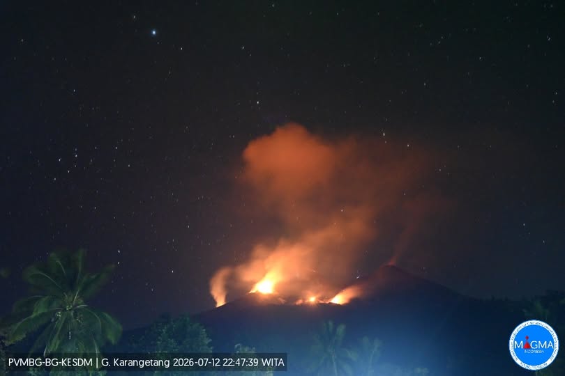
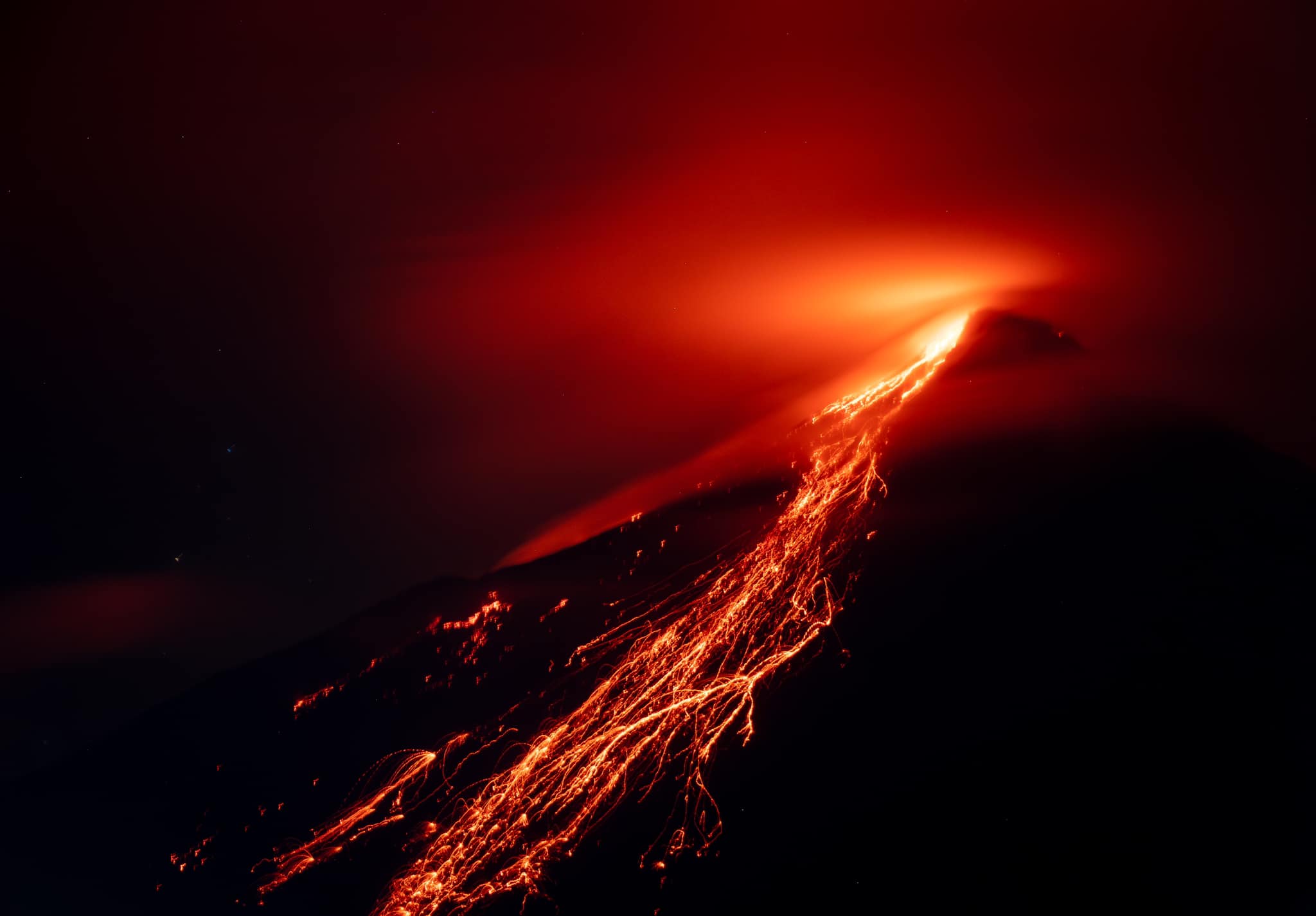
Eruption and ash emission is continuing. Eruption recorded on seismogram with maximum amplitude 50 mm. An incandescent lava eruption occurred at 19:13 WITA at the northern crater, reaching a height of ±100 meters, with volcanic material ejected approximately 300 meters to the south-southwest. Lava flows traveled ±700–1,000 meters to the south, ±400 meters to the west-southwest, and ±700–1,000 meters to the north-northwest.
Seismic observations
1 eruption earthquake with an amplitude of 50 mm and a duration of 153 seconds.
1 emission earthquake with an amplitude of 50 mm and a duration of 91.6 seconds.
4 episodes of non-harmonic tremor with amplitudes of 7.5 to 25 mm and durations of 40.1 to 156.5 seconds.
1 hybrid/multiphase earthquake with an amplitude of 10 mm and a duration of 18 seconds.
2 shallow volcanic earthquakes with amplitudes of 7.5 to 10 mm and durations of 5.1 to 6.7 seconds.
1 deep volcanic earthquake with an amplitude of 30 mm and a duration of 5.6 seconds.
14 distant tectonic earthquakes with amplitudes of 7.5 to 50 mm and durations of 35.9 to 474 seconds.
Recommendations
(1) The public, visitors, and tourists must not approach, climb, or conduct activities within the designated danger zone, defined as a 1.5 km radius around the summits of Kawah Dua (North Crater) and Kawah Utama (South Crater), as well as a sector extending 2.5 km to the south-southwest.
(2) Remain vigilant regarding lava avalanches and pyroclastic density currents (nuées ardentes), which may occur at any time due to the instability and collapse-prone nature of previously accumulated lava deposits, particularly in the south, southeast, west, and southwest sectors.
Source : PVMBG.
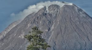
Photo : PVMBG , Baptiste Apps.(archive).
Colombia , Nevado del Ruiz :
Manizales, July 7, 2026, 3:00 PM.
Based on monitoring of the Nevado del Ruiz volcano’s activity, the Colombian Geological Service (SGC)—an agency attached to the Ministry of Mines and Energy—reports the following information:
During the week of June 30 to July 6, 2026, the volcano continued to exhibit unstable behavior.
Compared to the previous week, the main variations in monitored parameters were as follows:
– Seismic activity linked to fluid dynamics within the volcanic conduits increased, in terms of both the number of events and the seismic energy released, particularly regarding short-duration seismic signals. Despite this increase, the events showed low energy levels. As in previous weeks, no long-duration seismic signals were recorded, and no pulsatile ash emissions or variations in the apparent temperature of the gas column were confirmed.
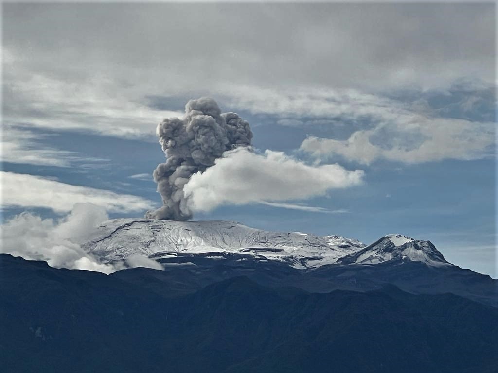
– Seismic activity associated with rock-fracturing processes within the volcanic edifice showed an increase in the number of recorded earthquakes but a decrease in the amount of seismic energy released. The earthquakes were primarily located at the Arenas crater and on the volcano’s northeast flank, extending up to 5 km from the crater. To a lesser extent, events also occurred on the south-southeast, southeast, and south-southwest flanks—within 3 km of the crater—as well as in other sectors of the volcano up to 7 km away. Earthquake depths ranged from less than 1 km (at the Arenas crater) to 7 km below the volcano’s summit. The maximum magnitude recorded was 1.1, corresponding to an earthquake on July 3 at 18:47, located on the eastern rim of the Arenas crater at a depth of 3 km.
– Emissions of water vapor and volcanic gases—primarily sulfur dioxide (SO₂)—into the atmosphere continued via the Arenas crater. The estimated SO₂ flux associated with degassing processes remained slightly higher than that of the previous week. Supplementary monitoring using satellite data platforms continued to show low levels of SO₂ emissions.
– The height of the gas and water vapor plume remained below 400 m above the volcano’s summit. The plume drifted primarily toward the west-northwest flank and, to a lesser extent, toward the northwest flank.
– Satellite monitoring of thermal anomalies at the bottom of the Arenas crater remained limited due to persistent cloud cover in the area. No anomalies were detected over the past week due to the aforementioned atmospheric conditions.
Source et photo : SGC.
Martinique , Mount Pelée :
Weekly Report, Institut de physique du globe de Paris / Martinique Volcanological and Seismological Observatory (OVSM).
Saint-Pierre, July 10, 2026, at 14:45 local time (GMT-4)
Between July 3, 2026, at 16:00 (UTC) and July 10, 2026, at 16:00 (UTC), the OVSM recorded 68 earthquakes
of volcanic origin:
• 64 volcano-tectonic earthquakes. Of these, 16 had a magnitude (local magnitude Mlv or duration magnitude Md) greater than 0.5, and 4 had a magnitude greater than 1. The largest event had a magnitude of Mlv=1.51; the others were of lower energy. These earthquakes were located at depths ranging from 1.1 to 2.0 km beneath the volcano’s summit. The volcano-tectonic seismicity is associated with micro-fracturing within the volcanic edifice, linked to the overall reactivation of the volcano observed since 2019.
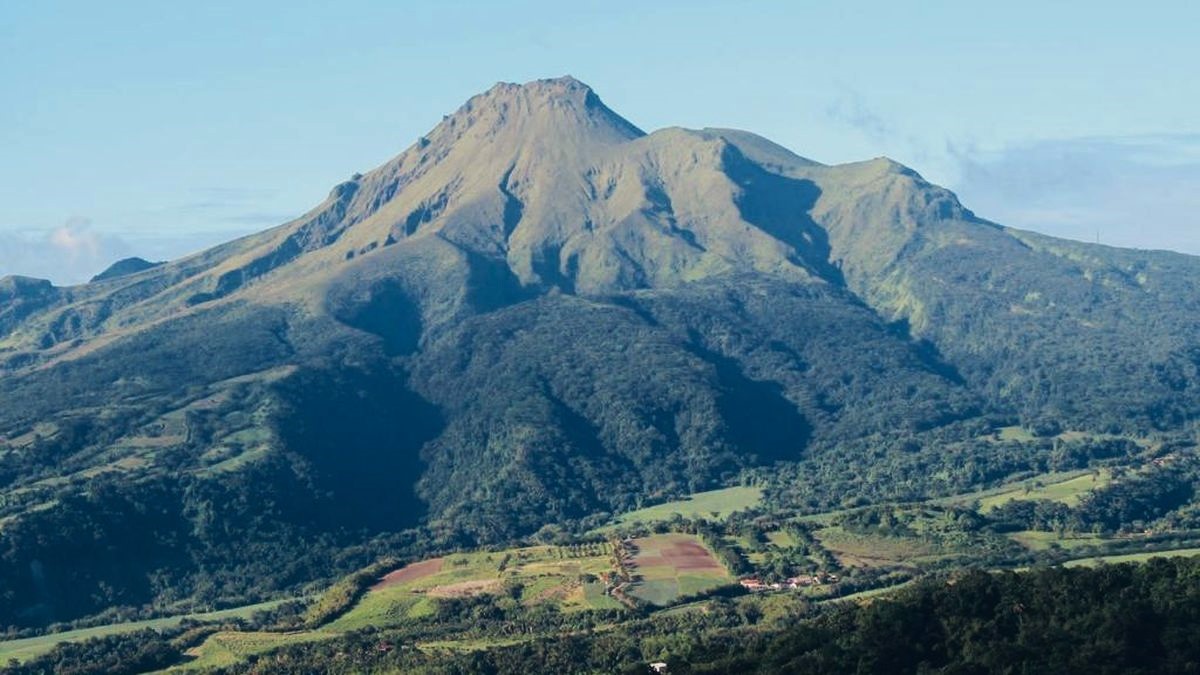
• 4 deep long-period earthquakes, 3 of which were successfully located. They are situated southeast of Montagne Pelée at depths ranging from 17 to 22 km, with magnitudes between Mlv = 0.93 and Mlv = 1.24. Deep long-period earthquakes are characterized by signals containing only low frequencies and are associated with the movement of magmatic fluids deep within the Montagne Pelée volcanic system.
No earthquakes were felt by the population.
The previous week, the OVSM recorded 160 earthquakes of volcanic origin. As of July 10, 2026, and over the past four weeks, the OVSM has observed a total of 396 volcanic earthquakes, representing an average of 99 earthquakes per week.
During phases of volcanic reactivation in volcanoes similar to Montagne Pelée, it is common to observe seismic activity that varies in intensity and frequency. The probability of short-term eruptive activity remains low. However, given the observations accumulated in recent years—and particularly over the last few months—a change in the situation over the medium term (weeks to months) cannot be ruled out.
The volcanic alert level, in accordance with protocols established by the authorities, is currently YELLOW: vigilance.
Source et photo : Direction de l’OVSM-IPGP.
Ecuador , El Reventador :
DAILY STATUS REPORT FOR REVENTADOR VOLCANO, Sunday, July 12, 2026.
Information: Geophysical Institute – EPN.
Surface activity level: High | Surface trend: Unchanged
Internal activity level: Moderate | Internal trend: Unchanged
From July 11, 2026, 11:00 to July 12, 2026, 11:00:
Seismicity:
Explosion (EXP): 76
Long-period (LP): 7
Emission tremor (TREMI): 11
Harmonic tremor (TRARM): 5
Precipitation / Lahars:
Precipitation was recorded in the region, but it did not trigger lahars. **Heavy rains can remobilize accumulated material and generate debris-laden mudflows (lahars), which could rush down the volcano’s flanks and flow into nearby rivers.**
Emissions / Ash Plume:
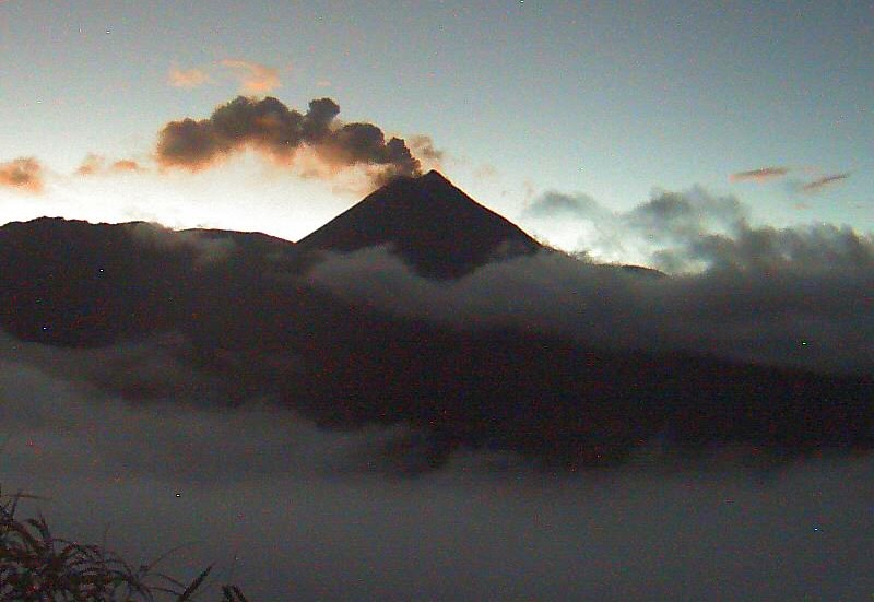
Due to cloud cover in the area, it was not possible to observe gas and/or ash emissions via surveillance cameras. However, yesterday afternoon, the GOES-19 satellite system detected a gas and ash plume moving west-northwest, reaching a height of less than 700 meters above the crater rim. In connection with this activity, the Washington VAAC issued a report noting an ash cloud reaching a height of 1,300 m and moving northwest.
Other Monitoring Parameters:
The MIROVA-MODIS and FIRMS satellite systems each detected one thermal anomaly, while the MIROVA-VIIRS-375 system detected two over the past 24 hours.
Observation:
From yesterday afternoon until the time of writing this report, satellite monitoring indicates that the area surrounding the volcano remains cloud-covered.
Alert Level – SGR: Orange
Source : IGEPN.
Photo : IGEPN
Guatemala , Santiaguito :
Weather conditions: Partly cloudy
Wind: Easterly
Precipitation: 78.48 mm
Activity
Continuous degassing is observed at the Caliente dome; the plume reaches a height of 400 meters and disperses towards the west and southwest. Low- to moderate-intensity explosions have been recorded, generating a gas and ash column that rises up to 800 meters above the dome and disperses towards the west. During the night and early morning, incandescence is visible at the summit of the dome as well as on its western and southwestern flanks, resulting from recurring avalanches cascading down these slopes.
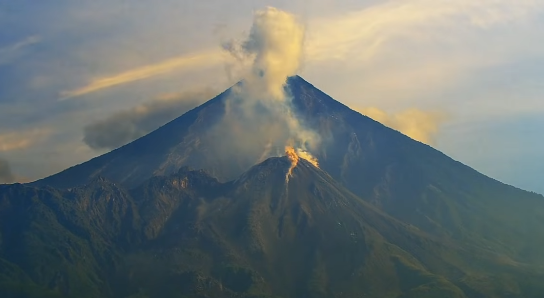
The formation of pyroclastic density currents cannot be ruled out; it is therefore essential to adhere to the recommendations set out in special bulletin BESAN-002-2025.
Given the rainfall in the volcanic zone, low- to moderate-intensity lahars could occur in the river channels on the southern flank (Nimá I, Tambor, and Cabello de Ángel, among others); consequently, the recommendations in special bulletin BESAN-012-2025 must be followed.
Source : Insivumeh.
Photo : AFAR TV