August 6 , 2026.
Guatemala , Fuego :
Guatemala, August 5, 2026, 06:45 (local time). ERUPTION UPDATE
Following the eruptive activity of the Fuego volcano described in special bulletin BEFGO-064-2026, INSIVUMEH continues to monitor its behavior. At the time of this bulletin’s release, forty-five hours have elapsed since the eruption began.
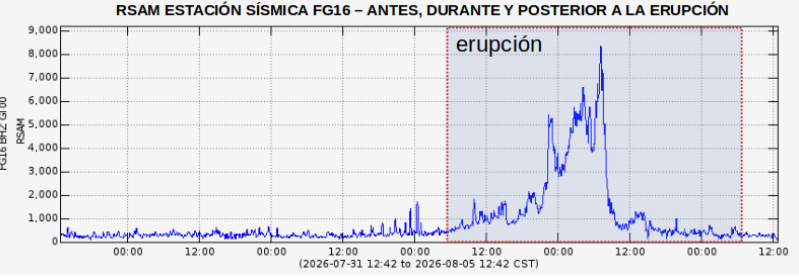
Continuous, low-intensity acoustic tremor is being detected; this activity is accompanied by gas and ash emissions, as well as degassing sounds lasting several minutes. RSAM monitoring continues, showing minor fluctuations and a sustained return to the initial baseline seismic signal values for the Fuego volcano.
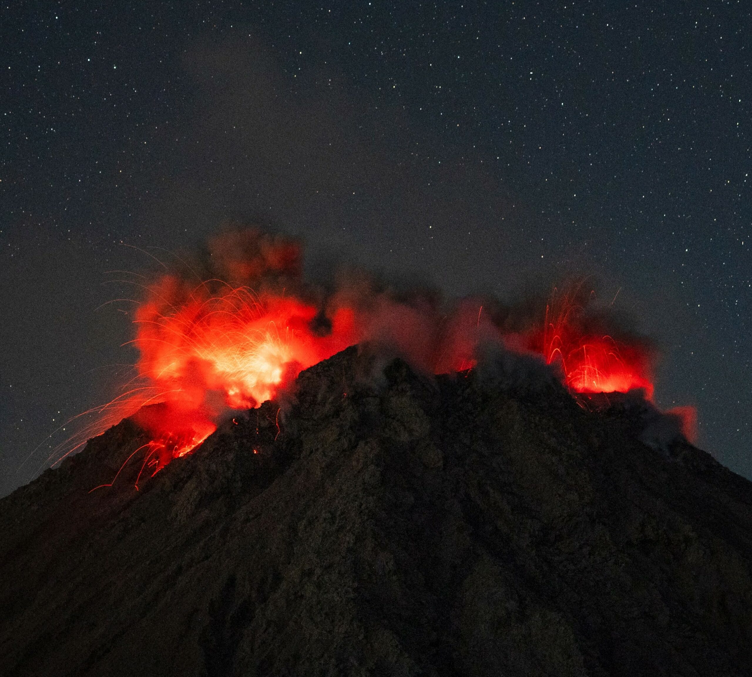
Webcams show faint incandescence and explosions of moderate to low intensity, ejecting lava fragments up to 100 or 150 meters above the crater rim. Some of the material ejected during the eruption has accumulated unstably on the upper part of the volcanic edifice, currently causing collapses and the descent of incandescent blocks into the Ceniza and Seca ravines.
There remains a risk that the unstable accumulation of lava fragments ejected during this eruptive activity could generate pyroclastic density currents. These could descend through any of the volcano’s ravines and travel distances of 5 to 7 kilometers; this remains the primary threat to communities located near these ravines, particularly those on the southwest flank (Seca, Taniluyá, and Ceniza).
Eruptive activity is expected to gradually decrease over the coming hours. Furthermore, due to forecast rainfall associated with an easterly wave, there is an imminent threat of low-to-moderate impact lahars—based on projections available on the INSIVUMEH website—primarily in the Seca and Ceniza ravines. Consequently, multi-parameter monitoring will continue using seismic and infrasound sensors, webcams, satellite imagery, and reports from field observers.
Guatemala, August 5, 2026, 1:00 PM (local time). END OF THE VOLCÁN DE FUEGO ERUPTION
Following special bulletin BEFGO-065, INSIVUMEH has maintained continuous multi-parameter monitoring of the eruptive activity, enabling the assessment and identification of significant variations in volcanic activity over the last few hours. Based on this analysis, it is confirmed that—after a duration of 50 hours since it began on August 3 at 8:30 AM—THE ERUPTION HAS ENDED.
This 50-hour period of activity generated a wide variety of volcanic products; the most impactful among them were pyroclastic density currents, as well as ash dispersion and fallout. The ravines most affected—and containing the largest accumulated volume of eruptive material—are the Seca ravine (western flank) and the Ceniza ravine (southwestern flank). The volcano’s crater also underwent significant erosion throughout the eruption, altering its morphology. The areas and communities most affected by ash fallout are located on the western and southwestern flanks, within the municipality of San Pedro Yepocapa (Chimaltenango).
Typical activity at Volcán de Fuego is characterized by: low-to-moderate explosions occurring at a rate of 4 to 6 per hour; incandescent pulses reaching heights of 100 to 200 meters above the crater; RSAM seismic values ranging from 200 to 600; and gas and ash columns reaching 4,800 meters above sea level. This activity is expected to continue in the coming days or weeks. It should be noted that, due to the volcanic products generated during the eruption, the following hazards remain active and must be taken into account in local and municipal response efforts: lahars, ash remobilization, and ash dispersion.
Source : Insivumeh.
Photos : Diego Rizzo , Insivumeh.
Italy / Sicily , Etna :
Statement on Etna’s activity, August 6, 2026, 03:51 (01:51 UTC)
The National Institute of Geophysics and Volcanology (INGV) – Etna Observatory reports that a sudden explosion occurred at the Voragine crater at 01:51 UTC. As shown by images from the camera network, this event coincided with the onset of Strombolian activity at the Voragine crater, generating a minor ash emission that is dispersing towards the east-southeast.
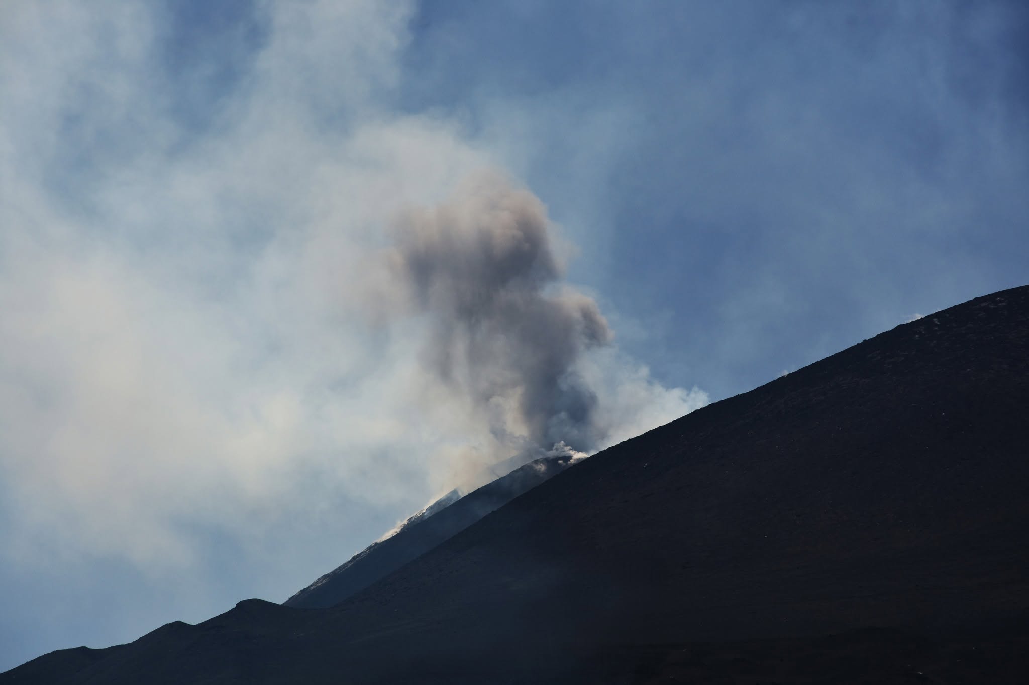
Seismically, the average amplitude of volcanic tremor is fluctuating within normal limits. The source centroid is located in the Northeast Crater area, at an elevation of approximately 1,600 m above sea level. Infrasonic activity has shown a moderate increase since late evening and remains localized at the Voragine Crater.
No significant variations have been detected in the time series from ground deformation monitoring stations.
Further information will be provided as soon as possible.
Source : INGV.
Photo : Pippo Scarpinati .
Indonesia , Lewotobi Laki-laki :
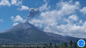
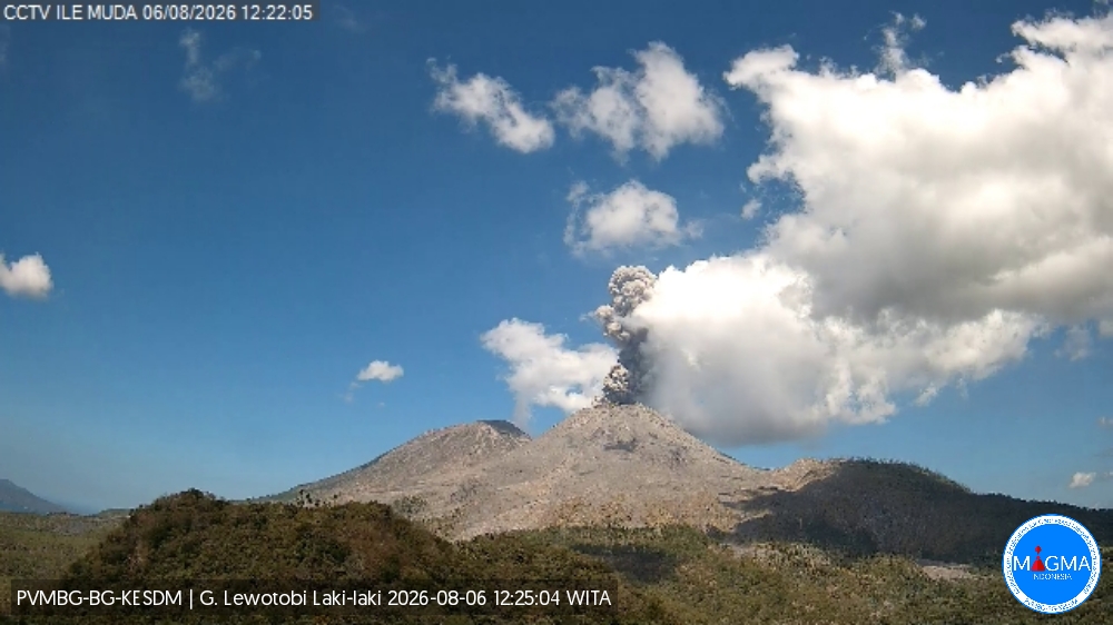
An eruption of Mount Lewotobi Laki-laki occurred on Thursday, August 6, 2026, at 12:20 WITA; the observed ash column reached a height of approximately 700 m above the summit (or about 2,284 m above sea level). This dense, gray ash column drifted toward the west and northwest. The eruption was recorded by the seismograph with a maximum amplitude of 11 mm and a duration of 121 seconds.
Seismic observations
1 eruption earthquake, with an amplitude of 14.8 mm and a duration of 174 seconds.
2 episodes of non-harmonic tremor, with amplitudes ranging from 5.1 to 7.4 mm and durations of 81 to 120 seconds.
2 distant tectonic earthquakes, with amplitudes ranging from 14.8 to 47.3 mm and durations of 43 to 91 seconds.
Recommendations
1. Communities located near Mount Lewotobi Laki-laki, as well as visitors and tourists, must not engage in any activities within a 5 km radius of the Mount Lewotobi Laki-laki eruption center.
2. The public is advised to remain calm, follow instructions from local authorities, and disregard information from unverified sources.
Source et photo : PVMBG.
Colombia , Chiles / Cerro Negro :
San Juan de Pasto, August 4, 2026, 4:00 PM
Based on monitoring of activity at the Chiles-Cerro Negro volcanic complex (CVCCN), the Colombian Geological Service (SGC)—an agency attached to the Ministry of Mines and Energy—reports the following information:
For the period from July 28 to August 3, 2026, the main changes in monitored parameters compared to the previous week are as follows:
● Amidst fluctuating seismic activity, a slight increase in the number of events was recorded, while the energy released rose significantly following a magnitude 4.2 earthquake on July 29 at 10:27 AM. Seismicity associated with rock-fracturing processes remains predominant, followed by activity linked to fluid dynamics.
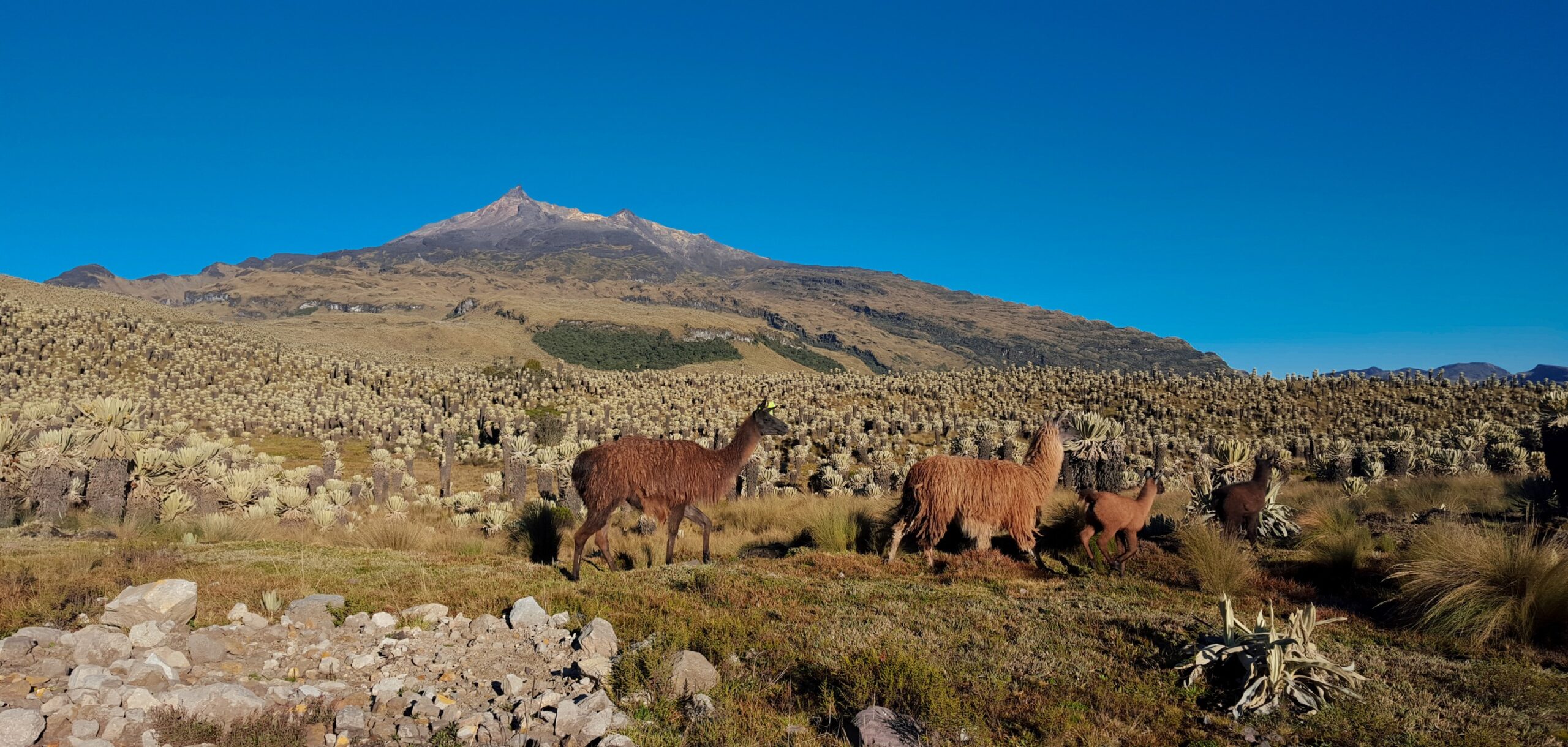
● The earthquakes were primarily concentrated in two seismic zones: the first was located near the center of the Chiles volcano, at depths of 2 to 6 km below the summit (4,700 meters above sea level), within a 2 km radius and with a maximum magnitude of 1.9. The second zone was located 7 to 10 km east of Chiles, at depths of 5 to 10 km below the summit and with a maximum magnitude of 4.2.
● Particular note should be made of the magnitude 4.2 earthquake recorded on July 29 at 10:27 a.m., which was felt by residents of the indigenous communities of Chiles and Nazate, as well as by those in the municipal seat of Cumbal.
● Analysis of data obtained via satellite sensors and ground stations continued to show variations associated with deformation processes in the volcanic area.
Based on the assessment and correlation of the monitored parameters, the SGC recommends closely following the situation’s evolution through weekly bulletins and other information published via our official channels, as well as adhering to the instructions of local and departmental authorities and the National Unit for Disaster Risk Management (UNGRD).
Volcanic activity remains at the yellow alert level: an active volcano showing changes in the baseline behavior of monitored parameters and other manifestations.
Source et photo : SGC.
La Réunion , Piton de la Fournaise :
Observations:
In June 2026, the OVPF-IPGP recorded a total of the following events at the Piton de la Fournaise massif:
• 43 shallow volcano-tectonic earthquakes (0.2 to 1.5 km above sea level), mostly beneath the Bory and Dolomieu summit craters;
• 51 deep earthquakes (below sea level);
• 253 rockfalls or collapses.
June 2026 was characterized by continued relatively moderate seismic activity beneath Piton de la Fournaise, comprising 43 shallow volcano-tectonic earthquakes (above the shallow magma reservoir) and 51 deep earthquakes located at depths of 6 to 8 km below sea level, west of the summit. This seismicity remains higher than during the Piton de la Fournaise’s quiet period between August 2023 and November 2025 and likely reflects the ongoing pressurization of the volcano’s magmatic system.
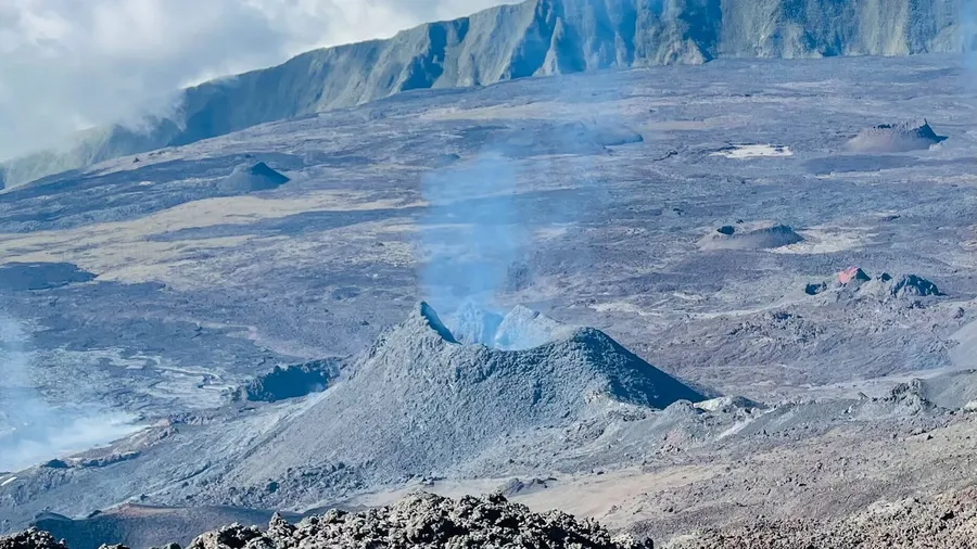
Numerous rockfalls were also observed (253 events). As is typically the case, these rockfalls were concentrated around the summit of Piton de la Fournaise and the Rivière de l’Est escarpment, as well as at the eruptive cones and recent lava flows on the volcano’s east-southeast flank.
Following the end of the eruption on April 12, 2026, slight inflation of the volcanic edifice was recorded through the end of April. No significant signals were detected thereafter until June 7, when inflation resumed—a trend clearly visible at GNSS stations located at the summit and base of the terminal cone. This inflation appears to have ceased as of June 24, 2026; this observation will need to be confirmed next month.
Numerical modeling for the inflation period of June 7–24 indicates a primary inflation source located beneath the volcano’s summit, at an elevation of 1 km above sea level.
This inflation source most likely reflects a slight pressurization of the shallowest magma reservoir during this period.
Source : OVPF.
Photo : Cynthia Veron