August 31 , 2026.
Indonesia , Sinabung :
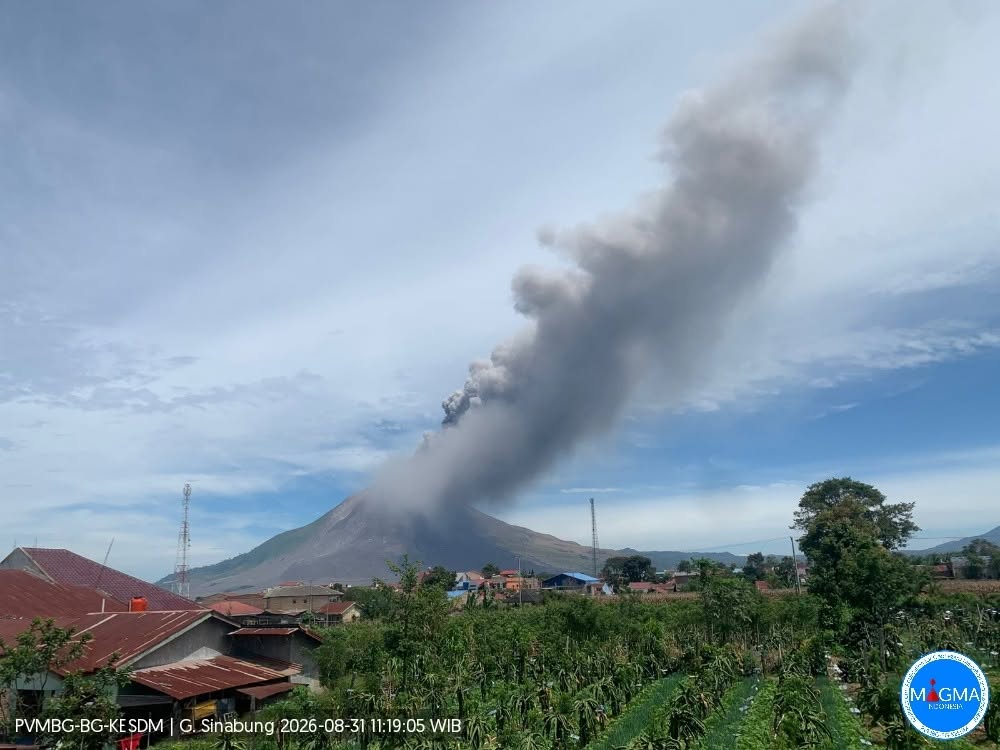
An eruption of Mount Sinabung occurred on Monday, August 31, 2026, at 10:17 a.m. (Western Indonesia Time), with an ash column reaching a height of approximately 3,500 m above the summit (or about 5,960 m above sea level). The observed ash column was black and dense, moving towards the east and southeast. At the time of writing this report, the eruption was still ongoing.
Seismic observations
3 deep volcanic earthquakes: amplitudes of 22 to 115 mm, and durations of 12 to 18 seconds.
1 local tectonic earthquake: amplitude of 6 mm, and duration of 25 seconds.
3 distant tectonic earthquakes: amplitudes of 2 to 4 mm, and durations of 36 to 235 seconds.
Recommendations
1. Residents and visitors/tourists must not engage in any activities in villages that have already been evacuated, nor within a 3 km radius of the summit of Mount Sinabung, nor within a 4.5 km radius in the southeast sector.
2. Residents living near watercourses originating from Mount Sinabung must remain vigilant regarding the risk of lahars.
3. The Karo Regency government must maintain constant coordination with the Center for Volcanology and Geological Hazard Mitigation (PVMBG) or the Mount Sinabung observation post.
Source et photo : PVMBG.
Hawaii , Kilauea :
HAWAIIAN VOLCANO OBSERVATORY DAILY UPDATE, U.S. Geological Survey
Sunday, August 30, 2026, 8:35 AM HST (Sunday, August 30, 2026, 18:35 UTC)
19°25’16 » N 155°17’13 » W,
Summit Elevation 4091 ft (1247 m)
Current Volcano Alert Level: ADVISORY
Current Aviation Color Code: YELLOW
Summary:
Kīlauea volcano is not erupting; the summit eruption in Halemaʻumaʻu is paused. After a period of instability, the summit has reinflated more steadily over the past two days. More data are needed to model the forecast window for the next episode.
Overview:
The summit eruption of Kīlauea in Halemaʻumaʻu is paused. Several brief periods of glow and flaming were observed overnight at the north vent. After an initial period of instability following lava fountaining episode 54, summit reinflation has proceeded more steadily over the past two days. Another episode may occur in the coming weeks, but more data are needed to model the forecast window.
No significant activity has been noted along Kīlauea’s East Rift Zone or Southwest Rift Zone.
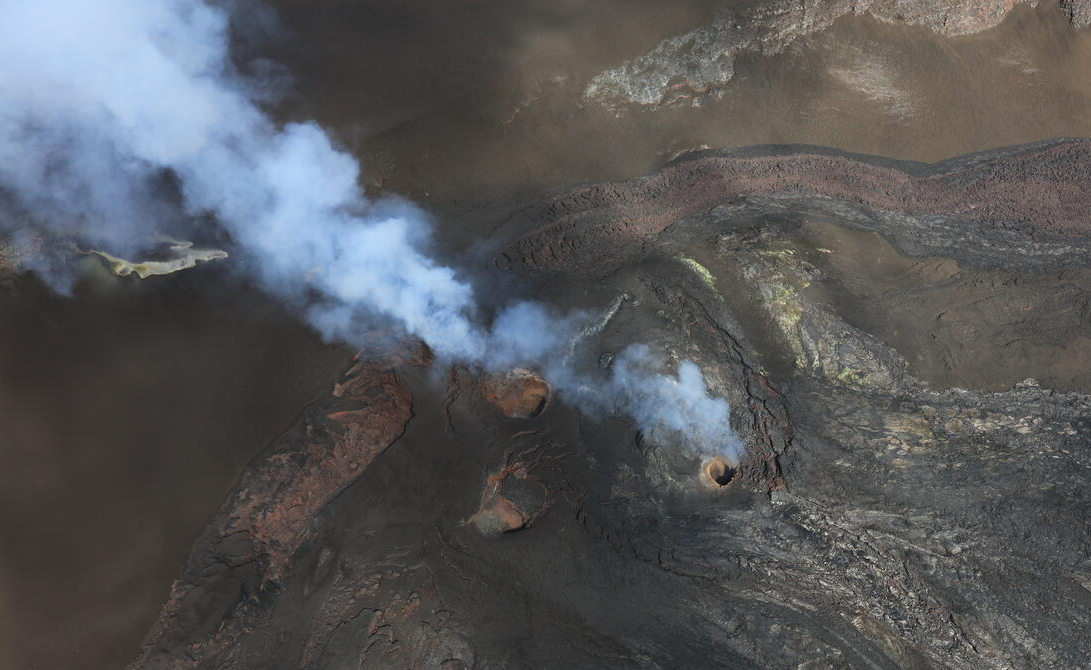
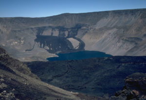
Another view of Kīlauea summit north, south, and west vents during a USGS Hawaiian Volcano Observatory monitoring helicopter overflight on Friday, August 28, 2026. Tephra and lava that filled in the south vent during lava fountaining episode 54 on August 25 is very noticeable here, whereas the north and west vents remain open and degassing.
Summit Observations:
Overnight webcam views showed several brief periods of glow and flaming at the Halema’uma’u north vent. Release and combustion of volcanic gas (likely hydrogen) appears to be occurring deep within the vent and is related to larger tremor bursts observed in seismic data streams. Little or no glow appears to be derived from incandescent magma, suggesting it is relatively deep and possibly crusted over between gas release tremor bursts. Both the west and south vents were dark, and the latter appears to be partially filled in by north vent spatter and tephra erupted during lava fountaining episode 54.
Low-frequency seismic tremor bursts—typical during the early stages of pauses between eruptive episodes—began with the cessation of episode 54 and have continued over the past several days. The larger bursts are related to flames and glow at the north vent, probably representing gas release deep within the vent. No shallow earthquakes have been recorded beneath the summit region over the past 24 hours.
After an initial period of instability following lava fountaining episode 54, summit reinflation has proceeded more steadily over the past two days. As of this morning, the Uēkahuna (UWD) tiltmeter has measured a total of 2.9 microradians of inflation relative to the end of lava fountaining episode 54. Deflationary tilt on UWD totaled 12.7 microradians during episode 54.
During inter-episode pauses, the sulfur dioxide (SO2) emission rate from the summit typically varies between 1,000 and 5,000 tonnes per day. Strong trade winds are pushing the degassing plume to the southwest over the Kaʻū Desert this morning.
Rift Zone Observations:
Rates of seismicity and ground deformation remain low in the East Rift Zone and Southwest Rift Zone. SO2 emissions from the East Rift Zone remain below the detection limit.
Source : HVO.
Photo : USGS / P. Dotray.
Colombia , Puracé – Los Coconucos volcanic chain :
Popayán, August 30, 2026, 3:00 PM.
Based on monitoring of the activity of the Los Coconucos volcanic chain, the Colombian Geological Service (SGC)—an agency attached to the Ministry of Mines and Energy—reports the following information:
Since 4:20 PM yesterday and up to the time of this bulletin’s release, the increase in seismicity associated with rock fracturing (volcano-tectonic, or VT)—previously reported in the special bulletin of August 29—has persisted in terms of both the number of events and the energy released. Approximately 472 VT events have been recorded, located primarily between 10 and 15 km northeast of the Puracé volcano, at depths ranging from 8 to 12 km below its summit. Regarding energy levels, 18 of these earthquakes had a magnitude of 2.0 or greater, and at least 7 were felt by residents in the area affected by the volcano, particularly in the municipalities of Puracé, Totoró, Sotará, and Popayán. Notable VT earthquakes occurred on August 29 at 4:21 PM, 6:18 PM, and 11:37 PM, with magnitudes of 3.9, 4.1, and 4.3, respectively.
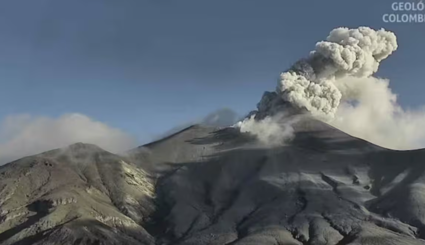
Regarding seismicity associated with fluid dynamics in volcanic conduits, tremor-type (TR) signals continue to be recorded beneath the crater of Puracé volcano at depths of less than 1 km.
Since 2:00 PM yesterday, two ash emissions have been recorded; however, due to adverse weather conditions (heavy cloud cover), they could not be visually confirmed by volcanic monitoring cameras. Concurrently, a process of slow deformation persists in the area between the Puracé, Piocollo, and Curiquinga volcanoes.
Additionally, the observer network reported secondary mudflows descending the Agua Blanca ravine this morning, triggered by heavy rainfall on the volcano’s upper slopes. This resulted in increased flow volumes and the transport of volcanic ash. The SGC is continuously monitoring for the potential formation of flows in the watercourses descending from the volcano.
Gas monitoring reveals continuous sulfur dioxide (SO2) emissions and a persistent upward trend in ground-level carbon dioxide (CO2) concentrations. No thermal anomalies associated with the crater floor have been detected, according to data published on satellite monitoring platforms.
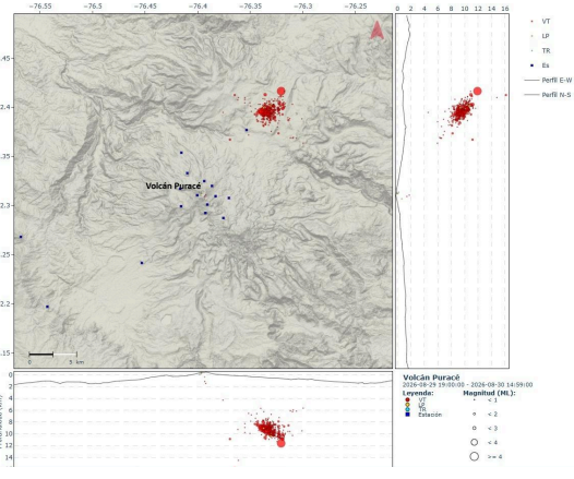
Location map of VT-type seismic events recorded between 4:20 PM on August 29 and 1:00 PM on August 30, 2026.
The public is advised not to approach the crater areas of the Puracé, Piocollo, and Curiquinga volcanoes, nor the headwaters of the rivers originating from them, as sudden emissions of gas and ash—accompanied by the ejection of rock fragments—could occur. Furthermore, the accumulation of ash and erupted material could trigger localized mudflows.
In light of the above, the SGC recommends closely monitoring the evolution of this activity through daily bulletins and other information released via our official channels, as well as adhering to the instructions of local and departmental authorities and the National Unit for Disaster Risk Management (UNGRD).
The volcanic alert level remains at Orange: a volcano showing significant changes in monitored parameters.
Source et photos : SGC.
Costa Rica , Rincón de la Vieja :
OVSICORI-UNA Weekly Volcanic Monitoring Bulletin, August 28, 2026
Latitude: 10.83° N;
Longitude: 85.34° W;
Elevation: 1,916 m above sea level.
Current activity level: Vigilance.
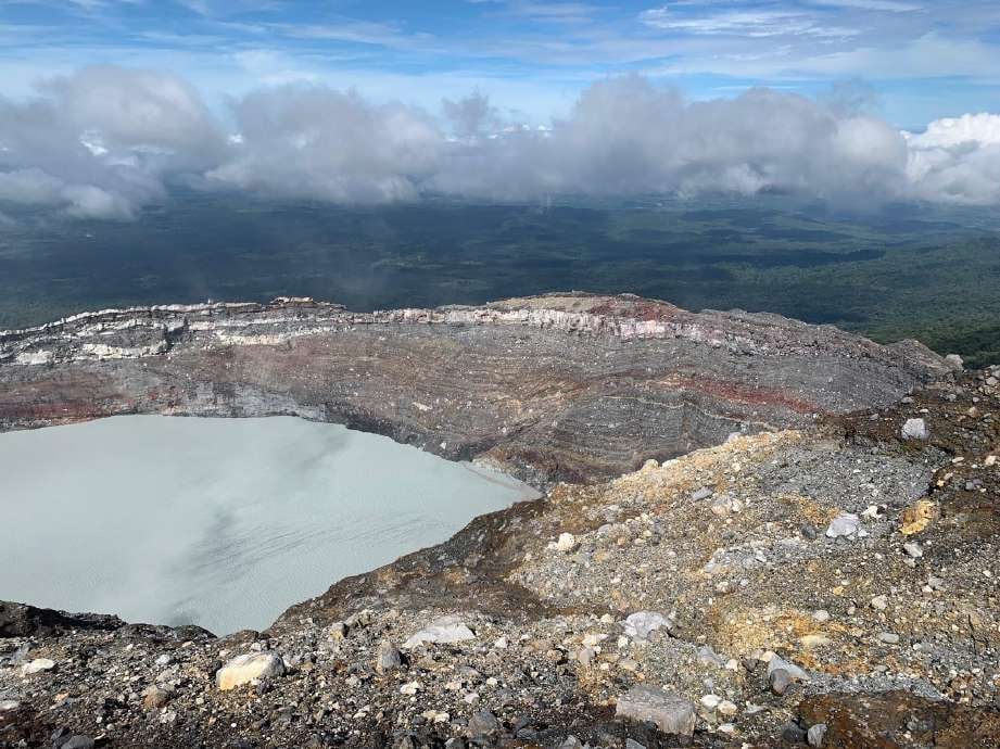
Fourteen eruptions were recorded this week, four of which reached an acoustic magnitude greater than 4. The eruption on August 25 at 11:10 PM exhibited the highest acoustic magnitude recorded since the beginning of the year. The eruption on August 24 at 2:13 PM generated a syn-eruptive lahar (triggered directly by the eruption), unlike the August 25 eruption, which had a higher amplitude. This phenomenon is explained by the fact that frequent eruptions in recent months have expelled water from the crater lake, thereby lowering its level.
An increase in the number of « tornillo » (screw-shaped) events was observed this week. However, the frequency of these events shows a downward trend. Background tremor generally remains low but increases following eruptions. Six volcano-tectonic earthquakes were also recorded: five in the immediate vicinity of the crater and one further away. No significant deformation has been observed. The average SO2 flux for the week was 590 ± 284 t/d, with a maximum value of 4,912 t/d. These figures are comparable to those of the previous week, when the average flux was 684 ± 361 t/d with a maximum of 4,524 t/d. The last detection of atmospheric SO2 by the Sentinel satellite was on October 14, 2025 (3 tonnes).
Source : Ovsicori .
Photo : Juan Carlos López del ICE.
Ecuador , Sangay :
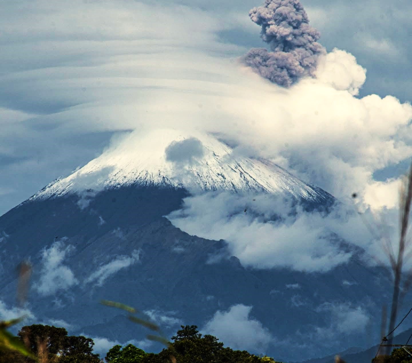
DAILY STATUS REPORT FOR SANGAY VOLCANO, Sunday, August 30, 2026.
Information from the Geophysical Institute – EPN.
Surface activity level: Low; Surface trend: Unchanged
Internal activity level: Moderate; Internal trend: Decreasing
Seismicity: From August 29, 2026, 11:00 AM to August 30, 2026, 11:00 AM:
Seismicity:
Here is the count of seismic events recorded at the reference station:
Explosion (EXP): 4
Precipitation / Lahars:
No precipitation was recorded in the volcano area. **In the event of heavy rain, accumulated material could be remobilized, generating mud and debris flows that would rush down the volcano’s flanks into adjacent watercourses.**
Emission plume / ash:
Due to adverse weather conditions, it was not possible to observe gas and ash emissions via the surveillance camera network or satellite imagery. Furthermore, the Washington VAAC has issued no reports regarding the volcano’s activity.
Observation:
From yesterday afternoon until the time of writing, the volcano remained entirely obscured by cloud cover.
Alert level: Yellow
Source : IGEPN
Photo : Cristopher Cárdenas ( archive).