August 17 , 2026.
Italy / Sicily , Etna :
Update on Mount Etna activity, August 16, 2026, 19:23 (17:23 UTC).
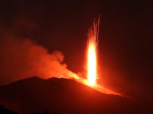
The National Institute of Geophysics and Volcanology (INGV) – Etna Observatory (INGV-OE) reports that field observations by its staff indicate ongoing effusive activity from vents located at elevations of 2,750 m and 1,990 m. The lava flow front has reached an elevation of 1,395 m, between Rocca delle Palombe and Rocca Musarra. Between 07:40 and 10:40 UTC, a series of short-lived explosions occurred at the Northeast Crater, generating an ash plume that dispersed over the summit area; according to wind forecast models, the plume drifted southeast. Strombolian activity resumed at the Voragine Crater at 16:22 UTC; subsequently, at 16:45 UTC, ash emission intensified at the Northeast Crater.
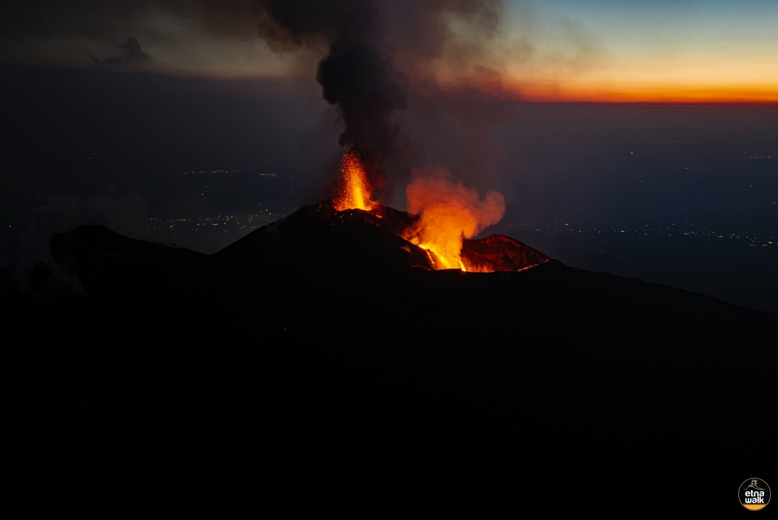
Regarding seismic activity, since late yesterday evening, the average amplitude of volcanic tremor has shown significant fluctuations between low and medium levels, with a general upward trend. This increase intensified during the final hours of the day; starting around 16:00 UTC, the tremor amplitude shifted from the medium to the high range. The tremor source centroids are located between the North-East Crater and the Voragine Crater, at elevations between 2,800 and 3,000 m. Low-intensity infrasonic activity began at the North-East Crater this morning at 05:30 UTC, characterized by sporadic low- and medium-energy events. From approximately 08:00 UTC, event energy increased slightly, reaching high levels around 10:00 UTC, although the number of infrasonic transients remained limited. From around 16:00 UTC, infrasonic activity showed a marked increase in the number of events; these exhibited low amplitudes but a distinct upward trend. These events are located at the Voragine Crater.
Starting at 16:37 UTC, signals from the tiltmeter networks revealed slight high-frequency variations at stations located on the northern flank. The Cratere del Piano station also recorded the onset of a slight trend. Signals from the GNSS network showed no significant variations.
Further updates will be provided as soon as possible.
Source : INGV.
Photo : Etna Walk / Giuseppe Distefano / Marco Restivo.
Nicaragua , Telica :
Telica volcano records low-magnitude explosion and light ashfall
Light volcanic ashfall has been reported in several neighborhoods and localities within the municipality of Chichigalpa (Chinandega Department) following activity at the Telica volcano. According to the incident report, the ashfall affected the neighborhoods of Bendición de Dios, Manantial de Vida, Wells, Quetzalia, Carlos Finca, Las Tajadas, San Antonio, Concepción, Mercedes, and La Parroquia. Ash was also reported in the localities of Guanacastal, La Isla, and Mojón.
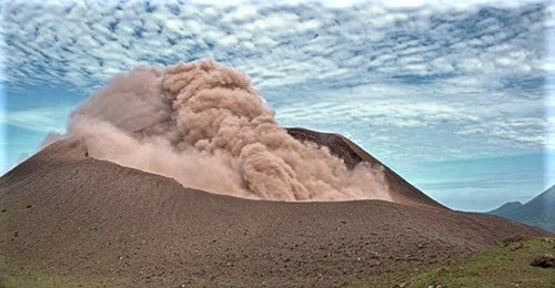
Meanwhile, the Nicaraguan Institute of Territorial Studies (INETER) reported that the Telica volcano had registered a low-magnitude explosion, accompanied by significant emissions of water vapor, gas, and ash.
According to the report, the plume of ejected material reached approximately 150 meters above the crater rim and drifted northwest.
In light of this activity, authorities continue to advise against climbing the Telica volcano as a safety and precautionary measure for the public.
Regarding the Masaya volcano, INETER indicated that it remains relatively calm. Access to Plaza Oviedo and stays at the site are permitted in small groups and for short durations, provided established safety measures are observed.
Similarly, the San Cristóbal, Cerro Negro, Momotombo, and Concepción volcanoes remain relatively calm, according to monitoring by the authorities.
Relevant agencies continue to monitor volcanic activity and recommend that the public remain attentive to official announcements regarding any changes in the behavior of the Telica volcano.
Source : Ineter / TN8.
Photo : Ineter ( archive).
Kamchatka , Klyuchevskoy :
KVERT VOLCANIC ACTIVITY NOTICE (VAN)
Issued: August 17 , 2026
Volcano: Klyuchevskoy (CAVW #300260)
Current aviation colour code: ORANGE
Previous aviation colour code: orange
Source: KVERT
Notice Number: 2026-88
Volcano Location: N 56 deg 03 min E 160 deg 39 min
Area: Kamchatka, Russia
Summit Elevation: 4750 m (15580 ft)
Volcanic Activity Summary:
The new summit explosive eruption of Strombolian type (lava fountaining in the volcano crater) of Klyuchevskoy volcano began on 15 August, 2026. The temperature of a thermal anomaly on the volcano sharp increased at 15:41 UTC on 15 August, 2026. KVERT continues to monitor Klyuchevskoy volcano.
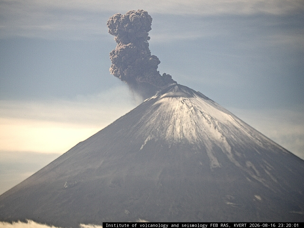
The summit explosive eruption of Strombolian type (lava fountaining in the volcano crater) continues. And сollapses of pyroclastic rocks from the Apakhonchich chute sides also continue. The ash plume is extending for 420 km to the southeast of the volcano.
The eruption of the volcano continues. Ongoing activity could affect low-flying aircraft.
Volcanic cloud height:
6000 m (19680 ft) AMSL Time and method of ash plume/cloud height determination: 20260817/0350Z – Video data
Other volcanic cloud information:
Distance of ash plume/cloud of the volcano: 420 km (261 mi)
Direction of drift of ash plume/cloud of the volcano: ESE / azimuth 111 deg
Time and method of ash plume/cloud determination: 20260817/0300Z – Himawari-9 14m15
Source : Kvert .
Photo : video data by KVERT, IVS FEB RAS. IVS FEB RAS
Indonesia , Anak Krakatau :
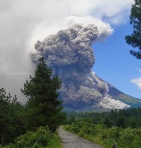
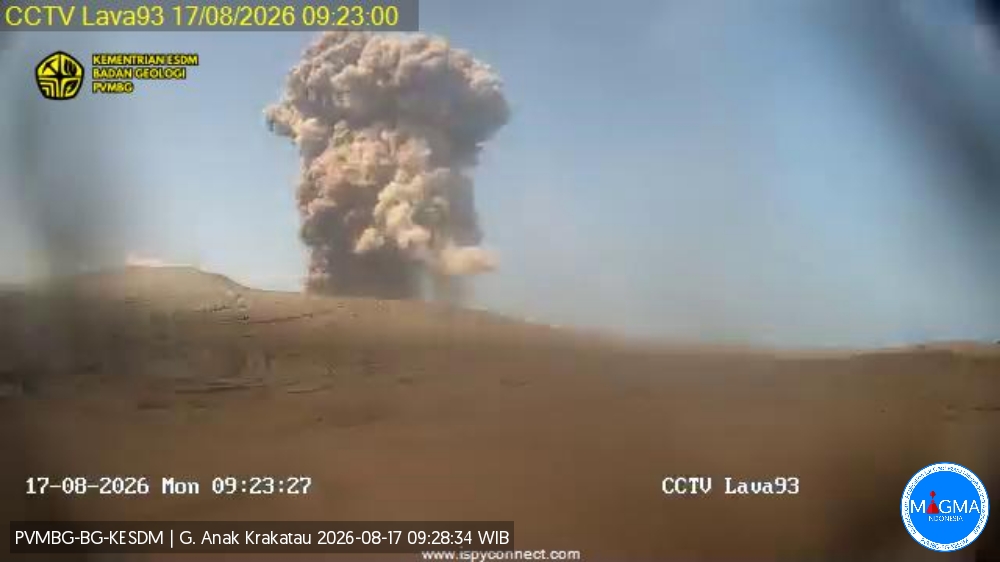
An eruption of Mount Anak Krakatau occurred on Monday, August 17, 2026, at 09:22 (Western Indonesia Time), with an ash column reaching a height of approximately 400 m above the summit (or about 557 m above sea level). The dense, gray-to-black ash column drifted northwest. The eruption was recorded by the seismograph with a maximum amplitude of 57 mm and a duration of 32 seconds.
Seismic observations
2 eruptive earthquakes with amplitudes of 56–57 mm and durations of 32–109 seconds.
32 emission earthquakes with amplitudes of 18–59 mm and durations of 20–98 seconds.
2 harmonic tremors with amplitudes of 36–43 mm and durations of 65–73 seconds.
2 hybrid/multiphase earthquakes with amplitudes of 43–50 mm and durations of 15–17 seconds.
1 continuous tremor with an amplitude of 2–50 mm (dominant amplitude of 20 mm).
Recommendations
The public, visitors, tourists, and hikers are advised not to approach Mount Anak Krakatau or engage in activities within a 3 km radius of the active crater.
Source et photo : PVMBG.
Colombia , Puracé – Los Coconucos volcanic chain :
Popayán, August 16, 2026, 2:00 PM.
Based on monitoring of the Los Coconucos volcanic chain’s activity, the Colombian Geological Service (SGC)—an agency attached to the Ministry of Mines and Energy—reports the following information:
Since the last bulletin, seismic signals associated with fluid dynamics within the volcanic conduits have remained predominant. Notable events include tremor signals (TR) and, to a lesser extent, long-period (LP) events, located beneath the Puracé volcano crater at depths of less than 2 km. Meanwhile, seismicity linked to rock fracturing has remained at a very low level—in terms of both frequency and magnitude—and is located 1 km beneath the crater. Additionally, slow ground deformation continues in the area encompassing the Puracé, Piocollo, and Curiquinga volcanoes.
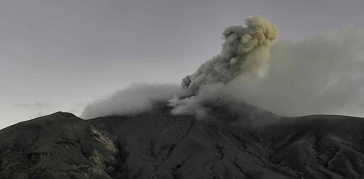
Since 2:00 PM yesterday and up to the time this bulletin was issued, seven ash emissions have been recorded; however, visual confirmation via monitoring webcams was not possible due to adverse weather conditions at the summits of the volcanic chain. Reports of ashfall have been received from the municipality of Puracé—specifically in the rural areas (*veredas*) of El Consuelo and 20 de Julio—as well as from the urban area of Coconuco.
Gas monitoring indicates that recorded sulfur dioxide (SO2) levels remain above the volcano’s usual average, and the upward trend in soil carbon dioxide (CO2) concentrations persists. Values recorded by instruments on the volcano in recent days are the highest observed to date, significantly exceeding established baseline levels; consequently, they indicate a major shift in the volcano’s dynamics, which remains at the orange alert level.
The public is advised to stay away from the crater areas of the Puracé, Piocollo, and Curiquinga volcanoes, as sudden ash or gas emissions posing a significant risk to individuals may occur.
In light of the above, the SGC recommends closely monitoring the situation via daily bulletins and other information released through our official channels, as well as adhering to instructions from local and departmental authorities and the National Unit for Disaster Risk Management (UNGRD).
The volcanic alert level remains at orange: a volcano exhibiting significant changes in monitored parameters.
Source et photo : SGC.