September 7 , 2026.
Indonesia , Anak Krakatau :
VOLCANO OBSERVATORY NOTICE FOR AVIATION – VONA
Issued : September 5 , 2026
Volcano : Anak Krakatau (262000)
Current Aviation Colour Code : RED
Previous Aviation Colour Code : orange
Source : Anak Krakatau Volcano Observatory
Notice Number : 2026KRA026
Volcano Location : S 06 deg 06 min 07 sec E 105 deg 25 min 23 sec
Area : Lampung, Indonesia
Summit Elevation : 502 FT (157 M)
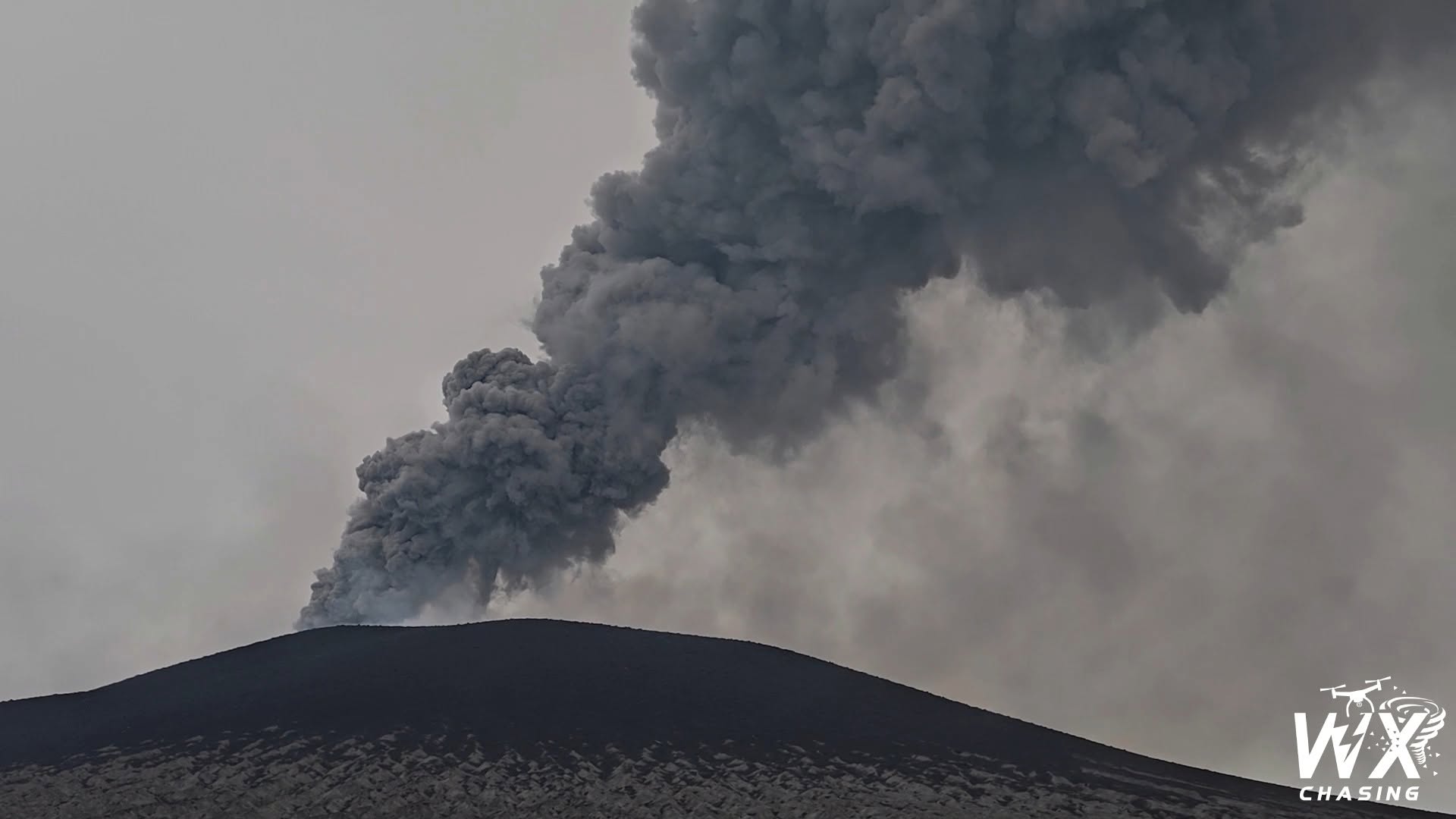
Volcanic Activity Summary :
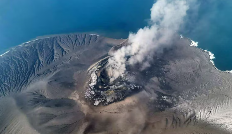
Eruption at 02h00 UTC (09h00 local).
Volcanic Cloud Height :
Ash-cloud is not observed.
Other Volcanic Cloud Information :
Ash-cloud is not observed.
Remarks :
Eruption and ash emission is continuing. Eruption recorded on seismogram with maximum amplitude 70 mm. Tremor recorded on seismogram with maximum amplitude 60 mm. Eruption accompanied by booming sounds and air shockwaves originating from Anak Krakatau
Seismic observations
9 harmonic tremors with amplitudes of 19–37 mm and durations of 21–86 seconds.
17 low-frequency earthquakes with amplitudes of 23–45 mm and durations of 7–15 seconds.
23 hybrid/multiphase earthquakes with amplitudes of 18–45 mm and durations of 7–15 seconds.
1 episode of continuous tremor with an amplitude of 3–20 mm (dominant amplitude of 8 mm).
Recommendations
The public, visitors, tourists, and hikers must not approach Mount Anak Krakatau or engage in any activities within a 3-kilometer radius of the active crater.
News outlets report that blasts could be heard up to 700 kilometers away. On Sunday, September 6, Indonesian authorities announced the extension of the suspension of operations at Jakarta International Airport, located more than 150 kilometers from the volcano. The suspension affected 209 flight movements and impacted over 22,000 passengers. The international route most affected is the one connecting to Singapore.
Muhamad Iid Mujtahiddin from the Meteorology, Climatology and Geophysics Agency (BMKG) told reporters that volcanic ash from Mount Anak Krakatau had reached a height of around 20,000 feet and was moving towards several areas, including West Java province.
Sources : PVMBG , C Granpey.ABC net
Photos : WXChasing , Ministry of Energy and Mineral Resources of Indonesia
Indonesia , Sinabung :
Modification of the recommended exclusion zone radius for Mount Sinabung, North Sumatra – Level III (SIAGA) – September 6, 2026, at 12:00 PM WIB
Mount Sinabung is an active volcano located in the Karo Regency, North Sumatra Province. Its current activity level has been classified as Level III (Siaga) since August 31, 2026.
The results of intensive monitoring conducted up to September 6, 2026, are as follows:
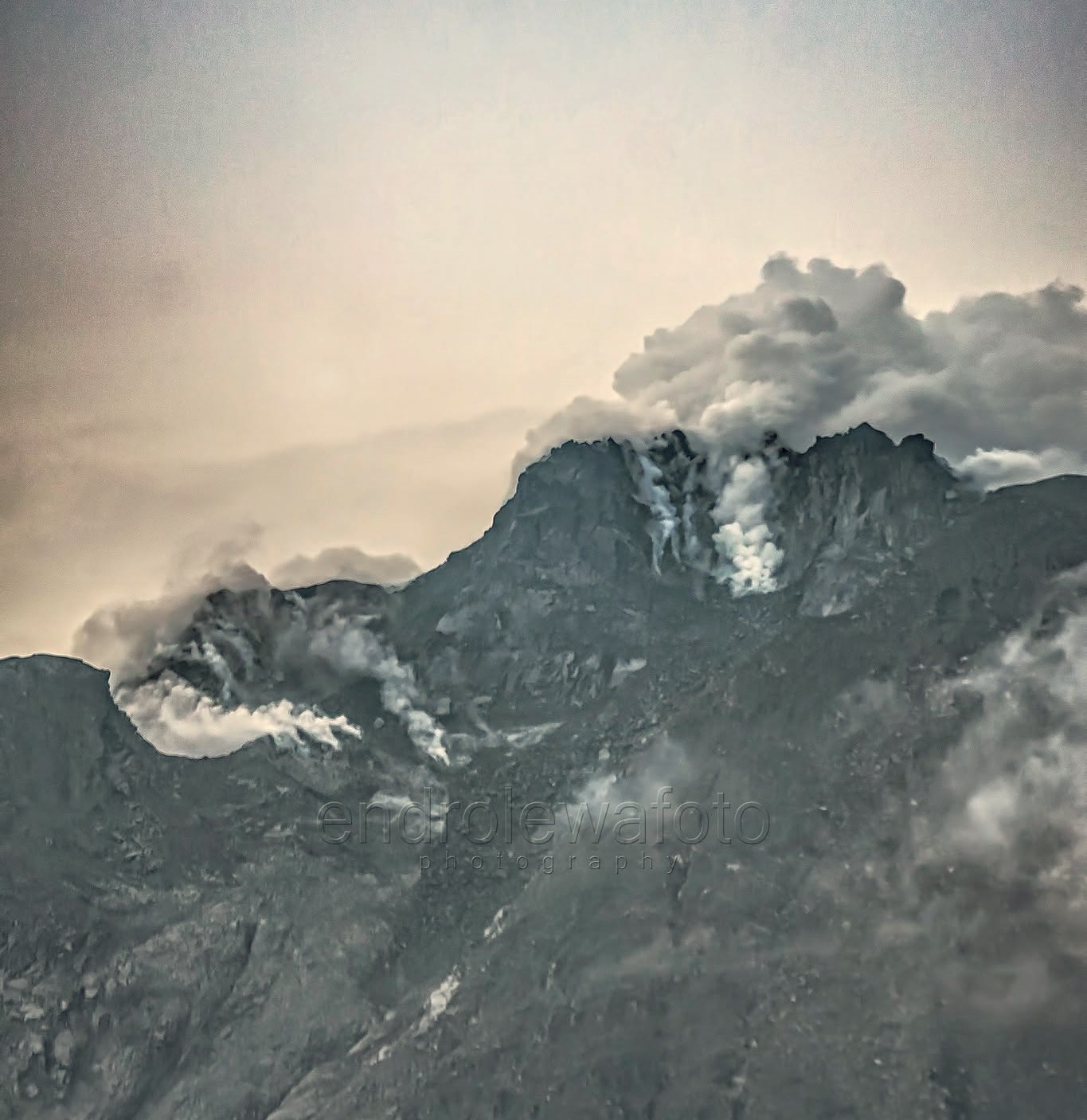
Dense white plumes rising from the crater have been observed, reaching heights of 300 to 500 meters above the summit.
Visual monitoring via drones has revealed no signs of new lava dome growth at Mount Sinabung’s eruptive center.
No rockfall-related earthquakes have been recorded, indicating that the existing lava dome remains stable (i.e., no new dome formation is underway). Lava dome growth capable of triggering a collapse is typically characterized by significant seismic activity—specifically hybrid and low-frequency earthquakes—phenomena that have not been detected to date.
Earthquakes associated with magma influx and shallow pressure buildup (types Va and Vb) continue to be recorded, although their frequency remains negligible.
Sulfur dioxide (SO2) levels remain high.
Based on visual and instrumental monitoring, Mount Sinabung’s activity level remains high; consequently, the status is maintained at Level III (SIAGA). However, the recommended exclusion zone has been adjusted: the previous 3 km radius around the summit (with a 6 km sectoral radius to the south-southeast) has been modified to a 3 km radius around the summit (with a 5 km sectoral radius to the south-southeast).
As of September 6, 2026, at 12:00 WIB, the Center for Volcanology and Geological Hazard Mitigation (PVMBG) of the Geological Agency recommends that the public, tourists, and hikers refrain from any activity within a 3 km radius of Mount Sinabung’s summit, as well as within a 5 km sectoral radius to the southeast of the volcano. In addition to direct threats such as incandescent rock ejections and ashfall, the public is also warned of potential secondary hazards—particularly lahars—especially during the rainy season. These lahars can flow along watercourses in the southwest sector that originate at the summit of Mount Sinabung.
Source : PVMBG.
Photo : Endro Lewa
Colombia , Galeras :
San Juan de Pasto, September 1, 2026, 5:20 PM.
Based on monitoring of activity at the Galeras volcano, the Colombian Geological Service (SGC)—an agency under the Ministry of Mines and Energy—reports the following:
During the week of August 25 to 31, 2026, the main variations in monitored parameters compared to the previous week were as follows:
● Amidst a context of low activity and fluctuating behavior of the Galeras volcanic complex, seismic activity increased in terms of the number of events but decreased in terms of energy released, remaining primarily associated with rock fracturing. Among the recorded events, two stand out for having a magnitude greater than 2.0: the first, recorded on August 29 at 1:00 PM, had a local magnitude of 2.7 and was located 5.6 km northeast of the Galeras volcano at a depth of 7.2 km; this event was felt by residents of Pasto. The second event occurred on August 30 with a local magnitude of 2.2; it was located 13.4 km northwest of the volcano at a depth of 13.9 km below the summit (4,276 m above sea level), and there were no reports of it being felt by the population. The other events were scattered within a radius of 1 to 13 km and at depths of less than 14 km.
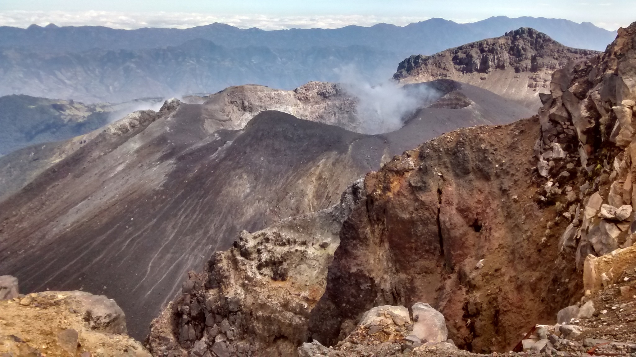
● Low-altitude emissions of white gas were recorded and dispersed according to wind direction. These emissions originated primarily from the El Paisita (to the north) and Las Chavas (to the west) fumarole fields, as well as from the main crater.
● Other volcanic monitoring parameters remained stable.
In light of the above, the SGC recommends closely monitoring the situation via weekly bulletins and other information published on our official channels, and adhering to instructions issued by local and departmental authorities and the National Unit for Disaster Risk Management (UNGRD).
Volcanic activity remains at the yellow alert level: an active volcano showing changes in the baseline behavior of monitored parameters and other manifestations.
Source et photo : SGC.
Ecuador , Sangay :
DAILY STATUS REPORT FOR SANGAY VOLCANO, Saturday, September 5, 2026.
Information from the Geophysical Institute – EPN.
Surface activity level: Low; Surface trend: Unchanged
Internal activity level: Low; Internal trend: Unchanged
Seismicity: From September 4, 2026, 11:00 AM to September 5, 2026, 11:00 AM:
Seismicity:
Here is the count of seismic events recorded at the reference station:
Explosion (EXP): 4
Precipitation / Lahars:
Precipitation was recorded in the volcano area but did not trigger mud or debris flows. In the event of heavy rain, accumulated material could be remobilized, generating mud and debris flows that would descend the volcano’s flanks and spill into adjacent watercourses.
Emission plume / ash:
No eruptive activity was recorded over the past 24 hours. Surveillance cameras and the GOES-19 satellite detected no gas or ash emissions, and the Washington VAAC issued no reports regarding the volcano’s activity.
Other monitoring parameters:
The FIRMS and MIROVA satellite systems recorded no thermal anomalies associated with the volcano over the past 24 hours.
Observation:
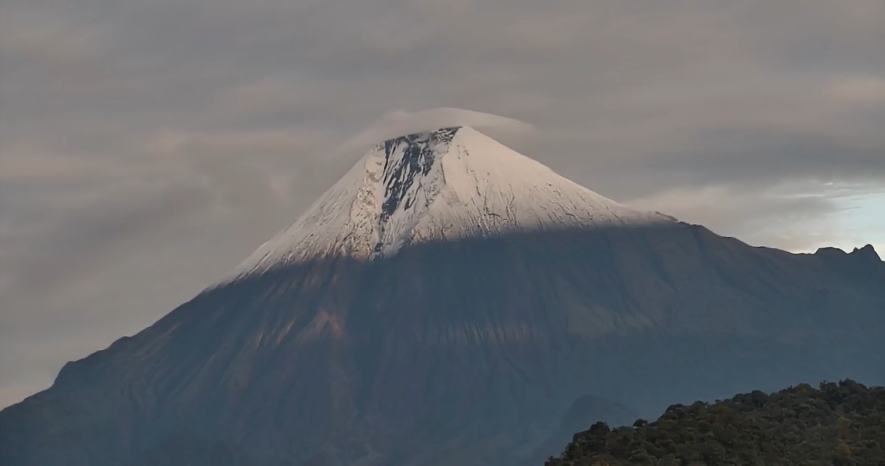
The volcano remained completely obscured by cloud cover yesterday afternoon and this morning.
Alert level: Yellow
Source : IGEPN
Photo : ecu 911.
Guatemala , Fuego :
Weather conditions: Clear skies
Wind: Easterly
Precipitation: 52.3 mm
Activity
Incandescence was observed in the crater of Fuego volcano during the night. Explosions occurred at a rate of 6 to 9 per hour, ranging in intensity from low to moderate—and at times strong; they were accompanied by gas and ash plumes reaching altitudes of 4,200 to 4,700 meters above sea level, dispersing primarily to the west and northwest. High-altitude winds are carrying fine ash particles up to a distance of approximately 30 km.
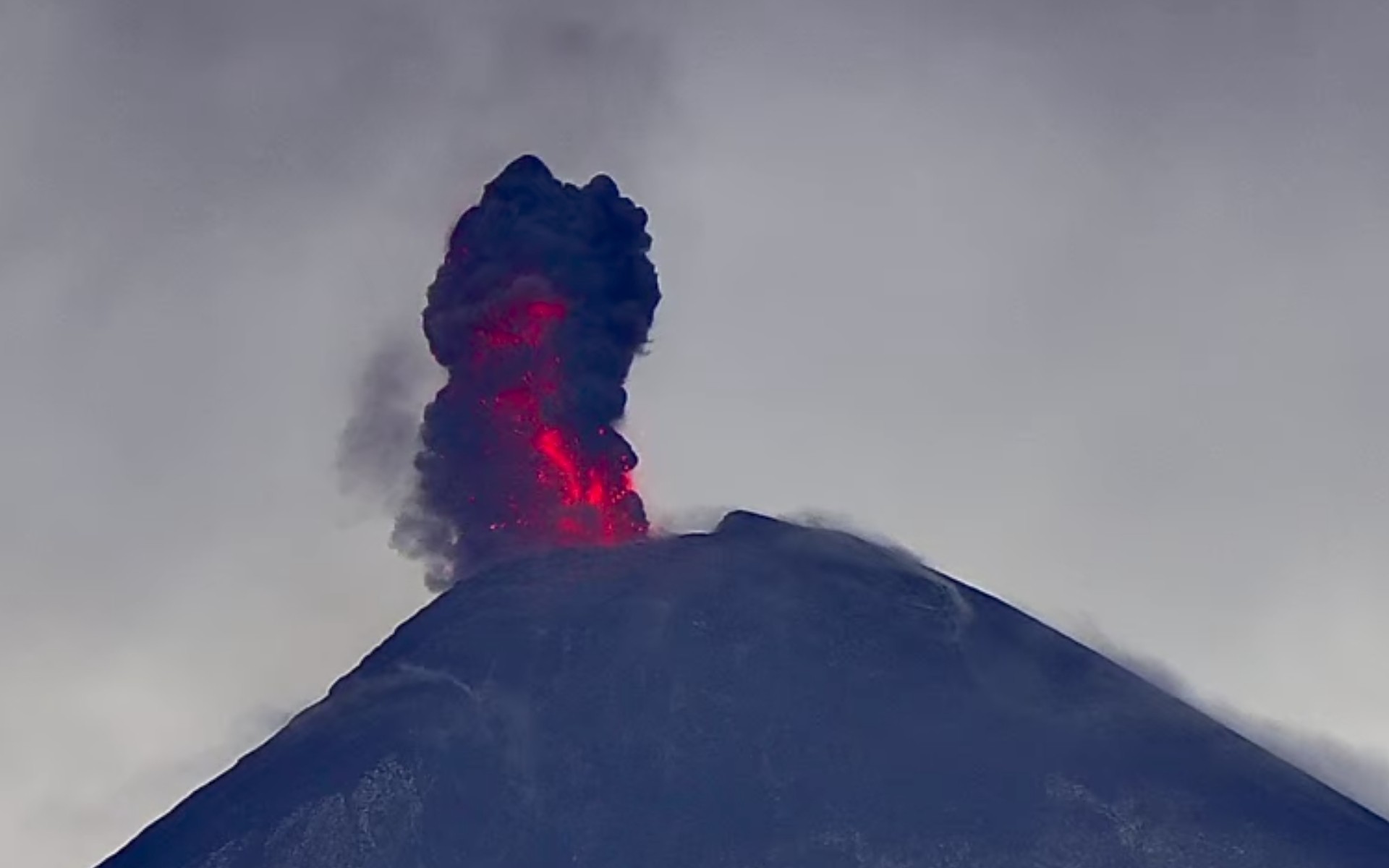
Explosive activity sometimes generates rumbling sounds accompanied by shockwaves and block avalanches on the southern, western, and southwestern flanks, as well as ashfall in Panimaché, Morelia, Santa Sofía, El Porvenir, San Pedro Yepocapa, and other localities. Due to the accumulation of volcanic material from the recent eruption, there is a risk of lahars forming in the Seca, Ceniza, and Lajas ravines and other channels, particularly during afternoon and evening rains. Consequently, extreme caution is advised when crossing these channels, and it is recommended to avoid parking on the plateau or in the immediate vicinity due to risks associated with volcanic activity.
Source : Insivumeh.
Photo : Afar TV