September 5 , 2026.
Indonesia , Anak Krakatau :
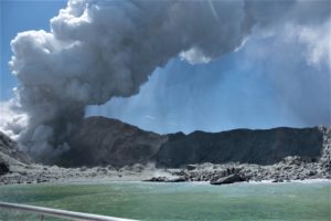
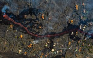
Ongoing eruption of the Anak Krakatau volcano on September 5, 2026.
Anak Krakatau is an active Type A volcano located in the waters of the Sunda Strait; administratively, it falls under the South Lampung Regency in Lampung Province. However, monitoring of Anak Krakatau is conducted from two observation posts: one in Kalianda (South Lampung Regency, Lampung Province) and the other in Pasauran (Serang Regency, Banten Province).
Historical records document a massive eruption in 1883 that generated a tsunami. Furthermore, on December 22, 2018, seismic tremors triggered an eruption and a partial collapse of the volcano’s structure, causing a tsunami in the Sunda Strait region. Following the December 22, 2018 event, a series of low-intensity eruptions—marking a rebuilding phase for Anak Krakatau—continued until December 16, 2023. A long period of quiescence ensued before eruptions resumed on July 2, 2026.
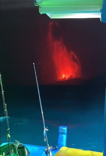
Since July 2, 2026, Anak Krakatau has remained at activity level III (Siaga/Vigilance). A series of Strombolian-type eruptions, characterized by the ejection of incandescent rocks and volcanic ash, continued until September 5, 2026. On September 5, 2026, at 11:07 PM (WIB local time), Anak Krakatau began a continuous eruption accompanied by rumbling sounds. By 4:40 AM (WIB) on September 5, 2026, the continuous eruption persisted, and rumbling associated with the activity remained audible from the Krakatau-Pasauran observation post. Although the height of the eruption column is not visible, the red glow of the eruptive jet remains clearly and continuously visible. This eruptive phenomenon resembles a « lava fountain » generating lava flows. Eruptions lasting several hours, accompanied by lava fountaining, are frequent. Detonations and tremors reported by residents in parts of West Java, Banten, and Lampung are attributed to the ongoing eruptive activity of Mount Anak Krakatau. Current assessments indicate that the rebuilding of the Anak Krakatau volcano—following the eruption of December 22, 2018—remains relatively limited and poses no risk of a collapse large enough to trigger a tsunami. Nevertheless, its activity and morphological changes continue to be closely monitored.
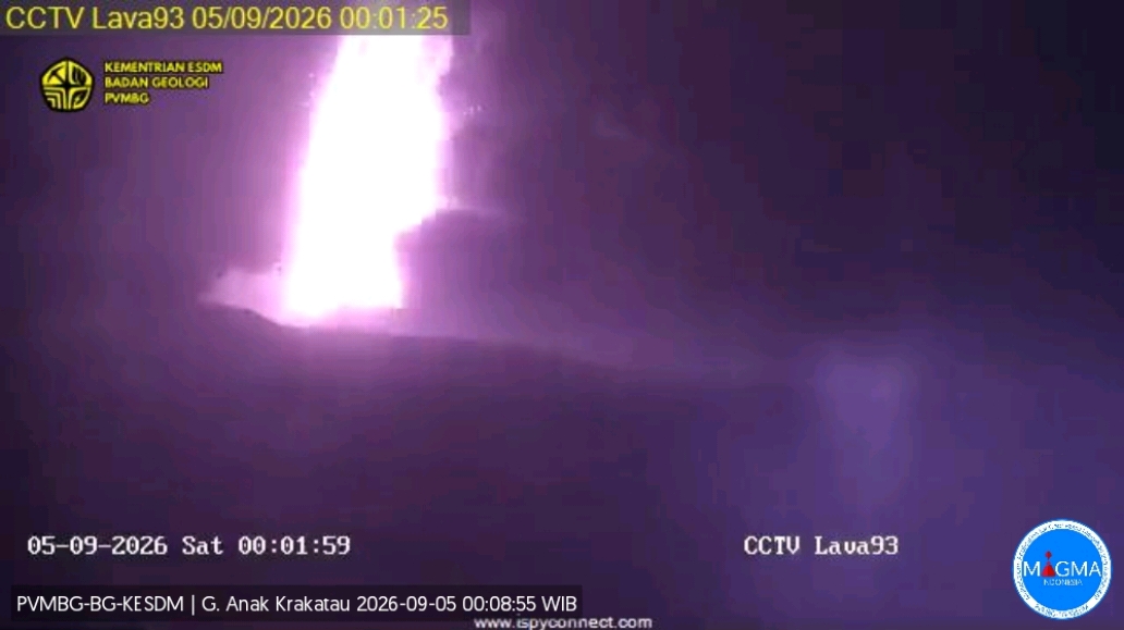
Currently, the activity level at Anak Krakatau remains at Level III (Alert/Siaga). The primary eruption risks stem from lava flows, which may be accompanied by the ejection of incandescent rocks.
The technical recommendations for Anak Krakatau at Level III (Alert) are as follows:
Local residents, visitors, tourists, and hikers are prohibited from entering or engaging in activities within a 3-kilometer radius of the volcano’s active center.
Increased vigilance is advised regarding risks such as pyroclastic flows, lava, incandescent rock ejections, and heavy ashfall.
Residents of coastal areas in the Banten and Lampung provinces are urged to remain calm and continue their daily activities as usual, while strictly adhering to the directives of local disaster management agencies (BPBD).
Source : PVMBG.
Photos : via Stela Malinova / FB , PVMBG.
Colombia , Puracé – Los Coconucos volcanic chain :
Popayán, September 4, 2026, 3:40 PM
Regarding the monitoring of activity in the Los Coconucos volcanic chain, the Colombian Geological Service (SGC), an agency attached to the Ministry of Mines and Energy, reports the following:
Since the publication of the last bulletin, seismic records continue to show a predominance of signals associated with fluid dynamics within the volcanic conduits—specifically tremor (TR) signals—located beneath the Puracé volcano crater at depths of less than 2 km. Seismicity associated with rock fracturing (volcano-tectonic, VT) continues to be recorded, primarily between 13 and 19 km northeast of the Puracé volcano, at depths ranging from 7 to 11 km. The highest recorded magnitude was 1.8 ML. Slow ground deformation continues in the area between the Puracé, Piocollo, and Curiquinga volcanoes.
Since 2:00 PM yesterday, two ash emissions have been recorded. Due to adverse weather conditions, it was not possible to determine the height of the ash column; however, reports of ashfall were received from residents and community monitoring members in the hamlets of Cristales and Loma Linda.
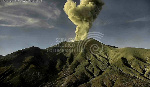
Gas monitoring indicates that sulfur dioxide (SO₂) emissions are ongoing and that soil carbon dioxide (CO₂) concentrations continue to rise. No thermal anomalies associated with the crater floor have been recorded, according to data from satellite monitoring platforms.
Overall, across various volcanic monitoring methods, instrument readings at the volcano in recent weeks have reached peak levels; these values significantly exceed the volcano’s baseline behavior, indicating a marked shift in its dynamics. Consequently, the volcano remains at an orange alert level.
The public is advised to stay away from the crater areas of the Puracé, Piocollo, and Curiquinga volcanoes, as well as the headwaters of the rivers originating from them, due to the risk of sudden gas and ash emissions—accompanied by the ejection of rock fragments. Furthermore, the accumulation of ash and erupted material could trigger localized mudflows.
The volcanic activity alert level remains Orange: indicating a volcano showing significant changes in monitored parameters.
Source et photo : SGC.
Martinique , Mount Pelée :
Weekly Report, Institut de physique du globe de Paris / Martinique Volcanological and Seismological Observatory (OVSM)
Saint-Pierre, September 4, 2026, at 14:15 local time (GMT-4)
Volcano-tectonic seismic activity
Between August 28, 2026, at 16:00 (UTC) and September 4, 2026, at 16:00 (UTC), the OVSM recorded 185 earthquakes of volcanic origin:
• 183 volcano-tectonic earthquakes. Two earthquakes had a magnitude (local magnitude Mlv or duration magnitude Md) greater than 1. The largest had a magnitude of Mlv = 1.6. The vast majority of these earthquakes were located at depths between 0.9 and 1.8 km below the volcano’s summit. However, one low-energy volcano-tectonic earthquake was located at a depth of 7 km below sea level, north of Montagne Pelée.
• 2 shallow, low-energy hybrid earthquakes (magnitudes Mlv = 0.3 and Mlv = 1.0), located at a depth of approximately 1 km below the volcano’s summit.
No earthquakes were reported felt by the population.
During the previous week, the OVSM had recorded 71 earthquakes of volcanic origin. As of September 4, 2026, and over the past four weeks, the OVSM has thus observed a total of 427 volcanic earthquakes, representing an average of 106 to 107 earthquakes per week.
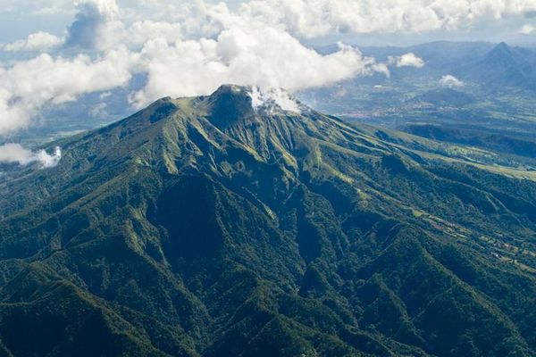
Deformations of Mount Pelée
Since May 2026, the OVSM has been recording ground displacements of several centimeters in the summit area of Mount Pelée. Over the past four weeks, maximum displacement rates have been around 0.6 cm per month, a slight decrease compared to the previous month. These displacements are consistent with deformation of the volcanic edifice caused by an inflating pressure source located at a depth of approximately 1 km beneath the summit.
The probability of short-term eruptive activity remains low. However, based on observations gathered over recent months and years, a change in the situation over the medium term (weeks to months) cannot be ruled out.
The volcanic alert level, in accordance with protocols established by the authorities, is currently YELLOW: vigilance.
Source : Direction de l’OVSM-IPGP
Photo : Parc Naturel .
Costa Rica , Poas :
Latitude: 10.20° N;
Longitude: 84.23° W;
Elevation: 2,687 m above sea level.
Current activity level: alert
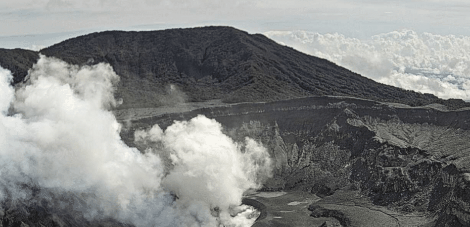
Last week, a significant eruption (400 m) was recorded on the 27th. In contrast, only a few small eruptions (< 50 m) were recorded this week. Some
of these generated a weak acoustic signal but no seismic signal. At times, they were observable only via camera, as ambient noise masked the acoustic signal.
Following last week’s eruption, tremor amplitude decreased and remained stable throughout the week.
Three volcano-tectonic earthquakes were recorded this week:
two proximal and one distal. None could be located. The number of long-period events had increased following the eruption on the 27th; this week, the count rose notably on September 1st and 2nd. The events occurring on those days displayed characteristics differing from the norm, featuring an emergent high-frequency (> 5 Hz) initial phase followed by a low-frequency (< 5 Hz) phase. The GNSS network shows no significant deformation, apart from a gradual uplift trend around the crater over the past few months. In the medium term (6 months), a trend of contraction and subsidence of the volcanic massif is observed.
InSAR satellite measurements from the last 6 months detect subsidence of up to 3 cm around the crater lake. Multi-GAS stations recorded a decrease in the SO2/CO2 ratio, averaging 0.8 ± 0.3, compared to 1.5 ± 0.6 the previous week.
The H2S/SO2 ratio remains below 0.1. NOVAC stations recorded 147 ± 25 tonnes of SO2 per day, with a maximum of 487 t/d. This flux is comparable to that of the previous week (188 ± 69 t/d, with a maximum of 704 t/d). The level of the hyperacidic lake rose by nearly one meter this week. It remains very hot (>70°C).
Source et photo : Ovsicori .
Alaska , Shishaldin :
Volcanic activity remains elevated, with frequent small earthquakes, ongoing tremor, and occasional infrasound signals from minor explosions deep within the conduit. While clouds obscured most satellite and webcam views, steam plumes were visible in web camera images during clear weather. Satellite data detected minor sulfur dioxide gas emissions on 2 days this past week.
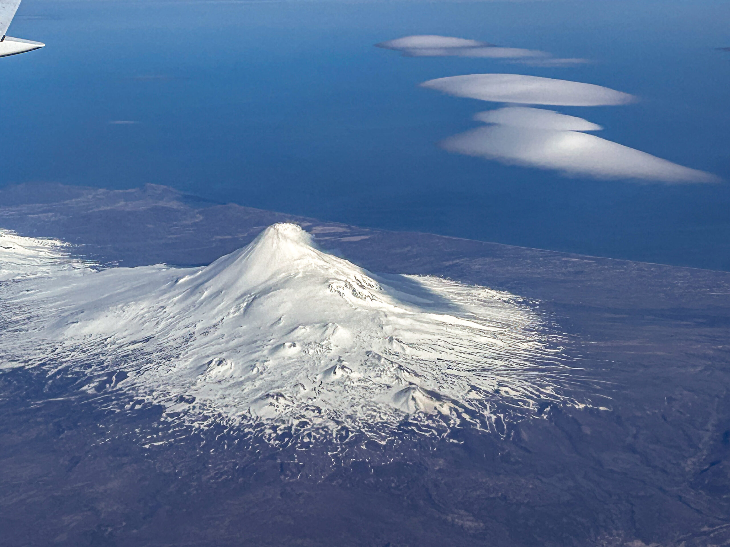
Shishaldin Volcano, from the north. Photo taken on Aleutian Airways flight between Dutch Harbor and Anchorage the evening of June 3, 2026.
Shishaldin Volcano is monitored by local seismic and infrasound sensors, web cameras, and a telemetered geodetic network. In addition to the local monitoring network, the Alaska Volcano Observatory uses nearby geophysical networks, regional infrasound and lightning data, and satellite data to monitor the volcano.
Source : AVO
Photo : Michelle Coombs / AVO/USGS.