September 20 , 2026.
Hawaii , Kilauea :
HAWAIIAN VOLCANO OBSERVATORY DAILY UPDATE U.S. Geological Survey
Saturday, September 19, 2026, 10:27 AM HST (Saturday, September 19, 2026, 20:27 UTC)
19°25’16 » N 155°17’13 » W,
Summit Elevation 4091 ft (1247 m)
Current Volcano Alert Level: WATCH
Current Aviation Color Code: ORANGE
Summary:
There is currently no active lava on the ground. The north and west vents continue to glow and emit flames. Minor summit inflation occurred overnight. There is no anomalous activity outside of the summit.
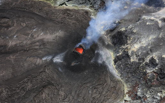
Glow and flames were observed on Kīlauea summit webcam footage overnight, accompanied by sporadic spattering; however, only incandescence was visible inside the vent during a monitoring overflight conducted by the USGS Hawaiian Volcano Observatory on the afternoon of September 18, 2026.
Overview:
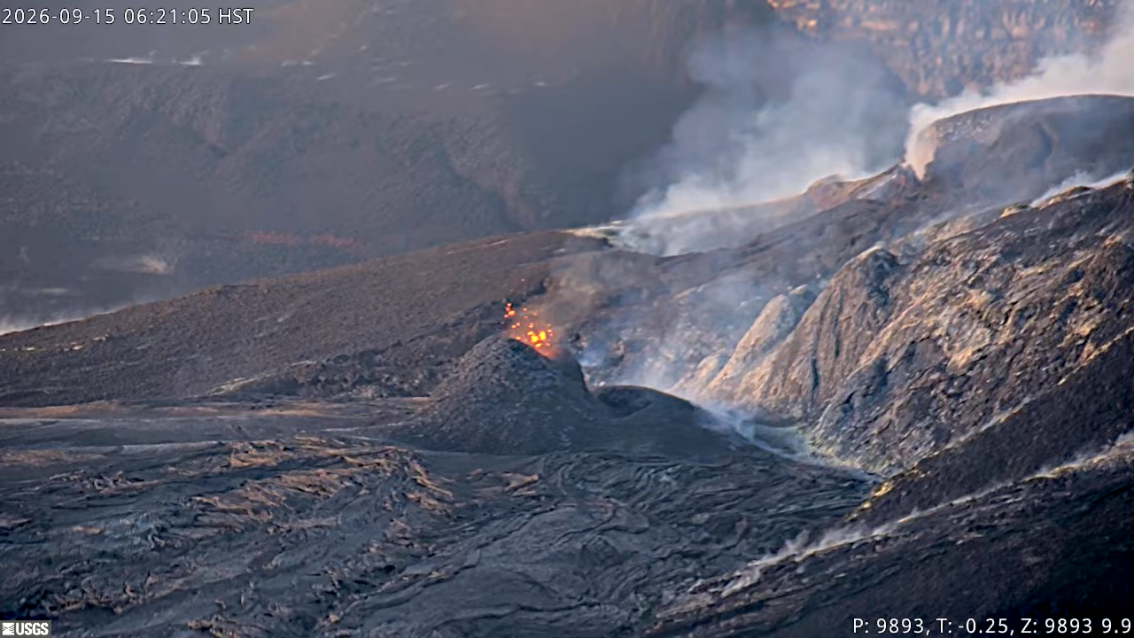
Glow and flames continued from the north and west vents throughout the night, the south vent was dark. None of the new vents along the crater wall showed any signs of activity in the past 24 hours. Slow inflation continues at the summit, gaining approximately 1 microradian over the past day. Tremor bursts continue to be the dominant seismic signal across the summit. No anomalous seismic activity or deformation has occurred outside of the summit region.
The system is within 1-2 days of reaching the maximum inflation of 16 microradians of tilt recovered since episode 54 fountaining ended. When this peak pressurization is reached, it is possible that activity will resume at the north-south-west vent complex, or reactivate the vent 1-6 system, or intrude another weak area in the summit region. None of these events are likely to produce a strong seismic precursor, so the alert levels have been left at ORANGE/WATCH as the volcano continues to « exhibit heightened unrest with an increased potential for eruption ».
Summit Observations:
Glow and flames continued all night from the north and west vent. The south vent was dark. No spattering was observed from any of the vents.
Strong tremor bursts continue this morning and are the dominant seismic signal across the summit. There were five small earthquakes located across the summit region in the past day, but they did not form clusters in time or location.
Summit inflation continues this morning, recording an increase of about 1 microradian over the past day. The total inflation since the end of episode 54 is currently about 15 microradians, more than two microradians greater than was lost during episode 54 fountaining.
During inter-episode pauses, the sulfur dioxide (SO2) emission rate from the summit typically varies between 1,000 and 5,000 tonnes per day.
Rift Zone Observations:
Rates of seismicity and ground deformation remain low in the East Rift Zone and Southwest Rift Zone. SO2 emissions from the East Rift Zone remain below the detection limit. No significant ground deformation was recorded in either rift zone.
Source : HVO.
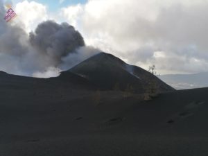
Photos : USGS / K. Lynn. USGS.
Indonesia , Ibu :
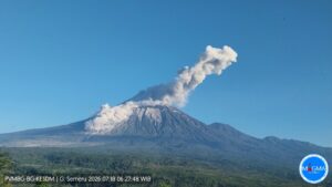
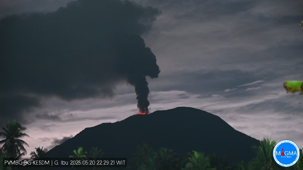
An eruption of Mount Ibu occurred on Saturday, September 19, 2026, at 10:01 a.m. (WIT), with an ash column reaching a height of approximately 600 m above the summit (or about 1,925 m above sea level). The column, ranging in color from white to gray and in intensity from moderate to dense, drifted northeast. At the time of writing, the eruption was still ongoing.
Seismic observations
91 eruption earthquakes with amplitudes of 15–28 mm and durations of 31–87 seconds.
3 emission earthquakes with amplitudes of 6–8 mm and durations of 33–44 seconds.
20 harmonic tremors with amplitudes of 3–28 mm and durations of 32–146 seconds.
100 low-frequency earthquakes with amplitudes of 2–15 mm and durations of 17–29 seconds.
152 shallow volcanic earthquakes with amplitudes of 2–6 mm and durations of 7–27 seconds.
2 deep volcanic earthquakes with amplitudes of 2–19 mm and durations of 15–22 seconds.
2 local tectonic earthquakes with amplitudes of 2 mm and durations of 22–28 seconds.
17 distant tectonic earthquakes with amplitudes of 2–28 mm and durations of 42–123 seconds.
Recommendations
1. Communities living near Mount Ibu, as well as visitors and tourists, are advised not to conduct any activities within a 2 km radius, nor within the 3.5 km sectoral extension zone stretching toward the crater opening located on the northern flank of Mount Ibu’s active crater.
2. In the event of ashfall, individuals outdoors are advised to protect their noses and mouths (using masks) and their eyes (using protective eyewear).
Source et photo : PVMBG.
Costa Rica , Poas :
Latitude: 10.20° N;
Longitude: 84.23° W;
Elevation: 2,687 m above sea level.
Current activity level: Advisory
No eruptions were recorded this week. Tremor amplitude remains moderate, with little variation. A proximal volcano-tectonic earthquake was recorded this week.
The number of long-period events has increased. In the short to medium term, a trend of contraction and subsidence of the volcanic edifice is observed. Multi-GAS stations recorded an SO2/CO2 ratio of 1.2 ± 0.3, comparable to the value from the previous week (1.1 ± 0.4).
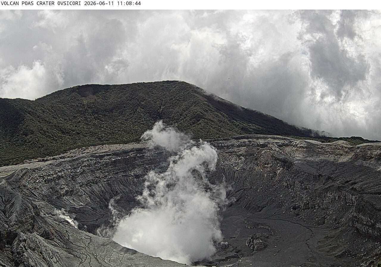
The H2S/SO2 ratio remains below 0.1. NOVAC stations recorded 190 ± 34 tonnes of SO2 per day, with a maximum of 843 t/d. This flux is comparable to that of the previous week (152 ± 38 t/d with a maximum of 520 t/d). The Sentinel satellite detected the SO2 plume on September 14 and 17, with a maximum value exceeding 40 tonnes of SO2.
The lake level stabilized this week, showing a rise of approximately 0.2 m.
Source et photo : Ovsicori .
Ecuador , El Reventador :
DAILY STATUS REPORT FOR REVENTADOR VOLCANO, Saturday, September 19, 2026.
Information from the Geophysical Institute – EPN.
Surface activity level: High; Surface trend: Unchanged
Internal activity level: Moderate; Internal trend: Unchanged
From September 18, 2026, 11:00 AM to September 19, 2026, 11:00 AM:
Seismicity:
Explosion (EXP): 96
Long-period (LP): 13
Emission tremor (TREMI): 14
Harmonic tremor (TRARM): 7
Precipitation / Lahars:
No precipitation was recorded in the area. **Heavy rains could remobilize accumulated material and generate debris-laden mudflows (lahars) capable of descending the volcano’s flanks and flowing into adjacent rivers.**
Emission plume / ash:
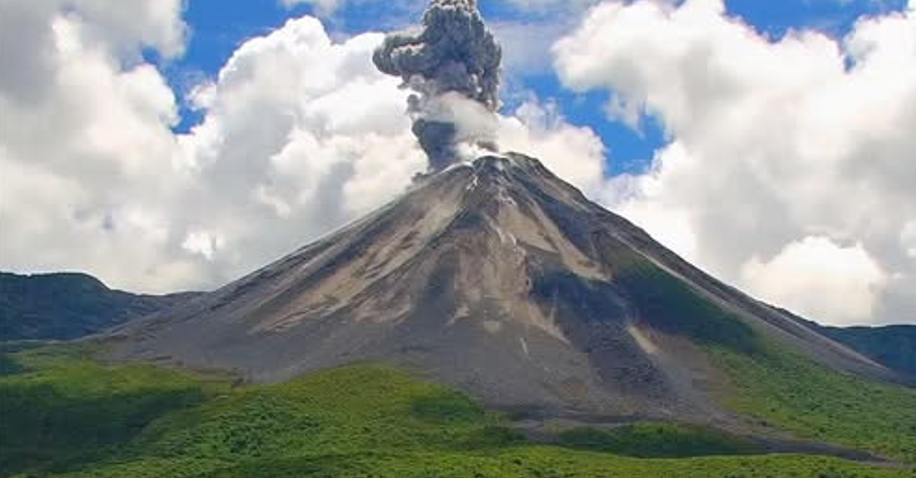
Monitoring cameras captured several gas and ash emissions reaching heights of 300 to 700 meters above the crater rim, drifting west, southwest, and west-southwest. In connection with this activity, the Washington VAAC issued two reports noting plumes reaching 700 meters above the crater, drifting west and northwest.
Other monitoring parameters:
The MIROVA MODIS satellite system recorded one thermal anomaly, the MIROVA VIIRS 750 system recorded one, and the MIROVA VIIRS 375 system recorded two over the past 24 hours.
Observation:
Overnight and early this morning, cameras recorded incandescent material descending as far as 1,100 meters below the crater rim. Currently, the volcano is completely obscured by clouds.
Alert Level – SGR: Orange
Source : IGEPN.
Photo : Afar tv
Colombia , Cumbal :
San Juan de Pasto, September 15, 2026, 6:30 PM
Based on monitoring of activity at the Cumbal Volcanic Complex (CVC), the Colombian Geological Service (SGC)—an agency attached to the Ministry of Mines and Energy—reports the following:
During the week of September 8 to 14, 2026, the main variations in monitored parameters compared to the previous week were as follows:
● Consistent with the fluctuating behavior characteristic of this volcanic complex, seismic activity increased compared to the previous week, while the energy
released remained at similar levels. Seismicity was primarily associated with rock-fracturing processes, followed by events linked to fluid
dynamics.
● Seismicity related to rock fracturing was concentrated at an average distance of 1.3 km west of Cumbal Volcano, within a radius of approximately 1.6 km; the maximum depth was 5.5 km relative to the elevation of the La Plazuela crater (4,700 m above sea level), and the maximum magnitude was 1.2. Other events were scattered across the volcanic area, with a maximum magnitude of 1.1 and a depth of 20 km. No earthquakes were felt by the population living near the volcanic area.
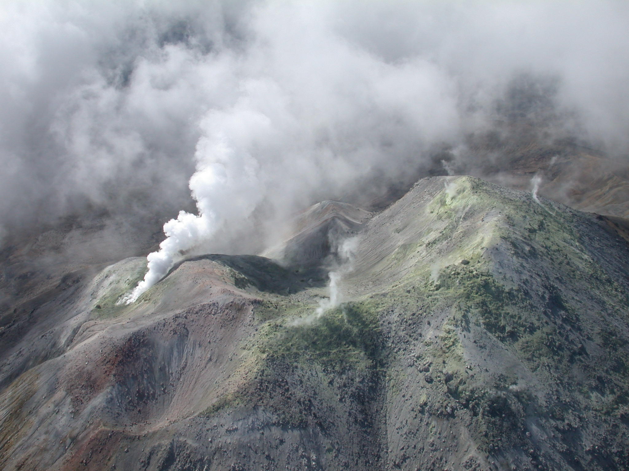
● Low-altitude white gas emissions were observed at the Boca Vieja and Rastrojos fumarole fields (southwest flank of the CVC). The dispersion of these plumes varied depending on wind direction.
● Other volcanic monitoring parameters remained stable.
In light of the above, the SGC recommends closely monitoring the situation via weekly bulletins and other information released through our official channels, as well as adhering to the guidelines issued by local and departmental authorities and the National Unit for Disaster Risk Management (UNGRD).
Volcanic activity remains at the yellow alert level: an active volcano showing behavioral changes relative to the baseline of monitored parameters, along with other manifestations.
Source et photo : SGC.