September 18 , 2026.
Hawaii , Kilauea :
HAWAIIAN VOLCANO OBSERVATORY DAILY UPDATE U.S. Geological Survey
Thursday, September 17, 2026, 10:01 AM HST (Thursday, September 17, 2026, 20:01 UTC)
19°25’16 » N 155°17’13 » W,
Summit Elevation 4091 ft (1247 m)
Current Volcano Alert Level: WATCH
Current Aviation Color Code: ORANGE
Summary:
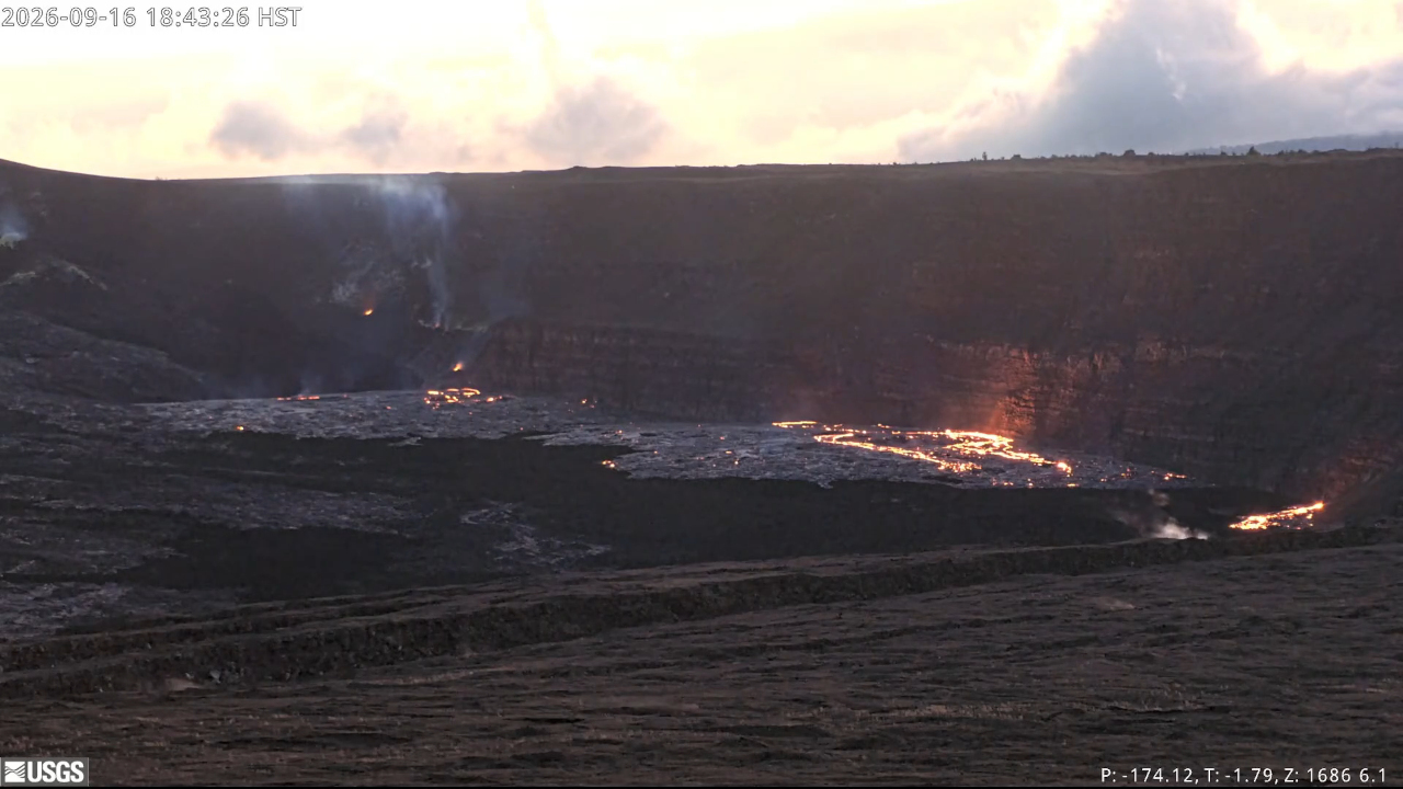
The new vents stagnated last night, there is currently no active lava on the ground. The north, south, and west vents continue to glow. A minor summit deflation began at about 5 pm HST last night. There is no anomalous activity outside of the summit.
Overview:
Summit tilt and tremor began dropping slowly at about 5:00 p.m. HST coincident with the opening of vent 6. However, by 8:30 p.m. HST all of the new vents had stagnated as slow deflation of the summit continued. Glow continued from the north, south, and west vents throughout the night, but was obscured by heavy rainfall in the early morning. The small summit deflation continues but has slowed this morning. Tremor bursts began reappearing at about 9 p.m. HST last night and continue to be the dominant seismic signal. No anomalous seismic activity or deformation has occurred outside of the summit region.
No significant activity has been noted along Kīlauea’s East Rift Zone or Southwest Rift Zone. However, tiltmeters on the East Rift Zone did show typical rainfall excursions early this morning. These changes are not related to magma movement.
Summit Observations:
Summit tilt and tremor began dropping around 5 p.m. HST yesterday just as vent 6 opened up north of the other vents. Shortly after, eruptive activity began to diminish on the new vents and was completely stagnated at all six vents by 8:30 p.m. HST. There were short-lived, small flows from several of the vents during the night as the vents depressurized.
Glow continued all night from the north-south-west vent complex along with flames at times. The vents were obscured by heavy rain and clouds in the early morning hours but no obvious changes in the intensity of glow from the vents could be detected. Spattering stopped at the north vent around 7 p.m. HST and about two hours later at the south and west vents.
Tremor began decreasing around 5 p.m. and by 9 p.m. HST was transitioning from continuous tremor to intermittent tremor bursts. Tremor bursts became dominant after 10 p.m. HST and strengthened until about 1:30 a.m. HST. Strong bursts continue this morning and are the dominant seismic signal across the summit. There were twelve earthquakes located across the summit region. Ten of these occurred within the last 8 hours, but do not form clusters in time or location.
.
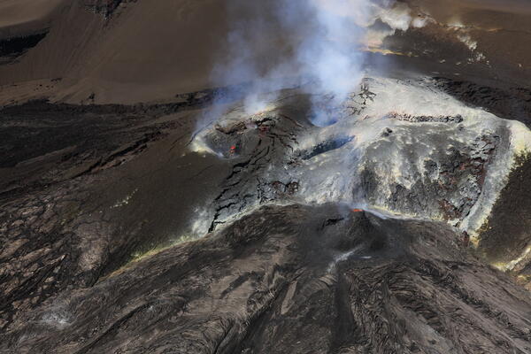
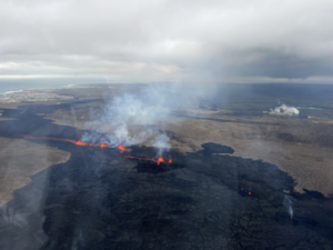
Oblique aerial view looking southwest of south (left) and north (right) vents, taken during a USGS Hawaiian Volcano Observatory helicopter overflight on September 16, 2026. Spattering from north vent has formed a cone that is approximately 10 meters (30 feet) tall.
The summit underwent a small deflation last night of about 2 microradians measured on the UWD tiltmeter. Slow deflation continues this morning but appears to be leveling off. The amount of deflation is similar to the deflationary « steps » recorded earlier in this repose period and in the periods leading up to episodes 51-54. The total inflation since the end of episode 54 is currently 14 microradians, over a microradian more than was lost during episode 54 fountaining.
During inter-episode pauses, the sulfur dioxide (SO2) emission rate from the summit typically varies between 1,000 and 5,000 tonnes per day. Moderate to strong trade winds (10 miles per hour, 5 meters per second or more) are pushing the degassing plume to the southwest of Kīlauea’s summit caldera this morning and are expected to continue. Models indicate that gases as well as fine ash and Pele’s hair would be transported to the south of Kaluapele if fountaining starts today with an episode 55.
Rift Zone Observations:
Rates of seismicity and ground deformation remain low in the East Rift Zone and Southwest Rift Zone. SO2 emissions from the East Rift Zone remain below the detection limit. No significant ground deformation was recorded in either rift zone, however, tiltmeters on the East Rift Zone did show typical, minor rainfall excursions early this morning. These changes are not related to magma movement.
Source : HVO.
Photos : USGS. , USGS / N. Deligne .
Indonesia , Anak Krakatau :
The Pusat Vulkanologi dan Mitigasi Bencana Geologi (PVMBG) reported ongoing eruptive activity at Krakatau during 9-16 September. During 6-11 September there were 14 Strombolian eruptions reported. There was one eruption detected on a seismograph at 00h47 on 9 September, but it was not visually confirmed. According to an analysis of a HIMAWARI-9 RGB image taken on that same day, an ash plume rose 2.1 km above the summit and drifted NW at 10h00. As of 16 September the five journalists and three crew members of a missing ship had not been found. The Alert Level remained at 3 (on a scale of 1-4) and the public was advised to stay 3 km away from summit.

Seismic observations
2 harmonic tremors with amplitudes of 6–7 mm and durations of 13–24 seconds.
1 low-frequency earthquake with an amplitude of 10 mm and a duration of 7 seconds.
1 hybrid/polyphase earthquake with an amplitude of 28 mm and a duration of 6 seconds.
1 episode of continuous tremor with amplitudes of 1–7 mm (dominant amplitude of 2 mm).
Recommendations
The public, visitors, tourists, and hikers must not approach Mount Anak Krakatau or engage in activities within a 3 km radius of the active crater.
Source : PVMBG , GVP.
Photo : Storm chaser / FB.
Kamchatka , Sheveluch :
KVERT VOLCANIC ACTIVITY NOTICE (VAN)
Issued: September 17 , 2026
Volcano: Sheveluch (CAVW #300270)
Current aviation colour code: ORANGE
Previous aviation colour code: orange
Source: KVERT
Notice Number: 2026-99
Volcano Location: N 56 deg 38 min E 161 deg 19 min
Area: Kamchatka, Russia
Summit Elevation: 3283 m (10768.24 ft), the dome elevation ~2500 m (8200 ft)
Volcanic Activity Summary:
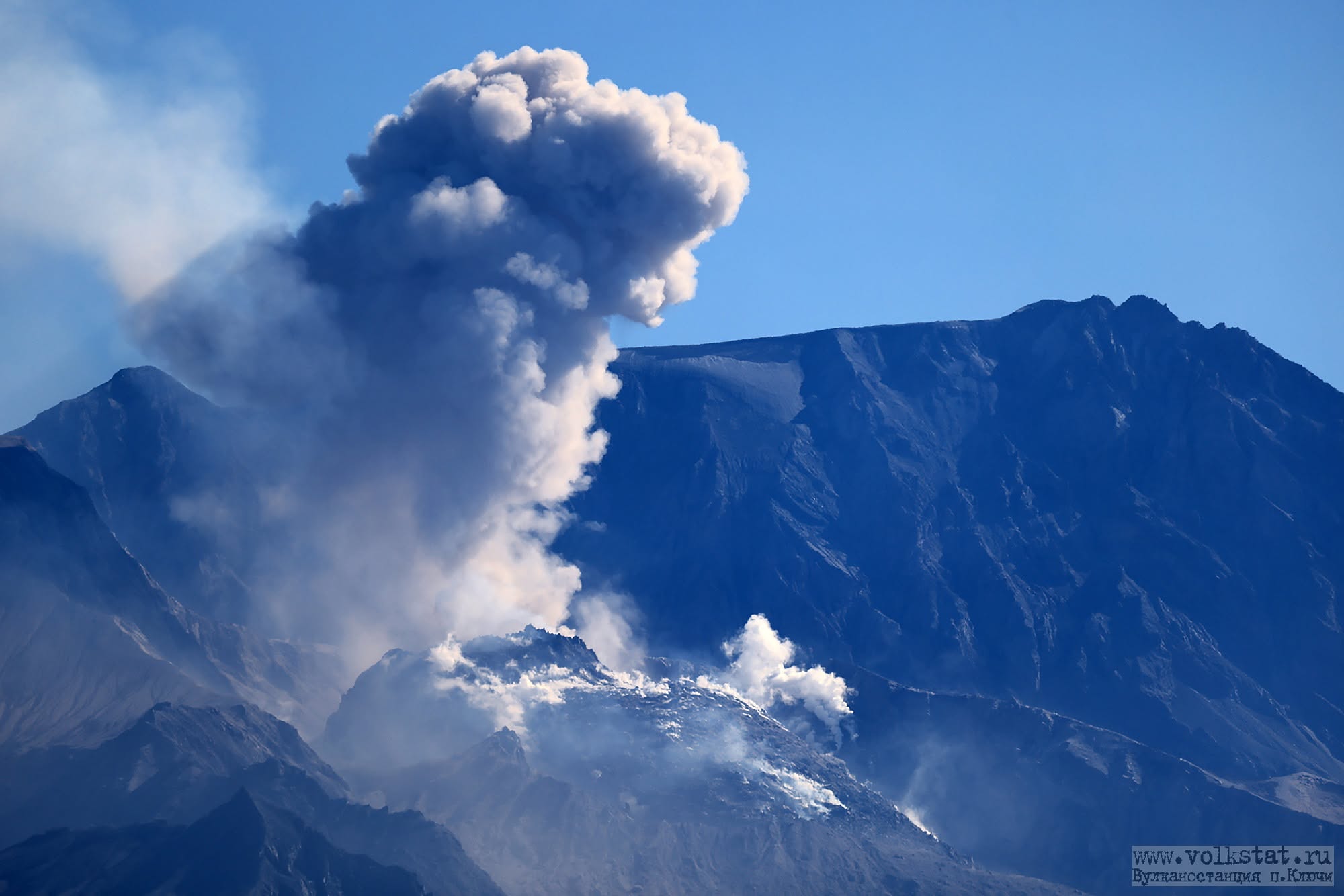
An explosive-extrusive eruption of the volcano continues, accompanied by powerful gas-steam activity; a new block of lava continues to grow in the northern part of the lava dome. Explosion sent ash up to 5.5 km a.s.l., and ash cloud moved to the east of the volcano.
An explosive-extrusive eruption of the volcano continues. Ash explosions up to 12 km (39,400 ft) a.s.l. could occur at any time. Ongoing activity could affect international and low-flying aircraft.
Volcanic cloud height:
5500 m (18040 ft) AMSL Time and method of ash plume/cloud height determination: 20260917/2239Z – Video data
Other volcanic cloud information:
Distance of ash plume/cloud of the volcano: 10 km (6 mi)
Direction of drift of ash plume/cloud of the volcano: E
Time and method of ash plume/cloud determination: 20260917/2239Z – Video data
Start time of explosion and how determined: 20260917/2239Z – Video data
Duration of explosion: ~ 10 min
The Kamchatkan Volcanic Eruption Response Team (KVERT) reported continuing lava effusion and explosive activity at the lava domes along the N crater floor of Young Sheveluch (on the SW flank of Old Sheveluch) during 9-15 September. A thermal anomaly was identified in satellite images on 11, 13, and 15 September; weather clouds occasionally obscured views. The Aviation Color Code remained at Orange (the second highest level on a four-color scale). Dates are based on UTC; specific events are in local time where noted.
Source : Kvert. , GVP.
Photo : volkstat ru.
Japan , Sakurajima :
The Japan Meteorological Agency (JMA) reported ongoing eruptive activity at Minamidake Crater (Aira Caldera’s Sakurajima volcano) during 8-14 September. Crater incandescence was visible in nighttime webcam images during 11-14 September. An eruptive event at 1246 on 8 September generated an ash plume that rose 1.3 km above the crater rim and drifted S. Volcanologists conducted a field survey on 10 September and measured high sulfur dioxide emissions, averaging 2,100 tons per day. A total of eight eruptive events during 13-14 September produced ash plumes that rose as high as 2.5 km above the crater and ejected large blocks 600 m from the vent. The Alert Level remained at 3 (on a 5-level scale), and the public was warned to be cautious within 1 km of both the Minimadake and Showa craters.
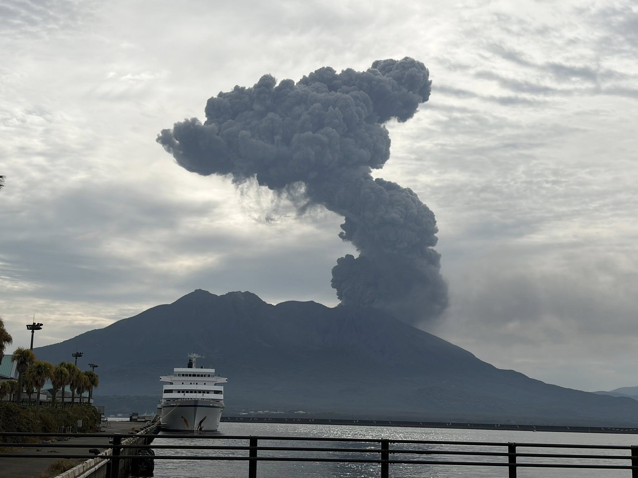
The Aira caldera in the northern half of Kagoshima Bay contains the post-caldera Sakurajima volcano, one of Japan’s most active. Eruption of the voluminous Ito pyroclastic flow accompanied formation of the 17 x 23 km caldera about 22,000 years ago. The smaller Wakamiko caldera was formed during the early Holocene in the NE corner of the caldera, along with several post-caldera cones. The construction of Sakurajima began about 13,000 years ago on the southern rim and built an island that was joined to the Osumi Peninsula during the major explosive and effusive eruption of 1914. Activity at the Kitadake summit cone ended about 4,850 years ago, after which eruptions took place at Minamidake. Frequent eruptions since the 8th century have deposited ash on the city of Kagoshima, located across Kagoshima Bay only 8 km from the summit. The largest recorded eruption took place during 1471-76.
Sources: Japan Meteorological Agency (JMA) , GVP.
Photo : Hanna Hanna.
Martinique , Mount Pelée :
Weekly Report, Institut de physique du globe de Paris / Martinique Volcanological and Seismological Observatory (OVSM)
Saint-Pierre, September 11, 2026, at 5:00 PM local time (GMT-4)
Volcano-related seismic activity
Between September 4, 2026, at 4:00 PM (UTC) and September 11, 2026, at 4:00 PM (UTC), the OVSM recorded 159 volcano-related earthquakes:
• 151 volcano-tectonic earthquakes. Four earthquakes had a magnitude (local magnitude Mlv or duration magnitude Md) greater than 1. The largest had a magnitude of Mlv = 1.95; the others were of lower energy. These earthquakes were located at depths ranging from 0.6 to 1.3 km beneath the volcano’s summit.
• 7 shallow hybrid-type earthquakes and 1 shallow long-period earthquake. The long-period event had a magnitude of Mlv = 1.0; the others were of lower energy. These earthquakes were located at a depth of approximately 1 km beneath the volcano’s summit.
No earthquakes were reported felt by the population.
During the previous week, the OVSM had recorded 185 volcano-related earthquakes. As of September 11, 2026, and over the past four weeks, the OVSM has thus observed a total of 532 volcanic earthquakes, representing an average of 133 earthquakes per week.
Deformations of Mount Pelée
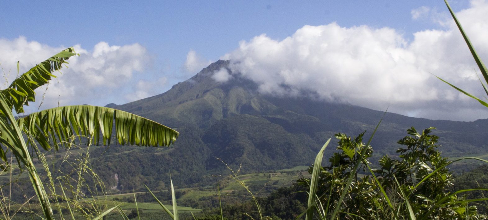
Since May 2026, the OVSM has been recording ground displacements of several centimeters in the summit area of Mount Pelée. Over the past four weeks, maximum extension rates have been around 0.8 cm per month, remaining stable compared to the previous month. These displacements are consistent with deformation of the volcanic edifice caused by an inflating pressure source located at a depth of approximately 1 km beneath the summit.
The probability of short-term eruptive activity remains low. However, based on observations gathered over recent months and years, a change in the situation over the medium term (weeks to months) cannot be ruled out.
The volcanic alert level, in accordance with the measures established by the authorities, is currently YELLOW: vigilance.
Source et photo : Direction de l’OVSM-IPGP