July 18 , 2026.
Kamchatka , Sheveluch :
KVERT VOLCANIC ACTIVITY NOTICE (VAN)
Issued: July 17 , 2026
Volcano: Sheveluch (CAVW #300270)
Current aviation colour code: ORANGE
Previous aviation colour code: orange
Source: KVERT
Notice Number: 2026-76
Volcano Location: N 56 deg 38 min E 161 deg 19 min
Area: Kamchatka, Russia
Summit Elevation: 3283 m (10768.24 ft), the dome elevation ~2500 m (8200 ft)
Volcanic Activity Summary:
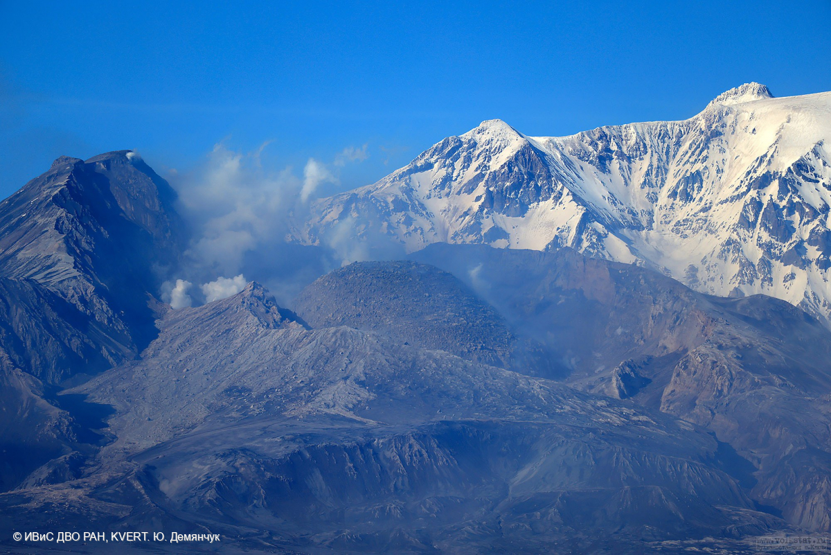
An explosive-extrusive eruption of the volcano continues, accompanied by powerful gas-steam activity; a new block of lava continues to grow in the northern part of the lava dome. Explosion sent ash up to 8.8 km a.s.l., and ash cloud move for 75 km to the east of the volcano.
An explosive-extrusive eruption of the volcano continues. Ash explosions up to 12 km (39,400 ft) a.s.l. could occur at any time. Ongoing activity could affect international and low-flying aircraft.
Volcanic cloud height:
8800 m (28864 ft) AMSL Time and method of ash plume/cloud height determination: 20260717/2040Z – Himawari-9 14m15
Other volcanic cloud information:
Distance of ash plume/cloud of the volcano: 75 km (47 mi)
Direction of drift of ash plume/cloud of the volcano: E / azimuth 93 deg
Time and method of ash plume/cloud determination: 20260717/2040Z – Himawari-9 14m15
Start time of explosion and how determined: 20260717/1930Z – Satellite data
Duration of explosion: ~ 5 min
Source : Kvert.
Photo : Yu. Demyanchuk / IVS FEB RAS / Kvert.
Indonesia , Semeru :
An eruption of Mount Semeru occurred on Saturday, July 18, 2026, at 06:21 (Western Indonesia Time), with an ash column reaching a height of approximately 1,000 m above the summit (or about 4,676 m above sea level). This dense column, ranging in color from white to gray, drifted towards the northeast, southeast, and south. The eruption was recorded by a seismograph, showing a maximum amplitude of 22 mm and a duration of 395 seconds.
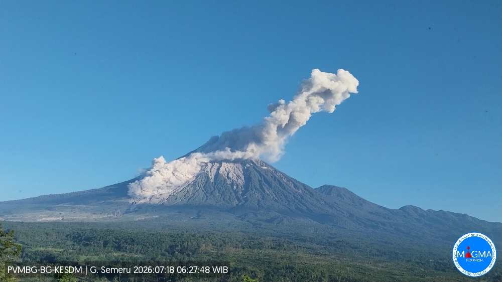
Seismic observations
16 eruption earthquakes, with amplitudes of 10–22 mm and durations of 93–158 seconds.
4 avalanche earthquakes, with amplitudes of 2–4 mm and durations of 40–74 seconds.
4 emission earthquakes, with amplitudes of 2–3 mm and durations of 41–61 seconds.
1 harmonic tremor, with an amplitude of 2 mm and a duration of 130 seconds.
1 distant tectonic earthquake, with an amplitude of 40 mm and a duration of 178 seconds.
Recommendations
1. Do not conduct any activities in the southeast sector along the Besuk Kobokan River within a 13 km radius of the summit (eruption center). Beyond this distance, the public must not conduct activities within 500 meters of the Besuk Kobokan riverbanks, due to the potential risk of pyroclastic flows and lahars extending up to 17 km from the summit.
2. Do not conduct any activities within a 5 km radius of the crater or summit of Mount Semeru, as this area is exposed to risks associated with (incandescent) rockfall.
Source et photo : PVMBG.
Colombia , Puracé – Los Coconucos volcanic chain :
Popayán, July 14, 2026, 2:00 PM.
Based on monitoring of the Puracé volcano—part of the Los Coconucos volcanic chain—the Colombian Geological Service (SGC), an agency attached to the Ministry of Mines and Energy, reports the following information:
During the week of July 7 to 13, 2026, behavior similar to that recorded in previous weeks was observed. Seismic activity linked to fluid movements (gases and liquids derived from magma and their interaction with the hydrothermal system) remains concentrated beneath the Puracé volcano crater, at depths of less than 3 km. The number of daily ash emissions decreased, and the associated plumes dispersed toward the northwest and west, reaching a maximum height of 500 m above the volcano’s summit.
Seismicity associated with rock fracturing (VT) remained comparable to that of the previous week, in terms of both the number of events and the seismic energy released. These earthquakes were primarily located between the Puracé and Piocollo volcanoes, at depths ranging from 1 to 3 km, with magnitudes below 1.
Images captured by webcams (visible and infrared spectrum) continued to show thermal anomalies at the fumarole field located on the outer rim of the Puracé volcano crater, as well as degassing phenomena at the craters of the Puracé and Curiquinga volcanoes. Likewise, sulfur dioxide (SO2) emissions into the atmosphere are continuing. The slow deformation process previously recorded in the area between the Puracé, Piocollo, and Curiquinga volcanoes persists.
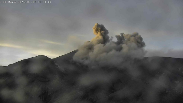
Camera footage from the Mina2 station—located 2.2 km northwest of the Puracé volcano—showing an ash emission on July 9, 2026, at 06:10.
In conclusion, the variations observed at the Puracé volcano (part of the Los Coconucos volcanic chain) indicate that the system continues to evolve; further ash emissions and fallout are possible, with their dispersion determined by prevailing wind directions. Furthermore, the occurrence of additional changes in volcanic activity—potentially leading to more energetic surface phenomena—cannot be ruled out. The public is advised to avoid the higher elevations of the volcanic chain and to stay informed through official SGC reports.
The volcanic activity alert level remains at « Yellow »: an active volcano showing changes relative to the baseline behavior of monitored parameters and other manifestations.
Source et photo : SGC.
Martinique , Mount Pelée :
Weekly Report / Institut de physique du globe de Paris / Martinique Volcanological and Seismological Observatory (OVSM).
Saint-Pierre, July 17, 2026, at 16:45 local time (GMT-4)
Between July 10, 2026, at 16:00 (UTC) and July 17, 2026, at 16:00 (UTC), the OVSM recorded 94 earthquakes of volcanic origin:
• 93 volcano-tectonic earthquakes. Of these, 14 had a magnitude (local magnitude Mlv or duration magnitude Md) greater than 0.5, and 6 had a magnitude greater than 1. The largest had a magnitude of Mlv=1.57; the others were of lower energy. These earthquakes were located at depths ranging from 0.9 to 2.0 km beneath the volcano’s summit. Volcano-tectonic seismicity is associated with micro-fracturing within the volcanic edifice, linked to the overall reactivation of the volcano observed since 2019.
• 1 deep long-period earthquake located southeast of Montagne Pelée at a depth of 33 km, with a magnitude of Mlv = 1.02. Deep long-period earthquakes are characterized by signals containing only low frequencies and are associated with the circulation of magmatic fluids deep within the Montagne Pelée volcanic system.
No earthquakes were felt by the population.
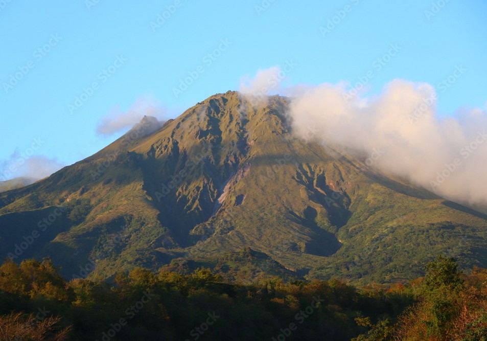
The previous week, the OVSM recorded 68 volcano-tectonic earthquakes. As of July 17, 2026, and over the past four weeks, the OVSM has observed a total of 375 volcanic earthquakes, representing an average of 93 to 94 earthquakes per week.
During phases of volcanic reactivation in volcanoes similar to Mount Pelée, it is common to observe seismic activity that varies in intensity and frequency. The probability of short-term eruptive activity remains low. However, given the observations gathered in recent years—and particularly over the last few months—a change in the situation over the medium term (weeks to months) cannot be ruled out.
The volcanic alert level, in accordance with the measures established by the authorities, is currently YELLOW: vigilance.
Source : Direction de l’OVSM-IPGP
Photo : Adobe Stock.
Guatemala , Santiaguito :
Weather conditions: Clear skies
Wind: Easterly
Precipitation: 5.6 mm
Activity
White gas emissions are observed above the Caliente dome; fumaroles rise up to 600 meters and disperse towards the west and southwest. Between one and three low-to-moderate intensity explosions are recorded per hour, ejecting columns of gas and ash up to 800 meters above the dome in the same direction. Incandescence was observed in the crater during the night and early morning, accompanied by collapses and the descent of incandescent blocks along the flanks.
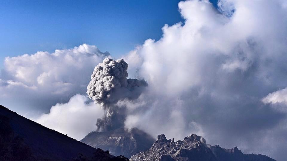
Given the high level of activity and the risk of major collapses, the formation of long-range pyroclastic density currents in any direction cannot be ruled out; it is therefore recommended to adhere to the instructions in special bulletin BESAN-002-2026. Furthermore, rainfall could mobilize material accumulated in ravines and riverbeds, triggering lahars during the afternoon and evening. It is recommended to avoid ravines and riverbeds and to strictly follow the instructions in special bulletin BESAN-016-2026.
Source : Insivumeh.
Photo : Auteur inconnu.