August 3 , 2026.
Italy / Sicily , Etna :
Statement on Etna’s activity, August 2, 2026, 13:04 (11:04 UTC).
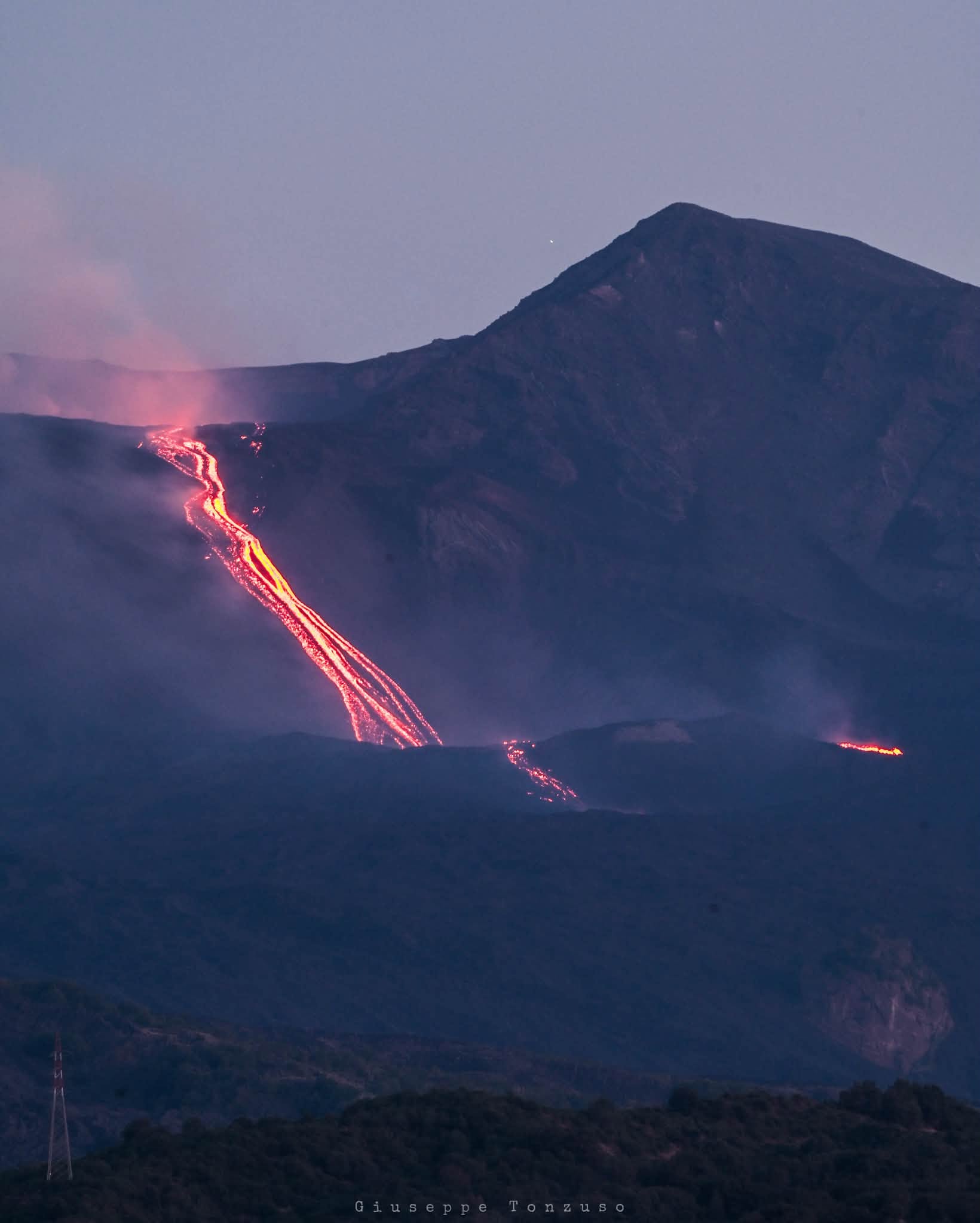
The National Institute of Geophysics and Volcanology (INGV) – Osservatorio Etneo – reports that, based on field observations conducted this morning by INGV personnel, the effusive activity in the upper part of the Valle del Leone—which began on July 30, 2026, at 18:49 UTC (statement no. 3 of July 30 at 19:30 UTC)—has ceased. The lava flows are no longer active and appear to be cooling. The summit craters continue to exhibit degassing activity.
Over the past 24 hours, the average amplitude of volcanic tremor has shown no significant variation and has remained within the usual range. The source centroid was located primarily in the Voragine crater area and in a sector extending from there towards the northwest and southeast, at depths ranging from 1,500 to 2,900 meters above sea level. Infrasonic activity is very low.
Ground deformation monitoring networks have recorded no significant signal variations over the past 24 hours.
Further information will be provided as soon as possible.
Source : INGV.
Photo : Giuseppe Tonzuso.
New Zealand , Ruapehu :
Update on Ruapehu: Increase in volcanic tremor but no other changes observed. Volcanic Alert Level remains at Level 1. Published: Mon Aug 3 2026 3:00 PM
During the last two weeks, volcanic tremor at Mt Ruapehu has gradually increased from weak to moderate levels. There has been minimal change in temperatures of Te Wai ā-moe (Ruapehu Crater Lake). Volcanic gas emissions continue in low-to-moderate amounts. Volcanic activity remains within the range typical for minor unrest. The Volcanic Alert Level remains at Level 1; the Aviation Colour Code remains Green.
Since July 22nd the tremor intensity has gradually increased from weak to moderate levels. Elevated tremor represents a minor change following almost two years of weak tremor levels. Starting early this year, small-magnitude earthquakes had been occurring beneath the volcano. They were mostly too small to locate accurately but since early July, those earthquakes appear to have stopped altogether.
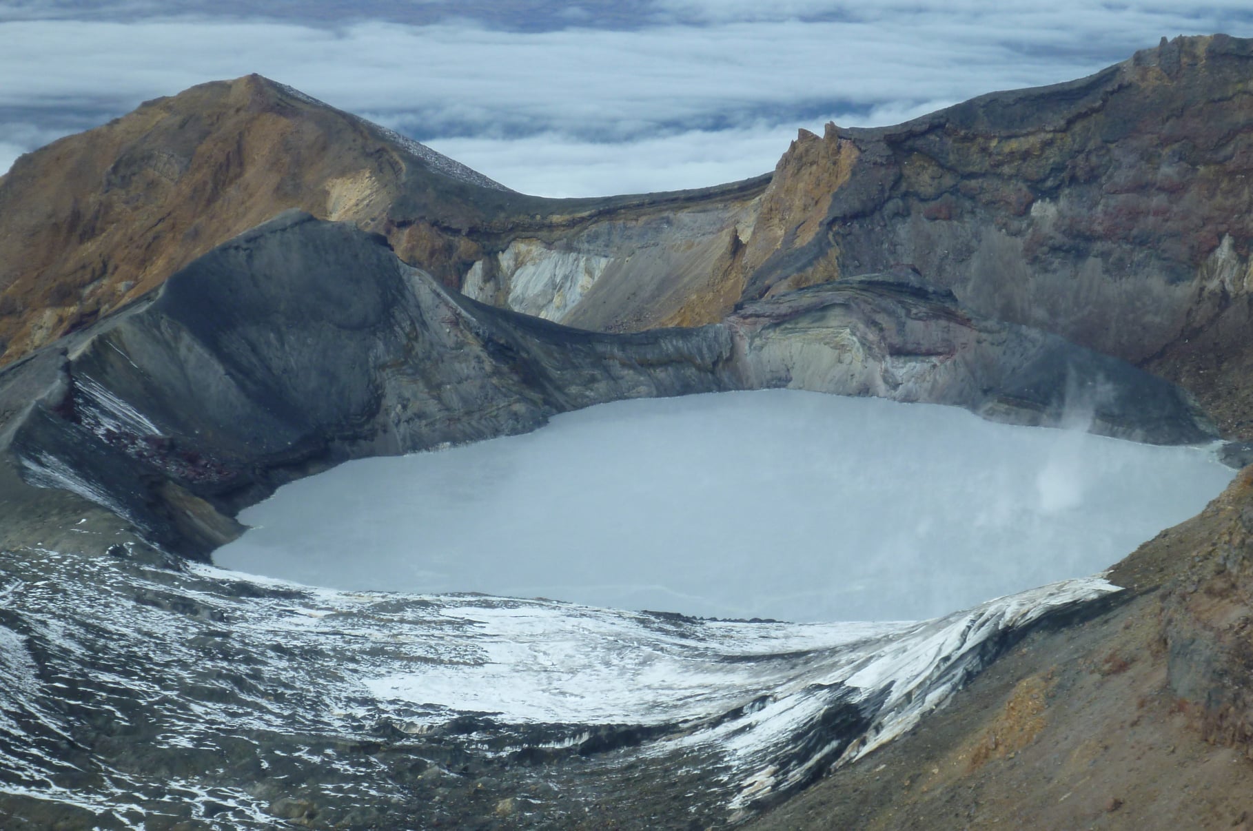
Crater Lake temperatures have not increased overall and have remained stable for the past four months (18–23°C), with daily to weekly variability driven by day/night effects and weather events such as last week’s snowfall. During sampling visits and other reported observations, persistent upwelling is visible, sulphur slicks trail across the grey lake, and there is an ongoing small overflow though the outlet channel.
The output of volcanic sulphur dioxide (SO₂) and hydrogen sulphide (H₂S) gases has been low to moderate relative to long-term trends.
Our collective observations and data are consistent with a dynamic hydrothermal system and intermittent input of volcanic gas and heat. Current activity at Mt Ruapehu is within the range expected during minor volcanic unrest and the Volcanic Alert Level therefore remains at 1 and the Aviation Colour Code at green.
The Earth Sciences New Zealand Volcano Monitoring Group and National Geohazards Monitoring Centre will continue to closely monitor Ruapehu for any changes in activity. We will provide further updates when information becomes available or the status changes.
Source : Geonet / Michael Rosenberg / Duty Volcanologist .
Photo : Geonet.
Indonesia , Ibu :
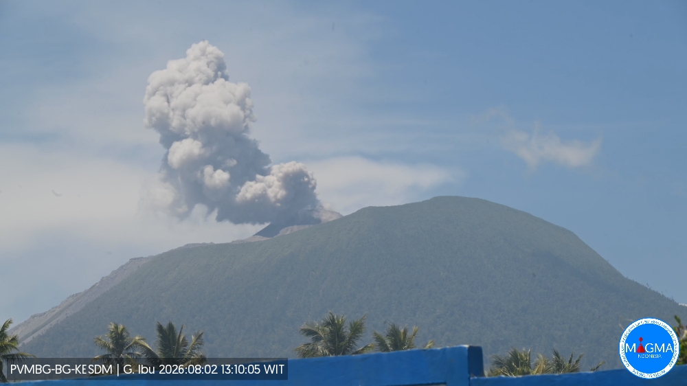
An eruption of Mount Ibu occurred on Sunday, August 2, 2026, at 1:06 PM WIT; an ash column was observed reaching approximately 400 meters above the summit (or about 1,725 meters above sea level). The ash column, which appeared dense and gray, drifted towards the northeast. The eruption was recorded by the seismograph with a maximum amplitude of 28 mm and a duration of 51 seconds.
Seismic observations
71 eruption earthquakes, with amplitudes of 13–28 mm and durations of 33–92 seconds.
1 avalanche earthquake, with an amplitude of 6 mm and a duration of 42 seconds.
4 emission earthquakes, with amplitudes of 7–8 mm and durations of 33–39 seconds.
18 harmonic tremors, with amplitudes of 3–28 mm and durations of 38–176 seconds.
62 low-frequency earthquakes, with amplitudes of 2–12 mm and durations of 17–29 seconds.
122 shallow volcanic earthquakes, with amplitudes of 2–8 mm and durations of 7–21 seconds.
9 distant tectonic earthquakes, with amplitudes of 2–28 mm and durations of 44–79 seconds.
Recommendations
1. Communities living near Mount Ibu, as well as visitors and tourists, must not conduct any activities within a 2 km radius, nor within the 3.5 km sectoral extension zone stretching towards the crater opening on the northern flank of Mount Ibu’s active crater.
2. In the event of ashfall, people outdoors are advised to protect their nose and mouth (using masks) and their eyes (using protective eyewear).
Source et photo : PVMBG.
Ecuador , Sangay :
DAILY STATUS REPORT FOR SANGAY VOLCANO, Sunday, August 2, 2026.
Information from the Geophysical Institute – EPN.
Surface activity level: Moderate; Surface trend: Decreasing
Internal activity level: Moderate; Internal trend: Decreasing
Seismicity: From August 1, 2026, 11:00 to August 2, 2026, 11:00:
Seismicity:
Here is the count of seismic events recorded at the reference station:
Explosion (EXP): 9
Precipitation / Lahars:
No precipitation has been recorded in the volcano area. **In the event of heavy rainfall, accumulated materials could be remobilized, generating mud and debris flows that would descend the volcano’s flanks and spill into adjacent rivers.
Emission plume / ash:
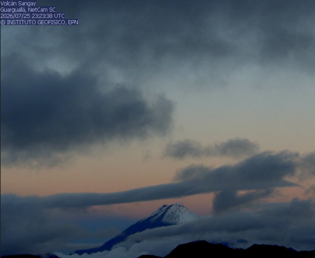
Due to cloud cover over the volcano, it has not been possible to observe gas and/or ash emissions via surveillance cameras or the GOES-19 satellite system. Furthermore, the Washington VAAC has issued no emission reports regarding this volcano.
Observation:
From yesterday afternoon until the time of writing this report, the volcano has remained under cloud cover.
Alert level: Yellow
Source et photo : IGEPN
Guatemala , Fuego :
Weather conditions: Clear skies
Wind: North-northeasterly
Precipitation: 0.0 mm
Activity
The Fuego Volcano Observatory (OVFGO) reports explosions occurring at a rate of 6 to 10 per hour; the style ranges from Strombolian to Vulcanian, and intensity varies from low to moderate, occasionally becoming strong. These explosions are accompanied by gas and ash plumes reaching altitudes between 4,200 and 4,700 meters above sea level; high-altitude winds are dispersing fine ash particles up to approximately 30 km away. Explosive activity is generating rumbling sounds and shockwaves, as well as avalanches on the southern, western, and southwestern flanks. Ashfall has been reported in Panimaché, Morelia, Santa Sofía, El Porvenir, San Pedro Yepocapa, Sangre de Cristo, and other localities.
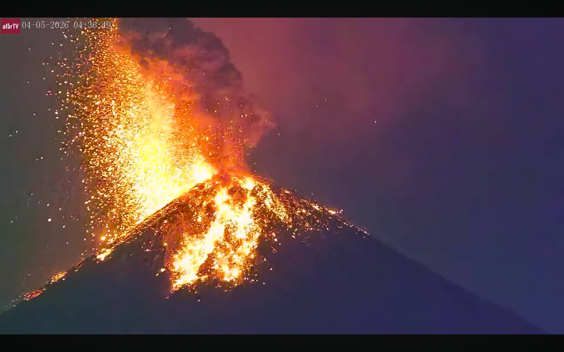
Sounds resembling those of a locomotive are also heard at times near the volcano. Incandescence at the crater was observed during the night and early morning. Due to the ejection of ballistic material—which can travel more than 700 meters from the crater—parking on the plateau or in the immediate vicinity is not recommended. Those climbing the volcano should wear clothing and use equipment suitable for high-mountain conditions, while also taking into account the likelihood of precipitation in the afternoon and overnight.
Source : Insivumeh.
Photo : Afar TV