August 2 , 2026.
Italy / Sicily , Etna :
Statement on Etna’s activity, August 1, 2026, 13:13 (11:13 UTC).
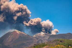
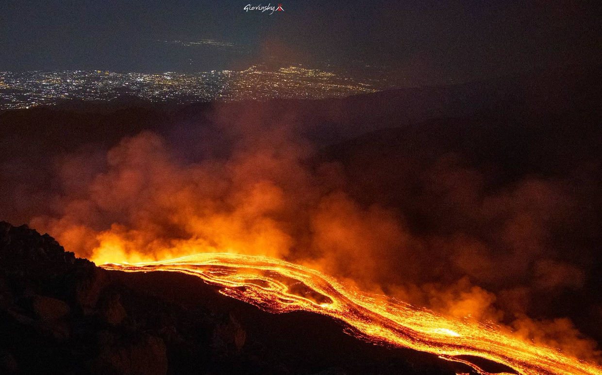
The National Institute of Geophysics and Volcanology (INGV), Osservatorio Etneo, reports that the lava emission described in the previous statement (No. 4 of July 31 at 08:23 UTC) is still ongoing, albeit with a low supply rate. Analysis of images from the Osservatorio Etneo’s surveillance camera network indicates that the most distal part of the lava field, as well as the flow fronts—located just upstream of Rocca Capra—appear inactive and are cooling. The summit craters are characterized by degassing activity.
Since the last update, the average amplitude of volcanic tremor has remained within normal ranges, while exhibiting significant fluctuations with occasional peaks dropping to low values.
The source centroid has been located primarily in the Voragine crater area and in a sector to its north and northeast, at depths generally ranging
between 2,500 and 2,900 m above sea level. Infrasonic activity, following a moderate increase yesterday afternoon, has remained low since the start of the day.
Regarding ground deformation, no significant changes have been recorded at the reference stations over the past few hours.
.
Further updates will be provided shortly.
Source : INGV.
Photo : Giovinsky Aetnensis
Indonesia , Sinabung :
Increased volcanic activity at Mount Sinabung, North Sumatra, on August 1, 2026.
Mount Sinabung is an active volcano located in the Karo Regency of North Sumatra Province. Its seismic activity is primarily characterized by tectonic earthquakes, although a limited number of volcanic earthquakes are also recorded. The volcano’s activity level has been classified as Level II (Alert/“Waspada”) since May 17, 2023.
Seismic monitoring conducted on August 1, 2026, revealed an increase in deep volcanic earthquakes. Additionally, emission earthquakes, low-frequency earthquakes, and hybrid earthquakes—phenomena rarely observed previously—were detected. Low- to moderate-intensity white emissions were observed at the crater, reaching heights of between 50 and 600 meters above the lava dome.
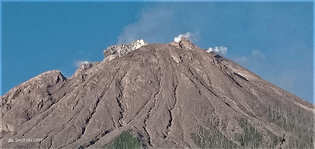
This increase in seismic activity warrants caution, given the risk of both phreatic and magmatic eruptions at Mount Sinabung. There is also a risk of lava dome destruction should pressure within the magmatic system rise significantly.
Since March 2024, the Center for Volcanology and Geological Hazard Mitigation (PVMBG) of the Geological Agency has advised the public, tourists, and hikers to refrain from any activity within a 2-kilometer radius of the Mount Sinabung summit, as well as within a 3.5-kilometer sectoral radius to the southeast. In addition to direct threats such as incandescent rock ejections and ashfall, the public is urged to remain vigilant regarding secondary hazards—particularly lahar flows—especially during the rainy season. These flows can travel along watercourses in the southwest sector that originate at the summit of Mount Sinabung.
Local authorities, including the Regional Disaster Management Agencies (BPBD) of North Sumatra Province and Karo Regency, are strongly urged to maintain active coordination with the Mount Sinabung volcano observation post located in the village of Ndokum Siroga.
Source : PVMBG.
Photo : Jeremia Bangun Jeremia Jeremia.
Colombia , Puracé – Los Coconucos volcanic chain :
Popayán, August 1, 2026, 11:30 AM
Based on monitoring of the Los Coconucos Volcanic Chain (CVLC) activity, the Colombian Geological Service (SGC)—an agency attached to the Ministry of Mines and Energy—reports the following:
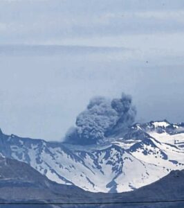
The alert level for the PURACÉ VOLCANO – LOS COCONUCOS VOLCANIC CHAIN has been raised to ORANGE: the volcano is exhibiting significant changes in monitored parameters.
Since July 20, a continuous increase in activity at the Puracé volcano (CVLC) has been recorded, as noted in recent weekly bulletins. To date, the changes in volcanic activity that have reached levels corresponding to orange alert status are as follows:
● An increase in seismic energy associated with continuous tremor and signals linked to ash emissions. This seismicity is localized less than 1 km beneath the Puracé volcano crater.
● An increase in the height of gas and ash emission columns, reaching up to 3,400 m above the Puracé volcano crater rim, accompanied by a rise in emission temperatures estimated at approximately 140°C.
● An increase in atmospheric sulfur dioxide (SO2) emissions, with estimated flux rates of up to 4,200 tonnes per day. This phenomenon is accompanied by a rise in ground-level carbon dioxide (CO2) concentrations, reaching 688 ppm (parts per million).
● Persistent ground deformation in the area between the Puracé, Piocollo, and Curiquinga volcanoes. The reported changes represent the highest values of this type recorded in the volcano’s instrumental database and, consequently, a significant shift in its behavior, currently corresponding to an orange alert level.
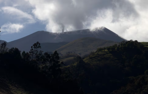
As long as the orange alert level remains in effect, temporary fluctuations in the volcano’s activity levels may occur—with activity sometimes decreasing compared to previous days or weeks—but this does not necessarily imply that the volcano has returned to a stable state. Downgrading to the yellow alert level requires a reasonable period to evaluate all monitored parameters and identify trends indicating reliable stability. The public is advised not to approach the crater areas of the Puracé, Piocollo, and Curiquinga volcanoes, as sudden ash or gas emissions—posing a significant risk to people—could occur.
The SGC recommends closely monitoring volcanic activity via special bulletins and other information released through our official channels, as well as following the instructions of local and departmental authorities and the National Unit for Disaster Risk Management (UNGRD).
The volcanic alert level is raised to ORANGE: the volcano is showing significant changes in monitored parameters.
Source et photo : SGC.
Costa Rica , Rincon de la Vieja :
Latitude: 10.83°N;
Longitude: 85.34°W;
Elevation: 1,916 m above sea level.
Current activity level: Alert.
Ten eruptions were recorded this week. None generated lahars, and the eruption amplitudes were lower than those of the previous week. Since July 26, short-duration tremor sequences have been observed, with variations in amplitude and duration from one event to another. Furthermore, background tremor has shown a more marked decrease in amplitude since July 29, suggesting reduced permeability or a blockage of the conduits. Sporadic long-period earthquakes and volcano-tectonic events—located both in the immediate vicinity of the crater and at a distance—were recorded.
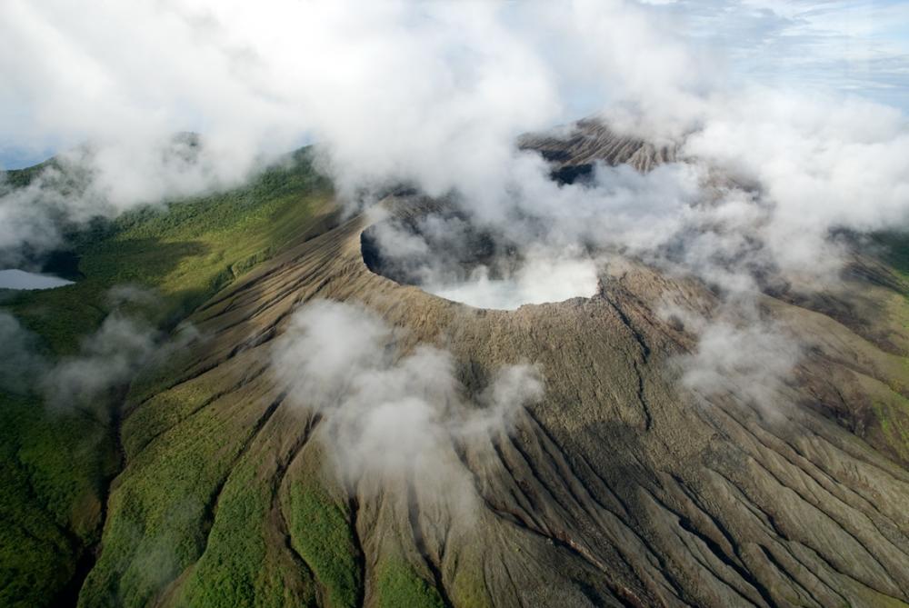
The dominant frequency of « tornillo »-type signals increased over the course of the week. Since mid-June, the geodetic network has recorded slight expansion at the volcano’s summit. No intensification of this signal was observed during the past week, and the variations remain within the measurement margin of error. NOVAC stations recorded a slight increase in SO2 flux (342 ± 288 t/d) compared to the previous week (289 ± 119 t/d).
Source et photo : Ovsicori .
Ecuador , El Reventador :
DAILY STATUS REPORT FOR REVENTADOR VOLCANO, Saturday, August 1, 2026.
Information: Geophysical Institute – EPN.
Surface activity level: High; Surface trend: Unchanged
Internal activity level: Moderate; Internal trend: Unchanged
From July 31, 2026, 11:00 to August 1, 2026, 11:00:
Seismicity:
Explosion (EXP): 85
Long-period (LP): 11
Emission tremor (TREMI): 8
Harmonic tremor (TRARM): 13
Precipitation / Lahars:
Precipitation has been recorded in the area, but it has not triggered lahars. **Heavy rains can remobilize accumulated material and generate debris-laden mudflows (lahars), which could rush down the volcano’s flanks and flow into nearby rivers.**
Ash emissions/plumes:
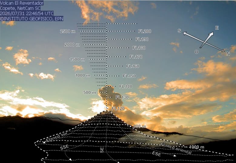
Since yesterday afternoon, the surveillance camera system has detected several gas and ash plumes reaching heights of 400 to 800 meters above the crater rim, drifting northwest, southwest, and west. In connection with this activity, the Washington VAAC issued three reports noting ash emissions reaching 700 meters above the crater rim and drifting northwest and west.
Observation:
Overnight and into the early morning hours, the surveillance camera system observed incandescent material descending up to 1,000 meters below the crater rim. At the time of writing, the volcano is obscured by cloud cover.
Alert Level – SGR: Orange
Source et photo : IGEPN.