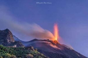
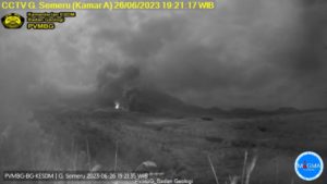
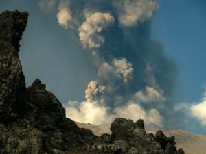
July 28 , 2026.
Hawaii , Kilauea :
HAWAIIAN VOLCANO OBSERVATORY DAILY UPDATE , U.S. Geological Survey
Monday, July 27, 2026, 9:05 AM HST (Monday, July 27, 2026, 19:05 UTC)
19°25’16 » N 155°17’13 » W,
Summit Elevation 4091 ft (1247 m)
Current Volcano Alert Level: ADVISORY
Current Aviation Color Code: YELLOW
Summary:
The Halemaʻumaʻu eruption is paused. The next fountain episode is likely between July 29 and August 2.
Overview:
The summit eruption of Kīlauea in Halemaʻumaʻu is paused. Degassing continues at both north and south vents, and both vents had persistent glow overnight. Summit deflation continued through yesterday and flattened out overnight. Summit inflation started again around 6 a.m. H.S.T. this morning. These observations have pushed back the modeled forecast time window for episode 52 fountains to between July 29 and August 2.
No significant activity has been noted along Kīlauea’s East Rift Zone or Southwest Rift Zone.
Summit Observations:
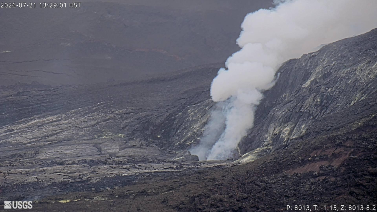
Degassing continues from both north and south vents, and both vents had persistent glow overnight.
Tremor remains relatively continuous with occasional tremor bursts associated with flames from the south vent. No earthquakes were located beneath the summit of Kīlauea summit in the past 24 hours.
Since episode 51 ended, inflation resumed and has recovered 10.3 microradians of tilt at the summit tiltmeter at Uēkahuna (UWD). Around midnight the night of July 23 to 24, summit tiltmeters started recording minor deflation, which continued through yesterday at a slower rate, flatting out overnight. Inflation resumed starting around 6 a.m. H.S.T. this morning. Over the past 24 hours, UWD has recorded a net loss of 0.3 microradians. Kīlauea summit deflation totaled 14.7 microradians during episode 51.
The sulfur dioxide (SO2) emission rate from the summit is likely now varying within a typical range of 1,000 to 5,000 tonnes per day. Degassing plumes from both vents are being blown toward the southwest this morning.
Rift Zone Observations:
Rates of seismicity and ground deformation remain low in the East Rift Zone and Southwest Rift Zone. SO2 emissions from the East Rift Zone remain below the detection limit.
Source et photo : HVO.
Indonesia , Lewotobi Laki-laki :
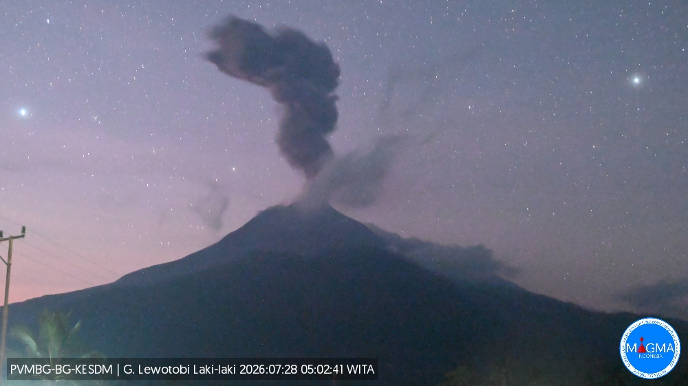
An eruption of Mount Lewotobi Laki-laki occurred on Tuesday, July 28, 2026, at 05:02 WITA; the observed ash column reached a height of approximately 1,200 m above the summit (or about 2,784 m above sea level). This dense, gray ash column drifted towards the north and northeast. The eruption was recorded by the seismograph with a maximum amplitude of 44.4 mm and a duration of 284 seconds.
Seismic observations
3 eruption earthquakes, with amplitudes of 37 to 44.4 mm and durations of 52 to 143 seconds.
6 episodes of non-harmonic tremor, with amplitudes of 2.9 to 7.4 mm and durations of 55 to 192 seconds.
1 low-frequency earthquake, with an amplitude of 4.4 mm and a duration of 21 seconds.
1 distant tectonic earthquake, with an amplitude of 7.4 mm and a duration of 77 seconds.
Recommendations
1. Communities located near Mount Lewotobi Laki-laki, as well as visitors and tourists, must not conduct any activities within a 5 km radius of the Mount Lewotobi Laki-laki eruption center.
2. The public is advised to remain calm, follow instructions from local authorities, and disregard information from unverified sources.
Source et photo : PVMBG.
Colombia , Galeras :
San Juan de Pasto, July 21, 2026, 4:20 PM.
Based on the monitoring of activity at the Galeras volcano, the Colombian Geological Service (SGC)—an agency under the Ministry of Mines and Energy—reports the following:
During the week of July 14 to 20, 2026, the main variations in monitored parameters compared to the previous week were as follows:
● Amidst a period of low volcanic activity, a slight increase was recorded in both the frequency of seismic events and the total energy released. Volcanic processes associated with rock fracturing within the volcanic edifice remain predominant.
● Due to low energy levels, only two earthquakes were located—approximately 1.4 km east of the volcanic crater—at depths ranging from 3.1 to 4.2 km below the summit of the Galeras volcano (4,200 meters above sea level), with a maximum magnitude of 0.2.
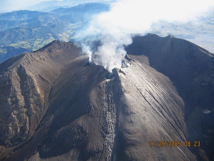
● Intermittent emissions of white gas were observed, characterized by low plume heights and dispersion directions that varied with the wind. These emissions originated primarily from the fumarole fields of El Paisita (to the north) and Las Chavas (to the west), as well as from the main crater.
● Other volcanic monitoring parameters remained stable.
In light of the above, the SGC recommends closely monitoring the volcano’s activity via the weekly bulletins and other information released through our official channels,
and adhering to the instructions issued by local and departmental authorities and the National Unit for Disaster Risk Management (UNGRD).
Volcanic activity remains at the yellow alert level: an active volcano showing changes in the baseline behavior of monitored parameters and other manifestations.
Source et photo : SGC.
Guatemala , Fuego :
Weather conditions: Clear skies
Wind: Easterly
Precipitation: 71 mm
Activity
Low-level degassing is observed above the crater; the plume reaches a height of 600 meters and disperses towards the west. Low- to moderate-intensity explosions are recorded at a rate of 5 to 7 per hour, generating gas and ash columns that rise up to 4,800 meters above sea level. Ash disperses over a distance of 10 to 20 km to the west. Fine ashfall is affecting localities on the western flank.
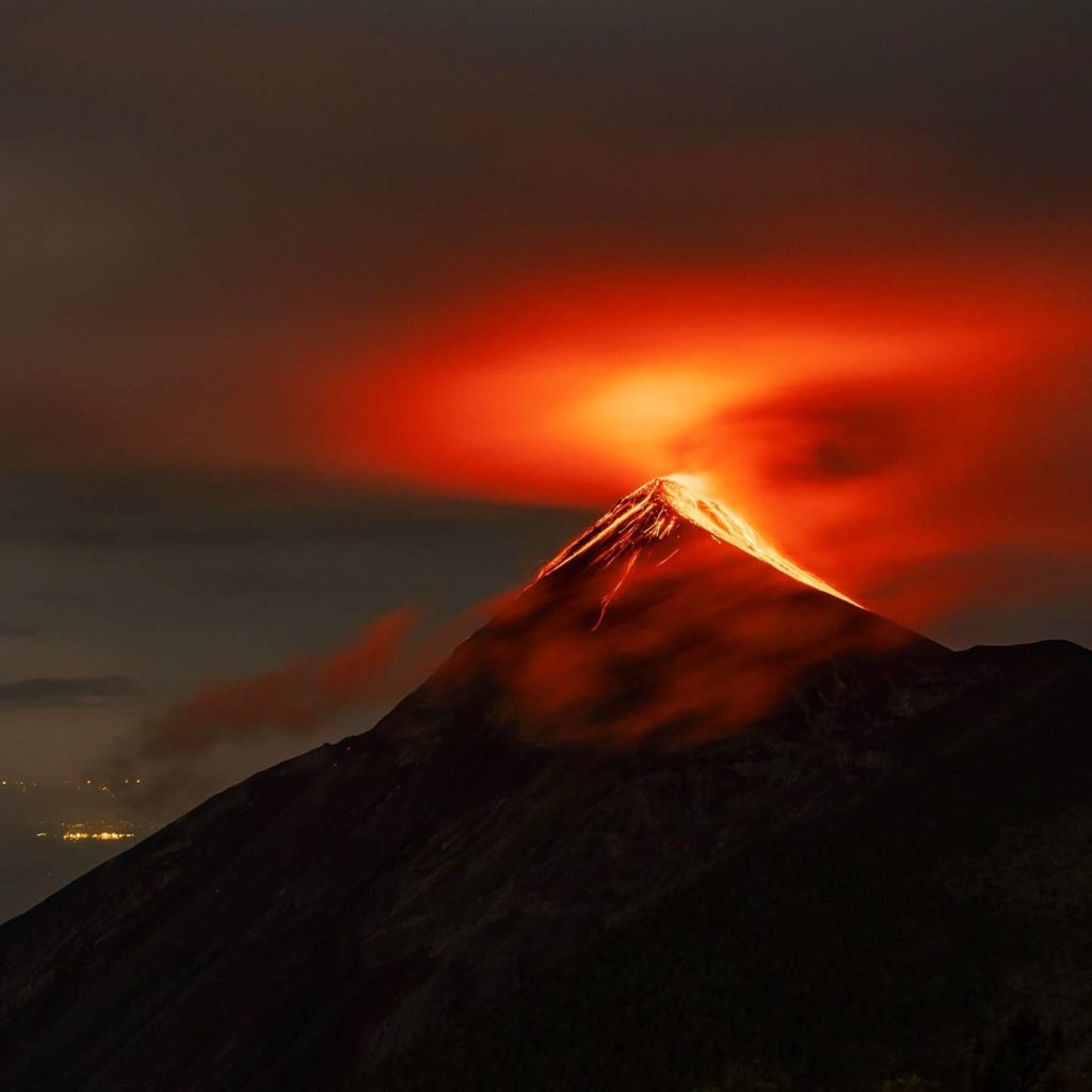
Ballistic projectiles and fallout of incandescent volcanic material resulting from the explosions are also observed moving toward the western, southern, and southwestern flanks, even reaching the vegetation. Furthermore, the explosive activity is accompanied by rumbling, shockwaves, and sounds resembling an aircraft turbine, caused by the continuous expulsion of gas. During the night and early morning, incandescence is visible within the crater, manifesting as both a steady glow and incandescent pulses reaching heights of 100 to 300 meters.
Source : Insivumeh.
Photo : Diego Rizzo .
Peru , Sabancaya :
Local date and time: July 27, 2026 – 12:05 PM
Bulletin analysis period: July 20–26, 2026
Volcanic alert level
Orange alert level: The volcano is showing a significant increase in eruptive activity. Increased seismic activity, frequent explosions, and emissions of ash and ballistic blocks have been observed.
Conclusions
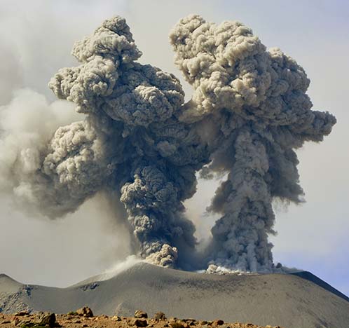
The IGP reports that the eruptive process at Sabancaya volcano is ongoing. During this period, no volcanic explosions were detected; only emissions of water vapor, ash, and gas reaching up to 1,500 m above the summit were observed, alongside seismic activity linked to the movement of magmatic fluids and internal fracturing. Consequently, the volcanic alert level remains at orange.
Recommendations
Adopt prevention and preparedness measures consistent with the current orange volcanic alert level.
Do not approach within 12 km of the crater. In the event of ashfall, cover your nose and mouth with damp cloths or masks. Keep doors and windows of homes closed.
Outlook
Volcanic explosions generating eruption columns exceeding 2 km in height are considered likely, posing a risk of impact on the Colca Valley districts and surrounding areas due to volcanic ash dispersion; the volcanic alert level therefore remains at orange.
Source : Cenvul
Photo : IGP ( archive).