September 28 , 2026.
Italy / Sicily , Etna :
VOLCANO OBSERVATORY NOTICE FOR AVIATION (VONA)
Issued: September 26 , 2026
Volcano: Etna 211060
Current Color Code: RED
Previous Color Code: red
Source: Etna Volcano Observatory
Notice Number: 2026/0117/07E09
Volcano Location: 3744N 01500E
Area: Italy
Summit Elevation: 3300 m
Volcanic Activity Summary:
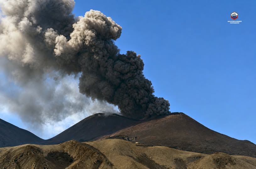
ASH EMISSION ONGOING
Volcanic cloud height:
VOLCANIC CLOUD HEIGHT IS ESTIMABLE: 4KM ABOVE SEA LEVEL
Other volcanic cloud information:
ASH CLOUD MOVES TOWARD S
Remarks:
THE PHENOMENON IS OBSERVED BY VISIBLE AND THERMAL SURVEILLANCE CAMERAS.
The suspension of all flights arriving at and departing from Catania’s Vincenzo Bellini International Airport continues for a third consecutive day due to volcanic ash emissions from Mount Etna. The disruption, initially scheduled to last until noon today, has been extended until 11:59 p.m. due to the closure of two airspace sectors, C1 and B3. This announcement was made by SAC, the company managing the airport, which advised passengers to « check their flight status with the airlines before heading to the airport. »
Sources : INGV , Acireale social /FB.
Photo : Salvatore Lo Giudice.
Indonesia , Ili Lewotolok :
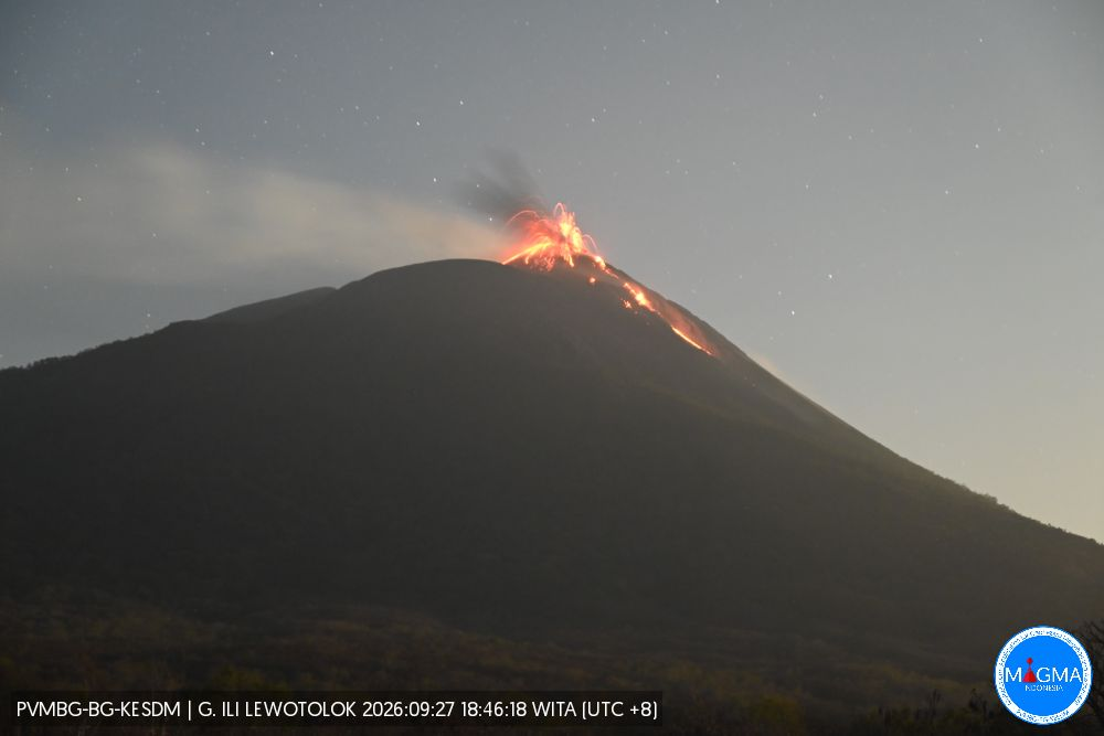
An eruption of Mount Ili Lewotolok occurred on Saturday, September 26, 2026, at 10:54 a.m. (WITA), with an ash column reaching approximately 500 meters above the summit (or about 1,923 meters above sea level). The observed ash column was gray and dense, and drifted westward. The eruption was recorded by the seismograph with a maximum amplitude of 40 mm and a duration of 45 seconds.
Seismic observations
177 eruption earthquakes, with amplitudes of 19.5–40 mm and durations of 30–84 seconds.
2 rockfall earthquakes, with amplitudes of 5.8–7.8 mm and durations of 42–66 seconds.
165 emission earthquakes, with amplitudes of 5.8–38.9 mm and durations of 20–57 seconds.
2 harmonic tremors, with amplitudes of 3.9–9.7 mm and durations of 119–124 seconds.
2 non-harmonic tremors, with amplitudes of 19.5–38.9 mm and durations of 80–210 seconds.
2 hybrid/multiphase earthquakes, with amplitudes of 7.8–11.3 mm and a duration of 22 seconds.
2 deep volcanic earthquakes, with amplitudes of 5.8–7.8 mm and durations of 8–15 seconds.
2 local tectonic earthquakes, with amplitudes of 16–19.5 mm and durations of 22–23 seconds.
1 distant tectonic earthquake, with an amplitude of 19.5 mm and a duration of 130 seconds.
Recommendations
1. Communities living near Mount Ili Lewotolok, as well as visitors, climbers, and tourists, are advised not to enter or conduct activities within a 2 km radius—and a 3 km radius in the southern and southeastern sectors—of the Mount Ili Lewotolok activity center. 2. Remain vigilant regarding potential dangers associated with lava avalanches/collapses and pyroclastic flows in the southern, southeastern, western, and northeastern sectors of Mount Ili Lewotolok.
Source et photo : PVMBG.
Hawaii , Kilauea :
HAWAIIAN VOLCANO OBSERVATORY DAILY UPDATE , U.S. Geological Survey
Sunday, September 27, 2026, 8:50 AM HST (Sunday, September 27, 2026, 18:50 UTC)
19°25’16 » N 155°17’13 » W,
Summit Elevation 4091 ft (1247 m)
Current Volcano Alert Level: WATCH
Current Aviation Color Code: ORANGE
Summary:
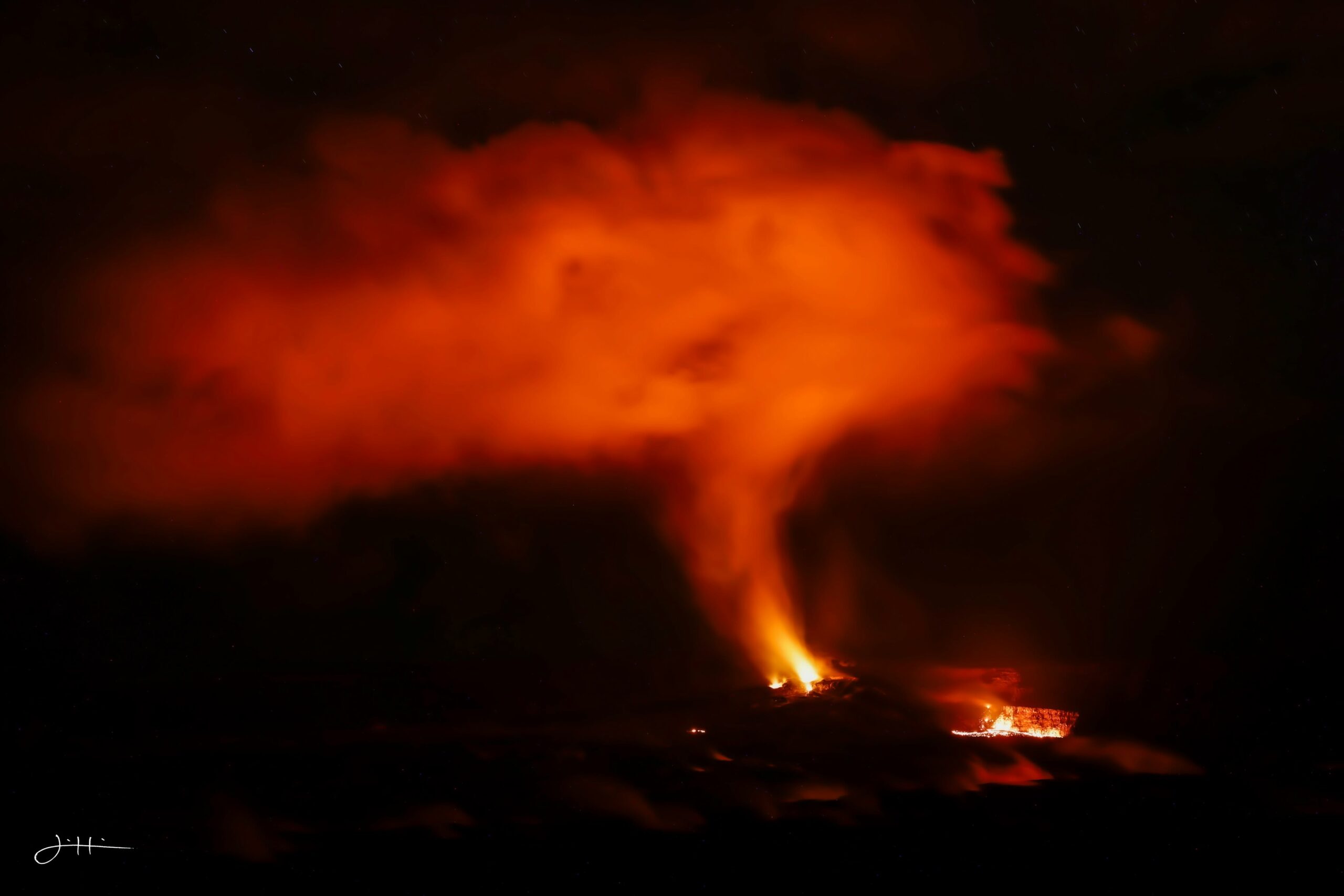
Small overflows from the north vent continue, along with tiny overflows from the south vent starting overnight. All vents have strong glow and intermittent spatter. There is no anomalous activity outside of the summit.
Overview:
Episode 55 remains a possibility during the ongoing Kīlauea summit eruption. Precursory overflows from the north vent resumed on the night of September 22 and continue this morning. The south vent also produced a few very small overflows overnight. Glow and flames were observed from the north-south-west vent complex throughout the night, with intermittent spatter bursts from all three vents. There are currently no signs of reactivation of the recent vents 1-6. The summit tilt has remained relatively flat over the past 24 hours, and continuous tremor remains the dominant seismic signal across the summit.
No anomalous seismic activity or deformation has occurred outside of the summit region, and no significant activity has been noted along Kīlauea’s East Rift Zone or Southwest Rift Zone.
Poor weather has greatly reduced visibility on streaming cams and webcams available to the public. Monitoring will continue using a variety of geophysical tools.
Summit Observations:
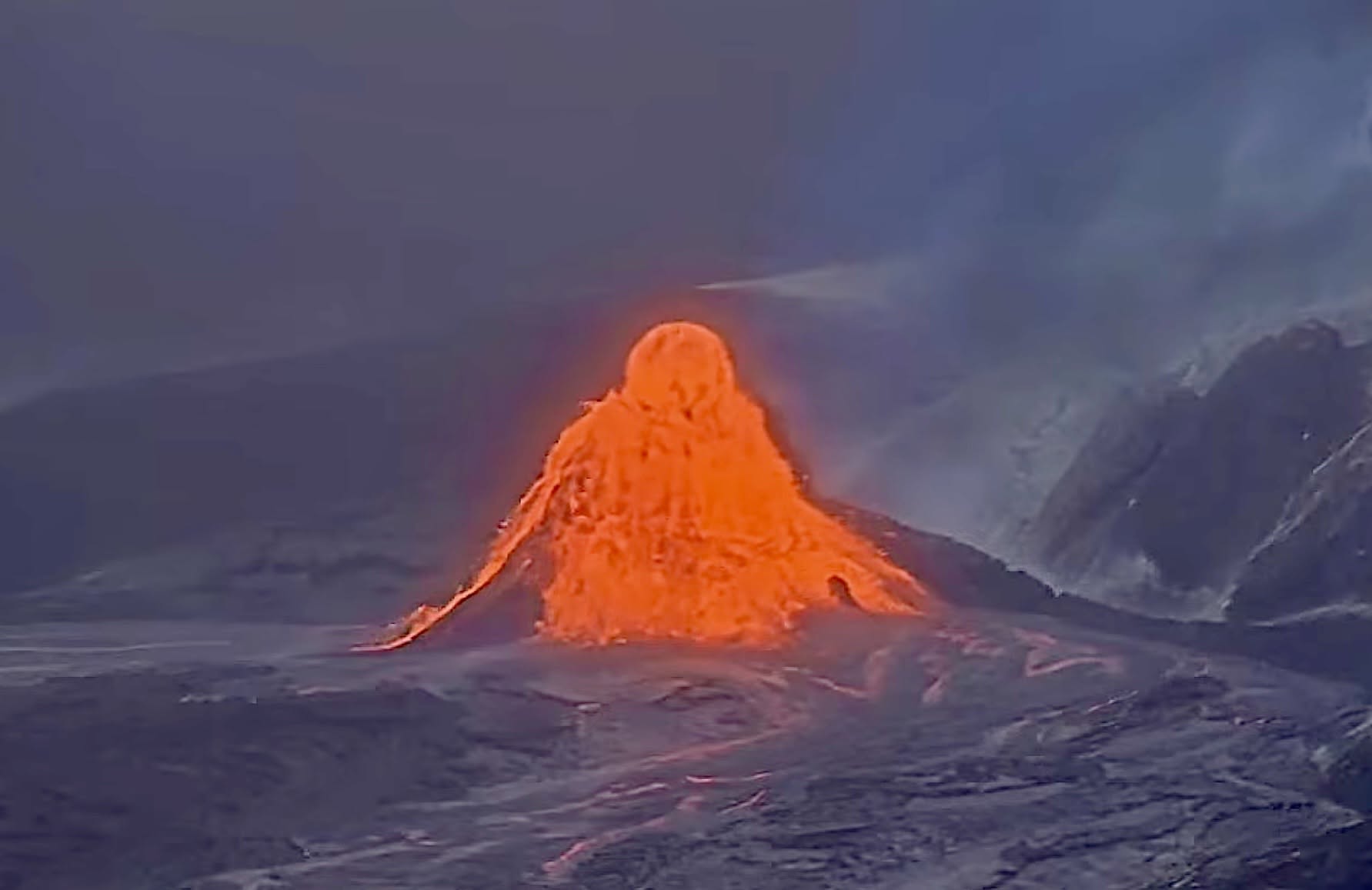
Precursory overflows from the north vent resumed on Tuesday night, September 22, beginning at 10:10 p.m. HST. Since then, there have been 53 overflows, most of them from the north vent, although several small overflows occurred from the south vent overnight. Most of the overflows have lasted about 5-35 minutes and produced lava flows that traveled a few hundred meters (yards) from the vent. Many of the overflows were fed by vigorous fountains that rise 15-30 feet (5-10 meters) above the small 30-50 foot (10-15 meter) cone that has built up at the north vent. The north, south, and west vents continued to glow strongly overnight, and emit flames and intermittent spatter. No other areas of incandescence were observed across the summit region last night.
Continuous tremor became punctuated with tremor spikes starting just after midnight. The tremor spikes appear to be correlated with strong spatter bursts from the west vent. There were 15 small and shallow earthquakes located across the summit region in the past day. Seven of these clustered around the « outlet » area at the south end of Kaluapele, the summit caldera.
Summit tilt has remained relatively flat over the past day, with slight overall deflation of about 0.4 microradians beginning around midnight. The current total inflation since the end of episode 54 is about 16.4 microradians, which is about 4 microradians greater than what was lost during episode 54 fountaining.
During inter-episode pauses, the sulfur dioxide (SO2) emission rate from the summit typically varies between 1,000 and 5,000 tonnes per day. Lower level winds are currently forecast from the northeast while higher level winds become more easterly.
Rift Zone Observations:
Rates of seismicity and ground deformation remain low in the East Rift Zone and Southwest Rift Zone. SO2 emissions from the East Rift Zone remain below the detection limit. No significant ground deformation was recorded in either rift zone.
Source : HVO.
Photos : Justin Hirako , Webcam.
Costa Rica , Poas :
Latitude: 10.20° N;
Longitude: 84.23° W;
Elevation: 2,687 m above sea level.
Current activity level: Warning
No eruptions were recorded this week. Although tremor amplitude generally remains moderate and stable, variations in spectral content have been observed, ranging from monochromatic to broadband spectra. No volcano-tectonic earthquakes were recorded this week. The number of long-period events has increased. Over the medium term (6 months), a trend of subsidence and contraction of the volcanic massif is observed. In the short term, no significant deformation has been recorded.
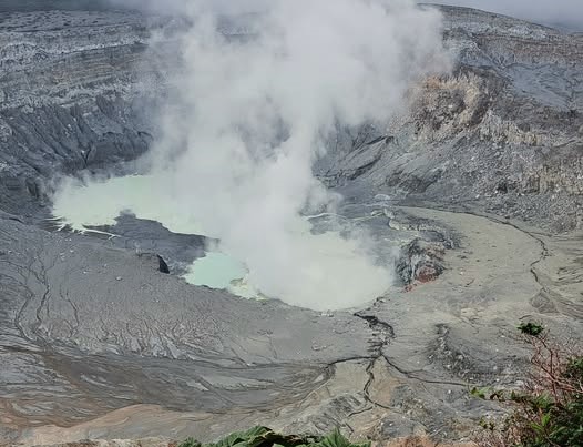
The Multi-GAS stations measured an SO2/CO2 ratio of 1.2 ± 0.5, comparable to the value from the previous week (1.2 ± 0.3). The H2S/SO2 ratio remains below 0.1. The NOVAC stations recorded 130 ± 94 tonnes of SO2 per day, with a maximum of 1,247 t/d. This flux is comparable to that of the previous week (190 ± 34 t/d with a maximum of 843 t/d). The Sentinel satellite detected the SO2 plume almost every day, with a peak value of 112 tonnes of SO2 in the atmosphere on September 20. The lake level remains stable this week. The lake temperature remains very high (>76°C).
Source : Ovsicori .
Photo : Sergio Lucena
Ecuador , Sangay :
DAILY STATUS REPORT FOR SANGAY VOLCANO, Sunday, September 27, 2026.
Information from the Geophysical Institute – EPN.
Surface activity level: Moderate; Surface trend: Unchanged
Internal activity level: Low; Internal trend: Unchanged
Seismicity: From September 26, 2026, 11:00 to September 27, 2026, 11:00:
Seismicity:
Here is the count of seismic events recorded at the reference station:
Explosion (EXP): 8
Emission tremor (TREMI): 2
Rainfall / Lahars:
No precipitation was recorded in the volcano area. Heavy rainfall could remobilize accumulated material, generating mud and debris flows that would descend the volcano’s flanks and spill into adjacent rivers.
Emission plume / ash:
Monitoring camera systems and the GOES-19 satellite recorded several gas and ash emissions reaching heights of 300 to 1,200 meters above the crater rim and drifting west and northwest. In connection with this activity, the Washington VAAC issued four reports regarding emissions reaching up to 1,500 meters, drifting west and northwest.
Other monitoring parameters:
The MIROVA VIIRS 750 satellite system detected 3 thermal anomalies, and the MIROVA VIIRS 375 system detected 4 over the past 24 hours.
Observation:
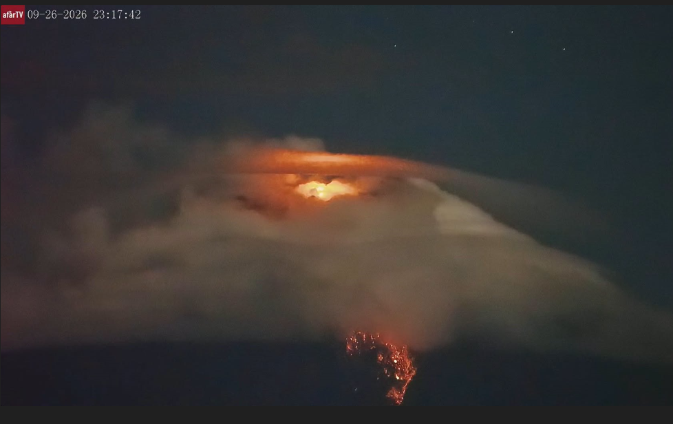
From yesterday afternoon until the time of writing, the volcano remained largely obscured by clouds. However, a descent of incandescent material was observed during the night.
Alert level: Yellow
Source : IGEPN
Photo : Afar tv.