September 27 , 2026.
Hawaii , Kilauea :
HAWAIIAN VOLCANO OBSERVATORY DAILY UPDATE, U.S. Geological Survey
Saturday, September 26, 2026, 8:41 AM HST (Saturday, September 26, 2026, 18:41 UTC)
19°25’16 » N 155°17’13 » W,
Summit Elevation 4091 ft (1247 m)
Current Volcano Alert Level: WATCH
Current Aviation Color Code: ORANGE
Summary:
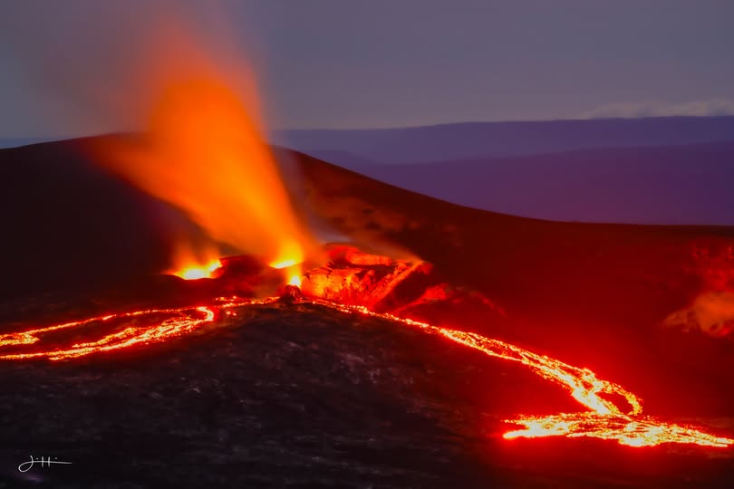
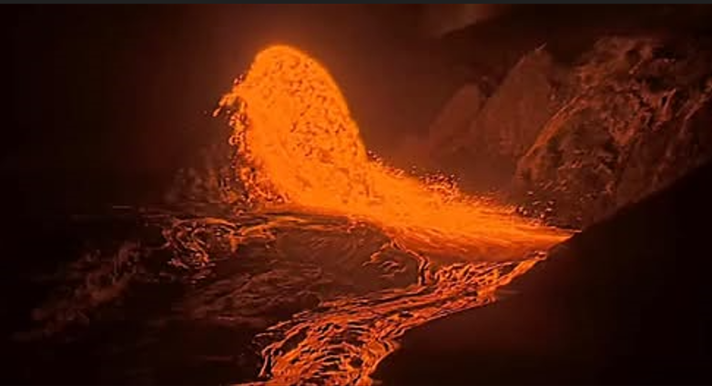
Small overflows from the north vent continue for the fourth day. All vents have strong glow, with overflows and intermittent spatter from the north vent. There is no anomalous activity outside of the summit.
Overview:
Episode 55 remains a possibility during the ongoing Kīlauea summit eruption. Precursory overflows from the north vent resumed on the night of September 22 and continue this morning. Glow and flames were observed from the north-south-west vent complex throughout the night, with intermittent overflows and spatter bursts from the north vent. There are currently no signs of reactivation of the recent vents 1-6. The summit has continued to inflate over the past 24 hours, and continuous tremor remains the dominant seismic signal across the summit.
No anomalous seismic activity or deformation has occurred outside of the summit region, and no significant activity has been noted along Kīlauea’s East Rift Zone or Southwest Rift Zone.
Hurricane Nolo is impacting the Island of Hawaiʻi today with rain and winds. HVO will continue to monitor volcanic and seismic activity across the island. Poor weather has greatly reduced visibility on streaming cams and webcams available to the public. Monitoring will continue using a variety of geophysical tools.
Summit Observations:
Precursory overflows from the north vent resumed on Tuesday night, September 22, beginning at 10:10 p.m. HST. Since then, there have been 33 overflows from the north vent. Most of the overflows have lasted about 10-35 minutes and produced lava flows that traveled a few hundred meters (yards) from the vent. There were no overflows for about 20 hours from 7:44 a.m. HST yesterday to 3:36 a.m. HST this morning with 7 overflows since that time. Many of the overflows were fed by vigorous fountains that rise 15-30 feet (5-10 meters) above the small 30-50 foot (10-15 meter) cone that has built up at the north vent. The north and south vents continued to glow strongly overnight and emitting nearly continuous flames. Glow from the west vent was sporadic and weak. Intermittent spatter bursts were also observed from the north vent last night between overflows. No other areas of incandescence were observed across the summit region last night.
Continuous tremor is the dominant seismic signal across the summit. There were ten small and shallow earthquakes located across the summit region in the past day. Six of these clustered around the « outlet » area at the south end of Kaluapele, the summit caldera.
Summit tilt has inflated over the past day, with about 0.8 microradians of inflation recorded. The current total inflation since the end of episode 54 is about 16.8 microradians, which is about 4 microradians greater than what was lost during episode 54 fountaining.
During inter-episode pauses, the sulfur dioxide (SO2) emission rate from the summit typically varies between 1,000 and 5,000 tonnes per day. Winds are currently from the northeast but may shift as Hurricane Nolo approaches Hawaiʻi Island.
Rift Zone Observations:
Rates of seismicity and ground deformation remain low in the East Rift Zone and Southwest Rift Zone. SO2 emissions from the East Rift Zone remain below the detection limit. No significant ground deformation was recorded in either rift zone.
Source : HVO.
Photos : Justin Hirako , Webcam .
Indonesia , Papandayan :
« Blue flame » phenomenon in Manuk Crater – Mount Papandayan, September 23–25, 2026
The blue flame phenomenon at Mount Papandayan had previously been observed on February 22, 2023, and July 12, 2025; in both instances, it appeared on the walls of Kawah Baru (the « New Crater »). In the early hours of September 24, 2026, a similar phenomenon was observed again, but this time in the Manuk Crater area, part of Mount Papandayan’s active crater complex.
Analysis of the observations indicates that the appearance of blue flames at the new thermal manifestation site within the Manuk Crater complex points to heat release intense enough to cause the combustion of surface materials. A powder resembling combustion ash was discovered near the site; it likely resulted from the heating or calcination of surface materials exposed to this heat.
Kawah Mas (the « Gold Crater »), located near the new thermal manifestation site, showed no significant changes in gas proportions. Consequently, gas ratio data indicate no major alteration to the hydrothermal system beneath Mount Papandayan that could be linked to the emergence of this new thermal manifestation in the Manuk Crater complex.
Measurements and observations indicate that thermal activity at the manifestation site is tending to decrease. Despite this decline in thermal activity, gas conditions around the site still reveal significant volcanic gas emissions. A strong sulfur odor remains perceptible downwind of the site; the gases present in the area therefore continue to pose a potential health risk upon direct exposure, particularly for individuals located downwind.
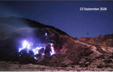
The appearance of blue flames on Mount Papandayan is a rare and unique attraction, as this phenomenon is typically associated only with Mount Ijen in East Java. However, this « blue flame » phenomenon has appeared in the Manuk crater area—near the main hiking trail and campsite, which are popular spots within the Mount Papandayan complex—necessitating increased vigilance. Potential hazards associated with this « blue fire » include sudden emissions and exposure to toxic volcanic gases or gas concentrations exceeding safety limits.
Mount Papandayan is currently at activity level I (Normal). Residents in the vicinity of Mount Papandayan, as well as tourists, hikers, and visitors, are advised to:
1. Refrain from any activities or camping within a 500-meter radius of the active crater areas of the Mount Papandayan complex—specifically Kawah Baru, Kawah Emas, Kawah Nangklak, and Kawah Manuk/Balagadama—or during overcast and rainy weather.
2. Remain alert to the risk of sudden increases in toxic gas concentrations.
3. Exercise vigilance regarding the possibility of sudden eruptions occurring without clear volcanic warning signs.
4. Be aware of the risk of landslides along the crater walls of the Mount Papandayan complex.
Source et photo : PVMBG.
Costa Rica , Rincon de la Vieja :
OVSICORI-UNA Weekly Volcanic Monitoring Bulletin, September 25, 2026
Latitude: 10.83° N;
Longitude: 85.34° W;
Elevation: 1,916 m above sea level.
Current activity level: Caution.
During this week, 27 eruptions were recorded; only one exceeded an acoustic magnitude of 4 (moderate). Most of these eruptions were of low magnitude. The eruption on September 21 at 06:40 showed the highest acoustic magnitude of the week. Frequent emissions of volcanic gases and water vapor (292) were observed this week, although their acoustic magnitude was very low. The amplitude of the low-frequency (0.7–2.5 Hz) background tremor increased over the course of the week, while also exhibiting variations in amplitude and frequency range. Harmonic tremor was observed on September 24, along with a few short-duration tremor pulses. Events located both near the crater and at greater distances were recorded. The number of long-period signals increased this week, while the number of « tornillo »-type events remained stable.
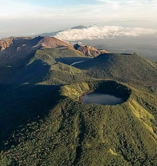
In the medium term (the last six months), a trend of subsidence has been observed at both the base and the summit of the volcano, accompanied by an expansion of the summit area. In the short term, no significant deformation has been observed, although the quality of last week’s data limits the precision of this assessment. The average SO2 flux for this week is 259 ± 196 t/d, with a maximum value of 2,104 t/d. These figures indicate an apparent decrease in SO2 emissions compared to the previous week, when the average flux was 390 ± 155 t/d, with a maximum of 6,153 t/d. However, this week’s readings may have been influenced by unfavorable wind direction, which could explain the apparent decline. These values remain above the volcano’s baseline level. The last detection of atmospheric SO2 emitted by the Rincón de la Vieja volcano, recorded by the Sentinel satellite, dates back to September 7, 2025.
Source : Ovsicori.
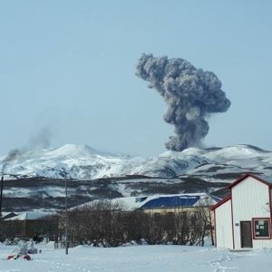
Photo : Via Volcannews /FB.
Ecuador , El Reventador :
DAILY STATUS REPORT FOR REVENTADOR VOLCANO, Saturday, September 26, 2026.
Information from the Geophysical Institute – EPN.
Surface activity level: High; Surface trend: Unchanged
Internal activity level: Moderate; Internal trend: Unchanged
From September 25, 2026, 11:00 AM to September 26, 2026, 11:00 AM:
Seismicity:
Explosion (EXP): 97
Long-period (LP): 19
Emission tremor (TREMI): 9
Harmonic tremor (TRARM): 5
Precipitation / Lahars:
No precipitation was recorded in the area. **Heavy rains could remobilize accumulated material and generate debris-laden mudflows (lahars) capable of descending the volcano’s flanks and flowing into adjacent rivers.**
Emission plume / ash:
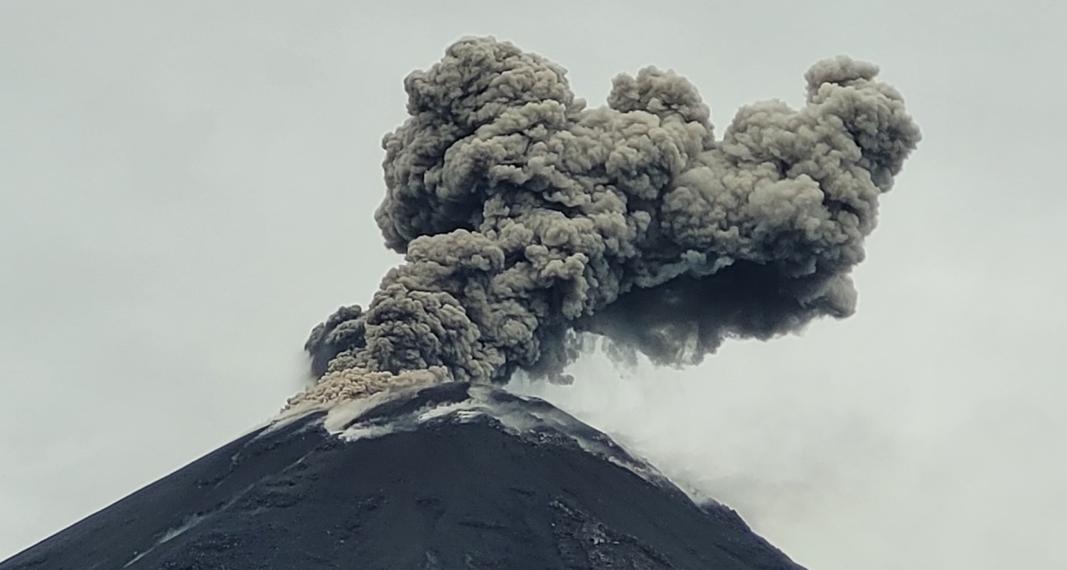
The surveillance camera system observed several gas and ash emissions; plumes reached heights of 400 to 800 meters above the crater rim, drifting west, northwest, and west-northwest. In connection with this activity, the Washington VAAC issued two reports regarding emissions reaching 1,300 meters above the crater rim, drifting northwest and west-northwest.
Other monitoring parameters:
The MIROVA VIIRS satellite system recorded two thermal anomalies, and the FIRMS satellite system recorded three over the past 24 hours.
Observation:
Overnight and early this morning, incandescence was observed at the crater, along with material descending up to 1,000 meters below the crater rim. At the time of writing, the volcano is obscured by clouds.
Alert Level – SGR: Orange
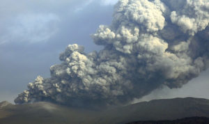
Source et photo : IGEPN.
Guatemala , Fuego :
Weather conditions: Clear skies
Wind: Southeast
Precipitation: 47.8 mm
Activity
During the night and early morning hours, light-gray degassing was observed at an altitude of 4,300 m above sea level. Between 4 and 7 explosions per hour—ranging from low to moderate or high intensity—were recorded, propelling gas and ash plumes to altitudes of 4,300 to 4,800 m (14,107–15,748 ft) and drifting toward the west and northwest.
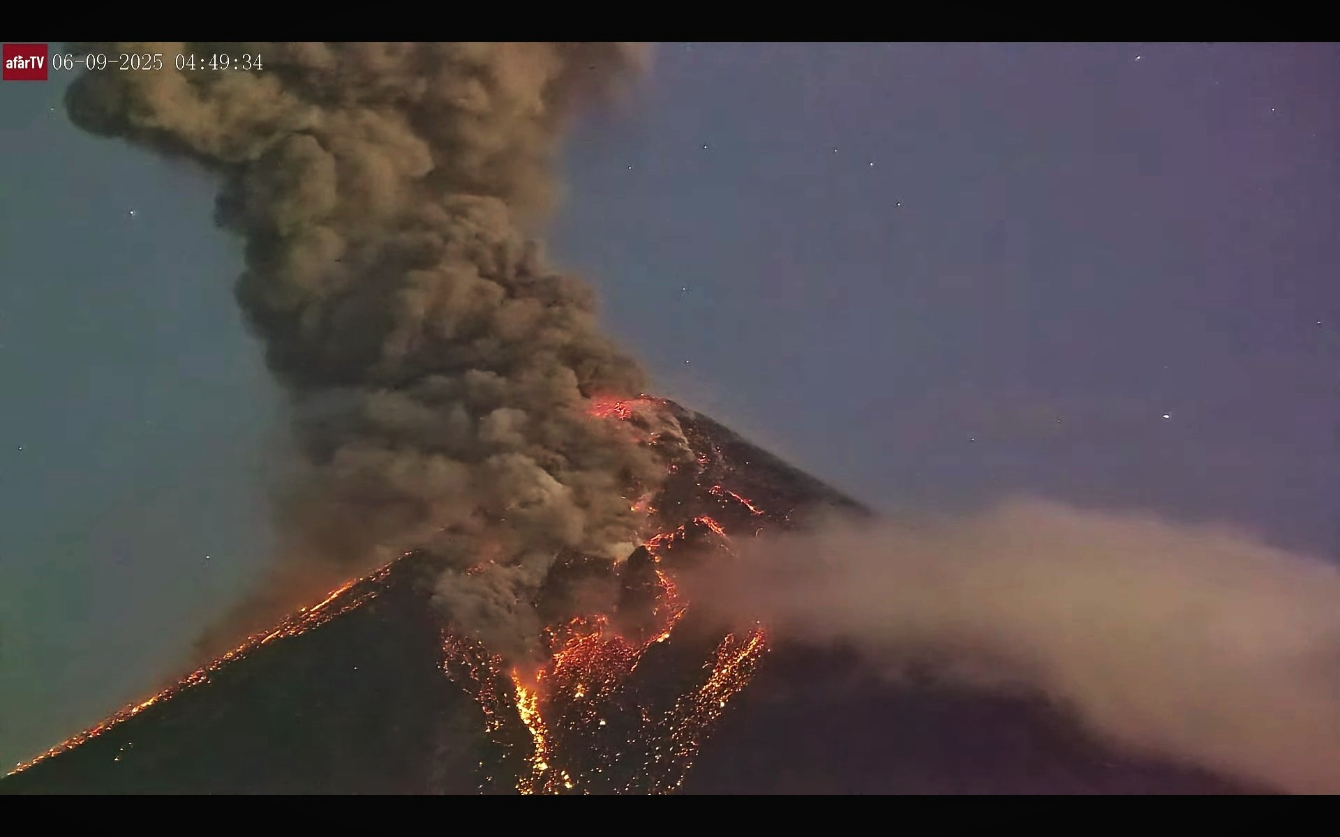
Some explosions are accompanied by noise, rumbling, and weak shockwaves. Incandescent bursts are observed at night, causing hot material to fall around the crater; this material flows into the Seca, Taniluya, Ceniza, Las Lajas, and Honda ravines (among others), sometimes reaching the edge of the vegetation zone. Additionally, fine ashfall has been reported in Panimaché II, Yepocapa, and the surrounding areas. Should rainfall occur during the day, torrential flows and/or lahars could develop; it is therefore advised not to stop within or near these ravines when it is raining on the volcanic edifice.
Source : Insivumeh.
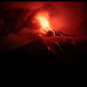
Photo : Afar tv.