July 27 , 2026.
Kamchatka , Sheveluch :
KVERT VOLCANIC ACTIVITY NOTICE (VAN)
Issued: JUly 26 , 2026
Volcano: Sheveluch (CAVW #300270)
Current aviation colour code: ORANGE
Previous aviation colour code: orange
Source: KVERT
Notice Number: 2026-82
Volcano Location: N 56 deg 38 min E 161 deg 19 min
Area: Kamchatka, Russia
Summit Elevation: 3283 m (10768.24 ft), the dome elevation ~2500 m (8200 ft)
Volcanic Activity Summary:
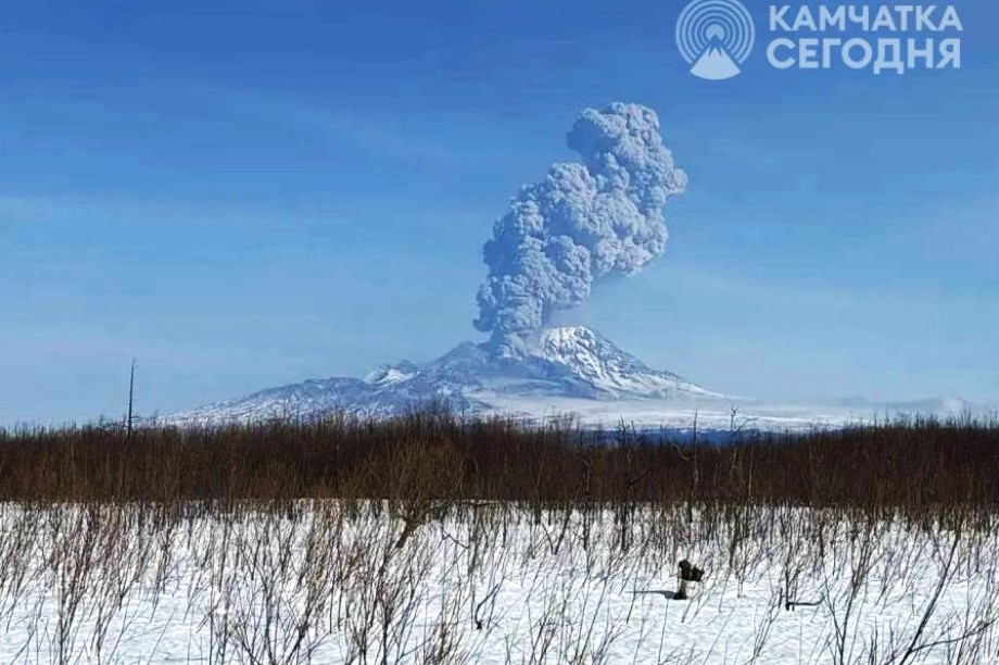
The explosive-extrusive eruption of the volcano continues, accompanied by powerful gas-steam activity; a new block of lava continues to grow in the northern part of the lava dome. Explosions sent ash up to 8.5 km a.s.l., and ash cloud move for 30 km to the north-west of the volcano.
The explosive-extrusive eruption of the volcano continues. Ash explosions up to 12 km (39,400 ft) a.s.l. could occur at any time. Ongoing activity could affect international and low-flying aircraft.
Volcanic cloud height:
8500 m (27880 ft) AMSL Time and method of ash plume/cloud height determination: 20260726/2050Z – Himawari-9 14m15
Other volcanic cloud information:
Distance of ash plume/cloud of the volcano: 30 km (19 mi)
Direction of drift of ash plume/cloud of the volcano: NNW / azimuth 330 deg
Time and method of ash plume/cloud determination: 20260726/2050Z – Himawari-9 14m15
Duration of explosion: ~ 5 min
Source : Kvert .
Photo : ИА Камчатка
Indonesia , Lewotobi Laki-laki :
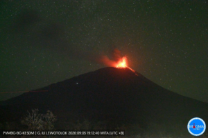
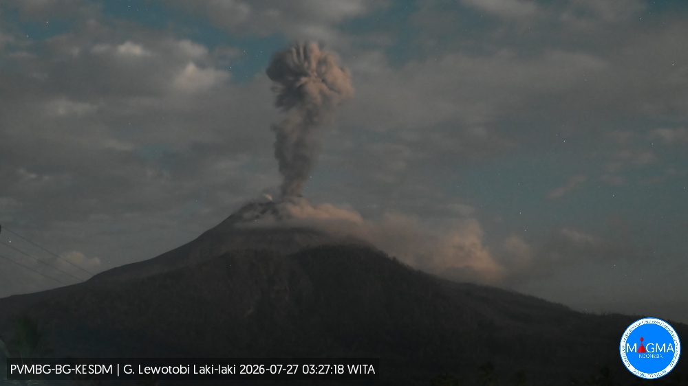
An eruption of Mount Lewotobi Laki-laki occurred on Monday, July 27, 2026, at 03:21 WITA; an ash column reaching approximately 1,000 meters above the summit (or about 2,584 meters above sea level) was observed. This thick, gray ash column drifted towards the west and northwest. The eruption was recorded by the seismograph with a maximum amplitude of 22.2 mm and a duration of 129 seconds.
Seismic observations
4 eruptive earthquakes with amplitudes of 22.2 to 44.4 mm and durations of 47 to 169 seconds.
5 non-harmonic tremors with amplitudes of 4.4 to 7.4 mm and durations of 65 to 94 seconds.
1 low-frequency earthquake with an amplitude of 2.9 mm and a duration of 24 seconds.
1 deep volcanic earthquake with an amplitude of 2.9 mm and a duration of 15 seconds.
Recommendations
1. Communities located near Mount Lewotobi Laki-laki, as well as visitors and tourists, must not conduct any activities within a 5 km radius of the Mount Lewotobi Laki-laki eruptive center.
2. The public is advised to remain calm, follow instructions from local authorities, and disregard information from unverified sources.
Source et photo : PVMBG.
Colombia , Nevado del Ruiz :
Manizales, July 21, 2026, 5:10 PM.
Based on monitoring of activity at the Nevado del Ruiz volcano, the Colombian Geological Service (SGC)—an agency attached to the Ministry of Mines and Energy—reports the following information:
During the week of July 14 to 20, 2026, the volcano continued to exhibit unstable behavior.
Compared to the previous week, the main variations in monitored parameters were as follows:
– Seismic activity associated with rock-fracturing processes within the volcanic edifice showed a decrease in the number of recorded earthquakes, while the seismic energy
released remained at similar levels. The earthquakes were located at the Arenas crater and, in a scattered manner, on various flanks of the volcano (notably the northern flank), at distances of up to 10 km from the crater. Earthquake depths ranged from less than 1 km to 2 km at the Arenas crater, and from 2 km to 7 km in other sectors. The maximum magnitude was 1.0, corresponding to the earthquake that occurred on July 20 at 4:33 AM, located 1 km north of the Arenas crater at a depth of 4 km.
– Seismicity associated with fluid dynamics within the volcanic conduits has decreased in terms of both the number of events and the seismic energy released. The seismic signals were short-lived and low-energy. As in previous weeks, no long-duration seismic signals were recorded; furthermore, no impulsive ash emissions or changes in the apparent temperature of the gas column were confirmed.
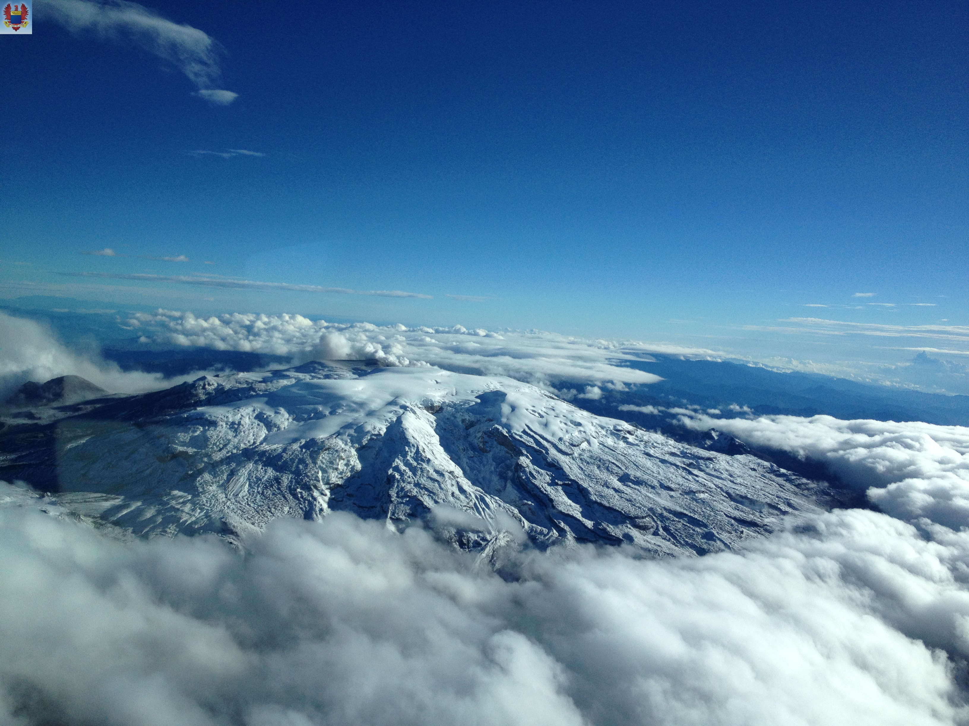
– Emissions of water vapor and volcanic gases—primarily sulfur dioxide (SO₂)—into the atmosphere continued from the Arenas crater. The estimated SO₂ flux associated with degassing processes increased compared to the previous week. Supplementary monitoring via satellite data platforms continued to show low levels of SO₂ output. The vertical height of the gas and water vapor plume remained at approximately 400 m above the volcano’s summit. The plume’s dispersion direction showed a preferential trend toward the volcano’s northwest flank and, occasionally, toward the west-northwest flank. It should be noted that reports of ashfall were recorded over the past two weeks, primarily in the municipalities of Manizales and Villamaría (Caldas department). This phenomenon was caused by strong winds in the volcanic area resuspending fine particles, which were then transported to these locations.
– Satellite monitoring of thermal anomalies at the base of the Arenas crater was limited by heavy cloud cover in the area. However, some anomalies indicating low energy levels were detected.
Source et photo : SGC.
Ecuador , Sangay :
DAILY STATUS REPORT FOR SANGAY VOLCANO, Sunday, July 26, 2026.
Information from the Geophysical Institute – EPN.
Surface activity level: Moderate; Surface trend: Decreasing
Internal activity level: Moderate; Internal trend: Decreasing
Seismicity: From July 25, 2026, 11:00 to July 26, 2026, 11:00:
Seismicity:
Here is the count of seismic events recorded at the reference station:
Explosion (EXP): 17
Precipitation / Lahars:
Precipitation was recorded in the volcano area, though it did not trigger mud or debris flows. **In the event of heavy rain, accumulated material could be remobilized, generating mud and debris flows that would descend the volcano’s flanks and discharge into adjacent rivers.
Emission plume / ash:
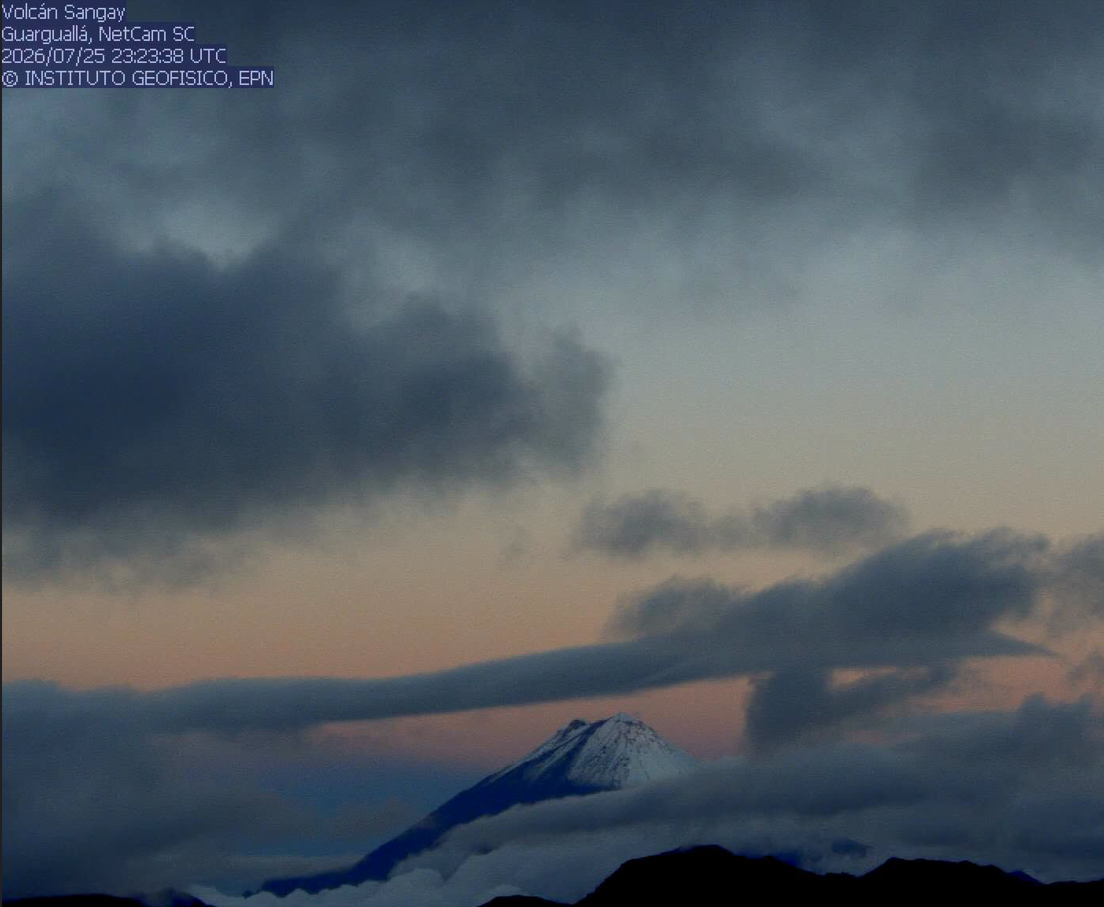
Due to cloud cover in the area, it was not possible to identify ash emissions via surveillance cameras or GOES-19 satellite imagery.
Similarly, the Washington VAAC has issued no reports indicating emissions.
Other monitoring parameters:
The FIRMS and MIROVA satellite systems recorded no thermal anomalies over the past 24 hours.
Observation:
Yesterday afternoon, the volcano remained partially visible. However, at the time of writing this report, the volcano remains obscured by clouds.
Alert level: Yellow
Source et photo : IGEPN
Guatemala , Santiaguito :
Weather conditions: Clear skies
Wind: Northeasterly
Precipitation: 1.00 mm
Activity
The Santiaguito volcano observatory reports favorable conditions for observing the dome.
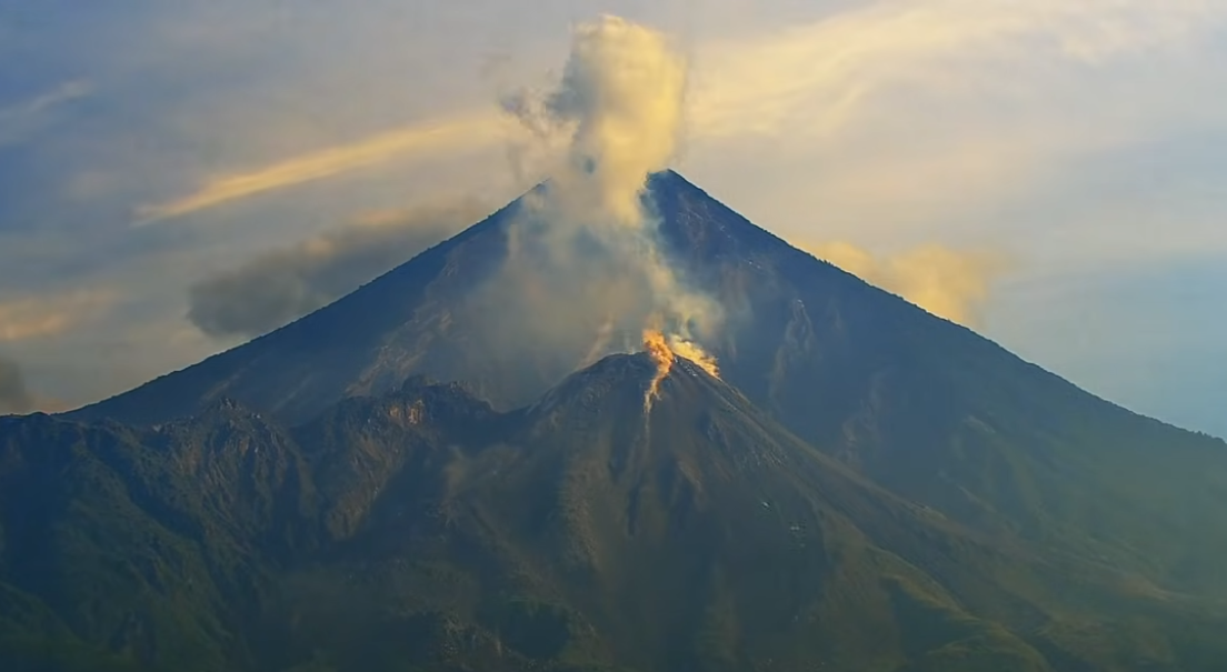
Low- to moderate-intensity explosions are being recorded at a rate of 1 to 3 per hour, ejecting gas and ash plumes up to 900 meters in altitude. These plumes are drifting southwestward due to the wind. Incandescence is visible at the dome, along with falls of incandescent rock blocks on the western, southwestern, and southern flanks.
Ashfall is possible over San Marcos Palajunoj, La Tranquilidad, and surrounding areas due to wind direction. Given the significant accumulation of rocky material, the Domo Caliente and the promontory overlooking the lava flow could collapse and generate long-range pyroclastic density currents moving southwest; consequently, the recommendations in special bulletin BESAN-016-2026 must be followed.
Source : Insivumeh.
Photo : Afar tv.