July 26 , 2026.
Colombia , Puracé – Los Coconucos volcanic chain :
Popayán, July 23, 2026, 11:00 AM.
Based on monitoring of the Los Coconucos volcanic chain’s activity, the Colombian Geological Service (SGC)—an agency attached to the Ministry of Mines and Energy—reports the following:
A significant and continuous increase in seismic energy is being observed in signals associated with fluid movements (gases and liquids of magmatic origin and their interaction with the hydrothermal system)—as noted in the weekly bulletin of July 21. These signals have been located primarily beneath the Puracé volcano crater, at depths of less than 3 km.
This seismic activity is accompanied by a notable increase in the height and intensity of degassing. Several of these events have generated ash emissions reaching up to 2,100 meters above the summit of the Puracé volcano. Seismicity linked to internal rock fracturing is also being observed at depths between 1 and 3 km beneath the Puracé and Piocollo volcanoes.
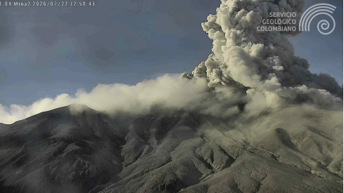
An ash emission occurred on July 22, 2026, at 07:50, recorded by the Mina camera located 2.2 km north of the summit of Puracé volcano.
These changes were accompanied by a notable increase in atmospheric sulfur dioxide (SO₂) and carbon dioxide (CO₂) emissions; these levels reached the highest values recorded by instrumental and satellite monitoring systems since the 2025 eruptive episode.
Furthermore, thermal cameras revealed a rise in emission temperatures compared to those recorded in recent months, and satellite observations detected persistent thermal anomalies within the crater of Puracé volcano. Regarding geodetic monitoring, deformation continues in the area situated between the Puracé, Piocollo, and Curiquinga volcanoes.
In conclusion, the variations observed at Puracé volcano—part of the Los Coconucos volcanic chain—indicate that the system continues to evolve. Further ash emissions are possible and would disperse according to prevailing wind directions. Additionally, the occurrence of further changes in volcanic activity cannot be ruled out; such changes could lead to surface manifestations involving greater energy or a modification of the volcanic alert level.
The public is advised not to visit high-altitude areas of the volcanic chain and to stay informed via reports from official SGC channels, as well as through instructions from local and departmental authorities and the National Unit for Disaster Risk Management (UNGRD).
The volcanic alert level remains at Yellow: Active volcano showing changes relative to the baseline behavior of monitored parameters and other manifestations.
Source et photo : SGC.
Indonesia , Anak Krakatau :
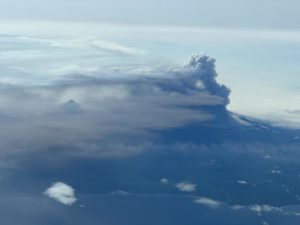
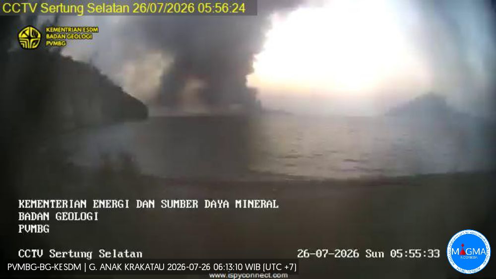
An eruption of Mount Anak Krakatau occurred on Saturday, July 25, 2026, at 4:52 p.m. (Western Indonesia Time), with an ash column reaching a height of approximately 300 m above the summit (or about 457 m above sea level). The dense, gray-to-black ash column drifted northwest. The eruption was recorded by the seismograph with a maximum amplitude of 43 mm and a duration of 63 seconds.
Seismic observations
1 hybrid/polyphase earthquake with an amplitude of 9 mm; duration of 6 seconds.
1 episode of continuous tremor with an amplitude of 2 to 25 mm (dominant amplitude of 5 mm).
Recommendations
The public, visitors, tourists, and hikers must not approach Mount Anak Krakatau or engage in activities within a 3 km radius of the active crater.
Source et photo : PVMBG.
Chile , Nevados del Chillan :
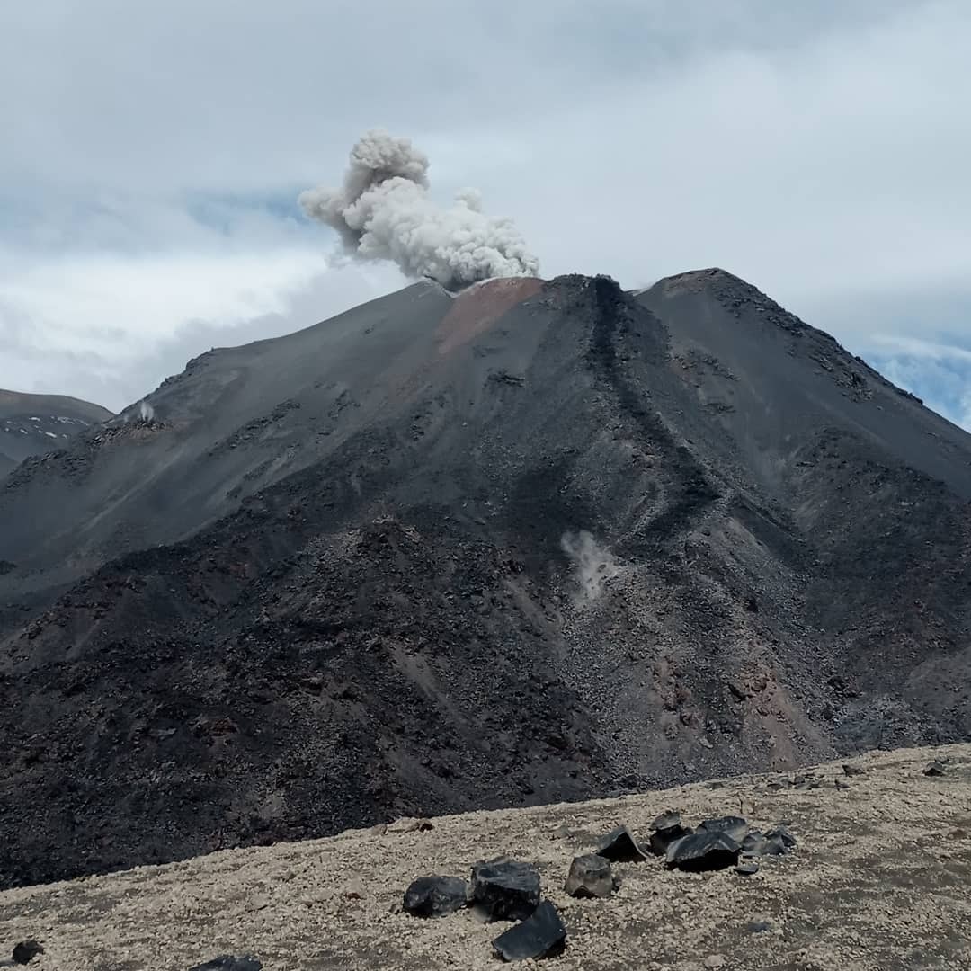
During the reporting period, volcano-tectonic (VT) seismic activity—associated with rock fracturing within the volcano—showed a decrease in the number of events, although energy release levels remained comparable to those of the previous period.
The most energetic VT event recorded had a local magnitude (ML) of 1.4 and was located 0.8 km northwest (NW) of the volcanic edifice, at a depth of 1.3 km below the active crater.
Seismic activity linked to fluid movement within the volcano—represented by long-period (LP), Tornillo (TO), and tremor (TR) events—also decreased in both the number of events and energy release values compared to the previous period. The maximum energy release value for LP events, measured by reduced displacement (RD), was 19 cm². For TR-type events, the maximum reduced displacement (RD) value was 5 cm². No TO-type events were recorded during the reporting period.
Two (2) hybrid (HB) events occurred, associated with both rock fracturing and fluid dynamics within the volcano. The most energetic event showed a reduced displacement (RD) value of 3 cm².
Analysis of images from OVDAS surveillance cameras revealed a decrease in recorded surface activity; degassing plumes were observed, reaching a maximum height of 100 m above the crater rim. No energetic explosive events were recorded during this two-week period; only a low-energy, passive ash emission pulse occurred on July 1. Furthermore, no incandescence or other volcanic phenomena were observed during this period.
Analysis of satellite imagery revealed one (1) very low-magnitude thermal anomaly detected by VIIRS375.
Analysis of high-resolution satellite imagery (PlanetScope and Sentinel-2 L2A) showed no morphological changes to the volcanic complex.
Source : Segemar
Photo : Sernageomin.
Ecuador , El Reventador :
DAILY STATUS REPORT FOR REVENTADOR VOLCANO, Saturday, July 25, 2026.
Information: Geophysical Institute – EPN.
Surface activity level: High; Surface trend: Unchanged
Internal activity level: Moderate; Internal trend: Unchanged
From July 24, 2026, 11:00 to July 25, 2026, 11:00:
Seismicity:
Explosion (EXP): 72
Long-period (LP): 9
Emission tremor (TREMI): 13
Harmonic tremor (TRARM): 5
Precipitation / Lahars:
Precipitation has been recorded in the area, but it has not triggered lahars. **Heavy rains can remobilize accumulated material and generate debris-laden mudflows (lahars), which could rush down the volcano’s flanks and flow into nearby rivers.**
Ash emissions/plumes:
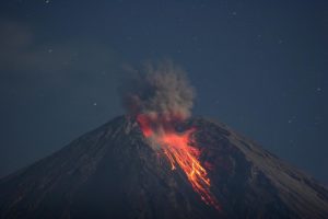
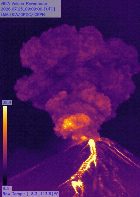
Since yesterday afternoon, the surveillance camera system has detected several gas and ash emissions reaching altitudes of 600 to 1,000 meters above the crater rim, drifting southwest and west. In connection with this activity, the Washington VAAC issued a report noting an ash emission rising 700 meters above the crater rim and moving southwest.
Other monitoring parameters:
The FIRMS and MIROVA satellite systems have recorded no thermal anomalies over the past 24 hours.
Observation:
Overnight and during the early morning hours, the surveillance camera system observed incandescent material descending to a level 1,100 meters below the crater rim. At the time of this report, the volcano is partially visible.
Alert Level – SGR: Orange
Source et photo : IGEPN.
Costa Rica , Rincon de la Vieja :
Latitude: 10.83° N;
Longitude: 85.34° W;
Elevation: 1,916 m above sea level.
Current activity level: Advisory.
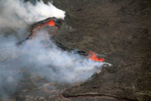
Six eruptions were recorded this week. The most energetic event occurred on July 20 at 03:02 and generated a syn-eruptive lahar (triggered directly by the eruption). Prior to this eruption, background tremor dropped sharply ten hours earlier, followed by a significant increase in tremor amplitude in the ensuing hours. This was the most energetic eruption recorded this year. An increase in the number of volcano-tectonic earthquakes near the crater was observed. Sporadic long-period and « tornillo » (screw-shaped) earthquakes were also recorded during the week. Tremor amplitude has been gradually decreasing since July 20, suggesting reduced permeability or a blockage of the conduits.

The geodetic network is detecting expansion of the summit and the northern flank, without significant uplift. The MultiGAS station continues to record low concentrations of volcanic gases. NOVAC stations recorded an average SO2 flux of 306 ± 121 t/d, compared to an average of 460 ± 290 t/d the previous week; despite this slight decrease relative to the prior week, the flux remains above baseline levels. The last detection of atmospheric SO2 over Rincón de la Vieja volcano by the SENTINEL satellite was on September 7, 2025.
Based on these observations, the activity level of Rincón de la Vieja volcano is being raised from Level 2 (Advisory) to Level 3 (Caution).
Source : Ovsicori
Photo : RSN.