July 25 , 2026.
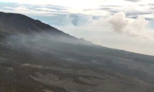
Alaska , Katmai :
AVO/USGS Volcanic Activity Notice
Current Volcano Alert Level: NORMAL
Current Aviation Color Code: GREEN
Issued: Friday, July 24, 2026, 4:19 PM AKDT
Source: Alaska Volcano Observatory
Notice Number: 2026/A151
Location: N 58 deg 16 min W 154 deg 57 min
Elevation: 6716 ft (2047 m)
Area: Alaska Peninsula
Summary:
Resuspended ash observed from 1912 eruption. Aviation color code and alert level remain at GREEN/NORMAL.
Volcanic Activity:
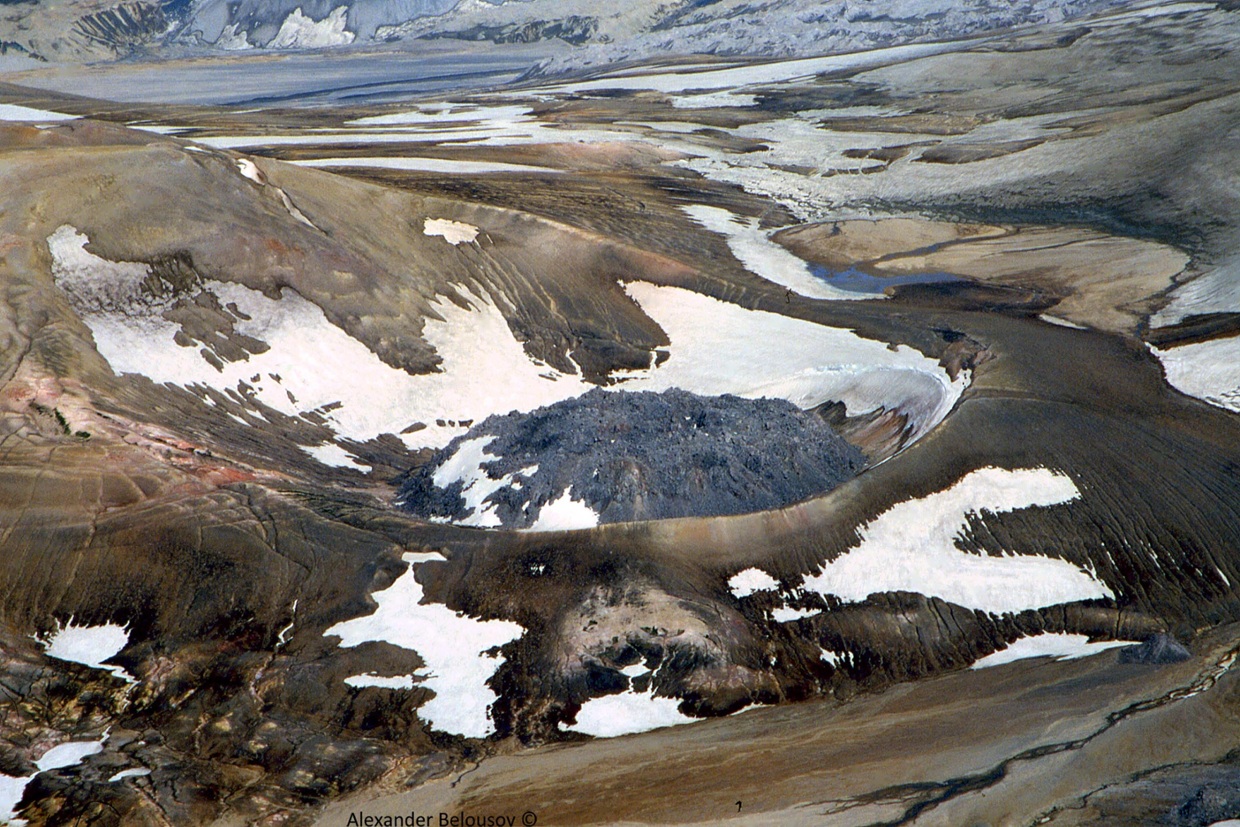
Strong northwesterly winds in the vicinity of Katmai and the Valley of Ten Thousand Smokes have picked up loose volcanic ash erupted during the 1912 Novarupta-Katmai eruption and are carrying it to the southeast. The National Weather Service has issued a SIGMET for this low-level event and suggests that the maximum cloud height is 6,000 ft (1.8 km) above sea level.
This phenomenon is not the result of recent volcanic activity and occurs during times of high winds and dry snow-free conditions in the Katmai area and other young volcanic areas of Alaska. No eruption is in progress. All of the volcanoes of the Katmai area (Griggs, Katmai, Novarupta, Mageik, Martin, Snowy and Trident) remain at Aviation Color Code GREEN and Alert Level NORMAL. Resuspended volcanic ash should be considered hazardous and could be damaging to aircraft and health
Source : AVO.
Photo : A. Belousov.
Kamchatka , Sheveluch :
KVERT VOLCANIC ACTIVITY NOTICE (VAN)
Issued: July 24 , 2026
Volcano: Sheveluch (CAVW #300270)
Current aviation colour code: ORANGE
Previous aviation colour code: orange
Source: KVERT
Notice Number: 2026-81
Volcano Location: N 56 deg 38 min E 161 deg 19 min
Area: Kamchatka, Russia
Summit Elevation: 3283 m (10768.24 ft), the dome elevation ~2500 m (8200 ft)
Volcanic Activity Summary:
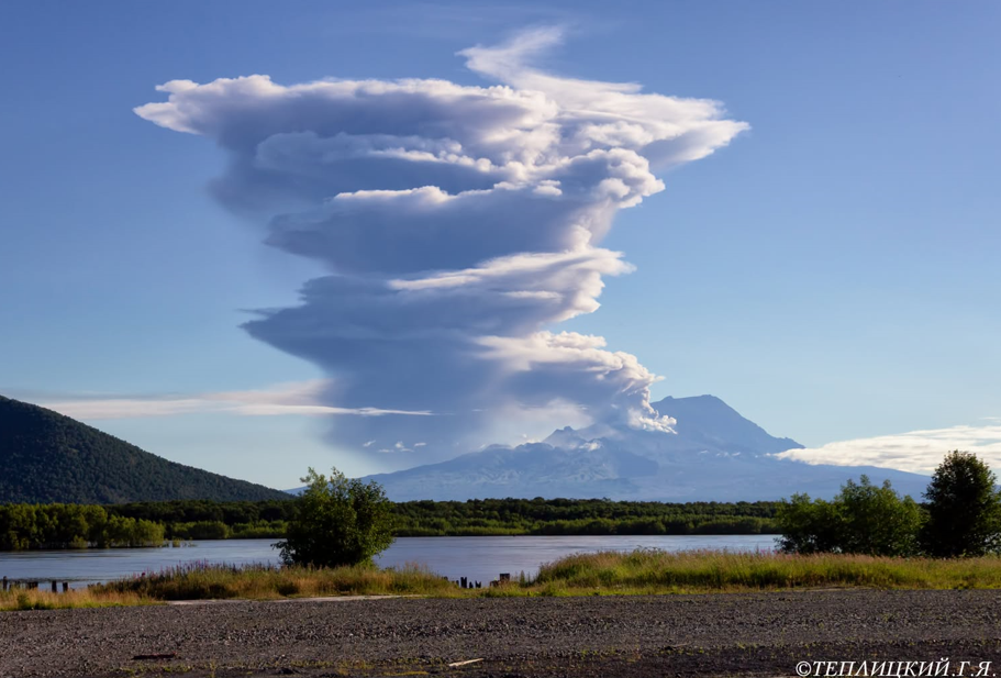
The explosive-extrusive eruption of the volcano continues, accompanied by powerful gas-steam activity; a new block of lava continues to grow in the northern part of the lava dome. Explosions sent ash up to 8 km a.s.l., and ash cloud move for 43 km to the northeast of the volcano.
The explosive-extrusive eruption of the volcano continues. Ash explosions up to 12 km (39,400 ft) a.s.l. could occur at any time. Ongoing activity could affect international and low-flying aircraft.
Volcanic cloud height:
8000 m (26240 ft) AMSL Time and method of ash plume/cloud height determination: 20260724/1950Z – Himawari-9 14m15
Other volcanic cloud information:
Distance of ash plume/cloud of the volcano: 43 km (27 mi)
Direction of drift of ash plume/cloud of the volcano: NE / azimuth 43 deg
Time and method of ash plume/cloud determination: 20260724/1950Z – Himawari-9 14m15
Source : Kvert .
Photo : Gennady Teplitsky.
Indonesia , Lewotobi Laki-laki :
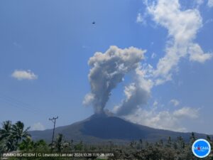
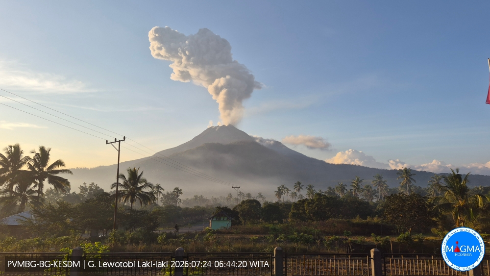
An eruption of Mount Lewotobi Laki-laki occurred on Friday, July 24, 2026, at 06:39 WITA, producing an ash column estimated to reach a height of approximately 1,600 m above the summit (or about 3,184 m above sea level). The dense, gray ash column drifted toward the north and northwest. The eruption was recorded by a seismograph with a maximum amplitude of 47.3 mm and a duration of 150 seconds.
Seismic observations
1 eruption earthquake, with an amplitude of 10.5 mm and a duration of 133 seconds.
2 emission earthquakes, with an amplitude of 2.9 mm and a duration between 34 and 41 seconds.
11 harmonic tremors, with an amplitude between 2.9 and 7.4 mm and a duration between 87 and 264 seconds.
10 non-harmonic tremors, with an amplitude between 2.9 and 10.5 mm and a duration between 77 and 238 seconds.
1 low-frequency earthquake, with an amplitude of 14.8 mm and a duration of 28 seconds.
1 distant tectonic earthquake, with an amplitude of 7.4 mm and a duration of 50 seconds.
Recommendations
1. Communities located near Mount Lewotobi Laki-laki, as well as visitors and tourists, must not conduct any activities within a 5 km radius of the Mount Lewotobi Laki-laki eruption center.
2. The public is advised to remain calm, follow instructions from local authorities, and disregard rumors from unverified sources.
Source et photo : PVMBG.
Martinique , Mount Pelée :
Weekly Report, Institut de physique du globe de Paris / Martinique Volcanological and Seismological Observatory (OVSM)
Saint-Pierre, July 24, 2026, at 2:30 PM local time (GMT-4)
Volcano-tectonic seismic activity
Between July 17, 2026, at 4:00 PM (UTC) and July 24, 2026, at 4:00 PM (UTC), the OVSM recorded 45 earthquakes of volcanic origin:
• 44 volcano-tectonic earthquakes. Of these, 4 had a magnitude (local magnitude Mlv or duration magnitude Md) greater than 1, and 2 had a magnitude greater than 2. The maximum magnitude was Mlv = 2.6. The others were of lower energy. These earthquakes were located at depths ranging from 0.7 to 1.8 km beneath the volcano’s summit.
• 1 deep long-period earthquake located southeast of Mount Pelée at a depth of 24 km, with a magnitude of Mlv = 1.0.
No earthquakes were reported felt by the population. However, shallow earthquakes with sufficient energy can produce sounds perceptible at close range. This week, a few hikers on Mount Pelée reported hearing a low-frequency rumble at a time consistent with one of the earthquakes exceeding magnitude 2.
The previous week, the OVSM had recorded 94 earthquakes of volcanic origin. As of July 24, 2026, and over the past four weeks, the OVSM has thus observed a total of 367 volcanic earthquakes, representing an average of 91 to 92 earthquakes per week.
Deformations of Mount Pelée
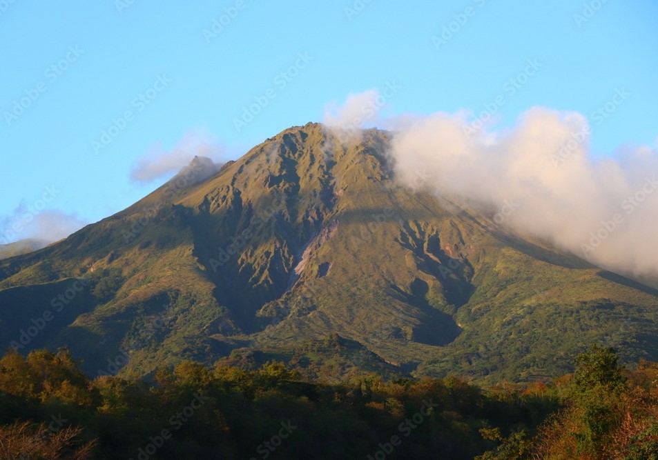
Since May 2026, the OVSM has been recording ground displacements of several centimeters in the summit area of Mount Pelée. Over the past four weeks, maximum displacement rates have been around 2 cm per month, similar to the previous month. These displacements are consistent with deformation of the volcanic edifice caused by an inflating pressure source located at a depth of approximately 1 km beneath the summit.
The probability of short-term eruptive activity remains low. However, given the observations gathered over recent months and years, a change in the situation over the medium term (weeks to months) cannot be ruled out.
The volcanic alert level, in accordance with protocols established by the authorities, is currently YELLOW: vigilance.
Source : Direction de l’OVSM-IPGP
Photo : OVSM
Costa Rica , Poas :
OVSICORI-UNA Weekly Volcanic Monitoring Bulletin, July 24, 2026
Latitude: 10.20°N;
Longitude: 84.23°W;
Elevation: 2,687 m above sea level.
Current activity level: Advisory
A very small-scale eruption (infrasonic magnitude of 1) was recorded this week, on July 21. It could not be visually observed. Tremor amplitude, which had gradually decreased over the previous week, increased following the eruption.
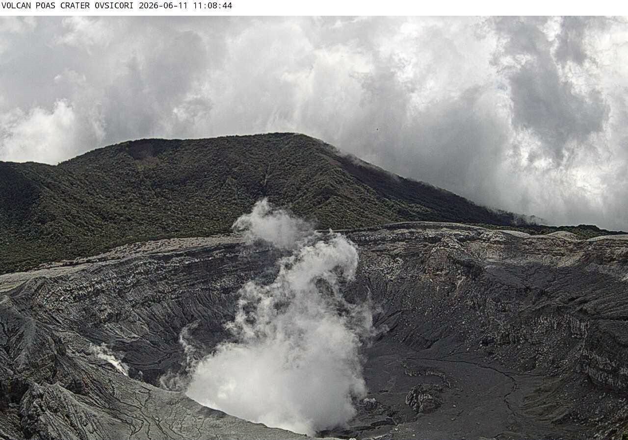
The number of long-period events remains stable at a moderate level. No volcano-tectonic earthquakes were recorded this week. The geodetic network indicates slight contraction around the crater. A significant drop in the SO2/CO2 ratio is reported, with values near 0.7 this week, compared to approximately 1.7 the previous week. The H2S/SO2 ratio remains below 0.1. NOVAC stations recorded an SO2 flux of 162 ± 33 tonnes per day, comparable to that of the previous week (211 ± 60 t/d). The last detection of atmospheric SO2 associated with Poás volcano by the SENTINEL satellite dates back to July 15. The level of the hyperacidic lake continues to rise rapidly—by approximately 1.5 m—due to a very rainy period.
Source et photo : Ovsicori .