July 15 , 2026.
Hawaii , Kilauea :
HVO/USGS Volcanic Activity Notice , 2026-07-15 01:29:03 UTC
Current Volcano Alert Level: WATCH
Previous Volcano Alert Level: ADVISORY
Current Aviation Color Code: ORANGE
Previous Aviation Color Code: YELLOW
Issued: Tuesday, July 14, 2026, 3:29 PM HST
Source: Hawaiian Volcano Observatory
Notice Number: 2026/H336
Location: N 19 deg 25 min W 155 deg 17 min
Elevation: 4091 ft (1247 m)
Area: Hawaii
Summary:
Precursory low-level eruptive activity before episode 51 of the ongoing Halemaʻumaʻu eruption began around 2:51 p.m. HST on July 14. Low level winds out of the NE, higher level winds are variable.
Volcanic Activity:
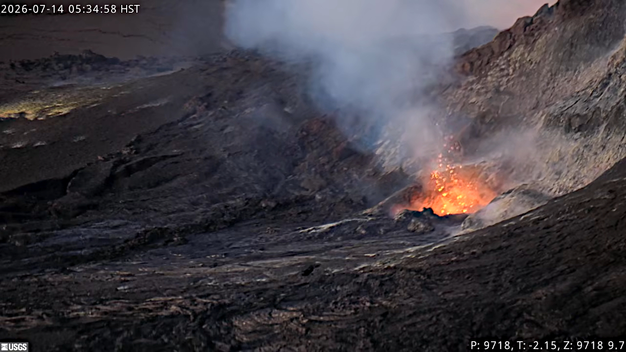
Precursory low-level activity for episode 51 of the ongoing Halemaʻumaʻu eruption at the summit of Kīlauea began around 2:51 p.m. HST on July 14 with a lava overflow from the north vent. Accordingly, HVO is raising the Alert Level for Kīlauea from ADVISORY to WATCH and the Aviation Color Code from YELLOW to ORANGE. This low-level precursory activity can continue for hours to days before the lava fountaining episode beings. The forecast for episode 51 of lava fountaining to start is between today and July 16. Low level winds are out of the northeast with possibility of tephra and ash being carried in the direction of Pāhala and Nāʻālehu. Higher level winds are variable with possibility of tephra being dispersed into communities adjacent to Hawaiʻi Volcanoes National Park. Another VAN will be published when lava fountaining episode 51 begins.
All eruptive vents and lava flows are confined to Halemaʻumaʻu crater within Hawaiʻi Volcanoes National Park. Tephra fall from volcanic ash clouds is greatest within 3 miles (5 km) of the vents, lighter ash and Pele’s Hair may stay suspended for large distances from the vents.
Source et photo : HVO.
Italy , Stromboli :
WEEKLY BULLETIN, July 6, 2026 – July 12, 2026 (Date of issue: July 14, 2026)
SUMMARY OF ACTIVITY STATUS
Based on monitoring data, the observations are as follows:
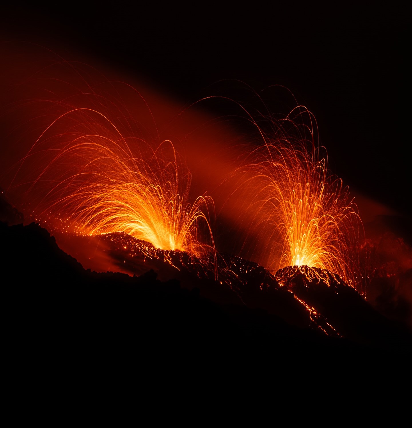
1) VOLCANOLOGICAL OBSERVATIONS: Typical Strombolian eruptive activity at both crater zones, accompanied by lava spattering in the North Crater zone. The frequency of total explosive activity—encompassing both the North Crater zone and the Central-South Crater zone—is at a medium level; explosion intensity is medium in the North Crater zone and medium to low in the Central-South zone.
2) SEISMOLOGY: Monitored seismic parameters show no significant variations.
3) GROUND DEFORMATION: The GNSS network shows no significant variations. The Punta Labronzo tiltmeter recorded a minor variation.
4) GEOCHEMISTRY: SO2 flux at a medium to low level.
Soil CO2 flux (Pizzo zone – STR02): No updated data available.
Plume C/S ratio: Average values.
Helium isotope ratio (R/Ra): No updated data available.
Soil CO2 flux in the San Bartolo zone: High to very high levels.
5) SATELLITE OBSERVATIONS: Satellite-observed thermal activity in the summit area remained generally low, with a few isolated anomalies of moderate intensity.
VOLCANOLOGICAL OBSERVATIONS
During the observation week, Stromboli’s eruptive activity was characterized through the analysis of images recorded by INGV-OE surveillance cameras located at an elevation of 190 m above sea level and at Punta dei Corvi (SCT-SCV and SPCT, respectively). Explosions in the North crater zone (Zone N) primarily produced coarse material (bombs and lapilli). In the Central-South crater zone (Zone CS), explosions predominantly produced fine material.
The average frequency and intensity of explosions from the North zone remained mainly at medium levels. In the Central-South zone, the average frequency and intensity of explosions remained at a low to medium level. The total daily average hourly explosion frequency (Zone N + Zone CS) remained at a medium level.
Source : INGV
Photo : Stromboli stati d’animo / Sebastiano Cannavo
Italy / Sicily , Etna :
WEEKLY BULLETIN, July 6, 2026 – July 12, 2026 (Date of issue: July 14, 2026)
SUMMARY OF ACTIVITY STATUS
Based on monitoring data, the observations are as follows:
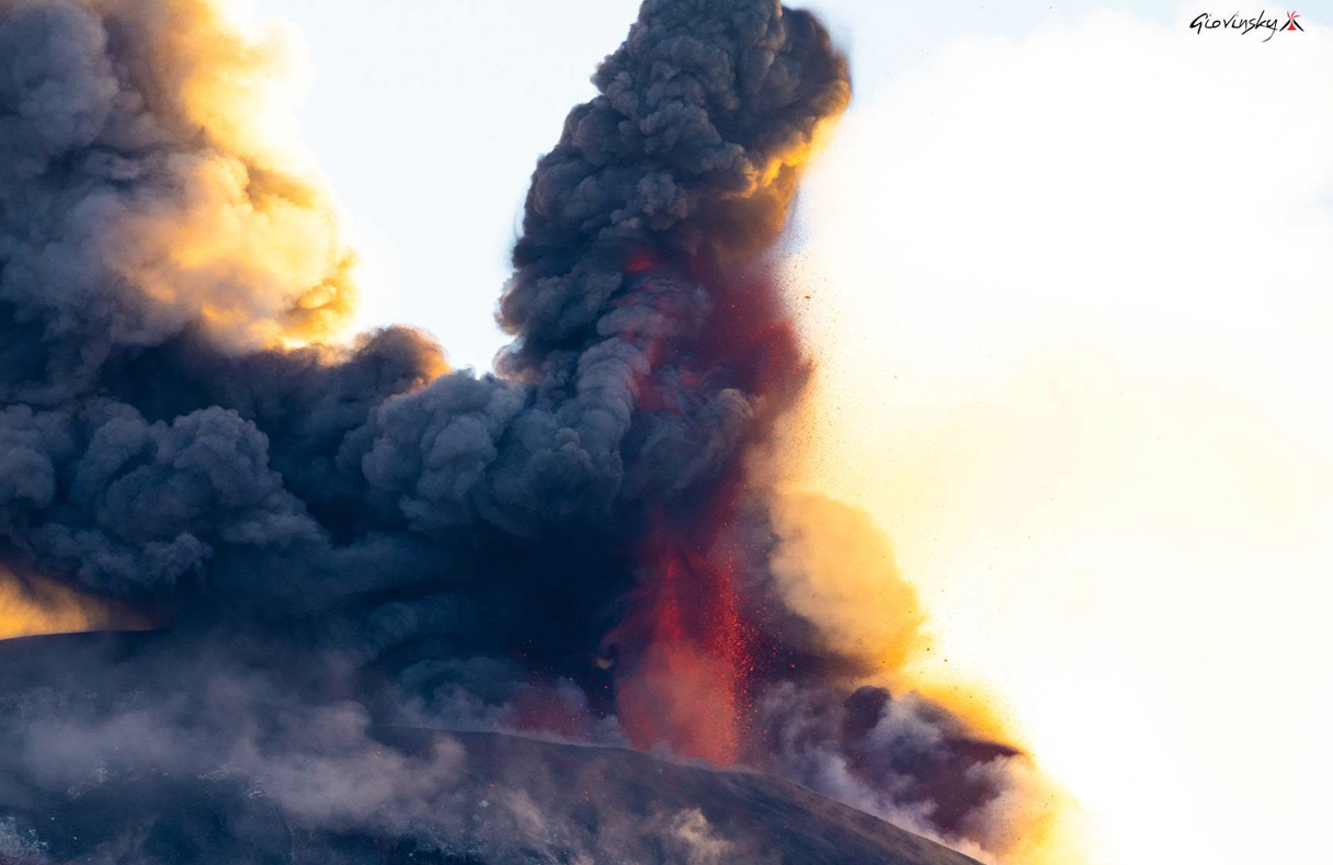
1) VOLCANOLOGICAL OBSERVATIONS: Strombolian-style activity with ash emissions and effusive activity along the eruptive fissure located between the Voragine and Northeast craters; intra-crater explosive activity at the Northeast and Bocca Nuova craters.
2) SEISMOLOGY: Low-intensity seismic activity associated with fracturing; no events exceeded the local magnitude (Ml) threshold of 2.0. Decrease in the average amplitude of volcanic tremor, shifting from a high level to a predominantly moderate level; significant fluctuations persist.
3) INFRASOUND: Infrasonic activity ranging between low and high levels.
4) GROUND DEFORMATION: During the week, deformation monitoring networks detected no significant changes, with the exception of high-precision signals from the ECP (borehole tiltmeter in the summit area) and DRUV (deep borehole dilatometer) stations, which showed slight variations on July 7.
5) GEOCHEMISTRY: SO2 flux at a moderate level.
Soil CO2 flux (Etnagas network): high values.
Partial pressure of dissolved CO2 in groundwater (EtnaAcque network): no update.
Helium (He) isotope ratio at peripheral sites: high values (latest data from July 9, 2026).
6) SATELLITE OBSERVATIONS: Over the past week, satellite-observed thermal activity in the summit area remained at a low level, with high values recorded in connection with the explosive activity that began on July 5 and ended on July 7.
7) OTHER OBSERVATIONS: Analyses of ash samples emitted from explosive vents active between the Voragine and Northeast craters on July 5 and 6 reveal a predominance of the very fine grain-size fraction; the samples show a predominance of the lithic component on July 5 and the tachylitic component on July 6.
Whole-rock analysis of samples collected between June 27 and July 2, 2026, indicates the absence of significant deep magma input into the volcano’s shallow feeding system.
VOLCANOLOGICAL OBSERVATIONS
Throughout the week, monitoring of Etna’s volcanic activity was conducted via the analysis of images from INGV–Osservatorio Etneo (INGV-OE) surveillance cameras and satellite imagery, as well as through direct field observations by INGV-OE personnel. Overall, the observation period was characterized by Strombolian activity accompanied by ash emissions and effusive activity along the eruptive fissure that had opened between the Voragine (VOR) and Northeast (CNE) craters, alongside intra-crater explosive activity at the Northeast and Bocca Nuova (BN) craters.
More specifically, regarding the activity along the eruptive fissure—which opened on July 5—Strombolian explosions accompanied by ash emissions and lava effusion (flowing toward the CNE) were observed until the morning of July 7. The eruptive activity, which had been gradually declining since the afternoon of July 6, ceased quite abruptly early in the afternoon the following day. During the remainder of the week, the VOR—and particularly the collapse crater on its upper eastern flank—as well as the eruptive fissure, exhibited only intense degassing.
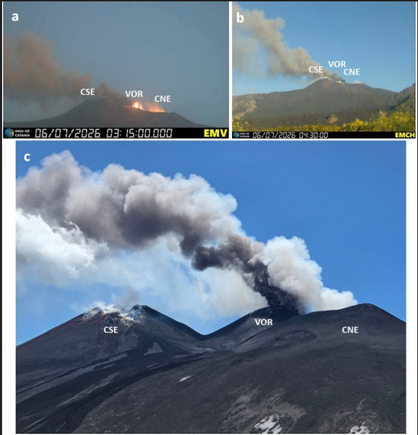
Figs. (a), (b), and (c): explosive and effusive activity along the eruptive fissure observed by the Milo camera (a) and the Mount Cagliato camera (b), both on July 6; (c) photograph of the eruption scene taken on July 7 from Pizzo Deneri by INGV-OE personnel.
Regarding the CNE, during the week in question, it continued to sustain intra-crater explosive activity as well as intense degassing.
During a field inspection of the summit area on July 11, INGV-OE personnel observed that the BN1 vent (part of the BN complex) was exhibiting modest intra-crater explosive activity, with ejected material falling back into the vent itself; this phenomenon was accompanied by weak, sporadic ash emissions that dispersed rapidly over the summit area. Finally, the CSE was characterized by fumarolic degassing, driven primarily by an alignment of depressions located on the northern flank of the crater.
Source : INGV
Photos : Giovinsky Aetnensis , INGV.
Indonesia , Dukono :
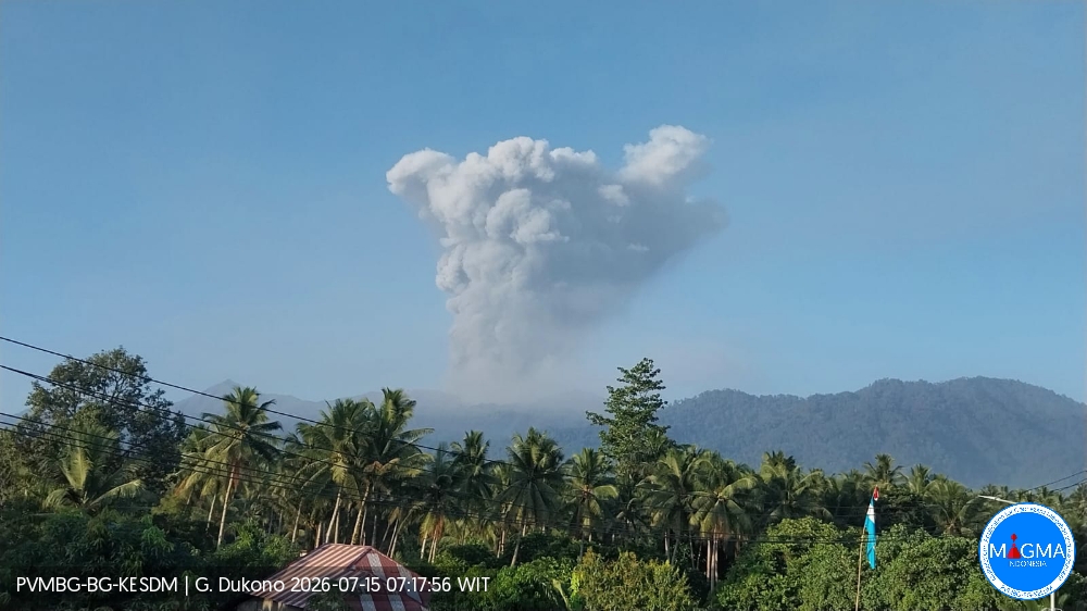
An eruption of Mount Dukono occurred on Wednesday, July 15, 2026, at 07:02 (WIT), producing an ash plume estimated to reach a height of ±2,300 m above the summit (±3,387 m above sea level). This dense, white-to-gray plume was drifting towards the north and northwest. At the time of writing, the eruption was still ongoing.
Seismic observations
2 eruption earthquakes, with amplitudes of 7–8 mm and durations of 45.76–140.34 seconds.
3 distant tectonic earthquakes, with amplitudes of 6–24 mm and durations of 72.56–122.24 seconds.
1 episode of continuous tremor with an amplitude of 1–4 mm (dominant amplitude: 2 mm).
Recommendations
(1) Communities located near Mount Dukono, as well as visitors and tourists, are advised to refrain from engaging in activities, hiking, or approaching the Malupang Warirang crater within a 4 km radius.
(2) Given that eruptions producing volcanic ash occur periodically and ash dispersal depends on wind direction and speed—resulting in variable affected areas—communities near Mount Dukono are advised to keep masks or nose and mouth protection readily available to guard against respiratory health risks associated with volcanic ash.
Source et photo : PVMBG.
Peru , Sabancaya :
Local date and time: July 13, 2026 – 12:19 PM
Bulletin analysis period: July 6 to 12, 2026
Volcanic alert level
Orange alert level: The volcano is showing a significant increase in eruptive activity. Increased seismic activity, frequent explosions, and emissions of ash and ballistic blocks have been observed.
Conclusions
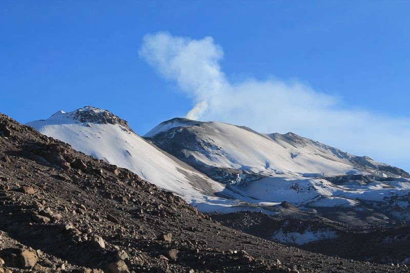
The IGP reports that the eruptive process at Sabancaya volcano is ongoing. During this period, no volcanic explosions were detected; activity was limited to emissions of water vapor, ash, and gas reaching up to 800 m above the summit, accompanied by seismic activity linked to the movement of magmatic fluids and internal fracturing. Consequently, the volcanic alert level remains at orange.
Recommendations
Adopt prevention and preparedness measures consistent with the current orange volcanic alert level.
Do not approach within 12 km of the crater. In the event of ashfall, cover your nose and mouth with damp cloths or masks. Keep doors and windows of homes closed.
Outlook
Volcanic explosions generating eruption columns exceeding 2 km in height are considered likely. These could affect the Colca Valley districts and surrounding areas through the dispersal of volcanic ash; the volcanic alert level therefore remains at orange.
Source et photo : Cenvul.