July 14 , 2026.
Alaska , Kupreanof :
56°45″ N 159°47’28 » W,
Summit Elevation 6217 ft (1895 m)
Current Volcano Alert Level: ADVISORY
Current Aviation Color Code: YELLOW
Summary:
Seismic activity and volcanic gas emissions were observed at Mount Kupreanof this week.
Earthquake activity continues near Mount Kupreanof volcano, with magnitudes under 2.5 this week. The two largest earthquakes had magnitudes of 1.92 and 2.46 and occurred on July 10. Deep low-frequency earthquakes, greater than 12 miles (20 km) below sea level, were also observed. Sulfur dioxide gas emissions were detected in satellite images on July 7 and 8.
AVO released an Information Statement on June 22 summarizing the ongoing volcanic unrest from a magmatic intrusion beneath the volcano, which is also now detected in satellite ground deformation data (satellite interferometric radar or InSAR).
There is no real-time geophysical monitoring network at Mount Kupreanof. The closest functioning seismometer is approximately 17 miles (27 km) to the east of the volcano as part of the Mount Veniaminof network. Mount Kupreanof is also monitored by satellite data, regional infrasound and lightning networks, and visual observations from pilots and mariners passing by the volcano.
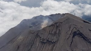
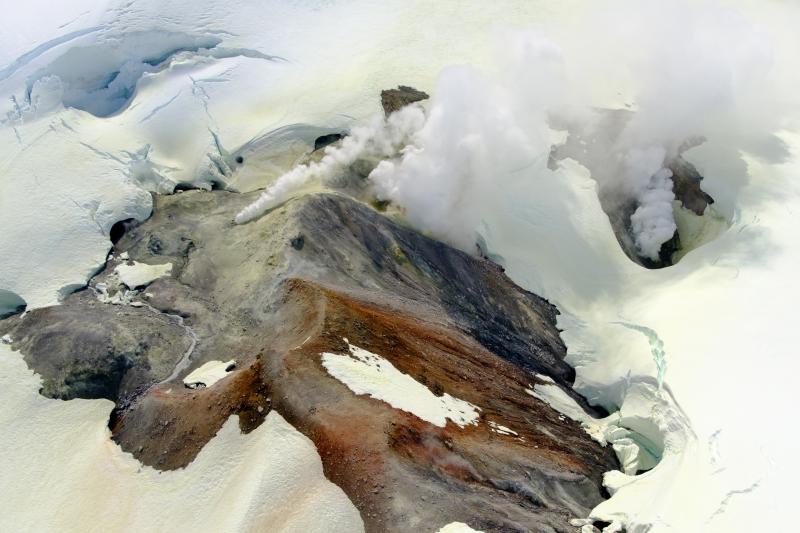
Mount Kupreanof is a heavily glaciated stratovolcano on the Alaska Peninsula with no known historical eruptions. Very little is known about its eruptive history. A single debris flow or block-and-ash flow deposit with a suspected Holocene age has been mapped in a valley south of the volcano. Eruptions will likely produce lahars and pyroclastic flows on the volcano’s flanks and into the surrounding uninhabited valleys. Ash plumes could affect communities and airplanes downwind of the volcano. A vigorous fumarole field just west of the summit produces persistent steam plumes.
Source : AVO.
Photo : Loewen, M. W / AVO / USGS .
Indonesia , Lewotobi Laki-laki :
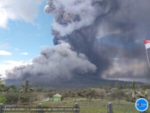
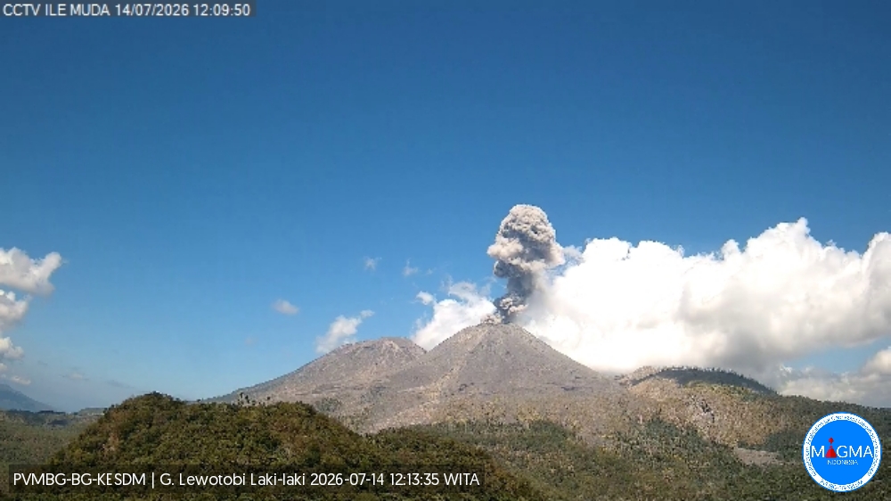
An eruption of Mount Lewotobi Laki-laki occurred on Tuesday, July 14, 2026, at 12:07 WITA; an ash column rising approximately 800 meters above the summit (or about 2,384 meters above sea level) was observed. This dense, gray ash column drifted towards the west and northwest. The eruption was recorded by the seismograph with a maximum amplitude of 22.2 mm and a duration of 189 seconds.
Seismic observations
2 eruption earthquakes, with amplitudes of 9.6–44.4 mm and durations of 31–54 seconds.
10 episodes of non-harmonic tremor, with amplitudes of 2.9–7.4 mm and durations of 69–152 seconds.
1 low-frequency earthquake, with an amplitude of 4.4 mm and a duration of 26 seconds.
1 deep volcanic earthquake, with an amplitude of 5.1 mm and a duration of 16 seconds.
1 distant tectonic earthquake, with a duration of 56 seconds.
Recommendations
1. Communities near Mount Lewotobi Laki-laki, as well as visitors and tourists, must not conduct any activities within a 5 km radius of the Mount Lewotobi Laki-laki eruption center.
2. The public is advised to remain calm, follow instructions from local authorities, and disregard information from unverified sources.
Source et photo : PVMBG.
Chile / Argentina , Laguna del Maule :
SPECIAL REPORT ON VOLCANIC ACTIVITY, July 11, 2026
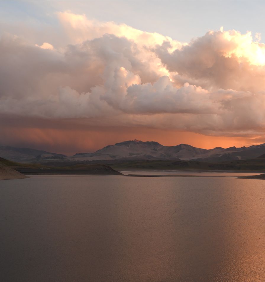
The Argentine Geological and Mining Service (SEGEMAR), through the Argentine Volcanic Monitoring Observatory (OAVV), reports that today, Saturday, July 11, 2026, starting at 11:43 local time (14:43 UTC), volcanic monitoring stations installed near the Laguna del Maule volcanic complex recorded an increase in the frequency of volcano-tectonic (VT) earthquakes, associated with rock fracturing within the volcanic system. Activity is ongoing at the time of this report; 110 events have been recorded, classifying this episode as a seismic swarm.
Information on the highest-energy event
Origin time: 11:49 local time (14:49 UTC)
Latitude: -36.097°
Longitude: -70.603°
Depth: 4.8 km
Local magnitude: 2.3 (ML)
OBSERVATIONS:
At the time of writing this report, VT activity continues to be recorded, although the majority of detected events are characterized by low energy levels. It should be noted that no surface activity or variations in other monitoring parameters for the volcanic complex have been detected. This particular episode has not affected Argentine territory, and no reports have been received from nearby populations located in Argentina.
CONCLUSIONS
The technical alert level remains unchanged, and volcanic monitoring will continue in constant communication with the Southern Andes Volcanological Observatory (OVDAS) in Chile; any changes that occur will be reported.
Source et photo : Segemar
Ecuador , Sangay :
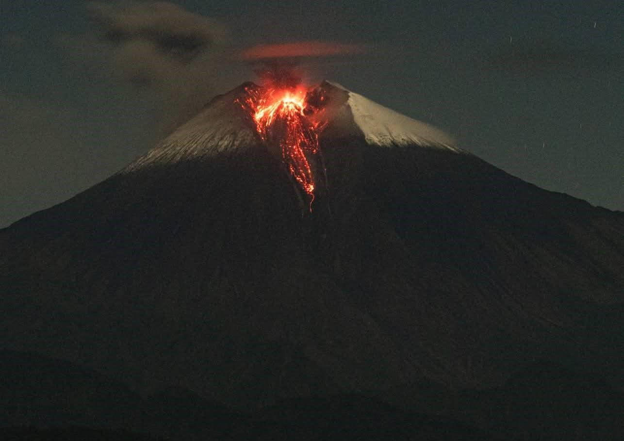
DAILY STATUS REPORT FOR SANGAY VOLCANO, Monday, July 13, 2026.
Information from the Geophysical Institute – EPN.
Surface activity level: Moderate; Surface trend: Decreasing
Internal activity level: Moderate; Internal trend: Unchanged
Seismicity: From July 13, 2026, 11:00 to July 13, 2026, 11:00:
Seismicity:
Here is the count of seismic events recorded at the reference station:
Explosion (EXP): 70
Precipitation / Lahars:
No precipitation has been recorded in the volcano area. **In the event of heavy rain, accumulated material could be remobilized, generating mud and debris flows that would rush down the volcano’s flanks and into adjacent rivers.**
Emission plume / ash:
Due to unfavorable weather conditions, it has not been possible to observe gas and ash emissions via either the surveillance camera system or satellite imagery. Furthermore, the Washington VAAC has issued no reports regarding the volcano’s activity.
Observation:
From yesterday afternoon until the time of writing this report, the volcano has remained entirely obscured by cloud cover.
Alert level: Yellow
Source : IGEPN
Photo : Cristopher Cárdenas.
Guatemala , Fuego :
Weather conditions: Clear skies
Wind: Easterly
Precipitation: 11.7 mm
Activity
During the night and early morning, light-gray degassing was recorded at an altitude of 4,300 meters above sea level. Between 6 and 11 explosions per hour—ranging from low to high intensity—were recorded, propelling columns of gas and ash to altitudes between 4,300 and 4,800 meters (14,107–15,748 feet); these plumes drifted westward and slightly northwestward, traveling distances of up to 30 km.
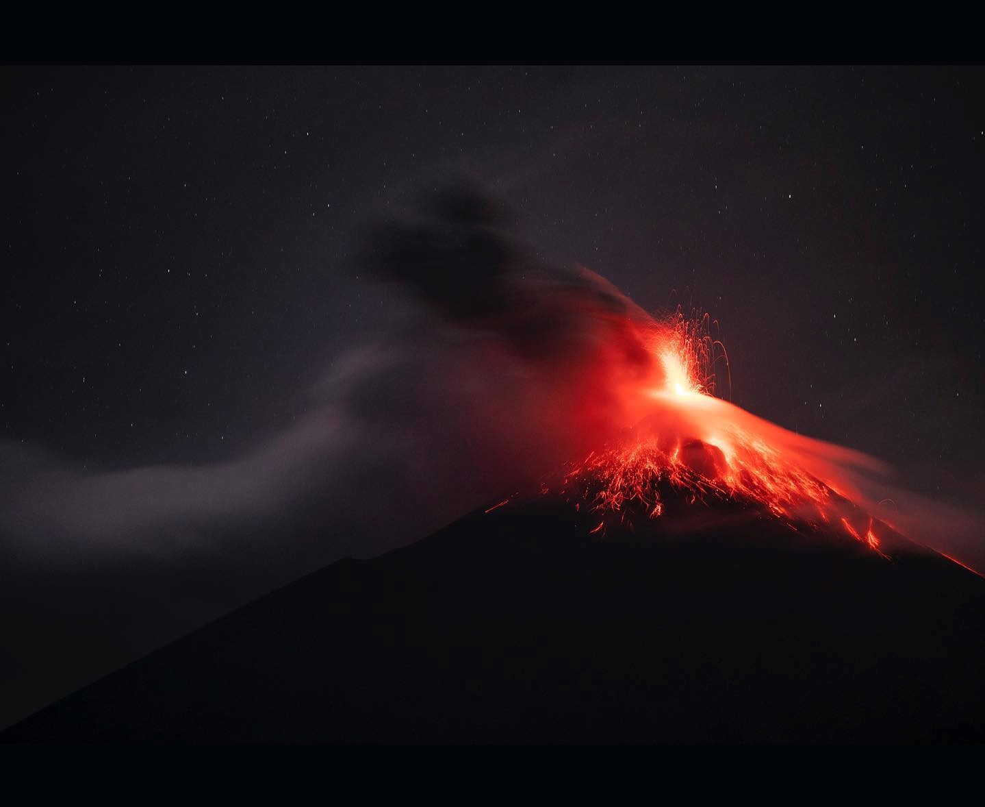
Some explosions have produced noises, rumbling sounds, and weak shockwaves. Incandescent pulses were observed during the night, causing hot material to fall around the crater and channel into the Seca, Taniluya, Ceniza, Las Lajas, and Honda ravines (among others), at times reaching the vegetation line. Fine ashfall is also possible in communities west of the volcano and in surrounding areas. Daytime rainfall could trigger torrents and/or lahars; it is recommended to avoid staying within or near these ravines when it is raining over the volcanic edifice.
Source : Insivumeh .
Photo : Diego Rizzo