June 29 , 2026
Indonesia , Ibu :
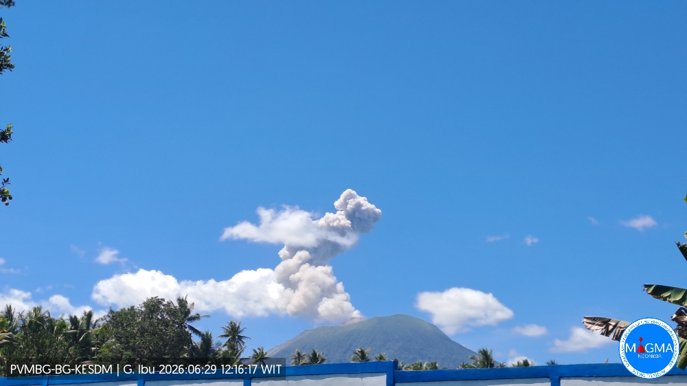
An eruption of Mount Ibu occurred on Monday, June 29, 2026, at 12:13 p.m. (local WIT time), with an observed ash column rising approximately 800 m above the summit (or about 2,125 m above sea level). This gray, moderately intense column drifted toward the southwest. The eruption was recorded by the seismograph with a maximum amplitude of 28 mm and a duration of 55 seconds.
VOLCANO OBSERVATORY NOTICE FOR AVIATION – VONA
Issued : June 29 , 2026
Volcano : Ibu (268030)
Current Aviation Colour Code : ORANGE
Previous Aviation Colour Code : orange
Source : Ibu Volcano Observatory
Notice Number : 2026IBU192
Volcano Location : N 01 deg 29 min 17 sec E 127 deg 37 min 48 sec
Area : North Maluku, Indonesia
Summit Elevation : 4240 FT (1325 M)
Volcanic Activity Summary :
Eruption with volcanic ash cloud at 03h13 UTC (12h13 local).
Volcanic Cloud Height :
Best estimate of ash-cloud top is around 6800 FT (2125 M) above sea level or 2560 FT (800 M) above summit. May be higher than what can be observed clearly. Source of height data: ground observer.
Other Volcanic Cloud Information :
Ash cloud moving to southwest. Volcanic ash is observed to be gray. The intensity of volcanic ash is observed to be medium.
Remarks :
Eruption recorded on seismogram with maximum amplitude 28 mm and maximum duration 55 second.
Source et photo : PVMBG.
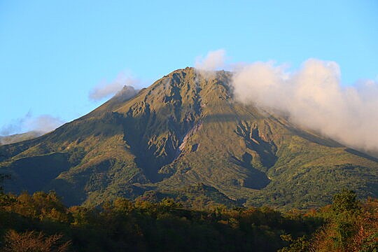
Guatemala , Fuego :
Weather conditions: Clear skies
Wind: East-northeast
Precipitation: 12 mm
Activity
Activity at Fuego volcano continues to be characterized by low- to moderate-intensity explosions—including a few strong ones—generating gas and ash plumes that reach altitudes of 4,200 to 4,700 meters above sea level. These emissions are dispersing westward, extending up to approximately 30 km from the crater. The activity is accompanied by avalanches of incandescent blocks and volcanic material cascading down the volcano’s western, southern, and southwestern flanks. Ashfall has also been reported in the communities of El Porvenir, San Pedro Yepocapa, Sangre de Cristo, and Quisache, as well as in other surrounding areas.
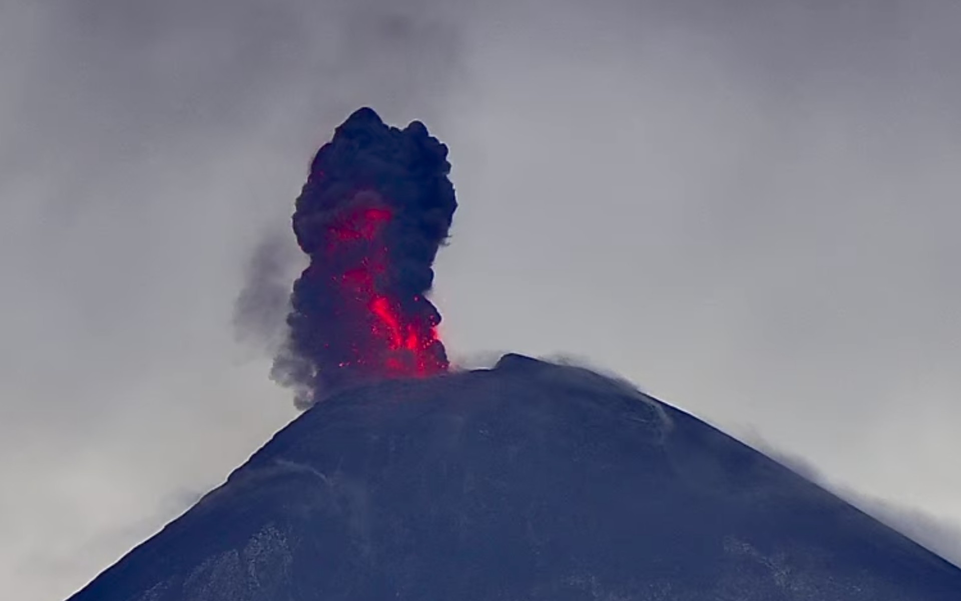
The most powerful explosions generate rumbling sounds and shockwaves that are perceptible in the municipalities and localities near the volcanic complex. Sounds resembling a locomotive, lasting several minutes, have also been reported. Current activity levels pose a high risk on the plateau and in the immediate vicinity of the crater due to the ejection of ballistic material that can travel distances exceeding 500 meters. Consequently, remaining in or traveling through these areas is not advised. Those climbing the volcano are advised to bring clothing and equipment suitable for high-altitude conditions, given the low local temperatures and the likelihood of precipitation during the afternoon and night.
Source : Insivumeh.
Photo : AFAR tv.
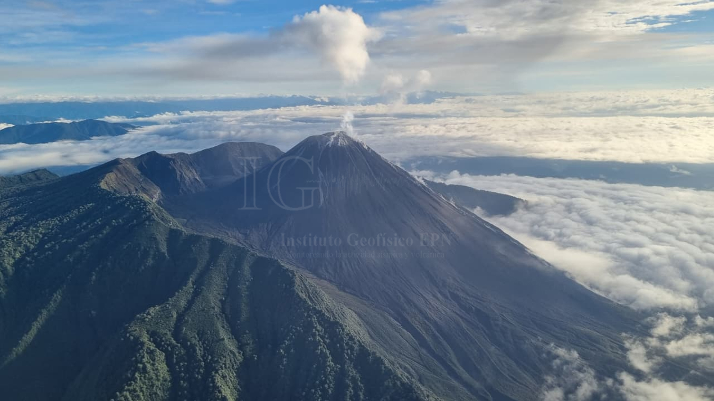
Ecuador , El Reventador :
DAILY STATUS REPORT FOR REVENTADOR VOLCANO, Sunday, June 28, 2026.
Information: Geophysical Institute – EPN.
Surface activity level: High; Surface trend: Unchanged
Internal activity level: Moderate; Internal trend: Unchanged
From June 27, 2026, 11:00 AM to June 28, 2026, 11:00 AM:
Seismicity:
Explosion (EXP): 52
Long-period (LP): 4
Emission tremor (TREMI): 4
Harmonic tremor (TRARM): 3
Precipitation / Lahars:
Precipitation was recorded in the region, but it did not trigger lahars. **Heavy rains can remobilize accumulated material and generate debris-laden mudflows (lahars), which could rush down the volcano’s flanks and flow into nearby rivers.**
Ash emission/plume:
Yesterday afternoon, the GOES-19 satellite system detected a gas and ash plume moving west-northwest and reaching a height of 700 meters above the crater rim. In connection with this activity, the Washington VAAC issued a report noting an ash cloud moving westward and reaching a height of 700 meters above the crater rim.
Other monitoring parameters:
Over the past 24 hours, the MIROVA-VIIRS 375 satellite system recorded two thermal anomalies, while the MIROVA-VIIRS 750 system recorded one.
Observation:
From yesterday afternoon until the time of writing this report, satellite monitoring indicates that the area above the volcano remains under cloud cover.
Alert Level – SGR: Orange
Source : IGEPN.
Photo : IGEPN
La Martinique , Mount Pelée :
Weekly Report / Institut de physique du globe de Paris – Martinique Volcanological and Seismological Observatory
Saint-Pierre, June 26, 2026, at 3:15 PM local time (GMT-4)
Between June 19, 2026, at 4:00 PM (UTC) and June 26, 2026, at 4:00 PM (UTC), the OVSM recorded 53 earthquakes of volcanic origin:
• 53 volcano-tectonic earthquakes. Of these, 11 had a magnitude (local magnitude Mlv or duration magnitude Md) greater than 0.5, and 3 had a magnitude greater than 1. The largest event had a magnitude of Mlv=2.22; the others were of lower energy. These earthquakes were located at depths ranging from 0.8 to 1.7 km beneath the volcano’s summit. This volcano-tectonic seismicity is associated with micro-fracturing within the volcanic edifice, linked to the overall reactivation of the volcano observed since 2019.
No earthquakes were felt by the population.
The previous week, the OVSM recorded 115 volcano-tectonic earthquakes. As of June 26, 2026, and over the preceding four weeks, the OVSM has observed a total of 414 volcanic earthquakes, representing an average of 103 to 104 earthquakes per week.
During phases of volcanic reactivation in volcanoes similar to Mount Pelée, it is common to observe seismic activity that varies in intensity and frequency. The probability of short-term eruptive activity remains low. However, given the observations gathered in recent years—and particularly over the last few months—a change in the situation over the medium term (weeks to months) cannot be ruled out.
The volcanic alert level, in accordance with the measures established by the authorities, is currently YELLOW: vigilance.
Source : Direction de l’OVSM-IPGP
Photo : OVSM-IPGP
Costa Rica , Rincon de la Vieja :
Latitude: 10.83° N;
Longitude: 85.34° W;
Elevation: 1,916 m above sea level.
Current activity level: Alert.
No eruptions or emissions were recorded this week. The last eruption was observed on May 20. Background tremor remains generally stable, with a frequency range of 1 to 3.5 Hz; however, amplitude variations have been observed. The number of long-period and « tornillo »-type events remained low this week. Fourteen distal and three proximal volcano-tectonic earthquakes were recorded. The geodetic network indicates summit subsidence; however, no clear trend is detected at the volcano’s base. The MultiGAS station continues to record low concentrations of volcanic gases.
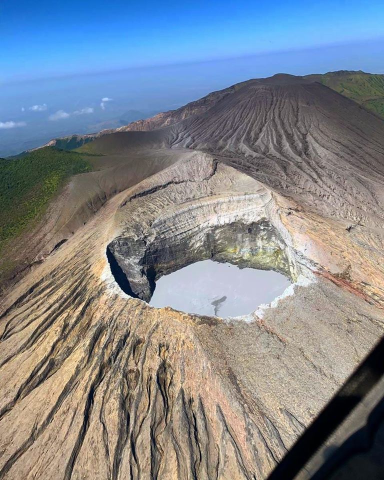
This week, NOVAC stations measured a daily SO2 flux of 242 ± 137 tonnes, higher than that of the previous week (146 ± 68 t/d). The last atmospheric SO2 detection at Rincón de la Vieja by the SENTINEL satellite occurred on September 7, 2025. The hyperacidic lake in Rincón’s main crater was sampled on April 17, 2026, following several years of sampling difficulties. The lake’s current chemical composition reveals water rich in sulfate ions relative to chloride ions, with a temperature of approximately 32°C and very high acidity (pH < 0.5).
Source : Ovsicori .
Photo : Christopher Allen.