June 21 , 2026.
Indonesia , Anak Krakatau :
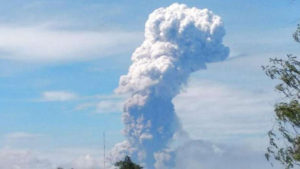
INCREASED VOLCANIC ACTIVITY AT ANAK KRAKATAU VOLCANO ON JUNE 20, 2026
Anak Krakatau (Child of Krakatoa) is an active Type A volcano located in the Sunda Strait, administratively within the South Lampung Regency, Lampung Province. Its activity is monitored from two observation posts: the Anak Krakatau Volcano Observation Post in Kalianda (South Lampung Regency, Lampung Province) and the Anak Krakatau Volcano Observation Post in Pasauran (Serang Regency, Banten Province).
Historically, a major eruption in 1883 triggered a tsunami. Additionally, seismic activity triggered the eruption of Anak Krakatau and a landslide of part of its crater, causing a tsunami in the Sunda Strait on December 22, 2018. Following this date, a series of low-intensity eruptions continued, constituting a building phase for the regeneration of the Anak Krakatau volcano, until December 16, 2023. An eruptive pause persists to this day. Nevertheless, the Anak Krakatau volcano continues to exhibit low-energy magmatic activity.
Since June 1, 2026, the Sentinel satellite has detected SO₂ emissions and thermal anomalies, as well as the appearance of hotspots in the crater since June 10, 2026. These phenomena are accompanied by strong smoke emissions and a significant increase in the number of shallow volcanic earthquakes (exhalations, hybrid/multiphase, and low-frequency earthquakes). Over the last two days (June 18 and 19, 2026), the number of emission, hybrid/multiphase, and low-frequency earthquakes has increased sharply, averaging more than 50 earthquakes per day. Although this increase is not accompanied by a rise in deep volcanic earthquakes or deformation, it indicates magmatic activity at the surface of Anak Krakatau volcano.
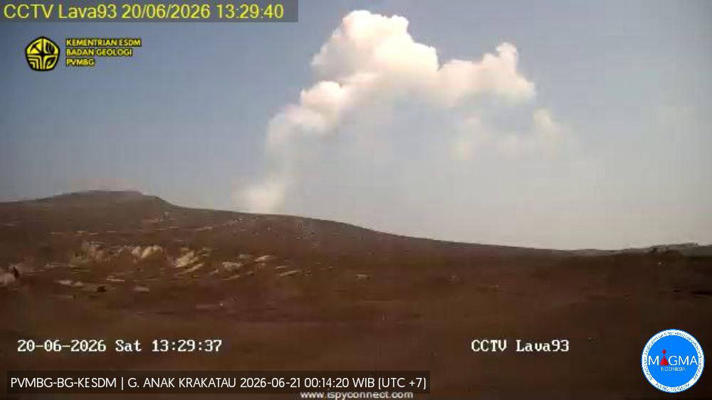
Despite increased signs of magmatic activity at the surface, the activity level of Anak Krakatau volcano remains at Level II (Waspada). This increase could signal an intensification of the volcano’s activity and lead to an eruption.
The potential danger in the event of an eruption comes from pyroclastic flows, lava projections, incandescent rocks, and significant ashfall.
The technical recommendations for Level II (Waspada) at Mount Anak Krakatau are as follows:
Communities living near Mount Anak Krakatau, as well as visitors, tourists, and climbers, are prohibited from entering or conducting any activities within a 2-kilometer radius of the volcano’s activity center. They must be especially vigilant due to the risks of pyroclastic flows, lava projections, incandescent rock ejections, and significant ashfall. Residents of coastal areas in Banten and Lampung provinces are urged to remain calm and not believe rumors that an eruption of Mount Anak Krakatau will cause a tsunami. They can continue their normal activities while following the instructions of the Regional Disaster Management Agency (BPBD).
Source : PVMBG.
Photos : ca_cal ( archive) , PVMBG.
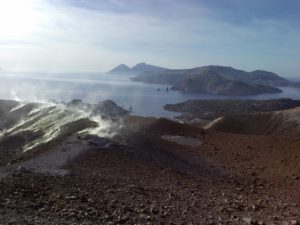
Colombia , Cumbal :
San Juan de Pasto, June 16, 2026, 5:20 PM
Regarding the monitoring of activity at the Cumbal Volcanic Complex (CVC), the Colombian Geological Service (SGC), an agency under the Ministry of Mines and Energy, reports the following:
During the week of June 9-15, 2026, the main variations in monitored parameters compared to the previous week were as follows:
● A decrease was recorded in both the frequency of earthquakes and the energy released. The most significant contribution comes from seismicity associated with rock fracturing, although the recording of events related to fluid dynamics continues.
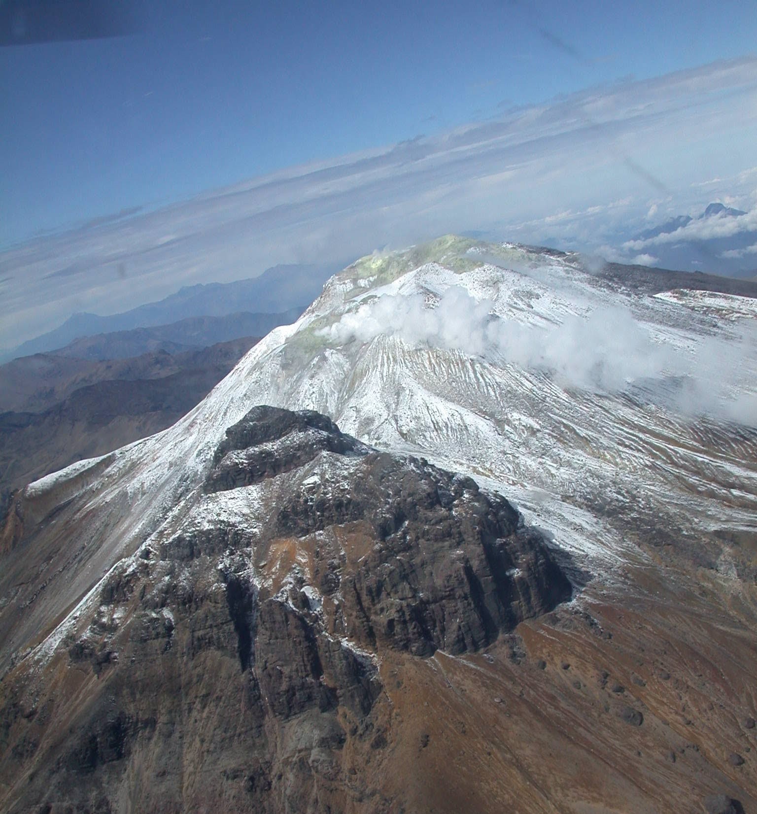
● Most of the seismic activity was located in the immediate vicinity of the summit of the volcanic complex, at depths of less than 2 km, using the La Plazuela crater (4,700 m altitude) as a reference point. A few isolated events were located to the northwest of the volcanic edifice. The maximum recorded magnitude was 1.1.
● Gas emissions were observed at the El Verde fumaroles (northeast flank) and Rastrojos (southwest flank of the CVC). The dispersion direction of the emission columns remained variable due to the wind.
● Other volcanic monitoring parameters remained stable.
In light of the above, the Geological Survey of Colombia (SGC) recommends closely monitoring the situation by consulting weekly bulletins and other information published through its official channels, as well as instructions from local and departmental authorities and the National Unit for Disaster Risk Management (UNGRD).
Volcanic activity remains at the yellow alert level: active volcano exhibiting changes in the baseline behavior of monitored parameters and other manifestations.
Source et photo : SGC.
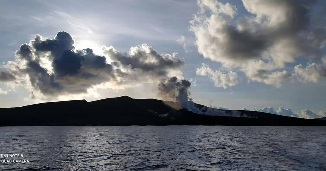
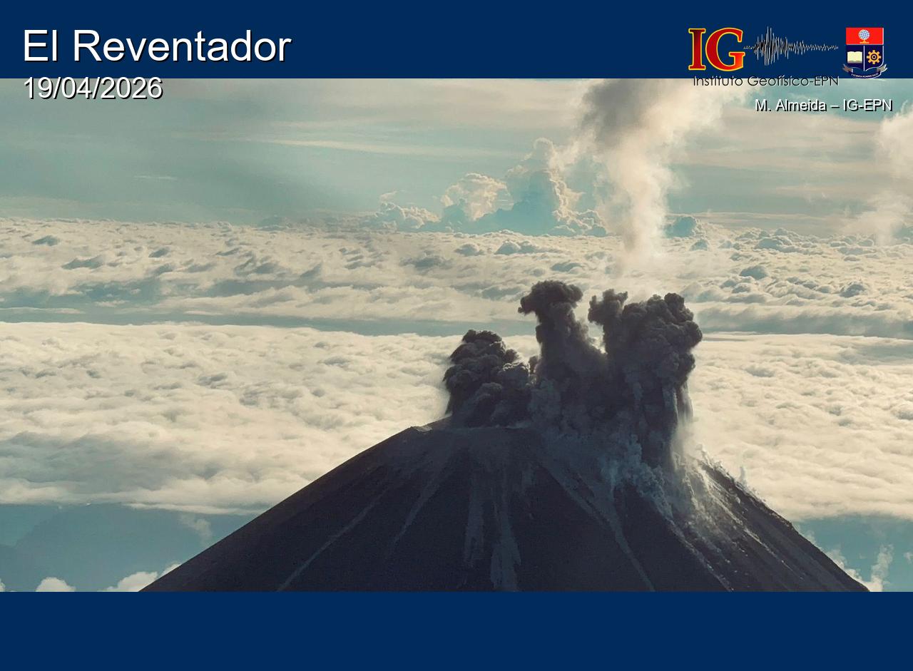
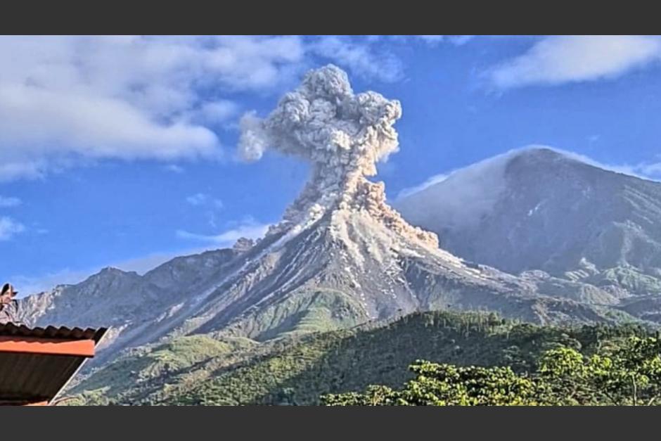
Ecuador , El Reventador :
REVENTADOR VOLCANO DAILY STATE REPORT, Saturday, June 20, 2026.
Information Geophysical Institute – EPN.
Surface Activity Level: High, Surface Trend: No Change
Internal Activity Level: Moderate, Internal Trend: No Change
From June 19, 2026, 11:00 AM to June 20, 2026, 11:00 AM:
Seismicity:
Explosion (EXP) 73
Long Period (LP) 6
Emission Tremor (TREMI) 1
Harmonic Tremor (TRARM) 2
Rainfall/Lahars:
Rainfall has been recorded in the region, but it has not triggered any lahars. **Heavy rain can remobilize accumulated material and generate debris-laden mudflows (lahars), which could rush down the volcano’s flanks and flow into nearby rivers.**
Emission Column/Ash:
Since yesterday afternoon, several emissions of gas and ash have been recorded by surveillance cameras. These emissions are drifting southwest and reaching altitudes between 700 and 1200 meters above the crater. In connection with this activity, the Washington VAAC agency issued two reports indicating an ash cloud reaching an altitude of 1100 meters above the crater and drifting westward.
Other monitoring parameters:
The FIRMS satellite system recorded two thermal anomalies, and the MIROVA-MODIS satellite system also recorded two in the last 24 hours.
Observation:
From yesterday afternoon until the publication of this report, the volcano remained mostly covered in clouds. During the night and early this morning, the monitoring camera system observed incandescent material falling up to 1,000 meters below the crater.
Alert level – SGR: Orange
Source : IGEPN.
Photo : M Almeida / IGEPN
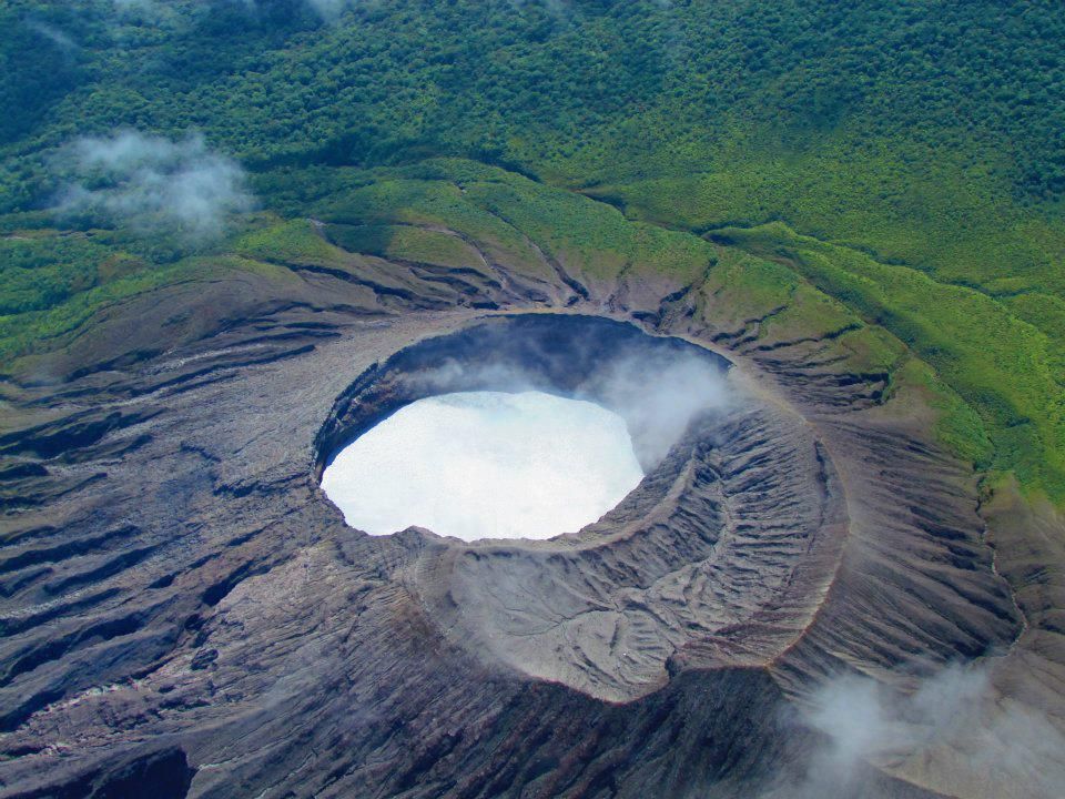
Costa Rica , Rincon de la Vieja :
Latitude: 10.83°N;
Longitude: 85.34°W;
Altitude: 1916 m
Current Activity Level: Alert.
No eruptions or emissions were recorded this week. The last eruption occurred on May 20.
The background tremor remains generally stable, with a frequency between 1 and 3.5 Hz; however, its amplitude varies. Since June 13, an increase in tremor amplitude has been observed.
The number of long-period and spiral-type events decreased this week.
The frequency of spiral codas is declining.
Twenty-six volcano-tectonic earthquakes distal to the crater have been recorded.
The geodetic network is recording subsidence at the summit; however, no clear pattern is detected at the base of the volcano. The MultiGAS station continues to record low concentrations of volcanic gases. This week, NOVAC stations recorded 146 ± 68 tonnes per day of SO₂, a slightly higher rate than the previous week (103 ± 68 t/d). The last detection of SO₂ in the atmosphere by the SENTINEL satellite, emitted by the Rincón de la Vieja volcano, was on September 7, 2025.
Source : Ovsicori .
Photo : Raul Mora / RSN / UCR
Guatemala , Santiaguito :
Weather conditions: Clear skies
Wind: Northeast
Rainfall: 11.4 mm
Activity
The Santiaguito Volcanological Observatory reports favorable conditions for observing the Caliente Dome.
Weak to moderate explosions are reported at a rate of 1 to 3 per hour, projecting columns of gas and ash up to 700 meters high.
These columns are drifting west-southwest due to the wind. Incandescence is visible on the dome, along with the detachment of incandescent rock blocks towards the west, southwest, and south flanks. Ashfall is possible in San Marcos Palajunoj, Loma Linda, and the surrounding area due to the wind direction. Because of the significant accumulation of rock material, the Dome Caliente and the promontory overlooking the lava flow are at risk of collapsing, generating large-scale pyroclastic flows to the southwest. Therefore, the recommendations of Special Bulletin BESAN-016-2026 should be followed.
Source : Insivumeh.
Photo : Conred.