June 18 , 2026.
Indonesia , Dukono :
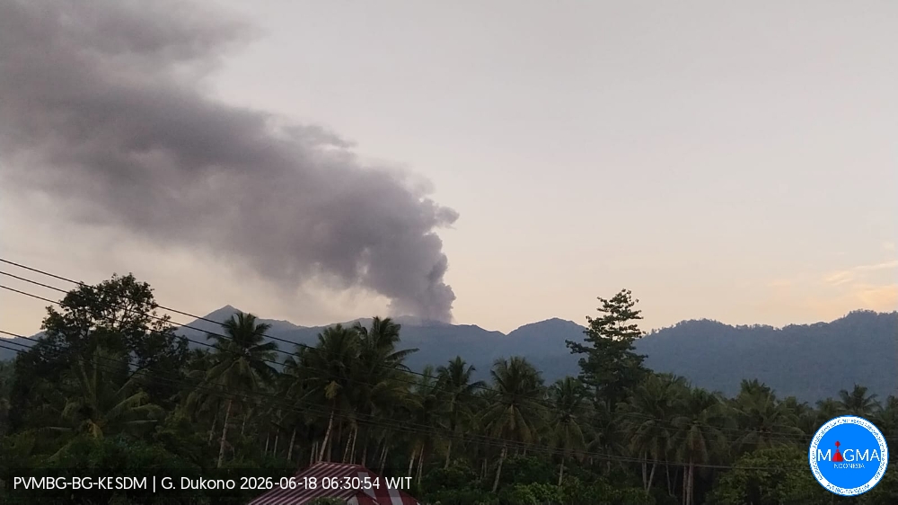
An eruption of Mount Dukono occurred on Thursday, June 18, 2026, at 06:22 WIT, with an observed ash column height of approximately 1000 m above the summit (approximately 2087 m above sea level). This ash column, white to gray in color, was highly intense and directed northeast. At the time of writing, the eruption was still ongoing.
Seismic Observations
36 eruption earthquakes with amplitudes between 6 and 34 mm and durations from 25.74 to 62.23 seconds.
68 low-frequency earthquakes with amplitudes between 3 and 6 mm and durations from 17.72 to 31.86 seconds.
One distant tectonic earthquake with an amplitude of 10 mm and a duration of 114.46 seconds.
One continuous tremor earthquake with an amplitude between 1 and 6 mm, predominantly 2 mm.
Recommendations
(1) Residents living near Mount Dukono and visitors/tourists are advised to refrain from any activity, climbing, or approaching the Malupang Warirang crater within a 4 km radius.
(2) Considering that eruptions with volcanic ash occur periodically and that the distribution of ash follows the direction and speed of the wind, so that the area where the ash lands is not constant, people living around Mount Dukono are advised to always carry masks/face coverings and mouth coverings to use when needed to avoid the threat that volcanic ash poses to the respiratory system.
Source et photo : PVMBG.
Colombia , Puracé – Los Coconucos volcanic chain :
Popayán, June 16, 2026, 3:30 PM
Regarding the monitoring of activity at the Puracé volcano – Los Coconucos volcanic chain – the Colombian Geological Survey (SGC), an agency under the Ministry of Mines and Energy, reports the following:
During the week of June 9-15, 2026, an increase in seismic activity, associated with fluid movements (gases and liquids from the magma and its interaction with the hydrothermal system), was recorded beneath the crater of the Puracé volcano, located less than 3 km deep. Between June 10 and 12, an increase in the number of daily ash emissions was observed, dispersed to the northeast and northwest, reaching an altitude of 1.5 km above the volcano’s summit. This led to the issuance of an extraordinary bulletin on June 12, 2026. Ashfall was reported in several rural areas of the municipality of Puracé, including Hato Viejo, Ambiró, Patico, Pululó, Chapío, Cristales, Campamento, 20 de Julio, Anambío, Loma Linda, and the municipal capital, Coconuco. Ashfall was also reported in some areas of the city of Popayán and its surrounding rural area. Furthermore, seismicity associated with rock fracturing (VT) and hybrid earthquakes (HB) increased slightly, both in the number of events and in seismic energy released, compared to previous weeks. These earthquakes, with a magnitude of less than 1, occurred mainly between the Puracé and Piocollo volcanoes, at depths of 1 to 3 km.
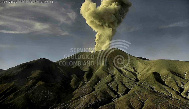
Recording from the Mina2 camera, located 2.5 km northwest of the Puracé volcano, showing the ash emission on June 12, 2026, at 6:22 AM.
In images captured by satellite sensors and visible and infrared webcams, thermal anomalies continued to be observed inside the Puracé volcano crater and in the fumarole field on its outer rim, as well as degassing phenomena in the craters of the Puracé and Curiquinga volcanoes. Similarly, sulfur dioxide (SO₂) emissions into the atmosphere continued. The slow deformation process recorded in the area between the Puracé, Piocollo, and Curiquinga volcanoes persists.
In conclusion, the variations observed at the Puracé volcano – part of the Los Coconucos volcanic chain – indicate that the system continues to evolve and that further ash emissions and fallout are possible, dispersed according to the prevailing wind direction. Furthermore, the possibility of additional changes in volcanic activity, potentially leading to more significant surface manifestations, cannot be ruled out. The public is advised not to travel to the upper reaches of the volcanic chain and to remain attentive to official reports from the Geological Survey of Colombia (SGC).
The alert level for volcanic activity remains yellow: Active volcano with changes in the baseline behavior of monitored parameters and other manifestations.
Source et photo : SGC.
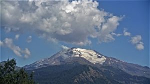
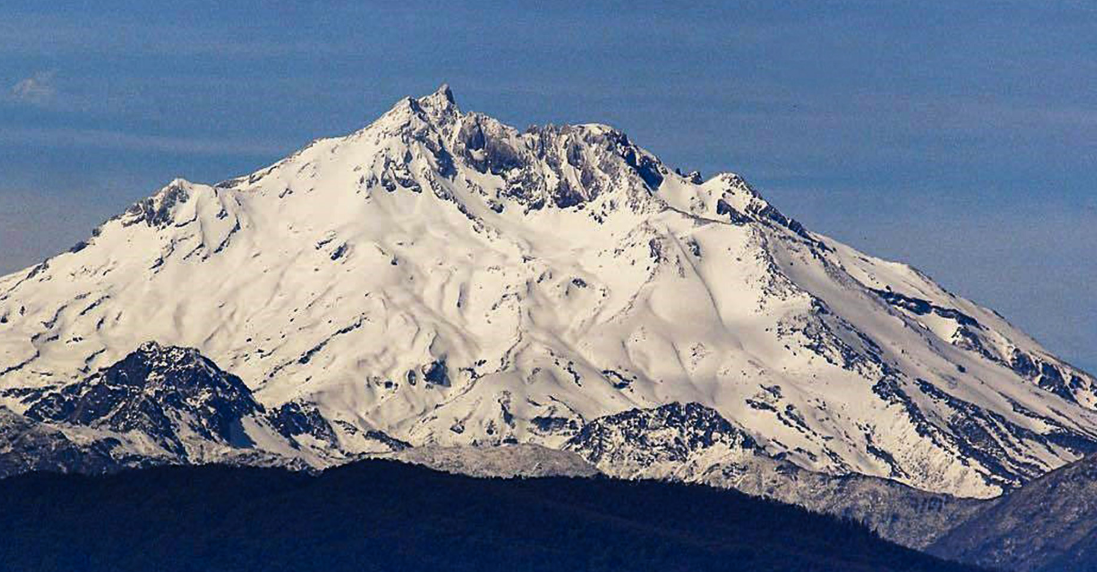
Argentina / Chile , Nevado de Longavi :
During the study period, volcano-tectonic (VT) seismic activity, associated with rock fracturing within the volcano, increased significantly in both the number of recorded events and energy levels compared to the previous period.
The highest-energy VT event recorded had a local magnitude (LM) of 4.3 and was located 4.6 km south-southwest (SSW) of the volcanic edifice, at a depth of 3.8 km from the active crater. Seismic activity associated with fluid movement within the volcano, represented by long-period (LP) events, increased slightly in both the number of recorded events and energy levels released, while remaining at very low values. The maximum energy released during LP events, recorded by reduced displacement (DR), was 1 cm².
The occurrence of a tremor-type event (TR) is noteworthy, associated with sustained fluid dynamics within the volcanic system. The maximum energy released during LP events, recorded by reduced displacement (DR), was 1 cm². For the period studied, the processing of satellite data revealed no anomalies in sulfur dioxide (SO₂) emissions into the atmosphere near the volcanic edifice. Furthermore, no thermal anomalies associated with the volcanic complex were recorded during the processing of satellite images. According to the analysis of high-resolution satellite images, such as PlanetScope and Sentinel-2-L2A, no surface changes associated with the volcanic edifice were detected.
CONCLUSIONS
Following the seismic event that began on May 20, the Nevado de Longaví volcano has shown a gradual decrease in seismic activity. In the days that followed, isolated events were recorded, with activity remaining at levels close to its baseline threshold. However, given the seismic magnitude reached during this event, its proximity to the volcanic edifice, and the fact that it is the most energetic seismic event recorded since the beginning of instrumental monitoring of the volcano, it is interpreted that the system has undergone a transient destabilization of its baseline state.
In this context, although activity shows a downward trend and no surface evidence has been observed, given the characteristics of the recorded event, it is considered prudent to maintain the current volcanic technical alert level in order to observe the evolution of the system and confirm a stable long-term trend. In the current scenario, any impact on Argentine territory is ruled out. Therefore, and as a precautionary measure, the technical alert level remains yellow. Monitoring of the volcano continues in constant communication with the Southern Andes Volcanological Observatory (OVDAS) of Chile, and any changes will be reported.
Source et photo : Segemar .
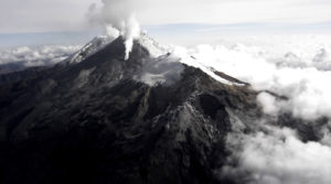
Guatemala , Santiaguito :
Atmospheric conditions: Clear skies
Wind: Southeast
Rainfall: 13.2 mm
Volcanic activity:
White degassing is observed above the Caliente dome, with fumaroles rising up to 600 meters and dispersing to the west and northwest. One to three low- to medium-intensity explosions occur per hour, projecting columns of gas and ash up to 800 meters above the dome, in the same direction. During the night and early morning, incandescence was recorded in the crater, accompanied by collapses and the fall of incandescent blocks on its flanks.
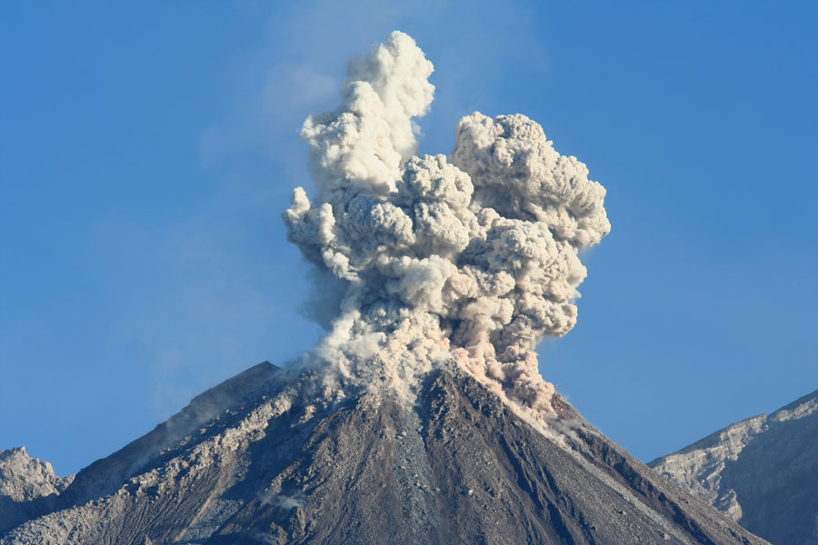
Given the high level of activity and the risk of major collapses, the formation of large-scale pyroclastic flows in all directions cannot be ruled out. It is therefore recommended to follow the instructions in Special Bulletin BESAN-002-2026. Furthermore, rainfall may mobilize accumulated material in ravines and riverbeds, causing lahars in the afternoon and evening. It is recommended to avoid ravines and riverbeds and to strictly follow the instructions in Special Bulletin BESAN-012-2026.
Source : Insivumeh.
Photo : Auteur inconnu
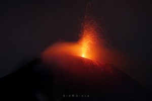
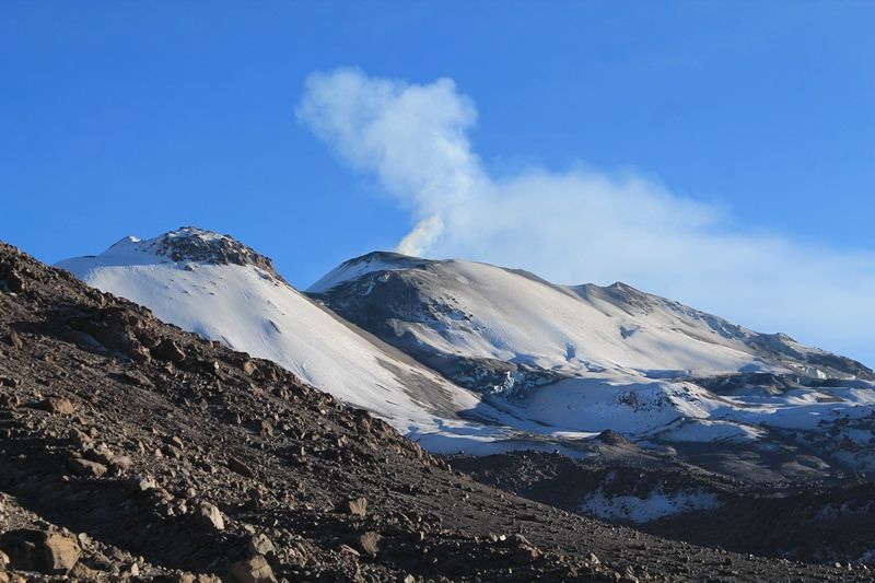
Peru , Sabancaya :
Volcanic Alert Level
Orange Alert Level: The volcano’s eruptive activity has increased significantly. Increased seismic activity, frequent explosions, and emissions of ash and ballistic fragments have been observed.
Conclusions
The IGP (Geophysical Institute of Peru) indicates that the eruptive process of the Sabancaya volcano continues. During this period, no volcanic explosions were detected, only emissions of water vapor, ash, and gas reaching up to 2,000 meters above the volcano’s summit, as well as seismic activity associated with the movement of magmatic fluids and internal fracturing. Consequently, the volcanic alert level remains orange.
Recommendations
Adopt the prevention and preparedness measures in place for the orange volcanic alert level.
Do not approach within 12 km of the crater. In case of ashfall, cover your nose and mouth with a damp cloth or a mask. Keep the doors and windows of your home closed. Stay informed about the volcanic activity of Sabancaya through the reports and bulletins published by the IGP.
Outlook
The occurrence of future volcanic explosions generating eruptive columns more than 2 km high is considered likely, with a risk of impact on districts located in the Colca Valley and surrounding areas due to the dispersal of volcanic ash. Therefore, the volcanic alert level remains orange.
Source et photo : Cenvul.