May 31 , 2026.
Indonesia , Ibu :
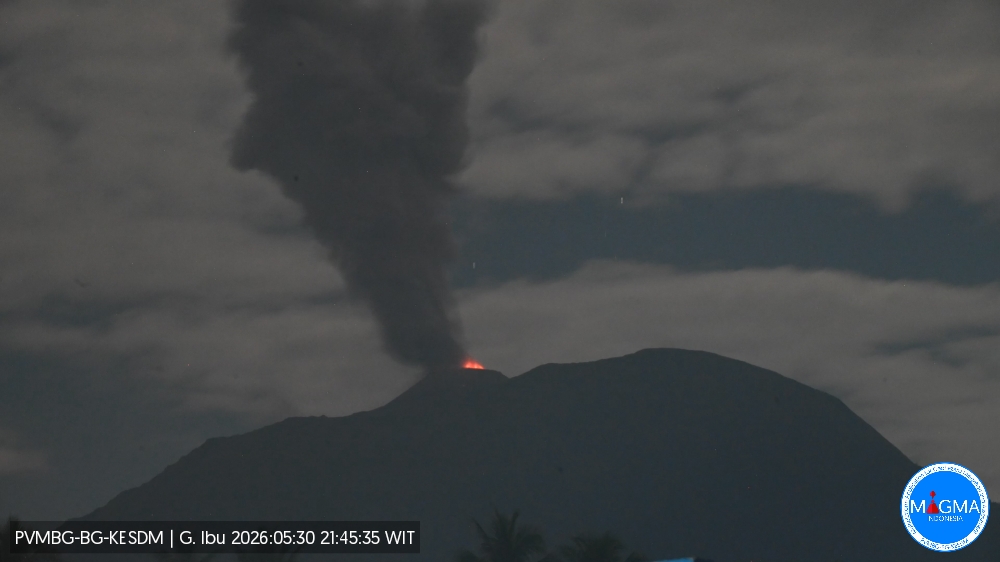
An eruption of Mount Ibu occurred on Saturday, May 30, 2026, at 9:44 PM WIT, with an observed ash column height of approximately 800 m above the summit (approximately 2125 m above sea level). This ash column was gray and dense, oriented towards the northeast. The eruption was recorded by a seismograph with a maximum amplitude of 28 mm and a duration of 69 seconds.
Seismic Observations
132 eruption earthquakes with amplitudes of 10 to 28 mm and durations of 31 to 87 seconds.
3 emission earthquakes with amplitudes of 4 to 8 mm and durations of 37 to 42 seconds.
12 harmonic tremors with amplitudes of 2 to 20 mm and durations of 36 to 107 seconds.
98 low-frequency earthquakes with amplitudes of 2 to 14 mm and durations of 17 to 29 seconds.
147 shallow volcanic earthquakes with amplitudes of 2 to 8 mm and durations of 7 to 21 seconds.
2 deep volcanic earthquakes with amplitudes of 4 to 6 mm and durations of 12 to 13 seconds.
Three local tectonic earthquakes with amplitudes between 5 and 28 mm, magnitudes between 3.6 and 8.2 seconds, and durations between 21 and 102 seconds.
Twenty-one distant tectonic earthquakes with amplitudes between 3 and 28 mm, magnitudes between 3.6 and 8.2 seconds, and durations between 45 and 156 seconds.
Recommendations
1. Residents living near Mount Ibu and visitors/tourists are advised to refrain from all activities within a 2 km radius and a 3.5 km sector in the direction of the crater opening, in the northern part of the active Mount Ibu crater.
2. In the event of ashfall, people engaging in outdoor activities are advised to wear a mask covering their nose, mouth, and eyes, as well as protective eyewear.
Source et photo : PVMBG.
Hawaii , Kilauea :
HAWAIIAN VOLCANO OBSERVATORY DAILY UPDATE , U.S. Geological Survey , Saturday, May 30, 2026, 8:19 AM HST (Saturday, May 30, 2026, 18:19 UTC)
19°25’16 » N 155°17’13 » W,
Summit Elevation 4091 ft (1247 m)
Current Volcano Alert Level: ADVISORY
Current Aviation Color Code: YELLOW
Summary:
The Halemaʻumaʻu eruption of Kīlauea remains paused. Spatter was visible within the north vent overnight. Summit inflation continues. The forecast window for the onset of episode 48 fountains is between today and Monday (May 30-June 1).
Overview:
The Halemaʻumaʻu eruption of Kīlauea remains paused. Glow was strong from both vents overnight with spatter visible from the north vent. Summit inflation continues. The forecast for episode 48 fountaining is between today and Monday (May 30-June 1) but may change if irregular deflation events resume.
No significant activity has been noted along Kīlauea’s East Rift Zone or Southwest Rift Zone.
Summit Observations:
Bright glow was visible from both Halemaʻumaʻu eruptive vents overnight. Common low-level spatter was visible throughout the night from within the north vent.
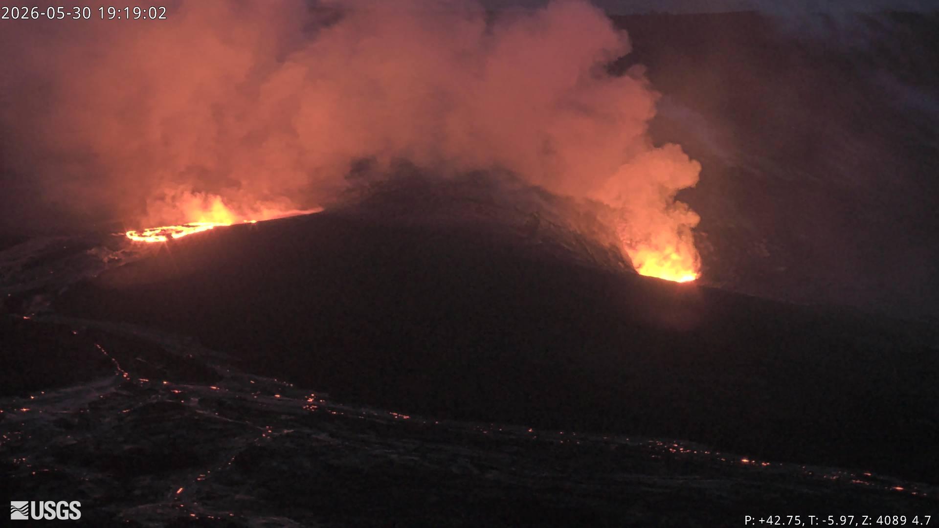
Kilauea Message 2026-05-30 18:34:26 HST
The first overflow was sluggish and only made it about 100 m from the vent and lasted about 5 minutes. A second overflow began at 6:27 pm HST. Spattering continues at the north vent and tremor shows clear gas pistoning.
Kilauea Message 2026-05-30 19:00:55 HST
Periodic precursory overflows are continuing. The NWS has issued a Special Weather Statement for south and east Hawaiʻi Island about potential for ashfall.
Low-level seismic tremor continues during the current pause and did not change significantly over the past day during the deflation event. Earthquake activity beneath Kīlauea summit remains low at this time.
Kilauea summit inflation continues this morning, but at a lower rate than previous days. Since the end of lava fountaining episode 47 on May 15, the Uēkahuna tiltmeter (UWD) has tracked about 16.6 microradians of inflationary tilt (a small tilt offset was due to the M6 earthquake on the west side of the island on Friday evening). This instrument recorded 15.6 microradians of deflationary tilt during episode 47.
With the eruption now paused, the sulfur dioxide (SO2) emission rate from the summit is likely now varying within a typical range of 1,000 to 5,000 tonnes per day. Measurements on Friday, May 22, indicated emission rates of about 2,000 tonnes per day. Surface winds are out of the northeast at the summit this morning.
Rift Zone Observations:
Rates of seismicity and ground deformation remain low in the East Rift Zone and Southwest Rift Zone. SO2 emissions from the East Rift Zone remain below the detection limit.
Source et photo : HVO.
Chile / Argentina , Laguna del Maule :
SPECIAL REPORT ON VOLCANIC ACTIVITY, May 22, 2026
The Argentine Geological and Mining Service (SEGEMAR), through its Argentine Volcanological Observatory (OAVV), reports that on Friday, May 22, 2026, starting at 2:25 p.m. local time (5:25 p.m. UTC), volcanic monitoring stations located near the Laguna del Maule volcanic complex recorded an increase in the frequency of volcano-tectonic (VT) earthquakes associated with rock fracturing within the volcanic system. At the time of writing, the activity continues, with 140 events recorded, characterizing this episode as a seismic swarm.
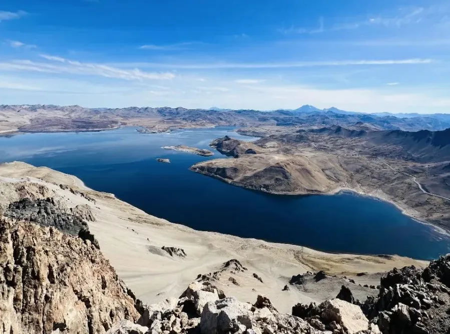
High-Energy Event Information
Origin Time: 3:34 PM local time (6:34 PM UTC)
Latitude: -36.055°
Longitude: -70.561°
Depth: 5.2 km
Local Magnitude: 2.5 (ML)
OBSERVATIONS:
At the time of publication of this report, volcano-tectonic activity continues to be recorded, but at a lower rate. It should be noted that no surface activity or changes in other monitoring parameters have been detected at the volcanic complex. This event had no impact on Argentine territory, and no reports have been received from neighboring populations in Argentina.
CONCLUSIONS:
The technical alert level remains in effect, and monitoring of the volcano continues in constant communication with the Southern Andes Volcanological Observatory (OVDAS) of Chile. Any changes will be reported.
Source : SEGEMAR.
Photo : OAVV.
Colombia , Nevado del Ruiz :
Manizales, May 26, 2026, 10:15 PM
Regarding the monitoring of activity at the Nevado del Ruiz volcano, the Colombian Geological Survey (SGC), an agency under the Ministry of Mines and Energy, reports the following:
During the week of May 19-25, 2026, the volcano continued to exhibit unstable behavior. Compared to the previous week, the main variations in monitored parameters were as follows:
– Seismic activity associated with rock fracturing processes within the volcanic edifice increased slightly, both in the number of recorded earthquakes and in the seismic energy released. The earthquakes were located in the Arenas crater and within 8 km of it, in the south-southwest and south-southeast sectors of the volcanic edifice, and scattered across other flanks of the volcano. Regarding the reference level, the depth of the events varied between less than 1 km and 2 km in the crater area, and between 2 km and 7 km on the flanks. The maximum recorded magnitude was 1.4, corresponding to the earthquake that occurred on May 21 at 2:46 a.m., 3 km south-southwest of the Arenas crater and at a depth of 4 km.
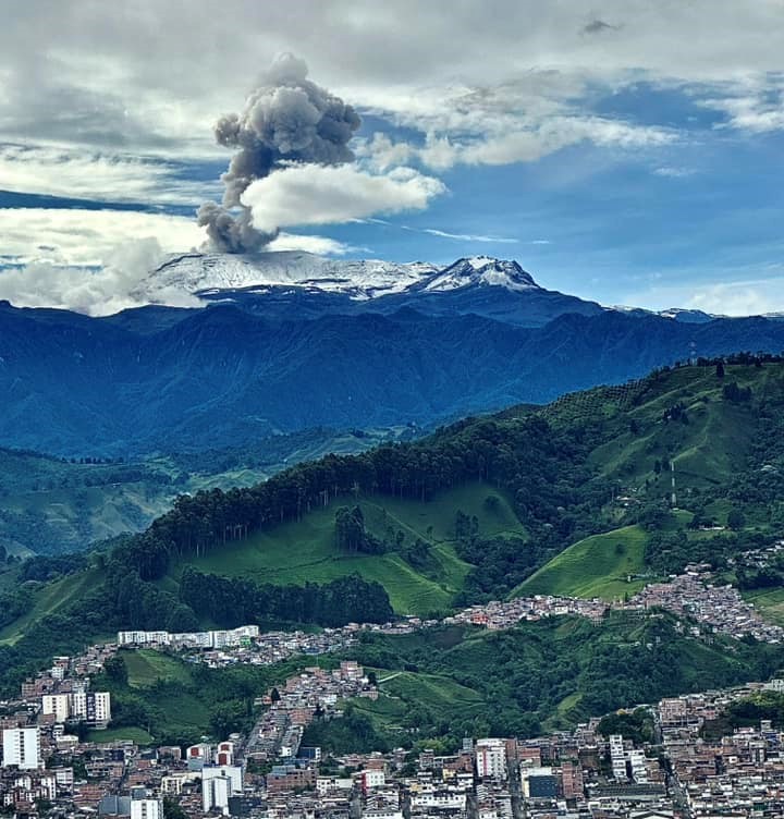
Seismicity associated with fluid dynamics within volcanic conduits decreased in the number of recorded earthquakes and, slightly, in seismic energy released. These seismic signals corresponded to short-duration, low-energy events, with the exception of May 25, when a moderate-intensity signal was recorded, a level not observed since early April of this year. As in the previous period, these seismic signals were not associated with ash emissions or changes in the apparent temperature of the gas column.
The emission of water vapor and volcanic gases, primarily sulfur dioxide (SO₂), into the atmosphere from the Arenas crater continued. Degassing processes intensified compared to the previous week, although satellite-observed levels remained low in terms of SO₂ releases.
The height of the gas and water vapor column remained below 400 m above the volcano’s summit, with elevations around 200 m being predominant. The column’s dispersion direction was primarily toward the northwest flank and, to a lesser extent, toward the southwest and northwest flanks of the volcano.
Satellite monitoring of thermal anomalies at the bottom of Arenas Crater remained limited by persistent cloud cover in the region. Despite this, the detected anomalies exhibited low energy levels.
Source : SGC.
Photo : Alex Jimenez Matiz.
Guatemala , Santiaguito :
Atmospheric conditions: Clear
Wind: East
Rainfall: 3.8 mm
Activity:
White outgassing is observed above the Caliente dome, with fumaroles rising up to 700 meters and dispersing westward. One to three low- to medium-intensity explosions occur per hour, lifting columns of gas and ash up to 800 meters above the dome in the same direction. During the night and early morning, incandescence was recorded in the crater, accompanied by collapses and the fall of incandescent blocks on its flanks.
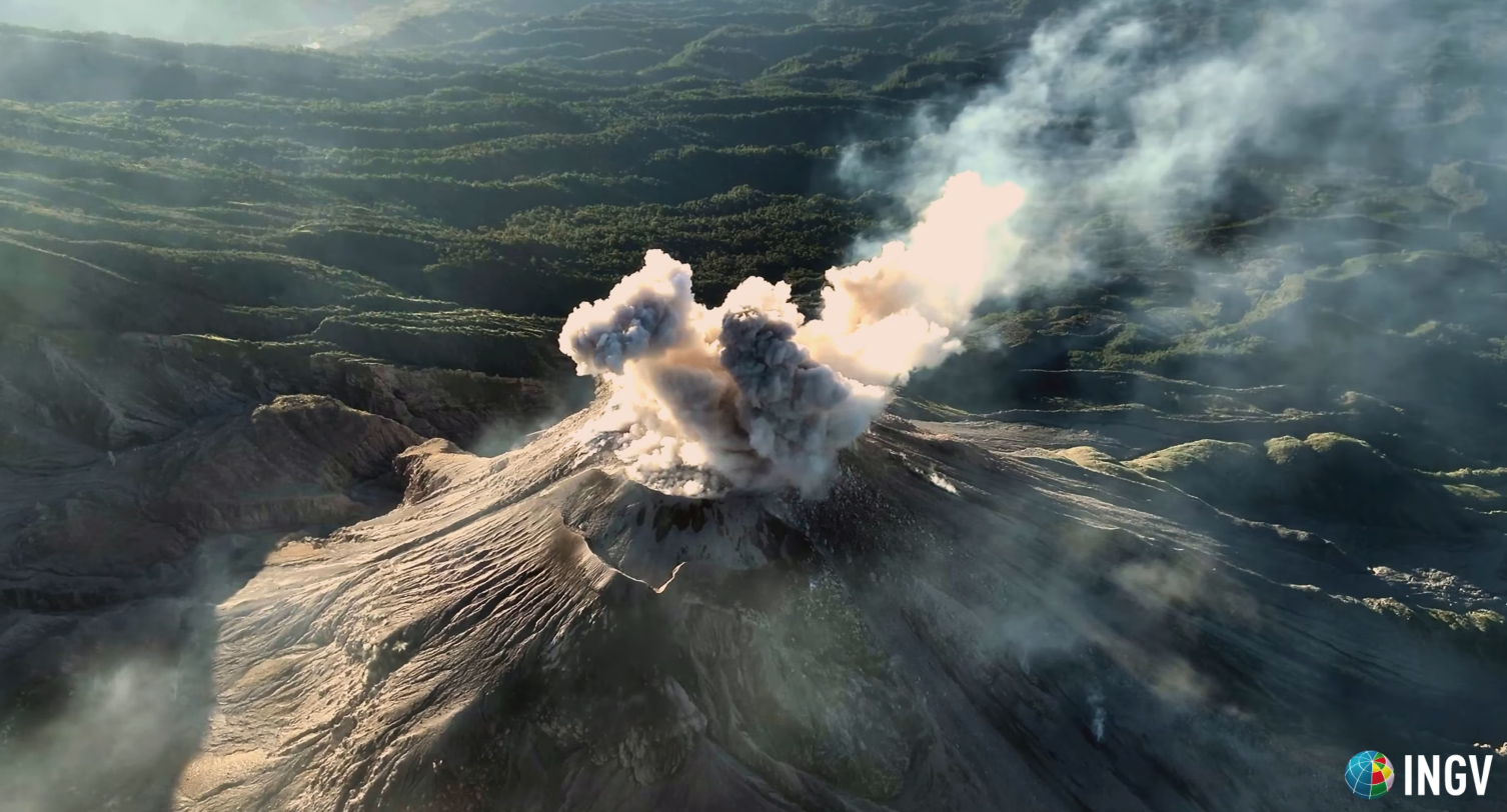
Given the high level of activity and the risk of major collapses, the generation of long-range pyroclastic density currents in all directions cannot be ruled out. It is therefore recommended to follow the guidelines of Special Bulletin BESAN-002-2026. Furthermore, rainfall may mobilize accumulated material in gullies and riverbeds, causing lahars in the late afternoon and evening. It is recommended to avoid gullies and riverbeds and to strictly follow the guidelines of Special Bulletin BESAN-012-2026.
Source : Insivumeh .
Photo : capture d’écran INGV Dr. Riccardo Civico